March 27 - April 2, 2022: Issue 532
Dorothy Hawkins
by John Illingsworth
VALE Dorothy Wilga Hawkins
22 June 1921 - 18 March 2022
Daughter of Joseph James Homer and Gladys May (Nee Arnold), wife of Ronald John Hawkins (Married 1947). Sister of Gladys, Edna, Jack, Grace, Daphne, Albert (Arthur), Reginald, Joseph, and June Homer. Beloved Mother of Coralie, Lynette (dec), John, Rhonda and Kevin. Mother-in-law of Lynne, treasured Nan to her 8 Grand-children, Great-Nan to 8 and Great-Great Nan to 2.
Late of Mona Vale and Narrabeen.
Our community lost one of much loved elders on Friday March 18th. Dorothy passed away peacefully at Mona Vale Palliative Care, aged 100.
A Celebration of her life took place on Friday March 25th in Mona Vale.
Dorothy's connection to our area reaches back to 1936 when her family ran a dairy near Winnererremy Bay at Mona Vale.
Fortunately John Illingsworth interviewed Mrs. Hawkins in 2019 and captured her insights and stories - Dorothy was a veritable history book of our area and still sharp as a tack at 97 years young!
As a Tribute of Love from our own community to her loved ones, and for all those just 9 or 7 years old who have not seen this sights, or heard these stories, Dorothy's film by John runs this week.
Our sincere condolences to her lovely family at this time. Dorothy is cherished by many, still.
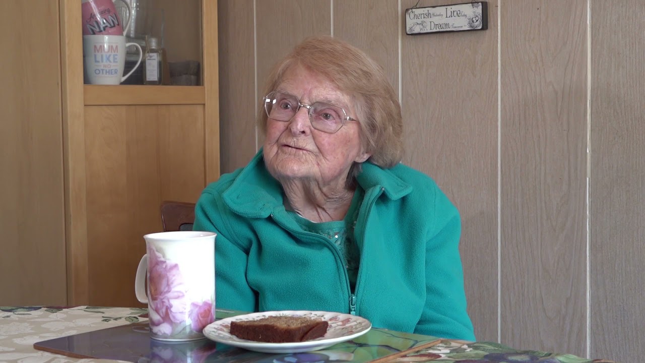
Dorothy Hawkins shares some wonderful local history of Bayview and Mona Vale in this new film by John Illingsworth.
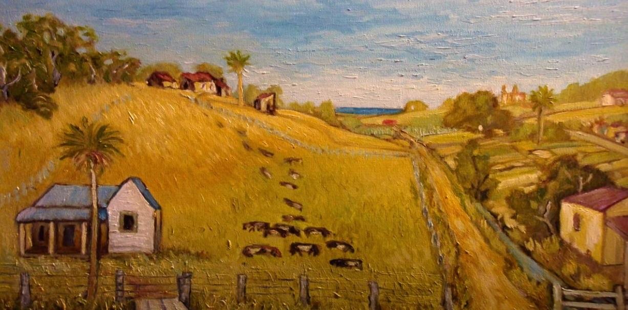
Dorothy Hawkins' family ran a dairy near Winnererremy Bay at Mona Vale from 1936. Mona Street is in the foreground of the painting shown in the film, Bassett Street with the ocean beyond in the far distance. Brock’s Folly (La Corniche) is on the hill to the right of the ocean.
Dorothy, still 14, lived in this house and worked in these fields. Her father, Joseph Homer, later purchased all the land seen here bounded by Bassett and Mona Streets, including the buildings on the hill. 98 year old Dorothy’s story as told here is a case study of a young woman living a semi-rural life at Mona Vale prior to WWII through to the late 1960s.
Dorothy was the last person to live on what is now Winnererremy Bay Park. Her account of eviction from the home she loved, following a brutal forced resumption, is wrenching. This was a private development by Warringah Shire Council in partnership with developer ‘Pacific Paradise’. After examining numerous documents and newspaper clippings and listening to Dorothy and her children, it seems doubtful due process was followed. A significant injustice may have been perpetrated against Dorothy and her sister, co-inheritors of the Centenary Estate Land which 32 years later became Winnerrremy Bay Park.
____________________________________________________________________________________
Brian Friend OAM sent in;
This is down where Pittwater High School was built.
The house on the corner of Mona Street/Bassett St was the Homers home. Sir Edward Halstrom (refrigerator builder) also leased the paddock when he supported Taronga Zoo to grow Lucern. The Olivers lived on the other corner and were part of the Mona Vale history. Ronnie Hawkins owned the property where the school is and had a trotting track for training 'trotters'. Ronnie was a real character and I remember changing a set of spark plugs in his old Holden FX ute after it had done just over 100,000 miles (true story).
Brian Friend OAM, Sunday March 27, 2022
Visit: Bayview Koala Sanctuary - Sir Edward John Lees Hallstrom Pittwater Roads II - Where the Streets Have Your Name: Mona Vale Pittwater Roads II: Where the Streets Have Your Name - Bayview
Extras
County of Cumberland Planning Scheme
by Dictionary of Sydney staff writer 2008
CC BY-SA 2.0
The County of Cumberland Planning Scheme was arguably New South Wales's first attempt at a comprehensive and coordinated town plan for metropolitan Sydney, and, after a short and troubled history, it was ultimately a failure.
Aware that post-war growth would put pressure on Sydney's existing footprint, in July 1944 the Labor Premier William McKell announced that he intended to introduce legislation concerning both
the extension of the boundaries of the City of Sydney, and the Union of Areas in the County of Cumberland.
The second proposal was a most radical innovation in metropolitan governance, in that it created a tier of government intermediate between local and state governments – the Cumberland County Council – to oversee preparation and implementation of metropolitan Sydney's first statutory plan. The Cumberland County Council was established under the provisions of the Local Government (Town and Country Planning) Amendment Act 1945, which enabled local councils to prepare comprehensive local planning schemes for the first time. The process was overseen by a new Town Planning Branch in the Department of Local Government, with another new creation, the Town and Country Planning Advisory Committee, providing high-level ministerial advice.
Released in 1948 but not legally gazetted until 1951, the County of Cumberland Planning Scheme has been described as
the most definitive expression of a public policy on the form and content of an Australian metropolitan area ever attempted.
It drew inspiration from the London plans of Patrick Abercrombie, and introduced land use zoning, suburban employment zones, open space acquisitions, and the idea of a 'green belt' for greater Sydney. The Main Roads Department supplied plans for an expressway network. The scheme tied in with the Commonwealth Government's strategy to prepare for predicted rapid postwar growth, and in June 1947 the Cumberland County Council was inaugurated by state parliament, to prepare 'for the guidance and control of growth in the County' – ultimately the future direction of growth for metropolitan Sydney.
Opposition to the plan
The cornerstone of the Cumberland County Council Scheme was a 'green belt' around the existing urban footprint, designed to restrict urban sprawl, while satellite towns beyond the belt would take care of future growth. But from the outset, the Cumberland County Council was in a precarious position, particularly with its constituent councils, which were uneasy about its new powers: only four suburban municipalities had worked to develop comprehensive town planning schemes by the time of the Cumberland County Council's formal demise. It also faced hostility from more entrenched state government agencies, such as the Sydney Water Board and the Department of Housing. It met strenuous opposition from property owners, and by the mid-1950s had 22,000 claims against it for 'injurious affectation' arising from county zoning. A further blow came when anticipated Commonwealth funding never eventuated.
The green belt to prevent sprawl was the most contentious element, and it was continually attacked by developers, who saw it as an impediment to future profits. In response to these mounting pressures, the Cumberland County Council was dissolved on 19 December 1963 and replaced by a State Planning Authority, in accordance with the State Planning Authority Act, 1963. With the advent of the conservative Askin state government in 1965, the Cumberland County Council Plan's grand objectives were finally put to rest, with the result that thousands of hectares of farmland were 'released' for housing, incrementally whittling the green belt away to accommodate ongoing population increases from both immigration and the long term results of the postwar 'baby boom'. The pressure of increasing demand for land also affected the Department of Main Roads' proposed 'County Roads': the state government requested that the Department eliminate the least necessary road reservations within the county. Thus raw new suburbs sprang up, devoid of vital infrastructure. An eventual compromise led to developers making contributions to help fund infrastructure in new release areas.
Dictionary of Sydney staff writer, County of Cumberland Planning Scheme, Dictionary of Sydney, 2008, http://dictionaryofsydney.org/entry/county_of_cumberland_planning_scheme
During the interim between coming into law and being made defunct, that green space we now know as Winnemerey Reserve, among others, was part of what was 'resumed':
LOCAL GOVERNMENT ACT, 1919
Warringah Shire Council: Proposed Resumption of Land at Bayview
HIS Excellency the Governor, with the advice of the Executive Council, and in pursuance of the Local Government Act, 1919, has approved of the Warringah Shire Council's causing a notice of resumption of the land together with all mines or deposits of coal, ironstone, kerosene shale, limestone, slate or other minerals under the said land (excepting any such mines or deposits as were reserved to the Crown in the original Grant of the said land) described in the Schedule hereto, together with a description of such land, to be published in the Government Gazette and in a newspaper circulating in the area in which the land is located, such land being required by the Warringah Shire Council for the purpose of the improvement and embellishment of the area and selling or leasing the whole or any portion of such land in one or more lots. (S. 60-622)
P. D. HILLS, Minister for Local Government. Department of Local Government,
Sydney, 5th August, 1960.
Schedule
All that piece or parcel of land situate in the Shire of Warringah, parish of Narrabeen and county of Cumberland, being lots 29, 30 and 31, section B, of the Centenary Estate, shown on plan catalogued 4,390 (L), and being also the whole of the land described in the Second Schedule to Deed Registered Book 2,365, No. 755,—having an area of 1 rood 4 perches or thereabouts and said to be in the possession of Halvorsen Boats Pty. Ltd.
Also all that piece or parcel of land situate as aforesaid being lot 33, section B, of the Centenary Estate shown on plan catalogued 4,390 (L) and being also part of the land described in Deed Registered Book 378, No. 573,—having an area of 16 1/2 perches or thereabouts and said to be in the possession of the estate of Clara Fowler, deceased.
Also, all that piece or parcel of land situate as aforesaid, being lots 41 to 44 inclusive, section B, of the Centenary Estate, shown on plan catalogued 4,390 (L) and being also the whole of the land described in the Second Schedule to Deed Registered Book 403, No. 729,—having an area of 1 rood 35 1/2 perches or thereabouts and said to be in the possession of Robert J. Amaral.
Also, all that piece or parcel of land situate as aforesaid, being lots 1 to 6 inclusive, section C, of the Centenary Estate, shown on plan catalogued 4,390 (L) and being also the whole of the land described in the Third Schedule to Deed Registered Book 2,348, No. 385,—having an area of 2 roods 20 1/2 perches or thereabouts and said to be in the possession of Halvorsen Boats Pty. Ltd.
Also, all that piece or parcel of land situate as aforesaid, being lots 19, 20 and 21, section C, of the Centenary Estate, shown on plan catalogued 4,390 (L) and being also the whole of the land described in the First Schedule to Deed Registered Book 2,365, No. 755,—having an area of 39 perches or thereabouts and said to be in the possession of Halvorsen Boats Pty. Ltd.
Also, all that piece or parcel of land situate as aforesaid, being lot 1, section D, of the Centenary Estate, shown on plan catalogued 4,390 (L) and being also the whole of the land described in Deed Registered Book 2,060, No. 534,— having an area of 19 1/2 perches or thereabouts and said to be in the possession of Joseph J. Homer.
Also, all that piece or parcel of land, situate as aforesaid, being lot 2, section D, of the Centenary Estate, shown on plan catalogued 4,390 (L) and being also the whole of the land comprised in Certificate of Title, Volume 3,308, folio 132,—having an area of 16 1/2 perches or thereabouts and said to be in the possession of Joseph J. Homer.
Also, all that piece or parcel of land situate as aforesaid, being lots 3, 4, 5 and 7, section D, of the Centenary Estate, shown on plan catalogued 4,390 (L) and being also the whole of the land described in the Second Schedule to Deed Registered Book 2,348, No. 385,—having an area of 1 rood 20 1/2 perches or thereabouts and said to be in the possession of Halvorsen Boats Pty. Ltd.
Also, all that piece or parcel of land situate as aforesaid, being lot 6, section D, of the Centertary Estate, shown on plan catalogued 4,390 (L) and being also the whole of the land described in Deed Registered Book 2,365, No. 756,—having an area of 23 perches or thereabouts and said to be in the possession of Halvorsen Boats Pty. Ltd.
Also, all that piece or parcel of land situate as aforesaid, being lots 8, 9 and 48, section D, of the Centenary Estate, shown on plan catalogued 4,390 (L) and being also the whole of the land described in Deed Registered Book 2,060, No. 535,—having an area of 39 1/2 perches or thereabouts and said to be in the possession of Joseph J. Homer.
Also, all that piece or parcel of land situate as aforesaid, being lot 10, section D, of the Centenary Estate, shown on plan catalogued 4,390 (L) and being also the whole of the land comprised in Certificate of Title, Volume 6,403, folio 222,—having an area of 13 1/2 perches or thereabouts and said to be in the possession of Jack M. Kirby.
Also, all that piece or parcel of land situate as aforesaid, being lots 11 and 12, section D, of the Centenary' Estate, shown on plan catalogued 4,390 (L) and being also the whole of the land comprised in Certificate of Title, Volume 6,071, folio 220,—having an area of 26 1/2 perches or thereabouts and said to be in the possession of Nora Barker.
Also, all that piece or parcel of land situate as aforesaid, being lots 13 to 16 inclusive, section D, of the Centenary Estate, shown on plan catalogued 4,390 (L),—having an area of 1 rood 12 1/2 perches or thereabouts and said to be in the possession of Cyril D. Duer.
Also, all that piece or parcel of land situate as aforesaid, being lots 17, 18, 39 and 40, section D, of the Centenary Estate, shown on plan catalogued 4,390 (L),—having an area of 1 rood 12 1/2 perches or thereabouts and said to be in the possession of the estate of Alfred Ingram, deceased.
Also, all that piece or parcel of land situate as aforesaid, being lots 41 to 44 inclusive, section D, of the Centenary Estate, shown on plan catalogued 4,390 (L),—having an area of 1 rood 12 1/2 perches or thereabouts and said to be in the possession of the estate of C. H. Ingram, deceased.
Also, all that piece or parcel of land situate as aforesaid, being lot 47, section D,: of the Centenary Estate, shown on plan catalogued 4,390 (L) and being also the whole of the land comprised in Certificate of Title, Volume 3,321, folio 198,—having an area of 13 1/2 perches or thereabouts and said to be in the possession of Violet C. Kirby.
Also, all that piece or parcel of land situate as aforesaid, being lot 49, section D, of the Centenary Estate, shown on plan catalogued 4,390 (L) and being also the whole of the land described in the First Schedule to Deed Registered Book 2,348, No. 385,—having an area of 13 perches or thereabouts and said to be in the possession of Halvorsen Boats Pty. Ltd.
Also, all that piece or parcel of land situate as aforesaid, being the sites of Darwin-street, Huxley-street, Spencer-street and the Esplanade, as shown on plan catalogued 4,390 (L) and that part of the site of the street 60 links wide shown on that plan lying to the south-west of the south-easterly prolongation of the north-eastern boundaries of lots 4 to 20 inclusive, section B, of the Centenary Estate, shown on the said plan catalogued 4,390 (L) 3—and having an area of about 4 acres 1 rood 9 perches.
All such pieces or parcels of land are shown on plan with the Department of Local Government, Sydney. (9827)
LOCAL GOVERNMENT ACT, 1919 (1960, August 5). Government Gazette of the State of New South Wales (Sydney, NSW : 1901 - 2001), p. 2409. Retrieved from http://nla.gov.au/nla.news-article220314811
The Scheme needs a tad more:
LOCAL GOVERNMENT ACT, 1919
Cumberland County Council: Proposed Resumption of Land at Bayview
HIS Excellency the Governor, with the advice of the Executive Council, and in pursuance of the Local Government Act, 1919, has approved of the Cumberland County Council's causing a notice of resumption of the land together with all mines or deposits of coal, ironstone, kerosene shale, limestone, slate or other minerals under the said land (excepting any such mines or deposits as were reserved to the Crown in the original Grant of the said land) described in the Schedule hereto, together with a description of such land, to be published in the Government Gazette and in a newspaper circulating in the area in which the land is located, such land being required by the Cumberland County Council for the purpose of carrying into effect the provisions of the County of Cumberland Planning Scheme. (S. 61-4,236)
P. D. HILLS, Minister for Local Government Department of Local Government, Sydney, 23rd March, 1962.
Schedule
All that piece or parcel of land situate in the Shire of Warringah, parish of Narrabeen and county of Cumberland, being lot 20, deposited plan No. 9,606, containing an area of perches, having a frontage to Pittwater-road, (late Bay view-road) and being the whole of the land comprised in Certificate of Title, volume 4,463, folio 41, said to be in the possession of Henry James Brown and shown on the plan with the Department of Local Government, Sydney. (2537). LOCAL GOVERNMENT ACT, 1919 (1962, March 23). Government Gazette of the State of New South Wales (Sydney, NSW : 1901 - 2001), p. 785. Retrieved from http://nla.gov.au/nla.news-article22024820
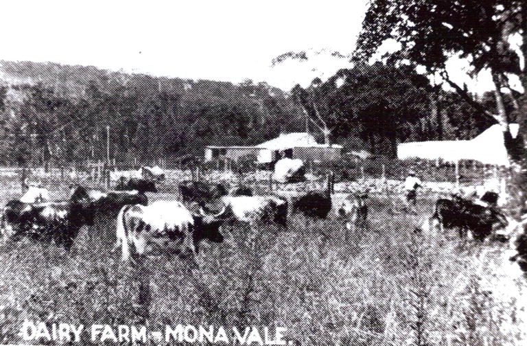
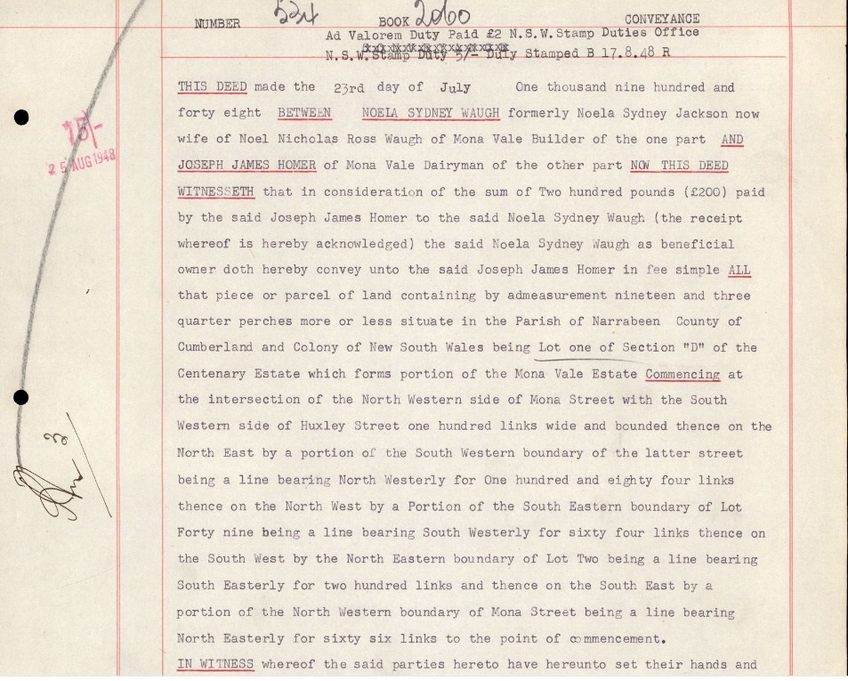
 | Dorothy Hawkins - family research notes.pdf Size : 427.693 Kb Type : pdf |
