Environment News: January 2025

January 1 - 31, 2025: Issue 638

Week Two: 13-19 January, 2025

Wildlife killed by Same roaming dog Pair Again: 2025 Review of NSW Companion Animals Act to Commence following Dog Attack Inquests    

Dogs killing wildlife at: North Narrabeen-Elanora-Ingleside-Warriewood - January 2024

Residents have reported that a pair of dogs witnessed killing a water dragon in 2023 are once more on the loose in North Narrabeen, Elanora and Ingleside. 

On Wednesday January 15 2025 one of the pair was seen with another dead water dragon dangling from its mouth.

One resident stated they 'had seen these two killing wildlife in November 2023 as well, so repeat offenders'. 

Another witness stated 'they caused havoc February to March 2023, were seen killing a water dragon and chasing down wallabies, trashed a couple of nurseries in Ingleside, attacked chooks and native ducks. And that's only what people saw. '

Another resident stated; 'These dogs have been a menace for years - it’s time these dogs were sorted out  - they’ve killed so much wildlife.'

The photograph sent into the news service in 2023 shows this is the same pair of dogs in that new image of January 15.

Chasing macropods can cause stress myopathy, a fatal condition that causes muscle tissue to break down.

All native birds, reptiles, amphibians and mammals (except the dingo) are protected in New South Wales by the Biodiversity Conservation Act 2016 (BC Act). This includes eggs and young ones.

However, wildlife continues to be attacked and/or killed in this area. Photographs, videos and emailed reports come in to the news service on a daily basis of dogs offleash across all public spaces and in wildlife preservation areas (WPA's).

Visit: 
The latest available official number of dog attack incidents reported by the northern beaches council to the Office of Local Government (NSW Gov.) from 1 July 2024 to 30 September 2024 (1st Quarter 2024/25) records 53 attacks. Of those on people, 5 were serious (required medical treatment and/or hospitalisation) and there were 15 less serious attacks, and 39 animals were attacked by dogs. The NBC LGA records forwarded to the NSW OLG states it has 74,025 microchipped dogs registered in the area.

In comparison Central Coast Council recorded 58 attacks on people, with 11 requiring medical attention or hospitalisation, 34 people  recorded as reporting to their council what was deemed a 'less serious attack', and 56 animals attacked. The CC LGA records it has 162,490 microchipped dogs registered for the LGA.

Shoalhaven City Council, the council area where 90 year old Ada "Sally" Holland died after she was attacked by a pack of unregistered dogs on a south coast beach, recorded 68 attacks of which 6 were people and serious and required medical treatment and/or hospitalisation, and 37 'less serious attacks' on people and 68 animals attacked as well. That council records 60,512 microchipped and registered dogs.

The Quarterly NSW Report of all Dog attack incidents reported by all councils from 1 July 2024 to 30 September 2024 (1st Quarter 2024/25) records 1,358 attacks on people.

These figures also record the victims as:
Adult 739
Child (Child is up to 16 years) 115
Dog 688
Cat 64
Livestock 235
Other (animal) 202

The injuries on people that were more serious record:
Medical treatment required 197
Hospitalisation 69

The Number of injuries on animals records 1188 in total for the first quarter of 2024-2025, and:
Medical treatment required 212
Hospitalisation 72
Deaths 383


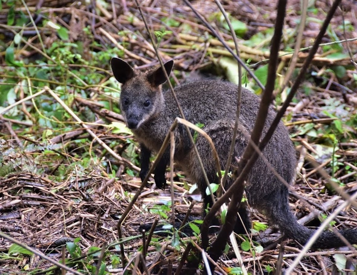
Young Wallaby in Warriewood. Photo: by Kevin Murray, March 2022.

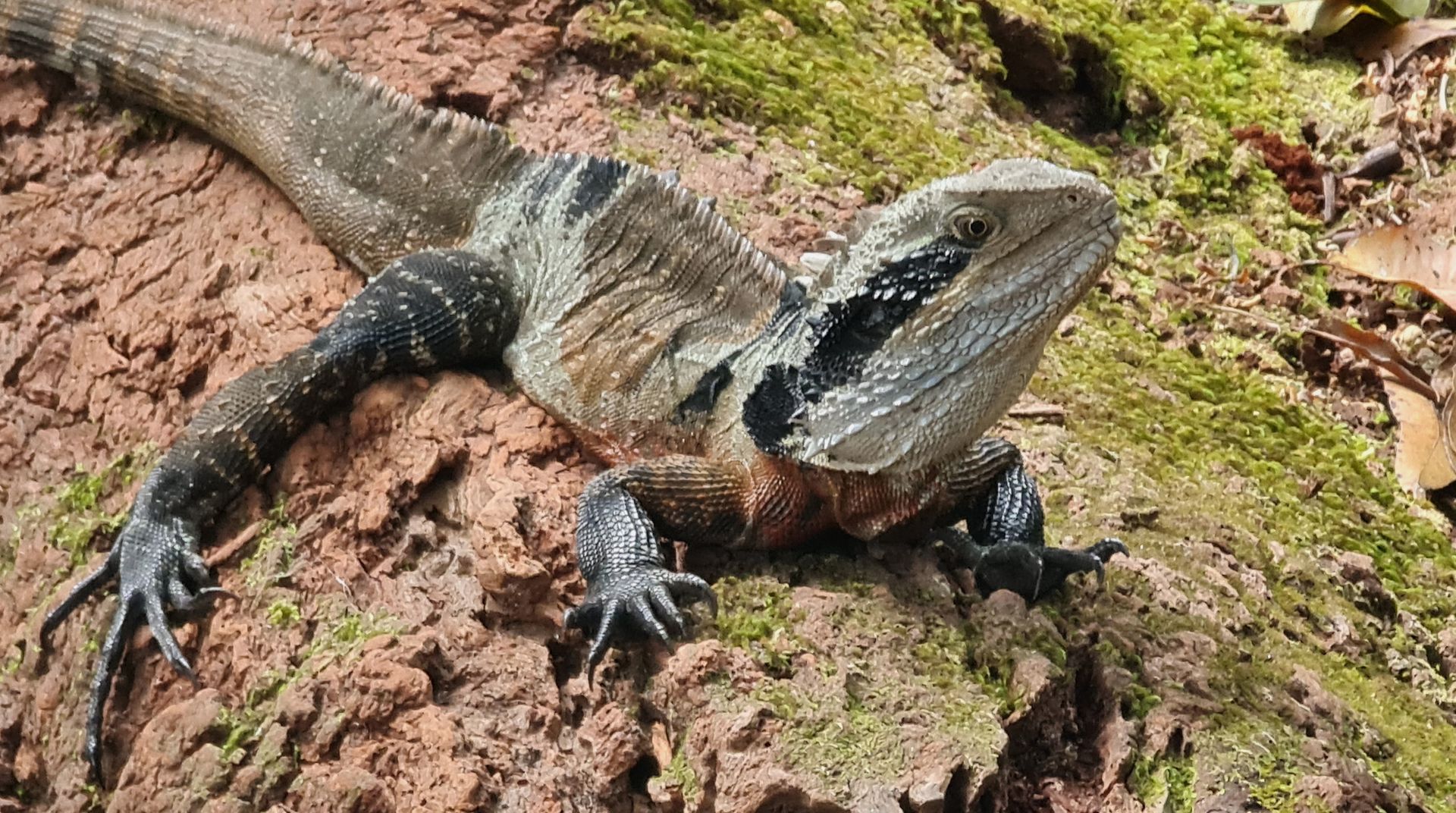
young Eastern Water Dragon at Irrawong Falls. Photo: by Joe Mills, January 2025.

In June 2024 the New South Wales coronial inquiry into dog attacks found the death of Ada Holland could have been prevented if the council had responded appropriately to another attack by the same dogs a week earlier.

On the 29th of March 29, 2020, a Sunday, Ada was walking on Collingwood beach with her daughter, Gloria Holland, when a group of three dogs attacked them.

Magistrate Forbes found Ms Holland had a heart attack after suffering "extreme injuries" in the "brutal attack" and could not be revived.

Gloria was also seriously injured and required 38 stitches while another lady, Carol Evans, was also injured and required 120 stitches.

"Her children and friends have been severely traumatised and are left bereft by her unnecessary and savage death," Magistrate Forbes told the court.

On Friday, January 17 2025, Deputy State Coroner Carmel Forbes delivered the findings of the inquest into the death of the "very cherished" five-week-old baby who died in July 2021 at Kariong on the Central Coast from "fatal injuries", including puncture wounds to his chest by an American Staffordshire terrier.

The inquest heard that around a month before the baby's death, a council ranger was called to the home because a neighbour's Cocker Spaniel was found dead in the yard. A hole was found under a fence between the two properties, but it was unclear whether the Cocker Spaniel had been dragged under the fence or was attacked after making its way beyond its home yard.

The ranger from the Central Coast Council who attended observed traits of the attacking animal including yellow eyes, white tips on its toes and its build, which made her suspect the dog was part Pit Bull. The Pit Bull is deemed in Australia, American Staffordshire Terriers are not. The council gave the owner one month to provide proof the dog was not a restricted breed or cross breed and sent a notice of intention to declare it a restricted breed.

Coroner Forbes made 10 recommendations, including:
  1. The Minister and the OLG review the adequacy of the penalties for non-compliance with registration and identification requirements for dogs in the CA Act and the Regulation.
  2. The Minister and the OLG, in consultation with councils, develop and implement a Statewide public awareness and education campaign to educate dog owners and the community generally about the risks posed by dogs and how safely to interact with them.
  3. The Minister and the OLG, in consultation with councils and other stakeholders, introduce a licensing requirement for dog ownership, which may involve particular licence conditions calibrated for particular breeds of dogs and with applicants being required to undergo education with respect to safety and risk management.
  4. The Minister and the OLG examine the adequacy of the maximum penalties for the offences provided by ss 12A, 13, 14, 16 and 17 of the CA Act.
  5. The Minister and the OLG amend s 16 of the CA Act to delete subsection (2)(b).
  6.  The Minister and the OLG amend s 18 of the CA Act to broaden the scope for exercise of that power.
  7. The Minister and the OLG amend: (a) the interim control obligations and interim powers enlivened under ss 36 and 58B of the CA Act upon the giving of a notice of intention to declare a dog (i) dangerous or menacing or (ii) restricted; and (b) s 58(4) so as to make clearer its intended operation.
  8. The Minister and the OLG introduce a general power in the CA Act for an authorised officer to direct an owner or person in control of a dog to secure the dog with a muzzle and / or lead for a specified period.
  9. The Minister and the OLG amend s 58C of the CA Act (a) regarding the prohibition on an authorised officer making a restricted dog declaration if the owner provides a written statement by an approved breed assessor or approved temperament assessor; and (b) to require breed and/or temperament assessors to provide an outline of the assessment carried out (including, for the temperament assessment, where, over what duration, and in what conditions).
  10. To the extent not already done, the Minister and the OLG investigate, or continue to investigate, facilitating reasonable access to DNA testing in NSW to assist breed identification of dogs.
In 2025 the NSW Government is reviewing the Companion Animals Act and Regulations. The 2025 CA Review will take a broad-based approach considering: responsible ownership of companion animals, compliance, and enforcement role of councils and the important consideration of the issues relating to the rehoming of companion animals.

The 2025 CA Review will include extensive consultation with key stakeholders, including NSW Local Councils, pet owners, breeders, veterinarians, rehoming and rescue organisations, animal welfare organisations, Department of Primary Industries in regional development, NSW Police, and NSW Department Communities and Justice.

A discussion paper to initiate the review is expected to be published in early 2025 for public comment. The paper will invite feedback on the three key focus areas relating to the management of companion animals.

The review is scheduled to commence at the conclusion of the series of dog attack inquests that Deputy State Coroner Forbes has been conducting and at the conclusion of the relevant Parliamentary Inquiries.

The timing of the review has been specifically set to allow those conducting the review to benefit from the findings from the inquests into dog attacks and the Parliamentary Inquiries.

This week the report of a dog attack on 4-year-old Lucia while playing on a beach near Perth has reminded people of what can happen when dogs are allowed offleash in public spaces. The dog grabbed Lucia by the neck and shoulder, repeatedly dragging her under the water.

Lucia was unresponsive and covered in blood from large puncture wounds to her neck and back by the time a stranger managed to help her mother Natalie and two siblings get the dog off her. She was airlifted to Perth to undergo surgery.

Her mother Natalie states the incident has left her family traumatised and is sharing her story, hoping it will serve as a warning to other parents about the unpredictability of dogs around children.

Although Lucia is now back at home, recovering, and her family is trying to come to terms with what they witnessed, the unprovoked attack on the little girl has left scars that may not heal.

"She cannot be around our family pet now. She doesn't want to go to the beach or be around dogs anymore," Natalie told the ABC.

"That beach is where most of our family holiday memories are. It should be a safe place. It's going to be a bit of a road to turn it back into that, from a place of fear."

This most recent unprovoked dog attack on a small child has renewed debate about dogs being allowed offleash in public spaces, including public beaches where young and small children will be present.

The south end of Mona Vale beach, currently the subject of a Plan of Management the council is seeking feedback on, which has been re-written from Pittwater Council days ostensibly to allow dogs offleash in this space, has already been the site of an attack on a child in July 2022. The owner of that dog ran away after the child was attacked.

Weeks before another toddler playing on the sand at south Mona Vale beach was run over by a large dog, the child's mother told by that pet owner to 'not come there as this was now a dog beach' and to walk her child right along the beach to the north end if she wanted the child to be able to paddle on hot days.

The south end of Mona Vale beach is NOT currently an area where dogs are allowed. There is a dog offleash area above the beach on Mona Vale Headland Park ( Robert Dunn Reserve).


The dog in W.A., a Rottweiler, was euthanised after the attack. Although not on the list of restricted breeds in Australia, Lucia's mum Natalie has spoken in support of others who have stated this breed should be added to that list. 

Dog breeds banned in Australia include: 
  • American Pit Bull Terrier: Also known as the pit bull terrier
  • Dogo Argentino
  • Fila Brasileiro
  • Japanese Tosa
  • Perro de Presa Canario: Also known as the Presa Canario
These breeds are prohibited from being owned, bred, or imported across Australia to reduce the risk of dog attacks and protect people and other animals. State and territory governments enforce strict regulations to ensure compliance. 

In NSW, any dog declared by an authorised officer of a council, under division 6 of the Companion Animals Act 1998, to be a restricted dog, is also then a restricted dog. If you own a restricted dog and it attacks or injures a person or an animal without being provoked, you must report it to your local council within 24 hours of the attack or injury.

However, hunting dog breeds are allowed - when used for stalking deer and pigs, or when targeting native or non-indigenous 'game' birds.  The NSW DPI, under its Native Game Bird Management Program, allows 'licensed, responsible volunteer hunters to help landholders manage the impacts of native game birds over their agricultural lands'.

In 2023-2024 there were 29, 266 native birds 'harvested' to benefit ricegrowers, almost double the previous years' deaths [1.]

The latest available reported numbers included 10,053 of the species Black Duck or Pacific Black Duck (Anas superciliosa), a bird which has a songline that traditionally runs through Pittwater.

The Northern Beaches Council was contacted to query what action it has taken between 2023 and now to address these two dogs hunting, chasing, attacking and killing local wildlife, and whether the dogs' owner was fined for the wildlife killed in 2023. A spokesperson for council stated:

''Council is aware of several complaints regarding these dogs and have confirmed the owner’s identity. 
 
In March 2023 reports were made to Council about a brown poodle allegedly attacking a water dragon on private property (?) in Ingleside and in addition a duck being killed at a nursery on Powderworks Road, Ingleside. The matter was investigated and there was insufficient evidence to prosecute the owner at this time. 
 
A second complaint has been received this week regarding allegations of two dogs attacking wildlife on Powderworks Road. This matter is currently under investigation by Council to confirm the dogs identity, their owners and the allegations made. 

Residents are encouraged to contact Council directly about these alleged incidents if they haven’t already to assist staff with their investigations, especially if they have witnessed them first-hand.''

The most recent attack on wildlife in the North Narrabeen-Elanora-Ingleside-Warriewood area was reported to the council, as had those that had been witnessed previously by others.

The news service chose not to run the images of the two dogs sent in in 2023 and in January 2025 so as NOT to make them targets - all dogs are hunters; it's built into their DNA - responsible pet ownership to ensure they do not chase wildlife is what is required, under law, of all pet owners in NSW.

Both are larger dogs, one black - which looks like a labradoodle - one dark brown - which looks like a curly haired retriever.

If you have seen a dog attack a person or animal, or you have been attacked by a dog yourself, report it to your local council. This advice stands for attacks that happen in public and private settings.

If the attack happened outside local council hours, you may call your local police station. Police officers are also authorised officers under the Companion Animals Act 1998. Authorised officers have a wide range of powers to deal with owners of attacking dogs, including seizing dogs that have attacked.

You can report dog attacks, along with dogs offleash where they should not be, to the NBC anonymously and via your own name, to get a response, at: https://help.northernbeaches.nsw.gov.au/s/submit-request?topic=Pets_Animals

If the matter is urgent or dangerous call Council on 1300 434 434 (24 hours a day, 7 days a week).

If you find injured wildlife please contact:
  • Sydney Wildlife Rescue (24/7): 9413 4300 
  • WIRES: 1300 094 737
  
  
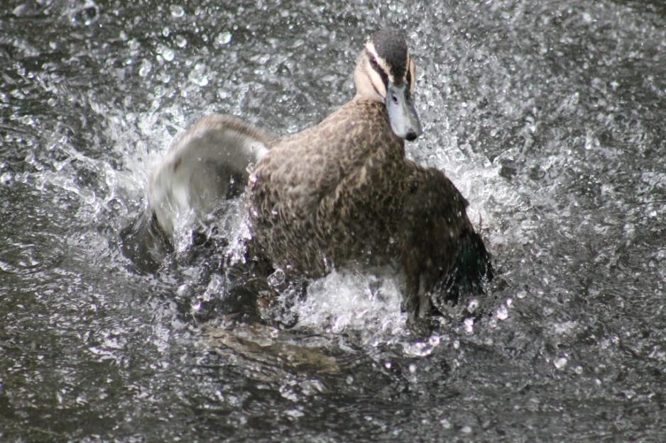
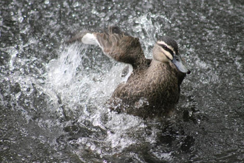
Black duck having a bird bath in Careel Creek, Pittwater; part of its traditional and ancient range.

Report updated Tuesday 21 January 2025
1. NSW Department of Primary Industries and Regional Development. Native Game Bird Management Program. Retrieved from DPI webpage: https://www.dpi.nsw.gov.au/hunting/game-and-pests/native-game-birds

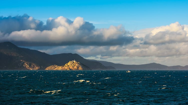
Breeding time for Little Penguins: Boaters urged to stick to speed limit - NSW Maritime Blitz 2025

🐧 Say hello to Manly's newest (and cutest) residents - Little Penguins! 

It's breeding season for these endangered guys, so boaters lets keep them safe by:
  • Keep speed to under four knots when entering North Harbour, Manly
  • Be extra careful at dawn and dusk
  • Don’t anchor in seagrass beds
  • Don’t bring dogs or cats onto beaches
To learn more visit: https://bit.ly/4g0HUbg

NSW Maritime 
January 16, 2025

NB: there is also a colony of Little Penguins on Lion Island and a colony of seals at Barrenjoey. Residents have reported vessels speeding on the Pittwater estuary during January 2025.


NSW Maritime on water safety Blitz 2025

In the first education and safety blitz of 2025, NSW Maritime officers hit the water to remind jetskiers of their responsibilities during Operation Cool Your Jets.

Across Saturday and Sunday (January 11-12), officers conducted nearly 2000 vessel safety checks statewide, including around 600 jetskis, with Port Stephens, Forster, Botany Bay, Lake Illawarra, Jervis Bay and the Murray River among the jetski hotspots targeted by patrols.

Officers issued 95 penalty notices and 256 official warnings over the weekend, with a quarter of those offences relating to jetskis.

Top offences related to licensing and registration (32 per cent), lifejackets (26 per cent) and safety equipment (15 per cent) breaches.

Top locations for offences were along the Murray River around Mulwala (43 offences), Forster (25 offences), around Tuggerah (22), and Brisbane Waters (20) on the Central Coast, and near Moama (20).

NSW Maritime Cool Your Jets Campaign Coordinator Jay Ruming said while the vast majority of riders are doing the right thing, there are some who are continuing to be a danger and a nuisance to other riders, swimmers, boaters, residents and marine life.

“It’s the school holidays, the weather is hot, and we’re seeing huge volumes of jetski riders right across the state,” Mr Ruming said.

“Most of these riders are behaving in a manner that doesn’t put lives at risk or discourages people from enjoying our waterways at the best time of the year to do so. 

“Unfortunately, a small minority of these riders continue to do the wrong thing on our waterways through aggression, recklessness or inexperience.”

The operation comes at a time when the popularity of jetskis is booming, with more than 92,000 riders currently licensed in NSW – a 43 per cent increase from the same time five years ago. Maritime officers are reminding riders to look out for their mates and loved ones following a spate of incidents involving crashes with riders known to one-another.

“Our data tells us that jetskis are heavily over-represented in serious injury incidents. People involved in an accident on a jetski have a 50 per cent likelihood they’ll suffer a serious injury.”

Since the start of summer there have been ten jet-ski related incidents, with one of those crashes leaving a jetskier with a double pelvic fracture, another with broken limbs and a third rider with serious facial and spinal injuries after he was knocked unconscious.

Key safety advice for new and experienced operators includes making sure riders and their passengers are always wearing a lifejacket, making sure their licence and registration is up to date, and maintaining a safe distance from other waterway users.

Mr Ruming said it is crucial jetskiers know the rules and abide by them to avoid a potentially hefty fine, licence suspension, or worse, a serious crash.

“It’s important jetskiers know they need to stay at least 30 metres away from other vessels, objects or the shore when travelling six knots (11km/h) or more. They also, where possible, need to stay at least 60 metres away from people or dive flags” Mr Ruming said. 

In addition to compliance checks, NSW Maritime officers responded to several incidents over the weekend, including the rescue of a family whose kayaks capsized at Windang south of Wollongong, and the joint agency response to a vessel fire on the Parramatta River. 

NSW Maritime has introduced a wave of new initiatives for the 2024-25 boating season aimed at improving the safety of all waterway users.

For more information on rules around riding jetskis or personal watercraft (PWCs) can be found on the rules sticker required to be on all registered jetskis in NSW, and in the online rules handbook for riders


Ball shaped debris washes up on Local Beaches: Call for Sydney Water to 'Come Clean' on How much Sewerage is leaking into environment 

The burst watermain at Bilgola on Sunday January 12. Photos: A J Guesdon/PON


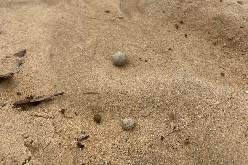
On Tuesday January 14 nine beaches in our area were closed after white/grey, ball-shaped debris was found washed up along the shore. 

Council was alerted to the debris and stated it is working closely with the state agency to collect samples for testing.

'So far, most samples identified are marble-sized with a few larger in size.' council said 

'The Council is organising the safe removal of the matter and is inspecting other beaches.'

Beachgoers were advised to avoid Manly, Dee Why, Long Reef, Queenscliff, Freshwater, North and South Curl Curl, North Steyne and North Narrabeen beaches until further notice and keep away from the material while the clean-up and investigations continue.

Most of the mysterious greyish balls that appeared on Sydney's Northern Beaches were the size and shape of a marble. (Supplied: Northern Beaches Council)

On Wednesday morning council advised it had reopened all beaches apart from South Curl Curl and Dee Why following the clean-up of marble-sized ball-shaped debris.  

South Curl Curl and Dee Why were still being assessed, and the clean-up is continuing at these locations until 2pm that afternoon, when the council stated it had reopened South Curl Curl but Dee Why beach remained closed while the clean-up there continued.

Mayor Sue Heins said the clean-up was organised swiftly to allow the beaches to be cleared of the debris and reopened as quickly as possible.

“I congratulate the crews for a fast clean up so we could get beachgoers back in the water today.

“We will continue to monitor the beaches condition, especially following the high tide this morning.”

A spokesperson for Sydney Water stated there had been no issue with the operation of its nearby Warriewood and North Head Water Resource Recovery plants.

"Sydney Water is continuing to work with the EPA to investigate the cause of the grease balls," the spokesperson said.

The material washing up are similar to the human waste found on beaches in the Eastern Suburbs last year. While the balls found on Tuesday are still subject to testing, the EPA has stated they have a similar appearance to those found in the eastern suburbs, which consisted of fatty acids and petroleum hydrocarbons.

The NSW EPA stated it first received a report of debris balls on Dee Why Beach.

''Testing conducted on the Eastern suburbs’ balls could not pinpoint a source or identify what caused them to form, as there was no source sample available for comparison.

Results of testing on balls that washed up on Bombo Beach, Kiama, in November found they had a similar composition to the Eastern suburbs’ debris balls. The EPA is still awaiting the final results of tests on balls that washed up on Silver Beach in Kurnell in December.'' the EPA stated

The NSW Greens stated on Tuesday repeated occasions where wastewater is causing pollution and with no clear source must be addressed by the Environment Protection Authority and Sydney Water.

Greens MP and spokesperson for the environment Sue Higginson said “The repeated discharge of sewage material onto Sydney Beaches in recent months is a sign that there is a systemic failure in Sydney’s waste water management. 

We know that Sydney loses significant amounts of water through cracked and damaged pipes, it’s time for Sydney Water to tell the public how much sewage is leaking into our environment. If they don’t know, why don’t they don’t know, because they should know. 

“Sydney Water has admitted that the human waste on beaches in Sydney’s east last year may have absorbed wastewater discharges indicating that our current treatment systems are not fit for purpose and the question remains, how much waste products are discharged by Sydney Water as part of their ‘normal operations’?” 

“We need to have a serious conversation about the accountability of utilities like Sydney Water, and we must do better when it comes to taking responsibility for subjects like where our crap goes. The environment cannot afford for us to just shrug and accept human waste turning up on beaches that are in regular use,”

“If the Environment Protection Authority (EPA) needs to consider what tools they will use to prevent Sydney Water from releasing waste products as part of their normal operations. If that means that Sydney Water’s licence must be varied, or be put on a pollution reduction program - then that’s what needs to happen,”

“In times of drought, we are rightly worried that clean water is leaking into the ground. We need to be just as concerned about the discharges of human waste and toxic chemicals due to inadequate systems and infrastructure. If Sydney Water needs more resources and better tools to get the job done then the Government must stump up,” Ms Higginson said.

Ms Higginson's comments have been echoed by Pittwater residents witnessing waters stinking of sewerage running down Cahill creek into Pittwater, potentially impacting Bayview Baths, and the die off of trees on Scotland Island, which is still waiting on, decades after this was first discussed, to have the basic water connections the rest of Sydney takes for granted.

Visit December 2024 reports: 

On Sunday January 12 a burst watermain above Bilgola at the Newport end, smelling faintly of sewerage, poured vast amounts of water down the hill and right along the southern end of the surf club and beach frontage for around an hour, despite council reporting it as soon as it commenced, swamping Norfolk pine roots, cutting a broad swathe through the sand and a plume of brown into the sea. 

Residents state this recurs around once a year, with huge amounts of water pouring down the Bilgola bends escarpment and into the ocean, eroding the banks of the bends and carrying massive amounts of debris and with it.

Anyone who notices this kind of white-grey balls debris on other beaches is encouraged to contact the council on 1300 434 434.

The burst watermain at Bilgola on Sunday January 12. Photos: A J Guesdon/PON

PNHA Newsletter 102: Summer 2024-2025 - Station Beach seagrass meadow, New project, what's in Avalon's ponds?, Pelican singing in the rain at McCarrs creek + More

PNHA Newsletter no: 102 - A few news excerpts below. Available in full at: pnha.org.au

Seagrass Meadows: Station Beach Continues to Contribute to Renewal of seagrass meadows elsewhere

Posidonia Sea Grass forms underwater meadows that are wonderful habitat for marine creatures and capture great amounts of carbon. But some meadows are now endangered because of damage by boats, anchors and moorings. 

Sydney Institute of Marine Science (SIMS) have been working on a project to restore sea grass in Sydney Harbour. This can be done by transplanting sea grass fragments that have washed up after large storms.

SIMS staff, PNHA volunteers and many other interested people went looking for viable shoots along Station Beach on December 5. We found just a couple, as the sea had been calm for some time. 

The plan is for volunteers to wander the beach after storms, and put pieces they find into a collection bin on the jetty beside Joeys Restaurant. SIMS staff will then collect the pieces and prepare them for transplanting into damaged sea grass meadows in Sydney Harbour. 

Photos: Marita/PNHA

PNHA’s new project -  Insects and Spiders

As a very young caterpillar this species is bright green. The adult moth is an important pollinator and probably food for Owls and Tawny Frogmouths.

Send us photos of Hawkmoths in your garden. We love PNHA’s new project -  Insects and Spiders

As a very young caterpillar this species is bright green. The adult moth is an important pollinator and probably food for Owls and Tawny Frogmouths.

Send us photos of Hawkmoths in your garden. We love our insects! 

Email: pnhainfo@gmail.com

Life in Avalon Frogponds

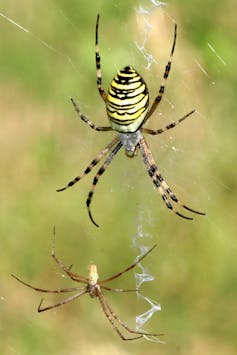
Clever Fishing Spider Dolomedes facetus

A medium to large-sized fishing spider, found along streams, rivers, creeks and freshwater lakes in coastal areas around Australia. It is found on the water's surface or on aquatic vegetation. It can run on water and can form underwater retreats with large air bubbles. The name facetus means 'clever', or 'adept', referring to its skill at catching fish; female 24mm, male 17mm. Learn all about this clever spider (and many other spiders) here.

Duckweed Lemna minor is one of the tiniest flowering plants.

Who would have guessed it is In the plant family Araceae?; so it is a relative of Arum Lily and Anthuriums! 

Photo: Robyn/PNHA member

Red Eyed Tree Frog 

You’ll notice on the internet it goes by two names Litoria chloris and a later one, Ranoidea chloris. Frogs are more often heard than seen and most often identified by the call Listen to its call here.

More about its lifestyle here at FrogId.

Photo: Joel/PNHA member

Pelican Singin’ in the Rain at McCarrs Creek

Animal behaviour is endlessly fascinating. This pelican sat in the rain with its beak open for several minutes, not singing actually, but letting the rain fall into its mouth. Fresh water must be a rare treat for a pelican.

Pelicans have many wonderful skills and characteristics, but “singing” is not one. Instead, listen here to its call.

Edna/PNHA member, captured this scene.

Join In

Membership of Pittwater Natural Heritage Association Landcare Group is open to all who share our aims of caring for the natural environment of the Pittwater area and working to enhance and protect it. You can find a Membership Application form on our website http://pnha.org.au/join/  or contact us on pnhainfo@gmail.com for one to be sent to you. Cost $20 per year, $10 unwaged.


Community rallies against accelerated logging in Great Koala National Park: Scruby Not backing Down Until GKNP Formalised - Higginson Calls for Labor to Honour its Election promise - Loggers want $300 Million compensation, state $1.3 Billion is the price tag to Cease Logging GKNP Trees

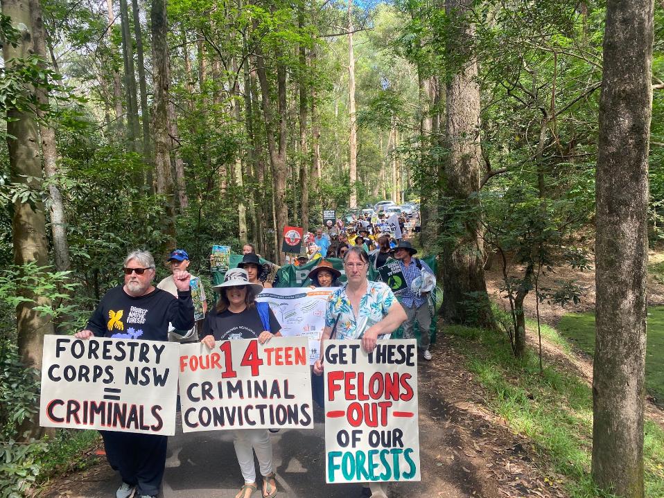
Coffs Harbour rally for the Great Koala National Park. Photo: Bob Brown Foundation

Community members rallied at the NSW Forestry Corporation’s offices in Coffs Harbour and Sydney on Monday morning, January 13 2025, as a new report revealed that logging in the Great Koala National Park has accelerated by 62% since the Minns Labor Government was elected on a platform to protect those forests. 

The North East Forest Alliance (NEFA) assessment ‘Accelerating Logging Within the Great Koala National Park’ identifies the net areas of native forest in the Great Koala National Park logged as:

  • 20,630 ha logged in 98 months since ALP’s 2015 commitment to protect the Great Koala National Park up until the March 2023 election
  • 7,185 ha logged in 21 months since the election of the Minns Government in 2023

The Forestry Corporation of NSW, which announced a $29 million dollar loss in logging hardwood native forests in its December 2024 released annual report, with the proposed GKNP area a key source for those, disputes the figures.

According to its own data, the Minns Government has already logged the homes of 500 koalas and another 37 threatened species, the 31 groups who have signed an open letter to the NSW Government state. They are demanding the NSW Government fulfil their promise to create a world class Great Koala National Park now.

''This carnage has to stop now. These forests also hold the soils together, sequester and store carbon, act as natural water reservoirs and could provide boundless opportunities for recreation, education and appreciation.'' 

The letter states:

The Minns’ Government was elected on a promise to save Koalas and create the Great Koala National Park, but instead they have increased logging, 21 months later they have logged 7,185 hectares of the park, 8.4% of its loggable area, and refuse to stop. This likely encompasses the homes of over 500 Koalas, along with another 37 Threatened Species.

In January 2015 the NSW ALP opposition leader Luke Foley first promised, if elected, to create the 315,000 hectare Great Koala National Park (GKNP), incorporating 175,000 ha of State Forests and 140,000 ha of existing reserves. This commitment was also taken to the 2019 election.

For the 2023 election the NSW ALP also committed $80 million to create an iconic GKNP protecting approximately 20 per cent of the wild koala population in NSW, the catch was that there would first be an assessment of the 176,000 ha of State Forest.

The Forestry Corporation have no intent to stop and the Minns’ Government has refused repeated requests to implement a moratorium, phase-out strategy or protect core Koala habitat, choosing instead to encourage logging. Far from protecting the GKNP, they are accelerating its degradation.

It took 8 months to commence the assessment. Conservation groups participated on the Community Advisory Panel on the promise that the assessment would be completed by the end of July 2024 and the Minns Government would decide areas to be included in the final GKNP by the end of 2024.

While the assessment was not completed until early November, conservation groups were still assured a Cabinet decision would be made in December 2024.

Now we are told a decision will be made early in 2025. Meanwhile, ten years after the ALP committed to protecting the full GKNP, and 21 months after the election of the Minns Government, the logging of the GKNP and core Koala habitat continues, with no commitment as to when they will stop logging the areas the assessment has identified as having amongst the highest densities of Endangered Koalas and Greater Gliders. 

It is evident that under the Minns Government logging has greatly accelerated within the boundary of the GKNP, with the area logged increasing from 1,968 ha in the 12 months before the election, to 3,285 ha in the 12 months after the election, with another 3,900 ha logged in just the past 9 months. Since they were elected the Minns Government has logged 8.4% of the loggable area of the GKNP. It’s being logged more than 60% faster by Labor than under the Coalition.

While the environmental assessment shows the whole proposal should be protected as one of NSW’s great national parks, we still have no idea how much will be, and how much more degradation the ALP will allow until then.

It is past time for the Minns’ Government to stop the logging and fulfil their original promise to create a world class Great Koala National Park.

The 31 groups echo the December 2024 call by Pittwater MP Jacqui Scruby, for the GKNP to be formalised by the end of last year.

The Pittwater MP's statement came in the same week the Annual Report of the NSW Forestry Corporation was tabled and recorded in 2024 it cost NSW taxpayers $29 million in losses to log the public native hardwood forest estate. This is almost double the previous year which cost $15 million in losses. 

The annual report shows that notwithstanding the massive public subsidies and investment into the NSW Forestry Corporation the hardwood division is in structural decline and is costing NSW over $3,000 for every hectare of forest, including threatened species habitat, that is destroyed. 

The new independent Pittwater MP was pushing hard for the NSW Labor Government to declare the long-promised Great Koala National Park and end all logging within the park before the end of the year.  

‘The clock is ticking, and the fate of one of Australia’s most iconic species may hinge on swift and bold action from the NSW Government,’ warned Ms Scruby on December 11    

In her first week in office, the MP for Pittwater joined fellow independent MPs in a written demand to Premier Chris Minns to act immediately, with the NSW Forestry Corporation intensifying logging within the proposed boundaries before they lose access.  

'This activity is a real threat to the integrity of the park,' the joint letter states.   

'The planned Great Koala National Park will significantly expand the protection for high biodiversity value native forests in the Coffs Harbour region, including some of the best koala habitat in the state. It's been an electoral promise from Labor for the past three elections, but after twenty months in power, it has still not been finalised.   

'We share many in the community's eagerness to see the park protected before the end of the year.   

'Once old trees are gone, these logged forests will take decades to recover, if they ever do. Their ecological integrity is significantly diminished and they become more vulnerable to fire and infestation by invasive weeds.   

The letter, which is co-signed by independent MP's Jacqui Scruby, Alex Greenwich MP, Member for Sydney, Michael Regan MP, Member for Wakehurst, Judy Hannan MP, Member for Wollondilly, and Greg Piper MP, Member for Lake Macquarie. 

'Native state forests are public assets belonging to everyone in our state', they wrote.  

'NSW Forestry Corporation is a public state-owned corporation, which the government controls. There is a clear public interest case to conserve these forests for current and future generations, as well as for carbon storage. We all have a stake in this, but only your government has the power to make it happen.'    

In their letter the independent MPs urged Chris Minns to declare the Great Koala National Park as a matter of urgency and 'deliver a legacy all of NSW can be proud of' and committed to work with the government to fulfil its election promise to exit entirely from logging in the NSW public native forest estate.    

‘A NSW inquiry warned that Koalas would be extinct by 2050 unless something done, so it is imperative that we act before it is too late.  The clock is ticking, and the fate of one of Australia’s most iconic species may hinge on swift and bold action from the NSW Government,’ said Ms Scruby. 

‘This sits heavily with people here because it wasn’t so long ago that Pittwater had koalas. And our philosophy is what we love in Pittwater is what we want for broader NSW. 

‘We have a large number of constituents, who are strong advocates to end native forest logging and protect koalas. In November, I attended a screening of The Koalas Film: A story about survival and panel discussion with conservation groups at a full Collaroy cinema to discuss what can be done to protect them.   

‘I plan to continue to put pressure on the NSW Government at every opportunity, until the park is delivered,’ promised Ms Scruby. 

The Minns Government, having made a commitment at its July 2024 Annual Conference to support the native forestry industry, and establishing the Independent Forestry Panel in August 2024 to consult with stakeholders and report to the NSW Government on the best options to achieve the balance between sustainable supplies of timber and NSW’s environmental commitments, ahead of the NSW Government developing its Forestry Industry Action Plan, is yet to finalise its plan.

In November 2024 the government was met with numerous media reports that the Australian Forest Products Association estimates that the Great Koala National Park is set to cost over $1 billion, and end over 2,000 jobs.

The price tag is old news to some.

The Australian Forest Products Association has been campaigning against the establishment of the park since it was first mooted.

A 2019 report stemmed from AFPA commissioning Ernst and Young to assess the 'worst case' economic impact of the proposed Great Koala National Park through assuming that it would result in the cancellation of all Wood Supply Agreements in the North Coast Forestry Area.

That 2019 analysis duly stated the cancellation of the NCFA WSAs could result in a loss of $757m in output, $292m in value add and 1,871 jobs in NSW.

In December 2024 the Australian Climate and Biodiversity Foundation stated NSW native forest logging businesses have massively inflated their financial and compensation demands to establish the Great Koala National Park, in a blatant attempt to gouge hundreds of millions of dollars from NSW taxpayers and scare the state government from establishing the GKNP.  

Analysis by the Australian Climate and Biodiversity Foundation (ACBF) found financial figures submitted by the industry to the NSW Government overstate payment demands by as much as 600 per cent in some cases, including $300 million in baseless compensation claims. 

In the first week of December, native forest sawmills and the Australian Forest Products Association NSW released their costings on options for creating the GKNP on the mid north coast with an eye-watering $1.3bn price tag. ACBF analysis has found those costings have been heavily inflated. 

“The industry has no interest in partnering with regional communities to deliver protection for Koalas and forests," ACBF chair Dr Ken Henry said. "Their goal is simply to disrupt the assessment process that has been established by the NSW Government so they can keep on logging these forests.” 

As part of the proposal to establish a national park to protect endangered koala habitats in NSW, the state government is negotiating a financial arrangement to cease native forest logging within the GKNP assessment area. In negotiating the last four years of wood supply contracts, the native forest logging industry has demanded $390 million in ‘compensation’ from NSW taxpayers - more than half the sum the government spent constructing the 2024 Tweed Valley Hospital. Based on precedents, ACBF considers the industry figure to be inflated by almost $300 million.

The $390 million figure is based on a timber price of $400 per cubic metre to buy out the remaining four years of Wood Supply Agreements held by native forest mills, or $100 per cubic metre per year. The most recent buyout of similar quality timber by the NSW Government was in 2015 at a price of $219 a cubic metre for a nine-year agreement, or $24 per cubic metre per year, adjusted for inflation. Using this recent precedent, the total cost of buyouts to establish the GKNP is only $95 million – just one quarter of the native forest logging industry’s inflated $390 million claim. 

“Native forest logging businesses are either trying to scare the NSW Government with inflated costs to force them to break an election promise or line their pockets with unjustified buyouts at taxpayers’ expense," Henry said. "They want the people of NSW to believe that it is too expensive to save koala habitat, and that it must therefore continue to be destroyed by their logging operations.”  

The Industry Advisory Panel (IAP) represents the native forest logging industry and is one of three groups consulted on the Great Koala National Park process. In their estimates, the IAP has suggested its National Parks and Wildlife Service estate management costs are $80 per hectare. By contrast, National Parks NSW’s standard land management costs between $13 per hectare and $19 per hectare. While the ACBF supports more funding for forest management, the IAP figures are highly inaccurate.   

The native forest logging division of Forestry Corp NSW has long been a loss-making industry at a heavy cost to the states’ taxpayers. Native forest logging in NSW recorded losses of $24 million across the 2022 and 2023 financial years, and recorded a loss of $10 million in just the first half of FY24. According to Forestry Corporation NSW’s 2023 annual report, the state’s native forest estate has been ‘fully impaired’ - meaning it has no commercial value. Forestry Corp NSW is yet to publish their final 2024 annual report.

“Native forest logging businesses have a clear choice – they can continue to try and disrupt legitimate efforts to protect Koala and Glider habitat with dodgy data, or they can make a constructive contribution and work with local communities and Government to secure an outcome that works for the environment and the regional economy," Henry said. "Native forest logging businesses have a lot of knowledge to contribute to the assessment process but they need to participate in good faith. It is important that they be transparent about their data sources and assumptions and be upfront about who is undertaking their modelling of wood supply, conservation impacts and financial costs.” 

ACBF is advocating for the establishment of the GKNP as well as the Improved Native Forest Management carbon method. By sequestering 1.5 million tonnes of carbon each year, INFM could deliver up to $2.6bn to the NSW government and fund 1700 new, permanent jobs in forest management while preserving our native forests for future generations.  

The Australian Forest Products Association is speaking out against the Improved Native Forest Management as well. 

In November 2024 AFPA was urging the Federal Government to withdraw support for the NSW Government’s proposed Improved Native Forest Management in Multiple-use Public Forests (INFM) method. Chief Executive of the AFPA Diana Hallam said the proposed method 'clearly fails to meet integrity standards'.

“There are serious questions over the validity and integrity of the INFM method proposed by the NSW Department of Climate Change, Energy, the Environment and Water (NSW DCCEEW). The Australian Carbon Credit Unit Scheme should not be hijacked to fund government projects at the cost of realising genuine carbon abatement,” Diana Hallam said.

“We are calling on the Federal Minister for Climate Change and Energy, Chris Bowen to ask the Emissions Reduction Assurance Committee (ERAC) to review how the INFM method satisfies integrity standards, including additionality, scale of abatement and adverse environmental and economic impacts.”

Diana Hallam said the proposed INFM method has expanded to include Tasmania and Queensland.

“The proposed INFM method requires a national cessation of native forestry operations and is not compatible with government commitments to support our sustainable native forestry industry.

“If a carbon method incentivising the cessation of native forestry operations is rejected by states practicing sustainable native forestry, as expected, it risks undermining the integrity of the carbon abatement scheme as a whole.”

However, polling conducted in the seat Eden Monaro (60 per cent of voters) in southeastern NSW and Richmond (72 per cent), which takes in Tweed Heads, Byron Bay and Murwillumbah in the state’s north. In Tasmania, where 40 per cent of native forest log volume comes from, polling said 58 per cent of voters in Lyons supported an end to the practice.

The quick amassing of thousands of signatures for Mackellar MP Dr. Sophie Scamps 'Save the Aussie Bush' petition, tabled in November 2024, also confirmed a growing and massive shift in Australians who are demanding the next generation is able to look upwards and see giant old Australian trees and all that lives in them.

Responding on Friday January 17 2025 to the new seat-based polling the Greens called on the PM to work to close logging loopholes in federal environment laws when Parliament returns in February.

Senator Sarah Hanson-Young, Greens spokesperson for the Environment, said:

“Time is up for native forest logging. Australians want the chainsaws and the bulldozers to stop. An overwhelming majority of voters want to close the loopholes that allow our native forests to be logged and bulldozed. 

“Labor would be wise to listen to the voters rather than the logging and mining lobby, and work with the Greens to protect nature for good. 

“In February the Prime Minister will have a choice: work with the Greens to protect our forests, or ram through his government's laws that allow the logging of critical habitat to continue with Peter Dutton.

“An area of forest the size of the MCG is logged and bulldozed every 2 minutes in Australia with wildlife like the Koala, the Swift Parrot and the Greater Glider hurtling towards extinction due to the destruction of their native forest habitat.

“Saving forests from logging is good for the climate, good for wildlife and good for the community.”

The Liberal Senator for Tasmania and Shadow Minister for the Environment, Fisheries and Forestry, Jono Duniam said calls to transition native forestry to plantations were “impractical and unrealistic,” and would not supply the amount of hardwood required.

On January 14 2025 Mr. Duniam, in response to news the Bendigo Bank will not lend funds to a Tasmanian business involved in native forestry logging, called on the incumbent Australian government to do all it can to ensure these 'businesses are able to obtain finance so that they can continue'.

He stated, “The Federal Coalition will not take a backward step in supporting Tasmania’s forestry industry. That will again be evidenced by the policies we will take to the Federal election.”

“We manage our forests better than anywhere else in the world. Under Labor, and especially after bans on native timber harvesting in Victoria and Western Australia, more and more timber is being imported from countries that don’t share our high environmental standards. This has the perverse effect of being worse for the environment.”

Greens MP Sue Higginson and Senator Sarah Hanson-Young attended the rally in Coffs Harbour on Monday January 13 2025 before visiting a nearby logged forest that was part of the assessment area for the new National Park.

Greens MP and spokesperson for the environment Sue Higginson said “The increased logging of the promised Great Koala National Park is setting these forests and koalas back decades, and is a complete betrayal and political failure by the Minns Labor Government,”

“This report from NEFA reveals that 8.4% for the loggable area within the Great Koala National Park has been destroyed in just 21 months despite election promises from Premier Chris Minns that these forests would be protected,”

The former Coalition Government was logging the Great Koala National Park at a rate of 211 hectares monthly, this has jumped by an astonishing 62% under the Minns Labor Government and is destroying critical koala habitat at a rate of 342 hectares every month,”

“The Forestry Corporation has refused to release their own data on just how much koala habitat they have logged in the promised park. The Minns Labor Government is providing cover for this rogue State Owned Corporation which cost taxpayers $29 million in losses over the last financial year logging our native forests. Every day that the park is not announced and that the logging continues is another failure and another betrayal,”

“Logging must end in the native forests of the Great Koala National Park today. We have waited 21 months for this Government to keep its promise, but instead everyday we have seen more koala habitat cut down. We aren’t waiting any longer.”

On Friday December 20 2024 an update from the NSW Government's Independent Forestry Panel stated; 

The Panel has now completed this work and has provided its stakeholder consultation report to Government. The next steps for the Forestry Industry Action Plan – and any public release of the Panel’s report – are now a matter for Government. 

Since the last email update, the Panel’s webpage has been updated with the remainder of the nearly 1700 public submissions received during this process and the publication of further transcripts and other documents from stakeholder meetings and briefings in line with the Panel’s Transparency Statement. 

Thank you for your interest in this process. 

________________________________________________________

Most recent related PON reports:

Dr. Sophie Scamps, Mackellar MP, Tables 'Save the Aussie Bush' Petition in Parliament

NSW Forestry Corporation Cost NSW Taxpayers $29 Million in 2023-2024, much more in loss of Habitat and Wildlife - 'State Government can’t see the forest for the trees': Greens 

For Those Whose Home Is Among The Gum Trees: Scamps, Labor Members, Greens, Australians at Local, State + Federal Level call for a Cessation of Habitat Destruction as NSW Government touts 'Forestry Industry Action Plan' Consultation 


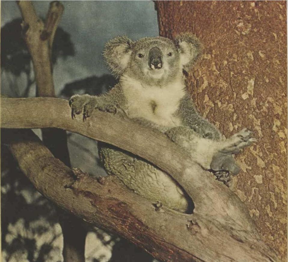
Photo: Koala in Mona Vale in 1958 from Australian Women's Weekly Article - see Bayview Koala Sanctuary

Sydney Wildlife (Sydney Metropolitan Wildlife Services) Needs Volunteers

January  7, 2025
As you know our work doesn't stop. 
We had the introduction of our new computer system which we all had to learn and get used to during a very busy time of the year! And everyone nailed it.

Now down to business; We need you!! Our next Rescue and Care Course is starting in February and we are desperate for members all over Sydney. Wouldn't it look great on your resume if you are looking for a job? ‘Volunteer at Sydney Metropolitan Wildlife Services’ the skills you learn are endless! 

I could write a list as long as my arm the suburbs we need members in. So if this is something you have ever thought about, dreamt about or even had a discussion with your neighbour about now is the time! 

Follow the link and sign up: 

Maybe you cant have animals in your residence but have a car. We also need transporters to transport animals to carers from vets email info@sydneywildlife.org.au

Don't have a car, can't keep animals at home? Sign up for our volunteer rescue line. This is run 24/7 by volunteers. One overnight shift a week (5pm-9am) could be your volunteer hours if Centrelink require you to volunteer. 
These shifts can be done from your own home so you can still feed the kids, pop them to bed, jump in to bed yourself and just answer the phone if it rings between those times or do set hours a week during the day. Contact Carolyn for a chat at 

An egg-cellent beach activity

Shark and skate egg cases come in all different shapes, colours and sizes, and they are all unique to the species. Only the Draughtboard Shark (Cephaloscyllium laticeps) lays eggs of this particular shape and size.


After hatching, the egg cases wash up on beaches, where they may be mistaken for seed pods or other marine creatures.

So while you're at the beach this summer, the CSIRO want you to record your sightings of shark egg cases for The Great Eggcase Hunt Australia.

The CSIRO have teamed up with The Shark Trust, so it's easy to record your sightings via their app or website. It would be a jaws-ome help to their work.

Find out more about the hunt and download the app at: https://www.csiro.au/en/news/all/articles/2023/march/great-eggcase-hunt

Draft Plan of Management for Dogs offleash On South Mona Vale Beach Open for feedback

The Northern Beaches Council announced on Wednesday December 11 2024 that it is placing its draft Plan of Management (PoM) for the southern end of Mona Vale Beach on exhibition for feedback.

Feedback closes on Sunday February 9 2025. The document is available here  (PDF: 4.06MB)

The adoption of this PoM would amend Pittwater Council’s Ocean Beaches Plan of Management (2005) (Ocean Beaches PoM) as set out in Appendix 9, pursuant to section 41 of the Local Government Act. The effect of the amendment is that the Ocean Beaches PoM would no longer apply to Mona Vale Beach (southern end).

The NSW Government (via Crown Lands, Department of Planning, Housing and Infrastructure) recently transferred the management of Crown Land at Mona Vale Beach and at Palm Beach to the Northern Beaches Council and gave consent for the draft PoM for South Mona Vale Beach to be publicly exhibited.

The State Government, which requires this document to be made, states, 'Plans of management are legal documents we develop and maintain to guide how Crown land will be sustainably managed. They provide a wealth of information about that site, including social, environmental, and economic values, set objectives and performance targets for community land, and provide for active land management and use, including the issuing of tenures over the land.'

The draft PoM, among other aspects of these standard documents, has ostensibly been prepared to include a proposal for a dog off-leash area.  

That does not mean residents of Pittwater should focus solely on that primary reason in any feedback provided. This is an opportunity to scrutinise how the Northern Beaches Council states it will protect coastal vegetation and wildlife habitat, support the ongoing use by the whole of the community of the foreshore (beach) area, and how it will assess whether it is meeting the criteria within its own PoM.

For instance, page 20 of the Draft POM records;

The NSW Biodiversity Values (BV) Map is facilitated by the NSW State Government and identifies land with high biodiversity value, particularly sensitive to impacts from development and clearing. On the 27 October 2023, the BV Map was updated to include the addition of revised habitat mapping for a number of threatened species. As a result, a portion of vegetation within the PoM is now identified on the BV Map (see Figure 7).

A draft PoM for Governor Phillip Park, another public whole of community (and whole of world) public space, which also includes a proposal for a dog off-leash area trial at Palm Beach (north) and has again been drafted primarily for the same reason, is also being developed by the Northern Beaches Council and this draft POM is expected to be prepared by mid-2025. 

The Northern Beaches Council has stated it will then seek the Department’s and then the Northern Beaches Council Councillors approval to also publicly exhibit this draft PoM.  

Dogs are currently prohibited at the southern end of Mona Vale Beach and on the beach at Palm Beach, however, dogs are seen on both beaches, and every other beach across the LGA, all day every day. 

The Northern Beaches Council has stated this restriction will remain in place unless the Northern Beaches Council adopts the draft PoM, amends the existing prohibition, and designates a part of the beach as an area for dogs to be off-leash under section 13(6) of the Companion Animals Act 1998.

Following public exhibition of the draft PoM, feedback will be reviewed, and the outcome of the public exhibition and any final draft POM will be reported to a Council meeting for Northern Beaches Council Councillors to approve. 

The land is a combination of escarpment and restored coastal vegetation leading down to partially vegetated foredune and beach and ocean. 

The land and beach is used by families with toddlers and young children, for surfing, swimming, and less strenuous activities such as just sitting and enjoying the view.

The area provides feeding and nesting habitat for aquatic and land-based birds and animals, environmental conservation and dune stabilisation within the dune areas. 

Those who enjoy strolling, running, passive and active beach and ocean activities and who contribute as volunteer bush revegetation and regeneration workers are the current every day and regular users of South Mona Vale Beach. 

The Northern Beaches Council said in a release it is yet to make a decision about proceeding with dog off-leash area trials at both locations as various processes must be completed before the Northern Beaches Council is in a position to do so. 

However, as both this and the PoM being drafted for Governor Phillip Park, and the REF that preceded these, were drafted specifically to permit dogs offleash in both these public spaces and wildlife habitat, and the Northern Beaches Council is again topping the state for dog attack statistics that resulted in the deaths of wildlife and hospitalisation of residents and visitors, and residents have reported to the news service again this week being attacked while using the ocean rock pools, beaches and public paths across the Local Government Area, the only fly in that ointment may turn out to be Mr. or Mrs. 'I'll Sue this ******** Council'.

Is this an area where those who have big dogs that need a kilometre or two to run fast in, more space than their backyards provide and as long as the whole of Mona Vale beach, where other users won't mind sitting and swimming in dog urine and faeces? 

Having your children run over, mauled and scarred for life or being told 'get out of here if you don't like it, this is a dog beach' looks set to be on its way, and has already been happening, at south Mona Vale beach.

Dog parks that include water features and large areas for furry darlings to romp are a success in Western Sydney areas, and have proved a lot less expensive than all the processes followed here has now accrued, in more than just financial costs, to our community.

''In the meantime, please only exercise your dog at approved locations across the area otherwise you may be subject to a $330 fine for contravening the dog off-leash rule or for being the owner of dog in prohibited public space.'' the Northern Beaches Council release states in closing

The 'you may be fined' under the Northern Beaches Council contrasts in messaging to the 'You Will Definitely Be Fined and/or Prosecuted' that occurs in other LGAs. But as a high amount of community reports on how the Northern Beaches Council is trying to rein in what has become a serious problem across the LGA come in every week, the 'may' has become 'will' again here too. Following advice by others to 'do what you want where you want and when you want' is leading to an insurmountable financial burden and absolute heartbreak for some.

It's heart-breaking hearing their stories of what happens when you ignore the law, NBC signage and rules, and follow that advice. And heart-breaking hearing of the trauma undergone and pain experienced by those who end up in hospital because someone has followed that advice.

Feedback closes on Sunday February 9 2025. The PoM document is available here  (PDF: 4.06MB)  The Northern Beaches Council webpage to provide feedback is at: yoursay.northernbeaches.nsw.gov.au/mona-vale-beach-south-plan-management

For those who wish to address more than the stated main reason for this new PoM; the habitat, other potential uses and other items drafted into the PoM, and use the emailing or writing option and format, rather than the 'yay' or 'nay' 1 minute survey on the NBC webpage, those addresses are:

Email: council@northernbeaches.nsw.gov.au

In writing: marked 'Mona Vale Beach (southern end) Plan of Management', Northern Beaches Council, PO Box 82, Manly NSW 1655.

The Northern Beaches Council also states it is providing:

Come and chat Pop-up event

Sunday 19 January 2025 12:00 pm to 02:00 pm, at Village Park, Mona Vale 

Come and chat with the Project Team at our stall at the Australian Made Markets

Book a call

Click the button (here) to book a call to chat with the project team. If none of the times available suit you, call 1300 434 434 to arrange another time.

Mon 13 Jan, 2 - 5pm

Wed 15 Jan, 8.30 - 11.30am

Wed 5 Feb, 11.30 - 2.30pm

Thur 6 Feb, 8.30 - 11.30am.

The whole of the 2023-2024 dog attack statistics for the Northern Beaches Council LGA were released in November 2024, and are available in: 

Australia Post urges councils to take strong action as dog attacks on Posties continue: Northern Beaches Council Dog Attack Numbers for 2023/24 Higher than LGAs with more than twice the number of registered dogs


North Palm Beach; dogs are taken into this area despite clear signage this is a no dogs area

Dogs on South Mona Vale Beach, Saturday December 15:image supplied

Dogs on Turimetta Beach, December 2024: Image supplied

Dogs on Narrabeen beach, December 2024: Image supplied


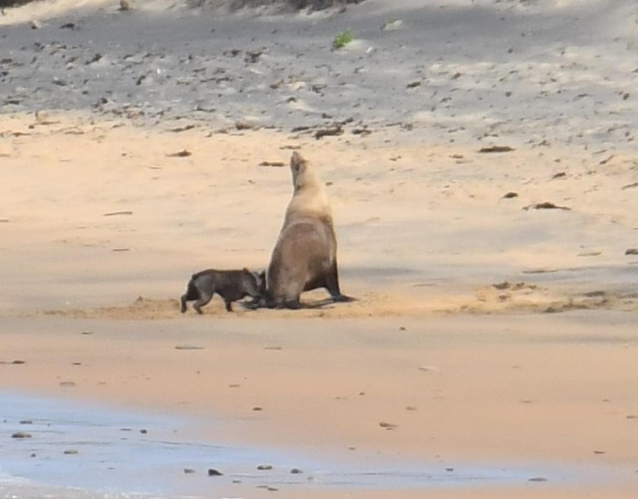
Dog attacking formerly resting seal at Long Reef Aquatic Reserve (a WPA). Photos supplied

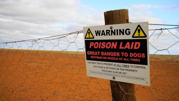
Garigal National Park: ‘1080 pest management’

Applies until Sat 01 Feb 2025, 2.12am. 
NSW National Parks and Wildlife Service will be conducting a baiting program using manufactured baits, fresh baits and Canid Pest Ejectors (CPEs) containing 1080 poison (sodium fluroacetate) for the control of foxes. 

The program is continuous and ongoing between 1 August 2024 and 31 January 2025 in Garigal National Park. Don’t touch baits or ejector devices. Penalties apply for non-compliance.
All baiting locations are identifiable by signs.

Domestic pets are not permitted in NSW national parks and reserves. Pets and working dogs may be affected (1080 is lethal to cats and dogs). Pets and working dogs must be restrained or muzzled in the vicinity and must not enter the baiting location. In the event of accidental poisoning seek immediate veterinary assistance.

Fox baiting in these reserves is aimed at reducing their impact on threatened species.

For more information, contact the local park office on: Forestville 9451 3479 (business hours)
NPWS after-hours call centre: 1300 056 294 (after hours)

Plastic Bread Ties For Wheelchairs

The Berry Collective at 1691 Pittwater Rd, Mona Vale collects them for Oz Bread Tags for Wheelchairs, who recycle the plastic.

Berry Collective is the practice on the left side of the road as you head north, a few blocks before Mona Vale shops . They have parking. Enter the foyer and there's a small bin on a table where you drop your bread ties - very easy.

A full list of Aussie bread tags for wheelchairs is available at: HERE 


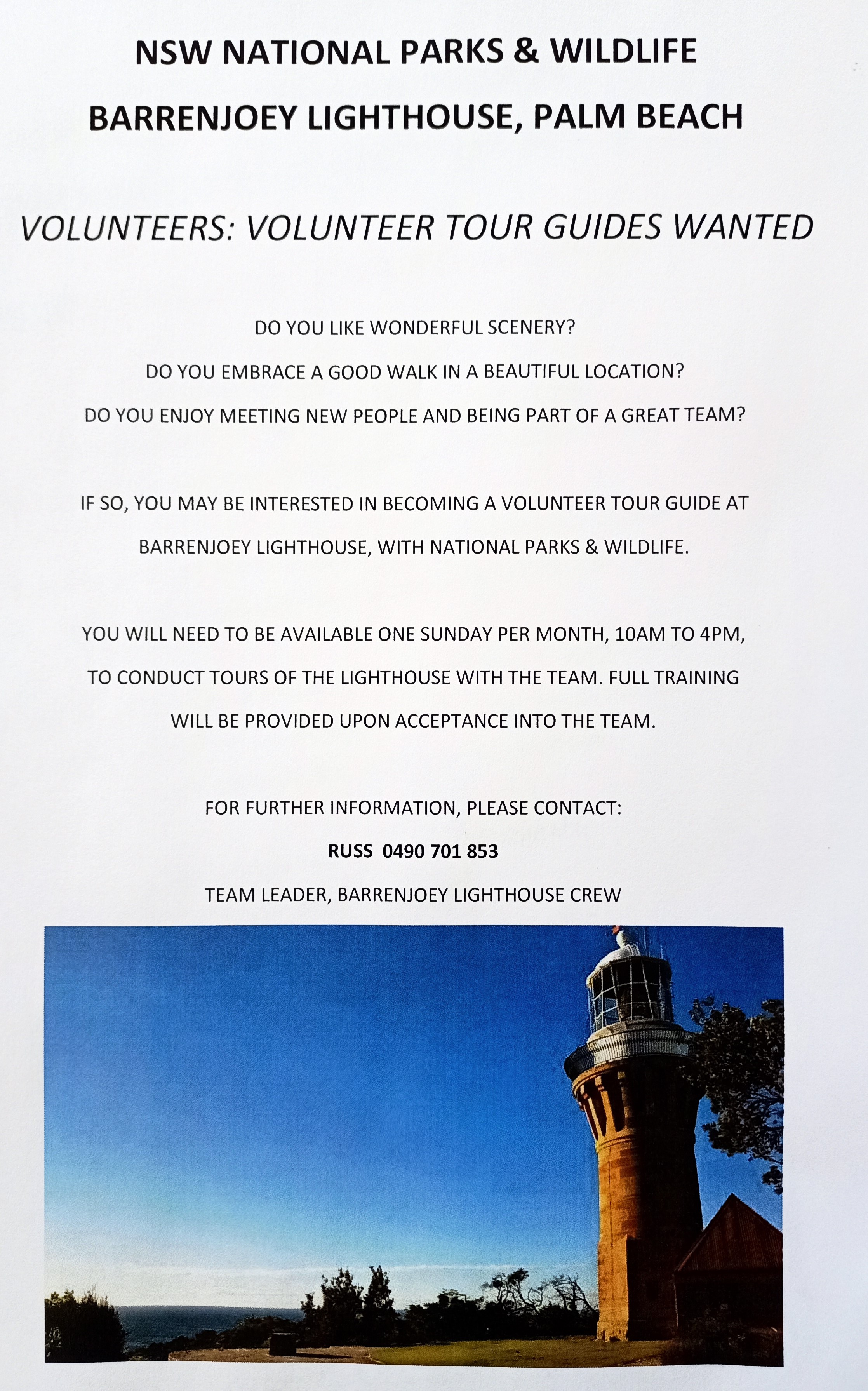
Volunteers for Barrenjoey Lighthouse Tours needed

Details:

Stay Safe From Mosquitoes 

NSW Health is reminding people to protect themselves from mosquitoes when they are out and about this summer.

NSW Health’s Acting Director of Environmental Health, Paul Byleveld, said with more people spending time outdoors, it was important to take steps to reduce mosquito bite risk.

“Mosquitoes thrive in wet, warm conditions like those that much of NSW is experiencing,” Byleveld said.

“Mosquitoes in NSW can carry viruses such as Japanese encephalitis (JE), Murray Valley encephalitis (MVE), Kunjin, Ross River and Barmah Forest. The viruses may cause serious diseases with symptoms ranging from tiredness, rash, headache and sore and swollen joints to rare but severe symptoms of seizures and loss of consciousness.

“People should take extra care to protect themselves against mosquito bites and mosquito-borne disease, particularly after the detection of JE in a sentinel chicken in Far Western NSW.

The NSW Health sentinel chicken program provides early warning about the presence of serious mosquito borne diseases, like JE. Routine testing in late December revealed a positive result for JE in a sample from Menindee. 

A free vaccine to protect against JE infection is available to those at highest risk in NSW and people can check their eligibility at NSW Health.

People are encouraged to take actions to prevent mosquito bites and reduce the risk of acquiring a mosquito-borne virus by:
  • Applying repellent to exposed skin. Use repellents that contain DEET, picaridin, or oil of lemon eucalyptus. Check the label for reapplication times.
  • Re-applying repellent regularly, particularly after swimming. Be sure to apply sunscreen first and then apply repellent.
  • Wearing light, loose-fitting long-sleeve shirts, long pants and covered footwear and socks.
  • Avoiding going outdoors during peak mosquito times, especially at dawn and dusk.
  • Using insecticide sprays, vapour dispensing units and mosquito coils to repel mosquitoes (mosquito coils should only be used outdoors in well-ventilated areas)
  • Covering windows and doors with insect screens and checking there are no gaps.
  • Removing items that may collect water such as old tyres and empty pots from around your home to reduce the places where mosquitoes can breed.
  • Using repellents that are safe for children. Most skin repellents are safe for use on children aged three months and older. Always check the label for instructions. Protecting infants aged less than three months by using an infant carrier draped with mosquito netting, secured along the edges.
  • While camping, use a tent that has fly screens to prevent mosquitoes entering or sleep under a mosquito net.
Remember, Spray Up – Cover Up – Screen Up to protect from mosquito bite. For more information go to NSW Health.

Mountain Bike Incidents On Public Land: Survey

This survey aims to document mountain bike related incidents on public land, available at: https://www.surveymonkey.com/r/K88PSNP

Sent in by Pittwater resident Academic for future report- study. The survey will run for 12 months and close in February 2025.

Report fox sightings

Fox sightings, signs of fox activity, den locations and attacks on native or domestic animals can be reported into FoxScan. FoxScan is a free resource for residents, community groups, local Councils, and other land managers to record and report fox sightings and control activities. 

Our Council's Invasive species Team receives an alert when an entry is made into FoxScan.  The information in FoxScan will assist with planning fox control activities and to notify the community when and where foxes are active.


marine wildlife rescue group on the Central Coast

A new wildlife group was launched on the Central Coast on Saturday, December 10, 2022.

Marine Wildlife Rescue Central Coast (MWRCC) had its official launch at The Entrance Boat Shed at 10am.

The group comprises current and former members of ASTR, ORRCA, Sea Shepherd, Greenpeace, WIRES and Wildlife ARC, as well as vets, academics, and people from all walks of life.

Well known marine wildlife advocate and activist Cathy Gilmore is spearheading the organisation.

“We believe that it is time the Central Coast looked after its own marine wildlife, and not be under the control or directed by groups that aren’t based locally,” Gilmore said.

“We have the local knowledge and are set up to respond and help injured animals more quickly.

“This also means that donations and money fundraised will go directly into helping our local marine creatures, and not get tied up elsewhere in the state.”

The organisation plans to have rehabilitation facilities and rescue kits placed in strategic locations around the region.

MWRCC will also be in touch with Indigenous groups to learn the traditional importance of the local marine environment and its inhabitants.

“We want to work with these groups and share knowledge between us,” Gilmore said.

“This is an opportunity to help save and protect our local marine wildlife, so if you have passion and commitment, then you are more than welcome to join us.”

Marine Wildlife Rescue Central Coast has a Facebook page where you may contact members. Visit: https://www.facebook.com/profile.php?id=100076317431064


Watch out - shorebirds about

Summer is here so watch your step because beach-nesting and estuary-nesting birds have started setting up home on our shores.
Did you know that Careel Bay and other spots throughout our area are part of the East Asian-Australasian Flyway Partnership (EAAFP)?

This flyway, and all of the stopping points along its way, are vital to ensure the survival of these Spring and Summer visitors. This is where they rest and feed on their journeys.  For example, did you know that the bar-tailed godwit flies for 239 hours for 8,108 miles from Alaska to Australia?

Not only that, Shorebirds such as endangered oystercatchers and little terns lay their eggs in shallow scraped-out nests in the sand, NSW National Parks and Wildlife Service (NPWS) Threatened Species officer Ms Katherine Howard has said.
Even our regular residents such as seagulls are currently nesting to bear young.

What can you do to help them?
Known nest sites may be indicated by fencing or signs. The whole community can help protect shorebirds by keeping out of nesting areas marked by signs or fences and only taking your dog to designated dog offleash area. 

Just remember WE are visitors to these areas. These birds LIVE there. This is their home.

Four simple steps to help keep beach-nesting birds safe:
1. Look out for bird nesting signs or fenced-off nesting areas on the beach, stay well clear of these areas and give the parent birds plenty of space.
2. Walk your dogs in designated dog-friendly areas only and always keep them on a leash over summer.
3. Stay out of nesting areas and follow all local rules.
4. Chicks are mobile and don't necessarily stay within fenced nesting areas. When you're near a nesting area, stick to the wet sand to avoid accidentally stepping on a chick.


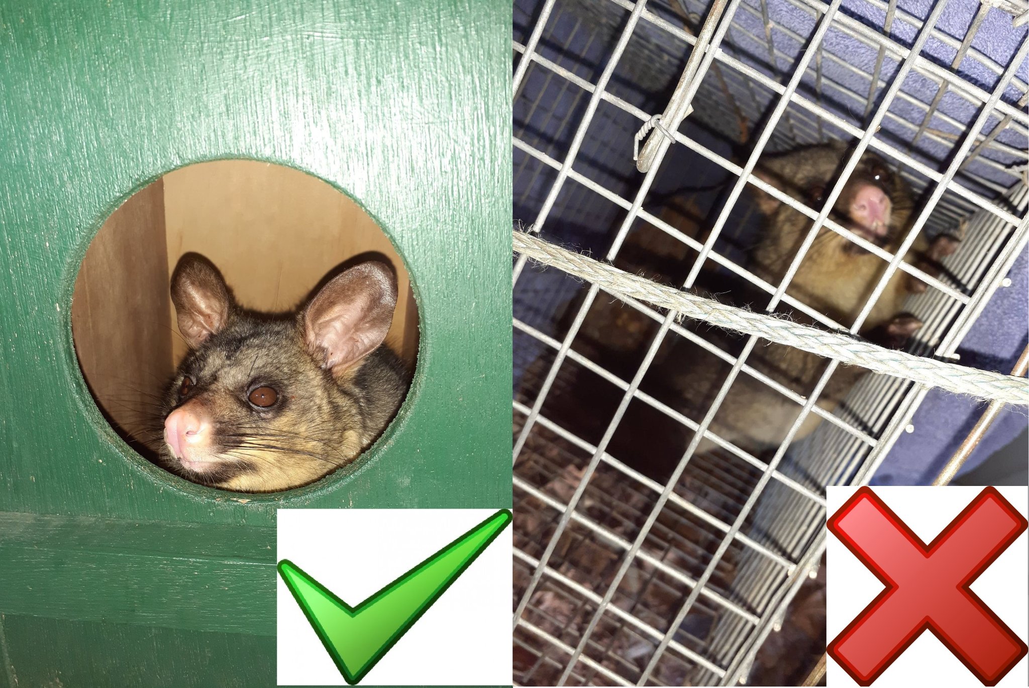
Possums In Your Roof?: do the right thing

Possums in your roof? Please do the right thing 
On the weekend, one of our volunteers noticed a driver pull up, get out of their vehicle, open the boot, remove a trap and attempt to dump a possum on a bush track. Fortunately, our member intervened and saved the beautiful female brushtail and the baby in her pouch from certain death. 

It is illegal to relocate a trapped possum more than 150 metres from the point of capture and substantial penalties apply.  Urbanised possums are highly territorial and do not fare well in unfamiliar bushland. In fact, they may starve to death or be taken by predators.

While Sydney Wildlife Rescue does not provide a service to remove possums from your roof, we do offer this advice:

✅ Call us on (02) 9413 4300 and we will refer you to a reliable and trusted licenced contractor in the Sydney metropolitan area. For a small fee they will remove the possum, seal the entry to your roof and provide a suitable home for the possum - a box for a brushtail or drey for a ringtail.
✅ Do-it-yourself by following this advice from the Department of Planning and Environment: 

❌ Do not under any circumstances relocate a possum more than 150 metres from the capture site.
Thank you for caring and doing the right thing.


Sydney Wildlife photos

Aviaries + Possum Release Sites Needed

Pittwater Online News has interviewed Lynette Millett OAM (WIRES Northern Beaches Branch) needs more bird cages of all sizes for keeping the current huge amount of baby wildlife in care safe or 'homed' while they are healed/allowed to grow bigger to the point where they may be released back into their own home. 

If you have an aviary or large bird cage you are getting rid of or don't need anymore, please email via the link provided above. There is also a pressing need for release sites for brushtail possums - a species that is very territorial and where release into a site already lived in by one possum can result in serious problems and injury. 

If you have a decent backyard and can help out, Lyn and husband Dave can supply you with a simple drey for a nest and food for their first weeks of adjustment.

Bushcare in Pittwater: where + when

For further information or to confirm the meeting details for below groups, please contact Council's Bushcare Officer on 9970 1367 or visit Council's bushcare webpage to find out how you can get involved.

BUSHCARE SCHEDULES 
Where we work                      Which day                              What time 

Avalon     
Angophora Reserve             3rd Sunday                         8:30 - 11:30am 
Avalon Dunes                        1st Sunday                         8:30 - 11:30am 
Avalon Golf Course              2nd Wednesday                 3 - 5:30pm 
Careel Creek                         4th Saturday                      8:30 - 11:30am 
Toongari Reserve                 3rd Saturday                      9 - 12noon (8 - 11am in summer) 
Bangalley Headland            2nd Sunday                         9 to 12noon 
Catalpa Reserve              4th Sunday of the month        8.30 – 11.30
Palmgrove Park              1st Saturday of the month        9.00 – 12 

Bayview     
Winnererremy Bay                 4th Sunday                        9 to 12noon 

Bilgola     
North Bilgola Beach              3rd Monday                        9 - 12noon 
Algona Reserve                     1st Saturday                       9 - 12noon 
Plateau Park                          1st Friday                            8:30 - 11:30am 

Church Point     
Browns Bay Reserve             1st Tuesday                        9 - 12noon 
McCarrs Creek Reserve       Contact Bushcare Officer     To be confirmed 

Clareville     
Old Wharf Reserve                 3rd Saturday                      8 - 11am 

Elanora     
Kundibah Reserve                   4th Sunday                       8:30 - 11:30am 

Mona Vale     
Mona Vale Beach Basin          1st Saturday                    8 - 11am 
Mona Vale Dunes                     2nd Saturday +3rd Thursday     8:30 - 11:30am 

Newport     
Bungan Beach                          4th Sunday                      9 - 12noon 
Crescent Reserve                    3rd Sunday                      9 - 12noon 
North Newport Beach              4th Saturday                    8:30 - 11:30am 
Porter Reserve                          2nd Saturday                  8 - 11am 

North Narrabeen     
Irrawong Reserve                     2nd Saturday                   2 - 5pm 

Palm Beach     
North Palm Beach Dunes      3rd Saturday                    9 - 12noon 

Scotland Island     
Catherine Park                          2nd Sunday                     10 - 12:30pm 
Elizabeth Park                           1st Saturday                      9 - 12noon 
Pathilda Reserve                      3rd Saturday                      9 - 12noon 

Warriewood     
Warriewood Wetlands             1st Sunday                         8:30 - 11:30am 

Whale Beach     
Norma Park                               1st Friday                            9 - 12noon 

Western Foreshores     
Coopers Point, Elvina Bay      2nd Sunday                        10 - 1pm 
Rocky Point, Elvina Bay           1st Monday                          9 - 12noon

Friends Of Narrabeen Lagoon Catchment Activities

Bush Regeneration - Narrabeen Lagoon Catchment  
This is a wonderful way to become connected to nature and contribute to the health of the environment.  Over the weeks and months you can see positive changes as you give native species a better chance to thrive.  Wildlife appreciate the improvement in their habitat.

Belrose area - Thursday mornings 
Belrose area - Weekend mornings by arrangement
Contact: Phone or text Conny Harris on 0432 643 295

Wheeler Creek - Wednesday mornings 9-11am
Contact: Phone or text Judith Bennett on 0402 974 105
Or email: Friends of Narrabeen Lagoon Catchment : email@narrabeenlagoon.org.au

Gardens and Environment Groups and Organisations in Pittwater


Ringtail Posses 2023

NSW marine life – the importance of seagrass

By NSW Fisheries, November 2024

Learn about seagrass and why it is so important for the health of many marine animals in NSW. Seagrass occurs throughout NSW’s estuaries and is protected because of its ecological values. 

This video was created by NSW DPIRD Fisheries with funding via the Marine Estate Management Strategy.

Underwater photo and video content courtesy of @williamgladstonephotography, used with permission.

Study shows hot leaves can’t catch carbon from the air. It’s bad news for rainforests – and Earth

Researchers study leaves in the Daintree rainforest in North Queensland, Australia, using a canopy crane. Alexander Cheesman
Kristine CrousWestern Sydney University and Kali MiddlebyJames Cook University

On the east coast of Australia, in tropical North Queensland, lies the Daintree rainforest – a place where the density of trees forms an almost impenetrable mass of green.

Stepping into the forest can feel like stepping back in time. It contains many ancient plant families dating back to the ancient supercontinent of Gondwana. The air is warm and thick with humidity, carrying the earthy scent of wet leaves and soil. Sunlight filters through the dense canopy in scattered beams, while ferns and seedlings carpet the forest floor.

The Daintree and other tropical rainforests, including those in the Amazon, the Congo Basin and Southeast Asia, have been called the “lungs” of our Earth. They absorb carbon dioxide from the air while releasing water vapour and oxygen via photosynthesis – the process by which plants take in carbon dioxide and fix energy.

Because of this, their leafy canopies play a crucial role in regulating the global climate – and mitigating global warming.

But our recent research shows that rising temperatures will severely affect the ability of tropical forests to photosynthesise. This will hinder their capacity to absorb carbon dioxide from the atmosphere, reducing their role in mitigating global warming and exacerbating climate change.

Coping with a rapidly changing climate

The ability of plants to adjust to different environments (also known as acclimating) is an important strategy for them to cope with a changing world.

Plants can dynamically acclimate to their environment. When warmed, they can adjust their photosynthesis to perform more efficiently at moderately higher temperatures. This allows them to maintain or even increase their carbon uptake under these new conditions.

However, tropical trees may have a limited capacity to acclimate to warming, because they have evolved under relatively stable climatic conditions. As a result, they are already near the upper limit of temperatures they can tolerate without suffering damage.

River running over rocks through a lush rainforest.
Tropical rainforests absorb carbon dioxide from the air while releasing water vapour and oxygen via photosynthesis. Kristine Crous

Warming the leaves of tropical rainforest trees

To test this theory, we set up an experiment in the Daintree rainforest focusing on tropical trees between 15 and 30 metres tall.

Using a canopy crane to access the treetops, we installed custom-made leaf-heater boxes to warm leaves from four mature tree species by 4°C – a temperature rise predicted for tropical systems by 2100.

Boxes were made from plastic takeaway containers with fishing wire to hold the leaf in place and a heating wire to heat the leaves. Leaf temperatures were measured throughout the experiment and a feedback control algorithm was used to maintain consistent heating.

The experiment lasted eight months, making it one of the longest running in-situ leaf warming experiments in a mature tropical forest.

By comparing the physiological responses of warmed leaves to the responses of non-warmed leaves, we were able to capture a realistic picture of how tropical tree leaves might respond to future climate warming.

Small plastic containers with heating elements attached to trees.
Scientists used custom-made leaf-heater boxes to warm leaves from four mature tree species. Kristine Crous

Warming reduces photosynthesis across all species

Our study found warming reduced photosynthesis across all species.

Photosynthetic rates dropped by an average of 35% in warmed leaves compared to non-warmed controls. This decline was driven by two key factors.

First, the leaf pores, called stomata, which allow carbon dioxide to enter and water to escape, became less open in response to the drier air around the warmed leaves.

Second, the warmer temperatures interfered with the enzymes essential for photosynthesis, reducing their ability to fix carbon.

Even after eight months of warming, the trees showed little ability to adjust to the higher temperatures. They did not improve their capacity to photosynthesise effectively at the elevated temperatures, nor did they shift the maximum temperature at which photosynthesis could be maintained.

This supports the idea that these trees may already be operating close to their thermal limits.

Infrared image of a heated leaf.
At 4°C of warming, the leaves of slow-growing rainforest trees had a significantly reduced ability to photosynthesise. Kali Middleby

Significant implications for the global water cycle

Our findings of reduced carbon uptake and decreased water loss due to stomatal closure under warmer temperatures align with the concept of a “weakened pulse” of water exchange in tropical systems.

This has significant implications for the global water cycle.

While stomatal closure can limit water released to the atmosphere, a drier atmosphere simultaneously extracts more moisture from trees, creating a complex dynamic.

The response of tropical forests to warming will undoubtedly affect the water cycle, but the overall impact remains uncertain.

Little room to adapt

Other studies have also pointed to detrimental effects of climate change on tropical ecosystems, including a warmer and drier atmosphere.

Lowland tropical environments are already near the physiological limits for photosynthesis. This leaves little room for trees to adapt to rising temperatures and drier conditions.

Combined with predictions of warming and drying from climate models, these studies point to less resilient tropical forests under climate change, weakening their role as the lungs of the Earth.

Morning mist floating above rainforest-lined mountside.
There is little room for tropical rainforests to adapt to rising temperatures and drier conditions caused by climate change. Michel Arnault/Shutterstock

Protecting rainforest biodiversity offers hope

However, the biodiversity of tropical rainforests offers some hope, as not all species are equally vulnerable.

Recent research shows fast-growing species are less affected by warming compared to slow-growing ones. While this is promising, it’s important to remember that species that live longer play the most significant role in long-term carbon storage.

These findings highlight the urgency of protecting tropical forests and limiting the magnitude of global warming by carbon dioxide emissions.

Conservation strategies should focus on maintaining biodiversity to enhance resilience, and identifying species that have a greater potential to acclimate in a warming world.The Conversation

Kristine Crous, Senior Lecturer, School of Science and Hawkesbury Institute for the Environment, Western Sydney University and Kali Middleby, Plant Ecophysiologist, James Cook University

This article is republished from The Conversation under a Creative Commons license. Read the original article.

We tracked the Tasmanian boobook as it flew a remarkable 250 kilometres non-stop across Bass Strait

By JJ Harrison - Own work, CC BY-SA 4.0.CC BY
Jessica Wei ZhouMonash University and Rohan ClarkeMonash University

Every year, tens of thousands of land birds make a long flight across Bass Strait – the stretch of water separating Tasmania from continental Australia.

Well known for its high winds and rough seas, crossing Bass Strait is no small feat for these migrant land birds. Migration is stressful for birds, as they encounter inhospitable environments, predators, and weather changes while expending peak energy.

But how exactly do these birds traverse this daunting stretch of ocean?

Understanding this is more crucial than ever. New developments proposed in Bass Strait, particularly offshore wind farms, may introduce challenges for migrating birds. And until now, no one has looked closely at the movement pathways of these little migrants.

Our new research tracked the migration paths of Tasmanian boobooks, Ninox leucopsis, as they crossed from Victoria to Tasmania.

We found the Tasmanian boobook was indeed a regular migrant across Bass Strait – making it Australia’s only migratory owl. Rather than island-hopping, these small owls completed the roughly 250 kilometre flight across the strait in a single night, in one continuous flight.

These insights may help us protect birds in a rapidly changing world.

choppy seas, island and cloud
Well known for its high winds and rough seas, crossing Bass Strait is no small feat for these migrant land birds. Shutterstock/nektofadeev

Tagging and tracking the Tasmanian boobook

As their name suggests, Tasmanian boobooks are common across Tasmania and were once considered endemic to the island. Over time, they were occasionally spotted in mainland Australia, with scattered records in Victoria and elsewhere.

In recent years, a more consistent pattern was revealed when keen birdwatchers discovered small numbers of these owls perched on Cape Liptrap, southeast of Melbourne, in spring. Could these birds actually be migrants about to make the Bass Strait crossing after winter on the mainland?

With thermal cameras, special nets, and lightweight miniature GPS-tracking devices in hand, we travelled to the southeast Victorian coast to catch five Tasmanian boobooks at these headlands.

Once we attached the tracking devices, we could follow their movements for up to three weeks before the tags failed and were dislodged.

researcher attaches tracker to owl
Researchers attached tracking devices to the owls. Jessica Zhou

Facinating findings

We found the Tasmanian boobook is Australia’s only migratory owl. In fact, it is what’s known as a “partial migrant”. This means while some birds of the species migrate, many other individuals remain in Tasmania year-round.

Three of our tagged birds departed southeast Victoria in October and November. They began their nonstop journeys at dusk and arrived in northern Tasmania early the following morning.

Two continued moving further inland to central Tasmania over subsequent nights and eventually settled at elevations of around 750 metres.

These observations suggest the migrating Tasmanian boobooks may be fleeing harsh winter conditions at high elevation areas. This phenomenon, known as altitudinal migration, has been observed in other Tasmanian birds such as the flame robin and crescent honeyeater.

We also discovered unexpected variety in the Tasmanian boobook migration patterns. Some birds left from Cape Liptrap and others from Wilsons Promontory, at the southern tip of Victoria.

They also flew at varying speeds under a surprising range of weather conditions, including headwinds upon departure. This is in an impressive feat for an owl, which weighs just 210–240 grams and probably undertakes the crossing by continuously flapping its wings.

New clues and questions about other Bass Strait migrants

Bird migration in the southern hemisphere is little-studied compared with northern hemisphere migration.

In Australia, movement patterns are particularly complex and variable due to the vast scale of the continental landmass, the variable geography such as mountains, deserts, and islands, and unpredictable climate.

At least 24 species migrate across Bass Strait. They range from songbirds and raptors to the critically endangered orange-bellied parrot and swift parrot.

Much of what we know comes from limited land-based observations. The Tasmanian boobooks we tracked give us just a small insight into the many migratory journeys across Bass Strait.

However, the variation we observed in just three migratory tracks for a single species raises questions about other Bass Strait migrants.

Are islands less crucial as stopover points than previously thought? Even for species like the orange-bellied parrot, which does use islands, it remains plausible many individuals might cross Bass Strait in a single non-stop flight.

These unanswered questions about bird movement across Bass Strait is not just a matter of curiosity.

Hazards old and new

Migratory birds are exposed to a greater range of threats than non-migratory birds. Crossing Bass Strait means risking inclement weather, artificial lighting, and collision with boats or oil rigs. Now, new developments may also present novel challenges.

Australia is rapidly expanding its renewable energy sector, including offshore wind.

Several areas in Bass Strait have been declared by the federal government as priority areas for wind farm development and many projects are already being planned.

These developments are essential for reducing emissions and combating climate change. But how do we balance the necessary transition to clean energy, while minimising direct harm to biodiversity?

Offshore wind farms can displace birds from their routes, or worse, introduce collision risks.

Environmental assessments are a mandatory part of wind farm development in Australia, but they need to be informed by robust ecological data.

Understanding the basic ecology of land-bird migration is crucial. We need to know where the threats to migratory birds are highest, which species are at risk of collisions, and how to mitigate these threats as the transition to renewable energy continues.The Conversation

Jessica Wei Zhou, Researcher in Ecology, Monash University and Rohan Clarke, Associate Professor, School of Biological Sciences, Monash University

This article is republished from The Conversation under a Creative Commons license. Read the original article.

Nothing new under the sun: Australia’s long history of missed chances to build sustainable homes

South Australian Home Builders’ Club members at work. SAHBC collection S284, Architecture Museum, University of South Australia
Julie CollinsUniversity of South Australia and Lyrian DanielUniversity of South Australia

Australians are no strangers to housing crises. Some will even remember the crisis that followed the second world war. As well as producing the popular mid-century modern style of architecture, these post-war decades were a time of struggle.

As the population grew quickly after the war, Australia faced an estimated shortage of 300,000 dwellings. Government intervention was needed. A 1944 report by the Commonwealth Housing Commission stated that “a dwelling of good standard and equipment is not only the need but the right of every citizen”.

A key recommendation was that the Australian government should encourage the building of more climate-responsive and healthy homes.

So, what happened? Why are so many homes today still not well-designed for the local climate?

An Australian Architectural Convention Exhibition display pavilion in 1956.
Australian Architectural Convention Exhibition display pavilion, 1956. Neighbour collection S294, Architecture Museum, University of South Australia

Building small and for a sunny climate

The postwar period was a time of shortages and rationing. As well as meat, sugar, clothing and fuel, building materials were in short supply.

Government restrictions limited house sizes in general to around 110 square metres. That’s less than half the average size of new houses today. Building activity and the prices of materials were also regulated.

While people waited for building permits, many had to arrange temporary housing. Some lived in sleepouts or rented spare rooms from strangers. Others camped in tents or lived in caravans or temporary buildings erected on land bought before the war.

Looking at the published advice on housing design in the 1940s and 1950s, it’s clear passive solar design, small home sizes and climate-responsive architecture were topics of interest. A passive solar design works with the local climate to maintain a comfortable temperature in the home.

An illustration and plan for a small house from 1953
A typical builder’s house plan of the post-war period, ‘This Week’s Plan’ from The Builder, March 20 1953. Architecture Museum, University of South Australia

This preference was not driven by concerns about climate change or carbon footprints. Rather, the Commonwealth Housing Commission called for solar planning “for health and comfort”.

The commission’s executive officer, architect Walter Bunning, demonstrated how to go about this in his book Homes in the Sun. He translated government recommendations into a format appealing to home builders.

This was a time before most home owners could afford air conditioning. It was advised that homes be sited to capture prevailing breezes, have insulated walls and roofs, use window shading and overhanging eaves, and plantings of shade trees and deciduous creepers. External spaces, such as patios, and north-facing living spaces oriented to the sun, were also promoted.

Among the designs were plans for the “Sun Trap House”. This design applied passive solar design principles to a modest freestanding home.

An illustration of the Sun Trap House
An illustrated view (above) and plans (below) for the Sun Trap House. From Walter Bunning, Homes in the Sun (1945, W.J. Nesbit, Sydney)
Plan and orientation of the Sun Trap House

‘New approach’ didn’t eventuate

Eventually, the housing crisis eased. However, this was not a result of Bunning’s hoped for “new approach to house planning”. Most of the new housing was traditionally designed and built suburban homes.

These came in the form of stock plans by builders and construction companies, with owner builders making up 40% of the homes constructed in 1953-54. Sponsored housing provision programs, including the War Service Homes Scheme and Soldier Settlement Scheme, were rolled out across the country.

Illustration of a house built under the War Service Homes Scheme
An illustration of a house built under the War Service Homes Scheme. Viney collection S278, Architecture Museum, University of South Australia

At a state level, arms of government such as the South Australian Housing Trust and the Victorian Housing Commission provided not only houses for the rental market but also for purchase. These houses included imported prefabricated dwellings.

Cover of 1953 Homebuilders Handbook from the Small Homes Service of South Australia
Homebuilders Handbook from the Small Homes Service of South Australia, 1953. Cheesman collection S361, Architecture Museum, University of South Australia

As a result, many homes built in the postwar housing crisis suffer from much the same problems as their predecessors. It led to a situation today where 70% of Australian houses have an energy rating of three stars or lower. That’s well short of the current seven-star standard for new homes.

It wasn’t for lack of architectural advice

In a time of shortage, most people were happy to have a roof over their heads no matter what the design. To architects, this seemed a wasted opportunity.

As a result, the Royal Australian Institute of Architects promoted architect-designed plans that people could buy for a nominal fee. In South Australia, these were available through the Small Homes Service.

House advice and plans for sale were featured in newspapers and magazines such as the Australian Home Beautiful. The institute also published brochures that promoted the idea that “better design considers climate and environment” and followed recommendations by the Commonwealth Experimental Building Station for maximum comfort.

Architect's plan from Small Homes Service of South Australia brochure
Architect’s plan from Small Homes Service of South Australia brochure. Cheesman collection S209, Architecture Museum, University of South Australia

Passive solar solutions are timeless

The energy-hungry mechanical heating and cooling of today’s houses often neglects passive solar and simple solutions such as insulation, eaves, window awnings, curtains and draught stoppers. These were common solutions in the post-war period.

The principles of passive solar design haven’t changed since then. The ideas advocated both in 1945 and today in design advice such as the Australian government’s Your Home guide to environmentally sustainable homes remain the same.

Black and white photo of a house built from plans by  Small Homes Service of South Australia in 1959.
A house built from Plan AC 301 by the Small Homes Service of South Australia, 1959. Tideman collection S307, Architecture Museum, University of South Australia

While our world today faces many crises affecting health, climate resilience, housing affordability and inequality, we have a chance to shape the solutions.

The federal government is developing a National Housing and Homeless Plan and has committed A$10 billion to its housing fund. The target is to build 1.2 million homes over the next five years. What better opportunity to learn from the past and build a brighter, more sustainable future?The Conversation

Julie Collins, Research Fellow and Curator, Architecture Museum, University of South Australia and Lyrian Daniel, Associate Professor in Architecture, University of South Australia

This article is republished from The Conversation under a Creative Commons license. Read the original article.

Cabana drama: 5 expert tips on how not to be branded a twit when using a beach tent

Shutterstock/Jun Huang
Samuel CornellUNSW Sydney

Debate erupted this week over the growing number of beach tents, or “cabanas”, proliferating on Australian beaches. The controversy, which began on social media, was fuelled by Prime Minister Anthony Albanese who declared it was “not on” for beachgoers to reserve a spot on the sand by erecting a cabana then leaving it vacant for hours.

Albanese told Nine’s Today show “everyone owns the beach” and staking a claim on the sand was “a breach of that principle, really”.

Other critics deem beach cabanas an eyesore. And lifeguards say the structures can obscure their view of the water, which poses a safety risk.

Beach cabanas do, however, serve a valid purpose. They provide some protection against the sun’s harmful ultraviolet rays and, from a recreational perspective, can enable people to spend longer at the beach on hot days than they might have otherwise.

I’m a member of the University of NSW Beach Safety Research Group, and I’ve worked with local councils and national parks to address health and safety issues on beaches. So let’s look at how to strike the right balance between personal convenience and public safety when using a cabana.

A fair go for all?

In years past, Aussies came to the beach with a towel and maybe a book, stayed a little while then left.

But more recently, the use of beach tents and cabanas has grown. It’s likely the result of Australia’s growing coastal population, and a rising awareness of the dangers posed by sun exposure.

These days, it’s not uncommon to visit a popular beach in summer and find a village of cabanas stretching as far as the eye can see.

It’s great to see so many people using the beach. Beaches and oceans are health-giving places, though they come with inherent dangers.

And of course, in Australia the beach is free for all who wish to use it. It’s an approach in line with our supposedly egalitarian culture, in which everyone gets a “fair go”. Here, beaches are a place to be shared, no matter what your income or social status.

The approach contrasts to many destinations in Europe, the United States and elsewhere, where large sections of beaches are reserved for private use. At Waikiki beach in Honolulu, for example, people pay US$100 or more to hire an umbrella and chairs, and a place on the sand for the day.

To some naysayers, cabana use in Australia challenges the notion that the beach is for everyone. They question whether people should be allowed to mark out beach territory no-one else can use. That’s why in 2020, a bid by a private company to introduce paid cabanas on Sydney’s Bondi Beach prompted a public outcry.

Cabanas bring practical challenges, too. They represent an unplanned influx of temporary infrastructure into busy public spaces. Left unchecked, they could cause pedestrian congestion and become a flashpoint for disagreement between beachgoers.

umbrellas and cabanas on crowded beach
Cabanas, pictured here among beach umbrellas, represent an unplanned influx of temporary infrastructure into busy public spaces. Shutterstock/LIGHTITUP

The current debate may prompt Australian beach authorities to consider bringing in cabana regulation, similar to what’s in place for some beaches in the US.

In the meantime, here are five tips for safe and fair use of beach cabanas:

1. Placement: Erect your cabana at the back of the beach and away from lifeguard towers or lifesaver tents to avoid obstructing lifeguards’ views. Clear sightlines to the water are essential for ensuring timely emergency responses. This positioning also leaves space closer to the water for other beachgoers, including children playing at the water’s edge.

2. Tying down: Secure your cabana firmly in the sand to prevent it from being blown away by strong winds. Flying cabanas are a danger to other beach users, potentially causing injuries and damage to property.

3. Spacing: Avoid overcrowding by maintaining two to three meters between structures. This ensures free movement and accessibility for all beachgoers, and ensures families and groups can enjoy the beach without feeling cramped. Also, stay within the boundaries of your cabana and don’t claim territory outside its boundaries.

4. Emergency access: Keep pathways and access points clear at all times. This is crucial for lifeguard vehicles, ambulances and surf rescue teams. Unobstructed access can make the difference between life and death in an emergency.

5. Common sense: As with using any shared space, consider the needs of others and apply common sense. How would you feel if someone set up a structure right in front of you, blocking your view of the waves or ruining your vibe? Or if you or a loved one needed medical attention on a beach, would you want an ambulance crew obstructed by an unbroken line of tents?

beach tent with cart on sand
Make sure you leave adequate spacing between beach tents to allow emergency access. Shutterstock/Daria Nipot

Looking ahead

In the past, some have called for a ban on beach cabanas. But the structures appear here to stay – and that’s not a bad thing. Skin cancer affects more young Australians than any other cancer, and the Cancer Council applauds the use of cabanas.

It’s important to note, however, that cabanas do not provide complete protection from UV rays. If you’re at the beach all day, you might still get too much sun even under a tent.

When it comes to your next visit to the coast, by all means pack your cabana. But make sure you use it carefully and responsibly, so everyone’s day at the beach is safe and enjoyable.The Conversation

Samuel Cornell, PhD Candidate, UNSW Beach Safety Research Group + School of Population Health, UNSW Sydney

This article is republished from The Conversation under a Creative Commons license. Read the original article.

This summer, please leave the sea shells by the seashore

Maël BALLAND/Pexels
Nathan Brooks EnglishCQUniversity Australia and Robert MuirIndigenous Knowledge

When I (Nathan Brooks English) was six years old, I snuck a starfish home from the beach and hid it in my closet. I regret that now, as my parents did then when the smell of rotting starfish overwhelmed the house. I regret it also because that starfish had a place and a purpose – and dying in a hot, dark closet next to my Hot Wheels was not it.

Likewise, the beautiful shells and natural flotsam that decorate Australian beaches have a place and a purpose. For many of us, summer at the beach is a cherished memory and collecting seashells is probably a part of that memory.

On most beaches in Australia, collecting shells without living creatures in them is legal, but let me convince you there are better options that ensure future Sallies will still find seashells by the seashore.

Someone needs that shell more than you

For native wildlife, both occupied and unoccupied shells provide important shelter and sources of calcium and grit.

Taking that beautiful snail shell could increase the cost of housing for a hermit crab or the small shrimp that needs it next. The beautiful conch shell that calls to you is actually an octopus caravan.

For these reasons, never pick up shells in the water or in tidal pools; chances are they are being used or will be shortly.

Likewise, collecting shells in marine parks is strictly prohibited.

A hermit crab crawls along in a sea shell.
Chances are that shell you want is being used – or will be shortly. William Edge/Shutterstock

Shells have spiritual and cultural importance

For the island Woppaburra People of central Queensland, beaches and shells have spiritual and cultural importance as part of Dreaming stories, dance and ceremonies.

In addition to their place and purpose in my (Robert Muir) stories and culture, shells can also provide valuable insight and context to our history on the island.

Middens (deep piles of shells left on the beach after being used to produce food or tools) provide archaeological evidence that the islands have been occupied for at least the past 5,000 years.

Back then, Woppa (also known as Great Keppel Island, in Queensland) and its beaches could sustainably support the 100 to 200 people who lived on the island for more than five millenia.

Today, Woppa hosts tens of thousands of visitors a year on three small beaches. And while people are welcome to pick up, examine and play with the shells, to preserve their place and purpose they must be left on the shore where they were found.

Woppa is seen from the sky.
Visitors to Woppa (also known as Great Keppel Island) can pick up shells, but they should put them back. Wazzy/Shutterstock

If everyone took a shell…

Increasing pressure on beaches and their natural resources isn’t just felt on Woppa.

The global population now exceeds 8 billion people and our collective (pun intended) impact on beaches is magnified. That’s twice as many people as when I (Nathan Brooks English) was a child in the late 1970s.

For example, in 2019 Bondi Beach had more than 2.1 million visitors (not that anyone is looking at shells). If everyone took a shell, there’d be hardly any left.

Even smaller beaches need time to accumulate shells and a summer rush of collectors can quickly deplete beaches of shells until the next cyclone or winter storm washes more up.

What to do instead of collecting shells

So how do we balance wanting a tangible reminder of the beach in our own yards or homes (the destination of many shells) versus not damaging the natural beauty and function of beach ecosystems?

Instead of taking a shell, take a picture instead. You can photograph unoccupied shells in place along the beach where the tide has collected, or arrange them together for a photographic collage.

Include them in your sandcastles as gates, windows, or little people to populate the castle.

For your artsy children (or adults), use crayons or coloured pencils and a small sketch pad to draw the shells.

Taking a few shells at a time to your umbrella to sketch them and then returning them to the tide line will sate the urge to collect and leave the beach unchanged.

You may even find you have a gifted scientific illustrator on your hands.

A woman and her daughter collect sea shells on the sea shore.
When you’re done with the shells, just leave them near the shore. Photo by Gustavo Fring/Pexels

When you’re done with the shells, leave them by the shore. Wind, tides and time (or tomorrow’s small visitor) will sweep them back into natural circulation, continuing their storied lives as creature homes or fine grit for our beautiful Australian beaches, their purpose and place preserved.

If you absolutely must pick something up and take it home, please pick up some of the vast amount of plastic found on Australian beaches.The Conversation

Nathan Brooks English, Associate professor; Flora, Fauna & Freshwater Research Cluster Lead, CQUniversity Australia and Robert Muir, Project Officer at the Woppaburra TUMRA Aboriginal Corporation, Indigenous Knowledge

This article is republished from The Conversation under a Creative Commons license. Read the original article.

How is Antarctica melting, exactly? Crucial details are beginning to come into focus

The front of the Ross Ice Shelf floats in the Ross Sea, Antarctica. Matt Siegfried/Scripps Institution of OceanographyCC BY-NC
Madelaine Gamble RosevearUniversity of TasmaniaBen Galton-FenziBishakhdatta GayenThe University of Melbourne, and Catherine VreugdenhilThe University of Melbourne

The size of the Antarctic ice sheet can be hard to comprehend. Two kilometres thick on average and covering nearly twice the area of Australia, the ice sheet holds enough freshwater to raise global sea levels by 58 metres.

Ice loss from this sheet is projected to be the leading driver of sea level rise by 2100, yet its contribution remains highly uncertain. While sea levels are certain to rise this century, projections of the contribution from Antarctic ice vary from a 44 cm rise to a 22 cm fall.

Much of this uncertainty is because the ocean processes that control the fate of the sheet occur on an incredibly small scale and are very difficult to measure and model.

But recently scientists have made significant progress in understanding this “ice-ocean boundary layer”. This progress is the subject of our new review paper, published today in Annual Reviews.

Shrinking, thinning and retreating

At the margins of the Antarctic ice sheet, glaciers flow into the Southern Ocean, forming floating ice shelves. These ice shelves act as keystones, stabilising the ice sheet. They’re also shrinking.

The ocean melts ice shelves from below – a process known as “basal melting”. Increased basal melting has led to the thinning and retreat of the ice sheet in some regions, raising global sea levels.

A giant chunk of ice calving off an ice sheet.
Ice shelves in Antarctica ice shelves act as keystones, stabilising the ice sheet, but they’re shrinking due to climate change. Goldilock Project/Shutterstock

It has also slowed the deepest current in the global overturning circulation, a system of ocean currents that circulates water around the globe.

Like the glaciers that feed them, ice shelves are immense. Yet the ocean processes that control basal melting, and the fate of the entire Antarctic ice sheet, occur on the scale of millimetres. They happen in a thin layer of ocean, just beneath the ice.

The boundary layer between the ice shelf and the ocean is cold, miles from anywhere, and beneath very thick ice, so it’s no wonder it has hardly been measured at all.

Studying this layer with other techniques such as computer simulations is also a huge challenge. Until recently, the tiny motions within the ice-ocean boundary layer put accurate modelling of ice melt out of reach.

These twin challenges have long stymied efforts to answer the deceptively simple question: “How does the ocean melt Antarctic ice shelves?”

An ice sheet with lava-like, flowing shapes.
The underside of ice shelves feature a weird and wonderful icescape. Filip Stedt

Modelling the micro-scale

Computer simulations of ocean processes aren’t new.

But only recently have simulations of the ice-ocean boundary layer become feasible, as computing resources grow and the cost of using them shrinks.

Several research groups around the world have taken on this problem, modelling the micro-scale ocean flow that supplies heat to the ice for melting.

Researchers are looking for a relationship between what the ocean is doing, and how quickly the ice melts. So far, they’ve uncovered not just one relationship but several, each indicating a different melt “regime”. Ocean conditions (temperature, salt content and the speed of ocean currents) and the shape of the ice determine which melting regime applies.

Ice sheet shape is key because meltwater is fresh and lighter than the surrounding ocean. Like hot air collecting at the top of a room, fresh, cold meltwater collects in hollows in the lower surface of the ice sheet, insulating the ice from the ocean water below and slowing melting.

For steeply sloping ice, the insulating effect is much less. The energetic flow of meltwater as it rises under steep ice leads to mixing with the warmer ocean waters. This increases melting.

Fast ocean currents have a similar effect, as they transfer heat to the ice.

Orange robotic submarine moving through ice floes.
Underwater robots have allowed scientists to get an unprecedented look at the underside of the ice in Antarctica. Filip Stedt/University of Gothenburg

Sonar-fitted robots

Recently, ocean robots, including autonomous underwater vehicles and tethered probes deployed by drilling through the ice, have provided unprecedented amounts of data on the environment beneath ice shelves.

Using sonar and cameras, these robots have revealed a weird and wonderful “icescape” on the underside of ice shelves.

This icescape is made of many different ice features, ranging from centimetres to kilometres in size. Some, like steep-sided crevasses, are formed by ice fracturing. Others, like dimpled depressions in the ice (often called “scallops”), stair-like “terraces”, mussel-shaped “scoops”, and larger basal channels, are thought to be formed by melt processes.

Streak of dark blue ice on a white ice sheet.
The strange shapes on the underside of ice shelves are thought to be formed by melt processes. Filip Stedt

Our new knowledge of melting from computer simulations and robots sheds light on these features and how they form. The existence of melt regimes helps explain the evolution of steep-sided terraces, or why different features appear in distinct parts of an ice shelf.

For instance, in the warm, calm eastern part of the Dotson ice shelf in west Antarctica, an autonomous robot observed basal terraces. In the west of Dotson – which experiences cold, fast currents – large mussel-shaped scoops were discovered.

Uncertainties remain

Exactly how some of these features form is still unknown.

New simulations that allow the ice-water boundary to move in time show the “self-sculpting” behaviour of ice melt. This is similar to how dunes form and move in a desert.

However, new computer models are needed to simulate the formation and evolution of the whole icescape.

Some of the recent advances highlighted here are helping to reduce the uncertainty in our understanding of the contribution of the Antarctic ice sheet to global sea level rise.

However, incorporating our new understanding of basal melt, and the dynamic icescape it forms, into climate and ice sheet models still presents a huge challenge.

Overcoming this challenge is urgent. Accurate representation of melt in climate and ice sheet models will reduce the deep uncertainty in sea level rise projections, especially as ocean conditions – and ice shelf melt regimes – shift into the future.The Conversation

Madelaine Gamble Rosevear, Postdoctoral Fellow in Physical Oceanography, University of TasmaniaBen Galton-Fenzi, Principal Scientist; Bishakhdatta Gayen, ARC Future Fellow & Associate Professor, Mechanical Engineering, The University of Melbourne, and Catherine Vreugdenhil, ARC DECRA Research Fellow in Fluid Dynamics, The University of Melbourne

This article is republished from The Conversation under a Creative Commons license. Read the original article.

Arctic has changed dramatically in just a couple of decades – 2024 report card shows worrying trends in snow, ice, wildfire and more

Twila A. MoonUniversity of Colorado BoulderMatthew L. DruckenmillerUniversity of Colorado Boulder, and Rick ThomanUniversity of Alaska Fairbanks

The Arctic can feel like a far-off place, disconnected from daily life if you aren’t one of the 4 million people who live there. Yet, the changes underway in the Arctic as temperatures rise can profoundly affect lives around the world.

Coastal flooding is worsening in many communities as Arctic glaciers and the Greenland Ice Sheet send meltwater into the oceans. Heat-trapping gases released by Arctic wildfires and thawing tundra mix quickly in the air, adding to human-produced emissions that are warming the globe. Unusual and extreme weather events, pressure on food supplies and intensifying threats from wildfire and related smoke can all be influenced by changes in the Arctic.

In the 2024 Arctic Report Card, released Dec. 10, we brought together 97 scientists from 11 countries, with expertise ranging from wildlife to wildfire and sea ice to snow, to report on the state of the Arctic environment.

They describe the rapid changes they’re witnessing across the Arctic, and the consequences for people and wildlife that touch every region of the globe.

Highlights from the 2024 Arctic Report Card. NOAA.

Pace of change in the Arctic accelerates

The Arctic of today looks stunningly different from the Arctic of even one to two decades ago. Over the Arctic Report Card’s 19 years, we and the many contributing authors to the report have watched the pace of environmental change accelerate and the challenges become more complex.

For the past 15 years, the Arctic snow season has been one to two weeks shorter than it was historically, shifting the timing and character of the seasons.

Shorter snow seasons can challenge plants and animals that depend on regular seasonal changes. Longer snow-free seasons can also reduce water resources from snowmelt earlier in spring or summer and increase the possibility of drought.

Change in Arctic snow cover and length of the season. Arctic Report Card 2024, NOAA Climate.gov

The extent of sea ice, an important habitat for many animals, has declined in ways that make today’s mostly thin and seasonal sea ice landscape unrecognizable compared with the thicker and more extensive sea ice of decades past.

With a shorter sea ice season, the dark ocean surface is exposed and can absorb and store more heat during summer, which then adds to air and ocean temperature increases. This aligns with observations of long-term warming for Arctic surface ocean waters. Sea ice-dependent animals can also be forced ashore or into longer fasting seasons. The Arctic shipping season is also lengthening, with rapidly increasing shipping traffic each summer.

Map showing Arctic sea ice at its lowest extent in 2024, in September, was much less than historic ice coverage. A chart accompanying the map shows ice coverage declining over time.
Arctic sea ice has been thinning and covering less area than in the past. Arctic Report Card 2024, NOAA Climate.gov

Overall, 2024 brought the second-warmest temperatures to the Arctic since measurements began in 1900, and the wettest summer on record.

A map shows Arctic temperatures in 2024 compared to the long-term average. A chart with it shows average temperature for the region trending upward faster than the global average since the 1960s.
Arctic surface temperatures have been rising faster than the global average. Arctic Report Card 2024, NOAA Climate.gov

Arctic tundra becomes a carbon source

For thousands of years, the Arctic tundra landscape of shrubs and permafrost, or frozen ground, has acted as a carbon dioxide sink, meaning that the landscape was taking up and storing this gas that would otherwise trap heat in the atmosphere.

But permafrost across the Arctic has been warming and thawing. Once thawed, microbes in the permafrost can decompose long-stored carbon, breaking it down into carbon dioxide and methane. These heat-trapping gases are then released to the atmosphere, causing more global warming.

Wildfires have also increased in size and intensity, releasing more carbon dioxide into the atmosphere, and the wildfire season has grown longer.

A map shows where Arctic land releases more carbon than it takes up, looking at 2002-2020 average.
Large parts of the Arctic that once took up more carbon that they released have become net carbon sources in recent years, contributing to climate change. Arctic Report Card 2024, NOAA Climate.gov

These changes have pushed the tundra ecosystem over an edge. Susan Natali and colleagues found that the Arctic tundra region is now a source – not a sink, or storage location – for carbon dioxide. It was already a methane source because of thawing permafrost.

The Arctic landscape’s natural ability to help to buffer human heat-trapping gasses is ending, adding to the urgency to reduce human emissions.

Stark regional differences make planning difficult

The Arctic Report Card covers October through September each year, and 2024 was the second-warmest year on record for the Arctic. Yet, the experience for people living in the Arctic can feel like regional or seasonal weather whiplash.

Stark regional differences in weather can make planning difficult and challenge familiar seasonal patterns. These include very different conditions in neighboring areas or big changes from one season to another.

For example, some areas across North America and Eurasia experienced more winter snow than usual during the past year. Yet, the Canadian Arctic experienced the shortest snow season in the 26-year record. Early loss of winter snow can strain water resources and may exacerbate dry conditions that can add to fire danger.

A maps shows that several regions of the Arctic had their highest precipitation on record, or near record, in winter 2024.
A map of Arctic precipitation from January to March 2024 shows the wide differences among regions and where some saw their wettest year on record. Arctic Report Card 2024, NOAA Climate.gov

Summer across the Arctic was the third warmest ever observed, and areas of Alaska and Canada experienced record daily temperatures during August heat waves. Yet, residents of Greenland’s west coast experienced an unusually cool spring and summer. Though the Greenland Ice Sheet continued its 27-year record of ice loss, the loss was less than in many recent years.

Ice seals, caribou and people feeling the change

Rapid Arctic warming also affects wildlife in different ways.

As Lori Quakenbush and colleagues explain in this year’s report, Alaska ice seal populations, including ringed, bearded, spotted and ribbon seals, are currently healthy despite sea ice decline and warming ocean waters in their Bering, Chukchi and Beaufort sea habitats.

However, ringed seals are eating more saffron cod rather than the more nutritious Arctic cod. Arctic cod are very sensitive to water temperature. As waters warm, they shift their range northward, becoming less abundant on the continental shelves where the seals feed. So far, negative effects on seal populations and health are not yet apparent.

A map shows where Arctic caribou herds have declined in size, particularly in northern Canada, Russia and parts of Alaska.
Many caribou herds have lost population in recent years. Arctic Report Card 2024, NOAA Climate.gov

On land, large inland caribou herds are overwhelmingly in decline. Climate change and human roads and buildings are all having an impact. Some Indigenous communities who have depended on specific herds for millennia are deeply concerned for their future and the impact on their food, culture and the complex and connected living systems of the region. Some smaller coastal herds are doing better.

Indigenous peoples in the Arctic have deep knowledge of their region that has been passed on for thousands of years, allowing them to flourish in what can be an inhospitable region. Today, their observations and knowledge provide vital support for Arctic communities forced to adapt quickly to these and other changes. Supporting Indigenous hunters and harvesters is by its very nature an investment in long-term knowledge and stewardship of Arctic places.

Action for the Arctic and the globe

Despite global agreements and bold targets, human emissions of heat-trapping gasses are still at record highs. And natural landscapes, like the Arctic tundra, are losing their ability to help reduce emissions.

Simultaneously, the impacts of climate change are growing, increasing Arctic wildfires, affecting buildings and roads as permafrost thaws, and increasing flooding and coastal erosion as sea levels rise. The affects are challenging plants and animals that people depend on.

Key messages from the Arctic Report Card 2024
Click to expand image. Arctic Report Card 2024, NOAA Climate.gov

Our 2024 Arctic Report Card continues to ring the alarm bell, reminding everyone that minimizing future risk – in the Arctic and in all our hometowns – requires cooperation to reduce emissions, adapt to the damage and build resilience for the future. We are in this together.The Conversation

Twila A. Moon, Deputy Lead Scientist, National Snow and Ice Data Center (NSIDC), Cooperative Institute for Research in Environmental Sciences (CIRES), University of Colorado BoulderMatthew L. Druckenmiller, Research Scientist, National Snow and Ice Data Center (NSIDC), Cooperative Institute for Research in Environmental Sciences (CIRES), University of Colorado Boulder, and Rick Thoman, Alaska Climate Specialist, University of Alaska Fairbanks

This article is republished from The Conversation under a Creative Commons license. Read the original article.

Trees ‘remember’ wetter times − never having known abundant rain could buffer today’s young forests against climate change

Trees killed by drought and an outbreak of bark beetles in California’s Tahoe National Forest in 2023. AP Photo/Godofredo A. Vásquez
Alana ChinCal Poly Humboldt Janneke Hille Ris LambersSwiss Federal Institute of Technology Zurich, and Marcus SchaubSwiss Federal Institute for Forest, Snow and Landscape Research (WSL)

What does the future hold for forests in a warmer, drier world? Over the past 25 years, trees have been dying due to effects of climate change around the world. In AfricaAsiaNorth AmericaSouth America and Europe, drought stress amplified by heat is killing trees that have survived for centuries.

Old trees may have grown through entire millennia that were wetter than the past 20 years. We are scientists who study forest dynamicsplant ecology and plant physiology. In a recent study, we found that trees can remember times when water was plentiful and that this memory continues to shape their growth for many years after wet phases end.

This research makes us optimistic that young trees of today, which have never known 20th-century rainfall, have not shaped their structure around water abundance and thus may be better equipped to survive in a chronically dry world.

Maps showing projected water deficits due to climate change by the mid-20th century across the U.S.
Climatic water deficit is a shortfall of water necessary to fully supply plants’ needs. If those needs are met, the deficit is zero. A higher number indicates drier conditions. Climate change will increase plants’ water needs, intensifying climatic water deficits in many areas. U.S. National Climate Assessment, 2023CC BY-ND

What if we water the forest?

This study built on nearly 20 years of forest research in response to early warning signs of forest loss in the 1990s in the dry Rhône River Valley of the Swiss Alps. At that time, scientists observed that Scots pine trees that had stood for around 100 years were declining and dying. They wondered whether drought or other climate factors were driving this loss.

To tackle this question, researchers at the Swiss Federal Institute for Forest, Snow and Landscape Research designed an ecological experiment. To understand the impacts of drought, they would irrigate a mature forest, doubling natural summertime rainfall, and then compare how these water-rich trees fared in comparison with those receiving only natural precipitation.

The Pfynwald experiment, launched in 2003, has shown that trees survived at higher rates in irrigated plots. After 17 years of irrigation, the team found that irrigation didn’t just help trees survive dry phases – it also increased their growth rates.

Tree physiologist Leonie Schönbeck conducts research at Pfynwald, a natural reserve in southern Switzerland, to learn how trees take up and store energy and use their reserves to recover from drought.

Legacy effects are forests’ memories

Trees experiencing drought alter their leaves, wood and roots in ways that prime them for continued dry conditions. Wood under drought might have smaller cells that are less vulnerable to future damage, and roots might increase relative to leaf area. These structural changes persist after the drought has passed and continue to influence the tree’s growth and ability to tolerate stress for many years.

Known as “legacy effects,” these lingering post-drought impacts represent an ecological memory of past climatic conditions at the tree and forest level. Knowing that trees hold a persistent memory of past dry phases, researchers wondered whether they might also show structural changes in response to past wet periods.

Eleven years after summertime irrigation started in Pfynwald, scientists stopped irrigating half of each plot in 2013 to address this question. The formerly irrigated trees, which at this point were about 120 years old, had experienced a lasting period of irrigation – but now those times of plenty were over.

Would the trees remember? A decade later, we found out.

Trees, trains and particle accelerators

On an early March morning in 2023, two of us (Alana Chin and Marcus Schaub) met at Pfynwald to collect very fresh leaf and twig samples so that we and colleagues could look inside to search for signs of lasting effects of past water richness.

At the site, we climbed canopy access towers to collect newly grown treetop leaves and twigs from control trees that had never been irrigated; trees that had been irrigated every summer since 2003; and formerly irrigated trees that had not received irrigation water since 2013.

We took our samples to the Swiss Light Source, an intensely powerful synchrotron – a type of particle accelerator that produces the world’s most intense beams of light. This facility is the home of the TOMCAT, an extremely high-resolution X-ray that allowed us to look inside our leaves and twigs without disturbing their structure.

Scanning our samples took all night, but when we stumbled out of the building, we had images capturing every cell in exquisite detail.

The memory of water

We found that the new leaves of once-irrigated trees were different from both continually watered trees and never-watered control trees. Leaves carry out photosynthesis that fuels a tree’s survival and growth. Inside them, we could see the legacy of past water abundance, written in the size, shape and arrangement of cells.

Reading this cellular signature, we observed that, at the expense of structures promoting productivity, formerly irrigated trees showed every sign of chronic water stress – even more so than never-irrigated trees. In their anatomy, we saw why these trees that had it easy for 11 wet years were now growing slowly.

Every cell in a leaf comes with a trade-off. Trees must balance investments in rapid photosynthesis with others that promote leaf survival. Rather than building the cells used to harvest sunlight and ship sugar to the rest of the tree, leaves on the trees that had been irrigated showed every indication of drought stress we could think to measure.

After receiving extra water for an 11-year stretch and then losing it, the trees were producing new, tiny leaves that invested mostly in their own survival. The leaves were structured to protect themselves from insects and drought and to store water reserves. Compared with leaves on trees that had never known irrigation, these looked as though they were in the middle of the drought of the century.

While this memory of water might seem negative, it likely once helped trees “learn” from past conditions to survive in variable environments. The formerly irrigated trees did not know that humans had played a trick on them. Like trees experiencing climate change, they had no way of knowing that the water was not coming back.

Laser scan of a leaf showing structural changes in response to water stress
A leaf cross section from a formerly irrigated Scots pine tree. In contrast to leaves of trees that have never experienced irrigation, trees that have lost abundant water place more emphasis on features such as water storage (black cells in the center) and protection (large resin ducts that look like holes ringing the leaf) than on the cells needed to produce energy for tree growth (spotted cells). Alana ChinCC BY-ND

When trees experience a drought event, recovery can mean reaching a “new normal” state, in which they are prepared to survive the next drought, with smaller, less vulnerable cells and increased energy reserves to ‘save up’ for future dry periods. They may have deeper roots or a smaller pool of leaves to support, helping them prepare for an unstable environment.

We wanted to know whether the same was true of trees that had experienced water abundance. Were they waiting in distress for the water to return?

Hard times may make tough trees

In some temperate forests, like the ones we studied in Switzerland, old trees once knew levels of water abundance that now are gone, thanks to climate change. That past abundance may have locked into place structural and epigenetic changes in the trees that are mismatched to today’s drier world. If this is true, then some of today’s devastating global tree mortality events may be, in part, due to the legacy effects of past water abundance.

In most of the world’s temperate forests, however, the current cohort of young forest trees – those sprouting in the past 15 to 20 years – has managed to establish itself under conditions that once would have been considered chronic drought. Those young trees, which have survived an endless dry period, will form the forests of the future.

In all, our observations in Pfynwald have provided us some room for hope that young trees currently taking their place in many forests worldwide may be better prepared to cope with the world as humans have shaped it. Climate shifts in recent decades have primed them for hard times, without the lingering memory of water.The Conversation

Alana Chin, Assistant Professor of Plant Physiology, Cal Poly Humboldt Janneke Hille Ris Lambers, Professor of Environmental Systems Science, Swiss Federal Institute of Technology Zurich, and Marcus Schaub, Group Leader, Forest Dynamics and Ecophysiology, Swiss Federal Institute for Forest, Snow and Landscape Research (WSL)

This article is republished from The Conversation under a Creative Commons license. Read the original article.

Property developers installing as few as half of promised ecological features – new report

Not all new property developments make enough provision for wildlife, despite planning stipulations. Nick Beer/Shutterstock
Kiera ChapmanUniversity of Oxford and Malcolm TaitUniversity of Sheffield

The UK is currently one of the world’s most biodiversity-depleted countriesUrbanisation is a known driver of the nature crisis. This means that the planning system, which regulates development in the UK, plays a crucial role in protecting nature from harm.

On paper, things look positive. Over the past 20 years, a growing list of international, national and local laws and policies have been passed to ensure that the planning system protects ecologically sensitive sites. In spring 2024, England’s new biodiversity net gain policy came into effect, requiring all new residential developments to achieve and maintain a 10% increase in biodiversity, secured for 30 years.

In practice, this means that when developers seek planning permission to build new housing, they have to conduct ecological surveys of their proposed site. The local planning authority reads these reports and lists a set of planning conditions, which are binding: in theory, the developer must adhere to them. This includes providing habitat for wildlife on the land used for development, minimising the harms to nature associated with the change of land use, from farmland to urban areas, for example.

However, in the summer of 2024, we audited 42 new developments across five local planning authorities in England to see whether developers were complying with these ecological conditions on the ground. We found just 53% of the ecological features that should have been there were actually present. When we excluded street trees, this fell to 34%.

Our report, which has not yet been peer reviewed, was commissioned and published by Wild Justice. This not-for-profit environmental campaigning organisationwas co-founded by broadcaster Chris Packham, author and conservationist Mark Avery and Ruth Tingay, a columnist who campaigns against raptor persecution – their work is funded by public donations. We wrote the report together with Sarah Postlethwaite, a senior planning ecologist who works for a local authority.

To research every site, we downloaded relevant documents from each council’s planning portal, including landscaping maps. We visited every street and public open space within each development and measured whether the planning conditions had been met on the ground. We walked over 291 hectares of land, surveyed nearly 6,000 houses and searched for 4,654 trees and 868 bird boxes.

graphic showing lost plants in housing development sites
Large percentages of each habitat we measured were missing. Wild Justice/Anna PethenCC BY-NC-ND

More than half (59%) of wildflower grasslands were sown incorrectly or damaged, and 48% of hedges were missing, along with 82% of specialist woodland edge grassland.

Statistics were even worse for species-specific mitigations: 83% of hedgehog highways were absent, along with 75% of bird and bat boxes. Some swift and bat boxes had even been installed upside down, making them useless to their intended occupants.

graph showing missing nature
Many species-specific mitigations were not present on-site. Wild Justice/Anna PethenCC BY-NC-ND

This pattern was surprisingly similar across the country, for all sorts of property developers, sizes of development and location. Given that we looked at many local, regional and national housebuilders, this strongly suggests a systemic issue across the planning and development system.

Lack of enforcement

So why is this happening? One simple reason is a lack of effective regulation. Planning consents are supposed to be enforced by specialist teams in local planning authorities.

Ideally, they would visit every new development and do similar checks, but enforcement budgets have been subjected to severe cuts since 2010, leaving them unable to deal with anything but the most serious breaches. Assessing the presence of ecological features also requires a specialist skillset that most people working in planning enforcement do not have. Alongside a resources problem, there is a skills and knowledge gap that needs to be filled.

But there’s also something more worrying going on. The planning system is focused on the processing of applications, paying little attention to the “concrete” outcomes of the system, in both senses of that word.

A great deal of the private sector consultancy that surrounds ecological mitigations (that includes the work of ecologists, landscape architects and private sector planners) is about producing documents that are prospective and virtual.

Hardly any effort is spent checking up on whether any of this activity equates to outcomes on the ground that genuinely help the natural world. With nobody checking whether conditions are met in practice, developers can simply break ecological planning conditions, and get away with it without consequences.

How to avoid irreparable harm

The situation urgently requires action because the government recently announced a huge increase in housing targets. Their assumption is that the ecological harms associated with this level of urbanisation will be mitigated by existing ecological policy and protections. Our work shows that these systems are simply not working in practice on development sites around the country. If nothing changes, what looks like a biodiversity net gain on paper could become a loss.

houses in background, green field in foreground
If nothing changes, a biodiversity net gain on paper will become a biodiversity loss. Malcolm TaitCC BY-NC-ND

The government has sought to downplay the severity of this situation, presenting housing as a battleground between environmental and social goals, between newts on the one hand and desperate victims of the housing crisis on the other But, presenting this as a direct conflict is a deeply unhelpful and old-fashioned framing. In reality, human and ecological wellbeing are irrevocably intertwined and biodiversity loss has so many hidden social costs. The key is to find affordable and effective solutions to both dimensions.

Habitat degradation is now predicted to lead to a drop in UK GDP of between 6-12% by the 2030s, a financial impact that could end up being greater than the financial crisis or COVID-19. Research suggests that delivering 300,000 homes a year would blow the entire carbon budget for England.

Other, far less environmentally harmful measures can provide a more meaningful solution to housing provision: building social housing on sites with low ecological value, retrofitting existing building stock and controlling the use of housing as an asset for investment to reduce the number of second homes would be a start.

Effective regulation is desperately needed. With the development industry making “supernormal” profits from the construction of housing, there is no excuse for failing both nature and people in this way.


Don’t have time to read about climate change as much as you’d like?
Get a weekly roundup in your inbox instead. Every Wednesday, The Conversation’s environment editor writes Imagine, a short email that goes a little deeper into just one climate issue. Join the 40,000+ readers who’ve subscribed so far.The Conversation


Kiera Chapman, Postdoctoral Research Fellow, Faculty of English, University of Oxford and Malcolm Tait, Professor of Planning, School of Geography, University of Sheffield

This article is republished from The Conversation under a Creative Commons license. Read the original article.

How the world’s tallest bridge saves thousands of tonnes of carbon emissions

The Millau Viaduct spans an entire valley in southern France. Nigel Jarvis / shutterstock
Florimond GueniatBirmingham City University

Measured from ground level to the top of its highest tower, the Millau Viaduct in France is the tallest bridge in the world. At 343 metres, it’s taller than the Eiffel Tower or indeed any skyscraper in western Europe.

The two kilometre long bridge, which recently celebrated its 20th birthday, spans an entire valley and is an astonishing feat of architecture and engineering. But it also has a climate impact.

A megaproject like this, with several skyscraper-sized concrete and steel towers, involves a lot of carbon emissions. Yet the gains it has offered in operational efficiency – a shorter, straighter route, with fewer traffic jams – will probably offset these emissions within ten years. Given that the viaduct is now two decades old, it has far surpassed its carbon break-even point.

How to calculate the emissions impact of a bridge

The viaduct’s architect, Lord Norman Foster, estimates its annual CO₂ emissions savings from heavy goods vehicles alone at 40,000 tonnes. The methodology behind this figure is not fully transparent and it doesn’t appear to be based on peer-reviewed research. (Foster and Partners did not respond to a request for further detail). But, as an academic expert in sustainable energy and transport, I can make some rough calculations that show the Foster figure is at least plausible.

small church with huge bridge in the background
Before the bridge, Millau was a huge transport bottleneck. Artyart / shutterstock

The viaduct forms part of the A75 motorway, a critical north-south route connecting Paris to the city of Montpellier and on to Barcelona. Before it was built, vehicles travelling on the A75 had to navigate a winding, congested route through the Tarn Valley and the town of Millau itself, adding a few stop-start miles to their journey.

The viaduct instead means vehicles can traverse the valley directly, cutting six kilometres from the journey. With about 4.7 million cars and 400,000 trucks using the A75 and the viaduct each year, all those savings add up.

We can estimate the emissions saved using standardised emissions factors of around 150 grams of CO₂ per kilometre for cars and 800 grams per kilometre for trucks. In all, it means the total savings from distance reduction alone amount to several thousand tonnes of CO₂ each year.

But there is more. Larger trucks who previously wanted a simpler and straighter drive generally took a different route through Lyon, a large city to the east, adding more than 60km to a journey from Paris to the south coast. The viaduct means these trucks can take the more direct route, saving perhaps 20,000 tonnes of CO₂. Of course it is hard to quantify exactly which trucks using the A75 would have taken which alternative route, but this is probably where the bulk of Lord Foster’s number comes from.

Before the viaduct was built, Millau was the main bottleneck on the French north-south motorway axis and experienced severe traffic congestion. The viaduct alleviated this congestion.

Research indicates that alleviating traffic congestion can reduce emissions by up to 25%. This is because vehicles consume less fuel when operating at steady speeds compared to frequent acceleration and deceleration in congested conditions. By applying this 25% reduction factor to the emissions saved from the 26km distance of the worst affected area, we can estimate the additional emissions savings attributable to improved traffic flow: a few thousand tonnes of CO₂ per year.

All considered, we can estimate the general emissions savings to be in the order of 25,000 tonnes of CO₂ per year, not too far from Lord Foster figure.

Construction costs vs efficiency savings

While the calculations provide a robust estimate of the viaduct’s emissions savings, it is only part of the story. For example, improved conditions on the A75 could mean more cars and trucks make the journey, partially offsetting the per vehicle fuel savings. This is an example of what’s known as a rebound effect.

That said, the rebound effect appears to be stronger for cars and individual people. For goods vehicles, who were mostly going to make these journeys anyway, research tends to show that new infrastructure like bridges mostly redirect and optimise traffic and do not generate a significant overall increase.

In a celebrated engineering feat at the time, the viaduct used structural components prefabricated off-site. This reduced on-site construction activities and limited the movement of heavy machinery and materials, minimising the impact on local biodiversity and the emissions associated with transportation and on-site operations.

The viaduct required 205,000 tonnes of concrete and 65,000 tonnes of steel. Concrete production emits approximately 75kg of CO₂ per tonne, while steel emits around 1,400kg. Based on these figures, the viaduct’s construction generated roughly 105,000 tonnes of CO₂.

To get a more complete picture of the viaduct’s environmental impact, we’ll need a comprehensive “lifecycle assessment” which would also look at maintenance, repairs, and its eventual decommissioning in 80 years time. For now, we can point to preliminary studies which estimate that around 40% of the carbon footprint of a bridge like this lie in the maintenance and decommissioning. So the bridge will still create a lot more atmospheric carbon in the rest of its lifetime.

Yet, even if the figures in this article are rough estimates, it seems clear that the emissions savings from the straighter and easier journey have already easily offset the carbon used to build and maintain the bridge. This shows how transport infrastructure policy can have a direct impact on decarbonisation. The Millau Viaduct has already prevented more atmospheric carbon than it has generated. From here on, those savings will only grow.


Don’t have time to read about climate change as much as you’d like?
Get a weekly roundup in your inbox instead. Every Wednesday, The Conversation’s environment editor writes Imagine, a short email that goes a little deeper into just one climate issue. Join the 40,000+ readers who’ve subscribed so far.The Conversation


Florimond Gueniat, Associate Professor in Mechanical Engineering, Birmingham City University

This article is republished from The Conversation under a Creative Commons license. Read the original article.

Week One: 1 - 12  January, 2025

Summer's New Pittwater Bubs

PON yard: Little Corella pair with new bubs, January 6 2025

PON yard: new bush turkey

Red triangle slugs appear soon after summer rains - January 2024

Fully recovering Australia’s threatened species would cost 25% of GDP. We can’t do it all at once – so let’s start here

An endangered golden-shouldered parrot. Imogen Warren/Shutterstock
April ResideThe University of QueenslandJames WatsonThe University of Queensland, and Josie CarwardineCSIRO

Australia has already lost at least 100 species since European colonisation. Across land and freshwater habitats, 1,657 species are currently threatened with the same fate. Their populations have fallen 2-3% every year over the last quarter century.

The accelerating loss of species is one of the greatest environmental challenges of our time. Losing biodiversity threatens cultural values, economic stability and society’s wellbeing.

Like many nations, Australia has pledged to stem these losses. We have signed international commitments to restore nature and halt species extinctions.

These are noble and necessary goals. But at present, we lack an understanding of the sheer size, range of options – and expense of the challenge.

In our new research, we estimate the costs of bringing Australia’s threatened species back to their potential ranges. Rather than being limited by current spend on conservation, we calculated what it would cost to fully recover Australia’s threatened species across their viable range.

Our cost models are designed to also be used at different resolutions and scales, from small urban parks up to landscape scale. We found the costs vary greatly, from very low to more than A$12,600 per hectare for areas where intensive efforts such as habitat restoration through tree planting and weed removal would benefit species.

To undo all the human-induced damage and bring nature roaring back across their viable continental range would come with a staggering cost – A$583 billion per year, every year, for at least 30 years. That’s 25% of our GDP.

Figure showing cost of nature recovery in regions of Australia
This figure shows the variation in how much it would cost to introduce all strategies to tackle threats to endangered species. Black indicates no cost (no threatened species occur there), colours represent costs (in AUD) per 1x1 km. Author provided

This, obviously, is infeasible. But it shows the extent of 200 years of human impacts on nature in Australia.

Importantly, it is a cautionary tale for what further damage will cost to repair. And – more positively – it gives us a way to cost and plan for species recovery at local or regional levels.

Australian biodiversity – globally significant, widely threatened

Of the world’s 195 nations, just 17 are mega-biodiverse – nations with very high numbers of species found nowhere else. Australia is one of them.

Unfortunately, feral predators, clearing for agriculture, widespread change to Indigenous fire regimes and other human impacts have caused among the greatest biodiversity losses on the planet in recent history.

Unsurprisingly, the need for species recovery are greatest – and most expensive – in the east and south-west of Australia, where impacts on biodiversity have been most significant. Tackling threats in these regions is particularly challenging and costly.

Map showing where threatened species are found around Australia
This shows the cost of implementing these repair strategies compared with the number of threatened species in a region. Paler areas denote lower cost and fewer species, dark purple denotes high cost and a greater number of species. Author provided

Previous estimates of the cost of recovering these species are orders of magnitude smaller. That’s because these estimates tended to focus on preventing extinction, rather than achieving full species recovery. Many previous estimates also excluded key expenses such as planning, labour and contingencies.

Why is full recovery so expensive?

Full species recovery would require widespread action across most of the continent, especially to manage fire, weed species and invasive predators (cats and foxes) and herbivores (rabbits, deer and more).

We were surprised to learn that the single most expensive measure across the continent wasn’t replanting native habitat or controlling cats and foxes. It’s tackling invasive weeds, such as blackberry and lantana.

At least 470 plant species are threatened by invasive weeds. The worst are “transformer” weeds – vigorous species such as invasive buffel and gamba grasses able to smother entire habitats, out-competing native plants and stopping seed-eating birds, such as the golden-shouldered parrot, squatter pigeon and black-throated finch, from finding food.

Controlling weeds accounts for 81% of our total costs. This is because weeds cover such large areas of Australia.

We acknowledge that full recovery of all of Australia’s threatened species at a continental scale is financially, technically and socially unfeasible. Policymakers need to balance nature restoration with other priorities.

Importantly, recovery actions must take place in a collaborative manner, with First Nations custodians and other land managers and stakeholders.

Bite-sized efforts for nature

Reversing Australia’s trajectory of biodiversity decline will require a range of different efforts across all regions and sectors. It’s important to clearly see the scale of the challenge we face – not to make it insurmountable, but so we can take steps in the right direction.

Our research offers bite-sized ways for organisations, environment groups and governments at all levels to take steps towards the repair of our species and native ecosystems. It provides digestible, local-scale options useful for planners, as well as important (and doable) actions that provide the most benefit threatened species for the resources available.

For example, some recovery efforts are relatively inexpensive per hectare and crucial for native species survival, such as reintroducing ecological burning regimes, and controlling cats and foxes. These type of efforts are often higher priority.

This is exactly what’s being done at Pullen Pullen Station in southwest Queensland, where feral cat control and better fire management are safeguarding the tiny populations of the night parrot – long thought extinct.

How recovering threatened species helps us too

Funding the restoration of nature is good not just for threatened species, but for us as well.

Restoring nature takes a huge effort, which means it would, for instance, involve up to one million people working full time for 30 years. Many of these jobs would be in rural and regional communities.

If implemented collaboratively, farmers could benefit greatly. For farmers, weeds and introduced animals such as mice and rabbits are a constant thorn in their side.

Introduced animals and plants cost billions each year. In the past, many weed-control programs have been done to benefit agriculture, as weeds can also sicken or kill livestock.

Restoration of habitat would, we estimate, store an extra 11 million tonnes of carbon each year, helping Australia towards net zero.

If successful, these efforts could reverse the long-term damage done to our native species and help create new, more sustainable and biodiverse pathways for Australia’s future.

kangaroos in a field with the weed Paterson's curse
Invasive weeds such as Paterson’s curse can be dangerous to native animals as well as livestock. cbpix/Shutterstock

We hope our work helps governments and other organisations see what’s possible and necessary when setting goals for nature and to guide nature related decision making.

The worsening plight of Australia’s biodiversity poses a direct and costly threat to meeting conservation targets. And the most cost-effective action is to avoid further damage.

We depend on nature and nature depends on us. We need to find new solutions for enabling social and economic progress without further harm to our natural world.The Conversation

April Reside, Lecturer in Conservation, The University of QueenslandJames Watson, Professor in Conservation Science, School of the Environment, The University of Queensland, and Josie Carwardine, Senior Research Scientist, Environmental Research, CSIRO

This article is republished from The Conversation under a Creative Commons license. Read the original article.

Sydney Wildlife (Sydney Metropolitan Wildlife Services) Needs Volunteers

January  7, 2025
As you know our work doesn't stop. 
We had the introduction of our new computer system which we all had to learn and get used to during a very busy time of the year! And everyone nailed it.

Now down to business; We need you!! Our next Rescue and Care Course is starting in February and we are desperate for members all over Sydney. Wouldn't it look great on your resume if you are looking for a job? ‘Volunteer at Sydney Metropolitan Wildlife Services’ the skills you learn are endless! 

I could write a list as long as my arm the suburbs we need members in. So if this is something you have ever thought about, dreamt about or even had a discussion with your neighbour about now is the time! 

Follow the link and sign up: 

Maybe you cant have animals in your residence but have a car. We also need transporters to transport animals to carers from vets email info@sydneywildlife.org.au

Don't have a car, can't keep animals at home? Sign up for our volunteer rescue line. This is run 24/7 by volunteers. One overnight shift a week (5pm-9am) could be your volunteer hours if Centrelink require you to volunteer. 

These shifts can be done from your own home so you can still feed the kids, pop them to bed, jump in to bed yourself and just answer the phone if it rings between those times or do set hours a week during the day. Contact Carolyn for a chat at 

Albanese Government Approves Four more coal mines: one until 2088 - Destroying Habitat; robbing today's + future generations of climate safety to benefit the greedy

Local communities and national grassroots organisations fighting against new and expanding coal mines condemn the decision by the Albanese Government to approve four new massive coal expansions on December 19 2024. 

These approvals bring the total coal projects the Albanese Government has approved since elected to 11, after it approved three in September 2024. 

Those approved as everyone 'clocked off' for the holiday break were Caval Ridge and Lake Vermont Meadowbrook; both in the Bowen Basin of QLD., and Vulcan South in Central QLD, and Boggabri in NSW. 

Vulcan South's approval comes despite the fact its owner, Vitrinite was under federal investigation for habitat clearing (koala homes) and mining at the site while the proposal was undergoing assessment.

Boggabri farmer Sally Hunter, who lives near Idemitsu’s Boggabri coal mine, said:
“The mining and burning of fossil fuels is causing more extreme weather and making farming increasingly difficult. Our farm has gone through a quick succession of droughts and floods, making earning a living a real challenge.

“Idemitsu’s Boggabri coal mine expansion will not only fuel the climate crisis, it will also have a devastating impact locally. It will use 600 million litres of water each year. Only last year, Idemitsu was fined for stealing more than one billion litres of water during a drought. 

“This company has already tarnished its reputation locally, and it’s a slap in the face to locals that the Albanese Government has rewarded Idemitsu for its water theft.”

Lock the Gate Alliance National Coordinator Carmel Flint has said: 
“These latest three coal mine approvals will not only damage land, water and nature but will also put all Australians at risk of more extreme weather caused by climate change.

“The Albanese Government should be backing Aussies as we prepare to face another long hot summer, with extreme heatwaves and worsening bushfires, not waving through more coal approvals for multinational mining corporations who have no stake in our future.

“The government has turned its back on reforms to environment laws to make sure climate impacts were properly assessed, and ignored the Federal Court who said our laws were not up to scratch to deal with climate change.

“They’ve failed us all, in order to smooth the path for mining giants, and the real world consequences for all Australians could not be more severe."

Lock the Gate Alliance Central Queensland Coordinator Claire Gronow said, “Central Queensland is particularly vulnerable to extreme weather, and this is set to worsen as the climate crisis intensifies. The Albanese Government's approval of new coal projects throws fuel on this already raging fire.

“These coal expansions come at a massive expense to the wider Queensland community.  Climate change-driven extreme weather events are already costing Queenslanders billions in massive cleanup bills, skyrocketing insurance premiums, and damage to the lucrative Great Barrier Reef tourism industry, not to mention the lives already lost.  

“What’s urgently needed from the Albanese Government is accelerated economic diversification and funding to support workers and create new industries in coal-affected communities.” 

Three mines alone will add 850 million tonnes of carbon emissions to the atmosphere.

Environment Minister Tanya Plibersek’s approval of a Central QLD coal project that cleared endangered koala habitat and began mining before government assessment was complete is the latest decision that exposes the Albanese Government’s total lack of environmental credentials, environment groups state.

The decision allows Vitrinite’s Vulcan south coal mine to clear more bushland; over 1,000 hectares of koala and greater glider habitat.

In October 2024 it was revealed Vitrinite had cleared 47 hectares of koala habitat and had commenced mining coal at its Vulcan South site, even though the federal assessment was ongoing. 

In November, Environment Department officials confirmed a criminal investigation was underway into whether Vitrinite had acted illegally, however the company’s application continued to progress through the assessment process. Vitrinite has also had compliance issues with its Queensland government approvals.  

The Boggabri coal mine in northern NSW cuts through the Leard State Forest, risking the lives of 34 threatened species and home to the most extensive remaining Box-Gum Woodland in Australia, was given the green light to dig up an additional 61.6 million tonnes of coal.

The Lake Vermont Meadowbrook project currently operates as an open-cut mine, producing approximately 9 million tonnes of metallurgical coal each year, and releasing an average of a little more than 318 thousand tonnes of CO2-e per year over the last 5 years. This coal mine application was not to simply extend the life of their existing open cut mine like the others, to develop not a new open cut pits, but an entirely new underground mine. According to a decarbonisation plan presented by the Jellinbah group in October 2023, emissions could skyrocket as a result of these new mines, especially its new underground mine.

The plan estimated that total fugitive emissions over the lifetime of the underground mine alone, could be as high as 31.8 million tonnes of carbon dioxide equivalent between 2025 and 2055. In fact, emissions could exceed 1 million tonnes by 2027, 1.5 million tonnes of CO2-e per by 2028 and 3 million tonnes per year by 2036, if not effectively mitigated.

If that trajectory holds true, it could become the 3rd biggest emitting coal mine in Australia by 2028.

Lock the Gate Alliance Central Queensland Coordinator Dr Claire Gronow said, “Any last residue of hope that we had in the Albanese Government to do the right thing for the environment and endangered species like the koala has vanished with this outrageous coal mine approval.

“It seems that under the Albanese Government, coal companies can mine and clear endangered species habitat without approval and suffer no consequences.

“You expect coal mining companies to get away with this sort of behaviour in countries with corrupt governments and undemocratic political systems. I’m devastated that Australia is following the same pathway of allowing big corporations to profit at the expense of ordinary Australians. This is a really sad day for Australia’s environmental protections and our much-loved endangered species like the koala.”

Gavan McFadzean, climate program manager at the Australian Conservation Foundation, stated approving coal projects was “the opposite of climate action” and was “undermining Australia’s emissions targets and our claims to be a good global citizen and a good neighbour to Pacific nations.”

Mr McFadzean states Jellinbah’s Lake Vermont project in the Bowen Basin will destroy the habitat of koalas, greater gliders and ornamental snakes that were all endangered species. BHP Mitsubishi’s Caval Ridge project threatens endangered habitats, and Idemitsu’s Boggabri project, which will also target thermal coal, will destroy the threatened habitat of the regent honeyeater songbird, he said, as well as microbats.

“Coal is fuelling the climate crisis, making bushfires, heatwaves and floods more frequent and more intense,” he said.

“These coalmine approvals will have consequences for Australians who are forced to live with the reality of a damaged climate.”

Carmel Flint, national coordinator at Lock the Gate, said the approvals “will not only damage land, water and nature but will also put all Australians at risk of more extreme weather caused by climate change”.

Ms Flint pointed out the Albanese Government has failed to legislate promised reforms to national environment laws.

“They’ve failed us all, in order to smooth the path for mining giants, and the real world consequences for all Australians could not be more severe,” she said.
  • Caval Ridge; approval has effect until 31 December 2062
  • Lake Vermont Meadowbrook; approval has effect until 1 October 2088
  • Vulcan South in Central QLD;
  • Boggabri in NSW; approval has effect until 31 December 2053

Preliminary summary of Australia's climate in 2024: second warmest year since records began - BOM

January 2, 2025
The Bureau of Meteorology has published the preliminary summary of Australia's 2024 climate information.

This follows the publication of the raw data for the full 2024 calendar year on the Bureau’s website.
The full Annual Climate Statement for 2024 will be released in early February 2025.

The Annual Climate Statement for 2024 is the official record of climate conditions across Australia in 2024. It includes information on temperature, rainfall, water resources, oceans, atmosphere and significant weather events.

2024 was Australia's second-warmest year since national records began in 1910, with the national mean temperature 1.46 °C warmer than the 1961–1990 average.

The national mean maximum temperature was 1.48 °C above average, the fourth-warmest since national records began in 1910. The national mean minimum temperature was 1.43 °C above average, and the warmest since national records began in 1910.

Warmth was persistent throughout the year. Nationally, summer 2023–24 was the third-warmest on record, winter was the second-warmest on record and spring was the warmest on record.

Low-intensity to severe heatwave conditions affected large parts of Australia during early 2024 and from September to December.

Nationally-averaged rainfall in 2024 was 28% above the 1961–1990 average at 594.0 mm, making it the eighth-wettest year since national records began in 1900.

Rainfall was above average for the Northern Territory, northern and inland areas of Western Australia, large parts of Queensland, northern and inland areas of New South Wales and western and north-eastern parts of South Australia.

Rainfall across northern Australia as a whole (north of 26° S) was 42% above the 1961–1990 average, making it the fifth-wettest year since national records began in 1900 and the wettest since 2011.

Rainfall was below average for parts of north-west and south-west Western Australia, southern areas of South Australia, most of Victoria, western and southern areas of Tasmania, south-eastern New South Wales and parts of Queensland's central interior and central coast.

Surface water storage levels declined across southern parts of the country, including in the Murray–Darling Basin, due to dry conditions and low inflows. However, Australia's total surface water storage remained high at the end of the year, at 72.9% of accessible capacity.

State of the Climate 2024 found that Australia’s climate has warmed by an average of 1.51 ± 0.23 °C since national records began in 1910.

The warming in Australia is consistent with global trends, with the degree of warming similar to the overall average across the world’s land areas.

Australia's climate in 2024
Temperature
  • Australia's second-warmest year since national records began in 1910, with the national mean temperature 1.46 °C warmer than the 1961–1990 average.
  • The national mean maximum temperature was 1.48 °C above average, the fourth-warmest since national records began in 1910. The national mean minimum temperature was 1.43 °C above average, and the warmest since national records began in 1910.
  • Warmth was persistent throughout the year. Nationally, summer 2023–24 was the third-warmest on record, winter was the second-warmest on record and spring was the warmest on record.
Low-intensity to severe heatwave conditions affected large parts of Australia during early 2024 and from September to December.
Rainfall
  • Nationally-averaged rainfall was 28% above the 1961–1990 average at 594.0 mm, making it the eighth-wettest year since national records began in 1900.
  • Rainfall was above average for the Northern Territory, northern and inland areas of Western Australia, large parts of Queensland, northern and inland areas of New South Wales and western and north-eastern parts of South Australia.
  • Rainfall across northern Australia as a whole (north of 26° S) was 42% above the 1961–1990 average, making it the fifth-wettest year since national records began in 1900 and the wettest since 2011.
  • Rainfall was below average for parts of north-west and south-west Western Australia, southern areas of South Australia, most of Victoria, western and southern areas of Tasmania, south-eastern New South Wales and parts of Queensland's central interior and central coast.
Water availability
  • Streamflows were above average in northern and parts of eastern Australia, while southern Australia experienced below average streamflows.
  • Surface water storage levels declined across southern parts of the country, including in the Murray–Darling Basin, due to dry conditions and low inflows. However, Australia's total surface water storage remained high at the end of the year, at 72.9% of accessible capacity.
  • Due to below average rainfall in the southern parts of the country, groundwater levels declined in western Victoria and south-eastern parts of South Australia. Elsewhere in the country, groundwater levels were average to above average.
Oceans and atmosphere
  • Average sea surface temperatures for the Australian region were in the range of 0.8 to 1.0 °C above the 1961–1990 average throughout the year.
  • Global sea surface temperatures were at record warm levels for each month from January to June. Since July, monthly sea surface temperatures have been slightly cooler than the record levels observed in 2023, though well above all other years.
  • Climate indicators of other major global oceanic and atmospheric systems that affected Australia during 2024 include:
  • The 2023–24 El Niño eased in early 2024 with a return to neutral El Niño–Southern Oscillation (ENSO) conditions in April. ENSO remained mostly neutral for the remainder of 2024, despite weak La Niña characteristics emerging at times in both oceanic and atmospheric indices.
  • The Indian Ocean Dipole (IOD) was neutral throughout 2024, though it dropped below the negative IOD threshold for a brief period during October and November.
  • A positive phase of the Southern Annular Mode was active at times during the year, particularly in January, April to June, September and November, with a prolonged negative phase during July and August.

2024 annual mean temperature and rainfall compared to historical observations.

This statement has been prepared based on information available on Thursday 2 January 2025. Results, including the maps, may change as further data becomes available.

NSW Forestry Corporation Cost NSW Taxpayers $29 Million in 2023-2024, much more in loss of Habitat and Wildlife - 'State Government can’t see the forest for the trees': Greens 

Monday December 16, 2024
The Annual Report of the NSW Forestry Corporation has now been tabled and this year it cost NSW taxpayers $29 million in losses* to log the public native hardwood forest estate, this is almost double the previous year which cost $15 million in losses. 

The annual report shows that notwithstanding the massive public subsidies and investment into the NSW Forestry Corporation the hardwood division is in structural decline and is costing NSW over $3,000 for every hectare of forest, including threatened species habitat, that is destroyed. 

Sue Higginson, Greens MP and spokesperson for the environment says, “This annual report must be the final wake up call for the Minns Labor Government to put an end to logging across our precious public native forest estate. It is beyond the absurd, that in 2024 our Government, through industrial logging is destroying one of our most valuable public environmental assets, driving our iconic endangered Koalas and Greater Gliders to extinction, diminishing our most effective carbon capture technology and the NSW public are paying millions and millions for them to do it”, 

“The annual report is a terribly sober read, it is clear that the hardwood logging section of the Forestry Corporation is in structural freefall, is harming people and is in fact dragging down and holding back the future of forestry, which is in sustainable plantation growth and management. Already 91% of saw logs come from plantations, yet the plantation land base only grew by 6500 hectares in the reporting period”, 

“Premier Chris Minns has got to wake up, what more will it take for him to make the call to end native forest logging. It is economically, environmentally and socially reckless and irresponsible to carry on native forest logging. A business-as-usual approach is just not tenable in the face of all of the evidence of harm and cost. The $29 million in losses is a dreadfully bad hit, but the truth is that this cost does not account for the price of the environmental damage that logging is doing to our forests, or the costs of making our forests more susceptible to more intense and frequent wildfire caused by logging or the costs of the carbon emissions and the drawdown and sequestration losses due to logging”, 

“The positive story and the future of the timber industry jobs is in sustainably managed plantations and our precious native forests being protected, regenerated and managed for all of their other important environmental, social and economic values”,  

“Premier Chris Minns and his Government can’t see the forest for the trees, and it is costing taxpayers millions in losses and creating a nature and carbon deficit that is dangerous and making all of NSW, and future generations poorer and more at risk. The Premier needs to act on the overwhelming amount of evidence on the table, I have no idea what he is waiting for, he has all the support in the Parliament that he needs to do his job to end native forest logging”.  

“The positive story and the future of the timber industry jobs is in sustainably managed plantations and our precious native forests should now be protected, regenerated and managed for all of their other environmental, social and economic values”,  

“Premier Chris Minns and his Government can’t see the forest for the trees, and it is costing taxpayers millions in losses and creating a nature and carbon deficit that is dangerous and making all of NSW, and future generations poorer and more at risk. The Premier needs to act on the overwhelming amount of evidence on the table, I have no idea what he is waiting for, he has all the support in the Parliament that he needs to do his job to end native forest logging”.  

Forestry Corporation Annual Report available to download at: 
* Page 29 of annual report

Developer-State Government Koala slaughter continuing in western Sydney

The Sydney Basin Koala Network and Total Environment Centre are calling for independent oversight of Transport NSW after a string of disasters killing Koalas on the roads of Sydney. 

Jeff Angel, Director of the Total Environment Centre said: ‘’The Department says it is genuinely concerned about Koalas but it appears to us to be a strategy of tokenism carried out in an incompetent manner. Just today a so-called protection fence along Picton Road was revealed to be falling down. Killing Koalas, for them, is a cost of doing business.  They clearly have a conflict of interest and in such a situation, you need external and expert independent oversight that reports publicly.’’    

Stephanie Carrick, Project Manager of the Sydney Basin Koala Network said: ‘’Since January 1 2024 50 koalas have been killed on the roads of South West Sydney, with state roads such as Appin Road (21), Heathcote Road (11), Hume Highway (3) and Picton Road (2) responsible for the majority of these deaths, risking sending this vital disease free population into decline (Bionet 2024)."

Key failings of Transport NSW during this time include:

- A cluster of five Koala deaths at Holsworthy on Heathcote Road this year, created by roadworks in the area (there were zero deaths at this spot the year prior).

- Koala road strikes have tripled in the area where the Appin Road upgrade is taking place (1 to 3) with many more reports of Koalas being displaced and trapped on the road by poorly implemented fencing. 

- Deadmans Creek project on Heathcote Road falling short with issues including inadequate crossings and open fence ends.

- The Picton Road upgrade has no additional connectivity provisions for Koalas, despite clear evidence of Koalas on either side of the upgrade area. 

- Ongoing fence maintenance issues on Picton Road resulting in Koala deaths.

- The lack of provision for an underpass at Mallaty Creek in Campbelltown despite this being identified as the most direct Koala corridor from the Nepean to Georges Rivers and the only corridor with a direct link to the Dharawal National Park. 

''The Chris Minns government is notably continuing with the previous Liberal Planning Minister’s (Anthony Roberts) appalling developer plan to cut off Mallaty Creek in Campbelltown (the most direct Koala corridor from the Nepean to Georges Rivers, and Dharawal National Park).'' the two groups have stated

Campbelltown City Council, this week voted unanimously to write to the State Government to reverse this decision, as Mallaty is a key migratory corridor identified in Campbelltown’s Koala Plan of Management, they will also call for lowering the speed limit on Appin Road which has been consistently ignored by Transport for NSW despite calls from advocacy groups across NSW calling for this over a year ago. 

On Wednesday December 11 another koala was hit by a truck on the Picton road. The driver just kept going. Witnessed and reported by others, the koala, with a broken pelvis and two broken legs, dragged itself off the road where it was found by a wildlife rescuer. The koala, a boy, had to be euthanised due to the extent of his injuries. 

Photo: Koala in Mona Vale in 1958 from Australian Women's Weekly Article - see Bayview Koala Sanctuary

Draft Plan of Management for Dogs offleash On South Mona Vale Beach Open for feedback

The Northern Beaches Council announced on Wednesday December 11 2024 that it is placing its draft Plan of Management (PoM) for the southern end of Mona Vale Beach on exhibition for feedback.

Feedback closes on Sunday February 9 2025. The document is available here  (PDF: 4.06MB)

The adoption of this PoM would amend Pittwater Council’s Ocean Beaches Plan of Management (2005) (Ocean Beaches PoM) as set out in Appendix 9, pursuant to section 41 of the Local Government Act. The effect of the amendment is that the Ocean Beaches PoM would no longer apply to Mona Vale Beach (southern end).

The NSW Government (via Crown Lands, Department of Planning, Housing and Infrastructure) recently transferred the management of Crown Land at Mona Vale Beach and at Palm Beach to the Northern Beaches Council and gave consent for the draft PoM for South Mona Vale Beach to be publicly exhibited.

The State Government, which requires this document to be made, states, 'Plans of management are legal documents we develop and maintain to guide how Crown land will be sustainably managed. They provide a wealth of information about that site, including social, environmental, and economic values, set objectives and performance targets for community land, and provide for active land management and use, including the issuing of tenures over the land.'

The draft PoM, among other aspects of these standard documents, has ostensibly been prepared to include a proposal for a dog off-leash area.  

That does not mean residents of Pittwater should focus solely on that primary reason in any feedback provided. This is an opportunity to scrutinise how the Northern Beaches Council states it will protect coastal vegetation and wildlife habitat, support the ongoing use by the whole of the community of the foreshore (beach) area, and how it will assess whether it is meeting the criteria within its own PoM.

For instance, page 20 of the Draft POM records;

The NSW Biodiversity Values (BV) Map is facilitated by the NSW State Government and identifies land with high biodiversity value, particularly sensitive to impacts from development and clearing. On the 27 October 2023, the BV Map was updated to include the addition of revised habitat mapping for a number of threatened species. As a result, a portion of vegetation within the PoM is now identified on the BV Map (see Figure 7).

A draft PoM for Governor Phillip Park, another public whole of community (and whole of world) public space, which also includes a proposal for a dog off-leash area trial at Palm Beach (north) and has again been drafted primarily for the same reason, is also being developed by the Northern Beaches Council and this draft POM is expected to be prepared by mid-2025. 

The Northern Beaches Council has stated it will then seek the Department’s and then the Northern Beaches Council Councillors approval to also publicly exhibit this draft PoM.  

Dogs are currently prohibited at the southern end of Mona Vale Beach and on the beach at Palm Beach, however, dogs are seen on both beaches, and every other beach across the LGA, all day every day. 

The Northern Beaches Council has stated this restriction will remain in place unless the Northern Beaches Council adopts the draft PoM, amends the existing prohibition, and designates a part of the beach as an area for dogs to be off-leash under section 13(6) of the Companion Animals Act 1998.

Following public exhibition of the draft PoM, feedback will be reviewed, and the outcome of the public exhibition and any final draft POM will be reported to a Council meeting for Northern Beaches Council Councillors to approve. 

The land is a combination of escarpment and restored coastal vegetation leading down to partially vegetated foredune and beach and ocean. 

The land and beach is used by families with toddlers and young children, for surfing, swimming, and less strenuous activities such as just sitting and enjoying the view.

The area provides feeding and nesting habitat for aquatic and land-based birds and animals, environmental conservation and dune stabilisation within the dune areas. 

Those who enjoy strolling, running, passive and active beach and ocean activities and who contribute as volunteer bush revegetation and regeneration workers are the current every day and regular users of South Mona Vale Beach. 

The Northern Beaches Council said in a release it is yet to make a decision about proceeding with dog off-leash area trials at both locations as various processes must be completed before the Northern Beaches Council is in a position to do so. 

However, as both this and the PoM being drafted for Governor Phillip Park, and the REF that preceded these, were drafted specifically to permit dogs offleash in both these public spaces and wildlife habitat, and the Northern Beaches Council is again topping the state for dog attack statistics that resulted in the deaths of wildlife and hospitalisation of residents and visitors, and residents have reported to the news service again this week being attacked while using the ocean rock pools, beaches and public paths across the Local Government Area, the only fly in that ointment may turn out to be Mr. or Mrs. 'I'll Sue this ******** Council'.

Is this an area where those who have big dogs that need a kilometre or two to run fast in, more space than their backyards provide and as long as the whole of Mona Vale beach, where other users won't mind sitting and swimming in dog urine and faeces? 

Having your children run over, mauled and scarred for life or being told 'get out of here if you don't like it, this is a dog beach' looks set to be on its way, and has already been happening, at south Mona Vale beach.

Dog parks that include water features and large areas for furry darlings to romp are a success in Western Sydney areas, and have proved a lot less expensive than all the processes followed here has now accrued, in more than just financial costs, to our community.

''In the meantime, please only exercise your dog at approved locations across the area otherwise you may be subject to a $330 fine for contravening the dog off-leash rule or for being the owner of dog in prohibited public space.'' the Northern Beaches Council release states in closing

The 'you may be fined' under the Northern Beaches Council contrasts in messaging to the 'You Will Definitely Be Fined and/or Prosecuted' that occurs in other LGAs. But as a high amount of community reports on how the Northern Beaches Council is trying to rein in what has become a serious problem across the LGA come in every week, the 'may' has become 'will' again here too. Following advice by others to 'do what you want where you want and when you want' is leading to an insurmountable financial burden and absolute heartbreak for some.

It's heart-breaking hearing their stories of what happens when you ignore the law, NBC signage and rules, and follow that advice. And heart-breaking hearing of the trauma undergone and pain experienced by those who end up in hospital because someone has followed that advice.

Feedback closes on Sunday February 9 2025. The PoM document is available here  (PDF: 4.06MB)  The Northern Beaches Council webpage to provide feedback is at: yoursay.northernbeaches.nsw.gov.au/mona-vale-beach-south-plan-management

For those who wish to address more than the stated main reason for this new PoM; the habitat, other potential uses and other items drafted into the PoM, and use the emailing or writing option and format, rather than the 'yay' or 'nay' 1 minute survey on the NBC webpage, those addresses are:

Email: council@northernbeaches.nsw.gov.au

In writing: marked 'Mona Vale Beach (southern end) Plan of Management', Northern Beaches Council, PO Box 82, Manly NSW 1655.

The Northern Beaches Council also states it is providing:

Come and chat Pop-up event

Sunday 19 January 2025 12:00 pm to 02:00 pm, at Village Park, Mona Vale 

Come and chat with the Project Team at our stall at the Australian Made Markets

Book a call

Click the button (here) to book a call to chat with the project team. If none of the times available suit you, call 1300 434 434 to arrange another time.

Mon 13 Jan, 2 - 5pm

Wed 15 Jan, 8.30 - 11.30am

Wed 5 Feb, 11.30 - 2.30pm

Thur 6 Feb, 8.30 - 11.30am.

The whole of the 2023-2024 dog attack statistics for the Northern Beaches Council LGA were released in November 2024, and are available in: 

Australia Post urges councils to take strong action as dog attacks on Posties continue: Northern Beaches Council Dog Attack Numbers for 2023/24 Higher than LGAs with more than twice the number of registered dogs


North Palm Beach; dogs are taken into this area despite clear signage this is a no dogs area

Dogs on South Mona Vale Beach, Saturday December 15:image supplied

Dogs on Turimetta Beach, December 2024: Image supplied

Dogs on Narrabeen beach, December 2024: Image supplied


Dog attacking formerly resting seal at Long Reef Aquatic Reserve (a WPA). Photos supplied

Garigal National Park: ‘1080 pest management’

Applies until Sat 01 Feb 2025, 2.12am. 
NSW National Parks and Wildlife Service will be conducting a baiting program using manufactured baits, fresh baits and Canid Pest Ejectors (CPEs) containing 1080 poison (sodium fluroacetate) for the control of foxes. 

The program is continuous and ongoing between 1 August 2024 and 31 January 2025 in Garigal National Park. Don’t touch baits or ejector devices. Penalties apply for non-compliance.
All baiting locations are identifiable by signs.

Domestic pets are not permitted in NSW national parks and reserves. Pets and working dogs may be affected (1080 is lethal to cats and dogs). Pets and working dogs must be restrained or muzzled in the vicinity and must not enter the baiting location. In the event of accidental poisoning seek immediate veterinary assistance.

Fox baiting in these reserves is aimed at reducing their impact on threatened species.

For more information, contact the local park office on: Forestville 9451 3479 (business hours)
NPWS after-hours call centre: 1300 056 294 (after hours)

Science To Revive Our Oceans: SIM's has a PHD Opportunity - operation Crayweed

The Sydney Institute of Marine Science is a collaborative research and training institute bringing together researchers from four NSW universities plus state and federal marine and environmental agencies.

SIMS conducts multidisciplinary marine research on impacts of climate change and urbanisation, eco-engineering and habitat restoration, ocean resources and technologies, and outcomes of marine management approaches.

By bringing together NSW’s leading marine scientists in a collaborative hub, SIMS ensures the efficient use of resources for research on Australia’s critical coastal environments.

They currently have an opportunity for someone to join the Operation Crayweed team. Pittwater Online News has been running updates on this project since 2014. There are a LOT of local connections here, from Barrenjoey to Manly should you feel inspired to get involved.

Image: A SIMS scientist planting crayweed at Cabbage Tree Bay, Manly. Photo SIMS

More on Operation Crayweed on the SIMS website at: www.operationcrayweed.com


You can peruse those previous reports at:

Details:


Laura Enever, Tom Hobbs and Tom Carroll at the Bondi planting event. Photo by Frame.co

Plastic Bread Ties For Wheelchairs

The Berry Collective at 1691 Pittwater Rd, Mona Vale collects them for Oz Bread Tags for Wheelchairs, who recycle the plastic.

Berry Collective is the practice on the left side of the road as you head north, a few blocks before Mona Vale shops . They have parking. Enter the foyer and there's a small bin on a table where you drop your bread ties - very easy.

A full list of Aussie bread tags for wheelchairs is available at: HERE 


Volunteers for Barrenjoey Lighthouse Tours needed

Details:

Stay Safe From Mosquitoes 

NSW Health is reminding people to protect themselves from mosquitoes when they are out and about this summer.

NSW Health’s Acting Director of Environmental Health, Paul Byleveld, said with more people spending time outdoors, it was important to take steps to reduce mosquito bite risk.

“Mosquitoes thrive in wet, warm conditions like those that much of NSW is experiencing,” Byleveld said.

“Mosquitoes in NSW can carry viruses such as Japanese encephalitis (JE), Murray Valley encephalitis (MVE), Kunjin, Ross River and Barmah Forest. The viruses may cause serious diseases with symptoms ranging from tiredness, rash, headache and sore and swollen joints to rare but severe symptoms of seizures and loss of consciousness.

“People should take extra care to protect themselves against mosquito bites and mosquito-borne disease, particularly after the detection of JE in a sentinel chicken in Far Western NSW.

The NSW Health sentinel chicken program provides early warning about the presence of serious mosquito borne diseases, like JE. Routine testing in late December revealed a positive result for JE in a sample from Menindee. 

A free vaccine to protect against JE infection is available to those at highest risk in NSW and people can check their eligibility at NSW Health.

People are encouraged to take actions to prevent mosquito bites and reduce the risk of acquiring a mosquito-borne virus by:
  • Applying repellent to exposed skin. Use repellents that contain DEET, picaridin, or oil of lemon eucalyptus. Check the label for reapplication times.
  • Re-applying repellent regularly, particularly after swimming. Be sure to apply sunscreen first and then apply repellent.
  • Wearing light, loose-fitting long-sleeve shirts, long pants and covered footwear and socks.
  • Avoiding going outdoors during peak mosquito times, especially at dawn and dusk.
  • Using insecticide sprays, vapour dispensing units and mosquito coils to repel mosquitoes (mosquito coils should only be used outdoors in well-ventilated areas)
  • Covering windows and doors with insect screens and checking there are no gaps.
  • Removing items that may collect water such as old tyres and empty pots from around your home to reduce the places where mosquitoes can breed.
  • Using repellents that are safe for children. Most skin repellents are safe for use on children aged three months and older. Always check the label for instructions. Protecting infants aged less than three months by using an infant carrier draped with mosquito netting, secured along the edges.
  • While camping, use a tent that has fly screens to prevent mosquitoes entering or sleep under a mosquito net.
Remember, Spray Up – Cover Up – Screen Up to protect from mosquito bite. For more information go to NSW Health.

Mountain Bike Incidents On Public Land: Survey

This survey aims to document mountain bike related incidents on public land, available at: https://www.surveymonkey.com/r/K88PSNP

Sent in by Pittwater resident Academic for future report- study. The survey will run for 12 months and close in February 2025.

Report fox sightings

Fox sightings, signs of fox activity, den locations and attacks on native or domestic animals can be reported into FoxScan. FoxScan is a free resource for residents, community groups, local Councils, and other land managers to record and report fox sightings and control activities. 

Our Council's Invasive species Team receives an alert when an entry is made into FoxScan.  The information in FoxScan will assist with planning fox control activities and to notify the community when and where foxes are active.


marine wildlife rescue group on the Central Coast

A new wildlife group was launched on the Central Coast on Saturday, December 10, 2022.

Marine Wildlife Rescue Central Coast (MWRCC) had its official launch at The Entrance Boat Shed at 10am.

The group comprises current and former members of ASTR, ORRCA, Sea Shepherd, Greenpeace, WIRES and Wildlife ARC, as well as vets, academics, and people from all walks of life.

Well known marine wildlife advocate and activist Cathy Gilmore is spearheading the organisation.

“We believe that it is time the Central Coast looked after its own marine wildlife, and not be under the control or directed by groups that aren’t based locally,” Gilmore said.

“We have the local knowledge and are set up to respond and help injured animals more quickly.

“This also means that donations and money fundraised will go directly into helping our local marine creatures, and not get tied up elsewhere in the state.”

The organisation plans to have rehabilitation facilities and rescue kits placed in strategic locations around the region.

MWRCC will also be in touch with Indigenous groups to learn the traditional importance of the local marine environment and its inhabitants.

“We want to work with these groups and share knowledge between us,” Gilmore said.

“This is an opportunity to help save and protect our local marine wildlife, so if you have passion and commitment, then you are more than welcome to join us.”

Marine Wildlife Rescue Central Coast has a Facebook page where you may contact members. Visit: https://www.facebook.com/profile.php?id=100076317431064


Watch out - shorebirds about

Summer is here so watch your step because beach-nesting and estuary-nesting birds have started setting up home on our shores.
Did you know that Careel Bay and other spots throughout our area are part of the East Asian-Australasian Flyway Partnership (EAAFP)?

This flyway, and all of the stopping points along its way, are vital to ensure the survival of these Spring and Summer visitors. This is where they rest and feed on their journeys.  For example, did you know that the bar-tailed godwit flies for 239 hours for 8,108 miles from Alaska to Australia?

Not only that, Shorebirds such as endangered oystercatchers and little terns lay their eggs in shallow scraped-out nests in the sand, NSW National Parks and Wildlife Service (NPWS) Threatened Species officer Ms Katherine Howard has said.
Even our regular residents such as seagulls are currently nesting to bear young.

What can you do to help them?
Known nest sites may be indicated by fencing or signs. The whole community can help protect shorebirds by keeping out of nesting areas marked by signs or fences and only taking your dog to designated dog offleash area. 

Just remember WE are visitors to these areas. These birds LIVE there. This is their home.

Four simple steps to help keep beach-nesting birds safe:
1. Look out for bird nesting signs or fenced-off nesting areas on the beach, stay well clear of these areas and give the parent birds plenty of space.
2. Walk your dogs in designated dog-friendly areas only and always keep them on a leash over summer.
3. Stay out of nesting areas and follow all local rules.
4. Chicks are mobile and don't necessarily stay within fenced nesting areas. When you're near a nesting area, stick to the wet sand to avoid accidentally stepping on a chick.


Possums In Your Roof?: do the right thing

Possums in your roof? Please do the right thing 
On the weekend, one of our volunteers noticed a driver pull up, get out of their vehicle, open the boot, remove a trap and attempt to dump a possum on a bush track. Fortunately, our member intervened and saved the beautiful female brushtail and the baby in her pouch from certain death. 

It is illegal to relocate a trapped possum more than 150 metres from the point of capture and substantial penalties apply.  Urbanised possums are highly territorial and do not fare well in unfamiliar bushland. In fact, they may starve to death or be taken by predators.

While Sydney Wildlife Rescue does not provide a service to remove possums from your roof, we do offer this advice:

✅ Call us on (02) 9413 4300 and we will refer you to a reliable and trusted licenced contractor in the Sydney metropolitan area. For a small fee they will remove the possum, seal the entry to your roof and provide a suitable home for the possum - a box for a brushtail or drey for a ringtail.
✅ Do-it-yourself by following this advice from the Department of Planning and Environment: 

❌ Do not under any circumstances relocate a possum more than 150 metres from the capture site.
Thank you for caring and doing the right thing.


Sydney Wildlife photos

Aviaries + Possum Release Sites Needed

Pittwater Online News has interviewed Lynette Millett OAM (WIRES Northern Beaches Branch) needs more bird cages of all sizes for keeping the current huge amount of baby wildlife in care safe or 'homed' while they are healed/allowed to grow bigger to the point where they may be released back into their own home. 

If you have an aviary or large bird cage you are getting rid of or don't need anymore, please email via the link provided above. There is also a pressing need for release sites for brushtail possums - a species that is very territorial and where release into a site already lived in by one possum can result in serious problems and injury. 

If you have a decent backyard and can help out, Lyn and husband Dave can supply you with a simple drey for a nest and food for their first weeks of adjustment.

Bushcare in Pittwater: where + when

For further information or to confirm the meeting details for below groups, please contact Council's Bushcare Officer on 9970 1367 or visit Council's bushcare webpage to find out how you can get involved.

BUSHCARE SCHEDULES 
Where we work                      Which day                              What time 

Avalon     
Angophora Reserve             3rd Sunday                         8:30 - 11:30am 
Avalon Dunes                        1st Sunday                         8:30 - 11:30am 
Avalon Golf Course              2nd Wednesday                 3 - 5:30pm 
Careel Creek                         4th Saturday                      8:30 - 11:30am 
Toongari Reserve                 3rd Saturday                      9 - 12noon (8 - 11am in summer) 
Bangalley Headland            2nd Sunday                         9 to 12noon 
Catalpa Reserve              4th Sunday of the month        8.30 – 11.30
Palmgrove Park              1st Saturday of the month        9.00 – 12 

Bayview     
Winnererremy Bay                 4th Sunday                        9 to 12noon 

Bilgola     
North Bilgola Beach              3rd Monday                        9 - 12noon 
Algona Reserve                     1st Saturday                       9 - 12noon 
Plateau Park                          1st Friday                            8:30 - 11:30am 

Church Point     
Browns Bay Reserve             1st Tuesday                        9 - 12noon 
McCarrs Creek Reserve       Contact Bushcare Officer     To be confirmed 

Clareville     
Old Wharf Reserve                 3rd Saturday                      8 - 11am 

Elanora     
Kundibah Reserve                   4th Sunday                       8:30 - 11:30am 

Mona Vale     
Mona Vale Beach Basin          1st Saturday                    8 - 11am 
Mona Vale Dunes                     2nd Saturday +3rd Thursday     8:30 - 11:30am 

Newport     
Bungan Beach                          4th Sunday                      9 - 12noon 
Crescent Reserve                    3rd Sunday                      9 - 12noon 
North Newport Beach              4th Saturday                    8:30 - 11:30am 
Porter Reserve                          2nd Saturday                  8 - 11am 

North Narrabeen     
Irrawong Reserve                     2nd Saturday                   2 - 5pm 

Palm Beach     
North Palm Beach Dunes      3rd Saturday                    9 - 12noon 

Scotland Island     
Catherine Park                          2nd Sunday                     10 - 12:30pm 
Elizabeth Park                           1st Saturday                      9 - 12noon 
Pathilda Reserve                      3rd Saturday                      9 - 12noon 

Warriewood     
Warriewood Wetlands             1st Sunday                         8:30 - 11:30am 

Whale Beach     
Norma Park                               1st Friday                            9 - 12noon 

Western Foreshores     
Coopers Point, Elvina Bay      2nd Sunday                        10 - 1pm 
Rocky Point, Elvina Bay           1st Monday                          9 - 12noon

Friends Of Narrabeen Lagoon Catchment Activities

Bush Regeneration - Narrabeen Lagoon Catchment  
This is a wonderful way to become connected to nature and contribute to the health of the environment.  Over the weeks and months you can see positive changes as you give native species a better chance to thrive.  Wildlife appreciate the improvement in their habitat.

Belrose area - Thursday mornings 
Belrose area - Weekend mornings by arrangement
Contact: Phone or text Conny Harris on 0432 643 295

Wheeler Creek - Wednesday mornings 9-11am
Contact: Phone or text Judith Bennett on 0402 974 105
Or email: Friends of Narrabeen Lagoon Catchment : email@narrabeenlagoon.org.au

Gardens and Environment Groups and Organisations in Pittwater


Ringtail Posses 2023

I Built a Wildlife Pond... and so Many Animals Came: Wildlife Habitats by Robert E Fuller

Published January 5, 2025
No wildlife habitat is complete without water, so when I started a project to improve wildlife visits to an old ash woodland, the first thing I did was dig a pond.

Building a pond
I began the project in December, when my work was least likely to disturb breeding birds or animals. After digging and lining the pond, I placed rocks around the edge so that the wildlife could easily climb in and out. Then I fitted cameras to monitor the wildlife that visited through the seasons. 

An owl box above
Once the pond was ready, I placed an owl box in a nearby tree so that new inhabitants had a water supply they could rely on. Then, once the snows melted, I filled the pond. 

First visitors
Within just a few days of filling the pond up with water, I spotted the first visitors - fieldfares! Other animals soon found their way to this new watering hole to bathe and drink, including a buzzard, badgers, and even a passing stoat.

Iced over
But just as the wildlife got used to the spot, a cold snap turned the water to ice and the animals found themselves skating instead of sipping! Among them a tawny owl who soon inspected the owl box nearby as possible place to lay her eggs.

Spring
As winter gave way to spring, more animals came out looking for food and water. A female roe deer passed through, moulting the last of her winter coat, and a pair of mallard ducks popped by for a drink. In the nest box, tawny owl pair Ozzy & Bonnie had two chicks.

Summer
In June, the summer heat attracted more birds to the pond. A woodpecker, a sparrowhawk and even the tawny owl, whom viewers on my channel named Bonnie, came to bathe. With more hours of sunshine, I even spotted a badger drinking in daylight.

Heatwave
Seven months after the pond was finished – a summer drought hit the Yorkshire Wolds and my pond became vital to the surrounding wildlife. A juvenile goshawk even appeared and when a rat wandered through, she snatched it up in one fell swoop. By night, tawny owl parents Bonnie & Ozzy also caught rodents here and it wasn't long before my cameras captured the moment the two tawny chicks, now 10 weeks old, visited the pond for the first time.

Autumn
As the leaves fell in autumn, the pond remained a hub of activity, attracting young stoats, and wintering bramblings returned from Scandinavia.

Winter
By December, I had been watching life at this watering hole for a year. It’s had been incredible to see the breadth of species coming to drink, bathe and even hunt.

And for me, it's just been amazing to create something so simple, yet so vital, for the wildlife here – a lifeline through the seasons, and a place they can rely on year-round!

ABOUT ME 

I am a British wildlife artist and filmmaker on a mission to share my love for wildlife with the world. As well as creating detailed animal film and art portraits, I promote wildlife tours around the world and do all I can to help conserve and protect wildlife here at my home in Yorkshire. I hope that by putting nature in the frame I can foster a deep love for wildlife amongst my followers.

In 2025, let’s make it game on – not game over – for our precious natural world

Jakub Maculewicz/Shutterstock
Darcy WatchornDeakin University and Marissa ParrottThe University of Melbourne

It’s just past midnight in the cool, ancient forests of Tasmania. We’ve spent a long day and night surveying endangered Tasmanian devils. All around, small animals scurry through bushes. A devil calls in the darkness. Microbats swoop and swirl as a spotted-tailed quoll slips through the shadows. Working here is spine-tingling and electric.

Weeks later, we’re in a moonlit forest in Victoria. It was logged a few years earlier and burnt by bushfire a few decades before that. The old trees are gone. So too are the quolls, bats and moths that once dwelled in their hollows. Invasive blackberry chokes what remains. The silence is deafening, and devastating.

In our work as field biologists, we often desperately wish we saw a place before it was cleared, logged, burnt or overtaken by invasive species. Other times, we hold back tears as we read about the latest environmental catastrophe, overwhelmed by anger and frustration. Perhaps you know this feeling of grief?

The new year is a chance to reflect on the past and consider future possibilities. Perhaps we’ll sign up to the gym, spend more time with family, or – perish the thought – finally get to the dentist.

But let us also set a New Year’s resolution for nature. Let’s make a personal pledge to care for beetles and butterflies, rainforests and reefs, for ourselves, and for future generations. Because now, more than ever — when the natural world seems to be on the precipice — it’s not too late to be a catalyst for positive change.

A trail of destruction

Our work brings us up close to the beauty of nature. We trek through deserts, stumble through forests and trudge over snowy mountains to study and conserve Australia’s unique wildlife.

But we must also confront devastating destruction. The underlying purpose of our work – trying to save species before it is too late – is almost always heartbreaking. It is a race we cannot always win.

Since Europeans arrived in Australia, much of the country has become severely degraded.

Around 40% of our forests and 99% of grasslands have been cut down and cleared, and much of what remains is under threat. Thousands of ecological communities, plants and animal species are threatened with extinction.

And it seems the news only gets worse. The global average temperature for the past decade is the warmest on record, about 1.2°C above the pre-industrial average. Severe bushfires are more and more likely. Yet Australia’s federal government recently approved four coalmine expansions.

Australia remains a global logging and deforestation hotspot. We have the world’s worst record for mammal extinctions and lead the world in arresting climate and environment protesters.

To top it off, a recent study estimated more than 9,000 native Australian animals, mostly invertebrates, have gone extinct since European arrival. That’s between one and three species every week.

Many will never be formally listed, named or known. Is this how the world ends – not with a bang, but with a silent invertebrate apocalypse?

moth on white flower
More than 9,000 native Australian animals, mostly invertebrates, have gone extinct since European arrival. Pictured: the Kangaroo Island forester moth, which was badly affected by the Black Summer fires. David A. Young

This destruction provokes ecological grief

The degradation of our environment affects more than distant plants and animals. It resonates deeply with many humans, too.

Ecological grief is an emotional response to environmental degradation and climate change, damaging our mental health and wellbeing. It can manifest as sadness, anxiety, despair or helplessness. Or it might bring a profound sense of guilt that we all, directly or indirectly, contribute to the problems facing the natural world.

Academic research on ecological grief is growing rapidly, but the concept has been around for decades.

In 1949, American writer and philosopher Aldo Leopold – widely considered the father of wildlife ecology and modern conservation – eloquently wrote in his book A Sand County Almanac that:

One of the penalties of an ecological education is that one lives alone in a world of wounds. Much of the damage inflicted on land is quite invisible to laymen. An ecologist must either harden his shell and make believe that the consequences of science are none of his business, or he must be the doctor who sees the marks of death in a community that believes itself well and does not want to be told otherwise.

Ecological grief is certainly a heavy burden. But it can also be a catalyst for change.

Turning grief into action

So how do we unlock the transformative potential of ecological grief?

In our experience, it first helps to share our experience with colleagues, friends and family. It’s important to know others have similar feelings and that we are not alone.

Next, remember that it is not too late to act – passivity is the enemy of positive change. It’s vital to value and protect what remains, and restore what we can.

Taking action doesn’t just help nature, it’s also a powerful way to combat feelings of helplessness and grief. It might involve helping local wildlife, supporting environmental causes, reducing meat consumption, or – perhaps most importantly – lobbying political representatives to demand change.

Lastly, for environmental professionals such as us, celebrating wins – no matter how small – can help buoy us to fight another day.

We are encouraged by our proud memories of helping return the mainland eastern barred bandicoot to the wild. The species was declared extinct on mainland Australia in 2013. After more than three decades of conservation action, it was taken off the “extinct in the wild list” in 2021, a first for an Australian threatened species.

Our work to support mountain pygmy-possum populations after the Black Summer fires helped to ease our grief at the loss of so many forests, as did seeing the end of native forest logging in Victoria a year ago.

So, for our New Year’s resolution, let’s harness our ecological grief to bring about positive change. Let’s renew the fight to return those lost voices, and protect our remaining ancient ecosystems. We can, and must, do better – because so much depends on it.

And maybe, just maybe, we’ll finally get to the dentist.The Conversation

Darcy Watchorn, Threatened Species Biologist, Wildlife Conservation & Science Department, Zoos Victoria, and Visiting Scholar, School of Life & Environmental Science, Deakin University and Marissa Parrott, Senior Conservation Biologist, Wildlife Conservation & Science, Zoos Victoria, and Honorary Research Associate, BioSciences, The University of Melbourne

This article is republished from The Conversation under a Creative Commons license. Read the original article.

La Niña back this summer? Not likely – and unofficial declarations are jumping the gun

Andrew KingThe University of Melbourne and Kimberley ReidThe University of Melbourne

It’s the height of summer and many Australians have already experienced heatwavesheavy rains and even significant bushfires over the Christmas and New Year period. But could we be in for something different as summer draws to a close?

Lower sea surface water temperatures in the central Pacific Ocean are leading to speculation about a La Niña event starting to form, raising the risk of wet weather. That would be unusual because La Niña events typically start in winter and get going properly in spring, before “decaying” in late summer and autumn.

Given the time of year, it would be hard for a proper La Niña event to get going now. But the Bureau of Meteorology’s outlook does point to a probable wet end to summer over most areas of Australia.

As the climate continues to change, there are challenges in monitoring and predicting El Niño and La Niña events. The best source of information is the Bureau’s outlooks as they encapsulate lots of climate information and don’t just focus on one driver of Australia’s climate.

What is a La Niña event and are we heading into one?

La Niña events are characterised by below-average temperatures in the central and eastern tropical Pacific Ocean and warmer waters in the west nearer to Australia. They often, but not always, bring wetter conditions for eastern and northern Australia. In contrast El Niño events, which are at the opposite end of the El Niño-Southern Oscillation (ENSO), usually bring drier weather to most of the continent.

Infographic explaining La Niña, showing the accumulation of warm water, cloud and rainfall north of Australia
La Niña: Trade winds strengthen, increasing the temperature of the warm water north of Australia. Cloudiness and rainfall north of Australia are enhanced, typically leading to above average winter–spring rainfall for eastern and central parts of the country, and a wetter start to the northern wet season. Bureau of MeteorologyCC BY

If a La Niña is on the horizon, many of us – especially people working in agriculture, emergency management and water resources – are keen to know in advance.

Since early last year, there has been speculation about a La Niña forming. The metrics used to determine if we are in an El Niño or La Niña (or somewhere in between) have been close – but not quite at the La Niña threshold – for much of the time over the past few months.

At the moment, some of the indicators used to track the state of the Pacific are just breaching the thresholds used for a La Niña event. This has led to discussion in some media outlets that we’re heading into a “rare summer La Niña”.

It’s worth noting that a criterion for a La Niña event is sustained cooler-than-normal conditions in the central Pacific, because there is some week-to-week fluctuation in sea surface temperatures. We are not yet close to having the three months of below average temperatures in the central Pacific that would often be required to declare a La Niña event.

Chart of central Pacific sea surface temperatures over time, showing we have just crossed the La Niña threshold but need to stay there before a La Niña event can be declared.
The Niño-3.4 index represents central Pacific sea surface temperatures. It has just crossed the La Niña threshold but would need to stay there for a La Niña to be declared. Bureau of MeteorologyCC BY

In autumn, the variability in tropical Pacific Ocean temperatures starts to settle down, so it would be very hard for a La Niña to start in January and be maintained through to April. Indeed, we often see blips of warmer or cooler conditions at this time of year.

The Bureau of Meteorology has not declared a La Niña and instead notes that the El Niño-Southern Oscillation (ENSO) is currently “neutral”“ (neither El Niño nor La Niña), albeit with some indices drifting close to La Niña thresholds. Any unofficial declaration of a La Niña is jumping the gun.

Tracking drivers of climate variability in a warming world

Keeping track of how the drivers of Australia’s climate are evolving is tricky. Climate change makes it even more complicated.

The rapid warming of our oceans means the characteristics of La Niña events may well be changing. Just identifying if we are in a La Niña is trickier than it used to be, so new measures to keep track of ENSO may become more useful.

Also, by warming the planet through our greenhouse gas emissions, we may be changing other aspects of La Niña events and their effects on Australian weather and climate.

At the moment, it’s hard to see any such changes because we don’t have lots of real-world La Niña events to study and detect trends. However, some studies suggest we should expect more strong La Niña events and stronger rainfall responses as we keep warming the planet.

Australia’s complex climate

La Niña is just one of many factors that can affect Australia’s weather.

Ocean temperature and wind patterns in the Indian OceanSouthern Ocean and tropics all combine to influence our day-to-day weather. While La Niña events are often wetter on average, cooler waters in the Eastern Pacific do not guarantee rainfall and floods.

Our recent study of the unusually wet 2022 in Eastern Australia (the most recent La Niña period), found La Niña can help promote the background conditions needed for heavy rainfall, such as more onshore winds over Eastern Australia.

But it is the chaotic, and sometimes unlucky, behaviour of the day-to-day weather systems such as tropical cyclones, highs, lows and cold fronts that ultimately bring the extreme weather. Therefore, it is foolish to look at climate drivers such as La Niña in isolation to forecast the weather and climate.

This is why the Bureau is moving away from forecasts that focus on individual climate drivers like La Niña and are instead emphasising their long-range forecast, which takes into account all the drivers of Australia’s weather.

This shift in communication of climate information is partly due to an effort to end sensationalist reporting on El Niño and La Niña that can lead to public misunderstanding.

Map showing the chance of exceeding the median rainfall for January to March 2025, illustrating wetter than average conditions.
The next few months are more likely to be wet than dry for most of Australia. Bureau of MeteorologyCC BY

Unfortunately, a reduction in information on El Niño and La Niña from the Bureau risks a vacuum that may be filled with unofficial climate statements.

The Bureau’s long-range forecasts are the best source of information for Australians wishing to know what weather and climate conditions the next few months may bring.The Conversation

Andrew King, Senior Lecturer in Climate Science, ARC Centre of Excellence for 21st Century Weather, The University of Melbourne and Kimberley Reid, Postdoctoral Research Fellow in Atmospheric Sciences, The University of Melbourne

This article is republished from The Conversation under a Creative Commons license. Read the original article.

Monarch butterflies are in decline in NZ and Australia – they need your help to track where they gather

Kathy ReidCC BY-SA
Myron ZaluckiThe University of Queensland

Monarch butterflies (Danaus plexippus) appear to be declining not just in North America but also in Australiasia. Could this be a consequence of global change, including climate change, the intensification of agriculture, and urbanisation?

We need more citizen scientists to monitor what is really going on.

Insect populations, even species that seemed impervious, are in decline globally. Monarch butterflies exemplify the problem. Once a very common species, numbers have declined dramatically in North America, engendering keen public interest in restoring populations.

The monarch butterfly is an iconic species. It is usually the species people recall when drawing a butterfly and observations are shared frequently on the online social network iNaturalist.

This is partly because monarch images are used in advertising, but the butterflies are also a species of choice for school biology classes and television documentaries on animal migration.

Monarchs in the southern hemisphere

Monarch butterfies hanging off a branch
Monarchs expanded their range to reach Australia and New Zealand during the mid-1800s. Kathy ReidCC BY-SA

The monarch butterfly’s ancestral home in North America is noted for an annual mass migration and spectacular overwintering of adults in fir forests in a few locations in Mexico, at densities of 50 million per hectare, and at multiple sites in Southern California. These sites are monitored to track the decline.

What is not as well known is that this butterfly greatly extended its range, spreading across the Pacific in the mid-1800s to reach Australia and New Zealand by riding on storms that blew in from New Caledonia.

The species is now part of the roadside scene in these countries and was once known as “the wanderer” – reflecting its propensity to fly across the landscape in search of milkweed plants (known as swan plants in New Zealand). In both countries, monarchs lay eggs on introduced milkweed species for their caterpillars to feed and develop. They take up the plant’s toxins as part of their own defence.

Interestingly, in their expanded range in the southern hemisphere, monarchs have adapted their migration patterns to suit local conditions. They have established overwinter sites – places where large numbers of adults congregate on trees throughout winter.

Need for citizen science

In Australia, the late entomologist Courtenay Smithers organised people to report these sites and participate in a mark-recapture programme. Essentially, this involves attaching a small unique identifying tag to the wing, noting the age and condition of the butterfly and the date and location of capture.

If the same individual is then recaptured sometime later and the information shared, it provides valuable data on survival and the distance and direction it moved, and even population size. This volunteer tagging programme enabled many aspects of the monarch’s ecology in Australia to be documented, but it was discontinued a few years ago.

Moths and Butterflies Australasia now hosts the butterfly database and has become an umbrella group for encouraging everyone with a mobile phone to get involved and report and record sightings.

Monarch butterflies hanging off a ginkgo tree.
Monarchs have established wintering sites in New Zealand and Australia. Kathy ReidCC BY-SA

A similar programme is run in New Zealand by the Moths and Butterflies of New Zealand Trust. Monarch overwintering sites and local breeding populations have been documented over the years. Alas, these data sets have been short term and haphazard.

What is intriguing is that populations appear to have declined in Australia and New Zealand, perhaps reflecting climate variability, expanding cities gobbling up local breeding habitats, and the intensification of agriculture.

What we need is reliable long-term data on adult numbers. Hence the call to reinvigorate interest in mark-recapture and reporting. We need the help of people who love the outdoors and love the monarch butterfly to become citizen scientists.

A Monarch butterfly with a tag on its wing
Citizen scientists are needed to help with tagging monarch butterflies. Anna BarnettCC BY-SA

The Moths and Butterflies of New Zealand Trust is asking individuals, groups and schools to tag monarch butterflies late in the autumn when the butterflies head for their overwintering habitat. This is a great project for schools, involving students in real science and addressing an environmental issue.

Each tag has a unique code. A computer system calculates the distance the monarch has flown and the time it took to get there. This information can then be collated with weather data to get a clearer picture of what is happening.

We hope people will spot tagged monarchs in their gardens and record where the butterfly was sighted, together with its tag number.


The author wishes to thank Washington State University entomologist David James and Moths and Butterflies of New Zealand trustee Jacqui Knight for their input, and Australian National University ecologist Michael Braby for comments.The Conversation


Myron Zalucki, Professor in Biological Sciences, The University of Queensland

This article is republished from The Conversation under a Creative Commons license. Read the original article.

Australia needs better ways of storing renewable electricity for later. That’s where ‘flow batteries’ can help

Maria Skyllas-KazacosUNSW Sydney

As more and more solar and wind energy enters Australia’s grid, we will need ways to store it for later.

We can store electricity in several different ways, from pumped hydroelectric systems to large lithium-ion battery systems. We can also use flow batteries. These are a lesser-known cross between a conventional battery and a fuel cell.

Flow batteries can feed energy back to the grid for up to 12 hours – much longer than lithium-ion batteries which only last four to six hours.

I was one of the inventors of one of the main types of flow battery in the 1980s. It has taken decades to bring batteries like these to commercial viability. But they are, finally, arriving in earnest.

This year, the Australian government launched a national battery strategy to expand domestic manufacturing of batteries. This A$500 million strategy will focus on the well-known lithium-ion batteries which power phones and cars. But it will also include flow batteries.

Batteries are becoming more and more important. They can now power cars, houses and even cities. Huge amounts are being spent on commercialising new battery chemistries to electrify transport and make it possible to green the power grid.

To date, most of Australia’s grid-scale batteries use chemistries such as lithium-ion. But as our grid shifts to renewables, we’ll need longer duration storage to eliminate the need for fossil fuel backup generators. That’s a task well suited to flow batteries.

What makes flow batteries different?

Conventional batteries such as lithium-ion batteries store power in their electrodes, commonly a metal.

Flow batteries store power in their liquid electrolytes. Electrolyte solutions are stored in external tanks and pumped through a reactor where chemical reactions take place at inert electrodes to produce energy.

Flow batteries can be altered to suit requirements of a task. You can change how much power you generate (in kilowatts) and how much storage (in kilowatt-hours). If you want more storage, you increase the volume of electrolytes in the tanks.

As you increase storage capacity, the cost per kWh of stored energy decreases dramatically. This is because you only have to add more liquid electrolytes rather than adding entirely new battery packs, as in conventional batteries.

This means flow batteries are currently the cheapest way to store electricity for longer durations (over 8 hours). Unlike lithium-ion batteries, flow batteries can run for tens of thousands of cycles and the electrolyte can last much longer – or even indefinitely. One downside is their weight – these batteries are very heavy and are not portable.

To date, zinc bromine and vanadium redox batteries have undergone the most testing and commercial implementation.

Vanadium flow

In the mid-1980s, my colleagues and I pioneered vanadium redox flow batteries at the University of New South Wales. Vanadium is an unusual metal. It can exist in different states of oxidation in the same solution. That means you can run a battery using just one element, instead of two, as in other chemistries. Doing so lets you avoid cross-contamination and gives the electrolyte solution an indefinite life.

After decades of development, vanadium flow batteries are now being commercially produced by companies in Japan, China and Europe, with several gigawatt hours worth of capacity now installed globally.

China, the world’s largest vanadium producer, has recently approved many large new vanadium flow battery projects. In December, the world’s largest came online in Dalian, China, with 175MW capacity and 700 mWH of storage.

vanadium flow battery grid
The world’s largest vanadium flow battery has come online in China. Rongke PowerCC BY-NC-ND

Australia’s first megawatt-scale vanadium flow battery was installed in South Australia in 2023. The project uses grid scale battery storage to store power from a solar farm.

The main challenge to commercialisation has been securing vanadium, which has fluctuated wildly in price and supply due to competing demand from the steel industry.

This is likely to change. Government investment in critical minerals has fast-tracked several new vanadium mines and processing plants. Australia could become a major global vanadium producer in the future. In 2023, Townsville became home to Australia’s first factory producing vanadium electrolyte.

Iron and zinc

Flow batteries can be built from many different chemistries. Two other promising chemistries are iron-iron and zinc bromide.

Iron flow batteries have been under development in the United States since 2011. These cells use iron, salt and water, avoiding the need for vanadium.

In Australia, Queensland-based company ESI Asia Pacific is planning to develop their own iron flow batteries at a new factory in Maryborough once construction is complete in 2026.

While iron is plentiful and cheap, these batteries rely on high purity iron chloride to reduce iron corrosion. This may mean electrolytes cost significantly more than expected. Field testing data is limited to date.

Zinc bromine batteries use a solution of zinc, a metal, and bromine, an element extracted from salt water. The chemistry means each cell has a higher electricity output than other flow batteries, but it comes with a challenge – finding ways to stop the growth of tree-like dendrites inside the cell, which can disrupt energy production or trigger short-circuits.

Battery-powered future?

Creating a larger Australian battery industry will take time and funding. But the demand for batteries will skyrocket globally in coming years, across the electricity and transport sectors.

As we work to electrify road transport, we will see demand for electricity increase as well as demand for the lithium-ion batteries now ubiquitous in electric vehicles.

As a major producer of lithium, Australia could also manufacture lithium batteries too, for domestic use or export. To compete globally, we would need to embrace automation.

Despite different chemistries, flow batteries share many common components which could be made locally and boost energy self-sufficiency. Flow batteries have long required time consuming and expensive manual assembly. But it’s now possible to automate assembly lines, which will cut costs and make Australian-made batteries better able to compete. My colleagues and I are working on this challenge at present.

Within a decade, Australia could become a globally competitive battery maker and exporter of critical minerals. Doing so would help the shift to clean energy, both domestically and around the world.The Conversation

Maria Skyllas-Kazacos, Professor Emeritus, School of Chemical Engineering, UNSW Sydney

This article is republished from The Conversation under a Creative Commons license. Read the original article.

Relentless warming is driving the water cycle to new extremes, the 2024 global water report shows

EPA/MIGUEL ANGEL POLO
Albert Van DijkAustralian National University

Last year, Earth experienced its hottest year on record − for the fourth year in a row. Rising temperatures are changing the way water moves around our planet, wreaking havoc on the water cycle.

The 2024 Global Water Monitor Report released today shows how these changes are driving extreme events around the world. Our international team of researchers used data from thousands of ground stations and satellites to analyse real-time information on weather and water underground, in rivers and in water bodies.

We found rainfall records are being broken with increasing regularity. For example, record-high monthly rainfall totals were achieved 27% more frequently in 2024 than at the start of this century. Record-lows were 38% more frequent.

Water-related disasters caused more than 8,700 deaths and displaced 40 million people in 2024, with associated economic losses topping US$550 billion (A$885 billion). The number and scale of extreme weather events will continue to grow, as we continue pump greenhouse gases into an already overheated atmosphere. The right time to act on climate change was about 40 years ago, but it’s not too late to make a big difference to our future.

Humanity in hot water

Warmer air can hold more moisture; that’s how your clothes dryer works. The paradoxical consequence is that this makes both droughts and floods worse.

When it doesn’t rain, the warmer and drier air dries everything out faster, deepening droughts. When it rains, the fact the atmosphere holds more moisture means that it can rain heavier and for longer, leading to more floods.


Ferocious floods

Torrential downpours and river floods struck around the world in 2024.

In Papua New Guinea in May and India in July, rain-sodden slopes gave way and buried thousands of people alive. Many will never be found.

In southern China in June and July, the Yangtze and Pearl Rivers flooded cities and towns, displacing tens of thousands of people and causing more than US$500 million (A$805 million) in crop damages.

In Bangladesh in August, heavy monsoon rains and dam releases caused river flooding. More than 5.8 million people were affected and at least one million tonnes of rice were destroyed.

Meanwhile, Storm Boris caused major flooding in Central Europe in September, resulting in billions of euros in damage.

Across western and central Africa, riverine floods affected millions of people from June to October, worsening food insecurity in an already vulnerable region.

In Spain, more than 500 millimetres of rain fell within eight hours in late October, causing deadly flash floods.


Devastating droughts

Other parts of the world endured crippling drought last year.

In the Amazon Basin, one of the Earth’s most vital ecosystems, record low river levels cut off transport routes and disrupted hydropower generation. Wildfires driven by the hot and dry weather burned through more than 52,000 square kilometres in September alone, releasing vast amounts of greenhouse gases.

In southern Africa, drought reduced maize production by more than 50%, leaving 30 million people facing food shortages. Farmers were forced to cull livestock as pastures dried up. The drought also reduced hydropower output, leading to widespread blackouts.

A rapidly changing climate

Over recent years, we have become used to being told the year just gone was the warmest on record. We will be told the same thing many times more in years to come.

Air temperatures over land in 2024 were 1.2°C warmer than the average between 1995 and 2005, when the temperature was already 1°C higher than at the start of the industrial revolution. About four billion people in 111 countries – half of the global population − experienced their warmest year yet.

The clear and accelerating trend of rising temperatures is speeding up an increasingly intense water cycle.

What can be done?

The Global Water Monitor report adds to a growing pile of evidence that our planet is changing rapidly.

Further change is already locked in. Even if we stopped releasing greenhouse gases today, the planet would continue warming for decades. But by acting now we still have time to avoid the worst impacts.

First, we need to cut greenhouse gas emissions as quickly as possible. Every tonne of greenhouse gas we do not release now will help reduce future heatwaves, floods and droughts.

Second, we need to prepare and adapt to inevitably more severe extreme events. That can mean stronger flood defences, developing more drought-resilient food production and water supplies, and better early warning systems.

Climate change is not a problem for the future. It’s happening right now. It’s changing our landscapes, damaging infrastructure, homes and businesses, and disrupting lives all over the world.

The real question isn’t if we should do something about it — it’s how quickly we still can.

The following people collaborated on the 2024 report: Jiawei Hou and Edison Guo (Australian National University), Hylke Beck (King Abdullah University of Science and Technology, Saudi-Arabia), Richard de Jeu (Netherlands), Wouter Dorigo and Wolfgang Preimesberger (TU Wien, Austria), Andreas Güntner and Julian Haas (Research Centre For Geosciences, Germany), Ehsan Forootan and Nooshin Mehrnegar (Aalborg University, Denmark), Shaoxing Mo (Nanjing University, China), Pablo Rozas Larraondo and Chamith Edirisinghe (Haizea Analytics, Australia) and Joel Rahman (Flowmatters, Australia).The Conversation

Albert Van Dijk, Professor, Water and Landscape Dynamics, Fenner School of Environment & Society, Australian National University

This article is republished from The Conversation under a Creative Commons license. Read the original article.

Shrinking wings, bigger beaks: birds are reshaping themselves in a warming world

The Common Bronzewing is one of the birds that has increased beak size in response to climate change. Ryan Barnaby.
Sara RydingDeakin UniversityAlexandra McQueenMonash University, and Matthew SymondsDeakin University

For wildlife, climate change is a bit like the “final boss” the protagonist faces in a video game: big, hulking and inescapable.

This formidable enemy has forced wildlife to alter where and how they live. Higher temperatures exert so much stress on wildlife that over generations, they are forced to change and adapt.

We wanted to better understand how this pattern of change was playing out in Australian birds.

Our two pieces of recent research identified that, in response to warming, more than 100 species of Australian birds have developed smaller bodies and bigger beaks over time.

Shape-shifting wildlife

When we talk about shape-shifting, we’re not talking about werewolves or Ant-Man. Rather, we are referring to body size getting smaller and appendages such as beaks, tails and limbs getting bigger.

This enables animals to shed excess heat more efficiently by providing more surface area to do so – something engineers know when designing radiators, for instance.

Just as the hot water pipes in radiators help dissipate internal heat through the periphery, bird beaks are perforated with blood vessels that transfer heat from the body’s core to the beak surface, where it is then lost to the environment.

This way, for both a radiator and a beak, increasing the surface area of the structure (while minimising the distance the heat has to travel from the core) maximises the heat loss.

The link between body shape and heat loss has led to the prediction that animals will change body shape over time, in response to climatic warming.

Three years ago, Deakin University researchers published a paper showing examples of such changes occurring in a handful of diverse species all across the world.

Now, we significantly expand on this with two recently published studies focusing on Australian birds. We identified decreasing body sizes and increasing beak sizes over time, in response to climatic warming. Combined, the studies include over 100 species of birds from across Australia.

What we did and what we found

Our studies used two different data sets and methods to detect shrinking and shape-shifting.

The first used an extraordinary dataset collected by community scientists of the Victorian Wader Study Group and the Australasian Wader Studies Group, who have been monitoring Australian shorebirds for nearly 50 years.

Their monitoring includes measurements such as bill length, wing length and body mass in more than 100,000 individual birds. The data allowed us to identify increasing beak sizes and decreasing body sizes in both resident and migratory species of shorebirds in northern and southern Australia.

For example, iconic migrants like red knots and sharp-tailed sandpipers have both increased beak size over the last 50 years.

The second dataset, collected by Deakin researchers, used 3D scans of museum specimens to measure the beak surface area of specimens from the past century.

Through this approach, more than 5,000 specimens were measured for beak surface area, which was supplemented by measurements of wing length.

The results showed the same pattern of bigger beaks and smaller body sizes were identified across a vast range of birds, all the way from ducks to songbirds.

For example, the chip-stealing silver gull and dazzling common bronzewing have both increased beak size over the past century.

Australia is heating up. The shape-shifting and shrinking that we see in birds indicate ways in which they may be adapting to cope with these higher temperatures.

Short-term weather versus long-term trends

One surprising aspect, reflected in both studies, is that short-term spells of excessive heat can cause responses in bird shape that contradict the long-term trends.

While body size decreases in response to shorter-term periods of higher temperature, bill size also shrank.

Since beak sizes increase over the long-term because of climatic warming, why would they decrease in response to short-term bursts of higher temperature?

Climatic warming does not only affect the temperature birds experience, but also their environment.

In an environment with high baseline temperatures, such as Australia, periods of high temperature may mean less food. This can hamper the growth of young birds.

In this way, both body and beak size would decrease after hot temperatures due to stunted growth as food gets more scarce.

And in short-term periods of extreme temperatures, having a big beak can be a liability. Hot air from the environment will actually move into the beak, causing the bird to heat up too much, with potentially fatal consequences.

Whatever their cause, the contrasting trends between short and long-term responses to hot environments show things are complex in a changing climate.

A question of survival

It might be tempting to view shrinking and shape-shifting as proof animals are successfully adapting to climate change.

However, that would be a premature conclusion: it shows us that some species are responding, but we don’t know how these changes impact their survival prospects.

Such questions are difficult to answer but form the focus of our current research.

Importantly, while both studies show bigger beaks and smaller bodies across species overall, both also show certain species are adapting more than others.

And many are not shrinking or shape-shifting at all in response to climate change.

Is that because these species don’t need to adapt, or because they can’t?

If the former, we can breathe a small sigh of relief. If the latter, we should be very concerned.

In the aftermath of COP29, the UN Climate Change Conference in November in Azerbaijan, discussion of how climate change impacts fauna should be high on everyone’s agenda.The Conversation

Sara Ryding, Postdoctoral research fellow, Deakin UniversityAlexandra McQueen, Postdoctoral fellow, Monash University, and Matthew Symonds, Professor, Deakin University

This article is republished from The Conversation under a Creative Commons license. Read the original article.

Don’t go chasing waterfalls: slippery rocks, currents and daredevil jumpers make Australia’s waterways surprisingly deadly

Dangar Falls in northern New South Wales. Timothy M. Roberts/FlickrCC BY-SA
Richard FranklinJames Cook University

Every summer, Australians look for ways to cool down. Millions of us head to the beach. Those inland head for rivers, waterholes and waterfalls. But cooling off comes with risks, from dangerous rips in the ocean to hidden logs in rivers.

In recent years, a surprising number of people have died at waterfalls and waterholes. These natural spectacles have hidden dangers, from slippery rocks to unexpected currents, to turbulent water.

While many of us know about the risks of drowning in the ocean, rivers are actually more deadly. Over the last 22 years, slightly more people have drowned in rivers and creeks than any other body of water. The drowning figures from 2022–23 show 76 people died in rivers and creeks, compared to 75 at beaches.

Every drowning death leaves a trail of grief. Here’s what you can do to stay safe.

How common are these deaths?

Deaths at popular waterfalls in recent years include:

  • Isabella Falls, inland from Cairns: three deaths in the last two years
  • Millaa Millaa Falls, inland from Cairns: two deaths this year
  • Dangar Falls in northern New South Wales: three deaths since 2012.

Then there are locations such as Babinda Boulders south of Cairns. While more waterhole than waterfall, this famous location has claimed 21 lives since 1959, leading authorities to fence off dangerous channels and pools where churning water can push swimmers under and keep them there. Even so, deaths continue.

Why are waterfalls dangerous? As water cascades, it often carves out a deep pool, known as a plunge pool. Visitors often swim at these pools, drawn by the natural beauty and deeper water.

waterfall and calm water
Milaa Milaa Falls inland from Cairns draws the crowds. Visual Collective/Shutterstock

But these idyllic scenes come with hidden risks. For instance, where the waterfall hits the pool, it creates turbulence and currents. If large volumes of water are falling, the pressure can be enough to push people underneath. Currents can also carry people underneath a rock ledge and trap them.

Adrenaline-seekers might jump off the lip of the waterfall. This is very risky, especially if you don’t know how deep the water is.

Droplets and mist from the falls mean the rocky sides are inevitably slippery and often covered in algae or moss.

Finally, there’s the popularity factor. The more inexperienced people who go, the higher the chance of something going wrong. Social media reels of influencers at beautiful locations encourage more people to seek out secluded waterfalls.

Are these deaths getting more common? We don’t know. That’s because deaths at waterfalls are rolled into statistics for river-related deaths. By one estimate 5% of drownings in inland water sources took place at waterfalls or swimming holes over the ten years to 2021.

We do know there’s been a surge in selfie deaths worldwide in recent years. Some of these deaths take place at waterfalls, usually when visitors jump the fence or make their way to the lip of the waterfall before slipping and dying. When you’re searching for the perfect selfie location, you’re not paying close attention to risks.

If you do get into trouble, help is often a long way away. Rescuers can take hours to arrive, while drowning happens very quickly. While popular beaches usually have lifeguards able to spring into action, waterfalls, waterholes and rivers do not.

waterfalls and red rock
Waterfalls are often spectacular. But beautiful doesn’t always mean safe. Pictured: King George Falls in the Kimberley, Western Australia. Philip Schubert/Shutterstock

How can we stay safe?

Waterfalls are some of the world’s great natural spectacles. The most famous attract millions of visitors each year, from Niagara Falls on the Canada-United States border to Victoria Falls between Zambia and Zimbabwe to Venezuela’s Angel Falls, the tallest uninterrupted waterfall. They are created when soft rock is washed away, or where a river meets a natural drop such as a cliff.

We’re drawn to these places, and that’s not going to change. So how can we visit safely?

Authorities have put up signs around many popular swimming spots, including waterfalls. These can be useful to indicate danger or prohibit an activity. But most people simply ignore them, according to a Queensland government spokesperson.

The most important thing is to proceed with caution. Just as you would check a new beach for signs of rip currents or dangerous waves, you should check waterfalls and waterholes for hidden dangers. Don’t assume picturesque places are safe because they’re pretty.

Familiarity matters too. Many people who have died at waterfalls have been visitors, whether from interstate or overseas. If you grew up near a waterfall or waterhole, you’re more likely to have learned about the dangers.

If you’ve checked the swimming hole, swimming should be reasonably safe. But it’s best to avoid going directly under the waterfall.

Climbing waterfalls is very dangerous. It might look fun, but slippery rocks can send you crashing to your doom, while turbulent water and hidden rocks under the surface can be lethal. The lip of a waterfall is extremely slippery and gravity is not on your side.

The lip of a waterfall is usually extremely slippery. This video shows a hiker in Hawaii slipping down a 15 metre waterfall. She survived.

Alcohol and waterfalls are a bad mix. Alcohol makes some people take more risks. Swim first, drink later.

Check the chance of rain before you go, and not only at the waterfall but upstream. Intense rain upstream can create flash floods surprisingly quickly, sweeping you off your feet.

And if you’re in northern Australia, you need to do one more vital check – for crocodiles. Many popular waterfalls and swimming holes are seen to be safe because they are elevated or far from the sea. But crocs can pop up in unexpected places.

Does this mean you should avoid waterways entirely? No. As Paul McCartney advised:

Don’t go jumping waterfalls

Please, keep to the lake

People who jump waterfalls

Sometimes can make mistakes.The Conversation

Richard Franklin, Professor of Public Health, James Cook University

This article is republished from The Conversation under a Creative Commons license. Read the original article.

Whales can live way longer than scientists had thought, with potential lifespans as much as double previous estimates

Animals with long lifespans tend to reproduce extremely slowly. Els Vermeulen
Greg BreedUniversity of Alaska Fairbanks and Peter CorkeronGriffith University

Southern right whales have lifespans that reach well past 100 years, and 10% may live past 130 years, according to our new research published in the journal Science Advances. Some of these whales may live to 150. This lifespan is almost double the 70-80 years they are conventionally believed to live.

North Atlantic right whales were also thought to have a maximum lifespan of about 70 years. We found, however, that this critically endangered species’ current average lifespan is only 22 years, and they rarely live past 50.

These two species are very closely related – only 25 years ago they were considered to be one species – so we’d expect them to have similarly long lifespans. We attribute the stark difference in longevity in North Atlantic right whales to human-caused mortality, mostly from entanglements in fishing gear and ship strikes.

chart illustrating proportion of individuals in two whale species are alive at various ages, with comparison line for people
Survivorship curves show female right whales can live to very old ages, but humans are causing North Atlantic right whales to die well short of their potential. Plotted for comparison is the U.S. survivorship curve for women as estimated by the Social Security Adminstration. Greg Breed

We made these new age estimates using photo identification of individual female whales over several decades. Individual whales can be recognized year after year from photographs. When they die, they stop being photographically “resighted” and disappear. Using these photos, we developed what scientists call “survivorship curves” by estimating the probability whales would disappear from the photographic record as they aged. From these survivorship curves, we could estimate maximum potential lifespans.

Twenty-five years ago, scientists working with Indigenous whale hunters in the Arctic showed that bowhead whales could live up to and even over 200 years. Their evidence included finding stone harpoon points that hadn’t been used since the mid-1800s embedded in the blubber of whales recently killed by traditional whalers. Analysis of proteins from the eyes of hunted whales provided further evidence of their long lifespan. Like right whales, before that analysis, researchers thought bowhead whales lived to about 80 years, and that humans were the mammals that lived the longest.

In the years following that report, scientists tried to figure out what was unique about bowhead whales that allowed them to live so long. But our new analysis of the longevity of two close relatives of bowheads shows that other whale species also have potentially extremely long lives.

Why it matters

Understanding how long wild animals live has major implications for how to best protect them. Animals that have very long lifespans usually reproduce extremely slowly and can go many years between births. Baleen whales’ life history – particularly the age when females start breeding and the interval between calves – is strongly influenced by their potential lifespan. Conservation and management strategies that do not plan accordingly will have a higher chance of failure. This is especially important given the expected impacts of climate disruption.

What still isn’t known

There are many other large whales, including blue, fin, sei, humpback, gray and sperm whales. Like bowhead and right whales, these were also almost wiped out by whaling. Scientists currently assume they live about 80 or 90 years, but that’s what we believed about bowhead and right whales until data proved they can live much longer.

How long can these other whale species live? Industrial whaling, which ended only in the 1960s, removed old whales from the world’s whale populations. Though many whale populations are recovering in number, there hasn’t been enough time for whales born after the end of industrial whaling to become old.

It’s possible, even likely, that many other whale species will also prove to have long lifespans.

aerial view of four Southern right whales swimming together at surface
Sixty years after the end of industrial whaling, today’s whale populations may still be missing their elders. Maxi Jonas/picture alliance via Getty Images

What other research is being done

Other research finds the loss of older individuals from populations is a phenomenon occurring across most large animal species. It diminishes the reproductive potential of many species. Researchers also argue this represents a real loss of culture and wisdom in animals that degrades their potential for survival in the face of changing conditions.

What’s next

We want to better understand how whaling affected the number of old individuals in current whale populations and predict when the number of old individuals will recover to prewhaling levels. Preliminary results suggest it may be another 100 years before whale populations truly recover, even for species whose populations now number as many as there were before whaling.

For North Atlantic right whales, our research shows that even when the population was increasing, the management actions taken were insufficient to prevent these whales from dying far too young.

The Research Brief is a short take on interesting academic work.The Conversation

Greg Breed, Associate Professor of Quantitative Ecology, University of Alaska Fairbanks and Peter Corkeron, Adjunct Senior Research Fellow, Centre for Planetary Health and Food Security, Griffith University

This article is republished from The Conversation under a Creative Commons license. Read the original article.

Heatwaves and bushfires can be a dangerous mix for the electricity grid. Here’s how to shore up your supplies this summer

Shukla PoddarUNSW Sydney and Merlinde KayUNSW Sydney

The Australian summer has started to unleash its power. On Monday, the Victorian town of Walpeup reached 47.1°C, and towns in Queensland, western New South Wales, South Australia and the Northern Territory all hit temperatures above 45°C.

More sweltering days and nights are expected. The Bureau of Meteorology forecasts above-average temperatures for most of Australia this summer.

What’s more, bushfire experts predict an increased fire risk across vast regions of the continent. Already this season, an out-of-control bushfire struck Creswick in central Victoria after Monday’s extreme heat.

All this is a dangerous cocktail for the electricity grid. Increasing temperatures puts a strain on supplies, while bushfire smoke can limit the electricity produced by solar panels. And troublingly, heatwaves and bushfires are set to worsen as climate change continues.

Here, we explain the challenges ahead this summer, and outline simple household measures to help keep your electricity supplies flowing.

The problem of heatwaves

Sometimes demand for electricity is greater than supply. This is most common in hot weather during the evening peak when, for example, many people return home and turn on their energy-hungry air-conditioning units at the same time.

Energy networks say the strain is greatest on the third and fourth consecutive hot days, when air-conditioners are turned up to combat heat that has accumulated in buildings. Electricity demand is also typically higher on weekends, and from mid-January as schools and businesses resume.

In some extreme cases, the immense demand means the entire electricity grid is at risk of becoming dangerously unstable. That’s when “load shedding” occurs. It involves the Australian Energy Market Operator intentionally cutting power to parts of the grid to reduce electricity demand and prevent the entire system from becoming dangerously unstable.

In January 2019, for example, supplies were temporarily cut to 200,000 electricity customers in Victoria. It followed a day of high temperatures and humidity, as well as outages at coal-fired power plants, and reduced output at others due to the heat.

As recently as last month, the market operator warned of potential blackouts in NSW amid a severe heatwave.

Heatwaves can also impede infrastructure such as generators and transmission lines. Power lines can droop and short-circuit. Transformers may overheat and fuses can fail.

Add bushfires to the mix, and the electricity grid can face even more challenges.

hand turning on air conditioning
When we all turn our air-con on after a hot day, it puts pressure on the grid. Shutterstock/Tanmoythebong

The bushfire threat

Solar electricity – both from solar farms and rooftop panels – is an important part of the electricity mix. It comprised 16% of total electricity generation last year, and this share is growing.

But bushfires can significantly reduce solar output. They release atmospheric aerosols in the form of smoke particles, which scatter and absorb the Sun’s rays. This reduces the radiation that reaches solar panels, reducing the amount of electricity they produce.

This is true for large-scale solar plants, as well as household rooftop solar systems.

For example, during the 2019–20 Black Summer bushfires, rooftop electricity generation from solar panels fell by up to 65% in affected areas.

Across the bushfire season, energy loss from residential and large-scale solar plants in NSW fell by 175 gigawatt hours, representing a 4.2% loss in total energy generation.

Particles released by fires can also settle on solar panels, again reducing their electricity output.

More broadly, fires can damage infrastructure such as transmission lines and towers, causing power disruptions and making it harder to keep the grid running smoothly.

The National Council for Fire & Emergency Services predicts an increased fire risk across large parts of Australia this summer. They include southeastern South Australia, western Victoria, around Alice Springs in central Australia, and the southern parts of Western Australia.

a map of Australia with red parts showing high bushfire risk
A map of Australia showing where the bushfire risk is high this summer. AFAC

How you can prepare

So what can households do to keep electricity supplies stable this summer, amid the twin threat of bushfires and heatwaves?

If you live in one of the four million Australian households with rooftop solar panels installed, there are several steps you can take.

Consider installing a battery to soak up any solar electricity you don’t use. It will provide you with a backup source of power in case of grid outages. Also make sure you keep your solar panels clean – especially if there is bushfire smoke around – to make sure they are operating as efficiently as possible.

man on ladder holds mop to clean solar panels
Cleaning your solar panels helps keep them working efficiently. Mabeline72/Shutterstock

If you live in a bushfire-prone area, with a high risk of damage to transmission lines, consider talking to your neighbours about installing a community-scale battery. These are neighbourhood-scale facilities that enable people to store solar power and share it when needed.

Regardless of whether your home has solar panels, you can cool your house earlier in the day to reduce stress on the grid in the peak hours. The cool energy is stored in the building’s walls and floors, helping keep it comfortable later.

And ahead of next summer, consider other ways you can heat-proof your home. This might include window treatments such as double-glazed glass, awnings and external blinds, or installing better insulation.

If you are building a new home in coming years, its energy performance should be a key consideration. Think about factors such as window placement, building materials and orientation.

Australia has a hot climate with high risk of bushfire, and this problem will only get worse under global warming. While energy companies and authorities have much work ahead to insure the electricity grid against these challenges, every electricity user has a role to play.The Conversation

Shukla Poddar, Postdoctoral Research Fellow, School of Photovoltaics and Renewable Energy Engineering, UNSW Sydney and Merlinde Kay, Associate professor, School of Photovoltaic and Renewable Energy Engineering, UNSW Sydney

This article is republished from The Conversation under a Creative Commons license. Read the original article.

A push to cool Australian cities may inadvertently increase our skin cancer risk, unless we act

Hugh StanfordRMIT University and Joe HurleyRMIT University

Picture this: you’re working from home and it’s sweltering outside. You venture out for a coffee and move between patches of shade as you go. Good thing you wore your sunglasses, because the glare of the new footpath almost blinds you. You order your coffee – make it iced – before hurrying back to your air-conditioned paradise.

If you live in an urban area in Australia, chances are this scenario resonates. Our cities are becoming ever hotter – due to both the way they’re built, as well as climate change and the extreme heat events it brings.

But the design and management of our cities is changing. In particular, reflective materials – such as light-coloured footpaths and roofs – are increasingly used to bounce solar radiation (and heat) back into the atmosphere, to reduce temperatures on the ground.

Efforts to cool our cities are welcome. Heatwaves are Australia’s most deadly type of natural disaster, and severely affect our quality of life. However, these measures may have unintended consequences. Light-coloured materials reflect not only heat, but ultraviolet (UV) radiation. This type of radiation is the dominant cause of skin cancers.

Our new research shows UV exposure is rarely considered in urban planning policies. Unless the problem is addressed, efforts to cool our cities may exacerbate a serious public health problem.

Some local governments are resurfacing roads to make them more reflective.

Understanding UV radiation

Darker surfaces reflect very little solar radiation – instead, they mostly absorb it. That’s why bitumen roads, for example, can get so hot in summer. Surfaces such as glass or metal facades, however, are far more reflective and bounce the sun’s rays – including both heat and UV radiation – back into the urban environment.

Studies have shown this reflection significantly increases people’s exposure to UV radiation. One study, for example, found reflective walls can increase UV exposure by up to 300% compared to walls with non-reflective materials.

UV radiation can cause melanoma and other skin cancers as well as sunburn, skin ageing and eye damage.

Australia has the highest melanoma rates in the world; more than two in three of us will be diagnosed with skin cancer in our lifetime. In 2019, more than 15,600 new cases of melanoma were diagnosed in Australia and the figure is growing each year.

So to what extent does urban planning policy in Australia take account of the risk of UV radiation when trying to cool our cities? Our latest research examined this question.

What we found

The research involved RMIT experts and Sun Smart, a Victorian skin cancer prevention program jointly funded by Cancer Council Victoria and the Victorian government.

The first step was to audit relevant health-policy documents for all 79 local government areas in Victoria, looking for mentions of skin cancer, skin cancer prevention, and UV and sun protection. We found where sun protection was mentioned, it was mostly in relation to reducing urban heat rather than UV exposure.

Second, researchers analysed a sample of seven relevant planning policies across both local and state government. Collectively, they included 102 specific policy items that required or recommended shade or surface material changes to improve health and comfort in urban outdoor environments.

Of these, 21 related to surface materials – mostly changing paving colour to reduce urban heat. The City of Melbourne also considered roof and façade materials.

For example, one requirement found in several planning schemes required new apartment developments to:

shade outdoor areas exposed to summer sun […] and use paving and surface materials that lower surface temperatures and reduce heat absorption.

However, there was no mention in these policies of UV radiation, skin cancer or related terms. That means decision-making in local government is unlikely to consider UV radiation and the public health risk.

We also conducted a workshop with 14 urban planners from government and industry. It highlighted a need to support planners in their decision-making, by providing guidance on matters such as:

  • how to encourage people to be active while not increasing their exposure to health risks such as UV radiation

  • which populations are most vulnerable to UV exposure

  • which locations present the greatest UV risk

  • the best policy and design responses.

Where to now?

Clearly, urban cooling policies should aim to reduce both UV radiation and heat.

Planners and designers should consider the location and type of reflective materials being proposed. For example, highly reflective materials may be best located away from the street level – such as on roofs – so they can reflect heat without exacerbating UV exposure.

Local governments are increasingly planting trees to provide shade. This both cools urban areas and provides UV protection. Establishing more trees in cities – particularly trees with large canopies – should become a planning priority.

Evidence-based guidance should be provided to local planners to ensure people are not unnecessarily exposed to UV radiation. And more research is needed to understand, for example, how urban design can best reduce UV exposure.

Climate change is set to worsen, and city planners will be looking for more ways to keep people cool. These measures must better balance the need to cool the city while addressing the risk of UV radiation, to keep people both comfortable and safe.The Conversation

Hugh Stanford, Researcher Associate, Centre for Urban Research, RMIT University and Joe Hurley, Professor, Sustainability and Urban Planning, RMIT University

This article is republished from The Conversation under a Creative Commons license. Read the original article.

Spiders ‘smell’ with their legs – new research

Male garden spider, Araneus diadematus. Robert Adami/Shutterstock
Dan-Dan ZhangLund University

Spiders have always lived alongside humans, so it’s surprising how much we still don’t know about them. One long-standing mystery was related to how spiders detect smells. Now, our latest research has finally uncovered the secret.

In a study published in Proceedings of the National Academy of Sciences, we demonstrated that male spiders use olfactory hairs called wall-pore sensilla on their legs as a “nose” to detect the sex pheromones released by female spiders.

Our discovery puts an end to a decade-long search for these elusive sensilla, which have now been both identified and mapped. It also opens up opportunities for in-depth studies on the mechanism underlying spiders’ olfaction.

Although spiders – which have been evolving for about 400m years – are renowned for their vibration sense and some, like jumping spiders, for excellent vision, surprisingly little is known about their sense of smell. There has been plenty of evidence showing that spiders can detect odours such as sex pheromones, but two big questions remained unanswered.

First, as spiders do not have antennae as insects, what is their primary olfactory organ? Second, previous studies suggested that spiders lack wall-pore sensilla, the specialised structures that insects rely on for smell. Without these, how do spiders detect odours at all?

Our study has solved these long-standing questions. We discovered previously overlooked wall-pore sensilla on the walking legs of male wasp spiders (Argiope bruennichi) and demonstrated that they can use them to detect airborne sex pheromones with high sensitivity.

We showed that the wall-pore sensilla are not unique to wasp spiders but are prevalent across the spider tree of life.

Under the microscope

We examined male and female A. bruennichi spiders by high-resolution scanning electron microscopy. We discovered thousands of wall-pore sensilla on all walking legs of male spiders and revealed specific features of these sensilla. In fact, they are different from those found in insects and other arthropods.

Male (bottom) and female (top) wasp spiders (A. bruennichi).
Male (bottom) and female (top) wasp spiders (A. bruennichi). Michael Schmitt

The wall-pore sensilla are located on the upper part of the male’s legs (close to the body), areas that hardly come in contact with the surface when spiders walk, capture preys or mate. This is complementary with the distribution of “putative gustatory sensilla” (the tip-pore sensilla) found in the lower part of legs, which frequently make contact with the surface.

This distribution pattern already suggested the role of wall-pore sensilla in detecting airborne odours (olfaction). Interestingly, wall-pore sensilla were found exclusively in adult male spiders, not in juvenile males or females, which strongly indicates their function in mate searching and recognition.

Evidence of neuronal activities

A. bruennichi is one of the few spider species in which the chemical structure of the sex pheromone has actually been identified. Female spiders release gaseous pheromones that attract males from a distance.

We decided to test whether the wall-pore sensilla respond to the pheromone compound. In these experiments, we carefully mounted live male spiders under a microscope and poked a recording electrode into the base of single wall-pore sensilla.

We then exposed each sensillum to a puff containing the pheromone compound. We found that even a tiny amount of the pheromone compound — just 20 nanograms — was sufficient to elicit a clear response as a burst of activity in neuronal cells from a wall-pore sensillum, and the response became stronger as the dose increased. We consistently observed the response of wall-pore sensilla to the pheromone compound, regardless of which leg pair was tested.

Our results show that spiders’ olfactory sensilla are incredibly sensitive, comparable to the most sensitive sex pheromone communication systems in insects. The thousands of sensilla on all walking legs will enable male spiders to detect even the faintest traces of sex pheromones in the air.

Other species

To explore the broader presence of wall-pore sensilla, we examined 19 additional species spanning 16 families across the spider tree of life. We found that wall-pore sensilla occur in most species, and were also specific to males.

However, the sensilla are absent in basally branching spider groups such as the basal trapdoor spiders found in Asia. The pattern we found suggests that wall-pore sensilla evolved independently multiple times within spiders and were lost in some lineages.

Our study paves the way for exciting future discoveries about how spiders perceive the world through olfaction. Many intriguing questions await further investigation.

How do female spiders smell without wall-pore sensilla? And beyond sex pheromones, what other chemicals can spiders detect and how are these relevant to their behaviour and ecology? Also, what is the molecular and neural basis of spiders’ olfaction? Finally, how has the sense of smell evolved across the vast diversity of spider species?

These questions set the stage for an exciting new chapter in our understanding of spider biology.The Conversation

Dan-Dan Zhang, Researcher of Sensory Biology, Lund University

This article is republished from The Conversation under a Creative Commons license. Read the original article.

Repression of climate and environmental protest is intensifying across the world

Oscar BerglundUniversity of Bristol and Tie Franco BrottoUniversity of Bristol

Climate and environmental protest is being criminalised and repressed around the world. The criminalisation of such protest has received a lot of attention in certain countries, including the UK and Australia. But there have not been any attempts to capture the global trend – until now.

We recently published a report, with three University of Bristol colleagues, which shows this repression is indeed a global trend – and that it is becoming more difficult around the world to stand up for climate justice.

This criminalisation and repression spans the global north and south, and includes more and less democratic countries. It does, however, take different forms.

Our report distinguishes between climate and environmental protest. The latter are campaigns against specific environmentally destructive projects – most commonly oil and gas extraction and pipelines, deforestation, dam building and mining. They take place all around the world.

Climate protests are aimed at mitigating climate change by decreasing carbon emissions, and tend to make bigger policy or political demands (“cut global emissions now” rather than “don’t build this power plant”). They often take place in urban areas and are more common in the global north.

Four ways to repress activism

The intensifying criminalisation and repression is taking four main forms.

1. Anti-protest laws are introduced

Anti-protest laws may give the police more powers to stop protest, introduce new criminal offences, increase sentence lengths for existing offences, or give policy impunity when harming protesters. In the 14 countries we looked at, we found 22 such pieces of legislation introduced since 2019.

2. Protest is criminalised through prosecution and courts

This can mean using laws against climate and environmental activists that were designed to be used against terrorism or organised crime. In Germany, members of Letzte Generation (Last Generation), a direct action group in the mould of Just Stop Oil, were charged in May 2024 with “forming a criminal organisation”. This section of the law is typically used against mafia organisations and had never been applied to a non-violent group.

In the Philippines, anti-terrorism laws have been used against environmentalists who have found themselves unable to return to their home islands.

Criminalising protest can also mean lowering the threshold for prosecution, preventing climate activists from mentioning climate change in court, and changing other court processes to make guilty verdicts more likely. Another example is injunctions that can be taken out by corporations against activists who protest against them.

3. Harsher policing

This stretches from stopping and searching to surveillance, arrests, violence, infiltration and threatening activists. The policing of activists is carried out not just by state actors like police and armed forces, but also private actors including private security, organised crime and corporations.

In Germany, regional police have been accused of collaborating with an energy giant (and its private fire brigade) to evict coal mine protesters, while private security was used extensively in policing anti-mining activists in Peru.

4. Killings and disappearances

Lastly, in the most extreme cases, environmental activists are murdered. This is an extension of the trend for harsher policing, as it typically follows threats by the same range of actors. We used data from the NGO Global Witness to show this is increasingly common in countries including Brazil, Philippines, Peru and India. In Brazil, most murders are carried out by organised crime groups while in Peru, it is the police force.

Protests are increasing

To look more closely at the global picture of climate and environmental protest – and the repression of it – we used the Armed Conflicts Location Event database. This showed us that climate protests increased dramatically in 2018-2019 and have not declined since. They make up on average about 4% of all protest in the 81 countries that had more than 1,000 protests recorded in the 2012-2023 period:

Graph
Climate protests increased sharply in the late 2010s in the 14 countries studied. (Data is smoothed over five months; number of protests is per country per month.) Berglund et al; Data: ACLEDCC BY-SA

This second graph shows that environmental protest has increased more gradually:

Graph
Environmental protests in the same 14 countries. Data: ACLEDCC BY-SA

We used this data to see what kind of repression activists face. By looking for keywords in the reporting of protest events, we found that on average 3% of climate and environmental protests face police violence, and 6.3% involve arrests. But behind these averages are large differences in the nature of protest and its policing.

A combination of the presence of protest groups like Extinction Rebellion, who often actively seek arrests, and police forces that are more likely to make arrests, mean countries such as Australia and the UK have very high levels of arrest. Some 20% of Australian climate and environmental protests involve arrests, against 17% in the UK – with the highest in the world being Canada on 27%.

Meanwhile, police violence is high in countries such as Peru (6.5%) and Uganda (4.4%). France stands out as a European country with relatively high levels of police violence (3.2%) and low levels of arrests (also 3.2%).

In summary, while criminalisation and repression does not look the same across the world, there are remarkable similarities. It is increasing in a lot of countries, it involves both state and corporate actors, and it takes many forms.

This repression is taking place in a context where states are not taking adequate action on climate change. By criminalising activists, states depoliticise them. This conceals the fact these activists are ultimately right about the state of the climate and environment – and the lack of positive government action in these areas.The Conversation

Oscar Berglund, Senior Lecturer in International Public and Social Policy, University of Bristol and Tie Franco Brotto, PhD Candidate, School for Policy Studies, University of Bristol

This article is republished from The Conversation under a Creative Commons license. Read the original article.

Travelling in 2025? Here’s how to become a ‘regenerative’ tourist

Jon LC/Shutterstock
Veselina StoyanovaUniversity of Birmingham

At the start of a new year, many of us contemplate resolutions aimed at self-improvement and a better lifestyle. It is also a time when many of us start thinking about holidays.

But have you considered combining the two? Could 2025 be the year when you resolve to be a better traveller?

For in 2024, many tourists were on the receiving end of a very loud and very clear message. In some of Europe’s most popular holiday destinations, including Barcelona and Mallorca, there were large protests against the negative effects of mass tourism.

Overcrowding, environmental damageunaffordable housing and cultural erosion appear to have pushed communities to their limits. There are vocal demands to make tourism more sustainable.

So, perhaps it’s time for travellers to shift towards a more sensitive and responsible form of travel.

“Regenerative” tourism, for example, aims to enhance the wellbeing of places and the people who live in them. Unlike mass tourism, which often strains resources and compromises residents’ quality of life, regenerative tourism is about giving back – by supporting local economies, preserving cultures and nurturing the environment.

This means treating your holiday as more than a personal escape. Instead of just lying on a sun lounger, consider planting trees in a reforestation project or learning traditional crafts from local artisans and participating in cultural events.

Depending on the location, there might be chances to join in community programmes which help alleviate poverty or improve the lives of Indigenous communities. These actions can empower locals and help create a more inclusive environment.

Group of people with spades in forest clearing.
Destination digging. VesnaArt/Shutterstock

Wherever you go, you can seek out experiences which help to restore and sustain the places you visit. Imagine, for instance, learning traditional Venetian glassblowing techniques as a way of supporting the artisans who keep this ancient craft alive in Italy.

In rural Spain, you could support local communities in remote villages by staying in family-run guesthouses. Or in Bulgaria, you could join farm-to-table dining experiences and visit organic farms in the Thracian Valley to help promote local food production and food security.

There may be local events or workshops you can join, cooking classes you can take, or cultural festivals where you can interact with residents and appreciate their perspective.

All of these – and countless other examples – are opportunities for travellers to make a contribution to the places they visit, leaving a positive impact. They also offer the traveller the chance to make personal connections and unforgettable memories – providing moments to engage directly with locals people, to ask questions and learn about local culture and history and community activities. Being a gracious guest promotes goodwill and strengthens the bond between travellers and locals.

Direction of travel

These connections also make holidays not merely about personal enjoyment, but about something deeper, with a positive affect on the places we visit.

So as you browse the idyllic destinations you might decide to travel to in 2025, it’s worth asking yourself whether you want to be a passive tourist, or a regenerative traveller who combines a sense of curiosity with a sense of responsibility.

Tourism in 2025 will be a big part of many countries’ economies, but not everyone is happy with the industry and its impact on the world. Yet, consumers can change its direction.

The choices we make about our travel plans could mean the difference between a holiday that contributes to a legacy of positive change or one that perpetuates the social and environmental issues facing the planet and its people.

As we look ahead, the question is not just where to travel on holiday, but how to travel. Perhaps 2025 could be the year that your adventures inspire transformation, creating a sustainable and inclusive future for tourism. It’s a resolution worth thinking about for years to come.The Conversation

Veselina Stoyanova, Associate Professor in Strategy & International Management, University of Birmingham

This article is republished from The Conversation under a Creative Commons license. Read the original article.

How China’s appetite for salmon could reshape global seafood markets – new research

Sorbis/Shutterstock
Dave LittleUniversity of Stirling and Mausam BudhathokiUniversity of Stirling

China’s demand for farmed salmon is growing at an unprecedented pace. In 2023, its imports grew by 46% year on year – with imports of fresh and chilled Atlantic salmon up 63%.

This remarkable growth is reshaping the global seafood trade. Exporters from Scotland, Norway, Chile, Australia, Faroe Islands, Canada and Iceland are racing to supply the needs of this vast and rapidly evolving market.

At the same time, China’s efforts to produce its own Atlantic salmon have faced significant challenges, highlighting the need for substitutes like rainbow trout to meet the country’s growing appetite for seafood delicacies.

An important shift occurred in 2018, when the Chinese government permitted rainbow trout to be labelled and sold as salmon. This decision blurred the distinction between imported Atlantic salmon and locally farmed rainbow trout, creating a more accessible option for cost-sensitive consumers.

Trout is comparable to salmon in appearance and size, with firm and oily meat that has a similar orange-pink colour. Nutritionally too, the species are alike, as are the ways in which they can be cooked and prepared.

In our new research which included taste tests, we found that many Chinese consumers could not distinguish between domestic rainbow trout and imported Atlantic salmon in blind testing. But when informed about the origin, testers’ preferences shifted strongly in favour of imported Atlantic salmon, highlighting the power of provenance in consumer tastes.

Although people’s willingness to pay did not vary initially in our blind tests, it became a decisive factor once the origin of the fish was revealed.

But we found that origin alone was not enough. For our testers to be prepared to pay higher prices, they also had to like the look, smell and taste of the product more, or be persuaded by its ecolabel (indicating environmental standards).

Environmental costs

Transporting Atlantic salmon from Scottish lochs, Norwegian fjords or Chilean waters to Chinese markets involves complex logistics and significant environmental costs. The carbon footprint of this trade, combined with the resource-intensive nature of salmon aquaculture, raises critical concerns about sustainability.

These challenges are particularly pronounced in China, where consumers have a strong preference for freshness. This drives demand for quick delivery of imported salmon despite its environmental impact, and consumers are increasingly turning to online platforms to buy their seafood.

E-commerce has reshaped seafood retail in China, offering quick delivery and products that cater to consumer demand for quality and freshness. Salmon stands out in this market due to its perceived high value, premium quality and price point. Unlike other expensive seafood that often needs to be sold live to maintain its value, salmon retains its appeal when chilled or frozen.

This makes salmon particularly suited to modern retail models, where sophisticated cold-chain logistics ensure its freshness without the complexities of live transport. However, these innovations come at a cost.

The energy-intensive storage and rapid transportation required for imported salmon contribute significantly to environmental harm. As China’s seafood market continues to grow, addressing the sustainability challenges associated with this trade will be critical to balancing consumer demand with environmental responsibility. Current international certification schemes aiming to improve the sector’s sustainability have had limited impact in China so far.

China has made significant efforts to establish a domestic Atlantic salmon industry, but these attempts have largely been unsuccessful due to technical challenges and environmental constraints. This has left a gap that domestically farmed rainbow trout is poised to fill.

In 2022, China produced 37,000 tonnes of rainbow trout. This is a relatively small amount compared with international production levels, but still notable considering that rainbow trout is a new farmed species in China, unlike traditional species like carp.

However, rainbow trout farming in China is geographically constrained, as the species thrives in cooler freshwater temperatures found in higher-lying lakes and reservoirs, as well as in “raceways” (channels supplied continuously with fresh water diverted from rivers).

Advances in aquaculture systems offer a potential pathway to expand China’s production. Trout farming is a more sustainable, locally sourced alternative to Atlantic salmon that reduces the carbon footprint associated with imports and ensures fresher options for Chinese consumers. Developing a robust domestic trout industry could enhance food security, reduce dependence on imports, and create economic opportunities in rural areas.

China’s evolving seafood market offers valuable lessons for the global industry. Emphasising quality, freshness and sustainability will resonate with the increasingly sophisticated Chinese consumer.

At the same time, investment in eco-friendly aquaculture practices, both domestically and internationally, will be essential to balance the growing demand for premium seafood with environmental responsibility. These could include reducing feed waste and recirculating aquaculture systems (which filter and reuse water) to minimise water use. Recycling waste nutrients by using them elsewhere in food production could also be key.

As rainbow trout gains prominence in China’s seafood landscape, the relationship between consumer preferences, environmental concerns and economic opportunities could in turn shape the future of the global salmon trade.

If domestic fish captures a larger share of the Chinese market, salmon producers in Europe, Canada and other exporting regions may face significant challenges. This could ultimately force them to rethink their strategies in order to adapt to shifting market dynamics.

Although the goal of creating a domestic Atlantic salmon industry has proved difficult for China, trout farming presents a practical and sustainable solution for its luxury seafood sector.The Conversation

Dave Little, Professor of Aquatic Resources Development, University of Stirling and Mausam Budhathoki, Postdoc Researcher, University of Copenhagen, University of Stirling

This article is republished from The Conversation under a Creative Commons license. Read the original article.

Pittwater Reserves: histories + Notes + Pictorial Walks

A History Of The Campaign For Preservation Of The Warriewood Escarpment by David Palmer OAM and Angus Gordon OAM
A Saturday Morning Stroll around Bongin Bongin - Mona Vale's Basin, Mona Vale Beach October 2024 by Kevin Murray
A Stroll Along The Centre Track At Ku-Ring-Gai Chase National Park: June 2024 - by Kevin Murray
A Stroll Around Manly Dam: Spring 2023 by Kevin Murray and Joe Mills
A Stroll Through Warriewood Wetlands by Joe Mills February 2023
A Walk Around The Cromer Side Of Narrabeen Lake by Joe Mills
A Walk on the Duffy's Wharf Track October 2024 by Kevin Murray and Joe Mills
America Bay Track Walk - photos by Joe Mills
An Aquatic June: North Narrabeen - Turimetta - Collaroy photos by Joe Mills 
Angophora Reserve  Angophora Reserve Flowers Grand Old Tree Of Angophora Reserve Falls Back To The Earth - History page
Annie Wyatt Reserve - A  Pictorial
Aquatic Reflections seen this week (May 2023): Narrabeen + Turimetta by Joe Mills 
Avalon Beach Reserve- Bequeathed By John Therry  
Avalon Beach This Week: A Place Of A Bursting Main, Flooding Drains + Falling Boulders Council Announces Intention To Progress One LEP For Whole LGA + Transport Oriented Development Begins
Avalon's Village Green: Avalon Park Becomes Dunbar Park - Some History + Toongari Reserve and Catalpa Reserve
Bairne Walking Track Ku-Ring-Gai Chase NP by Kevin Murray
Bangalley Headland  Bangalley Mid Winter
Bangalley Headland Walk: Spring 2023 by Kevin Murray and Joe Mills
Banksias of Pittwater
Barrenjoey Boathouse In Governor Phillip Park  Part Of Our Community For 75 Years: Photos From The Collection Of Russell Walton, Son Of Victor Walton
Barrenjoey Headland: Spring flowers 
Barrenjoey Headland after fire
Bayview Baths
Bayview Pollution runoff persists: Resident states raw sewerage is being washed into the estuary
Bayview Public Wharf and Baths: Some History
Bayview Public Wharf Gone; Bayview Public Baths still not netted - Salt Pan Public Wharf Going
Bayview's new walkway, current state of the Bayview public Wharf & Baths + Maybanke Cove
Bayview Sea Scouts Hall: Some History
Bayview Wetlands
Beeby Park
Bilgola Beach
Bilgola Plateau Parks For The People: Gifted By A. J. Small, N. A. K. Wallis + The Green Pathways To Keep People Connected To The Trees, Birds, Bees - For Children To Play 
Botham Beach by Barbara Davies
Bungan Beach Bush Care
Careel Bay Saltmarsh plants 
Careel Bay Birds  
Careel Bay Clean Up day
Careel Bay Marina Environs November 2024 - Spring Celebrations
Careel Bay Playing Fields History and Current
Careel Bay Steamer Wharf + Boatshed: some history 
Careel Creek 
Careel Creek - If you rebuild it they will come
Centre trail in Ku-ring-gai Chase National Park
Chiltern Track- Ingleside by Marita Macrae
Clareville Beach
Clareville/Long Beach Reserve + some History
Clareville Public Wharf: 1885 to 1935 - Some History 
Coastal Stability Series: Cabbage Tree Bay To Barrenjoey To Observation Point by John Illingsworth, Pittwater Pathways, and Dr. Peter Mitchell OAM
Cowan Track by Kevin Murray
Curl Curl To Freshwater Walk: October 2021 by Kevin Murray and Joe Mills
Currawong and Palm Beach Views - Winter 2018
Currawong-Mackerel-The Basin A Stroll In Early November 2021 - photos by Selena Griffith
Currawong State Park Currawong Beach +  Currawong Creek
Deep Creek To Warriewood Walk photos by Joe Mills
Drone Gives A New View On Coastal Stability; Bungan: Bungan Headland To Newport Beach + Bilgola: North Newport Beach To Avalon + Bangalley: Avalon Headland To Palm Beach
Duck Holes: McCarrs Creek by Joe Mills
Dunbar Park - Some History + Toongari Reserve and Catalpa Reserve
Dundundra Falls Reserve: August 2020 photos by Selena Griffith - Listed in 1935
Elsie Track, Scotland Island
Elvina Track in Late Winter 2019 by Penny Gleen
Elvina Bay Walking Track: Spring 2020 photos by Joe Mills 
Elvina Bay-Lovett Bay Loop Spring 2020 by Kevin Murray and Joe Mills
Fern Creek - Ingleside Escarpment To Warriewood Walk + Some History photos by Joe Mills
Hordern Park, Palm Beach: Some History + 2024 Photos of park from top to beach
Iluka Park, Woorak Park, Pittwater Park, Sand Point Reserve, Snapperman Beach Reserve - Palm Beach: Some History
Ingleside
Ingleside Wildflowers August 2013
Irrawong - Ingleside Escarpment Trail Walk Spring 2020 photos by Joe Mills
Irrawong - Mullet Creek Restoration
Katandra Bushland Sanctuary - Ingleside
Lucinda Park, Palm Beach: Some History + 2022 Pictures
McCarrs Creek
McCarr's Creek to Church Point to Bayview Waterfront Path
McKay Reserve
Milton Family Property History - Palm Beach By William (Bill) James Goddard II with photos courtesy of the Milton Family   - Snapperman to Sandy Point, Pittwater
Mona Vale Beach - A Stroll Along, Spring 2021 by Kevin Murray
Mona Vale Headland, Basin and Beach Restoration
Mona Vale Woolworths Front Entrance Gets Garden Upgrade: A Few Notes On The Site's History 
Mother Brushtail Killed On Barrenjoey Road: Baby Cried All Night - Powerful Owl Struck At Same Time At Careel Bay During Owlet Fledgling Season: calls for mitigation measures - The List of what you can do for those who ask 'What You I Do' as requested
Mount Murray Anderson Walking Track by Kevin Murray and Joe Mills
Mullet Creek
Muogamarra Nature Reserve in Cowan celebrates 90 years: a few insights into The Vision of John Duncan Tipper, Founder 
Muogamarra by Dr Peter Mitchell OAM and John Illingsworth
Narrabeen Creek
Narrabeen Lagoon Catchment: Past Notes Present Photos by Margaret Woods
Narrabeen Lagoon Entrance Clearing Works: September To October 2023  pictures by Joe Mills
Narrabeen Lagoon State Park
Narrabeen Lagoon State Park Expansion
Narrabeen Rockshelf Aquatic Reserve
Nerang Track, Terrey Hills by Bea Pierce
Newport Bushlink - the Crown of the Hill Linked Reserves
Newport Community Garden - Woolcott Reserve
Newport to Bilgola Bushlink 'From The Crown To The Sea' Paths:  Founded In 1956 - A Tip and Quarry Becomes Green Space For People and Wildlife 
Out and About July 2020 - Storm swell
Out & About: July 2024 - Barrenjoey To Paradise Beach To Bayview To Narrabeen + Middle Creek - by John Illingsworth, Adriaan van der Wallen, Joe Mills, Suzanne Daly, Jacqui Marlowe and AJG
Palm Beach Headland Becomes Australia’s First Urban Night Sky Place: Barrenjoey High School Alumni Marnie Ogg's Hard Work
Palm Beach Public Wharf: Some History 
Paradise Beach Baths renewal Complete - Taylor's Point Public Wharf Rebuild Underway
Realises Long-Held Dream For Everyone
Paradise Beach Wharf + Taylor's Wharf renewal projects: October 2024 pictorial update - update pics of Paradise Wharf and Pool renewal, pre-renewal Taylors Point wharf + a few others of Pittwater on a Spring Saturday afternoon
Pictures From The Past: Views Of Early Narrabeen Bridges - 1860 To 1966
Pittwater Beach Reserves Have Been Dedicated For Public Use Since 1887 - No 1.: Avalon Beach Reserve- Bequeathed By John Therry 
Pittwater Reserves: The Green Ways; Bungan Beach and Bungan Head Reserves:  A Headland Garden 
Pittwater Reserves, The Green Ways: Clareville Wharf and Taylor's Point Jetty
Pittwater Reserves: The Green Ways; Hordern, Wilshire Parks, McKay Reserve: From Beach to Estuary 
Pittwater Reserves - The Green Ways: Mona Vale's Village Greens a Map of the Historic Crown Lands Ethos Realised in The Village, Kitchener and Beeby Parks 
Pittwater Reserves: The Green Ways Bilgola Beach - The Cabbage Tree Gardens and Camping Grounds - Includes Bilgola - The Story Of A Politician, A Pilot and An Epicure by Tony Dawson and Anne Spencer  
Pittwater spring: waterbirds return to Wetlands
Pittwater's Lone Rangers - 120 Years of Ku-Ring-Gai Chase and the Men of Flowers Inspired by Eccleston Du Faur 
Pittwater's Great Outdoors: Spotted To The North, South, East + West- June 2023:  Palm Beach Boat House rebuild going well - First day of Winter Rainbow over Turimetta - what's Blooming in the bush? + more by Joe Mills, Selena Griffith and Pittwater Online
Pittwater's Parallel Estuary - The Cowan 'Creek
Pittwater Pathways To Public Lands & Reserves
Resolute Track at West Head by Kevin Murray
Resolute Track Stroll by Joe Mills
Riddle Reserve, Bayview
Salt Pan Cove Public Wharf on Regatta Reserve + Florence Park + Salt Pan Reserve + Refuge Cove Reserve: Some History
Salt Pan Public Wharf, Regatta Reserve, Florence Park, Salt Pan Cove Reserve, Refuge Cove Reserve Pictorial and Information
Salvation Loop Trail, Ku-Ring-Gai Chase National Park- Spring 2020 - by Selena Griffith
Scotland Island Dieback Accelerating: November 2024
Seagull Pair At Turimetta Beach: Spring Is In The Air!
Some late November Insects (2023)
Stapleton Reserve
Stapleton Park Reserve In Spring 2020: An Urban Ark Of Plants Found Nowhere Else
Stokes Point To Taylor's Point: An Ideal Picnic, Camping & Bathing Place 
Stony Range Regional Botanical Garden: Some History On How A Reserve Became An Australian Plant Park
Taylor's Point Public Wharf 2013-2020 History
The Chiltern Track
The Chiltern Trail On The Verge Of Spring 2023 by Kevin Murray and Joe Mills
The 'Newport Loop': Some History 
The Resolute Beach Loop Track At West Head In Ku-Ring-Gai Chase National Park by Kevin Murray
Topham Track Ku-Ring-Gai Chase NP,  August 2022 by Joe Mills and Kevin Murray
Towlers Bay Walking Track by Joe Mills
Trafalgar Square, Newport: A 'Commons' Park Dedicated By Private Landholders - The Green Heart Of This Community
Tranquil Turimetta Beach, April 2022 by Joe Mills
Turimetta Beach Reserve by Joe Mills, Bea Pierce and Lesley
Turimetta Beach Reserve: Old & New Images (by Kevin Murray) + Some History
Turimetta Headland
Turimetta Moods by Joe Mills: June 2023
Turimetta Moods (Week Ending June 23 2023) by Joe Mills
Turimetta Moods: June To July 2023 Pictures by Joe Mills
Turimetta Moods: July Becomes August 2023 by Joe Mills
Turimetta Moods: August Becomes September 2023 ; North Narrabeen - Turimetta - Warriewood - Mona Vale photographs by Joe Mills
Turimetta Moods: Mid-September To Mid-October 2023 by Joe Mills
Turimetta Moods: Late Spring Becomes Summer 2023-2024 by Joe Mills
Turimetta Moods: Warriewood Wetlands Perimeter Walk October 2024 by Joe Mills
Turimetta Moods: November 2024 by Joe Mills
Warriewood Wetlands - Creeks Deteriorating: How To Report Construction Site Breaches, Weed Infestations + The Long Campaign To Save The Warriewood Wetlands & Ingleside Escarpment March 2023
Warriewood Wetlands and Irrawong Reserve
Whale Beach Ocean Reserve: 'The Strand' - Some History On Another Great Protected Pittwater Reserve
Whale Migration Season: Grab A Seaside Pew For The Annual Whalesong But Keep Them Safe If Going Out On The Water
Wilshire Park Palm Beach: Some History + Photos From May 2022
Winji Jimmi - Water Maze

Pittwater's Birds

Attracting Insectivore Birds to Your Garden: DIY Natural Tick Control small bird insectivores, species like the Silvereye, Spotted Pardalote, Gerygone, Fairywren and Thornbill, feed on ticks. Attracting these birds back into your garden will provide not only a residence for tick eaters but also the delightful moments watching these tiny birds provides.
Aussie Backyard Bird Count 2017: Take part from 23 - 29 October - how many birds live here?
Aussie Backyard Bird Count 2018 - Our Annual 'What Bird Is That?' Week Is Here! This week the annual Aussie Backyard Bird Count runs from 22-28 October 2018. Pittwater is one of those places fortunate to have birds that thrive because of an Aquatic environment, a tall treed Bush environment and areas set aside for those that dwell closer to the ground, in a sand, scrub or earth environment. To take part all you need is 20 minutes and your favourite outdoor space. Head to the website and register as a Counter today! And if you're a teacher, check out BirdLife Australia's Bird Count curriculum-based lesson plans to get your students (or the whole school!) involved

Australian Predators of the Sky by Penny Olsen - published by National Library of Australia

Australian Raven  Australian Wood Duck Family at Newport

A Week In Pittwater Issue 128   A Week In Pittwater - June 2014 Issue 168

Baby Birds Spring 2015 - Rainbow Lorikeets in our Yard - for Children Baby Birds by Lynleigh Greig, Southern Cross Wildlife Care - what do if being chased by a nesting magpie or if you find a baby bird on the ground

Baby Kookaburras in our Backyard: Aussie Bird Count 2016 - October

Balloons Are The Number 1 Marine Debris Risk Of Mortality For Our Seabirds - Feb 2019 Study

Bangalley Mid-Winter   Barrenjoey Birds Bird Antics This Week: December 2016

Bird of the Month February 2019 by Michael Mannington

Birdland Above the Estuary - October 2012  Birds At Our Window   Birds at our Window - Winter 2014  Birdland June 2016

Birdsong Is a Lovesong at This time of The Year - Brown Falcon, Little Wattle Bird, Australian Pied cormorant, Mangrove or Striated Heron, Great Egret, Grey Butcherbird, White-faced Heron 

Bird Songs – poems about our birds by youngsters from yesterdays - for children Bird Week 2015: 19-25 October

Bird Songs For Spring 2016 For Children by Joanne Seve

Birds at Careel Creek this Week - November 2017: includes Bird Count 2017 for Local Birds - BirdLife Australia by postcode

Black Cockatoo photographed in the Narrabeen Catchment Reserves this week by Margaret G Woods - July 2019

Black-Necked Stork, Mycteria Australis, Now Endangered In NSW, Once Visited Pittwater: Breeding Pair shot in 1855

Black Swans on Narrabeen Lagoon - April 2013   Black Swans Pictorial

Brush Turkeys In Suburbia: There's An App For That - Citizen Scientists Called On To Spot Brush Turkeys In Their Backyards
Buff-banded Rail spotted at Careel Creek 22.12.2012: a breeding pair and a fluffy black chick

Cayley & Son - The life and Art of Neville Henry Cayley & Neville William Cayley by Penny Olsen - great new book on the art works on birds of these Australian gentlemen and a few insights from the author herself
Crimson Rosella - + Historical Articles on

Death By 775 Cuts: How Conservation Law Is Failing The Black-Throated Finch - new study 'How to Send a Finch Extinct' now published

Eastern Rosella - and a little more about our progression to protecting our birds instead of exporting them or decimating them.

Endangered Little Tern Fishing at Mona Vale Beach

‘Feather Map of Australia’: Citizen scientists can support the future of Australia's wetland birds: for Birdwatchers, school students and everyone who loves our estuarine and lagoon and wetland birds

First Week of Spring 2014

Fledgling Common Koel Adopted by Red Wattlebird -Summer Bird fest 2013  Flegdlings of Summer - January 2012

Flocks of Colour by Penny Olsen - beautiful new Bird Book Celebrates the 'Land of the Parrots'

Friendly Goose at Palm Beach Wharf - Pittwater's Own Mother Goose

Front Page Issue 177  Front Page Issue 185 Front Page Issue 193 - Discarded Fishing Tackle killing shorebirds Front Page Issue 203 - Juvenile Brush Turkey  Front Page Issue 208 - Lyrebird by Marita Macrae Front Page Issue 219  Superb Fairy Wren Female  Front Page Issue 234National Bird Week October 19-25  and the 2015 the Aussie Back Yard Bird Count: Australia's First Bird Counts - a 115 Year Legacy - with a small insight into our first zoos Front Page Issue 236: Bird Week 2015 Front Page Issue 244: watebirds Front Page Issue 260: White-face Heron at Careel Creek Front Page Issue 283: Pittwater + more birds for Bird Week/Aussie Bird Count  Front Page Issue 284: Pittwater + more birds for Bird Week/Aussie Bird Count Front Page Issue 285: Bird Week 2016  Front Page Issue 331: Spring Visitor Birds Return

G . E. Archer Russell (1881-1960) and His Passion For Avifauna From Narrabeen To Newport 

Glossy Black-Cockatoo Returns To Pittwater by Paul Wheeler Glossy Cockatoos - 6 spotted at Careel Bay February 2018

Grey Butcher Birds of Pittwater

Harry Wolstenholme (June 21, 1868 - October 14, 1930) Ornithologist Of Palm Beach, Bird Man Of Wahroonga 

INGLESIDE LAND RELEASE ON AGAIN BUT MANY CHALLENGES  AHEAD by David Palmer

Issue 60 May 2012 Birdland - Smiles- Beamings -Early -Winter - Blooms

Jayden Walsh’s Northern Beaches Big Year - courtesy Pittwater Natural Heritage Association

John Gould's Extinct and Endangered Mammals of Australia  by Dr. Fred Ford - Between 1850 and 1950 as many mammals disappeared from the Australian continent as had disappeared from the rest of the world between 1600 and 2000! Zoologist Fred Ford provides fascinating, and often poignant, stories of European attitudes and behaviour towards Australia's native fauna and connects these to the animal's fate today in this beautiful new book - our interview with the author

July 2012 Pittwater Environment Snippets; Birds, Sea and Flowerings

Juvenile Sea Eagle at Church Point - for children

King Parrots in Our Front Yard  

Kookaburra Turf Kookaburra Fledglings Summer 2013  Kookaburra Nesting Season by Ray Chappelow  Kookaburra Nest – Babies at 1.5 and 2.5 weeks old by Ray Chappelow  Kookaburra Nest – Babies at 3 and 4 weeks old by Ray Chappelow  Kookaburra Nest – Babies at 5 weeks old by Ray Chappelow Kookaburra and Pittwater Fledglings February 2020 to April 2020

Lion Island's Little Penguins (Fairy Penguins) Get Fireproof Homes - thanks to NSW National Parks and Wildlife Service and the Fix it Sisters Shed

Lorikeet - Summer 2015 Nectar

Lyre Bird Sings in Local National Park - Flock of Black Cockatoos spotted - June 2019

Magpie's Melodic Melodies - For Children (includes 'The Magpie's Song' by F S Williamson)

Masked Lapwing (Plover) - Reflected

May 2012 Birdland Smiles Beamings Early Winter Blooms 

Mistletoebird At Bayview

Musk Lorikeets In Pittwater: Pittwater Spotted Gum Flower Feast - May 2020

Nankeen Kestrel Feasting at Newport: May 2016

National Bird Week 2014 - Get Involved in the Aussie Backyard Bird Count: National Bird Week 2014 will take place between Monday 20 October and Sunday 26 October, 2014. BirdLife Australia and the Birds in Backyards team have come together to launch this year’s national Bird Week event the Aussie Backyard Bird Count! This is one the whole family can do together and become citizen scientists...

National Bird Week October 19-25  and the 2015 the Aussie Back Yard Bird Count: Australia's First Bird Counts - a 115 Year Legacy - with a small insight into our first zoos

Native Duck Hunting Season Opens in Tasmania and Victoria March 2018: hundreds of thousands of endangered birds being killed - 'legally'!

Nature 2015 Review Earth Air Water Stone

New Family of Barking Owls Seen in Bayview - Church Point by Pittwater Council

Noisy Visitors by Marita Macrae of PNHA 

Odes to Australia's Fairy-wrens by Douglas Brooke Wheelton Sladen and Constance Le Plastrier 1884 and 1926

Oystercatcher and Dollarbird Families - Summer visitors

Pacific Black Duck Bath

Painted Button-Quail Rescued By Locals - Elanora-Ingleside escarpment-Warriewood wetlands birds

Palm Beach Protection Group Launch, Supporters InvitedSaturday Feb.16th - Residents Are Saying 'NO' To Off-Leash Dogs In Station Beach Eco-System - reports over 50 dogs a day on Station Beach throughout December-January (a No Dogs Beach) small children being jumped on, Native birds chased, dog faeces being left, families with toddlers leaving beach to get away from uncontrolled dogs and 'Failure of Process' in council 'consultation' open to February 28th 

Pardalote, Scrub Wren and a Thornbill of Pittwater

Pecking Order by Robyn McWilliam

Pelican Lamps at Narrabeen  Pelican Dreamsong - A Legend of the Great Flood - dreamtime legend for children

Pittwater Becalmed  Pittwater Birds in Careel Creek Spring 2018   Pittwater Waterbirds Spring 2011  Pittwater Waterbirds - A Celebration for World Oceans Day 2015

Pittwater's Little Penguin Colony: The Saving of the Fairies of Lion Island Commenced 65 Years Ago this Year - 2019

Pittwater's Mother Nature for Mother's Day 2019

Pittwater's Waterhens: Some Notes - Narrabeen Creek Bird Gathering: Curious Juvenile Swamp Hen On Warriewood Boardwalk + Dusky Moorhens + Buff Banded Rails In Careel Creek

Plastic in 99 percent of seabirds by 2050 by CSIRO

Plover Appreciation Day September 16th 2015

Powerful and Precious by Lynleigh Grieg

Red Wattlebird Song - November 2012

Restoring The Diamond: every single drop. A Reason to Keep Dogs and Cats in at Night. 

Return Of Australasian Figbird Pair: A Reason To Keep The Trees - Aussie Bird Count 2023 (16–22 October) You can get involved here: aussiebirdcount.org.au

Salt Air Creatures Feb.2013

Scaly-breasted Lorikeet

Sea Birds off the Pittwater Coast: Albatross, Gannet, Skau + Australian Poets 1849, 1898 and 1930, 1932

Sea Eagle Juvenile at Church Point

Seagulls at Narrabeen Lagoon

Seen but Not Heard: Lilian Medland's Birds - Christobel Mattingley - one of Australia's premier Ornithological illustrators was a Queenscliff lady - 53 of her previously unpublished works have now been made available through the auspices of the National Library of Australia in a beautiful new book

7 Little Ducklings: Just Keep Paddling - Australian Wood Duck family take over local pool by Peta Wise 

Shag on a North Avalon Rock -  Seabirds for World Oceans Day 2012

Short-tailed Shearwaters Spring Migration 2013 

South-West North-East Issue 176 Pictorial

Spring 2012 - Birds are Splashing - Bees are Buzzing

Spring Becomes Summer 2014- Royal Spoonbill Pair at Careel Creek

Spring Notes 2018 - Royal Spoonbill in Careel Creek

Station Beach Off Leash Dog Area Proposal Ignores Current Uses Of Area, Environment, Long-Term Fauna Residents, Lack Of Safe Parking and Clearly Stated Intentions Of Proponents have your say until February 28, 2019

Summer 2013 BirdFest - Brown Thornbill  Summer 2013 BirdFest- Canoodlers and getting Wet to Cool off  Summer 2013 Bird Fest - Little Black Cormorant   Summer 2013 BirdFest - Magpie Lark

The Mopoke or Tawny Frogmouth – For Children - A little bit about these birds, an Australian Mopoke Fairy Story from 91 years ago, some poems and more - photo by Adrian Boddy
Winter Bird Party by Joanne Seve

New Shorebirds WingThing  For Youngsters Available To Download

A Shorebirds WingThing educational brochure for kids (A5) helps children learn about shorebirds, their life and journey. The 2021 revised brochure version was published in February 2021 and is available now. You can download a file copy here.

If you would like a free print copy of this brochure, please send a self-addressed envelope with A$1.10 postage (or larger if you would like it unfolded) affixed to: BirdLife Australia, Shorebird WingThing Request, 2-05Shorebird WingThing/60 Leicester St, Carlton VIC 3053.


Shorebird Identification Booklet

The Migratory Shorebird Program has just released the third edition of its hugely popular Shorebird Identification Booklet. The team has thoroughly revised and updated this pocket-sized companion for all shorebird counters and interested birders, with lots of useful information on our most common shorebirds, key identification features, sighting distribution maps and short articles on some of BirdLife’s shorebird activities. 

The booklet can be downloaded here in PDF file format: http://www.birdlife.org.au/documents/Shorebird_ID_Booklet_V3.pdf

Paper copies can be ordered as well, see http://www.birdlife.org.au/projects/shorebirds-2020/counter-resources for details.

Download BirdLife Australia's children’s education kit to help them learn more about our wading birdlife

Shorebirds are a group of wading birds that can be found feeding on swamps, tidal mudflats, estuaries, beaches and open country. For many people, shorebirds are just those brown birds feeding a long way out on the mud but they are actually a remarkably diverse collection of birds including stilts, sandpipers, snipe, curlews, godwits, plovers and oystercatchers. Each species is superbly adapted to suit its preferred habitat.  The Red-necked Stint is as small as a sparrow, with relatively short legs and bill that it pecks food from the surface of the mud with, whereas the Eastern Curlew is over two feet long with a exceptionally long legs and a massively curved beak that it thrusts deep down into the mud to pull out crabs, worms and other creatures hidden below the surface.

Some shorebirds are fairly drab in plumage, especially when they are visiting Australia in their non-breeding season, but when they migrate to their Arctic nesting grounds, they develop a vibrant flush of bright colours to attract a mate. We have 37 types of shorebirds that annually migrate to Australia on some of the most lengthy and arduous journeys in the animal kingdom, but there are also 18 shorebirds that call Australia home all year round.

What all our shorebirds have in common—be they large or small, seasoned traveller or homebody, brightly coloured or in muted tones—is that each species needs adequate safe areas where they can successfully feed and breed.

The National Shorebird Monitoring Program is managed and supported by BirdLife Australia. 

This project is supported by Glenelg Hopkins Catchment Management Authority and Hunter Local Land Services through funding from the Australian Government’s National Landcare Program. Funding from Helen Macpherson Smith Trust and Port Phillip Bay Fund is acknowledged. 

The National Shorebird Monitoring Program is made possible with the help of over 1,600 volunteers working in coastal and inland habitats all over Australia. 

The National Shorebird Monitoring program (started as the Shorebirds 2020 project initiated to re-invigorate monitoring around Australia) is raising awareness of how incredible shorebirds are, and actively engaging the community to participate in gathering information needed to conserve shorebirds. 

In the short term, the destruction of tidal ecosystems will need to be stopped, and our program is designed to strengthen the case for protecting these important habitats. 

In the long term, there will be a need to mitigate against the likely effects of climate change on a species that travels across the entire range of latitudes where impacts are likely. 

The identification and protection of critical areas for shorebirds will need to continue in order to guard against the potential threats associated with habitats in close proximity to nearly half the human population. 

Here in Australia, the place where these birds grow up and spend most of their lives, continued monitoring is necessary to inform the best management practice to maintain shorebird populations. 

BirdLife Australia believe that we can help secure a brighter future for these remarkable birds by educating stakeholders, gathering information on how and why shorebird populations are changing, and working to grow the community of people who care about shorebirds.

To find out more visit: http://www.birdlife.org.au/projects/shorebirds-2020/shorebirds-2020-program