Inbox and Environment News: Issue 270
July 3 - 9, 2016: Issue 270
National Tree Day in Pittwater
– July 31, 2016Whitney Reserve, Mona Vale & Careel Bay Reserve, Avalon
Participate in National Tree Day event from 9am-1pm and help enhance Pittwater’s natural environment. National Tree Day is Australia’s largest nature event. It is organised by Planet Ark and calls on community members to plant trees at selected sites to improve the local green canopy.
Trees cool and beautify neighbourhoods, bring nature to communities and have environmental benefits for years to come. More info available fromtreeday.planetark.org
Where: • Whitney Reserve, access from Whitney Road or Suzanne Street, Mona Vale and • Careel Bay Reserve North (near dog exercise area). Meet at the corner of Etival St and Barrenjoey Rd, Avalon.
Please wear suitable clothes such as long sleeves, trousers, sturdy shoes, a hat and bring water to drink. Council will provide refreshments and free native plants for you to take home and plant in your own garden.
RSVP: Helena Dewis on 9970 1367 or Bushcare@pittwater.nsw.gov.au
Plastic Free July
The challenge is quite simple...attempt to refuse single-use plastic during July.
Plastic Free July aims to raise awareness of the problems and amount of single-use disposable plastic in our lives and challenges people to do something about it. You can sign up for a day, a week or the whole month and try to refuse ALL single-use plastic or try the TOP 4: plastic bags, water bottles, takeaway coffee cups and straws.
By 2050 its estimated there will be more plastic than fish in the world's oceans. Most comes from land and was was once in our hands. Refuse single-use plastic and together lets keep our oceans clean. Join over 40,000 people, schools and organisations from 90 countries and let those same hands be part of the solution.
Accept the challenge and find out more here: www.plasticfreejuly.orgNominations open for the 2016 NSW Green Globe Awards
Media release: NSW OEH
Nominations are now open for the 17th Green Globe Awards celebrating NSW's exceptional environmental achievements.
Ian Hunter, Deputy Chief Executive, NSW Office of Environment and Heritage (OEH) said the Green Globe Awards are NSW's biggest sustainability awards, with ten award categories covering a range of resource, business, community and individual sustainability initiatives.
"The Awards are a chance to showcase NSW's green game changers nationally, internationally and celebrate the people behind the successes," Mr Hunter said.
"They provide a platform for participants to showcase innovative work, initiate projects, network and reach new audiences."
Previous winner, Chris Bins of City of Sydney, said their Green Globe Award had opened further opportunities to share their experiences and give them licence to push harder into the new horizons of sustainability.
"We've offered our Green Globe experience as an open invitation for discussion and knowledge sharing," Mr Bins said.
Brookfarm, winner of the 2015 Small Business Sustainability and Premier's Award for Environmental Excellence said since winning both awards they have implemented a rainwater harvesting system and energy management initiatives to meet new environmental certification goals.
Winner of last year's Young Sustainability Champion Award, Seda Hamoud, said her award has given her school Environmental Club an even stronger cross-school component and has allowed for greater membership.
Robin Mellon, Green Globe Award judging panel chair of chairs said the judges are excited to see this year's nominations and how nominees are reducing their environmental impacts in a diverse collection of ways.
"We look forward to seeing how their initiatives are really 'leading the pack' around NSW, Australia and hopefully around the world and how their actions are having a positive effect on businesses, people and communities," Mr Mellon said.
The NSW Green Globe Award winners set the gold standard in becoming a cleaner and greener state.
The Awards will be judged by a panel of independent experts and presented at a gala night at The Art Gallery of New South Wales in late October 2016.
Nominations are open until 11 July 2016. To enter your project, program or nominate, please go to: www.environment.nsw.gov.au/greenglobes
SUNDAY MORNING BIRDWATCHING with PNHA
Would you like to know more about our local birds and explore our bushland reserves? Then join us on one of our bird walks:
21 August, Chiltern Track, Ingleside (birds and wildflowers)
25 September, Irrawong Reserve, North Narrabeen
27 November, Warriewood Wetlands
Most walks start at 7.30 or 8am and last a couple of hours. Bring binoculars and morning tea for afterwards if you like. Contactpnhabirdwatching@gmail.com for details of each walk.
Nominations open for the 2016 NSW Green Globe Awards
Media release: NSW OEH
Nominations are now open for the 17th Green Globe Awards celebrating NSW's exceptional environmental achievements.
Ian Hunter, Deputy Chief Executive, NSW Office of Environment and Heritage (OEH) said the Green Globe Awards are NSW's biggest sustainability awards, with ten award categories covering a range of resource, business, community and individual sustainability initiatives.
"The Awards are a chance to showcase NSW's green game changers nationally, internationally and celebrate the people behind the successes," Mr Hunter said.
"They provide a platform for participants to showcase innovative work, initiate projects, network and reach new audiences."
Previous winner, Chris Bins of City of Sydney, said their Green Globe Award had opened further opportunities to share their experiences and give them licence to push harder into the new horizons of sustainability.
"We've offered our Green Globe experience as an open invitation for discussion and knowledge sharing," Mr Bins said.
Brookfarm, winner of the 2015 Small Business Sustainability and Premier's Award for Environmental Excellence said since winning both awards they have implemented a rainwater harvesting system and energy management initiatives to meet new environmental certification goals.
Winner of last year's Young Sustainability Champion Award, Seda Hamoud, said her award has given her school Environmental Club an even stronger cross-school component and has allowed for greater membership.
Robin Mellon, Green Globe Award judging panel chair of chairs said the judges are excited to see this year's nominations and how nominees are reducing their environmental impacts in a diverse collection of ways.
"We look forward to seeing how their initiatives are really 'leading the pack' around NSW, Australia and hopefully around the world and how their actions are having a positive effect on businesses, people and communities," Mr Mellon said.
The NSW Green Globe Award winners set the gold standard in becoming a cleaner and greener state.
The Awards will be judged by a panel of independent experts and presented at a gala night at The Art Gallery of New South Wales in late October 2016.
Nominations are open until 11 July 2016. To enter your project, program or nominate, please go to: www.environment.nsw.gov.au/greenglobes

SUNDAY MORNING BIRDWATCHING with PNHA
Would you like to know more about our local birds and explore our bushland reserves? Then join us on one of our bird walks:
21 August, Chiltern Track, Ingleside (birds and wildflowers)
25 September, Irrawong Reserve, North Narrabeen
27 November, Warriewood Wetlands
Most walks start at 7.30 or 8am and last a couple of hours. Bring binoculars and morning tea for afterwards if you like. Contactpnhabirdwatching@gmail.com for details of each walk.
Koala Spotted Crossing The Road Near Queanbeyan
Media release: 28 June 2016 - NSW OEH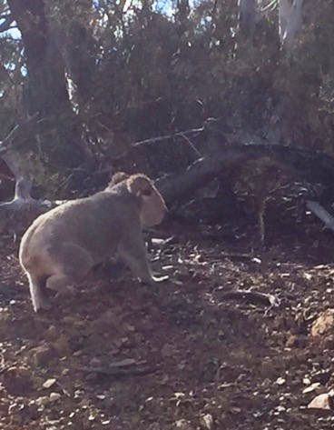
Photo: Koala spotted crossing the road near Queanbeyan
Koalas have been spotted crossing Captains Flat Road in Cuumbeun Nature Reserve this month delighting passing motorists but also serving as a reminder to slow down on the roads.
Susannah Power from the National Parks and Wildlife Service (NPWS) said the first sighting was reported by a member of the public on 30 May and since then NPWS have received details of two more sightings in the reserve just east of Queanbeyan.
"Some passing motorists have been extremely lucky to get photos of the animal as it crosses the road, climbs the embankment and up a nearby tree," said Ms Power.
"We're not sure if this particular animal is male or female but we know it's rare and very exciting to see a koala in the reserve.
"These sightings are really encouraging and I'm sure they have taken many drivers by surprise - but they also serve as a real reminder to slow down on rural roads.
"With wildlife about it's important for people passing through to take care and for park visitors to minimise their impact on this species habitat.
"The increased number of sightings also highlights the importance of this relatively small reserve in providing habitat for this iconic species," said Ms Power.
NPWS plan to undertake surveys at Cuumbean in the coming months to get a much better picture of the population this reserve supports.
"Until then we encourage people to keep reporting their sightings to the NPWS Queanbeyan Office and remind park users and motorists to please take care near the Reserve."
For more information on Cuumbeun Nature Reserve visit the NPWSwebsite.Camden Gasfields Petition
AGL still have 96 coal seam gas production wells in South Western Sydney, surrounding Camden, some between 40m - 200m from family homes and schools.
While the Eastern suburbs, electorates for Mike Baird and Malcolm Turnbull MP, have zero.
As the largest growth center in Sydney there are current plans to build 35,000 new homes as close as 20m from AGLs existing coal seam gas wells.
AGL plans to stop all production in this area by 2023. This is not acceptable. These families do not deserve 7 more years of these horrific health effects. 35,000 new homes in the same area is a health epidemic in the making.
Australian Mothers-Against-Gas started this petition with a single signature, now they need more support to help protect Camden and shut down those wells NOW.

Camden Gasfields Petition
AGL still have 96 coal seam gas production wells in South Western Sydney, surrounding Camden, some between 40m - 200m from family homes and schools.
While the Eastern suburbs, electorates for Mike Baird and Malcolm Turnbull MP, have zero.
As the largest growth center in Sydney there are current plans to build 35,000 new homes as close as 20m from AGLs existing coal seam gas wells.
AGL plans to stop all production in this area by 2023. This is not acceptable. These families do not deserve 7 more years of these horrific health effects. 35,000 new homes in the same area is a health epidemic in the making.
Australian Mothers-Against-Gas started this petition with a single signature, now they need more support to help protect Camden and shut down those wells NOW.
Katandra Sanctuary

Katandra is a sanctuary for flora and fauna where the wildflowers are their most colourful during spring but all year round there are opportunities for bird watching. The sanctuary covers 12 hectares and is situated on the Ingleside/Warriewood escarpment. Choose to follow a short walk of about 1km or the longer 2km track through rainforest remnants with creeks and fern-fringed pools. Visit: www.katandra.orgBAN THE BAG: NEW SOUTH WALES
An estimated 50 million plastic bags end up in our waterways and marine environment in Australia every year.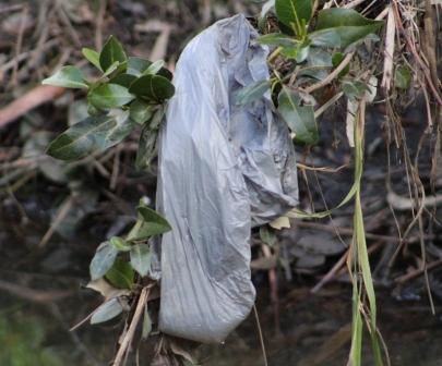
Plastic pollution is killing our marine life. 30% of the world’s turtles and 90% of seabird species have now ingested plastic debris. We have to act now to clean up our oceans.
Petition - Plastic bag in mangroves - Careel Creek, June, 2016


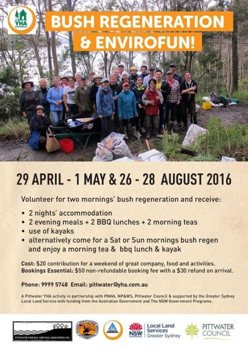
Bush Regeneration And Envirofun Weekend
On: August 26-28, 2016At: Pittwater YHA, Morning Bay
Volunteer for two mornings’ bush regeneration and receive free accommodation, two evening meals, two BBQ lunches and two morning teas and free use of kayaks over the weekend of 26 to 28 August. Alternatively come for a Saturday or Sunday morning bush regeneration and enjoy a morning tea and BBQ lunch and kayak. It is only a $20 contribution ($50 nonrefundable booking fee with a $30 refund on arrival) for a weekend of great company, food and activities.
Bookings essential: 9999 5748 Email: Pittwater@yha.com.au
A Pittwater YHA activity in partnership with: • Pittwater Natural Heritage Association • National Parks and Wildlife Service • Northern Beaches Council • supported by the Greater Sydney Local Land Service • with funding from the Australian Government and the NSW Government.
 First signs of healing in the Antarctic ozone layer
June 30, 2016
A simulation of the Antarctic ozone hole, made from data taken on October 22, 2015. Credit: NASA's Goddard Space Flight Center (edited by MIT News)
Scientists at MIT and elsewhere have identified the "first fingerprints of healing" of the Antarctic ozone layer, published today in the journal Science.
The team found that the September ozone hole has shrunk by more than 4 million square kilometers -- about half the area of the contiguous United States -- since 2000, when ozone depletion was at its peak. The team also showed for the first time that this recovery has slowed somewhat at times, due to the effects of volcanic eruptions from year to year. Overall, however, the ozone hole appears to be on a healing path.
The authors used "fingerprints" of the ozone changes with season and altitude to attribute the ozone's recovery to the continuing decline of atmospheric chlorine originating from chlorofluorocarbons (CFCs). These chemical compounds were once emitted by dry cleaning processes, old refrigerators, and aerosols such as hairspray. In 1987, virtually every country in the world signed on to the Montreal Protocol in a concerted effort to ban the use of CFCs and repair the ozone hole.
"We can now be confident that the things we've done have put the planet on a path to heal," says lead author Susan Solomon, the Ellen Swallow Richards Professor of Atmospheric Chemistry and Climate Science at MIT. "Which is pretty good for us, isn't it? Aren't we amazing humans, that we did something that created a situation that we decided collectively, as a world, 'Let's get rid of these molecules'? We got rid of them, and now we're seeing the planet respond."
Solomon's co-authors include Diane Ivy, research scientist in the Department of Earth, Atmospheric and Planetary Sciences, along with researchers at the National Center for Atmospheric Research in Boulder, Colorado, and the University of Leeds in the U.K.
Signs before spring
The ozone hole was first discovered using ground-based data that began in the 1950s. Around the mid-1980s, scientists from the British Antarctic survey noticed that the October total ozone was dropping. From then on, scientists worldwide typically tracked ozone depletion using October measurements of Antarctic ozone.
Ozone is sensitive not just to chlorine, but also to temperature and sunlight. Chlorine eats away at ozone, but only if light is present and if the atmosphere is cold enough to create polar stratospheric clouds on which chlorine chemistry can occur -- a relationship that Solomon was first to characterize in 1986. Measurements have shown that ozone depletion starts each year in late August, as Antarctica emerges from its dark winter, and the hole is fully formed by early October.
Solomon and her colleagues believed they would get a clearer picture of chlorine's effects by looking earlier in the year, at ozone levels in September, when cold winter temperatures still prevail and the ozone hole is opening up. The team showed that as the chlorine has decreased, the rate at which the hole opens up in September has slowed down.
"I think people, myself included, had been too focused on October, because that's when the ozone hole is enormous, in its full glory," Solomon says. "But October is also subject to the slings and arrows of other things that vary, like slight changes in meteorology. September is a better time to look because chlorine chemistry is firmly in control of the rate at which the hole forms at that time of year. That point hasn't really been made strongly in the past."
A healing trend
The researchers tracked the yearly opening of the Antarctic ozone hole in the month of September, from 2000 to 2015. They analyzed ozone measurements taken from weather balloons and satellites, as well as satellite measurements of sulfur dioxide emitted by volcanoes, which can also enhance ozone depletion. And, they tracked meteorological changes, such as temperature and wind, which can shift the ozone hole back and forth.
They then compared their yearly September ozone measurements with model simulations that predict ozone levels based on the amount of chlorine that scientists have estimated to be present in the atmosphere from year to year. The researchers found that the ozone hole has declined compared to its peak size in 2000, shrinking by more than 4 million square kilometers by 2015. They further found that this decline matched the model's predictions, and that more than half the shrinkage was due solely to the reduction in atmospheric chlorine.
"It's been interesting to think about this in a different month, and looking in September was a novel way," Ivy says. "It showed we can actually see a chemical fingerprint, which is sensitive to the levels of chlorine, finally emerging as a sign of recovery."
The team did observe an important outlier in the trend: In 2015, the ozone hole reached a record size, despite the fact that atmospheric chlorine continued to drop. In response, scientists had questioned whether any healing could be determined. Going through the data, however, Solomon and her colleagues realized that the 2015 spike in ozone depletion was due primarily to the eruption of the Chilean volcano Calbuco. Volcanoes don't inject significant chlorine into the stratosphere but they do increase small particles, which increase the amount of polar stratospheric clouds with which the human-made chlorine reacts.
As chlorine levels continue to dissipate from the atmosphere, Solomon sees no reason why, barring future volcanic eruptions, the ozone hole shouldn't shrink and eventually close permanently by midcentury.
"What's exciting for me personally is, this brings so much of my own work over 30 years full circle," says Solomon, whose research into chlorine and ozone spurred the Montreal Protocol. "Science was helpful in showing the path, diplomats and countries and industry were incredibly able in charting a pathway out of these molecules, and now we've actually seen the planet starting to get better. It's a wonderful thing."
This research was supported, in part, by the National Science Foundation and the U.S. Department of Energy.
Journal Reference:
Solomon et al. Emergence of Healing in the Antarctic Ozone Layer. Science, 2016


Southern Snowy Mountains Aboriginal Community To Jointly Manage Kosciuszko National Park
Media release: 27 June 2016The Southern Snowy Mountains Aboriginal Community now has stronger links with the National Parks and Wildlife Service (NPWS) in the management of Kosciuszko National Park and reserves in the Southern Ranges Region under a new Memorandum of Understanding (MOU).
In signing the MOU last week Tom Bagnat, Director Mountains and Metro branch with NPWS, said the agreement formally acknowledges both parties commitment to working together to care for the park's Aboriginal places and spiritual and cultural values.
"This MOU provides Original Owners of Monaro-Ngarigo decent with an opportunity to reconnect to country and a clearly defined role in identifying and conserving Aboriginal cultural heritage in the southern section of the park," Mr Bagnat said.
"The MOU covers the area south of Tolbar Road near Lake Eucumbene to the Victorian border, Country that includes important cultural sites and places of cultural significance within the landscapes and waterways."This cooperative approach to park management means decisions around the conservation of this cultural heritage will be more holistic and reflective of the Original Owner's aspirations.
"Under the agreement an Executive Advisory Committee made up of community members will be established to advise NPWS on other aspects of park management including tourism, fire and pest management operations.
"It's taken a long time to produce the MOU and I would like to thank all involved. It's through this process that a genuine and respectful partnership has developed," said Mr Bagnat.
The agreement was signed at a celebration on 25 June 2016 in Jindabyne with members of the Monaro Ngarigo community and NPWS."What this MOU represents is much more than an agreement to work collaboratively, it symbolises a shared vision to manage Kosciuszko National Park's unique values to deliver benefits not only to Country but to people and communities," Mr Bagnat said.
This MOU with the Monaro Ngarigo community is similar to an agreement already in place with the Tumut Brungle Gundagai Aboriginal Area Community.
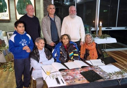
Above: MOU signing with Southern Snowy Mountains Aboriginal Community
L-R: front row Auntie Diana's Grandson, Auntie Diana Davidson, Auntie Rae Solomon- Stewart, Auntie Rachel Mullett. Back row: Mick Pettitt Southern Ranges Regional Manager, Dave Darlington former (now retired) NPWS Southern Ranges Regional Manager, Tom Bagnat NPWS Director Metropolitan and Mountains Branch

Another Bucket Of Coal: From Liverpool Plains Youth
June 28, 2016The Liverpool Plains Youth have got a new song for Australia. Hey mining! Leave the plains alone! No coal mining in Australia's food bowl!
The Australian Bird Feeding & Watering Study
The Australian Bird Feeding and Watering Study is a citizen science initiative being conducted by researchers at Deakin University and Griffith University. Our interests are the interactions people have with birds in their own backyards, as this can have a huge impact on bird diversity and abundance. One of the most common ways people interact with birds is through providing food and water.
Why do we find this interesting? For the simple reason that we do not know how providing food and water might impacts on bird ecology and diversity in Australia. While providing food and water to birds is a popular activity, little is known about what species are attracted to these resources and why people like to provide them. Most importantly we need to understand the ecological and behavioural effects of bird feeding as almost all information from other countries regarding bird feeding simply does not apply here. We acknowledge that feeding of wild birds is an important activity for large numbers of people and that the practice may be a significant way for many to connect with nature.
The Australian Bird Feeding and Watering Study aims to gather quantitative data on the effects of supplementary feeding and providing water for birds and the reasons why people provided food and/or water. In doing so we aim to develop purpose guidelines for people who feed birds to do so with minimum risk to birds.
If you provide food or water for birds and would like to take part in this exciting study, Sign up today! We would love to have you involved
Seaweeds Get Sick Too When They’re Stressed
01 July, 2016: DEBORAH SMITH - UNSW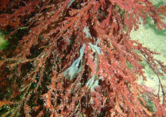
Normally harmless bacteria can cause bleaching disease in seaweeds when the "trees of the ocean" become stressed by high water temperatures, UNSW researchers have discovered.Bleached seaweed. Image: Alexandra Campbell
Seaweeds are the “trees” of the ocean, providing vital habitat, food and shelter for many species of fish and other coastal marine organism, such as crayfish and abalone.
“A lot of attention has been paid to coral bleaching, but seaweeds are also affected by temperature-related diseases,” says study senior author UNSW’s Dr Suhelen Egan.
“In most cases, the infectious agents that cause the diseases are unknown. Improving our understanding these disease processes is not only important for maintaining a healthy marine environment; it also has economic significance, given that seaweeds are increasingly being cultivated as sources of food and feed-stock for biofuels.”
These bacteria seize the chance to cause disease when the host is stressed, in the same way that normally harmless, common bacteria can cause disease in people who have weakened immune systems.The study, by Dr Egan’s team at the UNSW Centre of Marine Bio-Innovation, is published in the journal Environmental Microbiology.
The researchers collected samples of healthy and diseased red alga, Delisea pulchra, from about 8 metres under the water at different locations on the Sydney coastline. The diseased seaweeds had undergone natural bleaching, in which areas of pigment are lost.“Bleaching reduces the ability of the seaweed to photosynthesise and harvest energy from the sun, and to reproduce. It also makes them more susceptible to grazing by fish and other herbivores in the ocean,” says Dr Egan.The researchers isolated microbes that were in greater abundance on the diseased seaweeds and cultured them. They then tested the ability of these microbes to cause bleaching disease in seaweeds in the laboratory.“We were surprised to identify three very different kinds of bacteria which are usually present in low numbers on seaweeds, but which we now know can all cause the same bleaching disease,” says Dr Egan.“We also found that the usual balance of microbes was disturbed on the diseased seaweeds, with a lower diversity of microbes present than normal.“We believe these kinds of opportunistic pathogens are more common in marine environment than had been realised before. They seize the chance to cause disease when the host is stressed, in the same way that normally harmless, common bacteria can cause disease in people who have weakened immune systems.”The three newly identified pathogens that cause the bleaching disease are members of the Alteromonas, Aquimarina and Agarivorans genera.Palm Grove Nature Reserve Draft Plan: Have your say
What's this about?
Parks and reserves established under the National Parks and Wildlife Act 1974 are required to have a plan of management. The plan provides guidance on key conservation and other values of the park, and provides directions for future management. The plan of management is a legal document and, after the plan is adopted, all operations and activities in the park must be in accordance with the plan.
At the conclusion of the public exhibition period in August 2016, all submissions will be comprehensively reviewed and input will be sought from the Central Coast Hunter Regional Advisory Committee and the National Parks and Wildlife Advisory Council.
Once this input has been received, as required by the National Parks and Wildlife Act, a final plan will be considered for adoption by the Minister for the Environment.
Have your say
Submit your feedback by 22 August 2016 via the online consultation.
Tyagarah Nature Reserve Draft Plan
What is the draft plan of management for?
Parks and reserves established under the NSW National Parks and Wildlife Act 1974 are required to have a plan of management. A new draft plan for Tyagarah Nature Reserve has been prepared which will replace its existing plan. The exhibition of the draft plan provides members of the community with the opportunity to have a say in the future management directions for this reserve. Further information about Tyagarah Nature Reserve is available at the NPWS visitor website.
Have your say
Submit your written feedback on the draft plan by 22 August 2016 by using the online submission form on the Office of Environment and Heritage website, or by emailing npws.parkplanning@environment.nsw.gov.au, or by writing to:
NPWS Planner, Tyagarah Draft PoM, PO Box 1236. Coffs Harbour NSW 2450
Exhibition - Date: May. 13 - Aug. 22, 2016 Time: 9:00am — 5:00pm
Wongarbon Nature Reserve draft plan
The Wongarbon Nature Reserve draft plan of management is on public exhibition until 22 August 2016.
What is the draft plan of management for?
Parks and reserves established under the NSW National Parks and Wildlife Act 1974 are required to have a plan of management. The exhibition of the draft plan provides members of the community with the opportunity to have a say in the future management directions for this reserve.
Have your say
Submit your written feedback on the draft plan by 22 August 2016 in one of the following ways:
By email: email your submission to:npws.parkplanning@environment.nsw.gov.au.
By mail: post your written submission to:
NPWS Wongarbon POM, Planning Evaluation and Assessment Team, PO Box 1967. Hurstville BC NSW 1481
By filling out the online form on the OEH public exhibition page.
Exhibition - Date: May. 13 - Aug. 22, 2016 Time: 10:00am — 5:00pm
Report illegal dumping
NSW Government
The RIDonline website lets you report the types of waste being dumped and its GPS location. Photos of the waste can also be added to the report.
The Environment Protection Authority (EPA), councils and Regional Illegal Dumping (RID) squads will use this information to investigate and, if appropriate, issue a fine or clean-up notice.
Penalties for illegal dumping can be up to $15,000 and potential jail time for anybody caught illegally dumping within five years of a prior illegal dumping conviction.
This is the first time RIDonline has been opened to the public. Since September last year, the EPA, councils, RID squads and public land managers have used it to report more than 20,000 tonnes of illegally dumped waste across more than 70 local government areas.
The NSW Government has allocated $58 million over five years to tackle illegal dumping as part of its $465.7 million Waste Less Recycle More initiative. NSW Premier Mike Baird has also committed to reducing the volume of litter by 40%, by 2020 to help keep NSW's environment clean.
Think before you print ; A kilo of recycled paper creates around 1.8 kilograms of carbon emissions, without taking into account the emissions produced from transporting the paper. So, before you send a document to print, think about how many kilograms of carbon emissions you could save by reading it on screen.
Australian Native Foods website: http://www.anfil.org.au/

Palm Grove Nature Reserve Draft Plan: Have your say
What's this about?
Parks and reserves established under the National Parks and Wildlife Act 1974 are required to have a plan of management. The plan provides guidance on key conservation and other values of the park, and provides directions for future management. The plan of management is a legal document and, after the plan is adopted, all operations and activities in the park must be in accordance with the plan.
At the conclusion of the public exhibition period in August 2016, all submissions will be comprehensively reviewed and input will be sought from the Central Coast Hunter Regional Advisory Committee and the National Parks and Wildlife Advisory Council.
Once this input has been received, as required by the National Parks and Wildlife Act, a final plan will be considered for adoption by the Minister for the Environment.
Have your say
Submit your feedback by 22 August 2016 via the online consultation.
Tyagarah Nature Reserve Draft Plan
What is the draft plan of management for?
Parks and reserves established under the NSW National Parks and Wildlife Act 1974 are required to have a plan of management. A new draft plan for Tyagarah Nature Reserve has been prepared which will replace its existing plan. The exhibition of the draft plan provides members of the community with the opportunity to have a say in the future management directions for this reserve. Further information about Tyagarah Nature Reserve is available at the NPWS visitor website.
Have your say
Submit your written feedback on the draft plan by 22 August 2016 by using the online submission form on the Office of Environment and Heritage website, or by emailing npws.parkplanning@environment.nsw.gov.au, or by writing to:
NPWS Planner, Tyagarah Draft PoM, PO Box 1236. Coffs Harbour NSW 2450
Exhibition - Date: May. 13 - Aug. 22, 2016 Time: 9:00am — 5:00pm
Wongarbon Nature Reserve draft plan
The Wongarbon Nature Reserve draft plan of management is on public exhibition until 22 August 2016.
What is the draft plan of management for?
Parks and reserves established under the NSW National Parks and Wildlife Act 1974 are required to have a plan of management. The exhibition of the draft plan provides members of the community with the opportunity to have a say in the future management directions for this reserve.
Have your say
Submit your written feedback on the draft plan by 22 August 2016 in one of the following ways:
By email: email your submission to:npws.parkplanning@environment.nsw.gov.au.
By mail: post your written submission to:
NPWS Wongarbon POM, Planning Evaluation and Assessment Team, PO Box 1967. Hurstville BC NSW 1481
By filling out the online form on the OEH public exhibition page.
Exhibition - Date: May. 13 - Aug. 22, 2016 Time: 10:00am — 5:00pm
Report illegal dumping
NSW Government
The RIDonline website lets you report the types of waste being dumped and its GPS location. Photos of the waste can also be added to the report.
The Environment Protection Authority (EPA), councils and Regional Illegal Dumping (RID) squads will use this information to investigate and, if appropriate, issue a fine or clean-up notice.
Penalties for illegal dumping can be up to $15,000 and potential jail time for anybody caught illegally dumping within five years of a prior illegal dumping conviction.
This is the first time RIDonline has been opened to the public. Since September last year, the EPA, councils, RID squads and public land managers have used it to report more than 20,000 tonnes of illegally dumped waste across more than 70 local government areas.
The NSW Government has allocated $58 million over five years to tackle illegal dumping as part of its $465.7 million Waste Less Recycle More initiative. NSW Premier Mike Baird has also committed to reducing the volume of litter by 40%, by 2020 to help keep NSW's environment clean.
Think before you print ; A kilo of recycled paper creates around 1.8 kilograms of carbon emissions, without taking into account the emissions produced from transporting the paper. So, before you send a document to print, think about how many kilograms of carbon emissions you could save by reading it on screen.
Australian Native Foods website: http://www.anfil.org.au/

Tackling Coastal Erosion At Lennox Head
28.06.2016: Ministerial Media Release - The Hon. Rob Stokes MP, Minister for Planning
A new plan of action to manage coastal erosion at Lennox Head has been given the green light by the NSW Government. Ballina Shire Council’s Coastal Zone Management Plan has been certified by Planning Minister Rob Stokes and includes proposed works such as an upgrade to the Lennox Head seawall to protect the road and other public facilities. There will also be investigations into beach nourishment and ongoing monitoring at the site as part of the plan.
Mr Stokes said Lennox Head was a designated coastal erosion hotspot in NSW, and the new plan will help the Ballina coastal community be more resilient to potential impacts and threats. “Erosion at Lennox Head has been recognised as a major issue, and the NSW Government is determined to ensure this is managed and the community and the environment are protected,” Mr Stokes said. “The saltwater economy is an integral part of our way of life, and we want to ensure we have a healthy coast with thriving, resilient communities now and into the future.” North Coast Liberal MLC Catherine Cusack and North Coast Nationals MLC Ben Franklin both welcomed the plan. “This Coastal Zone Management Plan will ensure the Ballina Shire is able to look after its spectacular coastline, and be prepared for current and future threats,” Ms Cusack said. “Our local community is well aware of the long-running erosion issues at Lennox Head, and want something done. This plan is the solution,” Mr Franklin said. Ballina Shire Council’s Coastal Zone Management Plan covers the whole of the Ballina Shire coastline from Seven Mile Beach in the north to Patches Beach to the south of Richmond River was prepared by Ballina Shire Council in consultation with the local community.
Previously Unknown Global Ecological Disaster Discovered
June 28, 2016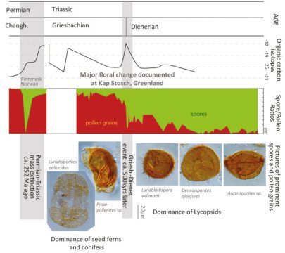
Approximately 500,000 years after the major natural disaster at the boundary between the Permian and the Triassic another event altered the vegetation fundamentally and for longer. Credit: Graphic UZHThere have been several mass extinctions in the history of Earth with adverse consequences for the environment. Researchers from the University of Zurich have now uncovered another disaster that took place around 250 million years ago and completely changed the prevalent vegetation during the Lower Triassic.
There have been several mass extinctions in the history of Earth. One of the largest known disasters occurred around 252 million years ago at the boundary between the Permian and the Triassic. Almost all sea-dwelling species and two thirds of all reptiles and amphibians died out. Although there were also brief declines in diversity in the plant world, they recovered in the space of a few thousand years, which meant that similar conditions to before prevailed again.
Change in flora within a millenniaResearchers from the Institute and Museum of Paleontology at the University of Zurich have now discovered another previously unknown ecological crisis on a similar scale in the Lower Triassic. The team headed by Peter A. Hochuli and Hugo Bucher revealed that another event altered the vegetation fundamentally and for longer approximately 500,000 years after the major natural disaster at the boundary between the Permian and the Triassic.
The scientists studied sediments towering over 400 meters high from North-Eastern Greenland. Carbon isotope curves suggest that the prevalent seed ferns and conifers were replaced by spore plants in the space of a few millennia. To this day, certain spore plants like ferns are still famous for their ability to survive hostile conditions better than more highly developed plants.
Catastrophic ecological upheaval changes plant worldUntil now, it was assumed that the environment gradually recovered during the Lower Triassic 252.4 to 247.8 million years ago. "The drastic, simultaneous changes in flora and the composition of the carbon isotopes indicate that the actual upheaval in the vegetation didn't take place until the Lower Triassic, i.e. around 500,000 years later than previously assumed," explains Hochuli.
The researchers didn't just observe the mass death of vegetation in Greenland; they already discovered the first indications of this floral shift a few years ago in sediment samples from Pakistan. Moreover, the latest datings of volcanic ash by Australian scientists show that the most significant change in the plant world did not happen until a few millennia after the Permian/Triassic boundary. During this period, the indigenous glossopteris seed plant group died out, an event that had previously been dated back to the Permian. Thanks to these findings, the sediment sequences of the supercontinent Gondwana in the southern hemisphere now need to be reinterpreted.
Crisis probably triggered by volcanic eruptionsWhat caused this newly described natural disaster remains unclear. "However, we see a link between this previously unknown global event and the enormous volcanic eruptions we know from the Lower Triassic in what's now Siberia," explains Bucher, Director of UZH's Institute and Museum of Paleontology.
Peter A. Hochuli, Anna Sanson-Barrera, Elke Schneebeli-Hermann, Hugo Bucher. Severest crisis overlooked—Worst disruption of terrestrial environments postdates the Permian–Triassic mass extinction.Scientific Reports, 2016; 6: 28372 DOI: 10.1038/srep28372
Bushcare in Pittwater
For further information or to confirm the meeting details for below groups, please contact Council's Bushcare Officer on 9970 1367Council's Cooee Newsletter - May- June 2016 HERE
BUSHCARE SCHEDULES
Where we work Which day What time
Avalon
Angophora Reserve 3rd Sunday 8:30 - 11:30am
Avalon Dunes 1st Sunday 8:30 - 11:30am
Avalon Golf Course 2nd Wednesday 3 - 5:30pm
Careel Creek 4th Saturday 8:30 - 11:30am
Toongari Reserve 3rd Saturday 9 - 12noon (8 - 11am in summer)
Bangalley Headland 2nd Sunday 9 to 12noon
Bayview
Winnererremy Bay 4th Sunday 9 to 12noon
Bilgola
North Bilgola Beach 3rd Monday 9 - 12noon
Algona Reserve 1st Saturday 9 - 12noon
Plateau Park 1st Friday 8:30 - 11:30am
Church Point
Browns Bay Reserve 1st Tuesday 9 - 12noon
McCarrs Creek Reserve Contact Bushcare Officer To be confirmed
Clareville
Old Wharf Reserve 3rd Saturday 8 - 11am
Elanora
Kundibah Reserve 4th Sunday 8:30 - 11:30am
Mona Vale
Mona Vale Beach Basin 1st Saturday 8 - 11am
Mona Vale Dunes 2nd Saturday+3rd Thursday 8:30 - 11:30am
Newport
Bungan Beach 4th Sunday 9 - 12noon
Crescent Reserve 3rd Sunday 9 - 12noon
North Newport Beach 4th Saturday 8:30 - 11:30am
Porter Reserve 2nd Saturday 8 - 11am
North Narrabeen
Irrawong Reserve 3rd Saturday 2 - 5pm
Palm Beach
North Palm Beach Dunes 3rd Saturday 9 - 12noon
Scotland Island
Catherine Park 2nd Sunday 10 - 12:30pm
Elizabeth Park 1st Saturday 9 - 12noon
Pathilda Reserve 3rd Saturday 9 - 12noon
Warriewood
Warriewood Wetlands 1st Sunday 8:30 - 11:30am
Whale Beach
Norma Park 1st Friday 9 - 12noon
Western Foreshores
Coopers Point, Elvina Bay 2nd Sunday 10 - 1pm
Rocky Point, Elvina Bay 1st Monday 9 - 12noon


Bushcare in Pittwater
Where we work Which day What time
Avalon
Angophora Reserve 3rd Sunday 8:30 - 11:30am
Avalon Dunes 1st Sunday 8:30 - 11:30am
Avalon Golf Course 2nd Wednesday 3 - 5:30pm
Careel Creek 4th Saturday 8:30 - 11:30am
Toongari Reserve 3rd Saturday 9 - 12noon (8 - 11am in summer)
Bangalley Headland 2nd Sunday 9 to 12noon
Bayview
Winnererremy Bay 4th Sunday 9 to 12noon
Bilgola
North Bilgola Beach 3rd Monday 9 - 12noon
Algona Reserve 1st Saturday 9 - 12noon
Plateau Park 1st Friday 8:30 - 11:30am
Church Point
Browns Bay Reserve 1st Tuesday 9 - 12noon
McCarrs Creek Reserve Contact Bushcare Officer To be confirmed
Clareville
Old Wharf Reserve 3rd Saturday 8 - 11am
Elanora
Kundibah Reserve 4th Sunday 8:30 - 11:30am
Mona Vale
Mona Vale Beach Basin 1st Saturday 8 - 11am
Mona Vale Dunes 2nd Saturday+3rd Thursday 8:30 - 11:30am
Newport
Bungan Beach 4th Sunday 9 - 12noon
Crescent Reserve 3rd Sunday 9 - 12noon
North Newport Beach 4th Saturday 8:30 - 11:30am
Porter Reserve 2nd Saturday 8 - 11am
North Narrabeen
Irrawong Reserve 3rd Saturday 2 - 5pm
Palm Beach
North Palm Beach Dunes 3rd Saturday 9 - 12noon
Scotland Island
Catherine Park 2nd Sunday 10 - 12:30pm
Elizabeth Park 1st Saturday 9 - 12noon
Pathilda Reserve 3rd Saturday 9 - 12noon
Warriewood
Warriewood Wetlands 1st Sunday 8:30 - 11:30am
Whale Beach
Norma Park 1st Friday 9 - 12noon
Western Foreshores
Coopers Point, Elvina Bay 2nd Sunday 10 - 1pm
Rocky Point, Elvina Bay 1st Monday 9 - 12noon
Benign Bacteria Block Mosquitoes From Transmitting Zika, Chikungunya Viruses
Infectious Disease Emergency Response Research Funding
High-Tech Scans Spare Lymphoma Patients Side Effects Of Chemo
EPICentre - Visualising Big Medical Data
Fire Discovery Sheds New Light On 'Hobbit' Demise
Decisive Action Taken To Set Up Rookwood Cemetery For The Future
Ancient “Deep Skull” From Borneo Full Of Surprises
Skating Carnival On South Brisbane Rink In 1915
______________________________________
UNSW's RoboCup Soccer World Champions Fly Out To Defend Title
UNSW's RoboCup Soccer World Champions Fly Out To Defend Title

The Great Western Woodlands
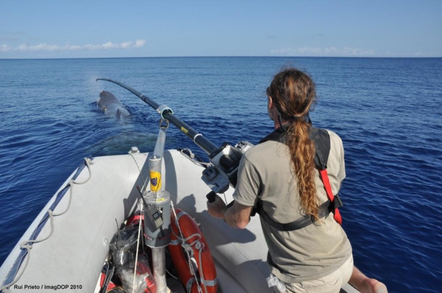
What Does The Sperm Whale Say?
