Inbox and Environment News: Issue 271
July 10 - 16, 2016: Issue 271
Newport Beach Clean
July 6, 2016: Living OceanOrganised by Living Ocean, Sarah Tait and Sally Gole with the Av Green Team spreading the word and gathering the troops.
Here is a list of some of the Rubbish that was picked up on the Beach, June 19th, 2016:
Straws/ Lolly Pop Sticks: 702Cigarette Butts: 235Plastic Drink Bottles: 76Plastic Bags: 30Plastic Cutlery: 10
Video by Robbi Luscombe-NewmanLiving Ocean: www.livingocean.org.au
Warrumbungle First Dark Sky Park In Australia
05.07.2016: Ministerial Media Release - The Hon. Rob Stokes MP, Minister for PlanningWarrumbungle National Park in Central Western NSW has been declared Australia’s first Dark Sky Park, recognising and protecting its key role in astronomical research. Planning Minister Rob Stokes and Environment Minister Mark Speakman welcomed the park’s new status, following confirmation from the International Dark Sky Association.
Mr Stokes said the park’s dark sky qualities will be protected with $100,000 in funding to control light pollution through implementation of updated planning policies. A new Dark Sky Planning Guideline has also been developed with the Australian Astronomical Observatory as part of the NSW Government’s review of state planning policies. “Warrumbungle National Park has long been recognised not only for its beauty at ground level, but also for the wonder it holds in the night sky above,” Mr Stokes said. “It’s an outstanding place to view the night sky and, with the nearby Siding Spring Observatory, plays an important role in Australian astronomical research. “As nearby communities grow, it’s important we plan to protect the park’s dark sky qualities from light pollution now and into the future.”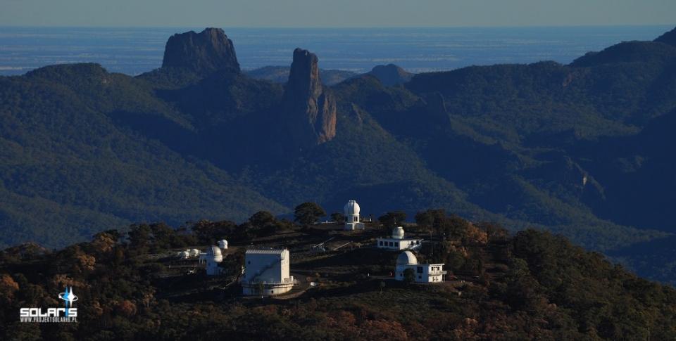
SSO Telescopes showing surrounding landscape - picture courtesy Australian National University (ANU)
Mr Speakman said the Dark Sky Park’s status would benefit the environment as well as stargazers. “Light pollution has a detrimental effect not only on professional and amateur astronomy, but it also impacts on those parts of the ecosystem, such as nocturnal animals, which are reliant on dark night skies,” Mr Speakman said. Member for Barwon Kevin Humphries welcomed the Dark Sky Park declaration.“Warrumbungle National Park is a place our local community has always treasured, and I’m delighted it’s now been recognised in this way,” Mr Humphries said. Australian Astronomical Observatory Head of Lighting and Environment Professor Fred Watson led the nomination for the Warrumbungle National Park to be Australia’s first Dark Sky Park. “I am thrilled with the new Dark Sky status, which will give central western NSW the opportunity to educate and exemplify the benefits of dark skies and the use of sky-friendly lighting,” Professor Watson said. Warrumbungle National Park joins other international parks such as Death Valley National Park in the United States and Galloway Forest Park in Scotland as officially designated Dark Sky Parks.
Siding Spring Observatory - Eyes On The Sky

Published on 18 Jul 2014 by Aussie PeteThis video tour shows the Siding Spring Observatory and its surrounds. Created to showcase SSO for Starfest Open Day 2014.
StarFest 2016 Dates And All Events
This year StarFest will held over the October long weekend (Sep 30 - Oct 2). www.starfest.org.au/
Siding Spring StarFest celebration will be held on the weekend of the 1st of October 2016.Open Day: October 1st 2016 – 9:30am till 4pmCan’t make Open Day but would like to see the talks? We will be streaming the talks live on the day.Where?Siding Spring Observatory (we will have the Mud Map and Program closer to the day to help you plan your day). Remember to pick up your What’s On booklet on the day!
There’s a whole day of activities – view the Mud Maps for Open Day, (will be available closer to the day).*Tour the telescopes*Hear talks by world famous astronomers in the AAT Dome (see Talks Program 2016 AAT)*Talks designed for children in the Exploratory (see Childrens Talks Program 2016)*Enjoy activities for the whole family (see the full Program for more details closer to the day)*See the science displays*Eat at the newly refurbished Exploratory cafe, or grab a sausage sizzle on the way round*And much much more
Parking; There’s tons of it – drive on inDo I Have To Book: No! Just rock on up – we would love to see you!
The Life and Times of our Milky Way Galaxy with Dr Amanda Bauer When: Sunday October 2nd, 2016 – 11:00 amWhere: Coonabarabran Bowling ClubWho: Dr Amanda Bauer!
Dr Amanda Bauer is an Astronomer and Outreach Officer for the Australian Astronomical Observatory. In 2015, she was named in the “Top 5 Under 40” among Australian Science Communicators and Researchers and received the Australian Institute of Physics NSW Community Outreach to Physics Award. Amanda uses earth-based and orbiting space telescopes to explore variations in how galaxies formed, how they lived their lives, and how they evolved into the diverse array of galaxy species we see today. You can find her online as @astropixie at http://amandabauer.blogspot.com/.What is the Subject?“The Life and Times of our Milky Way Galaxy”What will happen to our Milky Way Galaxy when it inevitably crashes into the titanic Andromeda galaxy? A lot of change! But no need to worry about this cosmic disaster during our lifetimes, though, as the head-on collision will not occur for another 4 billion years. This presentation takes the audience through the story of our Galaxy, from its formation soon after the Big Bang, to the distant future when the stars are no longer burning. The Milky Way Galaxy is an exciting place to call home!
SeatingTo book your seats is free but a gold coin donation is appreciated on the day - all donations to the NSW Volunteer Rescue Association (VRA))Book your seats at Sticky Tickets now!
Dr Amanda Bauer - photo by Glen Gagelsm
Siding Spring Observatory (SSO), on the edge of the Warrumbungle National Park near Coonabarabran, NSW, is Australia's premier optical and infrared observatory.
The Australian National University’s Research School of Astronomy and Astrophysics (RSAA) operates its research telescopes, and hosts those of other institutions at this spectacular location next to the picturesque Warrumbungle National Park. You can learn more about the various telescopes and organisations that own and run them on the telescopes of SSO http://rsaa.anu.edu.au/observatories/telescopes page.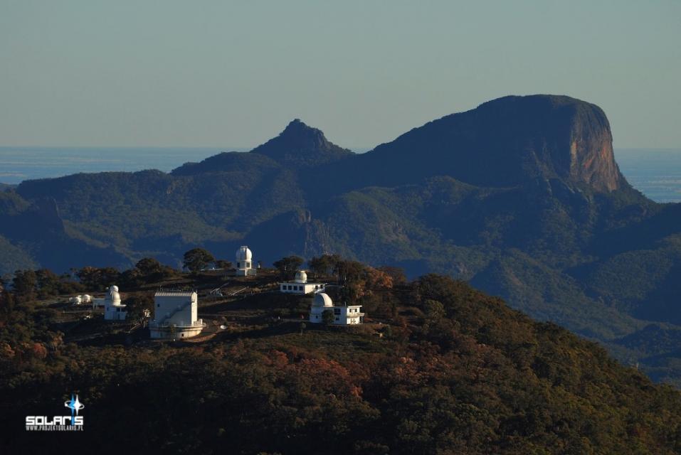
ANU Telescopes showing Warumbungle National Park - picture courtesy Australian National University (ANU)
SSO is a working research facility and as such it has no public star-gazing facilities. The Observatory and its surrounds are closed to the general public from 4pm each day.
There are, however, a range of activities for visitors to the observatory, including:• A visitor centre with informative and educational displays about telescopes and astronomy.• Access to the viewing gallery of the Anglo-Australian Telescope, which is run by the Australian Astronomical Observatory (AAO)• Spectacular views of the Warrumbungle National Park• A cafe and shop at the visitor centre that is stocked with great food and gift ideas. Morning and afternoon teas and light lunches are available - contact us for group pricing.• Our annual StarFest celebration is held in October. You can meet our astronomers and discover more about the observatory and the science that we do here.• School holiday activities, including guided walking tours of the observatory and talks by astronomers and scientists.• Tours for groups of all ages can be organised on request. Please contact the visitor centre in advance for pricing and availability. A minimum group size of 15 applies for all tours.• View upcoming events and activities at SSO on the activities page.
Email us for information about our school education programs, or Ask an Astronomer a question about astronomy or telescopes.From Australian National University: Research School of Astronomy & Astrophysics, ANU College of Physical & Mathematical Sciences: http://rsaa.anu.edu.au/observatories/siding-spring-observatory
The Siding Spring Exploratory houses a small astronomy exhibition area with hands on activities for the whole family. Enjoy a great coffee, lunch or a snack at the Exploratory café and browse the wonderful variety of souvenirs and gifts available.
The Australian Astronomical Observatory houses the Anglo-Australian Telescope which is the largest telescope in Australia. The AAT is an impressive two storeys high and holds a 3.9m, 16 ton ceramic glass mirror. Inside this massive dome is a visitor viewing gallery open to the public and free of charge. From the gallery you can see the telescope and read about its history and the discoveries it has made.
Behind the AAO building is a lookout which over looks the iconic Warrumbungle National Park. Take a moment to view the natural beauty of the landscape surrounding Siding Spring Observatory.
Opening hoursOpen 7 Days during NSW School Holidays except Good Friday, Christmas Day and Boxing DayOutside of school holidays;Tuesday to Friday: 9:30am to 4pmSaturday and Public Holidays: 10am to 4pmClosed Sunday and Monday
During times of Severe Fire Danger (or higher) and extreme weather events, the observatory will be closed to visitors.Please call us for more information on opening times.The weather here can be quite variable. It can be quite warm or at the other extreme quite cool. Sunscreen, a hat, water and a warm coat/jacket are advisable.Please note: Siding Spring Observatory (SSO) is a working research facility and as such we are not open at night for public viewing. Siding Spring Observatory is closed to the general public after 4pm.
The Warrumbungles
The Warrumbungles are a mountain range in the Orana region of New South Wales, Australia. The nearest town is Coonabarabran. The area is easiest accessed from the Newell Highway which is the major road link directly between Melbourne, Victoria and Brisbane, Queensland and cuts across inland New South Wales from the north to the south.
As the range is between the moist eastern coastal zone and the dryer plains to the west, it has provided protection for flora and fauna suited to both habitats. There are over 120 bird species identified on the range, including lories and lorikeets, rosellas and parrots. The centre of the range has served as an area of protection for a healthy and content colony of grey kangaroos. These animals have become fairly tame due to constant visitor attention and are easily approached.
The Siding Spring Observatory is on an eastern peak. The area has little light pollution to disturb astronomical viewing. The Warrumbungles hosted the 2006 World Rogaining Championships.
The base of the region was formed 180 million years ago. At that time a lake was formed that allowed sediment to slowly compress into sandstone. The Warrumbungles are the remnants of a large heavily-eroded shield volcano which was active from 13 to 17 million years ago. The volcano is estimated to have been 1,000 metres (3,300 ft) high and 50 kilometres (31 mi) wide. It formed as volcanic explosions occurred over millions of years. The remaining complex rocky formations are what is left after millions of years of erosion.
PhysiographyThis area is also known as the Warrumbungle-Liverpool Basalt Ranges, which is distinct physiographic section of the larger Hunter-Hawkesbury Sunkland province, which in turn is part of the larger East Australian Cordillera physiographic division.
The main features of the Warrumbungle mountains are a series of huge jagged outcrops in a roughly circular pattern, surrounded by hilly bush and woodland forest. Dykes, plugs and domes are common and mostly made from trachyte. The Grand High Tops is a section of the range where volcanic remnants are especially clustered. These vents and rocky formations are all named - Belougery Spire, Belougery Split Rock, Crater Bluff, Bluff Mountain, The Breadknife and Mount Exmouth. Pyroclastic rock is found in this area. The Breadknife, a straight wall of jagged rock nearly 100 metres (330 ft) high, is particularly rare. There is an extensive network of nine walking tracks across the central peaks.
Towards the southeast a broad belt of basalt outcrops extends towards the Liverpool Range. Near Chalk Mountain are outcrops of diatomite. Outer stretches of the volcano are made up of hawaiite and mugearite.
HistoryThe first European to sight and explore the area was John Oxley in 1818 on second expedition through New South Wales. Oxley named the range the Arbuthnot Range. The Gamilaroi name Warrumbungles which means 'crooked mountains' became the most common name.
Belougery Spire was first ascended by Eric Dark and Osmar White in 1932, and Crater Bluff by Dark and Dorothy Butler in 1936. The Breadknife was not ascended until 1954, by Russ Kippax and Bill Peascod. Climbing on the Breadknife has since been banned, to protect the walking track along its base from rockfall. Lieben, on Crater Bluff, was the most difficult rock climb in Australia for many years after its first ascent by Bryden Allen and Ted Batty in 1962. It was graded 17 — the hardest grade in the Ewbank system at the time — but is generally agreed to be much harder.
By 1953, 3,360 hectares (8,300 acres) of the range was recognised for its natural heritage and preserved as Warrumbungle National Park. In 2011, it was reported that the national park is contained within 23,312 hectares (57,600 acres).
ReferenceWarrumbungles. (2016, March 11). In Wikipedia, The Free Encyclopedia. Retrieved from https://en.wikipedia.org/w/index.php?title=Warrumbungles&oldid=709494130
Find out about visiting the Warrumbungle National Park at: http://www.nationalparks.nsw.gov.au/visit-a-park/parks/Warrumbungle-National-Park
To find out more about the Warrumbungle Dark Sky Park, please visit International Dark Sky Association or the Warrumbungle Dark Sky Park websites: www.warrumbungledarkskypark.org/ 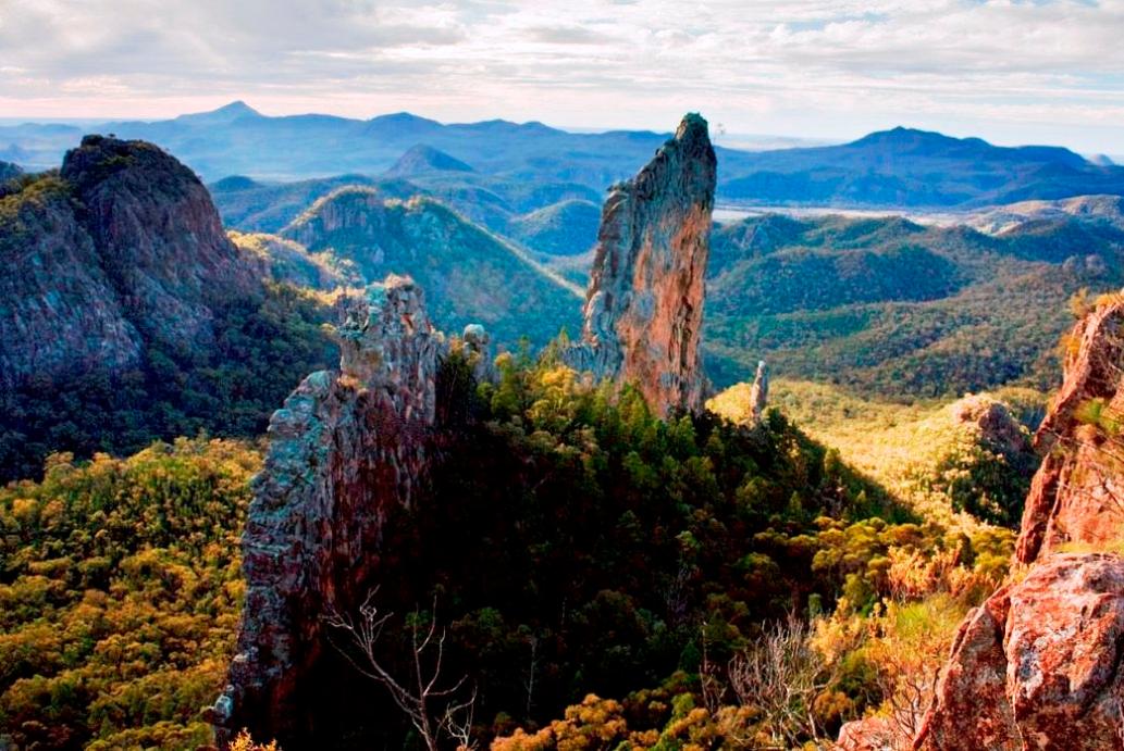 The Breadknife, in Warrumbungle National Park, NSW Australia. Photo Mgillaus - Own work


_______________________________________________
Scientists' Declartion: Accelerating Forest, Woodland And Grassland Destruction In Australia
8th July 2016Australia’s land clearing rate is once again among the highest in the world.
Remaining forests and woodlands are critical for much of our wildlife, for the health and productivity of our lands and waters, and for the character of our nation. Beginning in the 1990s, governments gradually increased protection of these remaining forests and woodlands.
However, those laws are now being wound back.
The State of Queensland has suffered the greatest loss of forests and woodlands. But while stronger laws by the mid-2000s achieved dramatic reductions of forest and woodland loss, recent weakening of laws reversed the trend. Loss of rtinture forest has more than trebled since 2009 [1]. In Victoria, home to four of Australia’s five most heavily cleared bioregions, land clearing controls were weakened in 2013, and in New South Wales, proposed biodiversity laws provide increased opportunities for habitat destruction [2].
Of the eleven world regions highlighted as global deforestation fronts, eastern Australia is the only one in a developed country [3]. This problem threatens much of Australia’s extraordinary biodiversity and, if not redressed, will blight the environmental legacy we leave future generations.
Australia’s wildlife at riskAlready, Australia’s environment has suffered substantial damage from clearing of forests, woodlands and grasslands, including serious declines in woodland birds and reptiles [4]. Vast numbers of animals are killed by forest and woodland destruction. For example, between 1998 and 2005 an estimated 100 million native birds, reptiles and mammals were killed because of destruction of their habitat in NSW [5]; in Queensland, the estimate was 100 million native animals dying each year between 1997 and 1999 [6]. As land clearing once again escalates, so too will these losses of wildlife.
The loss of habitat is among the greatest of threats to Australia’s unique threatened species, imperilling 60% of Australia’s more than 1,700 threatened species [7]. Habitat protection is essential for preventing more species from becoming threatened in the future, adding to our burgeoning threatened species lists [8]. Habitat removal eliminates the plants and animals that lived in it; increases risks to wildlife from introduced predators; impacts surface and groundwater-dependent ecosystems, and fragments habitat so that individuals are unable to move through the landscape. It also reduces the ability of species to move in response to climate change [9].
The societal costs of forest and woodland destructionForest and woodland destruction also causes long-term costs to farmers, governments and society. Removal of native vegetation:
- Hastens erosion and reduces fertility of Australia’s ancient and fragile soils [10]
- Increases the risk of soils becoming saline [11]
- Exacerbates drought [12]
- Reduces numbers of native pollinators and many wildlife species (such as woodland birds and insectivorous bats) that control agricultural pests [13]
- Reduces shade for livestock from heat and wind.
Continued and increasing removal of forests, woodlands and grasslands increases the cost of restoring landscapes and reduces the chance of success. For example, the Australian Government has committed to plant 20 million trees by 2020 [14]. Yet many more than 20 million trees are cleared every year in Queensland alone.
Forest and woodland destruction increases the threat to some of Australia’s most iconic environmental assets. Coral health on The Great Barrier Reef has declined precipitously from the effects of high temperatures associated with climate change, poor water quality, and the flow-on impacts it triggers (such as crown-of-thorns outbreaks) [15]. Native vegetation removal from catchments that flow into the Great Barrier Reef liberates topsoil and contaminants, reducing water quality and threatening the health and resilience of the Great Barrier Reef [16]. Governments have already spent hundreds of millions of dollars on this problem, with estimates of the full cost of restoring water quality as high as AUD$10 billion [17].
Native vegetation is a major carbon sink. Forest and woodland destruction is the fastest-growing contributor to Australia’s carbon emissions, as it transfers the carbon that was stored in the vegetation to the atmosphere. Hence, Australia’s increasing forest and woodland destruction threatens its ability to meet its commitments under four major international treaties: the Convention on Biological Diversity, the World Heritage Convention, the Convention to Combat Desertification, and the Framework Convention on Climate Change.
Urgently-needed solutions- Develop and implement a strategy to end net loss of native vegetation, and restore over-cleared landscapes
- Recognise all biodiversity, not just threatened species, in policy and legislation for the management of native vegetation
- Establish clear, transparent and repeatable national reporting of clearing of native vegetation
- Use rigorous biodiversity assessment methods for assessing clearing requests, accounting for all potential impacts, including cumulative and indirect impacts
- Identify habitats that are of high conservation value for complete protection
- For unavoidable losses of native vegetation, require robust and transparent offsets that meet the highest standards and improve biodiversity outcomes
Thirteen years ago, scientists from across the world expressed their grave concern about ongoing high rates of land forest and woodland destruction in the Australian State of Queensland[18]. For a while, the warning was heeded, and the Queensland state government acted to bring land clearing to historically low levels.
The progress made then is now being undone. Forest and woodland destruction has resumed at increasingly high rates. This return of large-scale deforestation to Australia risks further irreversible environmental consequences of international significance.
Today, scientists from across the world (including those listed), in conjunction with scientific societies and the delegates of the Society for Conservation Biology (Oceania) Conference, call upon Australian governments and parliaments, especially those of Queensland and New South Wales, to take action. We call for the prevention of a return to the damaging past of high rates of woodland and forest destruction, in order to protect the unique biodiversity and marine environments of which Australia is sole custodian.
SignatoriesScientific Societies
The Society for Conservation Biology OceaniaThe Ecological Society of AustraliaThe Royal Zoological Society of New South WalesThe Australian Wildlife Management Society
Scientists - over 400 - all listed here along with references numbered in above Statement
- Hastens erosion and reduces fertility of Australia’s ancient and fragile soils [10]
- Increases the risk of soils becoming saline [11]
- Exacerbates drought [12]
- Reduces numbers of native pollinators and many wildlife species (such as woodland birds and insectivorous bats) that control agricultural pests [13]
- Reduces shade for livestock from heat and wind.
- Develop and implement a strategy to end net loss of native vegetation, and restore over-cleared landscapes
- Recognise all biodiversity, not just threatened species, in policy and legislation for the management of native vegetation
- Establish clear, transparent and repeatable national reporting of clearing of native vegetation
- Use rigorous biodiversity assessment methods for assessing clearing requests, accounting for all potential impacts, including cumulative and indirect impacts
- Identify habitats that are of high conservation value for complete protection
- For unavoidable losses of native vegetation, require robust and transparent offsets that meet the highest standards and improve biodiversity outcomes
EPA completes final inspection of Wollangambe River clean-up as prosecution against Clarence Colliery continues
Media release: 7 July 2016The NSW Environment Protection Authority (EPA) has completed the final inspection of Clarence Colliery's clean-up of the Wollangambe River, as the prosecution against the company continues in the Land and Environment Court.
The EPA commenced a Tier 1 prosecution against Clarence Colliery Pty Ltd in May this year following a serious environmental incident at the coal mine near Lithgow in July 2015.
EPA officers carried out the final inspection on 29 June and on 5 July 2016 confirmed thatconditions of the Clean-Up Notice had been met. The EPA has now advised Clarence Colliery that the clean-up operation of the Wollangambe River can cease.
The company is now required to carry out a monitoring program of the Wollangambe River for two and half years to assess the recovery of the river environment.
The EPA’s Regional Manager Central West, Richard Whyte said the EPA will be keeping a close eye on these results and will not hesitate to require additional clean-up or rehabilitation work if needed.
The EPA has carried out 44 inspections since the incident.
“The focus of the EPA’s inspection program has been on making sure the clean-up is not causing further damage to the Wollangambe River and the aquatic ecosystem,” Mr Whyte said.
“To ensure the environment is protected, the EPA required Clarence Colliery to carefully and systematically remove the coal fines using manual techniques.”
A total of 214 tonnes of coal fines have been removed by hand and the company has made more than 700 trips in a helicopter to airlift bulka bags of coal fines out of the Blue Mountains National Park.
The case is next due in court on 12 August 2016.
EPA completes final inspection of Wollangambe River clean-up as prosecution against Clarence Colliery continues
Illegal Fishing Costs Man Thousands Of Dollars
7 Jul 2016A man found in possession of hundreds of abalone and whelks during a NSW Department of Primary Industries (DPI) fisheries compliance operation, has been fined $8000 in court.
The 44 year old man from Melbourne was sentenced in Bega Local Court last month for the offences committed at Merimbula in June 2015.
NSW DPI Acting Director Fisheries Compliance, Tony Andrews, said the man was inspected by Fisheries Officers at Merimbula boat ramp and found to be in possession of 83 shucked abalone and 776 whelks.
“The man was interviewed and charged by Fisheries Officers, with possess more than possession limit of fish which carries a maximum penalty of $22,000 or 6 months imprisonment or both, and possession of fish in circumstances of aggravation, which carries a penalty of $44,000 or 12 months imprisonment or both,” Mr Andrews said.
“All fish were seized and the whelks were returned to the water alive.“The man faced court and was convicted and fined $4,000 for each offence ($8,000 in total).
“Over harvesting of inter-tidal shellfish has a detrimental impact on the wider marine eco-system and is disappointing to those fishers who do the right thing.
“People wishing to take shellfish for consumption should familiarise themselves with the rules and regulations which are in place to ensure sustainable harvesting practices.”
The possession limit per person for abalone is two, with a minimum size limit of 11.7cm.
Fishers can also have up to a maximum of twenty whelks.All fishers must also make sure they carry a valid recreational fishing fee with them at all times.
“The collection of inter-tidal shellfish is a priority area for DPI Fisheries Compliance. Fisheries Officers will continue to monitor and enforce the regulations in this fishery,” Mr Andrews said.
“Anyone who suspects the illegal taking and sale of shellfish in NSW, or any illegal fishing, should report it to the Fisher's Watch Phoneline on 1800 043 536.”
The Blue Whale Of Iceland
Published on 22 Jun 2016 by Arnaud Muller
During my last trip to Iceland I got the amazing chance to film a blue whale with my dji phantom 4.
Music: Jordan Critz – AscensionThank you to Magnus Guojonsson from Whale Ambassador with whom that video would not have been possible.Camden Gasfields Petition
AGL still have 96 coal seam gas production wells in South Western Sydney, surrounding Camden, some between 40m - 200m from family homes and schools.
While the Eastern suburbs, electorates for Mike Baird and Malcolm Turnbull MP, have zero.
As the largest growth center in Sydney there are current plans to build 35,000 new homes as close as 20m from AGLs existing coal seam gas wells.
AGL plans to stop all production in this area by 2023. This is not acceptable. These families do not deserve 7 more years of these horrific health effects. 35,000 new homes in the same area is a health epidemic in the making.
Australian Mothers-Against-Gas started this petition with a single signature, now they need more support to help protect Camden and shut down those wells NOW.
Katandra Sanctuary
Camden Gasfields Petition
AGL still have 96 coal seam gas production wells in South Western Sydney, surrounding Camden, some between 40m - 200m from family homes and schools.
While the Eastern suburbs, electorates for Mike Baird and Malcolm Turnbull MP, have zero.
As the largest growth center in Sydney there are current plans to build 35,000 new homes as close as 20m from AGLs existing coal seam gas wells.
AGL plans to stop all production in this area by 2023. This is not acceptable. These families do not deserve 7 more years of these horrific health effects. 35,000 new homes in the same area is a health epidemic in the making.
Australian Mothers-Against-Gas started this petition with a single signature, now they need more support to help protect Camden and shut down those wells NOW.
Katandra Sanctuary
Katandra is a sanctuary for flora and fauna where the wildflowers are their most colourful during spring but all year round there are opportunities for bird watching. The sanctuary covers 12 hectares and is situated on the Ingleside/Warriewood escarpment. Choose to follow a short walk of about 1km or the longer 2km track through rainforest remnants with creeks and fern-fringed pools. Visit: www.katandra.orgNational Tree Day in Pittwater
– July 31, 2016Whitney Reserve, Mona Vale & Careel Bay Reserve, Avalon
Participate in National Tree Day event from 9am-1pm and help enhance Pittwater’s natural environment. National Tree Day is Australia’s largest nature event. It is organised by Planet Ark and calls on community members to plant trees at selected sites to improve the local green canopy.
Trees cool and beautify neighbourhoods, bring nature to communities and have environmental benefits for years to come. More info available fromtreeday.planetark.org
Where: • Whitney Reserve, access from Whitney Road or Suzanne Street, Mona Vale and • Careel Bay Reserve North (near dog exercise area). Meet at the corner of Etival St and Barrenjoey Rd, Avalon.
Please wear suitable clothes such as long sleeves, trousers, sturdy shoes, a hat and bring water to drink. Council will provide refreshments and free native plants for you to take home and plant in your own garden.
RSVP: Helena Dewis on 9970 1367 or Bushcare@pittwater.nsw.gov.au
SUNDAY MORNING BIRDWATCHING with PNHA
Would you like to know more about our local birds and explore our bushland reserves? Then join us on one of our bird walks:
21 August, Chiltern Track, Ingleside (birds and wildflowers)
25 September, Irrawong Reserve, North Narrabeen
27 November, Warriewood Wetlands
Most walks start at 7.30 or 8am and last a couple of hours. Bring binoculars and morning tea for afterwards if you like. Contactpnhabirdwatching@gmail.com for details of each walk.
BAN THE BAG: NEW SOUTH WALES
An estimated 50 million plastic bags end up in our waterways and marine environment in Australia every year.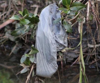
Plastic pollution is killing our marine life. 30% of the world’s turtles and 90% of seabird species have now ingested plastic debris. We have to act now to clean up our oceans.
Petition - Plastic bag in mangroves - Careel Creek, June, 2016


SUNDAY MORNING BIRDWATCHING with PNHA
Would you like to know more about our local birds and explore our bushland reserves? Then join us on one of our bird walks:
21 August, Chiltern Track, Ingleside (birds and wildflowers)
25 September, Irrawong Reserve, North Narrabeen
27 November, Warriewood Wetlands
Most walks start at 7.30 or 8am and last a couple of hours. Bring binoculars and morning tea for afterwards if you like. Contactpnhabirdwatching@gmail.com for details of each walk.

Plastic Free July
The challenge is quite simple...attempt to refuse single-use plastic during July.
Plastic Free July aims to raise awareness of the problems and amount of single-use disposable plastic in our lives and challenges people to do something about it. You can sign up for a day, a week or the whole month and try to refuse ALL single-use plastic or try the TOP 4: plastic bags, water bottles, takeaway coffee cups and straws.
By 2050 its estimated there will be more plastic than fish in the world's oceans. Most comes from land and was was once in our hands. Refuse single-use plastic and together lets keep our oceans clean. Join over 40,000 people, schools and organisations from 90 countries and let those same hands be part of the solution.
Accept the challenge and find out more here: www.plasticfreejuly.org
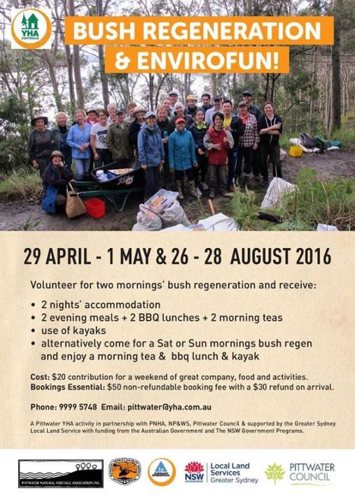
Bush Regeneration And Envirofun Weekend
On: August 26-28, 2016At: Pittwater YHA, Morning Bay
Volunteer for two mornings’ bush regeneration and receive free accommodation, two evening meals, two BBQ lunches and two morning teas and free use of kayaks over the weekend of 26 to 28 August. Alternatively come for a Saturday or Sunday morning bush regeneration and enjoy a morning tea and BBQ lunch and kayak. It is only a $20 contribution ($50 nonrefundable booking fee with a $30 refund on arrival) for a weekend of great company, food and activities.
Bookings essential: 9999 5748 Email: Pittwater@yha.com.au
A Pittwater YHA activity in partnership with: • Pittwater Natural Heritage Association • National Parks and Wildlife Service • Northern Beaches Council • supported by the Greater Sydney Local Land Service • with funding from the Australian Government and the NSW Government.

Have Your Say On:
Appin-West Cliff Mining Complex: Bulli Seam Operations Project - MOD 2
From doc: 'Approval is sought to construct and operate a 1 m diameter suction gas pipeline between Appin No. 3 Vent Shaft and the existing gas drainage plant at Appin No. 2 Shaft (approximately 4 km in length). The pipeline will be buried at the surface, for the most part, along Brooks Point Road.
South 32, Illawarra Coal (Illawarra Coal) proposes to continue its underground mining operations at the Bulli Seam Operations (Appin and West Cliff Mines), located in the Southern Coalfield of New South Wales, by extracting coal from the Bulli Seam using longwall mining techniques. In order to support the safe and efficient extraction of coal in the Bulli Seam Operations (BSO), Illawarra Coal proposes to optimise the underground extraction and utilisation of methane gas from the mine by implementing the “Mine Safety Gas Management Project” (MSGMP).
Installation and operation of the proposed pipeline will enable the existing Appin East gas drainage management system to remain in service for an extended period by reducing the frictional pressure drop and leakage in the pipelines between the mining areas and the gas extraction plant. Considerable benefits in terms of power generation and reduction in greenhouse gas emissions will also result from the Project.
If the proposed pipeline cannot be installed, the existing Appin East gas extraction system will not be able to provide sufficient suction to extract gas from the mining areas and additional gas extraction infrastructure will need to be installed at an alternative location.'
Exhibition Start 08/07/2016Exhibition End 05/08/2016
Pacific Highway Upgrade - Sapphire to Woolgoolga: Modification 8
Material Reuse Strategy
To permanently retain, at five (5) sites outside the Pacific Highway alignment in Sapphire Beach and Moonee Beach, surplus material generated during construction of the project. The surplus material has been used to carry out earthworks to create an improved landform. The re-use of the surplus material will ensure the final landform suits its proposed use or improves the amenity alongside the project, and provides beneficial future re-use opportunities at each site.
Exhibition Start 22/06/2016Exhibition End 22/07/2016
‘The Birds, The Sea & Me’:New Book On Endangered Shorebirds On South Coast
Media release: 7 July 2016A new children’s book about the lives of endangered shorebirds on the South Coast of NSW will be launched this weekend as part of a project funded by the NSW Environmental Trust and the National Parks and Wildlife Service (NPWS) South Coast Shorebird Recovery Program.
‘The Birds, The Sea & Me’ is a story about the fascinating life of three species of endangered shorebirds that live and breed on South Coast beaches; the Hooded Plover, the Pied Oystercatcher and the Little Tern.
The story is told through the eyes of Rikki, a ten-year-old girl, who goes on a journey of discovery about the birds and their beach environment. Rikki learns about what the shorebirds eat, who they share their beach homes with and why they’re endangered.
NPWS South Coast Shorebird Recovery Program Coordinator, Jodie Dunn said the book was a fascinating insight into the plight of the endangered shorebirds, achieved by the contribution of six Shoalhaven schools through a number of writing and art workshops in 2015.
“This book is a delightful and engaging tale and will connect with young and old alike,” Ms Dunn said.
“It creates a great understanding of the challenges our endangered shorebirds face.”
Local artists, Anna Jarrett and Julie Sydenham, worked with the students to create artwork and writing as part of their learning about the endangered shorebirds on their local beaches.
“Having the input of the local school kids was a fantastic way to present the plight of our shorebirds to the public,” Ms Dunn said.“Hopefully, this beautifully illustrated book will create more interest in the birds and lead to more people wanting to volunteer their time to assist in their recovery.”
The NSW Government’s Saving our Species (SoS) program aims to help almost a thousand animals and plants threatened with extinction in NSW. SoS workfocuses on the primary threats to beach-nesting shorebirds and the survival of their vulnerable eggs and chicks, namely predation by foxes and domestic dogs, disturbance by humans, inundation from storm surges and other flooding and native avian predators (mostly ravens and gulls).
Parents and schools interested in getting a copy ($20.00) can contact Jodie Dunn on 0427 012 960 or emailjodie.dunn@environment.nsw.gov.au
Hopefully in the near future copies of this great book will be available through National Parks and Wildlife Service Visitors Centres too.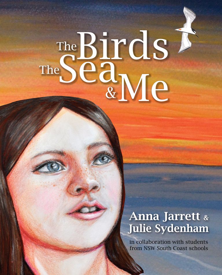

Warragamba - A Story Of Our Making
from Water NSW - June 2016Generations of Sydneysiders owe their thanks to the 2000 workers who worked round-the-clock shifts to build Warragamba Dam between 1948 and 1960. This is their story told by the men and women who lived and worked at Warragamba.
Appointment Of NSW Health Chief Nursing And Midwifery Officer
HIV study confirms clinically viable vaccine
Anxiety Drug Misuse Falls After Reclassification, Study Finds
Obese Preschoolers Have 60% Higher Healthcare Costs
How We Want To Live In 2053
Science Saving Man’s Best Friend From Snake Bites
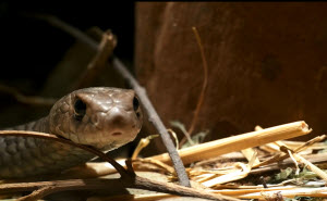 Image caption: Eastern Brown snakes are one of the most venomous snakes in the world.
NSW To Shut Down Greyhound Racing
Protecting Vulnerable Children
NSW Leads The Way In Health And Arts Collaboration
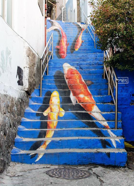
Stair Art In Seoul
Disclaimer: These articles are not intended to provide medical advice, diagnosis or treatment. Views expressed here do not necessarily reflect those of Pittwater Online News or its staff.