Put In Your Ten Cents' Worth On Deposit Scheme
August 24, 2016
The biggest initiative to tackle litter in the state’s history has moved a step closer to reality, with draft legislation on the NSW Government’s 10-cent container deposit scheme going out to public consultation, Environment Minister Mark Speakman said today.
The scheme, which will mean eligible drink containers between 150 ml and three litres can be returned for a 10 cent refund, is scheduled to roll out across the state in July 2017.
Mr Speakman said the container deposit scheme (CDS) was now at the stage of consulting with the public on the details.
“I was thrilled to announce in May along with Premier Mike Baird that NSW was delivering on a key election promise and introducing a long-awaited container deposit scheme – something the community had been asking for for decades,” Mr Speakman said.
“We are looking at several measures to reduce costs of the scheme, including working with Queensland on opportunities for a single scheme coordinator and driving competition by allowing for multiple network operators.”
A draft bill and discussion paper, on public exhibition until Wednesday, 21 September, aims to provide details to the public on how the scheme was proposed to work, including:
- How the scheme will be coordinated
- How the network of collection points will work
- How refunds will work including the potential for contactless (mobile phone) refunds
- How the scheme will interact with kerbside recycling, and
- Roles and obligations under the scheme
“From next year the people of NSW will be able to return most drink containers and receive 10 cents, while playing a part in reducing litter volume by 40 per cent by 2020, one of the Premier’s key priorities,” Mr Speakman said.
The draft Waste Avoidance and Resource Recovery Amendment (Container Deposit Scheme) Bill 2016 and Regulatory Framework Discussion Paper are open for public consultation until 21 September and feedback is welcome.
View the documents and submit comments online at www.epa.nsw.gov.au/waste/cds-draft-bill-consultation.htm
Koala Plans Receive Federal Government Approval
22 August 2016: RMS Media Release
Roads and Maritime Services today welcomed the news the Ballina Koala Plan and Koala Management Plan have been approved.
A Roads and Maritime spokesperson said this was a critical step in enabling the Woolgoolga to Ballina Pacific Highway upgrade between Broadwater and Coolgardie to proceed.
“As part of the project’s Conditions of Approval, no major work could start in this section until the plans were approved,” the spokesperson said.
The plans were carefully examined by the Federal Department of the Environment, including a Population Viability Analysis (PVA) for a 50 year timeframe examining the viability of the koala population in this area.
The PVA was the most extensive study ever carried out on koala populations along the highway and has added to the general body of knowledge about the koala.
“Roads and Maritime takes the project’s Conditions of Approval seriously and works to minimise impact on all sensitive environmental communities while building a safer Pacific Highway,” the spokesperson said.
The NSW Government has used an open and transparent process throughout the development of the Ballina Koala Plan, which was submitted for consideration in February this year.
The decision is important as it will allow the upgrade of the Pacific Highway to be completed to four lanes of divided road between Hexham and the Queensland border, providing a safer journey for thousands of motorists each day.
Roads and Maritime has committed to a range of important measures as part of the plans including completely closed fencing of the new highway between Richmond River and Coolgardie Road with improved fauna connectivity structures, additional fencing on the existing Pacific Highway and nearby local roads to further reduce koala deaths from road strikes.
Key measures include about 26 wildlife crossings to be installed, substantially increasing safe crossing points compared to the current highway.
About 130 hectares of koala food habitat will be planted to provide additional habitat and to guide koalas to safer crossing points across the highway.
The koala food habitat will start to be planted early to ensure it is well developed in time for the highway’s planned completion by 2020 and would provide resources not currently available to the koala.
Studies have shown this would not only offset a decline in the koala population, but even improve its future outlook when combined with the other measures.
The plans took more than 15 months to prepare and involved more than 13 scientific, environmental and research organisations and academics, including the NSW Chief Scientist and Engineer Professor Mary O’Kane AC and leading koala experts.
The principal task of the committee was to provide independent expert advice on the koala management on the Woolgoolga to Ballina upgrade. The committee had a particular focus on ensuring the Population Viability Analysis was scientifically robust and the full range of koala management options were examined.
Key to acceptance of the plans was recognition the upgraded highway will provide numerous mitigation measures including animal crossings, fauna fencing and koala habitat trees which can contribute to management of the remaining koala population.
“Roads and Maritime is committed to working with the community and stakeholders to protect wildlife along the Pacific Highway both during building and operation and we will continue to apply experiences and successes from other upgrade projects to ensure the highest level of biodiversity protection,” the Roads and Maritime spokesperson said.


SUNDAY MORNING BIRDWATCHING with PNHA
Would you like to know more about our local birds and explore our bushland reserves? Then join us on one of our bird walks:
Sunday 28 August, 9am Chiltern Track, Ingleside: 9 am.
Birds and wildflowers walk, with an expert plant guide on hand. Looking out for yellow-tufted and white-eared honeyeaters and grey shrike-thrushes, not seen on our other walks.
Note: In our annual plan this walk was advertised as 21 August. There is no walk on that date. We're meeting on 28 August instead.
Meet: 9am at the Fire Trail gate on the left hand side of the road, nearing the end of Chiltern Rd, Ingleside.
Bring: Binoculars, water, insect repellent, hat and morning tea.
Bookings: Not essential but if you reply to pnhabirdwatching@gmail.com to let us know you are coming, we can look out for you.
25 September, Irrawong Reserve, North Narrabeen
27 November, Warriewood Wetlands
Most walks last a couple of hours. Bring binoculars and morning tea for afterwards if you like. Contact pnhabirdwatching@gmail.com for details of each walk.
 Av Green Team's Sustainability Day
Saturday, September 3 at 12 PM
Bilgola Surf Life Saving Club
Bilgola Beach
The new youth-run environment initiative the Av Green Team is hosting a free sustainability day for everyone to enjoy!
The day will kick off with a beach clean of Bilgola Beach at 10.30am followed by a workshop and speaking-based event held at Bilgola Surf Club.
The sustainability event from 12-4pm will feature speakers and workshops from individuals and groups who are choosing to work or live sustainably. The aim of the event is to bring people together who would like to learn more about sustainability and becoming environmentally conscious. There will be nibbles and Chai tea prepared by members of the Av Green Team and live music too.
We hope to see you there!
Please RSVP to this event through the ticket link above!
Community Landcare Grants
Greater Sydney Local Land Services 2016 Community Landcare Grants are now open!
Grants of $5,000 - $30,000 over 18 months are available for community groups, including Landcare and other 'care' groups and landholders in the Greater Sydney region.
Applications open today Monday 8th August 2016 and close Monday 12th September 2016.
Projects must align with at least 1 of the Strategic Objectives developed for the Australian Government's National Landcare Programme:
• Projects that aim to maintain and improve ecosystem services through sustainable management of local and regional landscapes.Activities funded may include weed and pest control, bush regeneration, erosion management, fencing, plant propagation and revegetation, actions that protect for threatened species, development of management plans, community participation and engagement activities and training that contribute to the protection and restoration of ecosystem function, resilience and biodiversity.
• Projects that aim to build community awareness, participation, skills and knowledge in caring for their environment, including Aboriginal knowledge and participation. Activities funded may include the delivery of workshops, training courses, awareness raising events, booklets, signage, media and other activities designed to build awareness, improve skills and knowledge and/or promote the conservation and enhancement of biodiversity.
For full details including the grant guidelines please visit the Greater Sydney Local Land Services
Website
To discuss project ideas or to find out more please feel free to contact Council's Bushcare Officer on 9970 1367.
Bushcare in Pittwater
For further information or to confirm the meeting details for below groups, please contact Council's Bushcare Officer on 9970 1367
Council's Cooee Newsletter - May- June 2016 HERE
BUSHCARE SCHEDULES
Where we work Which day What time
Avalon
Angophora Reserve 3rd Sunday 8:30 - 11:30am
Avalon Dunes 1st Sunday 8:30 - 11:30am
Avalon Golf Course 2nd Wednesday 3 - 5:30pm
Careel Creek 4th Saturday 8:30 - 11:30am
Toongari Reserve 3rd Saturday 9 - 12noon (8 - 11am in summer)
Bangalley Headland 2nd Sunday 9 to 12noon
Bayview
Winnererremy Bay 4th Sunday 9 to 12noon
Bilgola
North Bilgola Beach 3rd Monday 9 - 12noon
Algona Reserve 1st Saturday 9 - 12noon
Plateau Park 1st Friday 8:30 - 11:30am
Church Point
Browns Bay Reserve 1st Tuesday 9 - 12noon
McCarrs Creek Reserve Contact Bushcare Officer To be confirmed
Clareville
Old Wharf Reserve 3rd Saturday 8 - 11am
Elanora
Kundibah Reserve 4th Sunday 8:30 - 11:30am
Mona Vale
Mona Vale Beach Basin 1st Saturday 8 - 11am
Mona Vale Dunes 2nd Saturday+3rd Thursday 8:30 - 11:30am
Newport
Bungan Beach 4th Sunday 9 - 12noon
Crescent Reserve 3rd Sunday 9 - 12noon
North Newport Beach 4th Saturday 8:30 - 11:30am
Porter Reserve 2nd Saturday 8 - 11am
North Narrabeen
Irrawong Reserve 3rd Saturday 2 - 5pm
Palm Beach
North Palm Beach Dunes 3rd Saturday 9 - 12noon
Scotland Island
Catherine Park 2nd Sunday 10 - 12:30pm
Elizabeth Park 1st Saturday 9 - 12noon
Pathilda Reserve 3rd Saturday 9 - 12noon
Warriewood
Warriewood Wetlands 1st Sunday 8:30 - 11:30am
Whale Beach
Norma Park 1st Friday 9 - 12noon
Western Foreshores
Coopers Point, Elvina Bay 2nd Sunday 10 - 1pm
Rocky Point, Elvina Bay 1st Monday 9 - 12noon
NSW Call to community and government groups to apply for local environmental grants
Media release: 15 August 2016 – NSW Office of Environment and Heritage (OEH)
A total of $4 million in grant funds is available to community groups and government entities for a range of local environment restoration and improvement projects under the NSW Environmental Trust’s 2016/17 Restoration and Rehabilitation Grant Program.
Terry Bailey, Chief Executive, NSW Office of Environment and Heritage and Trust Secretary said the grants will deliver grassroots funding to local environmental projects that restore, protect and enhance a variety of NSW environments.
“This valuable grant program has been running for over 20 years, making it one of the longest running environmental grant programs in Australia,” Mr Bailey said.
“Grants are awarded to help protect important ecosystems, to restore degraded environments and care for habitats of rare and endangered flora and fauna.
“I encourage community groups, not-for-profit and government entities from across the state to apply for a grant and help their local communities protect and conserve our vital natural environment.
“Fifty-six grants were awarded under this program last year and their projects are now tackling a number of local environmental issues.
“Thanks to this grant program landholders, local councils, state government agencies and community groups are now working to restore habitats for native and endangered species, improve water quality and rehabilitate wetland areas.
“As an example, Greening Australia’s $96,730 project is helping improve habitat for the vulnerable Glossy Black Cockatoo. Working alongside landholders, 5,000 trees are being planted and community seed collection and bird identification workshops are taking place.”
Applications open for the 2016/17 round of the Restoration and Rehabilitation Grant Program on 15 August 2016. Grants between $5,000 and $100,000 are available. Applications close on 26 September 2016.
Visit the Environmental Trust website for applications and further information: www.environment.nsw.gov.au/grants/restoration.htm
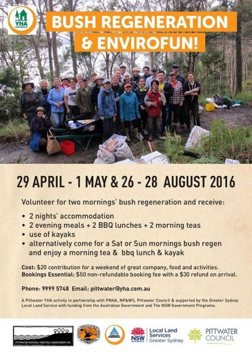
Bush Regeneration And Envirofun Weekend
On: August 26-28, 2016
At: Pittwater YHA, Morning Bay
Volunteer for two mornings’ bush regeneration and receive free accommodation, two evening meals, two BBQ lunches and two morning teas and free use of kayaks over the weekend of 26 to 28 August. Alternatively come for a Saturday or Sunday morning bush regeneration and enjoy a morning tea and BBQ lunch and kayak. It is only a $20 contribution ($50 nonrefundable booking fee with a $30 refund on arrival) for a weekend of great company, food and activities.
A Pittwater YHA activity in partnership with: • Pittwater Natural Heritage Association • National Parks and Wildlife Service • Northern Beaches Council • supported by the Greater Sydney Local Land Service • with funding from the Australian Government and the NSW Government.
Long Reef Guided Walks
Below is the Fishcare Volunteers’ upcoming Walks and Talks which might be of interest to readers. We have been offering this free service now for about 15 years. Most days see somewhere round 30 people, young and old, and we even get people from places like Auburn and further afield. I add my bit as a former Australian Museum person and we also have a geologist to talk about the landward side of Long Reef. We’re dictated by tides, hence the irregular times, but always on a Sunday.
Phil Colman
Free guided walks
with Fishcare Volunteers
Sunday 18 Sept 2016 2 pm – 4 pm
Sunday 16 Oct 2016 2 pm – 4 pm
Sunday 13 Nov 2016 1 pm – 3 pm
Sunday 11 Dec 2016 12 noon – 2 pm
Sunday 29 Jan 2017 3.30 pm – 5.30 pm
Sunday 26 Feb 2017 2.30 pm – 4.30 pm
Sunday 26 Mar 2017 1.30 pm – 3.30 pm
Sunday 9 Apr 2017 12.30 pm – 2.30 pm
• Subject to weather conditions
Long Reef Fishcare Educational Walks
Long Reef Aquatic Reserve, on Sydney’s northern beaches is a unique environment due to its geology and exposure to all four points of the compass. Protecting a huge variety of marine animals, birds and plants, it’s a great place to enjoy learning about our natural environment.
Department of Primary Industries NSW Fishcare Volunteers offer free, guided, educational walks onto the rock platform where in just two hours you’ll observe some of the vast variety of marine life.
You’ll also gain an understanding of the geographical features of the area, look at trace fossils and learn why some migratory birds travel tens of thousands of kilometres from Siberia and Japan to spend time at Long Reef.
An ideal family outing!
Have Your Say On The Amended Rocky Hill Coal Project Application
17.08.2016 : Departmental Media Release - Department of Planning and Environment
An amended development application by Gloucester Resources Limited for the Rocky Hill Coal Project will be on exhibition from today for community consultation.
The Department of Planning and Environment is keen to hear the community’s views on the amended proposal which involves:
- developing and operating an open-cut coal mine to produce up to two million tonnes of coal per year for up to 21 years
- constructing and operating a private coal haul road linking the Rocky Hill Coal Project with the Stratford Coal Complex, approximately nine kilometres to the south
- using the private haul road to transfer coal between 7:00 am and 6:00 pm only, Monday to Saturday
- using the private coal haul road to deliver heavy equipment and construction materials to the mine area
- rehabilitating the site
A spokesperson for the Department said the public should also view the modification application for the Stratford Extension Project, which is being exhibited simultaneously with the amended Rocky Hill Coal Project proposal.
“The public should also note the changes from a previous Rocky Hill Coal Project proposal which was exhibited in 2013,” a spokesperson said.
“Key changes in the amended proposal include three open cut pits instead of four and no night-time hours of work. Additionally, it proposes no evening hours of work for the first three years of the project.
“In the new proposal, coal would be hauled on a private haul road to the nearby Stratford Coal Mine. The Rocky Hill project would therefore not need a Coal Handling and Preparation Plant or a rail loop and train loading bin, or a coal conveyor.
The amended proposal does not include:
- constructing and operating an on-site Coal Handling and Preparation Plant
- constructing and operating a Rail Load-out Facility, including a rail loop and overhead loading bin, to dispatch the product coal to the Port of Newcastle
- developing a three kilometre partially-enclosed overland conveyor, to link the CHPP to the Rail Load-out Facility
- operating the mine during night-time hours
- operating the mine during evening hours for the first three years of the mining operations.
A spokesperson for the Department said the local community always has an opportunity to share their views.
“Community consultation is an integral part of the planning process and the applicant will have to respond to the feedback we receive.
“This feedback is taken into consideration as part of the assessment.
“It’s easy to participate by going online and we encourage everyone to take a look and have their say.”
Submissions can be made from 17 August until 14 October 2016.
Written submissions can also be made to:
Department of Planning and Environment
Attn: Director – Resource Assessments
GPO Box 39
Sydney NSW 2001
The application and EIS are also available to view in person at:
Department of Planning and Environment, 23-33 Bridge Street, Sydney
Nature Conservation Council, Level 14, 338 Pitt Street, Sydney
Mid Coast Council Offices:
- 89 King Street, Gloucester
- Breese Parade, Forster
- 2 Pulteney Street, Taree
- Customer Service Centre, 6 Church Lane, Stroud (9 am to noon)
Have your say on the modification application for Stratford Extension Project
17.08.2016 : Departmental Media Release Author: Department of Planning and Environment
A modification application for the Stratford Extension Project will be on exhibition from today for community consultation.
The Department of Planning and Environment is keen to hear the community’s views on Stratford Coal Pty Ltd’s modification application which seeks to:
- use a private haul road to transfer coal from the Rocky Hill Coal Project to the Stratford Coal Mine site
- construct an extension of the existing coal stockpile to accommodate Rocky Hill’s coal, and process coal from this stockpile through the existing Stratford Coal Handling and Preparation Plant
- place Rocky Hill product coal on the existing Stratford product coal stockpile
- load and dispatch Rocky Hill product coal from Stratford’s existing rail loop and coal load-out system
The community can also view the related but separate Rocky Hill Coal Mine amended development application also on exhibition currently, and make a submission.
A spokesperson for the Department of Planning and Environment said the local community always has an opportunity to share their views.
"Community consultation is an integral part of the planning process and the applicant will have to respond to the feedback we receive," the spokesperson said.
"This feedback is taken into consideration as part of the assessment.
"It’s easy to participate by going online and we encourage everyone to take a look and have their say."
To make a submission and the view the modification application visit www.majorprojects.planning.nsw.gov.au
Submissions can be made from 17 August to 14 October 2016.
Written submissions can also be made to:
Department of Planning and Environment
Attn: Director – Resource Assessments
GPO Box 39
Sydney NSW 2001
The application is also available to view in person at:
Department of Planning and Environment, 23-33 Bridge Street, Sydney
Nature Conservation Council, Level 14, 338 Pitt Street, Sydney
Mid Coast Council Offices:
- 89 King Street, Gloucester
- Breese Parade, Forster
- 2 Pulteney Street, Taree
- Customer Service Centre, 6 Church Lane, Stroud (9 am to noon)
United Wambo Open Cut Coal Mine Project
Street 134 Jerrys Plains Road
City Warkworth
Exhibition Start 11/08/2016
Exhibition End 22/09/2016
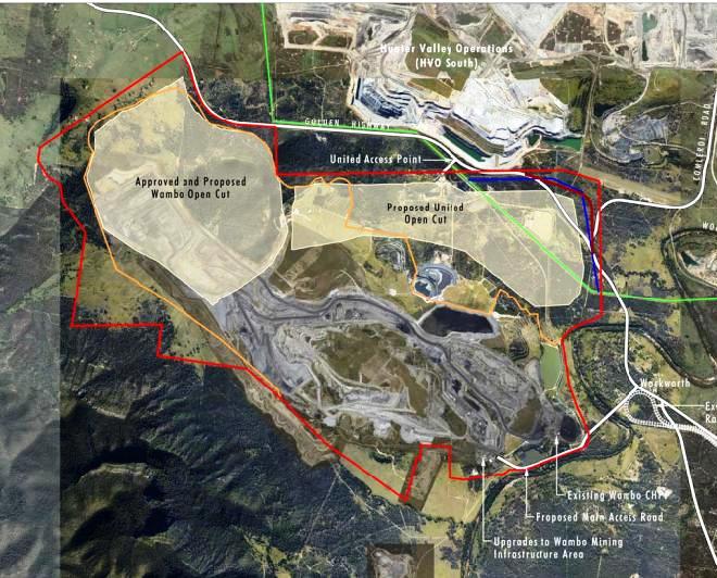
A Joint Venture project between United Collieries and Wambo Coal which combines the existing open cut operations at Wambo with a proposed new open cut at United.
The Project will utilise the existing Wambo Mining Infrastructure Area (MIA), Coal Handling and Preparation Plant (CHPP) and train loading facility. The Project anticipates delivering up to 6Mtpa of product coal, providing jobs for around 500 employees with a life of mine of approximately 23 years. The Project proposes to relocate a 2km section of the Golden Highway and a section of 330kV powerlines to optimise coal recovery in the United Open Cut.
Extent of Mining Areas:
Refer to Figure 1.3 - The project proposes realignment of the Wambo Open Cut boundary to maximise resource recovery. The realignment would result in approximately 5 hectares of additional disturbance for the Wambo Open Cut mine.
The Proposed United Open Cut mine is situated to the weast of the existing Wambo operations (refer to Figure 1.3)
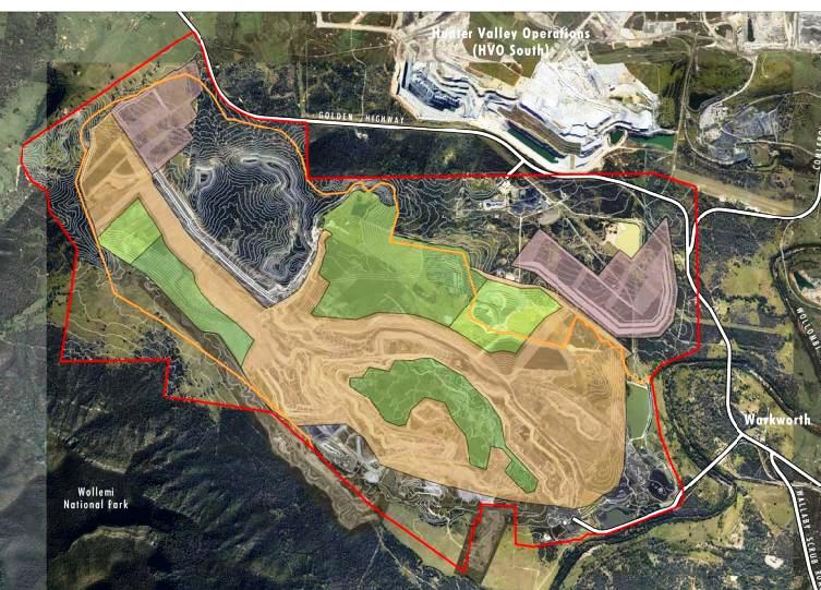
The conceptual staged mine plans are shown on Figure 3.2 to Figure 3.6
Operating Hours 24 hours a day, 7 days a week
Figure 1.3
Figure 3.2
Have Your Say On Wyong Coal Mine
Wallarah 2 Coal Project
Establishment of an underground coal mine and associated infrastructure (see Preliminary Environmental Assessment).
The proposal will also require Commonwealth assessment under the EPBC Act.
Exhibition Start 22/07/2016
Exhibition End 05/09/2016
City Wyong
State NSW
Post Code 2259
Country Australia
Local Governments Lake Macquarie City Council and Wyong Shire Council
Amended application Document:
HERE
The key features of the Project include:
• A deep underground longwall mine extracting up to 5 Million tonnes per annum of export quality thermal coal;
• The Tooheys Road Site (located north-east of the intersection of the M1 Motorway and the Motorway Link Road) which includes a portal, coal handling facilities and stockpiles, water and gas management facilities, small office buildings, workshop, coal transportation infrastructure and connections to municipal water and sewerage systems;
• The Buttonderry Site (near the intersection of Hue Hue Road and Sparks Road) which includes administration offices, bathhouse, personnel access to the mine, ventilation shafts and water management structures;
• The Western Ventilation Shaft Site (located in the Wyong State Forest) includes a downcast ventilation shaft and water management structures;
• An inclined tunnel (or ‘drift’) from the surface at the Tooheys Road Site to the coal seam beneath the Buttonderry Site;
• Transportation of product coal to the Port of Newcastle by rail; and
•An operational workforce of 300 full time employees.
The Project constitutes State Significant Development. As such, the Project has been subject to the assessment process under Division 4.1 of Part 4 of the Environmental Planning & Assessment Act 1979.
Katandra Sanctuary
Katandra is a sanctuary for flora and fauna where the wildflowers are their most colourful during spring but all year round there are opportunities for bird watching. The sanctuary covers 12 hectares and is situated on the Ingleside/Warriewood escarpment. Choose to follow a short walk of about 1km or the longer 2km track through rainforest remnants with creeks and fern-fringed pools. Visit: www.katandra.org Muogamarra in bloom
With spring just around the corner, it’s a great time of year to get outdoors in a national park and enjoy the crisp sunny days and beautiful blossoming flowers.
Muogamarra Nature Reserve, located in the northern outskirts of Sydney, transforms into a brilliant display of colour each August and September, when spring wildflowers come into bloom.
The reserve is only open for six weekends a year to preserve the fragile ecosystems and Aboriginal heritage, and this year, will be open each Saturday and Sunday from 13 August to 18 September.
The best way to explore the extraordinary nature reserve is on a special guided tour. There are three guided walks on offer, where you’ll see and learn about the reserve’s spectacular plants and enjoy stunning scenery.
Or for the more adventurous, join the full-day 18km kayaking tour along the Hawkesbury River to see the reserve from the shoreline, take in the sheer cliffs and learn about the area’s fascinating history.
Challenge yourself on The Coast track
Looking for a walking adventure close to Sydney? The Coast track in Royal National Park, just one hour south of the CBD, is definitely one for your to-do-list.
You’ll walk along cliffs, beaches and escarpments, taking in magnificent ocean views and the rugged beauty of the coastline as you go.
The 26km track can be walked over two days, combined with an overnight camping experience, or broken up into a series of day walks.
There’s also been no better time to lace up the boots and set out, as the track has recently undergone a $1.8 million upgrade over nine months. Works included construction of sandstone stairways and installation of 2.2km of new boardwalk at several sites.
This work has enhanced the walking experience for visitors, but has also prevented soil erosion and protected coastal vegetation.
The Coast track will also benefit from the recent funding announcement from the NSW Government, with $3.6 million allocated for the next 12 months and $9 million over four years.
Tackle The Tour De Gorge Through The Pilliga Forest
Media release: 26 August 2016
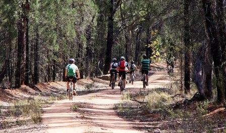
The Olympics might be over but you can still take part in the annual 45km Tour de Gorge bike ride through the remarkable Pilliga Nature Reserve near Baradine on Saturday 3rd September.
The Pilliga Forest is an iconic Australian landscape offering rugged beauty on a grand scale and by entering the Tour de Gorge riders get to pedal through areas usually restricted from public access.
The inaugural tour kicked off in 2013 and has been growing each year with 45 people entering in 2015.
National Parks and Wildlife (NPWS) Area Manager in Baradine, John Whittall, said the collaboration with the Gawambaraay Pilliga Co-management Committee (GPCC) to develop the Tour de Gorge allows people to experience the park in a unique way.
“Riders get the opportunity to take in the unique bush scenery as well as having the chance to spot some of the park’s resident birds and wildlife, including turquoise parrots, emus and wallabies. We also time the bike ride for this time of year to coincide with the emergence of a myriad of stunning wildflowers,” Mr Whittall said.
“It’s not all about the bike riders though, it’s a great day out for the whole family to come out to the park and enjoy the barbecue, take a walk around the Sculptures in the Scrub and relax while the bike riders have their adventure,” Mr Whittall said.
The guided bike ride starts at 8.30am at the Dandry Gorge picnic area and carpark and riders should bring a bike in good working order, spare inner tubes, a helmet, snacks and plenty of water.
“The event is promoted as an all-ages event, but because of its length, participants are usually at least 12 years old and have some bike riding experience,” Mr Whittall said.
“Some parts can be a little steep and challenging, but people are allowed to take their time. We have a sweeper who picks up anyone who feels that they’ve had enough. There are also two locations provided along the way where people can have a break and refill their water bottles.
“For those not keen on enjoying the park on two wheels, a free bus from Baradine to Dandry Gorge will be running and people can refuel at the coffee vendor and check out the stalls,” Mr Whittall said.
This year the ride is supporting the National Breast Cancer Foundation and is the first time NPWS has made the event a fundraiser.
“Cancer has been prominent in our local area lately, so we thought we’d like to do something at a local level to raise awareness and show support for the community,” Mr Whittall said.
Top Photo: courtesy OEH
NSW Forestry Industry Roadmap
25th August, 2016
The NSW Government has released a plan to build a stronger, more competitive and ecologically sustainable forestry industry.
Minister for Primary Industries Niall Blair said the NSW Forestry Industry Roadmap demonstrated NSW government support for the state's forestry industry, which is critical for many towns in regional NSW and the construction of new homes in Sydney.
NSW's softwood plantation sector is valued at $1.9 billion, and the native forestry sector is valued at $465 million. Locally-sourced timber is to be a primary construction material for the projected 660,000 new homes built by 2031.
“Our forestry industry is vibrant and sustainable – whether it’s pine for new homes or paper produced from plantations at Tumut or Oberon, or the beautiful hardwood timber floorboards sourced from renewable native forests at Lismore and Eden,” Mr Blair said.
The roadmap includes strategic actions around four key pillars:
- regulatory modernisation
- balancing supply and demand
- improving community understanding and confidence
- industry innovation and new markets.
The roadmap will help the NSW Government achieve its objective of creating 150,000 new jobs, including 30,000 new jobs in regional NSW. It will also help to increase the value of primary industries by 30 per cent by 2020.
Leard State Forest Coal Mines Clearing Audit Released
22.08.2016: Departmental Media Release - Department of Planning and Environment
The Department of Planning and Environment today released the findings from its Leard State Forest Coal Mines Clearing Audit.
Compliance officers visited the Leard State Forest Mining Precinct during the approved timeframe for vegetation clearing to check whether the mines were meeting consent conditions and following the rules.
The audit was undertaken in response to community concerns.
A spokesperson from the Department said the audit specifically focussed on vegetation clearing protocols from the approved Biodiversity Management Plans (BMP) attached to each mine.
“Weather stations were audited to ensure they comply with relevant Australian standards. Their locations and maintenance records were also checked,” a spokesperson said.
“The mines were found to be meeting their consent requirements to monitor temperature and stop clearing at the 35°C limit.
“In general all three projects in the precinct – Boggabri Mine, Tarrawonga Mine, and Maules Creek Mine – were found to be operating at a high-level of compliance with the clearing commitments in their BMPs.
“Two minor non-compliances were observed at Maules Creek and Tarrawonga mines respectively and the Department has worked with the companies to ensure appropriate action has occurred at each mine to rectify the issues.
“Compliance officers found an unmaintained sediment fence and inappropriate sediment controls in the clearing area at Maules Creek Mine and advised the operators who immediately ceased top soil clearing until adequate controls were in place. This non-compliance has been recorded by the Department.
“A warning letter has been issued to Tarrawonga Mine for failing to gain approval from the Office of Environment and Heritage for their Translocation Strategy as required in their BMP.
“This audit is in addition to regular major project site inspections carried out by the compliance team across NSW.
“Our compliance officers will follow-up with the three mines throughout the year to ensure the minor non-compliances are addressed and any opportunities for improvement can be considered prior to next year’s clearing window.
“The Department can issue the highest on-the-spot fines in the country for breaches of conditions.
“Community members are encouraged to contact the compliance officers with concerns about major projects in their neighbourhood.”
Charbon Coal fined in court for compliance breach
19.08.2016: Departmental Media Release - Department of Planning and Environment
Charbon Coal has been fined $175,000 in the Land and Environment Court for failing to comply with their project approval at the Charbon Coal Mine near Kandos in the State’s central west.
The judgment is a result of a prosecution brought by the Department of Planning and Environment after a compliance investigation was undertaken.
Charbon Coal pleaded guilty in the Land and Environment Court for failing to comply with the project approval, specifically for constructing a coal truck haul road outside of the approved location. Construction of the haul road resulted in the clearing of an area of native vegetation and disturbed an identified Indigenous heritage site.
A Department spokesperson said the company cooperated with the Department’s compliance investigation.
"Strict conditions are placed on all approved major projects and companies must follow these rules," a spokesperson said.
"Our compliance officers work with communities across NSW to monitor major projects across industry, infrastructure, mining and quarries.
"The team conducts audits, spot checks without warning, and works with companies to ensure they are complying."
Live-Stream Air Quality Data From Coal-Seam Gas Regions
25 August, 2016: CSIRO Media Release
Data from the first comprehensive air quality measurement program in the Surat Basin is now available online for anyone to live-stream.
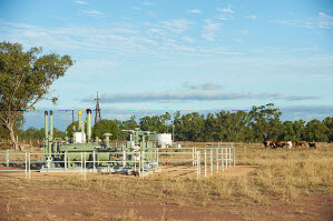
CSIRO, through the Gas Industry Social and Environmental Research Alliance (GISERA), is leading a study which includes collection of air quality measurements through a network of five ambient air quality stations in the Chinchilla, Miles and Condamine region of Queensland.
Specialised instruments are measuring a wide range of pollutants such as carbon monoxide, nitrogen dioxide, ozone and particles in the atmosphere.
Right: Coal seam gas well with air monitoring station in the background
CSIRO atmospheric researcher Sarah Lawson said live streaming the data showed transparency of the data collection process.
"The data is accessible to everyone which means local communities and the general public can stay informed about the air quality in the Western Downs region, how it compares to other parts of Queensland and how levels compare to the government's air quality standards," Ms Lawson said.
The Air Quality Monitoring team within the Department of Science, Information Technology and Innovation (DSITI) will be responsible for publishing the air quality monitoring data on the DEHP website.
Queensland Minister for Innovation, Science and the Digital Economy, Leeanne Enoch said this was a great example of scientific collaboration between CSIRO and Queensland Government.
"Hosting the live air quality data from coal seam gas regions to local community and people of Queensland is a great way to show transparency and build confidence in the research that is taking place," Ms Enoch said.
An air quality model will also be used to explore the degree to which different emission sources in the Surat Basin contribute to the levels of air pollution.
The model includes a variety of natural and man-made emission sources including the CSG industry, power stations, mines, livestock production, motor vehicles, bushfires, and vegetation.
By running the model with different emission sources switched on and off, the degree of contribution from sources, including the CSG industry can be investigated.
The model will also provide an understanding of the distribution of pollutants over a much larger area than can be determined by fixed monitoring stations.
"Both the air quality data and modelling results can be used by government to inform policy and regulations around CSG development and by industry to focus on improving practices that reduce emissions of pollutants" Ms Lawson said.
About GISERA
GISERA is a collaborative vehicle established to undertake publicly-reported independent research addressing the socio-economic and environmental impacts of Australia's natural gas industries. The governance structure for GISERA is designed to provide for and protect research independence and transparency of funded research. Visit
www.gisera.org.au.
Torres Strait Tropical Rock Lobster Fishery - Agency application 2016
Agency application on ecological sustainability
About the application
The current export approval for the Torres Strait Tropical Rock Lobster Fishery is valid until 9 May 2017 and the fishery, under proposed Torres Strait Fishery (Quotas for Tropical Rock Lobster (Kaiar)) Management Plan 2016, is now due for reassessment.
The Department of the Environment and Energy received an application, Strategic Assessment Report for the Torres Strait Tropical Rock Lobster Fishery, from the Australian Fisheries Management Authority in August 2016. The application has been prepared to address the Australian Government ‘Guidelines for the ecologically sustainable management of fisheries – 2nd edition’ and to provide updates on the implementation of recommendations made in the previous Australian Government assessment. The application will be used to assess the operation of the fishery for the purposes of Parts 10, 13 and 13A of the Environment Protection and Biodiversity Conservation Act 1999 (EPBC Act).
Consideration will be given to:
endorsing the plan of management under section 146 of the EPBC Act
declaring under section 33 of the EPBC Act, that actions approved in accordance with the accredited arrangement do not require approval under Part 9 of the EPBC Act.
declaring the Torres Strait Tropical Rock Lobster Fishery, as managed consistent with the Torres Strait Fisheries Act 1984 and the Torres Strait Fisheries Regulations 1985, as an approved wildlife trade operation under section 303FN of the EPBC Act, and
including in the list of exempt native specimens, specimens harvested in the Torres Strait Tropical Rock Lobster Fishery under the provisions of the Torres Strait Fisheries Act 1984 and the Torres Strait Fisheries Regulations 1985.
In accordance with the provisions of sections 146, 303FR and 303DC of the EPBC Act, you are invited to comment on this proposal.
Strategic Assessment Report: Torres Strait Tropical Rock Lobster Fishery (PDF - 695.38 KB)
Appendices: Strategic Assessment Report: Torres Strait Tropical Rock Lobster Fishery - August 2016 (PDF - 3.24 MB)
The call for public comments is open from 26 August 2016 until 29 September 2016.
Humans Have Caused Climate Change For 180 Years
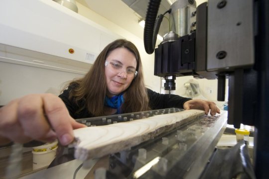
Australian National University researcher Associate Professor Nerilie Abram. Credit: Stuart Hay, ANU
August 24, 2016
An international research project has found human activity has been causing global warming for almost two centuries, proving human-induced climate change is not just a 20th century phenomenon.
Lead researcher Associate Professor Nerilie Abram from The Australian National University (ANU) said the study found warming began during the early stages of the Industrial Revolution and is first detectable in the Arctic and tropical oceans around the 1830s, much earlier than scientists had expected.
"It was an extraordinary finding," said Associate Professor Abram, from the ANU Research School of Earth Sciences and ARC Centre of Excellence for Climate System Science.
"It was one of those moments where science really surprised us. But the results were clear. The climate warming we are witnessing today started about 180 years ago."
The new findings have important implications for assessing the extent that humans have caused the climate to move away from its pre-industrial state, and will help scientists understand the future impact of greenhouse gas emissions on the climate.
"In the tropical oceans and the Arctic in particular, 180 years of warming has already caused the average climate to emerge above the range of variability that was normal in the centuries prior to the Industrial Revolution," Associate Professor Abram said.
The research, published in Nature, involved 25 scientists from across Australia, the United States, Europe and Asia, working together as part of the international Past Global Changes 2000 year (PAGES 2K) Consortium.
Associate Professor Abram said anthropogenic climate change was generally talked about as a 20th century phenomenon because direct measurements of climate are rare before the 1900s.
However, the team studied detailed reconstructions of climate spanning the past 500 years to identify when the current sustained warming trend really began.
Scientists examined natural records of climate variations across the world's oceans and continents. These included climate histories preserved in corals, cave decorations, tree rings and ice cores.
The research team also analysed thousands of years of climate model simulations, including experiments used for the latest report by the UN's Intergovernmental Panel on Climate Change (IPCC), to determine what caused the early warming.
The data and simulations pinpointed the early onset of warming to around the 1830s, and found the early warming was attributed to rising greenhouse gas levels.
Co-researcher Dr Helen McGregor, from the University of Wollongong's School of Earth and Environmental Sciences, said humans only caused small increases in the level of greenhouse gases in the atmosphere during the 1800s.
"But the early onset of warming detected in this study indicates the Earth's climate did respond in a rapid and measureable way to even the small increase in carbon emissions during the start of the Industrial Age," Dr McGregor said.
The researchers also studied major volcanic eruptions in the early 1800s and found they were only a minor factor in the early onset of climate warming.
Associate Professor Abram said the earliest signs of greenhouse-induced warming developed during the 1830s in the Arctic and in tropical oceans, followed soon after by Europe, Asia and North America.
However, climate warming appears to have been delayed in the Antarctic, possibly due to the way ocean circulation is pushing warming waters to the North and away from the frozen continent.
Nerilie J. Abram, Helen V. McGregor, Jessica E. Tierney, Michael N. Evans, Nicholas P. McKay, Darrell S. Kaufman, Kaustubh Thirumalai, Belen Martrat, Hugues Goosse, Steven J. Phipps, Eric J. Steig, K. Halimeda Kilbourne, Casey P. Saenger, Jens Zinke, Guillaume Leduc, Jason A. Addison, P. Graham Mortyn, Marit-Solveig Seidenkrantz, Marie-Alexandrine Sicre, Kandasamy Selvaraj, Helena L. Filipsson, Raphael Neukom, Joelle Gergis, Mark A. J. Curran, Lucien von Gunten.
Early onset of industrial-era warming across the oceans and continents.Nature, 2016; 536 (7617): 411 DOI:
10.1038/nature19082Seagrass Restoration Threatened By Fungi
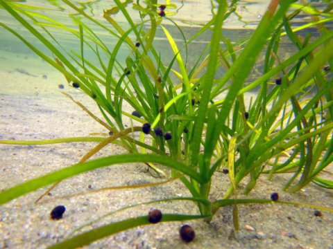
Seagrass (Z. marina) on the North Sea island of Sylt. Credit: Laura Govers
August 23, 2016
Dutch biologists have discovered that seagrass seed is killed by waterborne fungi that are related to the well-known potato blight. These fungi, which have not previously been found in seawater, hinder seed germination and thus prevent the restoration of seagrass. The biologists published their results in Proceedings of the Royal Society B.
The seawater fungi that are to blame (Phytophthora gemini and Halo Phytophthora sp. Zostera) have been identified as members of the large Phytophthora family, which also includes the fungus that causes potato blight. Fungi in this family cause severe damage in agriculture and horticulture, affecting potatoes, grapes and oak trees in California and eucalyptus trees in Australia.
The findings came to light during seagrass restoration trials in the Wadden Sea and the Grevelingen area, but the fungi turned out to be present at many other locations in Europe and America. The widespread presence of these pathogens therefore threatens the global recovery of seagrass. This problem deserves attention because these coastal ecosystems are just as important as coral reefs: they provide breeding grounds for various species, increase biodiversity, and contribute to coastal protection by damping the force of waves.
Nearly all seagrass seed is infected
This investigation was prompted by disappointing germination of sea grass seed that was collected for the restoration project on the North Sea island of Sylt. Nearly all this seed was found to be infected with Phytophthora. Lead researcher Laura Govers, who works at Radboud University and the University of Groningen, tested the germination of the infected seed. "This proved to be six times less likely to germinate than non-infected seed. Only three to four percent of all infected seeds germinated."
Copper treatment
In recent decades, many fields of seagrass have deteriorated worldwide. In the Netherlands, the vast seagrass beds that were originally present in the Wadden Sea disappeared after 1930 and never recovered. These fields were important breeding grounds for fish such as herring, and they contributed to the high biodiversity of the area. They also made the water clearer and contributed to coastal protection by damping the force of the waves. That's why biologists are investigating whether seagrass restoration in the Dutch Wadden Sea is possible. One way to improve the chances for seagrass restoration is by treating the seeds during storage with a copper solution. This method has been used in farming since the 19th century to combat Phytophthora infection and appears to be promising for seagrass seed.
The research project is the result of a collaboration between Radboud University, the University of Groningen, NIOZ Royal Netherlands Institute for Sea Research, the Fieldwork Company and the Virginia Institute of Marine Science, and was funded by Natuurmonumenten, Rijkswaterstaat (Department of Public Works) and the Netherlands Food and Consumer Product Safety Authority (NVWA).
Laura L. Govers, Willem A. Man in ‘t Veld, Johan P. Meffert, Tjeerd J. Bouma, Patricia C. J. van Rijswick, Jannes H. T. Heusinkveld, Robert J. Orth, Marieke M. van Katwijk, Tjisse van der Heide.Marine
Phytophthora species can hamper conservation and restoration of vegetated coastal ecosystems. Proceedings of the Royal Society B: Biological Sciences, 2016; 283 (1837): 20160812 DOI:
10.1098/rspb.2016.0812New leasing partnership heralds reinvigoration for the La Perouse precinct of Botany Bay National Park
Media release: 22 August 2016 - NPWS
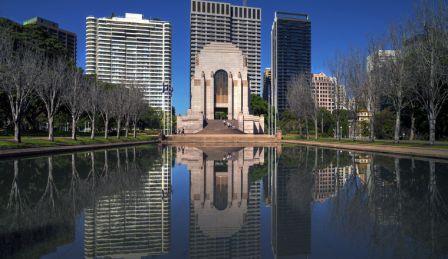
The La Perouse museum precinct in Botany Bay National Park will be reinvigorated with the NSW Government and Randwick City Council moving to lease the historic site.
National Parks and Wildlife Service (NPWS) Deputy Chief Executive Michael Wright said discussions were underway with Randwick City Council to lease the precinct to lead to an improvement in visitor facilities, attracting more visitors and providing better access for people to explore the area.
“Botany Bay National Park is highly significant to all Australians as it’s the site of the first meeting place of Aboriginal people and European cultures,” Mr Wright said.
“The history of the Park reflects thousands of years of Aboriginal culture, European settlement and French exploration - this was the last place French explorer Comte de Laperouse was seen before he left to sail to Samoa in 1788.”
The State Heritage Registered precinct’s buildings include the early 20th century La Perouse former Cable Station, now a museum, and historic structures including the Macquarie Watchtower, the La Perouse Monument and the Pere Receveur Tomb.
The leasing arrangement could include re-using part of the existing building as a cafe, restaurant or kiosk, conference facilities and museum exhibition space.
“Potential opportunities include the adaptive re-use of buildings including new museum exhibitions detailing the history of the precinct at the former Cable Station, conference facilities, events and functions and food services,” Mr Wright said.
It would also mean improvements to pedestrian walkways including disabled access and landscaping to this area of the Park.
Scientists Map Migration Paths Of Arctic Breeding Birds
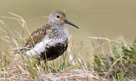
A new study looks at the migration of these birds that breed in Arctic Beringia during the summer months and travel to points south during the winter. The data helps identify key habitat used by the birds and informs the conservation of these areas. Credit: Zak Pohlen (WCS)
August 22, 2016
Conservation of intertidal habitat - 65 percent of which has been lost over the last 50 years - is critical to the survival of countless birds during migration on the East Asian Australasian Flyway.
In an effort to understand the threats and inform conservation of these areas, scientists from The Institute of Biological Problems of the North (Russian Academy of Sciences) and WCS (Wildlife Conservation Society) have collaborated to identify vital stopover areas for the dunlin, a shorebird known to migrate up to 7500 km (4700 miles) to reach its destination.
Arctic shorebirds breeding in Chukotka and Alaska depend upon key coastal intertidal sites along their migratory route to find food to supply energy on their flights. Such intertidal habitats are rapidly being lost to human development, resulting in marked declines of all species that have been studied on this flyway. Some, like the spoon-billed sandpiper, are now at critical risk of extinction, while 23 other species are now threatened, endangered, or vulnerable to extinction. Many others are in rapid decline, losing up to 10 percent of their numbers each year. A key driver of these losses is thought to be associated with development projects along the Yellow Sea coastline that convert intertidal mudflats to dry ground.
To better understand the nuanced threats to shorebird species that breed in Chukotka and nearby Alaska, Russian and American scientists have collaborated on a number of studies, including an assessment of nesting densities and factors influencing nest survival on breeding grounds in Russia. Most recently they have charted the migratory movements, timing, and wintering ground locations of a sub-species of dunlin, a relatively common shorebird that breeds in Chukotka.
"To prevent declines in populations of birds that breed in the Arctic, we must understand their needs after leaving the breeding grounds," said Dr. Rebecca Bentzen, Avian Research Coordinator with WCS and lead author of the study.
In order to track dunlin migrations, Russian researchers attached small geolocators to the legs of the birds. These devices, which weigh less than a paper clip, register light levels in relation to an internal timer, which can be used to estimate latitude and longitude (and hence the flight pattern of the bird) when the bird is recaptured upon return to its breeding grounds.
The data collected over the four-year study showed that dunlin captured during the breeding season in Chukotka wintered in China, South Korea, and Vietnam, primarily between the south coast of Bohai Bay, the Yellow Sea, and Gulf of Tonkin in China. Important stopover areas (places birds rest and replenish energy during these epic journeys) included Sakhalin Island (Russia), and coastal areas around the Yellow Sea (Korea and China). In addition to documenting migration routes both to and from breeding habitats in Russia, the scientists were able to determine other vital information, such as the location and amount of time spent at stopover locations.
Unfortunately while this research provides greater understanding of the critical habitats that allows these birds to thrive, it also raises new conservation challenges.
"Stopover sites have largely been overlooked as conservation priorities," said Bentzen. "By only focusing on certain stages of the life cycles of these birds -- be it their time on the breeding grounds or where they winter -- we have missed a key element of their annual cycles. It doesn't matter how well we protect the breeding grounds -- if these stopover sites are not adequately protected, dunlins and other species will never make it to the breeding grounds."
Along with those scientists directly involved from Russia and the U.S., "citizen scientists" along the flyway got involved in the study, including a Korean birdwatcher who photographed one of the study birds and identified it by leg bands.
Dr. Martin Robards, Director of the WCS Arctic Beringia Program and a study co-author said, "This work is only possible through the dedication and leadership of our Russian partners Alexei Dondua and Dr. Diana Solovyeva. They have consistently overcome the challenges of working in such a remote area and taken the time to develop the necessary transboundary partnerships that have allowed such exciting research to emerge."
The information from this study helps justify the need for conservation action at key stopover points and wintering areas, and will be a key focus during upcoming conferences, including the IUCN World Conservation Congress in September and the East Asian Australian Fly Partnership meeting of the Parties in January.
Bentzen said, "We need to work collaboratively with our international colleagues to provide the best possible protection for the habitat of migrating shorebirds at each stage of their annual movements. This project is a perfect example of what we can learn when we work together to address common problems."
Rebecca Bentzen, Alexei Dondua, Ron Porter, Martin Robards, Diana Solovyeva.
Large-scale movements of Dunlin breeding in Chukotka, Russia, during the non-breeding period. Wader Study, 2016; 123 (2) DOI:
10.18194/ws.00034
Early exposure to too much manganese causes attention deficits in rats
August 23, 2016
Researchers using a rodent model of childhood manganese exposure have found that too much manganese early in development causes lasting attention deficits and other impairments.
Manganese is an essential element, required by the body in trace amounts. High levels of exposure can have neurotoxic effects, however, leading to a condition called "manganism" in adults exposed to manganese dust or fumes in mining, welding, and other industrial occupations.
Studies of children and adolescents have associated excess manganese in the diet with attention deficits, but confounding factors in those studies have made it impossible to show a cause and effect relationship. Attention deficit hyperactivity disorder (ADHD) is the most prevalent neurobehavioral disorder in children, but its cause remains unclear and probably involves many different factors.
The new study, published in Environmental Health Perspectives, is the first study to establish a causal link between exposure to elevated manganese in the diet and attentional dysfunction in an animal model, according to senior author Donald Smith, professor of environmental toxicology at UC Santa Cruz.
"There are many environmental and biological factors that have been associated with increased risk for attention deficits in children, so it's very challenging to understand which factors may actually contribute to or cause attention deficits," Smith said. "Our study clarifies the effects of a single environmental agent, and it allowed us to tease out the specific nature of the deficits it causes, which is extremely difficult if not impossible to do in human studies."
The most common source of exposure to excess manganese is drinking water from wells, because groundwater in some areas is naturally high in manganese. Soy-based infant formulas also have much higher levels of manganese than breast milk. The exposure levels used in the rat study were chosen to produce increases in manganese intake (relative to the normal intake of baby rats) comparable to the relative increases that would be experienced by infants and young children exposed to contaminated drinking water, soy-based formulas, or both.
The impairments seen in the exposed rats were comparable in magnitude to the attentional dysfunction seen in children with ADHD, Smith said. A previous study by Smith's lab found that manganese exposure also causes deficits in fine motor abilities in rats, and he noted that similar deficits in coordination and dexterity are often seen in children with ADHD.
In the new study, newborn rats were exposed to 0, 25, or 50 milligrams of manganese per kilogram of body weight per day, for either the first 21 days after birth or for the duration of the study (about six months).
Behavioral testing for attention and impulsivity began when the rats were about 80 days old and continued six days a week for three months, using a well-accepted protocol. The animals were trained to focus their visual attention on a wall in the testing chamber with five ports and to respond to a brief flash of light within one port by poking their nose into that port. The researchers introduced distractions by delivering a puff of scented air into a different port within the test chamber.
"The odor-based distractor is very hard for the animals to ignore because they have very strong olfactory senses," Smith said. "With thousands of response trials over months of testing, we were able to obtain very detailed information to assess specific functions that we can compare to the assessments used for children."
The impairment caused by manganese exposure was most pronounced in the area of selective attention, assessed by response accuracy in the presence of a distracting odor. Deficits were also seen in other areas related to attention, but manganese exposure did not affect impulse control.
The results also showed that the susceptibility to manganese changed as the animals grew and matured. They were particularly sensitive to the neurotoxic effects during the early postnatal period, before weaning. According to Smith, the dependence of toxicity on the dose as well as the timing and duration of exposure is complicated for a substance like manganese that also has a beneficial biological function.
"The typical dose-response curve for biologically essential elements is U-shaped: too little is bad, too much is bad, and you want to be somewhere in the middle. This study shows that vulnerability also changes over the course of neurodevelopment," he explained.
In the experiment, the rats got a constant dose relative to their body weight, but their sensitivity to it changed as they aged. At the lower dose level (25 mg/kg/d), animals exposed throughout the study actually showed less impairment than those exposed only during the early postnatal period. At the higher dose level, the level of impairment from the longer exposure was the same as the effects of the early life exposure.
"The lower dose exposure over the early life period produced lasting deficits in attention, but if that same dose was continued into adulthood, it helped lessen the deficits caused by the earlier exposure. At the higher dose, however, they were unable to recover," Smith said.
He noted that such complex responses to differences in dose, timing, and duration of exposure may underlie the inconsistencies in published studies of the relationship between blood levels of manganese in humans and neurobehavioral deficits.
"It's difficult if not impossible to reconstruct the exposure histories of children," Smith said. "If we knew their exposure histories more thoroughly, we would likely find stronger associations with the neurobehavioral deficits."
Donald R. Smith, Myla Strawderman, Barbara J. Strupp, Stephane A. Beaudin.
Early Postnatal Manganese Exposure Causes Lasting Impairment of Selective and Focused Attention and Arousal Regulation in Adult Rats. Environmental Health Perspectives, 2016; DOI:
10.1289/EHP258

 Av Green Team's Sustainability Day

 With spring just around the corner, it’s a great time of year to get outdoors in a national park and enjoy the crisp sunny days and beautiful blossoming flowers.
 CSIRO, through the Gas Industry Social and Environmental Research Alliance (GISERA), is leading a study which includes collection of air quality measurements through a network of five ambient air quality stations in the Chinchilla, Miles and Condamine region of Queensland.

 August 25, 2016
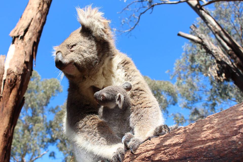
 Thursday, August 25, 2016Keepers at Taronga Western Plains Zoo are delighted to report early sightings of a male Koala joey that is now just over five months old and starting to emerge from its mother’s pouch.
 Thursday, August 25, 2016