Inbox and Environment News: Issue 324
August 6 - 12, 2017: Issue 324
Update On Baleen 2D HR Seismic Survey
(The survey comprises 46 2D lines of total length 208km.) - NOPSEMA 'Not reasonably satisfied – opportunity to modify EP'Decision date: 03/08/2017 Titleholder action Resubmission due date3: 02/09/2017
And NOPSEMA page Baleen 2D HR Seismic Survey: Asset Energy Pty Ltd - also: Decision notification (PDF 137 KB)
From Decision notification:Basis of decision NOPSEMA has assessed the environment plan in accordance with its assessment policies and procedures.
On completion of assessment, NOPSEMA has decided that it is not reasonably satisfied that the environment plan meets the criteria below as set out in regulation 10A of the Environment Regulations: (a) is appropriate for the nature and scale of the activity (b) demonstrates that the environmental impacts and risks of the activity will be reduced to as low as reasonably practicable (c) demonstrates that the environmental impacts and risks of the activity will be of an acceptable level (d) provides for appropriate environmental performance outcomes, environmental performance standards and measurement criteria (e) includes an appropriate implementation strategy and monitoring, recording and reporting arrangements (g) demonstrates that: (i) the titleholder has carried out the consultations required by Division 2.2A (ii) the measures (if any) that the titleholder has adopted, or proposes to adopt, because of the consultations are appropriate
Titleholder requirements For OMR decision In accordance with regulation 10, the titleholder is required to modify and resubmit the environment plan. Upon resubmission of the plan, NOPSEMA will continue to assess the submission in accordance with its assessment policies and make a decision under regulation 10. After a titleholder has been provided with reasonable opportunity to modify and resubmit an environment plan, NOPSEMA will make a final decision on whether to accept or refuse to accept the environment plan. 

Muogamarra Season 2017
Hidden wildflower garden open for just six weekends31 July 2017: NPWS and NSW OE&HA hidden wildflower garden with a rare collection of botanical treasures and native plant species will open its gates this August and September for six weekends only.
NSW National Parks and Wildlife Service (NPWS) Area Manager Michele Cooper said Muogamarra Nature Reserve-just north of Sydney-is home to more than 900 species of native plants as well as the remnants of an ancient volcano.
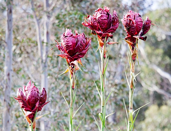
"Muogamarra is home to a vast range of Australian wildflowers such as native orchids, towering Gymea lily, pink Boronia, eriostemon and old-man Banksia, which makes it a spectacular wildflower destination," said Ms Cooper.
"This unique array of flora and fauna is one reason why we need to limit the opening times to just six weekends each year to allow it to flourish, to preserve the fragile ecosystems and to protect the reserve's Aboriginal cultural heritage.
"This year during our open season, visitors can join a Discovery guided tour on foot or on a kayak and discover the secrets of this special place," she said.
Some of the walking tracks in the reserve provide outstanding views of the Hawkesbury, Aboriginal rock engravings and convict built roads, and other tracks wind through rainforest and historic relics.
One of the guided walks leads people down to Peat's Crater, which is an unusual volcanic structure called a diatreme that is not found in many parts of Australia.
"By joining a guided walk you'll will see and learn all the secrets of the reserve that you might miss by going on your own," said Ms Cooper.
The launch weekend (12-13 August) will also mark the 50th anniversary of NPWS.
"The Muogamarra open season will launch on Saturday 12 August with a Welcome to Country by Uncle Ray Davison, cultural workshops throughout the day delivered by Aboriginal Discovery Ranger Jess Sinnott, and activities for young children including free show bags for the first 50 children," said Ms Cooper.
"While visitors can certainly come along on any of the weekends during our open season and explore the park at their own pace, keep in mind that the Discovery walks and kayak tours will need to be pre-booked online as numbers are limited and places can fill up quickly," she said.
Muogamarra Nature Reserve will open to the public every Saturday and Sunday from Saturday 12 August until Sunday 17 September 2017.
What's on- Discovery tours include the Muogamarra Highlights Walk (new in 2017), Muogamarra Bird Gully Walk, Muogamarra Lloyd Trig Walk and Muogamarra Peats Bight Walk.
- A kayaking tour is also available: Paddle our Parks Muogamarra, the first of which will take place on Saturday 12 August.
- An event in celebration of the NPWS 50 Year Anniversary will take place on the first weekend (12 - 13 August).
More informationPrior bookings are essential for the guided walks and kayak tours and can be made by visiting the NPWS website:
Muogamurra Nature Reserve is located on the western side of the Pacific Highway, 3.35 kilometres north of Cowan Station.
A park access fee applies during the 6 annual open weekends of $15 for adults, $10 for children, and $40 for families of 2 adults and 2 children.
- Discovery tours include the Muogamarra Highlights Walk (new in 2017), Muogamarra Bird Gully Walk, Muogamarra Lloyd Trig Walk and Muogamarra Peats Bight Walk.
- A kayaking tour is also available: Paddle our Parks Muogamarra, the first of which will take place on Saturday 12 August.
- An event in celebration of the NPWS 50 Year Anniversary will take place on the first weekend (12 - 13 August).

Have Your Say On Marine Park Draft Plans
21 July 2017: Media release - Australian Government, Director of National ParksAustralia is surrounded by magnificent oceans and a marine environment that is the envy of the world. Our marine parks are distinctive and diverse, home to marine life found nowhere else.And from today you can have your say on how we will manage our marine parks into the future.
The Director of National Parks Sally Barnes has released five draft plans to manage 44 Australian Marine Parks over the next 10 years.“Our marine parks protect important marine habitats and species,” Ms Barnes said.
“They also support people’s livelihoods and the Australian lifestyle. They provide places for people to watch wildlife, dive and snorkel, go boating, and fish. They create jobs in industries like fishing and tourism, and are a source of food and energy.”
Ms Barnes said Australian Marine Parks recognised our oceans as a shared resource -– protecting our environment and supporting the sustainability of our fishing industry and the communities whose livelihoods rely on it.
“I’d encourage everyone to take a look at these five plans my team at Parks Australia have put together,” she said.
“This is your chance to influence how we’ll manage a large area of our marine environment over the next 10 years. We want to hear from you, all of you. It’s your passion that will make marine parks work for everyone.”
Australian Marine Parks (also known as Commonwealth marine reserves) were established in 2012 to protect our oceans. This was a significant contribution to Australia’s marine parks which now cover more than 3.3 million square kilometres of ocean – that’s an area the size of India.
“Before creating these plans, my team and I met with many of you from across our country. We listened to many people, fishers, conservationists, tourism operators, traditional owners and coastal communities before writing these plans,” Ms Barnes said.
“These draft plans balance our commitment to protect the marine environment, while supporting a sustainable fishing industry, promoting tourism and providing cultural, recreational and economic benefits for coastal communities.”
Australian Marine Parks are located in Commonwealth waters that start at the outer edge of state and territory waters, generally no less than three nautical miles (5.5 km) from the shore, and extend to the outer boundary of Australia’s exclusive economic zone, 200 nautical miles (about 370 km) from the shore. The draft plans cover Commonwealth waters off the coast of New South Wales, Queensland, Western Australia, South Australia and the Northern Territory.
Individual marine parks have been carefully zoned to include representative examples of Australia’s marine habitats and features. This builds the resilience of our marine environment to withstand pressures, including some of the impacts of climate change, cyclones, marine pollution, and invasive species.
Ms Barnes has considered comments from over 54,000 submissions providing feedback on the preparation of draft plans. She has also considered the recommendations from the independent review of Commonwealth marine reserves released in 2016; the best available science; the expertise of traditional owners on managing sea country; and experiences from those managing Australian and international marine parks.
“Finalising these plans makes us one of the world’s leaders in marine protection. Already our country’s marine parks cover 36 per cent of waters around this country. That’s more than comparable to many similar countries, like the United States, France, Canada, Mexico or Chile,” Ms Barnes said.
“I truly believe that we will enhance our international reputation as marine park managers with these plans. But I want to hear your thoughts on whether we’ve got that balance right. Doing nothing is not an option for anyone – we want to provide certainty to all. So please have a read of the plans, and let us know what you think.”To reduce any impacts on commercial fishers, the Australian Government will make funding available to assist those directly affected by the new arrangements.
The draft plans can be found at www.parksaustralia.gov.au/marine .
We are seeking your feedback on whether we have the balance right in these draft plans. Please send your feedback on these draft plans or the proposed renaming by 20 September 2017, by:
1. Filling in our feedback form, available at: parksaustralia.gov.au/marine
2. Emailing: managementplanning.marine@environment.gov.au 3. Writing (free of charge) to: Australian Marine Parks Management Planning CommentsDepartment of the Environment and EnergyReply Paid 787Canberra ACT 2601 To help us to consider your feedback, please: • Say what you would like to see kept or changed in the plan/s and why• Refer your points to a specific marine park or use, where appropriate• Give sources of any information you refer to, where possible. Please note, comments sent after 11.59 pm AEST Wednesday 20 September 2017 or to an address other than those listed above cannot be considered. Comments may be made public. Personal information provided to us will be dealt with in accordance with the Australian Privacy Principles.
Further information and our privacy notice is available atwww.parksaustralia.gov.au/marine. Your personal information may be disclosed to the Minister, relevant government agencies, the Australian Parliament and where required by law.
Your submission may also be published online by the Director of National Parks. Please tell us in your submission if you do not want it published. Your submission will still be considered in the Director’s Report on the Preparation of the Management Plans, and may be provided to the Minister and tabled before Parliament.
Important facts and figuresWith 36 per cent of Australia’s waters included in marine parks, we are well ahead of both the international benchmark ‘Aichi target’ of 10 per cent by 2020, and a recent World Conservation Congress resolution calling for 30 per cent by 2030.
According to data from the IUCN’s World Database on Protected Areas, we compare very favourably with the United States of America (41 per cent), New Zealand (30 per cent), the United Kingdom (28 per cent), Mexico (22 per cent), Canada (less than 1 per cent), and France (15 per cent).
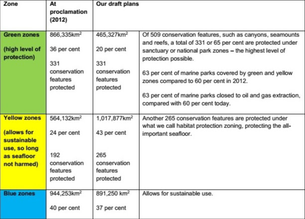
Under the zoning proposed in the draft plans, the portion of green (or no take) zones within all of the marine parks managed by the Commonwealth would be 25 per cent.
There is no reliable ‘league table’ against which we can compare this with other nations as methodology and reporting differ considerably, but we are among the closest nations to meeting the 2016 call by the World Conservation Congress four countries to designate 30 per cent of their marine parks to have no extractive activities.
Thanks to our carefully targeted approach to zoning, the same number of conservation features are protected in green zones in the plans released today as those in 2012.
Australia’s biodiversity hotspots and sites of ecological significance, including Coral Sea reefs and the Bremer Reserve are protected in these plans.
97 per cent of waters within 100 kilometres of the coast are open for recreational fishing.
By intelligently zoning conservation areas like this, we have halved the economic impact on commercial fishers compared with 2012, from $8.2 million to $4.1 million a year (that’s less than 0.3 per cent of total income generated by Australia’s wild catch fisheries). This zoning will also enable a continued Australian tuna fishing industry based out of northern Queensland.
The Australian Government has committed an additional $56.1 million over four years to fund the management of Australian Marine Parks.Our more balanced approach means there is a significant increase in yellow zones – where the seafloor is protected, but activities like diving and fishing are allowed. Our green zones are based on the best available science – while minimising impacts on our important tourism and fishing industries.
New Rules To Better Protect And Enable Access To The Whitsundays
August 1st 2017: Media Release - GBRMPNew rules coming in to effect tomorrow (2 August 2017) will better protect the Whitsundays area, one of the iconic areas of the Great Barrier Reef Marine Park.
The updates to the Whitsunday Plan of Management — an area-specific plan that manages use in this highly visited region in addition to Reef-wide zoning — follows extensive consultation.
Great Barrier Reef Marine Park Authority Chairman Russell Reichelt said it was vital to protect the area’s values that attract visitors to this iconic destination.
“The Whitsundays is one of the most spectacular areas in the Great Barrier Reef Marine Park, attracting more than 40 per cent of the more than two million visitors who come to the Reef each year,” he said.
“It’s important we continue to safeguard this unique environment while allowing for a range of experiences and types of use that sustains a healthy tourism industry.
“The changes include some new additions to how the area will be managed, but previous measures in place to protect the Whitsundays will remain. There are no changes to zoning.”
Among the changes in the updated Plan of Management:- Greater recognition of the connection Traditional Owners (Ngaro people) have to the Whitsundays and the value of working with them to manage sea country.
- Seabirds such as black naped and bridled terns protected by further limiting the time vessels and aircraft can access nesting areas during key nesting periods.
- Twenty-one new superyacht anchorages to be established at carefully selected locations with no corals or other sensitive habitats, providing further tourism opportunities and still protecting the area’s core values.
- More motorised water sports areas, additional scenic flight opportunities and up to 20 new private moorings to provide flexibility to cater for situations where a private mooring may be needed.
- Boundaries for areas where activities can occur — for example, areas where motorised water sports are allowed — will change from ‘buffer style’ within 1500 metres of a reef or coastline to coordinate based, consistent with the zoning plan.
- Enhancing access for cruise ships and vessels greater than 70-metres with two new anchorages near Hamilton Island and Dent Island, as well as an extended anchorage at Funnel Bay. This provides alternative sites for cruise ships to access key locations in the Whitsundays.
Previous protections in place for the Whitsundays — such as 1000 feet minimum flight height and maximum vessel lengths and group sizes — will remain to protect the area’s scenic and recreational values.
Most changes will take effect from 2 August 2017 and will be implemented in stages over the next 12 months. Full details are available online, including for a map detailing the locations of the new motorised water sports areas and superyacht anchorages.
There is still more work to be done in the Whitsundays to address concerns about congestion including developing site plans and reviewing the use of tourism permits for this area.
The Whitsundays Plan of Management — one of four such plans for the Great Barrier Reef — was first released in 1998 and has been amended progressively since that time to ensure it remains relevant to current environmental and user needs.
Plans of management are generally prepared for intensively used, or particularly vulnerable groups of islands and reefs, and for the protection of vulnerable species or ecological communities.
Plans of management complement zoning by addressing specific issues in greater detail than can be accomplished by the broader reef-wide zoning plans.
- Greater recognition of the connection Traditional Owners (Ngaro people) have to the Whitsundays and the value of working with them to manage sea country.
- Seabirds such as black naped and bridled terns protected by further limiting the time vessels and aircraft can access nesting areas during key nesting periods.
- Twenty-one new superyacht anchorages to be established at carefully selected locations with no corals or other sensitive habitats, providing further tourism opportunities and still protecting the area’s core values.
- More motorised water sports areas, additional scenic flight opportunities and up to 20 new private moorings to provide flexibility to cater for situations where a private mooring may be needed.
- Boundaries for areas where activities can occur — for example, areas where motorised water sports are allowed — will change from ‘buffer style’ within 1500 metres of a reef or coastline to coordinate based, consistent with the zoning plan.
- Enhancing access for cruise ships and vessels greater than 70-metres with two new anchorages near Hamilton Island and Dent Island, as well as an extended anchorage at Funnel Bay. This provides alternative sites for cruise ships to access key locations in the Whitsundays.
Have Your Say On New Environmental Measures For Scrap Metal Businesses
Media release: 26 July 2017 - EPAThe NSW Environment Protection Authority (EPA) is inviting the community to have a say on proposed minimum environmental standards for scrap metal facilities.
The scrap metal industry in NSW ranges from small car wrecking yards to large metal processing facilities, and plays an important role in diverting waste from landfill and recovering resources.
While many operators in the industry are doing the right thing, some scrap metal businesses have shown poor environmental controls and inadequate management practices. Common issues across the industry have required regulatory action by the EPA and other agencies. These issues include management of oils and solvents, air pollution and odour issues, noise and vibration, fire risks and the on-site management of waste. Inadequate management of these issues can lead to pollution incidents, including soil and groundwater contamination.
To address these environmental concerns, the EPA has drafted a consultation paper that outlines proposed minimum environmental standards across the scrap metal industry. These standards include things like putting controls in place for the safe storage and disposal of liquids and chemicals, no burning of waste on site, measures to minimise noise and vibrations, and the construction of bunds to manage any spills. If adopted these standards would be legislated and apply across the industry.
EPA Executive Director Waste and Resource Recovery Steve Beaman said the proposed standards were an important step in the right direction.
“Many scrap metal businesses are doing the right thing but there are some outliers putting the environment at risk,” Mr Beaman said.
“It’s important for the community – including people working in the scrap metal business – to have their say on these proposed environmental standards so that when they come into force, they accurately reflect the challenges and realities of the industry.”
To view the consultation paper and provide feedback please visit the EPA website The submission period closes at 5pm on 18 September 2017.
Bushcare in Pittwater
For further information or to confirm the meeting details for below groups, please contact Council's Bushcare Officer on 9970 1367
BUSHCARE SCHEDULES
Where we work Which day What time
Avalon
Angophora Reserve 3rd Sunday 8:30 - 11:30am
Avalon Dunes 1st Sunday 8:30 - 11:30am
Avalon Golf Course 2nd Wednesday 3 - 5:30pm
Careel Creek 4th Saturday 8:30 - 11:30am
Toongari Reserve 3rd Saturday 9 - 12noon (8 - 11am in summer)
Bangalley Headland 2nd Sunday 9 to 12noon
Bayview
Winnererremy Bay 4th Sunday 9 to 12noon
Bilgola
North Bilgola Beach 3rd Monday 9 - 12noon
Algona Reserve 1st Saturday 9 - 12noon
Plateau Park 1st Friday 8:30 - 11:30am
Church Point
Browns Bay Reserve 1st Tuesday 9 - 12noon
McCarrs Creek Reserve Contact Bushcare Officer To be confirmed
Clareville
Old Wharf Reserve 3rd Saturday 8 - 11am
Elanora
Kundibah Reserve 4th Sunday 8:30 - 11:30am
Mona Vale
Mona Vale Beach Basin 1st Saturday 8 - 11am
Mona Vale Dunes 2nd Saturday+3rd Thursday 8:30 - 11:30am
Newport
Bungan Beach 4th Sunday 9 - 12noon
Crescent Reserve 3rd Sunday 9 - 12noon
North Newport Beach 4th Saturday 8:30 - 11:30am
Porter Reserve 2nd Saturday 8 - 11am
North Narrabeen
Irrawong Reserve 3rd Saturday 2 - 5pm
Palm Beach
North Palm Beach Dunes 3rd Saturday 9 - 12noon
Scotland Island
Catherine Park 2nd Sunday 10 - 12:30pm
Elizabeth Park 1st Saturday 9 - 12noon
Pathilda Reserve 3rd Saturday 9 - 12noon
Warriewood
Warriewood Wetlands 1st Sunday 8:30 - 11:30am
Whale Beach
Norma Park 1st Friday 9 - 12noon
Western Foreshores
Coopers Point, Elvina Bay 2nd Sunday 10 - 1pm
Rocky Point, Elvina Bay 1st Monday 9 - 12noon

Bushcare in Pittwater
Where we work Which day What time
Avalon
Angophora Reserve 3rd Sunday 8:30 - 11:30am
Avalon Dunes 1st Sunday 8:30 - 11:30am
Avalon Golf Course 2nd Wednesday 3 - 5:30pm
Careel Creek 4th Saturday 8:30 - 11:30am
Toongari Reserve 3rd Saturday 9 - 12noon (8 - 11am in summer)
Bangalley Headland 2nd Sunday 9 to 12noon
Bayview
Winnererremy Bay 4th Sunday 9 to 12noon
Bilgola
North Bilgola Beach 3rd Monday 9 - 12noon
Algona Reserve 1st Saturday 9 - 12noon
Plateau Park 1st Friday 8:30 - 11:30am
Church Point
Browns Bay Reserve 1st Tuesday 9 - 12noon
McCarrs Creek Reserve Contact Bushcare Officer To be confirmed
Clareville
Old Wharf Reserve 3rd Saturday 8 - 11am
Elanora
Kundibah Reserve 4th Sunday 8:30 - 11:30am
Mona Vale
Mona Vale Beach Basin 1st Saturday 8 - 11am
Mona Vale Dunes 2nd Saturday+3rd Thursday 8:30 - 11:30am
Newport
Bungan Beach 4th Sunday 9 - 12noon
Crescent Reserve 3rd Sunday 9 - 12noon
North Newport Beach 4th Saturday 8:30 - 11:30am
Porter Reserve 2nd Saturday 8 - 11am
North Narrabeen
Irrawong Reserve 3rd Saturday 2 - 5pm
Palm Beach
North Palm Beach Dunes 3rd Saturday 9 - 12noon
Scotland Island
Catherine Park 2nd Sunday 10 - 12:30pm
Elizabeth Park 1st Saturday 9 - 12noon
Pathilda Reserve 3rd Saturday 9 - 12noon
Warriewood
Warriewood Wetlands 1st Sunday 8:30 - 11:30am
Whale Beach
Norma Park 1st Friday 9 - 12noon
Western Foreshores
Coopers Point, Elvina Bay 2nd Sunday 10 - 1pm
Rocky Point, Elvina Bay 1st Monday 9 - 12noon
Free Guided Bush Walk.
Dundundra Falls Reserve, Terrey Hills.10th September 10 -12 pm at Myoora end of Larool Road Fire Trail Terrey HillsCome down and enjoy the wild flowers and have all your questions answered by our qualified bush consultant.
This reserve is exploding with colour at the moment so even if you can’t make this special walk you can come down anytime and enjoy our new map and information signs and appreciate what this 40 Hectare recreational Reserve is all about.
Wear clothes and shoes suitable for bush walking and be prepared for Ticks and Leeches as unfortunately they like living here too.
Questions to dundundrafalls@gmail.com

Navigation Warning - NSW Coastal Waters: Whale Migration Season
NSW COASTAL WATERS2017 WHALE MIGRATION SEASONJune to December 2017
DESCRIPTIONMigrating whales and whale calves are expected to be present in numbers off the NSW coast during this time.
From June to August whales will be in greater abundance generally moving north within about five nautical miles (nine kilometres) of the coast.
From August to December whales will be in greater abundance generally moving south within about 10-15 nautical miles (18-28 kilometres) of the coast.
From July to December Southern Right Whales with calves are likely to be present within 10 nautical miles of the NSW coast and within coastal estuaries.
DIRECTIONWithin this period it is expected that whale sightings may be common and mariners are advised to navigate with due care and appropriate caution around any whale activity, including reducing to an appropriate speed to maintain safe navigation.
The approach distance for whales in NSW and Commonwealth waters is 100 metres for whales without calves. If calves are present the approach distance is 300 metres.
In the event of a collision with a whale, entanglement or whale carcass sighting please call:
National Parks and Wildlife Service Incident Duty Officer on: 02 9895 6444
MAP & CHARTS AFFECTEDCharts: AUS 806 to AUS 813 Inclusive.
RMS Coastal Boating Maps: 1-14 Inclusive.
Contact Details:
For further details please contact the National Parks and Wildlife Service, Wildlife Team on 9585 6523 or (RMS Contact details 13 12 36)
Information regarding the current location of whales may be obtained at:http://www.wildaboutwhales.com.au/
Further information about whale approach distances or whale behaviour may be obtained from the Office of Environment and Heritage website at:http://www.environment.nsw.gov.au/
MARINE NOTICE SY1724
LGNSW Congratulates Minister On CDS Milestone
July 31, 2017: Media Release - LGNSW
The peak body for the Local Government sector has welcomed the Container Deposit Scheme (CDS) arrangements announced by Environment and Local Government Minister Gabrielle Upton. The Minister named TOMRA -Cleanaway as Network Operator, and Exchange For Change (a consortium of Coca-Cola Amatil, Carrlton and United Breweries, Coopers, Lion and Asahi) as Scheme Coordinator. Local Government NSW (LGNSW) said the Container Deposit Scheme, which provides for a 10c refund on the return of most empty beverage containers, was a fantastic initiative which deserved extensive support to ensure a smooth introduction. "Councils spend hundreds of thousands of dollars each year picking up litter, and would much prefer to be investing this money in other community services," LGNSW President Keith Rhoades said. "The scheme has the potential to cut litter in NSW by up to 43%, but the complexity of the collection and refund processes required have become increasingly clear. "We congratulate the Environment Protection Authority (EPA) and the Government on their hard work to get the scheme up and running. "It's also great that the EPA is working with LGNSW on supports for councils to ensure the scheme works well from the get-go. "Things like expert advice and guidance for councils, a community education package, and data will be vital to help ensure councils get the best deal for their ratepayers in contracts with Material Recycling Facilities (MRFs)." Clr Rhoades said the CDS had also resulted in amendments to the State Environmental Planning Policy to fast track the approval of low-impact container collection and sorting points. "The EPA and the Department of Planning and Environment (DPE) have worked together to streamline the design approval process for many of these facilities, but in some cases councils are still the consent authority," he said. "We always enjoy working collaboratively with both the EPA and the DPE to achieve the best outcomes for local NSW communities." The CDS is scheduled to commence on 1 December.
Ski And Board Through Kosciuszko National Park's Virtual Streets
Media release: 3 August 2017: NPWSIs it a bird? Is it a plane? No! It's a camera-mounted Google Trekker backpack strapped to a park ranger skiing Kosciuszko National Park's slopes and resorts.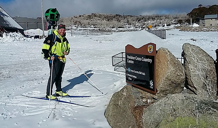
For the first-time the Google Street View Trekker has been taken on skis by the National Parks and Wildlife Service (NPWS) and captured 360 degree views of the high country and ski resorts.
Tim Greville is the intrepid NPWS ranger who took the trekker onto the slopes.
"The images captured by the trekker are now on Google Street View, so people can literally take a slide on my skis and see the park's cross country trails from their tablet or mobile device," said Mr Greville.
"These free digital 'maps' mean skiers and snowboarders can scope out trails before they come to the park and better plan their trip.
"Or for those who have never skied before, Street View from the slopes gives a pretty good sense of what to expect and may whet their appetite for a trip to the snow.
"This Street View series is also a great way for people who are mobility impaired to see this spectacular country in Winter.
While nothing compares to seeing the snow fall and breathing the fresh mountain air, these maps open Kosciuszko National Park and its resorts to a whole new audience.
Richard Phillips, Sales and Marketing Manager at Perisher said the Google Trekker backpack was attached to a snowmobile and taken across the resort areas of Perisher, Blue Cow, Smiggin Holes and Guthega.
"Fantastic images were collected that showcase the huge amount of terrain available for skiers and boarders across the resort. Having this content available online will be a great tool in promoting the whole area," said Mr Phillips.
Stuart Diver, Resort Operations Manager at Thredbo said that it's exciting to know that now, from all corners of the globe, people can put themselves in the heart of Thredbo.
"From anywhere in the world you can take a tour around the resort and experience the Snowy Mountains," said Mr Diver.
The new Google Street View imagery of Kosciuszko National Park can be seen at Google Street View Trekker in NSW national parks

Spot The Spotted-Tailed Quoll
Monday, 24 July 2017: Media Release - Gabrielle Upton, Minister for the EnvironmentThe NSW Government is asking people to help spot Illawarra’s spotted-tailed quoll among a line-up of thousands of animals as part of a citizen science project, Environment Minister Gabrielle Upton said today.
More than 100,000 images from 29 remote cameras are online for the public to help sort through as part of the NSW Government Saving our Species quoll project in the Illawarra.
“We need help sorting through thousands of animal selfies to help narrow down the number of spotted-tailed quolls in the region,” Ms Upton said.
“This is an important conservation project because the spotted-tailed quoll is the only remaining quoll species in the state.”
Quolls are the project’s target animal but the cameras have also captured other species such as a wedge-tailed eagle eating a ringtail possum, long-nosed potoroos and even a powerful owl.
“All this information will go towards improving the monitoring of quolls and other threatened species across the region,” Ms Upton said.
It will help the NSW Government increase the resilience and size of the local quoll population.
The project, undertaken at the Barren Grounds Nature Reserve and Budderro National Park, is funded under the NSW Government’s $100 million Saving our Species project.
The photos are available to view on DigiVol, which is a crowdsourcing platform developed by the Australian Museum in collaboration with the Atlas of Living Australia.
For more information, visit:http://volunteer.ala.org.au/institution/index/17733578
Department Seeks Community Input On Improving Environmental Impact Assessments
July 5th, 2017: Departmental Media Release, Department of Planning and Environment
The community has a chance to improve the way state significant projects are assessed during workshops to gather feedback on new draft Environmental Impact Assessment (EIA) guidelines.
The draft guidelines are on exhibition until Friday,1 September 2017, and representatives from the Department of Planning and Environment will be holding community information sessions across NSW during the exhibition period.
Executive Director, David Kitto, said the new guidelines are an important initiative to drive better practice in NSW.
“While state significant projects such as large infrastructure, industry, mining and urban renewal developments are essential for NSW, they require a comprehensive triple-bottom line assessment with extensive community input,” Mr Kitto said.
“Last year we exhibited a discussion paper on improving the assessment process and received strong support for the improvements from industry and the community.
“After extensive consultation we developed draft guidelines and we’re undertaking workshops to hear what the community has to say about them.
“This is an important opportunity for the community to make sure we get the new guidelines right.”
Mr Kitto said key improvements include getting the community involved much earlier in the assessment process, focussing on the most important issues and improving the quality of all assessment documents.
“While assessment documents, such as environmental impact statements, need to be technically rigorous they also need to be easy to understand and clearly address issues raised by the community. This means everyone should be able to understand them, not just technical experts,” he said.
All public feedback gathered during the exhibition and roadshows will be considered and will assist the Department in finalising the EIA guidelines.
On exhibition are:- Guides for proponents covering all stages of the assessment process
- A guide to help the community understand and participate in the assessment process
- A guide on the Department’s approach to setting conditions for projects
To view the draft guidelines currently on public exhibition and make a submission, visit the Department’s website http://www.planning.nsw.gov.au/EIAreview
To attend the public information sessions, people should call 1300 305 695 or visit the Department’s website at http://www.planning.nsw.gov.au/EIAreview
Once registered, relevant information for the community information session will be provided via email.Comment by September 1st, 2017
Visit a community information session
Tuesday 25 July SydneyS1: 12:00pm - 2.30pmS2: 4:30pm – 7:00pm
Thursday 10 August Sydney S1: 12:00pm - 2.30pm
Guideline 1Overview of the EIA Improvement ProjectThis document outlines the proposed improvements. It will help you locate further details of the improvements outlined in each of the guidelines.Make a submission
Guideline 2Community Guide to EIAThis guideline outlines the opportunities to participate at each phase of EIA, what information the community can expect to receive and how the community’s knowledge and opinions will be used by the proponent and the Department.Make a submission
Guideline 3Scoping an Environmental Impact StatementThis guideline will help proponents identify the key issues for assessment in the EIS by providing guidance on how to scope a project and setting out the requirements for engagement with the community and other stakeholders in the early phases of EIA.Make a submission
Guideline 4Preparing an Environmental Impact StatementThis guideline will help proponents prepare a clear and consistent EIS with all the required information. It will also enhance understanding by the community and other stakeholders.Make a submission
Guideline 5Responding to External Submissions This guideline provides direction to proponents on how to address comments and issues and communicate to the community and other stakeholders who have made a submission in response to a proposed project during the exhibition of the EIS.Make a submission
Guideline 6Community and Stakeholder EngagementThis guideline encourages proponents to engage earlier with the community and other stakeholders by introducing a set of engagement requirements applicable to all projects. It will also help proponents to improve the quality of engagement by directing them to focus on meeting participation outcomes during the preparation of the EIS.Make a submission
Guideline 7Approach to Setting ConditionsThis guideline outlines the Department’s approach to setting conditions of approval. It will promote understanding of the role of conditions of approval in decisions about the project and the management of environmental impacts during construction and operation.Make a submission
Guideline 8Modifying an Approved ProjectThis guideline will help proponents to understand if changes are permitted using the same development consent, if the consent needs to be modified or if a new application is required. It will also help them to understand whether community and other stakeholder engagement is required.Make a submission
Guideline 9Peer ReviewThis guideline sets out a methodology for independent peer review including criteria to determine the suitability of a peer reviewer, review practice, review reporting and post approval requirements. It will provide for greater consistency in peer review.Make a submission
For further information, please call our Information Centre on 1300 305 695 or email EIAproject@planning.nsw.gov.au.
- Guides for proponents covering all stages of the assessment process
- A guide to help the community understand and participate in the assessment process
- A guide on the Department’s approach to setting conditions for projects
Bushcare’s Major Day Out At Mona Vale 2017
Mona Vale Bushcare and Pittwater Natural Heritage Association have been awarded a Stronger Communities Grant to continue the restoration of the coastal dune and littoral rainforest at the end of Basset Street. The Bushcare group will continue to remove weeds, replant native species and encourage natural regeneration. The $12,000 received will be used to support the group through contract bush regeneration and the purchase of native plants.
This site has been chosen for Bushcare volunteers to come together and join in the nationwide “Bushcare’s Major Day Out” event to support all our local volunteers working to conserve and restore our unique natural environment.
When: September 17, 2017 - 8.30 a.m.to 12p.m.Where: Mona Vale Basin Beach Reserve, at the end of Bassett Street Mona Vale
Grants Of Up To $3 Million Available For Innovative Solutions For Organic Waste
Media release: EPAApplications for grants up to $3 million are now open to councils, waste and/or organics processing companies and not-for-profit organisations who have plans for projects that can tackle the amount of food and garden waste that goes to landfill.
The NSW Environment Protection Authority and Environmental Trust are inviting applicants to submit their proposals under three different grant streams:- Organics Processing Infrastructure - up to $3 million for infrastructure process more source separated organics from households and businesses
- Food Donation Infrastructure – up to $500,000 for equipment to collect, store and redistribute surplus food to people in need
- Product Quality – up to $500,000 for equipment to improve recycled organics product quality
Previous rounds of these grants have already funded projects that have made a positive impact on local communities. Last year 3 Pallaettes was awarded a $295,600 Organics Processing Infrastructure Grant to provide the Central Coast with an open windrow composting system for organic wastes, that would otherwise be sent to landfill, to produce a premium grade humified soil conditioner.
With a $89,500 grant under the Food Donation stream, Settlement Services were able to purchase a van, cool rooms and freezer to run The Staples Bag program, supplying a bag of food staples to people in need.
EPA Unit Head Organics Amanda Kane said the grants gave councils and community groups the chance to fund projects that could make a real difference when it came to organic waste.
“From saving good food from being wasted and tackling food insecurity in our state, to increasing NSW capacity to process more collected green waste, these grants are designed to tackle organic food waste from every angle,” Ms Kane said.
The Office of Environment & Heritage (OEH) Director Grants Peter Dixon said the Environmental Trust was pleased to offer the new rounds of organics funding for organics collections under the Waste Less, Recycle More initiative.
“This is a significant amount of money that will go to projects that will make a significant change to organic waste in our state.”
The grants are being delivered through a partnership between the EPA and the Environmental Trust (which is administered by OEH).
Applications close 5pm Thursday 10 August 2017. The EPA is hosting webinars to assist potential applications find out more about grant programs. More information on these webinars available here
For more information on the organics collections grants and webinar visit.http://www.epa.nsw.gov.au/wastegrants/local-gov-organics.htm
- Organics Processing Infrastructure - up to $3 million for infrastructure process more source separated organics from households and businesses
- Food Donation Infrastructure – up to $500,000 for equipment to collect, store and redistribute surplus food to people in need
- Product Quality – up to $500,000 for equipment to improve recycled organics product quality
4nature Inc V Centennial Springvale Pty Limited And Others
UPDATE 2 August 2017: EDO NSWThe NSW Court of Appeal has found in favour of our client 4nature in its court case to protect Sydney’s drinking water catchment from the impacts of Springvale coal mine.
Springvale coal mine, operated by Centennial Coal, lies beneath the Newnes State Forest in the Blue Mountains. In September 2015, the NSW Planning Assessment Commission (PAC) approved an extension to the mine operations that allowed the mine to discharge large amounts of mine water into the river system that forms part of Sydney’s drinking water catchment.
The PAC’s approval allowed Centennial Coal to extract 4.5 million tonnes of coal from the Springvale mine every year for a further 13 years. Millions of litres of highly saline mine water was permitted to be discharged every day into the Coxs River, which flows into Lake Burragorang, Sydney’s major drinking water reservoir. Water discharged from the mine also contains nitrates, phosphates, zinc, nickel and other contaminants.
Following the PAC approval, on behalf of 4nature Inc, EDO NSW launched landmark legal action against the owners of the mine (Centennial Springvale Pty Limited and Springvale SK Kores Pty Limited) and the Minister for Planning in the NSW Land and Environment Court. The case argued that the approval was unlawful because the PAC could not be satisfied the development will have a ‘neutral or beneficial’ effect on water quality in the catchment – a standard introduced by the NSW Government in 2009 specifically to protect Sydney’s drinking water catchment.
The NSW Land and Environment Court found the PAC’s approval was lawful, and that the extension could proceed. However, 4nature appealed that decision in the Court of Appeal. The challenge was successful, with the Court overturning the Land and Environment Court’s decision and declaring that the PAC’s approval was in fact unlawful. A further hearing will be required to consider the orders appropriate to resolve the proceedings.
This was the first case to test laws passed in 2009 that were introduced to protect Sydney’s drinking water catchment. Under those laws, a development cannot be approved unless the consent authority is satisfied that the development will have a ‘neutral or beneficial’ effect on water quality.
EDO NSW is grateful to barristers Richard Lancaster SC and Nicholas Kelly for their assistance in this matter.
To stay up to date with this case and our other cases, sign up to our weekly eBulletin.
LinksProtections for water too fluid?, EDO NSW blog 22 February 2017.
Link to this case summary.
Memorial Dedicated To Staff On World Ranger Day
Monday, July 31st, 2017: The Hon. Gabrielle Upton, Minister for the Environment
The NSW Government has dedicated a memorial to National Parks and Wildlife Service staff who have lost their lives in the line of duty on World Ranger Day, NSW Environment Minister Gabrielle Upton said today.
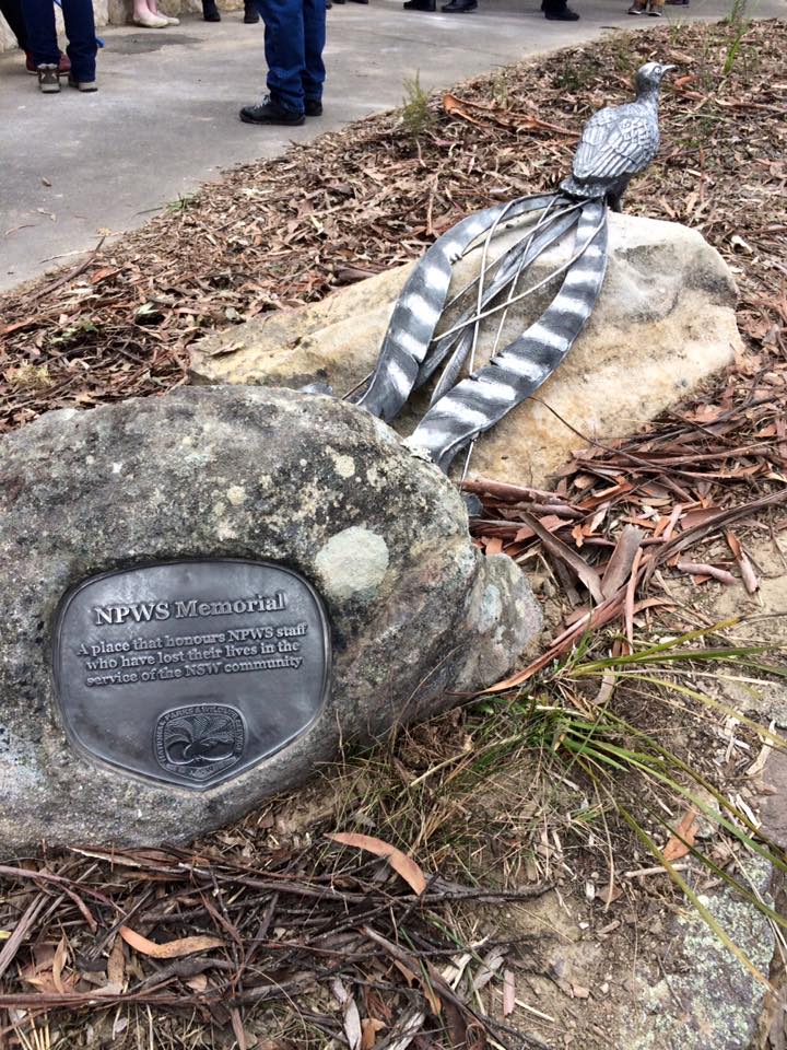
World Ranger Day is observed on the 31 July each year to commemorate the many rangers killed or injured in the line of duty.
Ms Upton said the memorial near Govetts Leap in the Blue Mountains National Park acknowledged 10 men and women since 1978 who have lost their lives while doing their job protecting the state’s conservation areas.
“Caring for NSW’s national parks and reserves is no ordinary job. Our rangers and staff are extraordinary people,” Ms Upton said.
“They make a difference every day to the conservation and enjoyment of national parks. The work they do is important, rewarding, but also sometimes dangerous.
“Today is about taking a moment to say thank you for the contribution these men and women made to our community and to our State’s conservation.”
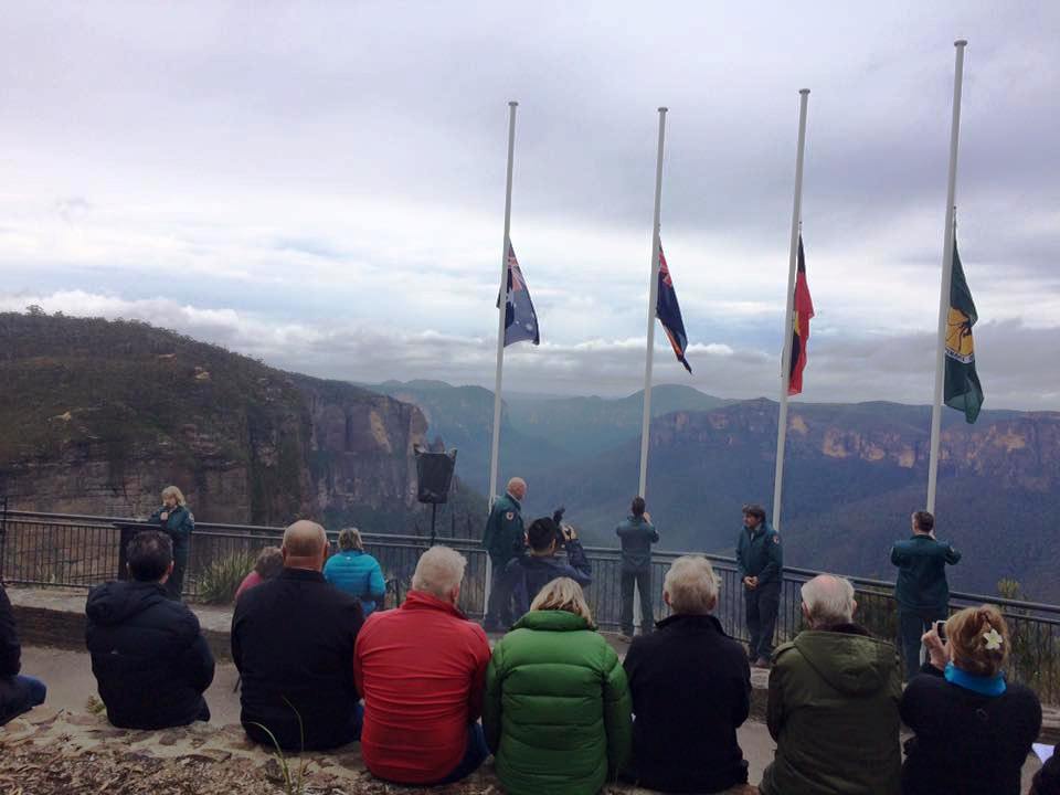
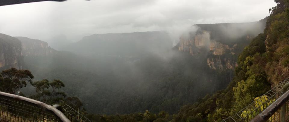
Photos courtesy Pittwater's Julie Hegarty, a Member of the National Park and Wildlife Advisory Council:
"I was fortunate to be a special guest at the NPWS Memorial Dedication at George Phillips Lookout, Blue Mountains National Park, to honour those employees that have lost their lives in the line of duty. A sobering moment standing in 7degree temps in the rain."


A Further $6 Million For 20 Million Trees Available For Community Projects
Media release - The Hon. Josh Frydenberg MP, Minister for the Environment and Energy
Under our 20 Million Trees Program, the Turnbull Government will invest $70 million to plant 20 million trees by 2020.
Community groups, organisations or individuals can now apply for grants between $20,000 and $100,000 for tree planting projects that will put back threatened bushland and support threatened species.
Priority will be given to projects that target nationally-listed Threatened Ecological Communities.
Under previous 20 Million Trees funding rounds, Landcare groups and community projects across Australia have planted three million trees. With 13.4 million trees already contracted for planting, today’s announcement will ensure that the 20 million trees election commitment target is met.
The 20 Million Trees Grant Guidelines: Round Three are also now available and applications close on 15 August 2017.
The 20 Million Trees initiative is an important part of the Turnbull Government’s National Landcare Program.
More information is available at www.nrm.gov.au/20-million-trees.
Applications will be accepted from eligible individuals, landholders, community groups, Indigenous groups, non-government organisations and state, territory and local government agencies.
Projects may occur on public and private land; in urban, peri urban and regional areas across Australia.
There is no limit to the number of applications applicants can submit. Each application will be for a single 20 Million Trees Project.
Refer to Part 3 of the Guidelines for the eligibility and funding conditions for Applicants, Projects and Activities.
Key datesApplications open: 19 June 2017Applications close: 2.00pm AEST (Canberra time) Tuesday 15 August 2017
Round Three projects must be prepared to commence before 1 December 2017 and must be able to be completed by:- 30 June 2019, for Projects seeking grant funding of $20,000 to $60,000 (GST exclusive); or
- 30 June 2020, for Projects seeking grant funding of $60,010 to $100,000 (GST exclusive).
Note: Projects will not be able to undertake any planting activities in the final six months of the project period with the exception of planting to make good on any losses. This is necessary for plantings to be sufficiently advanced to allow an accurate final survey to determine the number of trees established at the end of the Project period.
- 30 June 2019, for Projects seeking grant funding of $20,000 to $60,000 (GST exclusive); or
- 30 June 2020, for Projects seeking grant funding of $60,010 to $100,000 (GST exclusive).
Bird Walks And Talks 2017: PNHA
Come and see and hear some of our fantastic native birds, many of which you'll never see in your garden. Join in a Sunday guided bird walk with Pittwater Natural Heritage Association. All walks start at 8am and end about 10am.
August 27 Chiltern Track. Meet at gate, off northern of Chiltern Rd Ingleside.
September 17 Irrawong reserve. Meet at corner Irrawong Rd and Epworth Rd.November 26 Warriewood Wetlands. Meet end of Katoa Close, north Narrabeen.
Bring binoculars if possible. Drink, hat and comfortable shoes.More information contact pnhabirdwatching@gmail.com or Ph Kerry on 0402 605 721.
You don't need to book but if we know you're coming we'll watch out for you. Call if in doubt about weather as we won't go out if it's raining.


Petition: Rescind Adani's Unlimited Water License And Support Aussie Farmers!
As Queensland farmers, water is crucial for our livelihoods. As our climate gets hotter and drier, our water resources are even more precious. We call on the Queensland Premier to rescind the unlimited, free 60-year water license they are proposing to grant to the Adani coal mine.
Background: My name is Angus Emmott and I'm proud to be a third generation grazier from Longreach in outback Queensland. I'm committed to a sustainable future for farming in Australia and ask you for your support to protect our precious groundwater.
In Queensland, the proposed Adani-owned Carmichael coal mine has been granted unlimited access to groundwater. The mine, the biggest of nine proposed for the Galilee Basin west of Rockhampton, is expected to draw 26 million litres of water per day from its pits. Over its life this mine alone would total 355 billion litres of water and modelling already demonstrates that 2 springs will be shut down.
As farmers we are angry about the special deal struck by the Queensland government to give Adani free water for its proposed coal mine. I am launching this petition today to call upon Premier Annastacia Palaszczuk to support Aussie farmers and to rescind the water licenses that allow Adani access to unlimited water for 60 years.
All over the country, farmers are battling to stop fossil fuel mining and fracking on their land. Nearly 90% of Queensland is currently drought declared, so why are we giving an Indian billionaire access to unlimited groundwater for a new coal mine?
I'm asking all Australians, to stand with me in calling upon the Premier to rescind this approval before irrevocable damage is done to our groundwater systems and the long term sustainability of Queensland agriculture.
Angus Emmott with Farmers for Climate Action
Take Precautions To Reduce Risk Of Spreading Flu
- get vaccinated every year – vaccination is best before winter starts but it’s not too late to be vaccinated
- wash your hands regularly, cover coughs and sneezes, and dispose of used tissues
- ask sick people to stay away until they are well
- if you are vulnerable to severe influenza see your doctor as soon as influenza symptoms start as early treatment of influenza can help prevent complications.
NSW Parents Not Planting Enough Vegies On Plates
New Chair For Southern NSW LHD Board
New Operators Announced For The Transfer Of Supported Accommodation And Respite Services
- Life Without Barriers – Central Coast, Nepean Blue Mountains, South Eastern Sydney
- Cerebral Palsy Alliance (CPA) – Northern Sydney
- Achieve Australia – Norton Rd SSL and the remaining SSL group homes arising from the Metro Residences redevelopment.
- Northcott
- House with No Steps
- LiveBetter Community Services, formerly known as CareWest
- Hunter Valley Disability Services Limited
- Mid North Coast Disability Services Limited.
New Treatment For Lung And Kidney Cancer On PBS
New Data Shows Widespread Sexual Assault And Sexual Harassment At Australian Universities
Disability Support For Conferences
Vale Les Murray
State Funeral For Les Murray AM
World First Light Rail Vehicle Arrives In Sydney
Grants Program Update For Arts Organisations
- Four Year Funded organisations can make one application for project funding per calendar year, subject to the Catalyst restrictions below
- If your Catalyst project funding concludes after May 2018 it will be counted as one of your applications to the Australia Council for 2017.
- If your Catalyst project funding concludes after September 2018 it will be counted as one of your applications to the Australia Council for 2018.
Cracking The Code Of Megapests

Microgrid Construction Begins At Garden Island
Banks To Overhaul Consumer Credit Insurance Sales Processes
- how a deferred-sales model for CCI sold with credit cards over the phone and in branches will work
- what measures need to be implemented for CCI sold with credit cards over the Internet
- other measures to promote good consumer outcomes (including well informed decision making) for CCI sold with credit cards and other loan products; and
- the data necessary to ensure that the success of these reforms can be monitored (such as data on complaints, claims performance and cancellations).
$40 Million For Dementia Research Projects
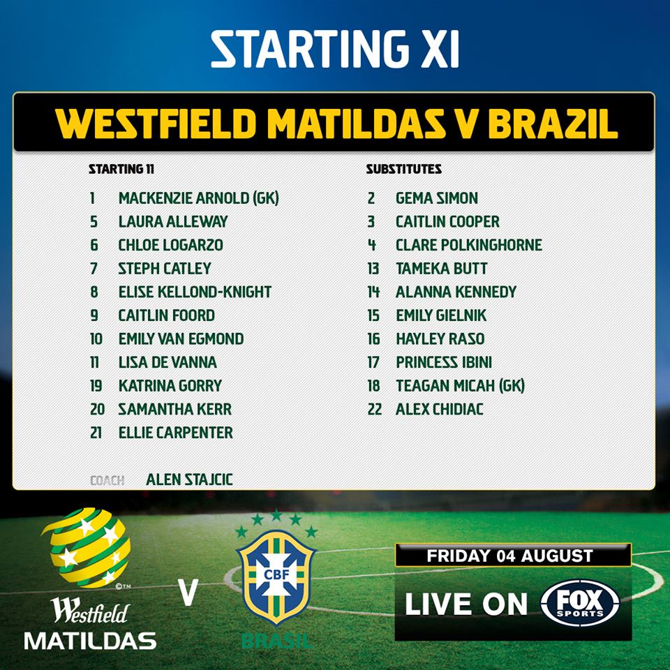
Champions! Australia Wins Tournament Of Nations


Mawson’s Huskies Make It Onto The Map

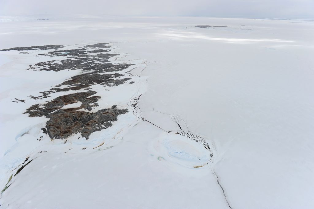
Sir Douglas Mawson's Huskies (File Footage)
Summer Scholarships At National Library Of Australia
- an applicant's academic potential and capacity for research
- the value and quality of the proposed research at the Library to the applicant's academic progress
- the relevance of the National Library's collections for the proposed research
- Register as an applicant
- You can only submit your application online. Instructions are provided during the application process.
- After you have submitted an application, you will receive a confirmation email. A reference number and a copy of your application will be attached to the email.
- You are required to attach to your application a PDF copy of a certified transcript of your academic record and a PDF copy of a recently completed piece of research writing (eg a thesis chapter).
- You must nominate two referees, with their current contact details. The National Library will directly contact your referees but it is your responsibility to provide referees with a copy of your application.
- Applications close on 30 September 2017.
NFSA Calls On Music And History Buffs To Have Their Say!
Christine Anu My Island Home
The song “My Island Home”, was originally written and composed in 1987 by the Wurrumpi band. The song was written about George Rrurrambu who fronted the Wurrumpi Band.
The original song starts off with the sound of water hitting a tinny. The sound itself isn’t actually water but a small group of instruments imitating the sound, e.g. guitar and drums. The sound is played at the beginning of the song because it signifies aboriginal culture and being on a boat, spear fishing, is part of aboriginal tradition. It also relates to the song being about home being an island.
Warumpi Band - My Island Home 1988
Vale Dr G Yunupingu
Disclaimer: These articles are not intended to provide medical advice, diagnosis or treatment. Views expressed here do not necessarily reflect those of Pittwater Online News or its staff.