Inbox and Environment News: Issue 402
April 28 - May 4, 2019: Issue 402
Asset Energy Confirm Will Seek Permission To Conduct 3D Seismic Testing Off The Central Coast
Over 3000 Dolphins Found Dead On The Coast Of Peru
Ducks At Narrabeen Lagoon Showing 'Angel Wings' Due To Being Fed Bread
Native Wildfoods For Native Birds
School Of Hammerhead Sharks At Palm Beach
- Great Hammerhead – Endangered (IUCN); not listed (EPBC Act 1999)
- Scalloped Hammerhead – Endangered (IUCN); Conservation Dependent (EPBC Act 1999)
- Smooth Hammerhead – Vulnerable (IUCN); not listed (EPBC Act 1999)
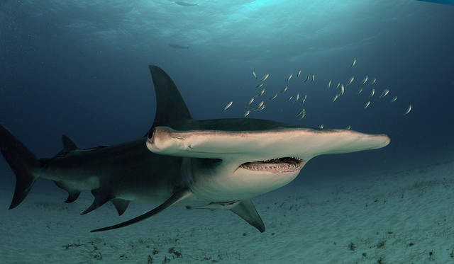
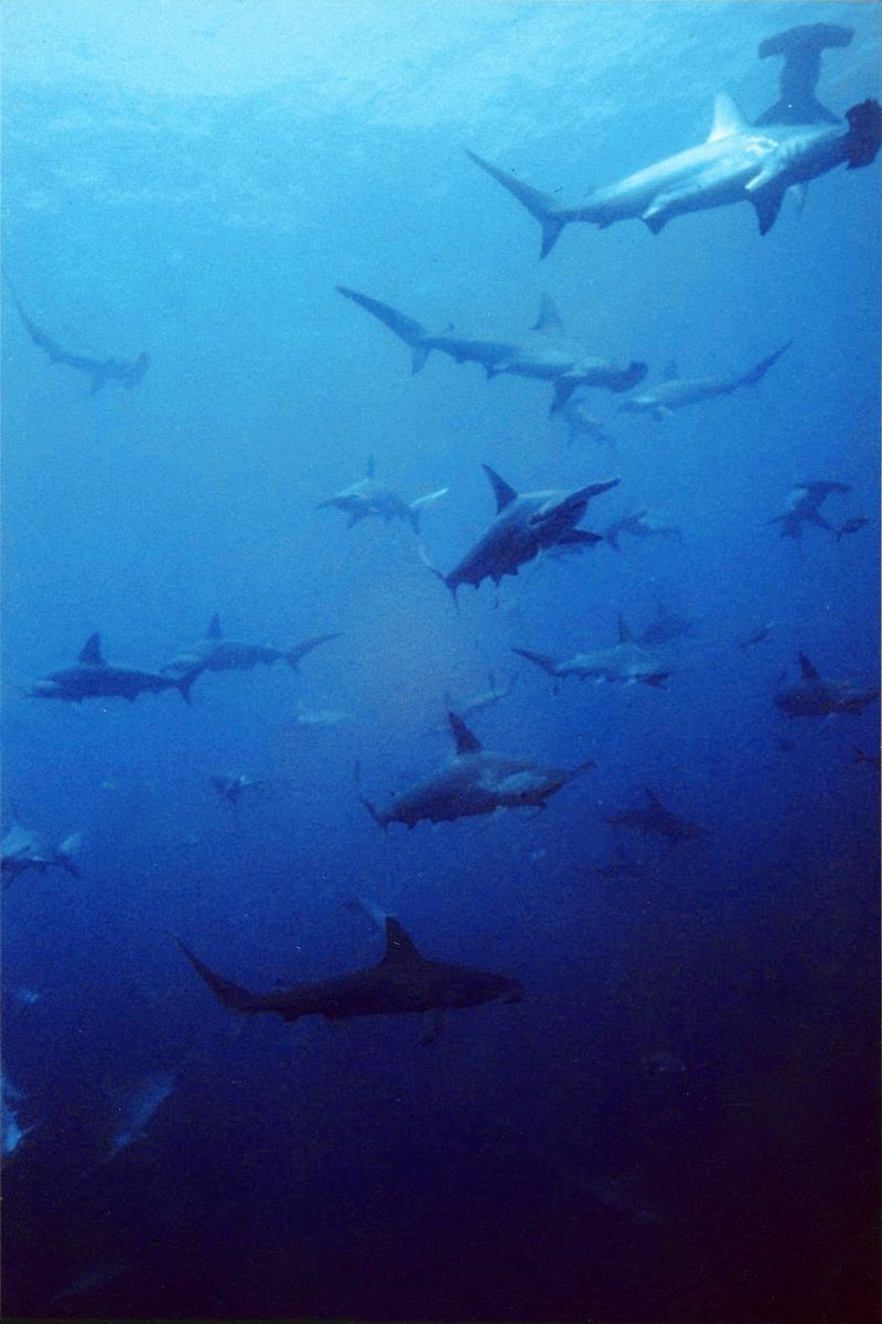
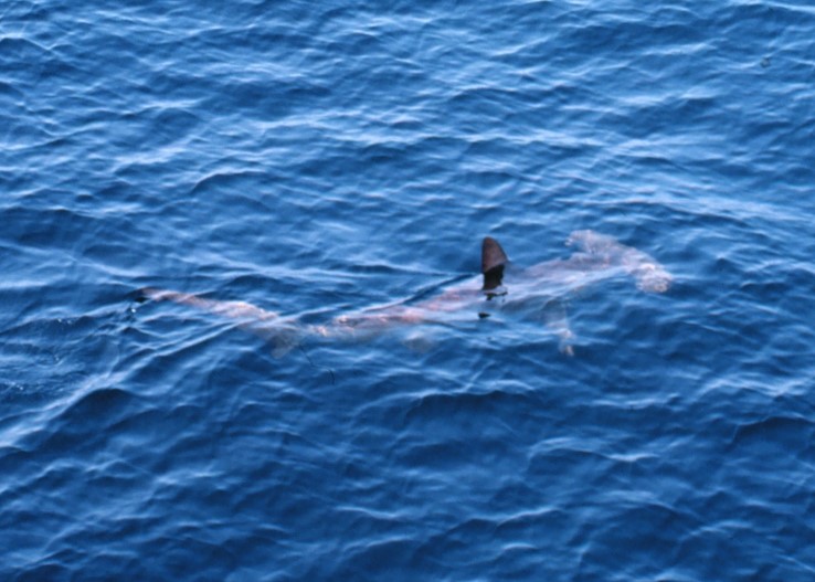
- Great Hammerhead: NSW, QLD, NT, WA
- Scalloped Hammerhead: NSW, QLD, NT, WA
- Smooth Hammerhead: NSW, VIC, TAS, SA, WA
- scalloped hammerhead shark (Sphyrna lewini)
- great hammerhead shark (Sphyrna mokarran)
- smooth hammerhead shark (Sphyrna zygaena).
- scalloped hammerhead shark (Sphyrna lewini) 200 tonnes per year
- great hammerhead shark (Sphyrna mokarran) 100 tonnes per year
- smooth hammerhead shark (Sphyrna zygaena) 70 tonnes per year.
- scalloped hammerhead shark (Sphyrna lewini)
- great hammerhead shark (Sphyrna mokarran)
- smooth hammerhead shark (Sphyrna zygaena).
Recent Endangered Hammerheads Mortality Statistics For QLD Show Thousands Being Slaughtered By Gillnets
PITTWATER YHA OFFERS FREE BEDS FOR GREEN HEARTS
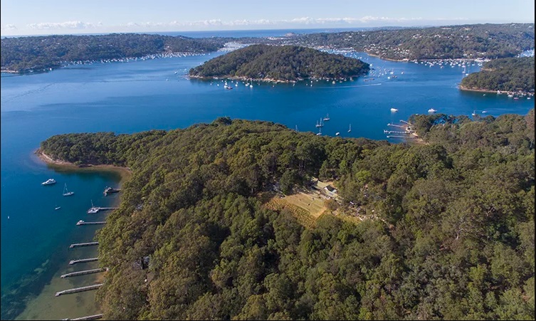
Sydney Wildlife Carers Course May 2019
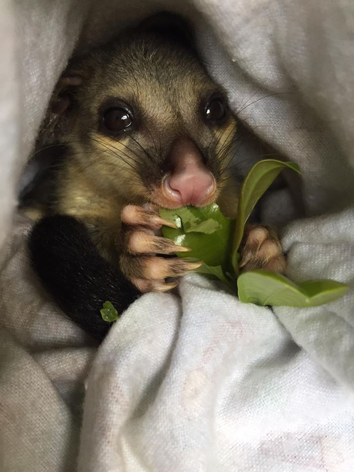
Ingleside Pygmy Possum
Spotted in April 2019!
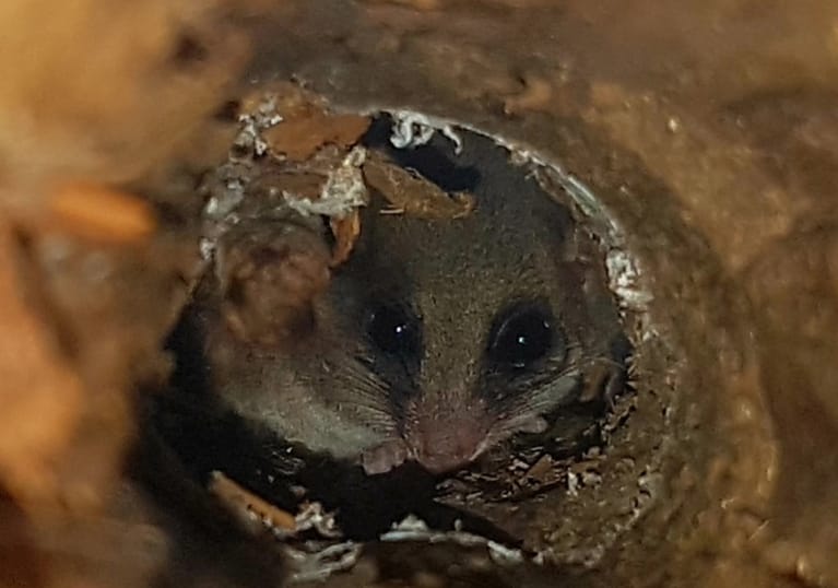
The eastern pygmy possum (Cercartetus nanus) is a diprotodont marsupial of south-eastern Australia. Occurring from southern Queensland to eastern South Australia and also Tasmania, it is found in a range of habitats, including rainforest, sclerophyll forest, woodland and heath.
Eastern pygmy possums are very small, weighing from 15 to 43 grams (0.53 to 1.52 oz) and having a body length of between 7 and 9 centimetres (2.8 and 3.5 in) with a 8 to 11 centimetres (3.1 to 4.3 in) tail. They are dull grey above and white below, with big, forward pointing, almost hairless, ears and a long prehensile tail, with thick fur at the base that becomes sparser towards the tip. They have long whiskers, and a narrow ring of dark fur around each eye.
The eastern pygmy possum is an active climber. It uses its brush tipped tongue to feed on nectar and pollen, especially from Banksia, Eucalyptus and Callistemon species. It also feeds on insects, and will eat soft fruits when flowers are not available. It is a largely solitary animal, sheltering in tree hollows and stumps, abandoned bird nests, and thickets. During winter it spends time in torpor.
They are nocturnal, and, although generally thought to be solitary, have been reported to share communal nests, and to be seen in groups of two or more adult individuals. Males occupy home ranges of 0.24 to 1.7 hectares (0.59 to 4.20 acres), which overlap with each other and with the smaller, 0.18 to 0.61 hectares (0.44 to 1.51 acres) ranges of females.
Distribution and habitat
Eastern pygmy possums are found along the southeastern Australian coast, from eastern South Australia to southern Queensland, and on Tasmania. They inhabit shrubby vegetation in a wide variety of habitats, from open heathland or shrubland to sclerophyll or rain forest, at elevations from sea level to 1,800 metres (5,900 ft). Despite this apparent diversity of habitats, their distribution is patchy, and they are usually low in number where they are found.
Reproduction
Eastern pygmy possums typically breed twice a year, although they may breed a third time if food is plentiful. Females have a well-developed pouch with four to six teats, and usually give birth to four young, although larger litters are not uncommon. Gestation lasts around 30 days, after which the young spend 33 to 37 days sheltering in the pouch. They are weaned at 60 to 65 days, and remain with the mother for at least a further ten days, by which time they weigh about 10 grams (0.35 oz).
The young reach the full adult size at around five months, but may be able to breed as little as three months after birth. They live for up to 7.5 years in captivity, but probably no more than five years in the wild.
Discovery
The first specimen of an eastern pygmy possum known to Europeans was collected by François Péron, a naturalist aboard Nicolas Baudin’s voyage to the south seas. Whilst on a short stay on Maria Island, off eastern Tasmania between 19 and 27 February 1802, Péron traded with the Aboriginal inhabitants for a single small marsupial. Péron wrote (in translation) ‘In the class of mammiferous animals, I only saw one kind of Dasyurus, which was scarcely as large as a mouse. I obtained one that was alive, in exchange for a few trifles, from a savage who was just going to kill and eat it’. In an unpublished manuscript (now held in the Le Havre Museum in France) Péron also wrote that the animal ‘was given to me by the natives; it was still alive; I believe it to be a new species and have described it as Didelphis muroides because of its resemblance to the D. mus of Linnaeus’. The specimen collected by Péron (a juvenile male) was transported back to France, and is now held in the Muséum National d’Historie Naturelle in Paris as the holotype
In New South Wales, it is considered vulnerable under the Threatened Species Conservation Act 1995.
Photo courtesy Sonja Elwood, a Biodiversity Officer with Northern Beaches Council. Council has a program of installing and monitoring nesting boxes for this vulnerable species in our area. Find out more in their webpage 'Environmental Programs and Resources'
EQUINOR Environment Plan Submission For The Great Australian Bight
Australia Paddles Out To Fight For The Bight - Sydney
“After categorising all the entries, 1039 were considered to address specific parts of our EP with questions, comments or concerns. While many of these have not led to changes in our EP, they have all been considered by our experts. In most cases, we found that our EP already addressed what was raised in the comments….. Among the public comments, 13 comments have led to improvements or changes to our EP…” Statement from Equinor

Predator-Proof Zone To Protect Vulnerable Native Animals Installed In NSW
April 23, 2019: NSW Government
Bilbies, bandicoots and other small native mammals will soon be reintroduced to Sturt National Park for the first time in more than 90 years. A 40-square-kilometre predator-proof zone in the north west of NSW will offer protection to vulnerable native mammals.
Predators like rabbits, cats and foxes have been eradicated from the enclosure.
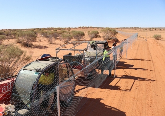
One of the fenced off areas in Sturt National Park. Picture: UNSW
Over time, greater bilbies, burrowing bettongs, western barred bandicoots, golden bandicoots, western quolls, greater stick-nest rats and crest-tailed mulgaras will be returned to their homes, without the threat of feral predators.
The UNSW Wild Deserts team established the feral-free zone in the Sturt National Park as part of the NSW Government’s Saving our Species program, which has committed $42 million to reintroduce locally extinct species in western NSW.
The bilbies, some of which are being bred by the Taronga Conservation Society Australia, will be the first animals to be set free in their new home.
UNSW scientist and Wild Deserts project co-ordinator Dr Reece Pedler, who lives in the park, said it had been a been a huge effort to eradicate rabbits, cats and foxes from such a large area.
“This 40 square-kilometre area now represents one of the largest rabbit-free areas in the country – this is an amazing achievement given these deserts supported millions of rabbits in the past, which decimated vegetation, causing soil erosion and the loss of our native fauna,” he said.
NSW Minister for Environment Matt Kean said the Wild Deserts project was part of the Berejiklian government’s Saving our Species program, aiming to secure populations of precious Australian native mammals.
“There are many native animals that we haven’t seen in this area in decades because they’ve been killed off by feral foxes and cats,” Mr Kean said.
“This new feral-free zone is great news because we now have 40 square kilometres in the Sturt National Park which will be a safe haven for protecting and recovering native mammal populations.”
Team leader of the Wild Deserts project, Professor Richard Kingsford, said the current drought had actually been a silver lining for the project.
“It has meant that along with many native animals and plants, the ferals have also done it tough,” he said.
Wild Deserts Ecologist, Dr Rebecca West, said like much of the country, the area had received less than 100mm of rain over the last two years – the driest conditions since rainfall records began, leading to low ground cover and frequent dust storms.
“Not only has the drought reduced rabbit, cat and fox numbers but it has also made tracking easier over large areas of bare red sand,” she said.
In addition to extensive tracking, the team also regularly used remote cameras and spotlight surveys over the last year to make sure that all feral animals were found.
The desert area is now well placed to take advantage of any late summer rain which will support vegetation and invertebrates – the food for the seven locally extinct mammal species the team will soon introduce, including the western quoll, burrowing bettong, two species of bandicoot and stick-nest rat.
“If the rain comes in the next few months, we hope to reintroduce bilbies first,” said Dr West.
Already, the Wild Deserts team has had an unexpected discovery in their current intensive ecological surveys – they caught a threatened plains mouse.
“Excitingly, this is the first time that this small mammal species – which was thought to be extinct – has been recorded in Sturt National Park,” said Dr West.
“It was rediscovered in NSW in 2015. This is all the more surprising given the intense drought that has gripped western NSW and which Sturt is currently experiencing. The removal of feral cats, foxes and rabbits will likely set the scene for this species to recolonise the area.”
The team is also expanding the project into a massive training area of more than 100 square kilometres, where these small mammals can take back their desert domain, once they have bred up their numbers. This represents another major initiative by the team, not attempted before at the same scale, with the linking of predator proof fences onto the Dingo Fence.
Learn more about the Saving our Species program
Learn more about the Sturt National Park
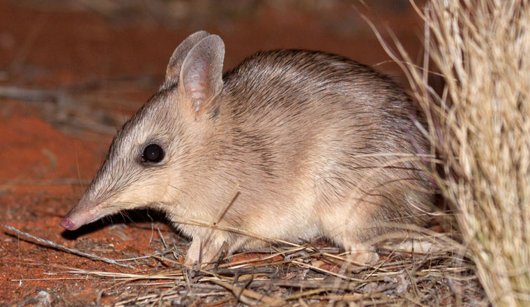
Western barred bandicoot - UNSW photo
CEIN NSW: Taking Sustainability To The Next Level
April 23, 2019: by Stuart Snell, UNSW
The size and complexity of the waste challenge facing society dominated discussion at the first stakeholders’ meeting of the newly announced Circular Economy Innovation Network (CEIN).
The CEIN is an initiative of the NSW government through the Office of the Chief Scientist and Engineer to bring together stakeholders from across governments, industry, universities and not-for-profit groups to reduce waste and enhance sustainability by developing a circular economy in which waste is valued as a resource.
CEIN Director, Professor Veena Sahajwalla, who is Founding Director of the UNSW Centre for Sustainable Materials Research and Technology (SMaRT) Centre, said many stakeholders already had been making great progress in reducing waste and using it as a resource, and the first stakeholders meeting was a testament to that.
“What is clear is that we need much greater coordination and connectivity across stakeholders to identify the opportunities and problems in getting a circular economy really going,” she said. “And that is where the new Network comes in. CEIN will bring stakeholders together to not only enhance current efforts to build a circular economy, but to identify the big-impact opportunities.”
CEIN Co-Director, Ashley Brinson, who is Executive Director of the Warren Centre at Sydney University, said the passion and enthusiasm displayed during the first stakeholder meeting session demonstrated a strong collective desire to establish a truly circular economy in NSW and Australia.
“We heard from both the Chair and Co-Chair of the NSW government’s Steering Committee for the CEIN, as well as many stakeholders representing the different sectors and industries that are central to a circular economy, and a key acknowledgement was the need for a coordination of sustainability efforts.”
The CEIN will look to map and identify opportunities for stakeholders to work together to reduce waste, enhance sustainability and ultimately boost industry (growth and jobs) by developing a circular economy.
The first stakeholders’ meeting was held at UNSW as CEIN host, was attended by 150 stakeholders wanting to enhance sustainability, and was emceed by Michael Sharpe, Director of the federal government-initiated Advanced Manufacturing Growth Centre.
The CEIN is in start-up phase and is developing a series of stakeholder workshops to identify themes and opportunities, as well as other activities such as identifying tools and resources needed to promote innovative solutions to re-use waste and improve product design and production to reduce waste.
Professor Sahajwalla said: “For instance, we can actually change the way things are done now in design, production and manufacturing to reduce waste, and we know we can use waste as a resource rather than for most of it to end up in tips. By making the right connections between researchers, businesses and governments, we can play a significant role in developing a true circular economy in Australia.”
What Earth's Gravity Reveals About Climate Change
April 16, 2019: GFZ GeoForschungsZentrum Potsdam, Helmholtz Centre
On March 17, 2002, the German-US satellite duo GRACE (Gravity Recovery and Climate Experiment) were launched to map the global gravitational field with unprecedented precision. After all, the mission lasted a good 15 years -- more than three times as long as expected. When the two satellites burnt up in the Earth's atmosphere at the end of 2017 and beginning of 2018, respectively, they had recorded the Earth's gravitational field and its changes over time in more than 160 months.
This so-called time-resolved satellite gravimetry makes it possible, among other things, to monitor the terrestrial water cycle, the mass balance of ice sheets and glaciers or sea-level change, and thus to better understand the mechanisms of the global climate system, to assess important climatic trends more precisely and to predict possible consequences.
A review in the journal Nature Climate Change, in which Frank Flechtner, Christoph Reigber, Christoph Dahle and Henryk Dobslaw from the Helmholtz Centre Potsdam German Research Centre for Geosciences GFZ and Ingo Sasgen from the Alfred Wegener Institute, Helmholtz Centre for Polar and Marine Research (AWI) participated, now presents highlights in the field of climate research based on GRACE observations.
Ice sheets and glaciers
GRACE produced the first direct measurement of ice-mass loss from ice sheets and glaciers ever. Previously, it had only been possible to estimate the masses and their changes using indirect methods. Within the first two years of the mission it was already possible to observe clear signals of ice-mass loss in Greenland and Antarctica. The measured data showed that that 60 percent of the total mass-loss is due to enhanced melt production in response to Arctic warming trends, while 40 percent is due to an increase of ice flow into the ocean. According to GRACE data, between April 2002 and June 2017 Greenland lost about 260 billion tons of ice per year, Antarctica about 140 billion tons. In addition to long-term trends, the gravity field data also provide evidence of the direct effects of global climate phenomena such as "El Niño" on ice sheets and glaciers worldwide.
Terrestrial water storage
Among the most impactful contributions of the GRACE mission has been the unveiling of Earth's changing freshwater landscape, which has profound implications for water, food and human security. Global estimates of GRACE trends suggest increasing water storage in high and low latitudes, with decreased storage in mid-latitudes. Though the GRACE record is relatively short, this observation of large-scale changes in the global hydrological cycle has been an important early confirmation of the changes predicted by climate models through the twenty-first century.
GRACE data also help to analyse and assess the sea level more accurately, as the storage of freshwater on land is linked to the sea level by various mechanisms. Analyses of GRACE data have enabled the first-ever estimates of groundwater storage changes from space. They confirm excessive rates of groundwater depletion from individual aquifers around the world. The data on terrestrial water storage have also contributed to the validation and calibration of various climate models.
Sea-level change and ocean dynamics
Within this century, sea-level rise could accelerate to 10 millimetres per year -- a rate unprecedented during the past 5000 years and a profound and direct consequence of a warming climate. High-precision sea-level measurements have been available since the early 1990s but they only show the absolute sea-level change. In the 25 years between 1993 and 2017, the sea-level rose by an average of 3.1 millimetres per year. To find out how thermal expansion, melting ice and the continental influx of water each affect sea-level, it is necessary to study the water's mass distribution. GRACE has shown that 2.5 millimetres of the average annual sea-level rise of 3.8 millimetres between 2005 and 2017 is caused by the inflow of water or other mass and 1.1 millimetres by the thermal expansion of water. Resolving this composition is important for sea-level projections. GRACE data provide a constraint on ocean mass change and thus indirectly on the Earth's energy imbalance, which is a fundamental global metric of climate change. GRACE has shown that most of the warming released by the rise in temperature occurs in the upper 2000 metres of the oceans, which are the most important energy sinks of climate change. GRACE also contributes to a better understanding of the dynamics and impact of ocean currents, in particular for the Arctic Ocean.
Climate service applications
The gravity field data of the GRACE satellites help to improve the United States Drought Monitor. This helps US authorities to react to droughts in a timely and sensible manner. With EGSIEM (European Gravity Service for Improved Emergency Management), the European Union has promoted a service designed to identify regional flood risks as early as possible. Between April and June 2017, test runs with historical flood data took place, showing that the wetness indicators for large river basins determined by GRACE can improve forecasts, for example for the Mississippi or the Danube. Current results also show that GRACE data can be used to more accurately predict the risk of seasonal wildfires.
The GFZ operated the GRACE mission together with the German Aerospace Center (DLR) and on the US side with the NASA Jet Propulsion Laboratory (JPL). In May 2018, the follow-up mission GRACE Follow-on (GRACE-FO) was launched. The first monthly gravity field maps should be available to international users by the end of July this year. Unexpected difficulties delayed the submission of the products. "The reason was the failure of a control unit on the second GRACE-FO satellite," explains Frank Flechtner of GFZ. "This made it necessary to switch to the replacement unit installed for such scenarios. But now, with GRACE-FO, a more than two decades long recording of the mass changes in the system Earth is within reach." (ph)
Background: The weight of water
The greater the mass of an object, the greater its gravitational attraction. For example, the Alps exert a higher gravitational pull than the North German lowlands. When satellites orbit the Earth and fly over a massive region, they accelerate minimally when approaching it and slow down as they fly away.
A tiny part of the gravitation emanating from the Earth is based on water on or near the surface in oceans, rivers, lakes, glaciers and underground. This water reacts to seasons, storms, droughts or other weather effects. GRACE took advantage of the mass displacement of water by recording its effect on the satellite duo that orbited our planet 220 kilometres in a row. Microwaves were used to measure their distance. This distance changed over time due to the mass shift on Earth. From the data, the researchers then calculated monthly maps of the regional changes in the Earth's gravitational pull and the causal changes in the masses on the surface.
Byron D. Tapley, Michael M. Watkins, Frank Flechtner, Christoph Reigber, Srinivas Bettadpur, Matthew Rodell, Ingo Sasgen, James S. Famiglietti, Felix W. Landerer, Don P. Chambers, John T. Reager, Alex S. Gardner, Himanshu Save, Erik R. Ivins, Sean C. Swenson, Carmen Boening, Christoph Dahle, David N. Wiese, Henryk Dobslaw, Mark E. Tamisiea, Isabella Velicogna. Contributions of GRACE to understanding climate change. Nature Climate Change, 2019; DOI: 10.1038/s41558-019-0456-2
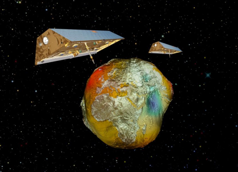
The satellite twins GRACE with the Earth's gravitational field. Credit: AIRBUS/GFZ
Solution To Riddle Of Ocean Carbon Storage
April 17, 2019: University of Tasmania
Research by a team of the world's leading oceanographers has proposed a new explanation for how the ocean absorbs and stores carbon, solving a riddle that has long puzzled scientists. It's well established that carbon in the atmosphere is absorbed by phytoplankton and transported to the ocean floor as the microscopic organisms die and sink by gravity through the water.
However, researchers have identified that this process -- the biological gravitational pump (BGP) -- cannot account for all of the carbon reaching the deep ocean, and a range of additional pathways that inject a much wider range of particles have been explored.
Led by IMAS Professor Philip Boyd and including scientists from France and the US, the Review article in the journal Nature proposes that the additional pathways known as particle injection pumps (PIPs) move just as much carbon as the BGP.
Professor Boyd said the research, based on a review of previous studies and new modelling, could reshape understanding of how carbon reaches the seafloor and what happens while it is there.
"Our study goes a long way to finally solving one of the real puzzles that oceanographers have grappled with for a number of years," Professor Boyd said.
"The ocean stores huge amounts of carbon indirectly absorbed from the atmosphere and in doing so plays a major role in moderating the climate impacts of anthropogenic carbon emissions.
"We can measure the sinking flux of carbon-rich particles and compare it with the gradient of dissolved inorganic carbon from low levels near the surface to high levels in the deep ocean.
"But until now we haven't been able to 'balance the books' in explaining the mechanisms that transport and store carbon, as the BGP only explains around half of the carbon that is present."
Professor Boyd said new ocean observation technologies and the datasets they provide have shown in unprecedented detail the way in which PIPs contribute to the carbon cycle.
"PIPs are a range of physical and biological mechanisms that move carbon, including ocean eddies and zooplankton which feed on phytoplankton and excrete carbon-rich faeces as they migrate to deeper water.
"By combining the effects of the biological gravitational pump with PIPs we can, for the first time, balance the books and fully account for ocean carbon storage.
"This breakthrough is vital in allowing us to establish a baseline against which we can measure and understand future changes in ocean carbon and its effects on the global climate.
"It also highlights a number of areas that require further research, so we can better understand the mechanisms involved and their relative contribution to the ocean carbon cycle.
"The more we discover about the ocean the more we are coming to appreciate how complex and four dimensional it is, with multiple processes interacting and feeding back on each other over time.
"As the ocean is such a major influence on global climate it is vital that we improve our understanding of the multi-dimensional mechanisms at work," Professor Boyd said.
Philip W. Boyd, Hervé Claustre, Marina Levy, David A. Siegel, Thomas Weber. Multi-faceted particle pumps drive carbon sequestration in the ocean. Nature, 2019; 568 (7752): 327 DOI: 10.1038/s41586-019-1098-2
Carbon Dioxide Blown To Sea From Cities Increases Coastal Ocean Waters Pollution By 25 Percent
April 23, 2019: Monterey Bay Aquarium Research Institute
MBARI researchers recently measured high concentrations of carbon dioxide in air blowing out to sea from cities and agricultural areas, including Silicon Valley. In a new paper in PLOS ONE, they calculate that this previously undocumented process could increase the amount of carbon dioxide dissolving into coastal ocean waters by about 20 percent.
Extending their calculations to coastal areas around the world, the researchers estimate that this process could add 25 million additional tons of carbon dioxide to the ocean each year, which would account for roughly one percent of the ocean's total annual carbon dioxide uptake. This effect is not currently included in calculations of how much carbon dioxide is entering the ocean because of the burning of fossil fuels.
Less than half of the carbon dioxide that humans have released over the past 200 years has remained in the atmosphere. The remainder has been absorbed in almost equal proportions by the ocean and terrestrial ecosystems. How quickly carbon dioxide enters the ocean in any particular area depends on a number of factors, including the wind speed, the temperature of the water, and the relative concentrations of carbon dioxide in the surface waters and in the air just above the sea surface.
MBARI has been measuring carbon dioxide concentrations in the air and seawater of Monterey Bay almost continuously since 1993. But it wasn't until 2017 that researchers began looking carefully at the atmospheric data collected from sea-surface robots. "One of our summer interns, Diego Sancho-Gallegos, analysed the atmospheric carbon dioxide data from our research moorings and found much higher levels than expected," explained MBARI Biological Oceanographer Francisco Chavez.
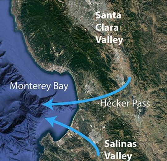
This map shows how carbon dioxide blows from land areas out across Monterey Bay with morning land breezes Credit: Base image: Google Earth
Chavez continued, "If these measurements had been taken on board a ship, researchers would have thought the extra carbon dioxide came from the ship's engine exhaust system and would have discounted them. But our moorings and surface robots do not release carbon dioxide to the atmosphere."
In early 2018 MBARI Research Assistant Devon Northcott started working on the data set, analysing hourly carbon dioxide concentrations in the air over Monterey Bay. He noticed another striking pattern -- carbon dioxide concentrations peaked in the early morning.
Although atmospheric scientists had previously noticed early-morning peaks in carbon dioxide concentrations in some cities and agricultural areas, this was the first time such peaks had been measured over ocean waters. The finding also contradicted a common scientific assumption that concentrations of carbon dioxide over ocean areas do not vary much over time or space.
Northcott was able to track down the sources of this extra carbon dioxide using measurements made from a robotic surface vessel called a Wave Glider, which travels back and forth across Monterey Bay making measurements of carbon dioxide in the air and ocean for weeks at a time.
"Because we had measurements from the Wave Glider at many different locations around the bay," Northcott explained, "I could use the Wave Glider's position and the speed and direction of the wind to triangulate the direction the carbon dioxide was coming from."
The data suggested two main sources for the morning peaks in carbon dioxide -- the Salinas and Santa Clara Valleys. The Salinas Valley is one of California's largest agricultural areas, and many plants release carbon dioxide at night, which may explain why there was more carbon dioxide in the air from this region. Santa Clara Valley [aka Silicon Valley] is a dense urban area, where light winds and other atmospheric conditions in the early morning could concentrate carbon dioxide released from cars and factories.
Typical morning breezes blow directly from the Salinas Valley out across Monterey Bay. Morning breezes also carry air from the Santa Clara Valley southward and then west through a gap in the mountains (Hecker Pass) and out across Monterey Bay.
"We had this evidence that the carbon dioxide was coming from an urban area," explained Northcott. "But when we looked at the scientific literature, there was nothing about air from urban areas affecting the coastal ocean. People had thought about this, but no one had measured it systematically before."
The researchers see this paper not as a last word, but as a "wake-up call" to other scientists. "This brings up a lot of questions that we hope other researchers will look into," said Chavez. "One of first and most important things would be to make detailed measurements of carbon dioxide in the atmosphere and ocean in other coastal areas. We need to know if this is a global phenomenon. We would also like to get the atmospheric modelling community involved."
"We've estimated that this could increase the amount of carbon dioxide entering coastal waters by roughly 20 percent," said Chavez. "This could have an effect on the acidity of seawater in these areas. Unfortunately, we don't have any good way to measure this increase in acidity because carbon dioxide takes time to enter the ocean and carbon dioxide concentrations vary dramatically in coastal waters."
"There must be other pollutants in this urban air that are affecting the coastal ocean as well," he added.
"This is yet another case where the data from MBARI's autonomous robots and sensors has led us to new and unexpected discoveries," said Chavez. "Hopefully other scientists will see these results and will want to know if this is happening in their own backyards."
Devon Northcott, Jeff Sevadjian, Diego A. Sancho-Gallegos, Chris Wahl, Jules Friederich, Francisco P. Chavez. Impacts of urban carbon dioxide emissions on sea-air flux and ocean acidification in nearshore waters. PLOS ONE, 2019; 14 (3): e0214403 DOI: 10.1371/journal.pone.0214403
Public Consultation On The Review Of The Carbon Credits (Carbon Farming Initiative - Land And Sea Transport) Methodology Determination
Public Consultation On The Toorale Water Infrastructure Project
Why Unique Finches Keep Their Heads Of Many Colours
April 23, 2019: Cornell University
There appears to be an underlying selection mechanism at work among Gouldian Finches -- a mechanism that allows this species to produce and maintain individuals with red heads, black heads, and yellow heads. Research by scientists from the the University of Sheffield in the United Kingdom, the Cornell Lab of Ornithology, and other institutions, reveals what this additional evolutionary process might be. Findings were published today in the journal Nature Communications.
"Most people have heard of natural selection," says lead author Kang-Wook Kim at the University of Sheffield. "But 'survival of the fittest' cannot explain the colour diversity we see in the Gouldian Finch. We demonstrate that there is another evolutionary process -- balancing selection -- that has maintained the black or red head color over thousands of generations."
The yellow-headed type (actually more orange) is produced by a completely different mechanism that is not yet understood. Yellow-headed Gouldian Finches make up less than one percent of the wild population.
"Having distinct multiple colour types -- a polymorphism -- maintained within a species for a long time is extremely rare," explains co-author David Toews, who did this work as a postdoctoral researcher at the Cornell Lab and who is now at Pennsylvania State University. "Natural selection is typically thought of in a linear fashion -- a mutation changes a trait which then confers some reproductive or survival advantage, which results in more offspring, and the trait eventually becomes the sole type in the population."
Studies from Macquarie University in Australia have shown the red-headed finches have the apparent advantage. Female Gouldian Finches of all colors prefer the red-headed males, who also happen to be more dominant in the social hierarchy. So why hasn't the black-headed type disappeared? It turns out there are disadvantages to having a red head, too, such as higher levels of stress hormones in competitive situations.
"If advantages are cancelled out by concurrent disadvantages, these two colour types can be maintained -- that's balancing selection," Toews says. "Red forms are not as common in the wild, so the counterbalancing pressure reduces the advantage of being red. That's super cool!"
Teams from the University of Sheffield and the Cornell Lab independently zeroed in on a particular gene called follistatin which is found on the Gouldian Finch sex chromosome and regulates melanin to produce either red- or black-headed finches. Rather than competing, the two teams decided to join forces and share their data. For the yellow morph, a different gene, not located on the sex chromosome, is controlling the head pigmentation, but it hasn't yet been found and it's not clear what forces are allowing the yellow morph to persist in the wild.
In another twist, Toews and co-author Scott Taylor, at the University of Colorado-Boulder, have done previous research that revealed the genes likely governing the plumage differences between North American Blue-winged and Golden-winged Warblers -- and one of those regions is in the same spot on the sex chromosome that differs among Gouldian Finches with different head colors.
"We didn't expect we'd locate the exact genomic region that governs plumage differences in both the Gouldian Finch and the two warblers," says Toews. "But now that we've done it, it opens up the possibility that the same region in other species may also be controlling plumage colour."
Kang-Wook Kim, Benjamin C. Jackson, Hanyuan Zhang, David P. L. Toews, Scott A. Taylor, Emma I. Greig, Irby J. Lovette, Mengning M. Liu, Angus Davison, Simon C. Griffith, Kai Zeng, Terry Burke. Genetics and evidence for balancing selection of a sex-linked colour polymorphism in a songbird. Nature Communications, 2019; 10 (1) DOI: 10.1038/s41467-019-09806-6

Gouldian Finch (stock image). Credit: © Duncan Noakes / Fotolia
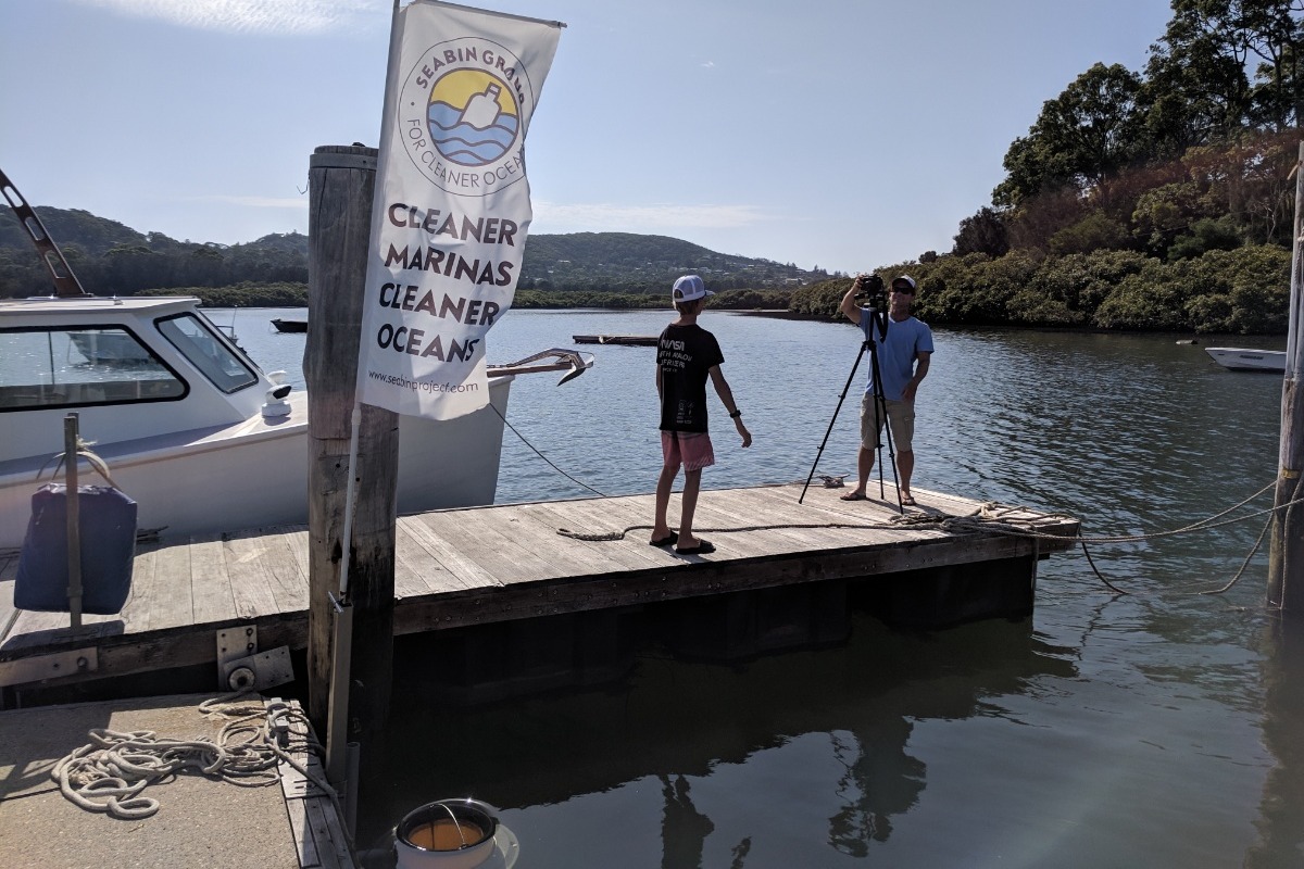
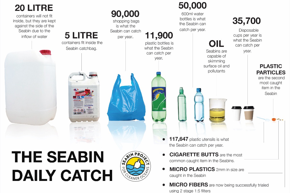
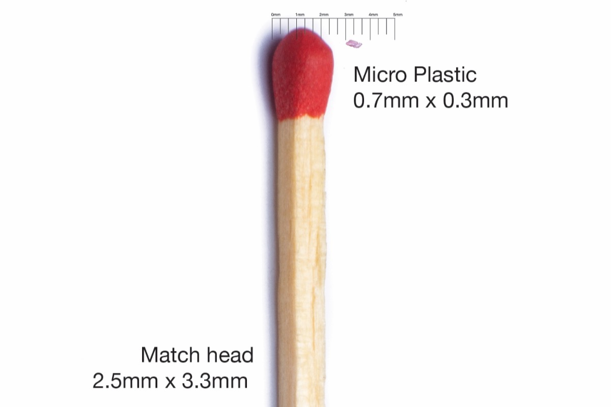
Archie's Pittwater Clean Up

FAQS SHEET
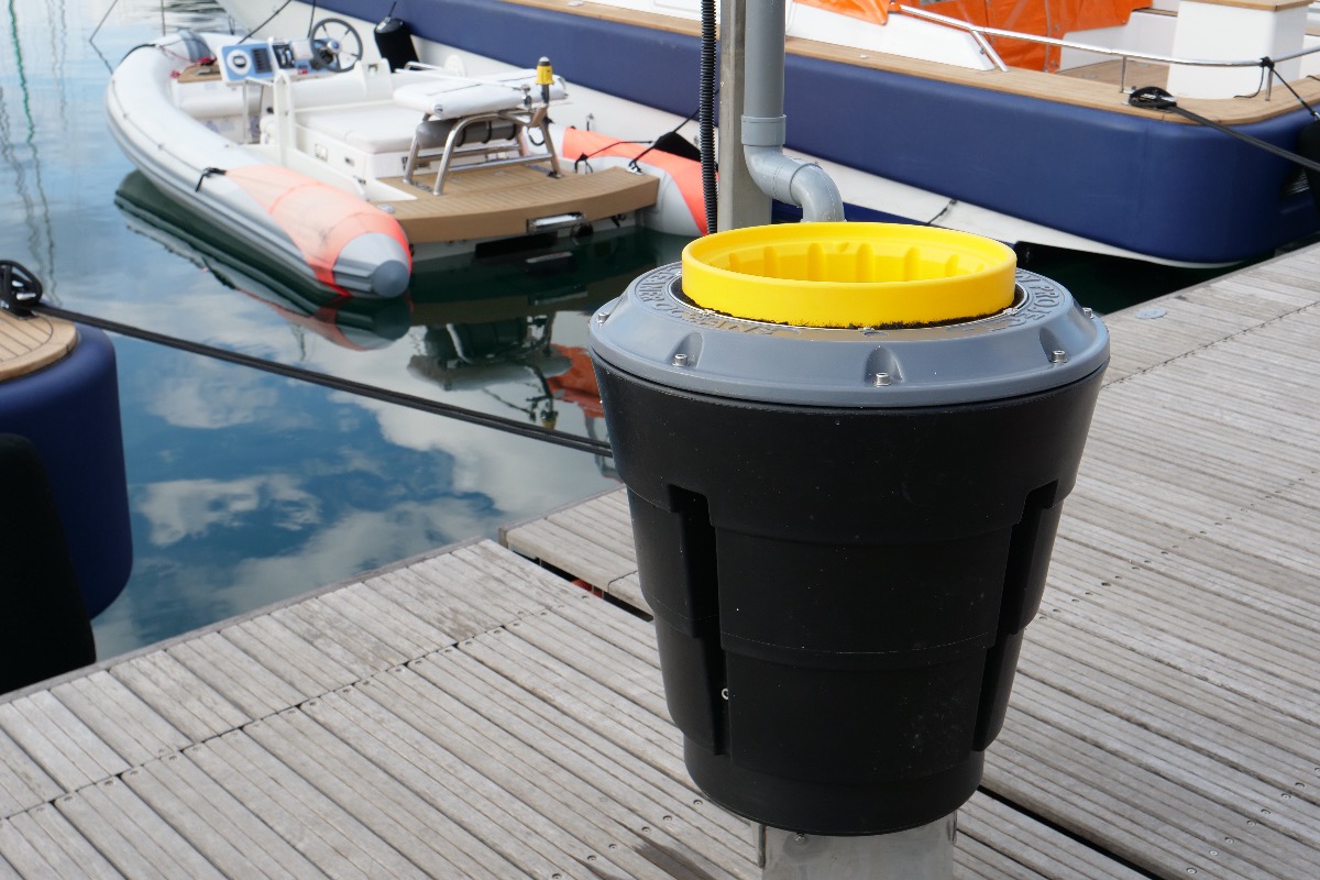
Seabin Project FAQs
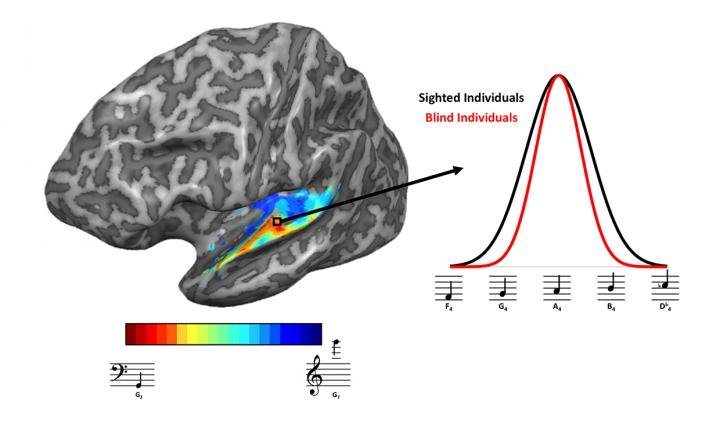
Brains Of Blind People Adapt To Sharpen Sense Of Hearing
Travellers Heading Overseas Urged To Get Measles Jab
Older Australians Pushed Into Poverty By Newstart
"Poverty is an increasing reality for jobless older Australians demoralised by long-term unemployment and an inadequate Newstart allowance that hasn’t been adequately increased for decades."
"Fixing pensioner poverty is a key National Seniors election priority and requires swift action by whichever party wins government."
Light Physical Activity Reduces Brain Ageing
Consumer Experience Reports In Home And Community Care
- Control
- Local residence
- Interpersonal interaction
- Flexibility
- Affordability
- Administrative and financial literacy
- Safety
- Timeliness of service provision.
The Secret To A Stable Society? A Steady Supply Of Beer Doesn't Hurt

Eating Elderberries Can Help Minimise Influenza Symptoms

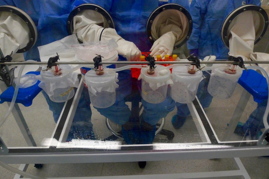
Dengue Mosquito Is Queensland's Biggest Threat For Spreading Zika Virus
- an contract Zika from the bite of a female mosquito carrying the virus
- A woman infected with Zika can pass the virus to her unborn child causing neurological problems including microcephaly, when the brain does not develop properly and the baby has a smaller than normal head
- While more than 50 cases of Zika have been reported in Australia, all were contracted overseas
Disclaimer: These articles are not intended to provide medical advice, diagnosis or treatment. Views expressed here do not necessarily reflect those of Pittwater Online News or its staff.