Inbox and Environment News: Issue 431
December 1 - 7, 2019: Issue 431
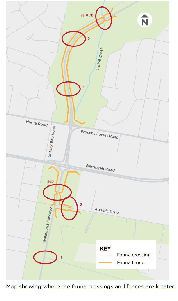
Fauna Crossings Promised On Northern Beaches Hospital's Road Upgrade Still Missing
From a resident this week:
I was astounded that a $500m spend by govt could not include a fauna overpass/underpass at a cost of $20m (?) to connect the two parts of a major wildlife corridor.
I'm talking about the Warringah Road upgrade at Frenchs Forest.
I heard last night from people at meeting that the original plans included a wildlife overpass but this was dropped (to save $ ?).
The Wakehurst mitigation at locations close to hospital has been done but Warringah road has nothing. Meaning the animals are stuck. No safe path.across this multi-line highway. And no safe passage further down Wakehurst parkway in either direction.
So I asked:
"if they had no intention to put in mitigation why did they not add a wildlife hospital to the new hospital project for all the casualties? "
Stunned silence was the answer.
RIP Wildlife.
________________________________________________
Northern Beaches Hospital Upgrade - October 2018 Update
Retrieved from October 2018 -RMS Doc: https://www.rms.nsw.gov.au/projects/01documents/northern-beaches-hospital/nbh-community-update-2018-10.pdf
Fauna management on the Northern Beaches Hospital road upgrade
Before construction began, environmental management and biodiversity offset plans were established to minimise the impact of the road infrastructure on the local environmental.
Fauna crossings and fences
Box culverts are being built under Wakehurst Parkway and Aquatic Drive providing passage beneath the road for small and large animals.
Rope bridges will be installed over Wakehurst Parkway and Aquatic Drive for small to medium sized animals that like to climb.
New fences will also connect with existing boundary fences to keep animals off the road.
More information about environmental management is available on the project website.
Map showing where the fauna crossings and fences are located:
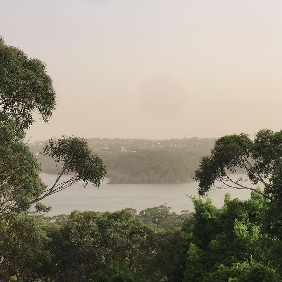
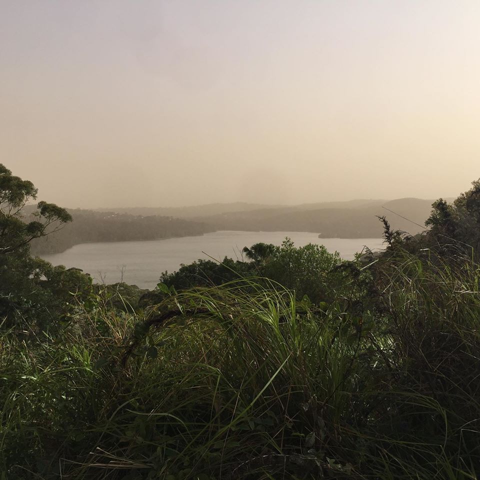
Dust Storm Reaches Narrabeen Lagoon - Again
Tuesday November 26th, 2019 - photos by Selena Griffith
Dust storm frequency and impact over Eastern Australia determined by state of Pacific climate system
Milton S.Speer. Climate Change Research Centre, Faculty of Science, The University of New South Wales. 2013. https://doi.org/10.1016/j.wace.2013.10.004
Abstract
Dust storms resulting from synoptic-scale mid-latitude frontal systems affect inland, eastern Australia, predominantly through spring and summer but extend to the east coast only rarely when strong, frontal westerly winds crossing the continent are sustained over the coast. Here it is shown that extreme westerly wind dust events are anomalous to the more pervasive southerly winds that have shaped the sand dunes over inland eastern Australia. It is also shown that while antecedent dry conditions are very important, higher SON and DJF dust storm frequencies from 1957 to the mid-1970s occurred due to both anomalously strong, southerly winds existing on the western side of a cyclonic anomaly adjacent to the east Australian coast, which resulted from the state of the Pacific climate system, and an anticyclonic anomaly at the top of the Great Australian Bight. A change in BoM observing practice, after 1973, is unlikely to be the major cause of changes in total dust frequency from the mid-1970s. Rather, extreme rainfall years are more likely to have been a major contributing factor to the large decreases in dust occurrence from 1973 to 1976, in addition to the other La Niña periods of 2000/01 to 2010/11. Synoptic-scale frontal systems in the westerlies that result in the transport of dust remained low in frequency throughout the whole period from 1957 to 2011. However, those dust storms in the westerlies that do reach the east coast, although infrequent, tend to occur during El Niño-dominated years. On the other hand, they occur during both negative and positive phases of the southern annular mode (SAM). This ambiguity with the SAM phase is consistent with the fact that the mid-latitude westerlies and associated frontal systems are usually at their most equatorward position in Australian longitudes in late winter/spring regardless of the SAM phase. This suggests little change is likely in the frequency of westerly induced dust storms in late winter/spring over central/eastern Australia even though the seasonal westerly winds are expected to contract further poleward under increased global warming. However, a complicating factor is that the increasing likelihood of longer dry spells under climate change would imply reduced vegetation for longer periods over the dust-prone source region of Lake Eyre basin, which could worsen the impact of dust storm events. Furthermore, longer dry spells throughout the year would increase the risk of more frequent westerly dust storm events in other seasons when strong, westerly frontal systems can also occur.
The first spatial study of dust storm occurrence over Australia was by Middleton (1984), who found the highest frequency of dust storms occur in the centre of Australia, where there was an average of 10.8 at Alice Springs and a maximum of 65 events per year.
_____________________________________________________
ABC - November 22, 2019 (The 'double whammy' of weather conditions leading to more dust storms - By Yara Murray-Atfield and Christopher Testa):
In Central Gippsland in Victoria's east, farmers have told the ABC relentless dust storms were worsening their situation by damaging drought-affected paddocks, contaminating feed and water and distressing animals.
And Mildura resident Sara White has told the ABC while the city is used to dust storms, it feels different now: "If you talk to any of the locals, everyone is saying the same thing ” they've never known the frequency of dust that we're getting at the moment."
Mr How says lots of vegetation is drying out, which means there are more dusty and dry conditions in central parts of Australia "and even parts of Australia where we wouldn't normally see these kinds of conditions".
He says the dry conditions mean there are a lot more "source regions" where dust storms can form, meaning there's a "much larger pool of dust available".
It's not being helped by other weather patterns
Dust storms tend to peak in Spring, because of cold fronts moving across dry parts of the country's centre.
Mr How says we're currently experiencing a "double whammy" because of a weather pattern known as the Southern Annular Mode.
At the moment, we're in what's called a Negative Southern Annular Mode, which means we're seeing cold fronts further north, causing stronger winds to blow over the interior of the country where dust is more easily picked up.
____________________________________________________
DustWatch Report
February 2019
Dust activity
February 2019 was the dustiest February in our records dating back to 2005 (Figure 1). Many severe thunderstorms caused local dust throughout the month. A great video of one such event is at Community DustWatch.
A massive statewide dust storm added to the hours of dust on 12 and 13 February 2019, causing air quality alerts in the east of the State. This event was widely covered by the media (e.g. Dust shrouds Sydney as air quality readings in NSW reach 'hazardous' levels) and social media posts.
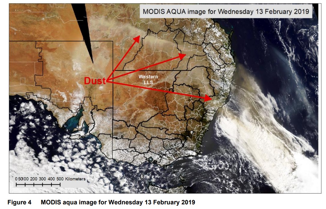
The two low-pressure troughs caused two distinctive dust plumes, clearly visible on the satellite image the following day (Figure 4). It is very interesting to note that some of the dust was lifted above the cloud layer off the east coast of Australia. This dust continued all the way to New Zealand.
The dust plume stretched nearly 2000 kilometres (Figure 4). The Bureau of Meteorology estimated the amount of soil loss of the Australian coast at around one million tonnes for that event.
NSW OEH DustWatch Reports 2019:
DustWatch report October 2019
Published 14 Nov 2019: Highest October record of dust activity since records began in 2005.
DustWatch report September 2019
Published 28 Oct 2019: Large increase in dust; some sites logged over 100 hours.
DustWatch report August 2019
Published 26 Sep 2019: Massive dust storm in the south west.
DustWatch report July 2019
Published 6 Sep 2019: Dust activity was less than expected due to increasing cover in the west.
DustWatch report June 2019
Published 29 Jul 2019: Dust activity lower than May 2019.
DustWatch report May 2019
Published 3 Jul 2019: Dust activity further reduced from April following good rainfall in April.
DustWatch report April 2019
Published 24 May 2019: Dust activity reduced from March 2019.
Dust activity
As the groundcover improved in April 2019, the average hours of dust across the network decreased (Figure 1) to only five hours in April for two reasons:
1. Very welcome rainfall increased the autumn groundcover values (Table 1 and Figure 4).
2. 30% fewer hours of strong wind than 10-year average, half of last year.
Clusters of the southern stations around Wagga Wagga in the south east and Buronga in the south west recorded much higher values than the rest of the network
DustWatch report March 2019
Published 29 Apr 2019: Dustiest March in DustWatch records (since 2005).
March 2019 was the dustiest March since DustWatch records began in 2005 (Figure 1). This dust is caused by the very low groundcover across much of New South Wales coupled with stronger than average wind conditions. In fact, the groundcover values are the lowest values for the month of March since MODIS records commenced in 2001 (Figure 5) in many natural resource management (NRM) regions. Dust storms occurred evenly throughout the month and across most sites.
The area with less than 50% groundcover (red and yellow colours in Figure 3) has remained almost unchanged over the last three months (Figure 4 and Table 1). Most of the area west of a line from Moree to Wagga Wagga remains below the cover threshold figure of 50%. Large areas west of the Darling river are below 20% groundcover and therefore a substantial and ongoing source of dust in the western parts of New South Wales.
The area above 50% cover has slightly increased for all NRM regions covered by this report (Figures 4 and 5). The increase of groundcover during winter in western New South Wales in 2017 and 2018 (about 20% – red circles in Figure 5) was much smaller than the average winter increase (about 40%). This double season failure of growth led to a drastic decline in overall groundcover since July 2017. Groundcover in summer 2019 could be even lower if the current winter recovery is similar.
Dust storms in March occurred entirely under cloud and are not visible on any satellite image. This highlights the need for on-ground monitoring as satellite images do not always detect raised dust.
Emergency Temporary Air Quality Monitors Installed On NSW North Coast
November 23, 2019: NSW OEH
Residents of Taree, Coffs Harbour, Grafton and Lismore – Ballina will have access to hourly air quality updates following the installation of temporary air quality incident monitors in response to the ongoing bushfires burning in their areas.
NSW Department of Planning, Industry and Environment Director of Climate and Atmospheric Matthew Riley said that smoke from bushfires across NSW is significantly contributing to poor air quality in areas across New South Wales, and these additional monitors will provide up-to-date real time info for the people on the North Coast.
"These areas normally have some of the best air quality in the world," Mr Riley said.
"Unfortunately, the severe bushfires in these regions and the unprecedented fire season we are dealing with has resulted in ongoing air quality issues from the smoke and dust.
"These temporary monitors will ensure people and health services in those areas can get the information they need to make important decisions on providing health care advice for the community or for individuals implementing their own health plans.
"The NSW Government operates the most comprehensive accredited air quality monitoring network in Australia, now with approximately 90 stations across the state, and we have been working to broaden the network into more regional areas in consultation with local councils.
"The expanded Rural Air Quality Monitoring network together with the ongoing incident monitoring in Port Macquarie and the new station in Armidale have provided important information on the air quality impacts of these bushfires.
"NSW Government scientists will now be able to use the information gathered by these emergency monitors to build a more complete assessment of air quality across NSW during this emergency.
NSW Government scientists are also working with the NSW Rural Fire Service to understand wildfire conditions and the likelihood of smoke persisting, and the Bureau of Meteorology who give a broader outlook on winds and weather conditions that exacerbate air quality in New South Wales.
Member for Northern Tablelands Adam Marshall said that he was pleased this information is available for communities living in the north of the State.
"Information provided by the incident monitoring stations mean people and their health care providers can better understand when to take steps that minimise the impacts of smoke from these unprecedented fires," Mr Marshall said.
"The NSW Government's air quality monitoring network ensures that the community of NSW has accurate and up-to-date information about air quality that government agencies and others can use to provide high-quality, reliable information for the public on health, land management and regulation.
Information about air quality in NSW, including subscription to email and SMS alerts is available at Air program and health advice in relation to air quality is available at NSW Health.
Kentlyn Koala Rescue
November 25th, 2019: A Sydney Wildlife koala rescuer today saved this koala in Kentlyn, near Campbelltown (western Sydney). This beautiful girl found herself in a jacaranda tree in a yard next to a yard with a dog. She was rescued and released into the Bushlands nearby for her safety.
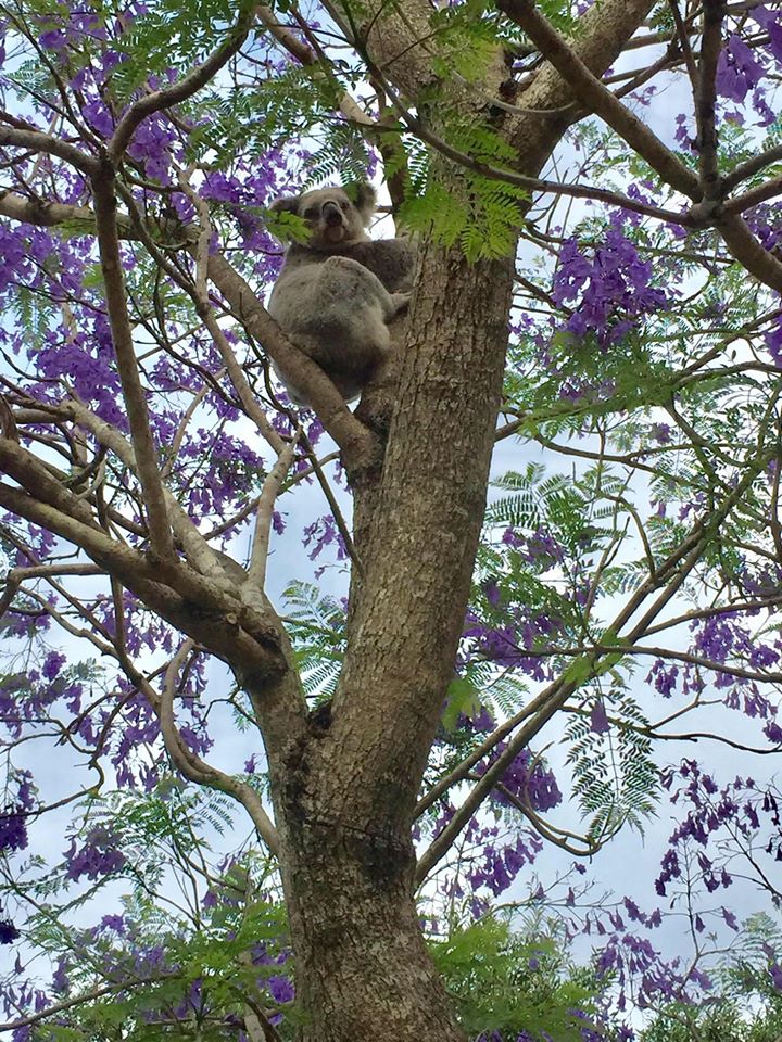
Photo courtesy Help Save the Wildlife and Bushlands in Campbelltown
Have Your Say On Belmont Desalination Plant
Date:21.11.2019
Type:Departmental Media Release
Author:NSW Department of Planning and Environment
The Department of Planning, Industry and Environment is asking for community feedback on an application by Hunter Water for a drought response desalination plant at Belmont.
Executive Director, Infrastructure Assessments, David Gainsford, said community input is a vital part of the planning process and encouraged everyone to have their say on the draft proposal.
“Hunter Water has lodged a State Significant Infrastructure application for a desalination plant at Belmont which could be used to supplement the Lower Hunter’s water supplies during times of extreme drought,” Mr Gainsford said.
“The desalination plant, which is considered State Significant Infrastructure, would be able to make 15 million litres of fresh water each day from seawater. This would cater for over 10 per cent of the Lower Hunter’s water needs during periods when Level 3 water restrictions are in place.”
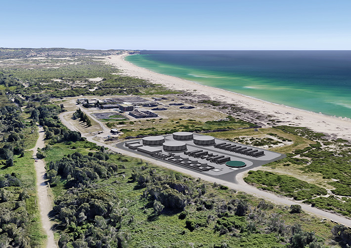
Mr Gainsford said if required, the drought response desalination plant would be built next to the Belmont Wastewater Treatment Plant off Ocean Park Road at Belmont.
It is one a range of a drought response measures set out in the Lower Hunter Water Plan. These measures include reducing demand and increasing supply.
“The proposal before the Department is for a $87 million desalination plant. It includes construction of seawater intake wells, process units, and upgrades to power and water connections,” he said.
“Hunter Water advises it has further plans for associated pipeline infrastructure that could bring its overall investment to about $100 million.
“The reverse osmosis plant would pump in seawater which would be filtered to remove salt and impurities providing fresh water for the Lower Hunter community. Desalinated water would be tested to ensure it meets drinking water quality requirements. Remaining brine water would be pumped back into the ocean via the existing Belmont Wastewater Treatment Plant outfall.”
Mr Gainsford said the proposal is on public exhibition until Thursday 19 December 2019 with community members invited to make submissions.
“We want to hear from the community about their views on this proposal to help us undertake a thorough and rigorous assessment and ensure any potential impacts to the surrounding area and local residents are considered,” he said.
“The Department will consider all community submissions along with advice and feedback from government agencies including Lake Macquarie City Council.”
The State Significant Infrastructure (SSI) Application, Environmental Impact Statement and accompanying documents can be viewed on the Department's website.
Residents can also view the application at Lake Macquarie City Council, Hunter Water Head Office and the Belmont Library.
Dig And Ditch: Mining Company Wants To Leave QLD Taxpayers With $379m Clean Up Bill
WA: First 'Rights Of Nature Bill' Introduced In Australia
Documents Reveal NSW Government U-Turn On Coal Mines And Greenhouse Gas Emissions
- these emissions are a consequence of the proposed development and are therefore a relevant consideration under the EP&A Act - the weight to be given to them is a matter for the consent authority to determine.”
- “The consideration of scope 3 emissions in development assessment processes is well established in many other jurisdictions and has been a factor in the assessment of mining projects in NSW since the commencement of the Mining SEPP.”
- “To address its concerns, the NSWMC may request the Mining SEPP be amended to remove the requirement to assess downstream emissions. However, this would not prevent GHG emissions being considered and may create more uncertainty as it would still be open to a consent authority to consider such matters.”
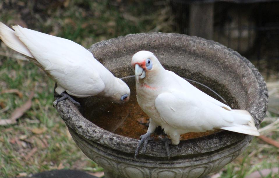
On Hot Days Please Keep Your Bird Baths Topped Up Or Put Out Dishes Of Water For Local Fauna
PNHA Christmas Cards Of Local Beauties
PNHA Christmas Cards with local trees, flowers, insects, birds, scenery are now ready - write your own message. $2.00 each. Contact us on pnhainfo@gmail.com to select from our big range. A few of the images available on their covers sampled here:
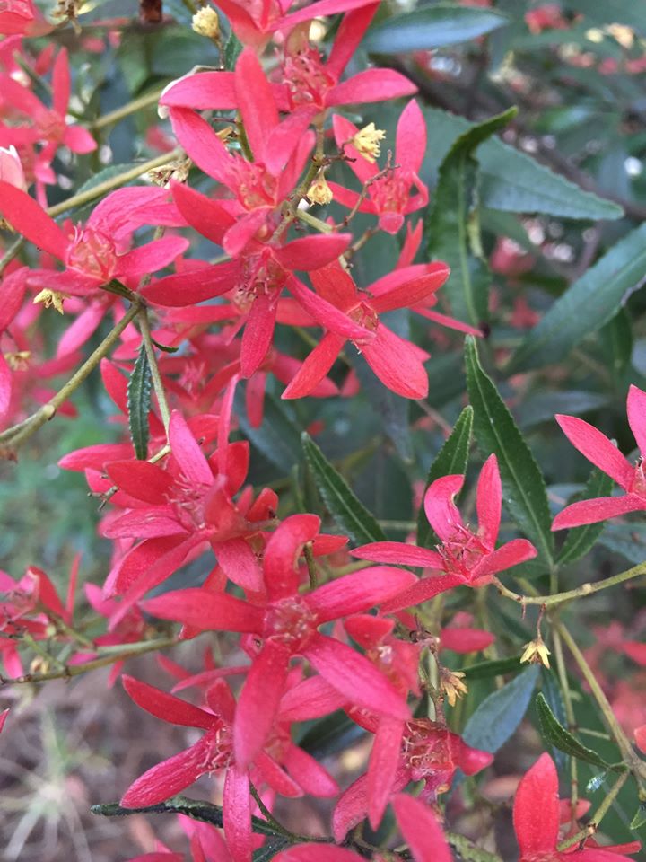
NSW Christmas Bush

Sleepy Eastern Pygmy Possum
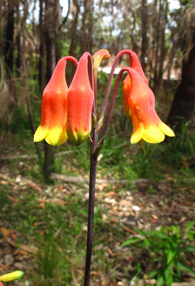
Christmas Bells
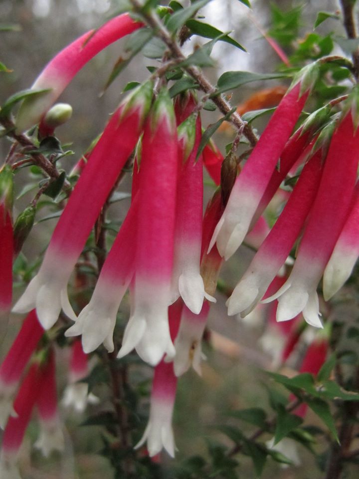
Native Fuchsia
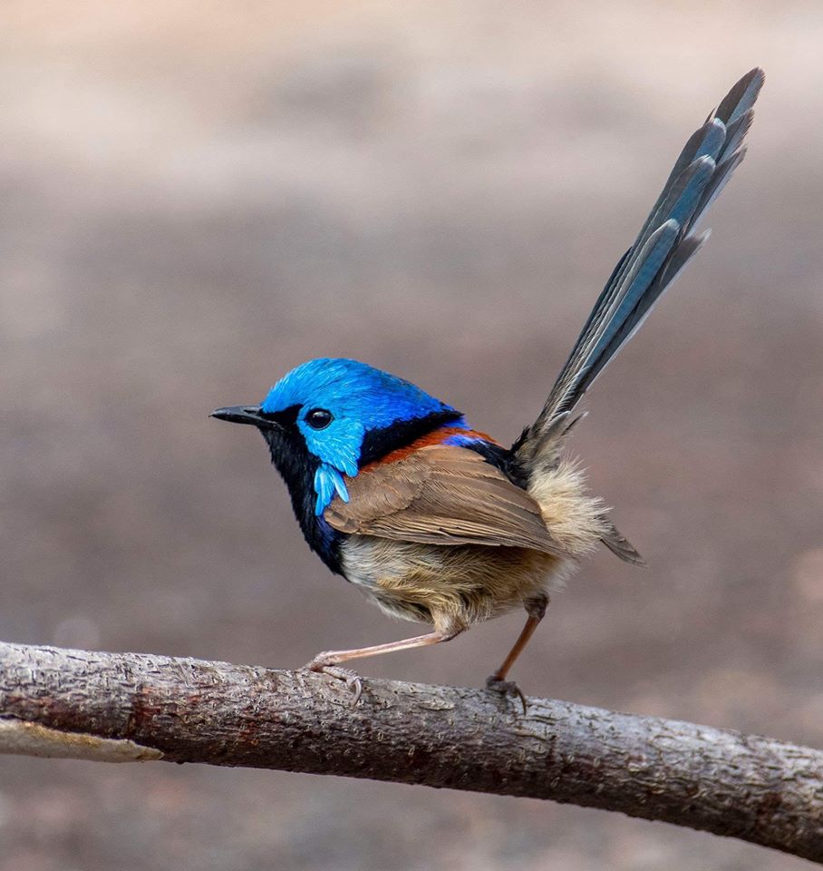
Male Variegated Wren, one of Pittwater's two Fairy Wrens. Image: Neil Fifer
Bushcare In Pittwater
Where we work Which day What time
Avalon
Angophora Reserve 3rd Sunday 8:30 - 11:30am
Avalon Dunes 1st Sunday 8:30 - 11:30am
Avalon Golf Course 2nd Wednesday 3 - 5:30pm
Careel Creek 4th Saturday 8:30 - 11:30am
Toongari Reserve 3rd Saturday 9 - 12noon (8 - 11am in summer)
Bangalley Headland 2nd Sunday 9 to 12noon
Bayview
Winnererremy Bay 4th Sunday 9 to 12noon
Bilgola
North Bilgola Beach 3rd Monday 9 - 12noon
Algona Reserve 1st Saturday 9 - 12noon
Plateau Park 1st Friday 8:30 - 11:30am
Church Point
Browns Bay Reserve 1st Tuesday 9 - 12noon
McCarrs Creek Reserve Contact Bushcare Officer To be confirmed
Clareville
Old Wharf Reserve 3rd Saturday 8 - 11am
Elanora
Kundibah Reserve 4th Sunday 8:30 - 11:30am
 Mona Vale
 Mona Vale Beach Basin 1st Saturday 8 - 11am
Mona Vale Dunes 2nd Saturday+3rd Thursday 8:30 - 11:30am
Newport
Bungan Beach 4th Sunday 9 - 12noon
Crescent Reserve 3rd Sunday 9 - 12noon
North Newport Beach 4th Saturday 8:30 - 11:30am
Porter Reserve 2nd Saturday 8 - 11am
North Narrabeen
Irrawong Reserve 2nd Saturday 2 - 5pm
Palm Beach
North Palm Beach Dunes 3rd Saturday 9 - 12noon
Scotland Island
Catherine Park 2nd Sunday 10 - 12:30pm
Elizabeth Park 1st Saturday 9 - 12noon
Pathilda Reserve 3rd Saturday 9 - 12noon
Warriewood
Warriewood Wetlands 1st Sunday 8:30 - 11:30am
Whale Beach
Norma Park 1st Friday 9 - 12noon
Western Foreshores
Coopers Point, Elvina Bay 2nd Sunday 10 - 1pm
Rocky Point, Elvina Bay 1st Monday 9 - 12noon
Grants Available To Reduce Climate Change Impacts
Aussie Bread Tags Collection Points

BARRENJOEY 365
Mobile Phone Detection Cameras To Catch Drivers Illegally Using A Phone
Train Songs
'Trains have been a theme in both traditional and popular music since the first half of the 19th century and over the years have appeared in all major musical genres, including folk, blues, country, rock, jazz, world, classical and avant-garde.'
'The earliest known train songs date to two years before the first public railway began operating in the United States. "The Carrollton March", copyrighted July 1, 1828, was composed by Arthur Clifton to commemorate the groundbreaking of the Baltimore & Ohio Railroad. Another song written for the occasion, "Rail Road March" by Charles Meineke, was copyrighted two days after Clifton's, one day before the July 4 ceremonies.'
"Pardon me, boy, is that the Chattanooga Choo Choo?""Yes, yes, Track 29!""Boy, you can give me a shine.""Can you afford to board the Chattanooga Choo Choo?""I've got my fare, and just a trifle to spare."
 In October 1944, a new recording by Captain Glenn Miller and the Army Air Forces Training Command Orchestra featuring Sgt. Ray McKinley and the Crew Chiefs on vocals was released as a V-Disc by the U.S. War Department, one of a series of recordings sent free by the U.S. War Department to overseas military personnel during World War II.
How Does A Penguin Launch Itself From The Sea?
Friday essay: how Indigenous songs recount deep histories of trade between Australia and Southeast Asia
Aaron Corn, University of AdelaideIn 1983, the prolific Yolŋu (Yolngu) educator and musician, Mandawuy Yunupiŋu, composed his first ever popular song, Djäpana: Sunset Dreaming. A decade later, this song would become an iconic Australian hit as Yunupiŋu’s band, Yothu Yindi, rose to stardom in the early 1990s.
At a time when other Yolŋu popular bands were emulating imported country and gospel styles, the composition of Djäpana: Sunset Dreaming changed music history. It drew on the Manikay tradition, the vast body of public ceremonial songs that were bestowed on Yolŋu clans of northeast Arnhem Land countless generations ago by the original ancestors who named, shaped and populated their homelands.
This revolutionary artistic act initiated an entirely new genre of popular music from Arnhem Land, with Yothu Yindi at its vanguard, which would build new bridges with audiences worldwide. Yet, unknown to most listeners is that this song echoes long histories of early engagements with Southeast Asian visitors that remain integral to Yolŋu ceremonial law to this day.
A Song Of Homesickness
While other early hit songs by Yothu Yindi like Treaty and Mainstream inspire hope for a better future, the mood of Djäpana: Sunset Dreaming is sorrowful. It was composed when Yunupiŋu was working away from home as an Assistant Principal at Shepherdson College in Galiwin’ku on Elcho Island in Arnhem Land, while his wife and young children remained on the mainland some 150 kms to the east on the Gove Peninsula.
After work one evening, Yunupiŋu sat with his guitar and, in the fading light of the setting sun, channelled his homesickness into song. The lyrics that came to him reminded him of home: warwu (sorrow), djäpana (coral sunset), rräma rrämani (coral sunset clouds), dhurulaŋala galaŋgarri (fading coral sunset).
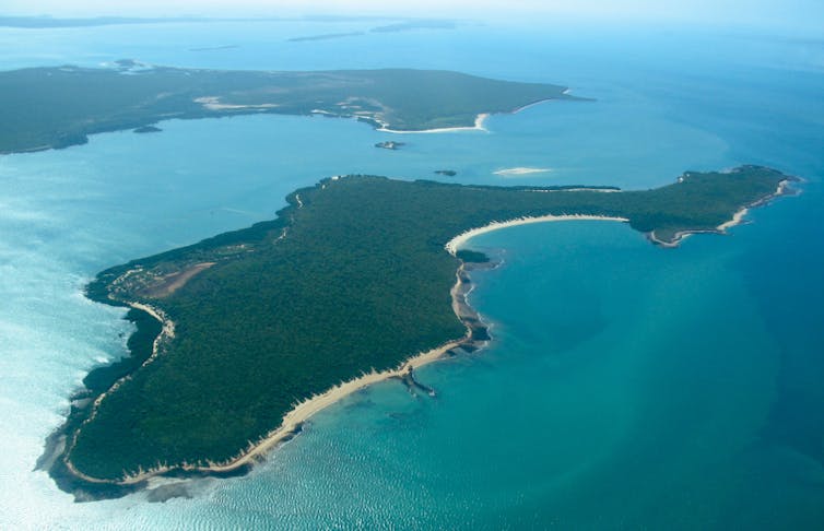
They affirmed Yunupiŋu’s own deep ancestry through the Gumatj Yolŋu clan and drew on a Gumatj Manikay series of distinct song subjects for the clan’s country of Bawaka on Port Bradshaw. The series remembers early Southeast Asian visitors. Specifically, the lyrics were drawn from a terminal song subject from this Manikay series, Djäpana (Coral Sunset).
Before The First Wave
The long histories of trade between commercial trepang (sea cucumber) harvesters from the port of Makassar in the pre-Indonesian Sultanate of Gowa on Sulawesi, and Indigenous Australian peoples of the Kimberley and Arnhem Land coastlines have been widely discussed by scholars since the release of Campbell Macknight’s seminal 1976 book, The Voyage to Marege’. Articles about this contact in magazines such as Walkabout appeared as early as 1934.

Based on Dutch colonial records from Jakarta dating from 1754, the Makassan trepang industry gained momentum in the 1750s. The trade with trepang harvesters predated British colonial contacts with most local Indigenous Australians by more than 50 years.
This is not a history of British exploration and conquest from the first wave of colonial expansion in Australia. Rather, it is one of lengthy exchanges with Southeast Asian neighbours in Australia’s north that predate the founding of New South Wales as a British Crown Colony in 1788. The exchanges left an enduring legacy that continues to influence language, culture and memory among Indigenous peoples of north Australia.
Trepang was a lucrative commodity, and is still sold at a premium throughout East and Southeast Asia. Used in Chinese cooking since the 17th century, it was coveted by Chinese buyers in Makassar both as a culinary delicacy and as a medicinal enhancer of male virility.
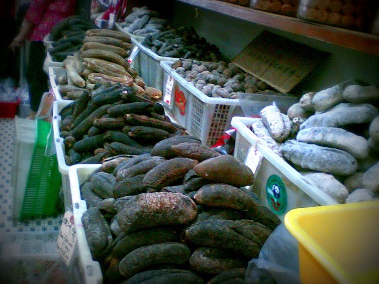
For at least 150 years, Makassan vessels known as perahu sailed to north Australia to harvest trepang from its warm coast waters. They arrived on the northwest monsoon each January, and returned home with hulls full of trepang, pearl shell, beeswax and ironwood around April.
The crews of these vessels were mostly speakers of the Makassan and Bugis languages, but also likely included people of Sama (Bajau), Butonese and other ethnicities. They knew the Kimberley by the name of Kayu Jawa and Arnhem Land as Marege’.
Macknight estimated that at the height of this trade, some 30–60 Makassan vessels carried at least 1,000 sailors from Sulawesi to Arnhem Land each year. In 1803, during their voyage on the HMS Investigator, Matthew Flinders and Robert Brown met a fleet of 60 Makassan vessels off Arnhem Land’s coast and spoke at length with one of their captains, Pobassoo.
Harvesting trepang in Arnhem Land for Asian markets began to ebb in 1884 following the 1883 eruption of Krakatoa and the imposition of new taxes upon Makassan vessels landing in the Northern Territory. One final Makassan perahu captained by Otching Daeng Rangka, the Bunga Ejaya, sailed to Arnhem Land in 1906 and its departure in 1907 brought the exchanges to an end.
Trade And Autonomy
Long before the first Methodist missionaries arrived in northeast Arnhem Land at Milingimbi in 1923, the Yolŋu held extensive knowledge of their Southeast Asian neighbours. Some Yolŋu people even travelled to Makassar and made families with shared Makassan ancestry.
Read more: Long before Europeans, traders came here from the north and art tells the story
Makassan religion, culture, goods and seacraft are recorded in many Yolŋu ceremonies still practised today. In return for rights to harvest their resources, the Yolŋu received goods imported by the Makassans including rice, tamarind, tobacco, alcohol, cloth, axes and knives.
Consequently, Yolŋu languages still retain hundreds of Makassar and Bugis words including rrupiya (money), bandirra (flag), buthulu (bottle), lipalipa (canoe), and baŋ’kulu (axe). Many Yolŋu Manikay series also refer to these historical visitations extensively.
Accordingly, most Manikay series for the Dhalwaŋu clan homeland of Gurrumuru sing of Makassan exchanges through song subjects including yiki’ (knife), ŋarali’ (tobacco), manydjarrka (cloth), dhamburru (drum), djuliŋ (flute), dopulu (playing cards), ŋänitji (alcohol), barrundhu (drunken fighting), parrurru (flag), berratha (rice) and watjpalŋa (rooster). Other subjects sung by the Warramiri and Gumatj clans include wurramu (a ghost Makassan captain), djakura ga lanytja (kickboxing), waraliny (pipe smoking), wayathul’ (scrub fowl), Luŋgurrma (northerly trade wind) and djäpana (coral sunset).
Imams accompanied Makassan fleets to Australia and observations of Islamic practices were recorded in Yolŋu ceremonial law. The Wurramu mortuary ceremony, for instance, sings of offerings of thanks to Allah.
The Yolŋu elder, David Burrumarra MBE, explained that the Makassans’ god was absorbed into Yolŋu ceremonial law as a kind of ancestral mokuy (ghost) called Walitha’walitha after the devotional Islamic recitation, Lā ʾilāha ʾillā llāh (There is no god but God). The purpose of Walitha’walitha in Yolŋu law is to provide an ancestral basis for the existence of foreign peoples beyond Australia’s shores.
Makassan captains were also immortalised in Yolŋu law as ancestral ghosts with the potential for malevolence. This reflected the reality that, while Makassan seafarers imported goods that were useful and desirable to the Yolŋu, their presence could also bring conflict.
The Yolŋu developed an elaborate system of colour-coded flags made from imported cloth that marked beaches owned by different clans where Makassan visitors could land. Used prominently in public ceremonies, these flags remain strongly linked to Yolŋu clan identities to this day.
Yet, Yolŋu ceremonies also record that, whenever Makassan visitors failed to observe Yolŋu law, the country itself would expel them. Many are remembered for meeting unfortunate ends including being chased by swarming bees into a boiling cauldron for cooking trepang, and having their vessels capsized amid torrents of seawater and entrails projected by the trepang themselves.
Read more: Friday essay: Dr Joe Gumbula, the ancestral chorus, and how we value Indigenous knowledges
In the Daygurrgurr Gupapuyŋu clan homeland of Djiliwirri, the trespassing Makassan captain, Nuwa, was repelled with such great force that sparks flew down the escarpment creating fires and termite mounds at the wellspring, Buŋu. Gupapuyŋu ceremonies also recount how the ancestor, Djunranydjura (Dingo), refused Makassan offers of trade to remain free from foreign influence.
Women who travelled with foreign crews were also observed. For instance, in the Birrkili Gupapuyŋu clan homeland of Luŋgutja, a trespassing vessel captained by Bäpa-djambaŋ was unable to weigh anchor and devoured whole by the ancestor, Mundukul (Water Python), in the form of a thunder storm.
Its wreckage is now a coral reef. A young girl who was kept chained in its hold, Wurrathithi, also remains there as an ancestral ghost, watching over Luŋgutja’s waters as she tends to the Gupapuyŋu clan’s recently deceased.
Reenactment And Revival
In 1986, 10 Aboriginal students from Batchelor Institute accompanied the historian Peter Spillet to Makassar. They were amazed to find many words and images that their own languages and traditional designs had absorbed. Since then, several initiatives have commemorated the long history of Makassan exchanges with Yolŋu communities.
For the Australian Bicentenary of 1988, Spillet commissioned a replica perahu called the Hati Marege’ (Heart of Arnhem Land) to reenact the old sea voyage from Makassar to Galiwin’ku. Its captain was Mansjur Muhayang, whose late father had been the last surviving crewman to have sailed to Arnhem Land on the Bunga Ejaya in 1906.
In Sydney, the Bicentenary’s reenactment of the 1788 landing of the British First Fleet was met by more than 40,000 protesters for Indigenous rights. Yet, the landing of the Hati Marege’ in Galiwin’ku returned Makassan mariners to Arnhem Land for the first time in 82 years.
The Hati Marege’s crew were greeted by their Yolŋu hosts as family through ceremony. Witnessing their moving arrival even inspired the prolific local band, Soft Sands, to compose a new rock ballad, Land, Our Mother, which captured the warmth of the Hati Marege’s welcome to Galiwin’ku, while simultaneously asserting the enduring rights of the Yolŋu in their ancestral homelands.
In 1993, the celebrated Yolŋu artist, John Bulunbulun, led an ensuing visit from Maningrida to Makassar, where he directed a three-night Marayarr Murrukundja diplomacy ceremony. It involved the creation of an elaborate ceremonial pole that represents the mast and rigging of a Makassan perahu.
Two subsequent initiatives were championed by the noted Indigenous anthropologist, Marcia Langton. The first, Trepang: An Indigenous Opera, premiered in Makassar in 1997, and reunited an intermarried Yolŋu–Makassan family who had been separated since the Bunga Ejaya’s departure from Arnhem Land in 1907.
The second, the Trepang exhibition, opened at the Capital Museum in Beijing in 2011 and explored the historical sale of Australian trepang into China. I was honoured to play yidaki (didjeridu) for Bulunbulun’s stepson, Paul Pascoe, as he sang Manikay to launch this exhibition.
Such initiatives continue to widen public awareness of the most recent wave of Makassan trade in Arnhem Land (1750–1907). However, the prominence of Southeast Asian contact histories in Yolŋu ceremonies still practised today has never waned, and retains intriguing allusions to even earlier waves of international exchange.
How Far Back?
While we know Southeast Asian trade in northeast Arnhem Land ended in 1907, we do not know when it began or how many different foreign peoples sailed to Australia before 1750. Recent radiocarbon dating in Arnhem Land tells us that a Southeast Asian pottery shard from Groote Eylandt was made as early as 1107, that rock art depicting a perahu in Wellington Range was painted before 1664, and that a person of Southeast Asian origin perished at Anuru Bay before 1730.
Read more: Archaeology is unravelling new stories about Indigenous seagoing trade on Australia's doorstep
It is difficult to know who these early Southeast Asian visitors might have been or why they visited Arnhem Land. Yolŋu ceremonial law is a heterogeneous system incorporating dozens of different clans across northeast Arnhem Land, who maintain their own unique ancestral traditions of ceremonial names, songs, dances and designs.
These traditions encode knowledge in ways that necessitate interpretation by ceremonial leaders and through firsthand experience of specific sacred sites on country. Consequentially, Yolŋu Manikay series that address contact histories typically reference earlier waves of seafaring visitors in cryptic and multilayered ways.
Burrumarra recalled that the first wave of foreign visitors were whale, dugong and turtle hunters, who the Yolŋu saw as equals. Unlike the commercially motivated Makassans who arrived much later, they shared the Yolŋu’s dark skin, and came from north(east) of Arnhem Land in dugout sailing canoes.
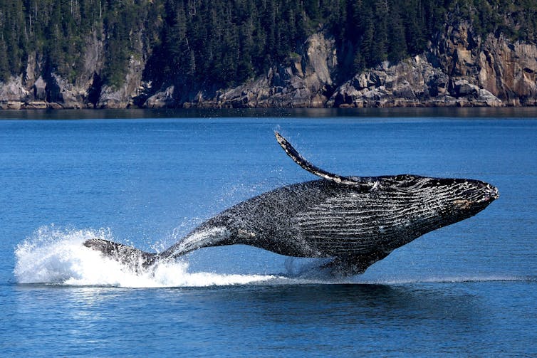
These hunters were followers of Allah. But, like the Yolŋu, they also held ceremonial law for Whale and Octopus, and possessed a colour-coded flag of their own with two horizontal bands of black over white representing their camp at Motatj in the Wessel Islands.
They remain known to the Yolŋu by various names including the Bäpayili, Wurramala, Gelurru and Dhurrutjini. This latter name suggests a Sama origin, as Turijene is a Makassan moniker for the Sama clans who settled in Sulawesi and Kalimantan in the 16th century, and later spread to nearby islands including Lesser Sunda, Maluku and Raja Ampat.
Coral Sunset
Burrumarra also mentioned an ensuing wave of visitors with distinctive golden skin, who did not harvest trepang, and instead built boats, made pottery, grew rice, dug wells and loomed cloth. They mostly respected the Yolŋu and participated in their ceremonies, yet kept their technological secrets to themselves, which led to conflict and their eventual departure.
The Yolŋu associate this intermediate wave of seafarers with a class of women ancestors known as the Bayini. The Bayini presence at Bawaka informs the sorrowful mood of Gumatj clan Manikay for Djäpana (Coral Sunset), which later imbued Yunupiŋu’s composition of Djäpana: Sunset Dreaming and sparked the creative impetus towards his band, Yothu Yindi.
Read more: My favourite album: Yothu Yindi's Tribal Voice
At Bawaka, there was a beautiful Bayini woman named Djotarra, who was enslaved by a foreign captain, Gurrumulŋa, in his vessel, the Mätjala. In a recurring theme found in various Yolŋu Manikay series, Djotarra was chained in the Mätjala’s hold and, as it set sail from Bawaka into the djäpana sunset, it stuck a submerged rock in the shallows drowning all aboard.
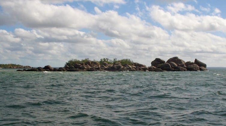
The Mätjala’s wreckage remains in Port Bradshaw’s waters as the island of Binanhaŋay, while the tragedy of Djotarra serves as another Yolŋu exemplar for exercising caution in dealings with foreigners. This wariness of foreign motivations would also imbue Yunupiŋu’s composition of Djäpana: Sunset Dreaming, which warns, “Don’t be fooled by the Balanda [European] ways”.
Such assertions remain an intrinsic trait of how the Yolŋu understand and negotiate the otherness of foreigners in the contemporary world. They stem from an enduring legacy of extensive engagements with Southeast Asia that long predate the 1788 landing of the British First Fleet in Sydney and continue to affirm the ancestral rights of Indigenous peoples in Australia.
This essay draws on Aaron Corn’s essay with Brian Djangirrawuy Garawirrtja in The First Wave: Exploring Early Coastal Contact History in Australia edited by Gillian Dooley and Danielle Clode.
The Gupapuyŋu App is a free download from Charles Darwin University that provides a Yolŋu language pronunciation guide.![]()
Aaron Corn, Professor of Music · Director, Centre for Aboriginal Studies in Music (CASM) · Director, National Centre for Aboriginal Language and Music Studies (NCALMS), University of Adelaide
This article is republished from The Conversation under a Creative Commons license. Read the original article.
Seniors’ Stories Volume 5 Available Now
Communities Must Band Together To Protect Against Bushfires
Drought Impact Study Shows New Issues For Plants And Carbon Dioxide
Sex And Gender In Health Research: Australia Lags Behind
A Solar-Powered Freezer For Today’s Catch: UNSW Engineering Makes An Impact In Fiji

The Rise Of The Middle-Aged Share House
Did Human Hunting Activities Alone Drive Great Auks' Extinction?
First Recording Of A Blue Whale's Heart Rate
Disclaimer: These articles are not intended to provide medical advice, diagnosis or treatment. Views expressed here do not necessarily reflect those of Pittwater Online News or its staff.
