Inbox and Environment News: Issue 449
May 10 - 16, 2020: Issue 449
Echidna Season
Echidna season has begun. As cooler days approach, our beautiful echidnas are more active during the days as they come out to forage for food and find a mate. This sadly results in a HIGH number of vehicle hits.
What to do if you find an Echidna on the road?
- Safely remove the Echidna off the road (providing its safe to do so).
- Call Sydney Wildlife or WIRES
- Search the surrounding area for a puggle (baby echidna). The impact from a vehicle incident can cause a puggle to roll long distances from mum, so please search for these babies, they can look like a pinky-grey clump of clay
What to do if you find an echidna in your yard?
- Leave the Echidna alone, remove the threat (usually a family pet) and let the Echidna move away in it's own time. It will move along when it doesn't feel threatened.
If you find an injured echidna or one in an undesirable location, please call Sydney Wildlife on 9413 4300 for advice.
www.sydneywildlife.org.au
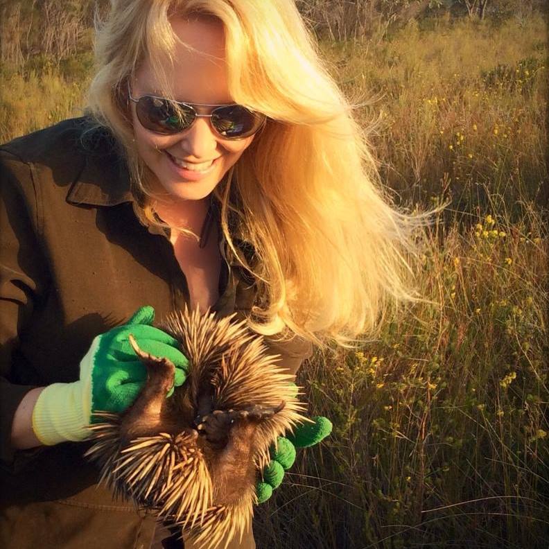
Lynleigh Greig, Sydney Wildlife, with a rescued echidna being returned to its home
Recent Australian Wildfires Made Worse By Logging
May 6, 2020: University of Queensland
Logging of native forests increases the risk and severity of fire and likely had a profound effect on the recent, catastrophic Australian bushfires, according to new research.
In the wake of the country's worst forest fires in recorded history, University of Queensland researchers have been part of an international collaboration, investigating Australia's historical and contemporary land-use.
UQ Professor and Wildlife Conservation Society Director James Watson said logging regimes have made many forests more fire prone for a host of reasons.
"Logging causes a rise in fuel loads, increases potential drying of wet forests and causes a decrease in forest height," Professor Watson said.
"It can leave up to 450 tonnes of combustible fuel per hectare close to the ground -- by any measure, that's an incredibly dangerous level of combustible material in seasonally dry landscapes.
"By allowing these practices to increase fire severity and flammability, we undermine the safety of some of our rural communities.
"It affects wildlife too by creating habitat loss, fragmentation and disturbance for many species, with major negative effects on forest wildlife."
Lead author, Australian National University's Professor David Lindenmayer, said there are land management actions we can take to stop these fires from occurring in the future.
"The first is to prevent logging of moist forests, particularly those close to urban areas," Professor Lindenmayer said.
"We must also reduce forest fragmentation by proactively restoring some previously logged forests.
"In the event of wildfires, land managers must avoid practices such as 'salvage' logging -- or logging of burnt forests -- which severely reduces recovery of a forest."
The Federal Government has launched a Royal Commission to find ways to improve Australia's preparedness, resilience, and response to natural disasters.
Researcher Michelle Ward, from UQ's School of Earth and Environmental Sciences, said it was time for government to act.
"We urge policy makers to recognise and account for the critical values of intact, undisturbed native forests, not only for the protection of biodiversity, but for human safety," Ms Ward said.
"Let's act strongly and swiftly for the sake of our communities, the species they house, our climate and Australia's wild heritage."
David B. Lindenmayer, Robert M. Kooyman, Chris Taylor, Michelle Ward, James E. M. Watson. Recent Australian wildfires made worse by logging and associated forest management. Nature Ecology & Evolution, 2020; DOI: 10.1038/s41559-020-1195-5
Saving Energy And Lives: How A Solar Chimney Can Boost Fire Safety
May 6, 2020: RMIT University
A must-have in green building design, solar chimneys can slash energy costs up to 50%. Now research reveals they could also help save lives in a building fire.
In a world-first, researchers designed a solar chimney optimised for both energy saving and fire safety, as part of the sustainable features of a new building in Melbourne, Australia.
Modelling shows the specially-designed solar chimney radically increases the amount of time people have to escape the building during a fire -- extending the safe evacuation time from about two minutes to over 14 minutes.
A solar chimney is a passive solar heating and cooling system that harnesses natural ventilation to regulate the temperature of a building.
With an estimated 19% of the world's energy resources going to heating, ventilating and cooling buildings, integrating solar chimneys into new builds and retrofitting to existing structures offers great potential for reducing this massive environmental cost.
In the new project, a collaboration between RMIT University and the City of Kingston, researchers designed a solar chimney to maximise its efficiency for both ventilating fresh air and sucking smoke out of a building in case of fire.
Researcher Dr Long Shi said solar chimneys have well established environmental credentials, but their potential for improving fire safety had not been explored.
"In an emergency situation where every second counts, giving people more time to escape safely is critical," Shi said.
"Our research demonstrates that solar chimneys offer powerful benefits for both people's safety and the environment.
"Delivering on two important functions could boosts the already strong cost-effectiveness of this sustainable technology.
"We hope our findings will inspire more investment and development of solar chimneys in Australia, and around the world."
Kingston Mayor Georgina Oxley said Council was excited to be a part of the groundbreaking project.
"Creating new and innovative ways of reducing energy consumption in our building design is something that is a priority for Council," Oxley said.
"The solar-chimney that has been installed at the new state-of-the-art Mentone Reserve Pavilion not only allows us to harness clean green energy to heat and cool the building, helping Council achieve its environmental goals, but it also has the potential to save lives in the event of a fire. This is a truly remarkable design."
While calculations around the 6-fold increase in safe evacuation time were specific to the new building, previous research by the team from RMIT's School of Engineering has confirmed solar chimneys can successfully achieve both functions -- ventilation and smoke exhaustion.
Hot air rises: how a solar chimney works
The passive design approach behind solar chimneys operates on the well-known principle that hot air always rises.
Modern solar chimneys usually feature a wall of glass next to a wall that is painted black, to maximise the absorption of solar radiation. Vents at the top and bottom control the airflow in and out of the chimney for heating or cooling.
As the sun warms the chimney, this heats the air inside it.
The hot air rises and is vented out of the top of the chimney, which draws more air in at the bottom, driving ventilation through a building to naturally cool it down.
When it's cold outside, the chimney can be closed, to direct the absorbed heat back into the building and keep it warm.
It's an ingeniously simple concept that is relatively cheap to retrofit and adds almost no extra cost to a new build, but can drive energy consumption down.
Reducing smoke, increasing safety
During a fire, the same principle -- hot air rises -- enables the solar chimney to suck smoke out of the building.
Less smoke means better visibility, lower temperatures and reduced carbon monoxide -- all of which contribute to increasing the amount of time people have to safely evacuate.
To understand exactly how much evacuation time a solar chimney could deliver for a specific building, you need to model for that exact design, Shi said.
"This will differ from building to building, but we know that any extra time is precious and improves fire safety, which could ultimately help to save lives," he said.
The new research offers a technical guide for optimising the design and engineering of solar chimneys in real buildings, to expand their application across the two functions.
Long Shi, Anthony Ziem, Guomin Zhang, Jie Li, Sujeeva Setunge. SOLAR CHIMNEY FOR A REAL BUILDING CONSIDERING BOTH ENERGY-SAVING AND FIRE SAFETY – A CASE STUDY. Energy and Buildings, 2020; 110016 DOI: 10.1016/j.enbuild.2020.110016
NSW Hunters Provided Licence Relief & Access Back Into State Forests
May 6, 2020: NSW DPI
The State’s hunters who hold a Restricted Licence (R-Licence) will have the duration of their licences extended by four weeks after recreational hunting areas in State Forests were closed to reduce the spread of COVID-19 last month.
Minister for Agriculture Adam Marshall announced the extension today, saying it would reimburse hunters for the time they were unable to access State Forests.
Mr Marshall also announced that from today, the booking system would reopen, allowing hunters back into State Forests from Friday as part of the easing of COVID-19 movement restrictions.
“This is really good news for the almost 19,000 R-Licence hunters across NSW,” Mr Marshall said.
“This extension means that all R-Licences will have an extra four weeks added to their licences, the same period they were unable to access the State Forests booking and hunting maps.”
“I encourage hunters to renew their licences to take advantage of the extension. For those hunters whose R-Licences lapsed during the suspension period and do not wish to renew, a pro-rata refund will also be available.”
Mr Marshall said the decision to re-open State Forests for hunting was not made lightly.
“The hunting community was extremely understanding of the need to suspend access to State Forests as part of the broader COVID-19 response and extending their current license is a small thing we can do to get the hunting community back into swing,” he said.
“I want to urge hunters to still closely follow social distancing guidelines and respect measures that might be in place to assist with that, including any advice from State Forests regarding camping and facilities use.
“However, this is not an excuse for people to pack their bags and head on a holiday to a regional area – that is still not allowed.”
R-Licence holders are able to hunt game and feral animals on public land that has been declared and opened to hunting, or on private land with the permission of the landholder.
On 6 April 2020, all hunting in State Forests was suspended until further notice due to the outbreak of COVID-19, which impacted 18,821 R-Licence holders.
For more information and updates about hunting in NSW State forests visit: www.dpi.nsw.gov.au/hunting and the NSW DPI Hunting Facebook page.
Heavy Fines For Illegal Firewood Collection In National Parks
May 5, 2020
As the weather cools, the NSW National Parks and Wildlife Service (NPWS) is reminding residents across the Central West that it is illegal to collect firewood in national parks, state conservation areas and nature reserves.
NPWS Central West Area Manager Fiona Buchanan said it is important that residents around Bathurst, Orange, Dubbo, Condobolin, Forbes and Grenfell are aware of the heavy fines that apply.
“We are getting the message out there that collecting firewood, including dead wood and fallen trees, is not permitted in national parks,” Ms Buchanan said.
“Dead hollow-bearing trees and woody debris provide habitat for many endangered native animals in the Central West. Illegally cutting down dead trees and removing this fallen timber for firewood destroys critical habitat that these animals depend on for survival.
“We want residents in the Central West to understand that fallen timber in our national parks is not a low-cost option for heating during the winter.
“NPWS uses surveillance cameras in parks to detect illegal activities, including firewood collection. On-the-spot-fines apply, and very large fines can be handed out by the courts.
“Last year, three individuals in Forbes received $7,100 in fines and court costs for illegal firewood collecting,” she said.
Firewood collection is permitted in some Forestry Corporation state forests, however those wishing to collect firewood must obtain a permit before doing so and ensure that they follow the associated permit conditions. Firewood permits are available online at Forestry Corporation of NSW
Funding Available To Help Restock Our Rivers
May 6, 2020
The NSW Government is calling on anglers, community groups, councils and others to apply for funding under the Dollar for Dollar Native Fish Stocking program, with applications now open.
NSW Department of Primary Industries (NSW DPI) Senior Fisheries Manager, Cameron Westaway said the Dollar for Dollar program complements the NSW Government’s native fish stocking recovery plan, by increasing fish stocking activities.
“This program is an investment in the future of our recreational fisheries,” Mr Westaway said.
“Fish stocking activities play an important role in our communities, providing greater recreational fishing opportunities in the region, as well as a number of cultural, environmental, social and economic benefits.
“Under the 2020/2021 program, the NSW Government will match funding between $1,000 and $6,000 for fish stocking activities involving high priority recreational fishing species including Australian Bass, Golden Perch and Murray Cod.
“In support of this, applicants can also apply for a fuel card grant, to provide assistance for transporting fish from hatcheries.”
Mr Westaway said the program is great example of NSW fishing licence fees at work, with funding provided from the Recreational Fishing Trust.
“The Dollar for Dollar Native Fish Stocking program allows for hundreds of thousands of fish to be stocked into various NSW waterways each season, through the support of locals who know their area best.
“Of course, it is important that all fish stocking is conducted responsibly in order to protect biodiversity and the aquatic environment and releasing fish into NSW public waters without a permit is illegal,” Mr Westaway said.
Applications can be made via the online form, and close on Friday 26 June 2020. For more information visit the NSW DPI website, www.dpi.nsw.gov.au
Narrabri Coal To Pay $120,000 After Mine Waste Caused Landfill Fires
April 28, 2020
Narrabri Coal Operations Pty Ltd will pay $120,000 to the Environmental Trust as part of an Enforceable Undertaking agreed with the NSW Environment Protection Authority (EPA) for allegedly transporting hazardous waste which subsequently caused a series of fires at the Narrabri landfill.
“The Narrabri Shire Council landfill had a number of fires in early to mid-April 2019 allegedly caused by equipment from the Narrabri Coal mine disposed of at the landfill,’’ said EPA Director Regulatory Operations Metro North Adam Gilligan.
“The EPA investigation found that after a training exercise at the mine, over 100 self-rescuer units were put into an industrial bin which was then taken to the landfill.”
Self-rescuer units supply workers with oxygen during incidents in underground mines. The units contained between 90 and 120 kilograms of potassium hydroxide, which is classified as a corrosive dangerous good as it can generate very high pH levels when exposed to liquids.
“These units should not have been disposed of at the landfill as they are classified as hazardous waste, which the landfill is not authorised to receive.
“When split open by compaction of the landfill cell, chemicals from the units can ignite. This is not only a safety issue but a breach of hazardous waste rules.”
Mr Gilligan said the EPA considers that the incident breached Narrabri Coal’s licence and the company’s waste transport obligations.
Following the incident Narrabri Coal hired a contractor to manually search through 700 cubic metres of general waste to try to recover the self-rescue units. A five-week search recovered 12 of the units. An ongoing clean-up operation continues within the impacted waste cell to ensure the site is safe for workers and the environmental impacts are addressed.
Enforceable undertakings are a tool the EPA can use as an alternative to prosecution. The legally binding agreements are designed to prevent similar incidents occurring in the future and improve environmental outcomes.
The $120,000 that Narrabri Coal will pay to the Environmental Trust as part of the agreement will be provided to Narrabri Shire Council to help to fund the development of a new waste cell at the landfill.
The company will also alert all Whitehaven Coal Limited mines about the incident, pay the EPA’s legal and investigation costs, design a compulsory training module for employees on management of hazardous substances and present about the incident and key lessons at a NSW Minerals Council Environment and Community Committee meeting.
For more information about the EPA’s regulatory tools, see the EPA Compliance Policy or read the enforceable undertakings guidelines.
Enforceable undertaking agreements can be viewed on the public register
NSW Government’s Digital Decision A ''Disgrace'' For Communities Suffering From Coal And Gas
April 30, 2020
The NSW Government’s decision to enable digital hearings for two extremely controversial resource projects in NSW’s north west will prevent many people from having their say, according to Lock the Gate Alliance.
This morning, the NSW Government confirmed via the media that it is amending the Environmental Planning and Assessment Regulation to permit the Independent Planning Commission to hold the digital hearings.
Planning Minister Rob Stokes had earlier directed the IPC to find a way to hold public hearings for Santos’ coal seam gas project and Whitehaven’s Vickery coal mine expansion, despite the coronavirus crisis restrictions on public gatherings.
In response, Lock the Gate Alliance wrote to the Minister and the IPC, warning them that holding public hearings online or on the phone would be unlawful and would restrict community participation due to lack of access to technology, computer literacy, and reliable phone and internet connections in regional areas.
The Narrabri Gas Project is the most controversial project to ever work through the NSW Planning assessment process, with more than 22,000 objections to the coal seam gas proposal.
“Many people living in north west NSW will struggle to participate in digital hearings because they live on the wrong side of the digital divide,” Lock the Gate NSW coordinator Georgina Woods said.
“These hearings remove the community’s legal rights to have the merits of any decision challenged in court, so it’s vitally important that they are thorough and inclusive.”
Eric Hannan, who lives in a rented house on the historic “Kurrumbede” property with his wife Carol, and owns land adjacent to the planned Vickery railway line, said the decision to hold digital meetings was “wrong.”
Mr Hannan, who is aged in his seventies and worked as a stockman on Kurrumbede for 40 years, said a public, in-person hearing would have provided him an opportunity to point out Whitehaven’s false claims about how the property would be impacted by the mine.
“We had a public meeting before and it was good because you could get up and have your say,” he said.
“You can look at the people, and you can see the IPC people listening to you.
“When Whitehaven’s employees got up, I was able to point out when they were lying. If it’s all digital we’ll have none of that. I’ve worked on this property for 40 years and I know it damn well better than they do.”
Tony Pickard, who lives adjacent to Santos’ proposed Narrabri gasfield, said he and other locals would now be restricted from having their say.
“There are many people in the north west who lack quality internet connection and I am one of them,” Mr Pickard said.
“I’m right at the front line of potential damage from this gasfield. I have a right to be heard and to hear what Santos, the Government and all speakers have to say at any public hearing about this project.
“By forcing the Planning Commission to go ahead with this process while people are locked in their homes, the Planning Minister is showing a deep lack of respect for people in this region that will be harmed by this gasfield. It’s a disgrace.”
Logging Intensity To Increase Six-Fold As Forest Corp Pledges To Maintain Wood Supply
May 1, 2020
The NSW Forestry Corporation’s determination to supply the same volume of timber after the devastating bushfires will see logging intensity increase six-fold in forests on the South Coast and double on the North Coast.
Forestry Corporation documents released through parliamentary processes show for the first time the full extent of damage to native forests in the corporation’s portfolio. [1]
The data shows 85% of the native forests designated for logging on the South Coast and 44% of those on the North Coast were burnt during the bushfire crisis.
Despite the extent of fire damage, the state-owned logging company has told wood supply contract holders it is confident it can maintain supply.
“This can only be done by increasing the logging intensity in viable forests, which will be devastating for koalas and other forest species,” Nature Conservation Council Chief Executive Chris Gambian said.
“Maintaining supply from the southern forests where only 15% of the public native forest estate was unscathed will require a six-fold increase in logging intensity in those unburnt areas.
“On the North Coast, where about 56% of the public native forest estate was unburnt, this would require a doubling of logging intensity in those unburnt areas.
“Even before the fires, our native forests were being logged too hard and too often to allow them to recover between harvests.
“If the Forestry Corporation insists on supplying the same volume of timber after such devastation, our forests will be stripped and will take generations to recover, if they can at all.”
The Federal Government announced in December that 30% of the Mid-north Coast’s koalas died in the fires, yet the NSW Government continues to log koala habitat as if nothing has changed.
“Right now, we know that koala habitat is being logged in unburnt Lower Bucca and Nambucca state forests near Coffs Harbour,” Mr Gambian said.
“Koalas are struggling after the worst bushfires on record. Logging their habitat for wood chips and floorboards should not be allowed. This is totally unacceptable.”
Mr Gambian said the government must pause all native forest logging until the full ecological impacts of the fires are assessed and publicly reported; and renegotiate wood supply agreements to ensure logging operations do not exceed the intensity of pre-fire levels.
The Nature Conservation Council supports a government assistance package for the forest industry and its employees during this very difficult time. Any such assistance package must require a commitment to the transition from native forests to sustainably managed plantations and a just structural adjustment package for contractors, mill owners and employees.
Reference
Westpac Climate Policy Leaves Governments In The Dust
May 5, 2020
The Nature Conservation Council welcomes Westpac’s commitment to stop funding thermal coal mines and power stations by 2030 and urges the federal government to match the bank’s level of ambition.
Westpac is reportedly the 30th major international financial institution this year to declare it was abandoning coal. The company also aims to provide $3.5 billion of new finance for climate change solutions over three years so its own operations have net zero emissions by 2025. [1]
“If Westpac can quit thermal coal by 2030, then the federal government can also quit coal by 2030,” Nature Conservation Council Chief Executive Chris Gambian said.
“NSW still burns coal for 80% of its electricity and the federal government is stuck in the past without a plan to transition to clean energy. This can and must change.”
Westpac joins CommBank and Australia’s three major insurers in committing to quit thermal coal by 2030 or earlier.
“The big banks and insurers are moving because it is in their shareholders’ interests. The federal government must also act because it is in the interests of all Australian citizens to quit coal.
“In the post coronavirus world, investing in clean energy will be the best way to drive economic recovery and create a sustainable society.”
[1] Westpac abandons funding for thermal coal mining, SMH-Age, 5-5-20
Aren’t We In A Drought? The Australian Black Coal Industry Uses Enough Water For Over 5 Million People
May 4, 2020
By Ian Overton, Adjunct Associate Professor, Centre for Global Food and Resources, University of Adelaide
Water is a highly contested resource in this long, oppressive drought, and the coal industry is one of Australia’s biggest water users.
Research released today, funded by the Australian Conservation Foundation, has identified how much water coal mining and coal-fired power stations actually use in New South Wales and Queensland. The answer? About 383 billion litres of fresh water every year.
That’s the same amount 5.2 million people, or more than the entire population of Greater Sydney, uses in the same period. And it’s about 120 times the water used by wind and solar to generate the same amount of electricity.
Monitoring how much water is used by industry is vital for sustainable water management. But a lack of transparency about how much water Australia’s coal industry uses makes this very difficult.
Adani’s controversial Carmichael mine in central Queensland was granted a water licence that allows the company to take as much groundwater as it wants, despite fears it will damage aquifers and groundwater-dependent rivers.
Now more than ever, we must make sure water use by coal mines and power stations are better monitored and managed.
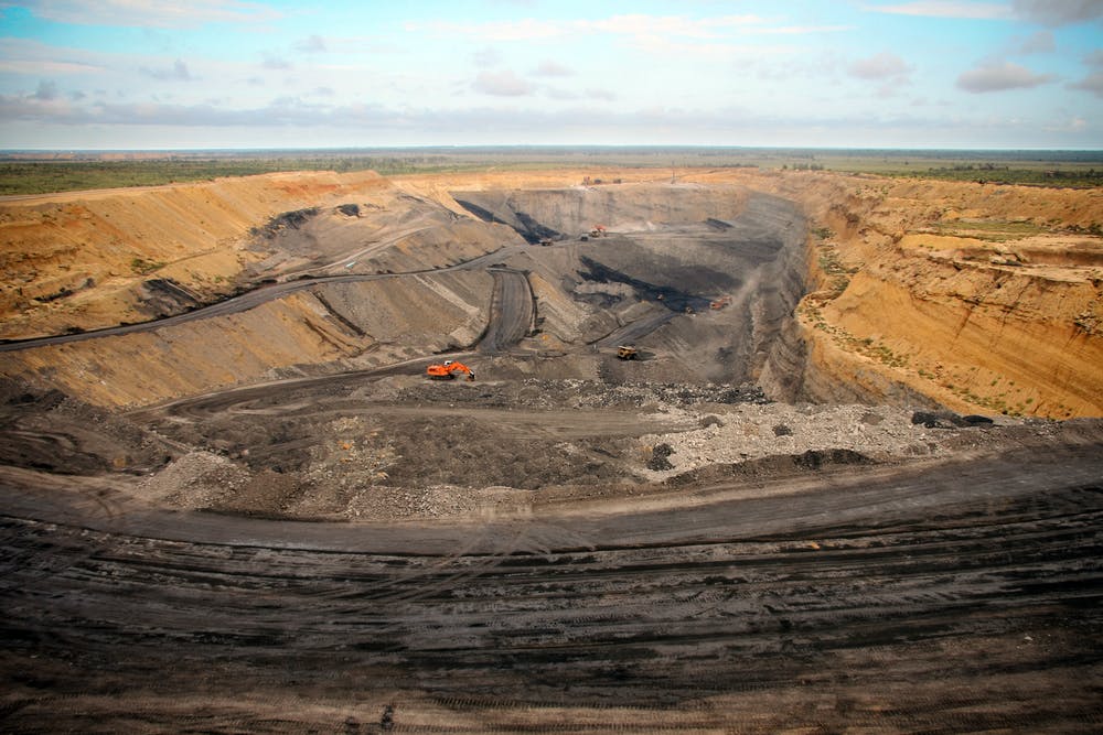
Data on total water use by coal mines is not publicly available. Shutterstock
Why does coal need so much water?
Mines in NSW and Queensland account for 96% of Australia’s black coal production.
Almost all water used in coal mines is consumed and cannot be reused. Water is used for coal processing, handling and preparation, dust suppression, on-site facilities, irrigation, vehicle washing and more.
Coal mining’s water use rate equates to a total consumption of almost 225 billion litres a year in NSW and Queensland, which can be extrapolated to 234 billion litres for Australia, for black coal without considering brown coal.
About 80% of this water is freshwater from rainfall and runoff, extracted from rivers and water bodies, groundwater inflows or transferred from other mines. Mines are located in regions such as the Darling Downs, the Hunter River and the Namoi River in the Murray-Darling Basin.
The other 20% comes from water already contained in tailings (mine residue), recycled water or seepage from the mines.
The burning of coal to generate energy is also a large water user. Water use in coal-fired power stations is even harder to quantify, with a report from 2009 providing the only available data.
Water is used for cooling with power stations using either a once-through flow or recirculating water system.
The water consumed becomes toxic wastewater stored in ash ponds or is evaporated during cooling processes. Water withdrawn is returned to rivers which can damage aquatic life due to the increased temperature.
No transparency
Data on total water use by coal mines is not publicly available. Despite the development of Australian and international water accounting frameworks, there is no reporting to these standards in coal mine reports.
This lack of consistent and available data means water use by the coal industry, and its negative effects, is not widely reported or understood. The problem is compounded by complex regulatory frameworks that allow gaps in water-use reporting.
A patchwork of government agencies in each state regulate water licences, quality and discharge, coal mine planning, annual reviews of mine operations and water and environmental impacts. This means that problems can fall through the gaps.

Wind and solar energy uses 120 times less water to generate the same amount of electricity. AAP Image/Mick Tsikas
Digging for data
An analysis of annual reviews from 39 coal mines in NSW, provided data on water licences and details of water used in different parts of the mine.
Although they are part of mandatory reporting, the method of reporting water use is not standardised. The reviews are required to report against surface water and groundwater licences, but aren’t required to show a comprehensive water balanced account. Annual reviews for Queensland coal mines were not available.
Collated water use — both water consumption and water withdrawal – showed coal mining consumes approximately 653 litres for each tonne of coal produced.
This rate is 2.5 times more than a previous water-use rate of 250 litres per tonne, from research in 2010.
Using this rate the total water consumed by coal mining is 40% more than the total amount of water reported for all types of mining in NSW and Queensland by the Australian Bureau of Statistics in the same year.
By the numbers
NSW and Queensland coal-fired power stations annually consume 158,300 megalitres of water. One megalitre is equivalent to one million litres.
A typical 1,000-megawatt coal-fired power station uses enough water in one year to meet the basic water needs of nearly 700,000 people. NSW and Queensland have 18,000 megawatts of capacity.
Coal-fired generation uses significantly more water than other types of energy.
In total, coal mining and coal-fired power stations in NSW and Queensland consume 383 billion litres of freshwater a year – about 4.3% of all freshwater available in those states.
The value of this water is between A$770 million and A$2.49 billion (using a range of low to high security water licence costs).
They withdraw 2,353 billion litres of freshwater per year.
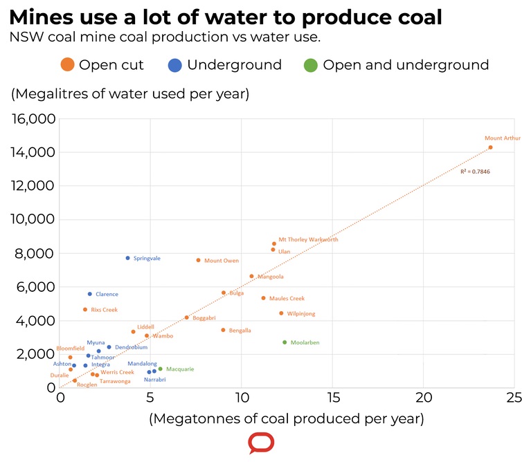
Author provided/The Conversation, CC BY-ND
The problem with large water use
Coal mining is concentrated in a few regions, such as the Hunter Valley and the Bowen Basin, which are also important for farming and agriculture.
In NSW and Queensland, the coal industry withdraws about 30% as much water as is withdrawn for agriculture, and this is concentrated in the few regions.
Coal mining and power stations use water through licenses to access surface water and groundwater, and from unlicensed capturing of rainfall and runoff.
This can reduce stream flow and groundwater levels, which can threaten ecosystem habitats if not managed in context of other water users. Cumulative effects of multiple mines in one region can increase the risk to other water users.
The need for an holistic approach
A lack of available data remains a significant challenge to understanding the true impact of coal mining and coal-fired power on Australia’s water resources.
To improve transparency and increase trust in the coal industry, accounting for water consumed, withdrawn and impacted by coal mining should be standardised to report on full water account balances.
The coal industry should also be subject to mandatory monthly reporting and a single, open-access point of water data must be created. Comprehensive water modelling must be updated yearly and audited.
Coal water use must be managed in a holistic manner with the elevation of water accounting to a single government agency or common database.
Australia has a scarce water supply, and our environment and economy depend on the sustainable and equitable sharing of this resource.
This article was published first in The Conversation, click here to read the original item. Republished under a Creative Commons licence.
One Small Area Of Ocean Not Changed By Global Warming
May 6, 2020
Climate and marine scientists are observing pervasive warming of the ocean and the land surfaces across the globe. Since the middle of the 19th century, the average global temperature recorded on the land surface has risen by around one degree centigrade, and by 0.6 degrees across the ocean surface. Global warming has been most pronounced in the alpine regions and the Arctic.
Over the period 1982 to 2011, however, a cooling trend was recorded in surface waters in some parts of the Southern Ocean around the Antarctic continent, specifically in the area south of 55 degrees latitude. This cooling was strongest in the Pacific sector of the Southern Ocean, where the ocean surface cooled by around 0.1°C per decade, and the weakest in the Indian and parts of the Atlantic sectors.
Climate and marine scientists have so far been unable to provide satisfactory explanations as to why parts of the Southern Ocean have bucked the trend of global warming. Now a group of scientists led by ETH Professor Nicolas Gruber has solved the puzzle with the help of simulations with a high-resolution ocean model.
.jpg?timestamp=1588796964906)
Changes in temperature and salinity of the Southern Ocean between 1982 and 2011 (from Haumann et al, AGU Adv 2020)
Simulations highlight the influence of sea ice
In a paper just published in the journal AGU Advances, the scientists use a series of simulations to show that sea-ice changes are the most probable cause for the cooling of the surface waters in the Southern Ocean. Only when Alex Haumann, lead author and Professor Gruber's former doctoral student, and the team incorporated the observed changes in sea ice into the model were they able to correctly replicate the observed pattern of the temperature changes. When they omitted this effect and only took into account the other potential factors -- such as a more vigorous ocean circulation or increased freshwater fluxes from the melting of the Antarctic glaciers -- the pattern was not accurately simulated.
Their considering of the role of sea ice in causing the surface cooling was based on the observation that over the same period as the cooling took place, i.e., from 1982 to 2011, the sea-ice extent steadily increased in the Southern Ocean around Antarctica, while in the Arctic it shrunk significantly over the same period.
A few years ago, Haumann and Gruber and various colleagues already discovered the reason for this expansion of sea ice in the Southern Ocean. They noticed that stronger southerly winds over this period propelled more of the sea ice that is being formed along the coast out into the open sea, enhancing the melting there. The resulting stronger conveyor belt enhanced the transport of freshwater from near the continent out into the open ocean. This is because when sea ice is being formed from seawater, the salt is left behind, whereas when the sea ice melts in the summer well away from the coast, the freshwater is released into the surface, reducing the salinity of the seawater there.
This reduction in surface salinity strengthened the vertical stratification of the seawater: the fresher, and in this part of the ocean lighter water stays in the upper 100 m, while the denser saltier water remains below. In general, the saltier and colder the water, the greater its density and the greater its depth in the ocean.
Smaller heat exchange between the water layers
The stronger stratification reduced the exchange of heat between the deeper layers and the surface water, causing the heat to remain trapped at depth. In addition, the air above the Southern Ocean during winter is generally colder than the temperature of the seawater. Combined with the reduction of the vertical exchange of heat in the ocean, this ultimately created the observed situation where the surface water cooled and the subsurface warmed.
The strong role of salinity in controlling the vertical stratification is a peculiarity of the Southern Ocean, since there is actually very little difference in temperature between the ocean's surface water and the subsurface: only a few tenths of a degree. The strong salinity driven stratification also explains why the surface cooling did not induce deep mixing.
No material to feed global warming sceptics
"The cooling of the Southern Ocean over three decades is really unusual, bearing in mind that otherwise all other parts of the planet, especially the land surface, have warmed up," says Nicolas Gruber.
Cooling in just one area of the ocean should not be interpreted as a reduction of the long-term warming of the global climate system as a whole. It is merely a redistribution of heat in the Southern Ocean from the surface to the deeper layers of the ocean. "We assume the strong winds pushing the sea ice in the Southern Ocean northward are potentially a side-effect of climate change," Gruber stresses. "Climate change is clearly man-made and cannot be disputed simply because one area of the ocean shows signs of cooling."
In addition, the current study went only up to 2011. "We have observed a trend reversal since 2015. The sea ice around the Antarctic is now starting to recede at a rapid rate," says the ETH Professor. "And this is very much in line with the overall trend of continuing global warming."
F. Alexander Haumann, Nicolas Gruber, Matthias Münnich. Sea‐Ice Induced Southern Ocean Subsurface Warming and Surface Cooling in a Warming Climate. AGU Advances, 2020; 1 (2) DOI: 10.1029/2019AV000132
More Rescue Missions Possible As Platypuses Rehomed
May 1, 2020
UNSW scientists expect more platypus rescues in future as climate change takes a stranglehold on their natural habitat.
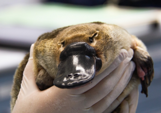
A platypus prepares for tagging at Taronga Wildlife Hospital before release at Tidbinbilla Nature Reserve. Photo: ACT Government
UNSW researchers have launched a platypus monitoring study after returning three of the unique creatures to their home at Tidbinbilla Nature Reserve, near Canberra.
Scientists from UNSW Sydney, Taronga Conservation Society and Tidbinbilla yesterday released the platypuses implanted with tracking devices.
The platypuses were among a group which Taronga Zoo temporarily rehomed in late December because their waterways had dried up during extreme drought.
In the months since, rain renewed their ponds, enabling the platypuses to now return home.
Three more tagged platypuses will be released in coming weeks.
But researchers worry that these rescues will become more common to save platypus populations from drying rivers in light of climate change projections.
Dr Gilad Bino, a researcher at the UNSW Centre for Ecosystem Science, said the collaboration between UNSW, Taronga and Tidbinbilla would enable scientists to better understand the movements and habits of these secretive animals.
“This project will provide never-before-studied insights into the habitat use, movement behaviour and interactions of platypuses during the next 18 months,” Dr Bino said.
“What we learn will improve our understanding of platypus habitat use and requirements, as well as the ecosystem's capacity to sustain a platypus population.
“In addition, the study will examine post-release behaviour and the re-acclimatisation success of these animals to inform future rescue strategies as droughts become more frequent under predicted climate change.”
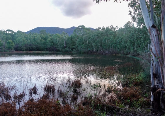
Tidbinbilla Nature Reserve where the platypuses returned home. Photo: ACT Government
Habitat condition impacts platypus
Professor Richard Kingsford, Director of the UNSW Centre for Ecosystem Science, said a key part of the project would focus on investigating the impact of habitat condition and habitat use.
“So, we will also monitor water availability and quality, as well as prey availability – platypus feed on macro-invertebrates, such as insects and yabbies,” Prof Kingsford said.
“We anticipate the findings will advance our understanding of platypus habitat requirements – not only for Tidbinbilla Nature Reserve but also for wild platypus populations across Australia.”
Dr Bino thanked Taronga Conservation Society and Tidbinbilla Nature Reserve for working with UNSW on the new study.
“We all understand how important it is to study the platypus: it’s an iconic aquatic species but the International Union for Conservation of Nature (IUCN) lists its conservation status as ‘Near Threatened’ because of continuing population declines and threats,” Dr Bino said.
“Our previous research found the platypus was increasingly threatened – the increased frequency and severity of drought and fire within a changing climate will likely pose significant challenges to the long-term viability of already degraded and fragmented platypus populations.
“Under projected climate change conditions, the rescue of platypuses from drying rivers in extreme drought may become a necessary strategy to maintain platypus populations.
“Consequently, there is a genuine need to understand platypus habitat use under different conditions, as well as the success of platypus re-acclimatisation when returned to their natural environment.”
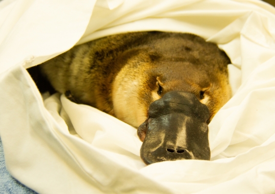
A platypus has a health check at Taronga Wildlife Hospital before returning to Tidbinbilla Nature Reserve. Photo: ACT Government
Platypuses thrived while away
Taronga Wildlife Conservation Officer Dr Phoebe Meagher said Taronga scientists were thrilled to return the first three platypuses back home to Tidbinbilla.
“During their stay at Taronga our platypus keepers went above and beyond to keep these animals healthy and to ensure they kept their natural behaviours,” Dr Meagher said.
“They achieved this by limiting their contact with the Tidbinbilla platypus, supplying live food for active foraging and keeping them separate from Taronga’s own animals.
“From a research perspective, having the platypus at Taronga allowed us to collect samples during their veterinary health checks that will contribute to our research on this elusive Australian species.”
Tidbinbilla Nature Reserve is home to an estimated 10 to 15 platypuses and other native animals that were evacuated during summer, including brush-tailed rock-wallabies and eastern bettongs.
Subsidies Drive Murray-Darling Basin Extractions As Environment Loses
May 1, 2020
Subsidised irrigators extracted up to 28 per cent more water than those who received no funds under a national Murray-Darling Basin irrigation efficiency program, a new study has found.
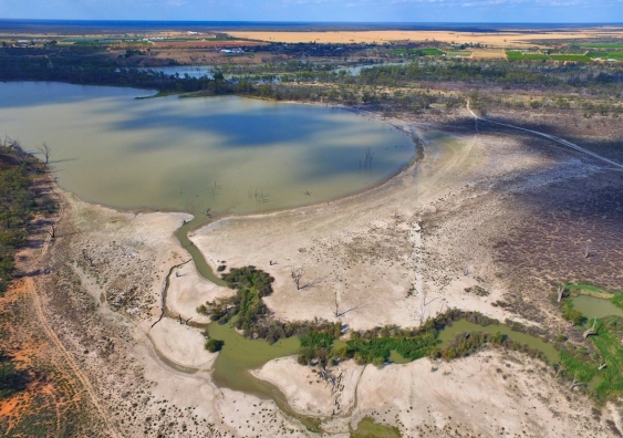
The Murray Darling Basin during drought. Photo: Shutterstock
The Australian Government’s $4 billion irrigation efficiency program has led to irrigators who received irrigation infrastructure subsidies extracting up to 28 per cent more water in the Murray-Darling Basin (MDB) than those who did not receive any funds – affecting the environment and other users, new research has found.
Water management experts across disciplines from UNSW, The University of Adelaide, Australian National University (ANU) and the Environmental Defenders Office examined the impact of taxpayer-funded irrigation infrastructure upgrades on water extractions and environmental water recovery in the MDB.
Their findings, published in the international journal Resources, Conservation and Recycling this week, analysed almost 2500 on-farm MDB irrigation surveys, with surveys in 2010-2011 and 2015-2016, identifying a “rebound effect” of increased water extractions, coinciding with the Australian Government’s investment in irrigation infrastructure upgrades.
Combined with documented concerns around measurement of water and compliance, this raises serious doubts about the true extent to which environmental flows are increasing at a catchment and basin level, as a consequence of the subsidised upgrades.
Lead author and resource economist Professor Sarah Wheeler from The University of Adelaide said: “Our analysis over the past decade found that irrigators who received infrastructure grants actually increased their water extraction volumes by 21 to 28 per cent, compared to irrigators who received no subsidies.”
The subsidies aim to help irrigators upgrade their infrastructure technology to save water and return some savings to the environment, in a bid to increase stream flows and ultimately reinstate a sustainable level of extraction in the MDB.
"Robbing Peter to pay Paul"
Study co-author and environmental scientist Professor Richard Kingsford, Director of the Centre for Ecosystem Science at UNSW Sydney, said the Murray-Darling Basin Plan was an ambitious initiative to solve the escalating problems the basin’s rivers faced, but the implementation of some government programs seemed to have the opposite effect of what they had intended.
“The ‘buyback’ of irrigation water has put water back into the rivers, but our research found the subsidised infrastructure program could be ‘robbing Peter to pay Paul’ by enabling more water extractions than water recovered through the efficiency program,” Prof Kingsford said.
Compounding the problem, the study used publicly available water data that suggested reductions in extractions from the MDB — supposedly commensurate with increases in environmental flows — may have been overestimated, particularly in the Northern MDB.
Concerningly, the study also found that half of all irrigators surveyed agreed that the taxpayer-funded program for the irrigation infrastructure was "wasteful and inefficient". There was further evidence the program favoured corporate agriculture, in terms of subsidy amount per entity, more than family farms.
Co-author and ANU resource economist Professor Quentin Grafton said: “Increased water extraction occurred because of changes to crop types and increased irrigated areas, partly enabled through increased surface-water entitlement utilisation and water trade participation. But we are most concerned with the ‘leaky bucket’ at the basin scale which means less water in streams and rivers.”
Co-author and Environmental Defenders Office Special Counsel Emma Carmody said: “There are a range of regulatory and governance issues which could result in the increased taking of water from some rivers and aquifers in the MDB, beyond specified limits. These include illegal extractions, increased floodplain harvesting, groundwater substitution and problems with ‘sustainable diversion limit’ compliance tools in some catchments.”
Long-term sustainability in doubt
Prof Kingsford said the researchers’ findings also cast uncertainty on the long-term sustainability of the basin’s rivers and the communities which rely on these flows for their livelihood.
“We found water consumption is not being controlled as required by the Basin plan, which means the health of rivers and groundwater systems in the MDB will continue to degrade, without even accounting for the current and future threat of climate change,” he said.
“We call upon the government to consider our findings as an opportunity to continue developing and implementing transparent, fully audited and robust accounting and accurate measurement of all forms of water extractions across the MDB for the sake of the environment and the communities which depend on the Basin.”
The researchers recommend further MDB water and rural policy actions to address these water governance challenges, including improved compliance, fines and regulation, and prioritising the cost-effectiveness of water recovered for the environment.
Read the full research paper in Resources, Conservation and Recycling: https://doi.org/10.1016/j.resconrec.2020.104755
6,000 years of climate history: an ancient lake in the Murray-Darling has yielded its secrets
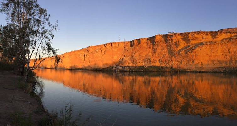
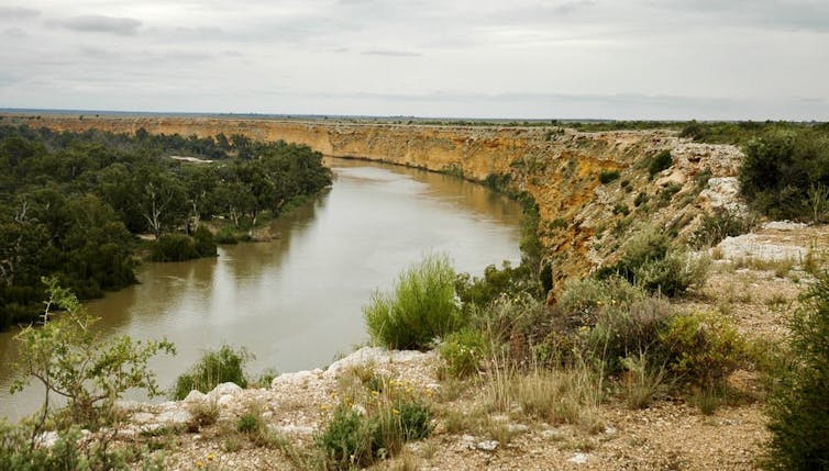
For millions of years, the Murray River has flowed from the Australian Alps across the inland plains, winding through South Australia before emptying into the ocean. But the final leg of its journey once looked vastly different.
Our research released today conclusively shows what has long been suspected: 6,000 years ago, water levels in the Lower Murray River were so high that much of the system in South Australia comprised a huge lake.
We also uncovered an invaluable long-term record of floods and droughts in the Murray Darling Basin, by drilling deep into layers of silt and clay built up over 12,000 years.
Our findings point to how Australia’s most important river system might be altered by future sea level rise. What’s more, a better record of past floods and drought will help manage water use in Australia’s most important river system.
Probing The Past
Our climate is changing and sea levels are rising. Scientists are working hard to forecast what environments such as rivers and estuaries will look like under higher sea levels and, in Australia, more intense droughts and floods.
One way to do this is to look back to a period 5,000-8,000 years ago, to a point in the sea level cycle known as the Holocene highstand. The Holocene refers to the past 11,700 years or so of Earth’s history. The highstand is the point at which sea levels were highest.
Today, the Murray River crosses into South Australia and flows within a narrow valley, then gradually widens towards Lake Alexandrina where it empties into the sea.
But it wasn’t always this way. After the peak of the last glacial period 18,000 years ago, melting ice caused sea levels to rise from about 120 metres below today’s level. About 6,000 years ago, sea level peaked at two metres above today’s level.
Researchers have previously hypothesised that over several thousand years, the high sea level at the mouth of the Murray acted like a dam, causing water to back up in the river, creating a saltwater lake known as Lake Mannum.
Our research confirms that the lake existed, and that it was enormous - stretching from the mouth of the Murray to about 200 kilometres upstream near Swan Reach.
We used high resolution two- and three-dimensional modelling modelling of water levels and flows to confirm the presence of the lake, and how it formed.
Layers Of History
The naturally still waters of Lake Mannum acted as a enormous trap for clay and silt discharged upstream. Under various conditions, such as floods, the sediment travelled downstream and settled to the lake’s floor.
Today, the climate history for the Murray-Darling Basin is written in these sediment layers.

We collected a 30 metre-long sediment core from the present day floodplain of the Lower Murray River.
The core contains an 11-metre section of sediment deposited on the floor of Lake Mannum between 8,500 and 5,000 years ago. Each metre took roughly 315 years to accumulate - about three millimetres a year.
We believe each layer in the core probably represents an episode of increased or decreased river flow.
Most layers were probably produced when snow melt from the Australian Alps in spring and summer transported mud along the river system. Some layers will represent large floods that came down the Murray River, while others will represent floods that flowed down the Darling.
Longer-term variations in the thickness of the layers may correspond to extended periods of wetter and drier weather.
The next phase of our research will involve a close analysis of the sediment layers to obtain a reliable, detailed, high resolution record of flood and drought in the Murray Darling Basin.
What Can We Learn?
As sea level dropped to modern levels over the last 5,000 years, the lake slowly drained and turned back into a river.
These days, the lower Murray River is intensively managed. Five barrages, or barriers, have been erected near the river mouth to keep the water fresh by preventing seawater from creeping in, and to maintain water levels. Significant volumes of water have been extracted for irrigation and domestic use.
Some people argue the barrages should be removed to restore the natural tidal estuary and allow sea water to influence lake levels. Their removal is unlikely in the near future. But our research gives insight into what could happen if the barrages were removed, and sea levels rise under climate change.
We expect the next step in our research, analysing the sediment cores, to provide valuable data on long-term river flows and indicate whether intense droughts, such as the Millenium drought, are more or less frequent than the once-in-a-century figure often suggested.
In future, water managers deciding on water allocations may benefit from knowing how much water has historically come down the system, and how often.![]()
Hannah Power, Senior Lecturer in Coastal Science, University of Newcastle; Anna Helfensdorfer, PhD Candidate, University of Sydney, and Tom Hubble, Associate professor, University of Sydney
This article is republished from The Conversation under a Creative Commons license. Read the original article.
Severe Coral Loss Leaves Reefs With Larger Fish But Low Energy Turnover
May 6, 2020: British Ecological Society
Research on the Great Barrier Reef has found severe coral loss to be associated with substantial increases in the size of large, long-living herbivorous fish. However, decreased recycling of this fish biomass could leave the ecosystem vulnerable to crashing. The research is published in the British Ecological Society journal Functional Ecology.
By comparing reef surveys from 2003-2004 and 2018, an international team of researchers led by James Cook University, found severe coral loss, of up to 83% in some areas, was associated with increases in fish biomass, productivity and consumed biomass, meaning the reef now has more energy stored in the form of fish weight, is able produce more fish weight and these fish are being consumed by predators.
Renato Morais, lead author of the study, said "It's as if the herbivorous fish community has been scaled up, with larger fish growing and providing more food for predators when they die. However, this does not come without a cost."
Superficially, the increased biomass may seem positive from a human perspective, with the presence of bigger fish after a coral reef collapse suggesting a stable population. However, the researchers warn that reduced turnover, or recycling of biomass, in the reef could mean that this trend benefiting large fish might not last long.
"The fish have not multiplied. Instead, there are more bigger fish and less smaller ones." Said Mr Morais "This suggests that many of these long-living herbivorous fishes, such as surgeon fish which can live up to 40 years, could have been there before the corals died, only growing bigger. Eventually, these older fish will die and, if not replaced by young ones, productivity could collapse."
The increased growth of large fish like surgeonfish, parrotfish and rabbitfish is likely to have been made possible by the accessibility and quality of algal turf, the preferred food of these herbivores. These algal 'lawns' grow abundantly over the skeletons of dead coral. A recovery of the coral could result in a reduction in this food source and collapse of these herbivores.
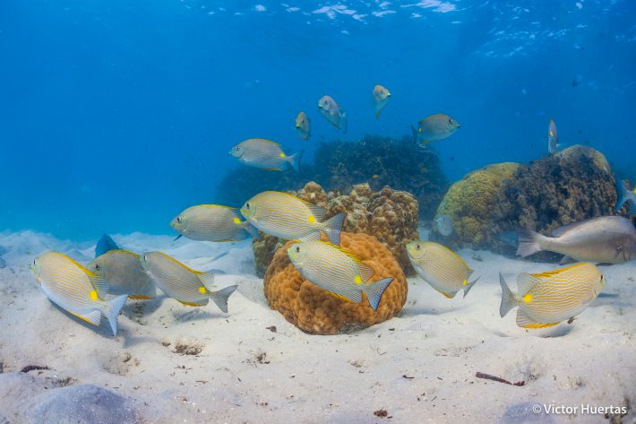
School of gold-spotted rabbitfish. Credit Victor Huertas.
Erosion of dead coral structures and subsequent loss of refuges for fish could also cause a population crash. Although the researchers did observe a decline in coral structure in the reef area studied, it is possible that it had not reached a level where fish biomass would start to decline.
Between 2014 and 2017 the reefs around lizard island, where the research took place, were subjected to two back-to-back mass bleaching events and two severe cyclones that decimated the coral populations. Combined, these events led to an 80% decline in coral cover throughout the islands.
Previous research has mainly taken a static look at the impacts of coral loss on fish. In this study the researchers looked at the cumulative effects of coral mortality over time using metrics often absent from coral reef studies: fish growth, mortality and energy turnover.
To record the data, the researchers carried out fish and benthic (sea floor) surveys at Lizard Island, on Australia's Great Barrier Reef in 2003 to 2004, and 14 years later in 2018. The benthic surveys quantified live coral cover and algal turf cover. Fish surveys recorded 12 common types of reef fish families.
Because the study comprises of two snapshot assessments 15 years apart the researchers were limited to looking at long term trends. "If there were changes to the energetic balance of the fish assemblages at that reef that happened between surveys but did not have a lasting effect, they would have gone unnoticed." Explained Mr Morais.
Mr Morais also cautions that the findings apply to the one reef the researchers surveyed and other reefs could behave differently, although a number of features suggest similar changes may have taken place elsewhere. For instance, increases in herbivore populations are common in post-coral reefs. Collecting the same data on other reefs will help to establish if this is the case.
The researchers are looking to follow this reef to see if new energetic shifts occur. "Any further shifts will depend on what happens to the reef," said Mr Morais, "Will there be a recovery of corals? Or will this degraded state be maintained? Then, will these large and old herbivorous fishes be replaced by younger ones? There are many aspects in this story to be investigated."
Renato A. Morais, Martial Depczynski, Christopher Fulton, Michael Marnane, Pauline Narvaez, Victor Huertas, Simon J. Brandl, David R. Bellwood. Severe coral loss shifts energetic dynamics on a coral reef. Functional Ecology, 2020; DOI: 10.1111/1365-2435.13568
Tree Trunks Take A Licking As Koalas Source Water
May 3, 2020: University of Sydney
Koalas are one of the world's most charismatic animals. But there is a lot we still don't know about them. For example, how do the marsupials access water in the treetops? Do they only absorb moisture from the gum leaves they eat? Or do they come down from the trees to drink from a waterhole? Until now, no one really knew.
A study published today in Ethology, led by a researcher from The University of Sydney, has captured koala drinking behaviour in the wild for the first time. The paper describes how koalas drink by licking water running down smooth tree trunks during rain.
The news arrives in time to celebrate Wild Koala Day on Sunday 3 May.
"For a long time, we thought koalas didn't need to drink much at all because they gained the majority of the water they need to survive in the gum leaves they feed on," said Dr Valentina Mella, in the School of Life and Environmental Sciences. "But now we have observed them licking water from tree trunks. This significantly alters our understanding of how koalas gain water in the wild. It is very exciting."
Survival
Australia is currently suffering the longest dry period ever documented, with severe rainfall deficits and record maximum temperatures. Koalas experience severe heat-stress and mass mortality events in prolonged hot and dry conditions and they spend more time drinking from artificial water stations if rain is scarce.
Further research could investigate when and why koalas from different areas need access to free water -- not contained in the leaves as moisture but available freely as liquid, such as rain, river water or puddles -- and whether water supplementation is necessary for some populations.
"This type of drinking behaviour -- licking tree trunks -- relies on koalas being able to experience regular rainfall to access free water and indicates that they may suffer serious detrimental effects if lack of rain compromises their ability to access free water," Dr Mella said.
"We know koalas use trees for all their main needs, including feeding, sheltering and resting. This study shows that koalas rely on trees also to access free water and highlights the importance of retaining trees for the conservation of the species."
Koalas rarely drink water
Each day, wild koalas eat around 510 grams of fresh succulent eucalyptus leaves, and the water in the foliage they feed on is believed to contribute about three quarters of their water intake in both summer and winter.
Among their adaptations to the Australian climate, koalas also possess extraordinary urinary concentrating abilities and have restricted respiratory and cutaneous water loss compared to similar-sized mammals.
In captivity, koalas have been observed to drink water, but this behaviour has often been considered unusual and attributed to disease or to severe heat stress.
However, anecdotal reports suggest that koalas in the wild drink from waterholes in summer when temperatures exceed 40 degrees Celsius.
Koalas have also been observed approaching humans to access free water (in bottles, gardens and swimming pools during drought and after fire. But this is considered an unusual occurrence.
Observing licking behaviour
For this study, Dr Mella collated observations of koalas drinking in the wild made by citizen scientists and independent ecologists between 2006 and 2019 at the You Yangs Regional Park in Victoria and the Liverpool Plains in NSW. Each observation was koala behaviour noticed by chance and reported to Dr Mella.
There were 44 observations of free ranging koalas licking water running down a tree trunk during or immediately after rain in the You Yangs Regional Park.
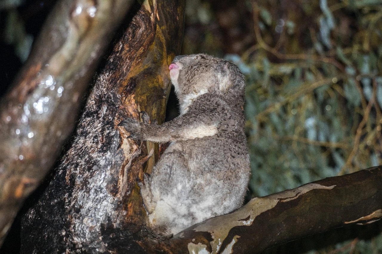
Adult male koala licking water from a White Box tree in a rainstorm in the Liverpool Plains, NSW. Photo: George Madani and Lachlan Hall.
The other two observations of koala drinking behaviour were recorded between the towns of Gunnedah and Mullaley, in the Liverpool Plains. One was an adult female, with a joey, who drank profusely and uninterruptedly for 15 minutes. The other was an adult male who drank at a steady pace for 34 minutes.
"As koalas are nocturnal animals and observation of their behaviour rarely occurs during heavy rainfall, it is likely that their drinking behaviour has gone largely unnoticed and has therefore been underestimated in the past," Dr Mella said. "Our observations probably only represent a minority of the drinking that normally takes place in trees during rainfall."
Koalas were observed accessing water in trees by licking the wet surfaces of branches and tree trunks during rain across a range of weather conditions, even when free-standing water was available in dams.
"This suggests koalas were drinking not as a result of heat stress and that this behaviour is likely to represent how koalas naturally access water," said Dr Mella.
Valentina S. A. Mella, Caitlin Orr, Lachlan Hall, Sabrina Velasco, George Madani. An insight into natural koala drinking behaviour. Ethology, 2020; DOI: 10.1111/eth.13032
Scientists Find Highest Ever Level Of Microplastics On Seafloor
April 30, 2020: University of Manchester
An international research project has revealed the highest levels of microplastic ever recorded on the seafloor, with up to 1.9 million pieces in a thin layer covering just 1 square metre.
Over 10 million tons of plastic waste enters the oceans each year. Floating plastic waste at sea has caught the public's interest thanks to the 'Blue Planet Effect' seeing moves to discourage the use of plastic drinking straws and carrier bags. Yet such accumulations account for less than 1% of the plastic that enters the world's oceans.
The missing 99% is instead thought to occur in the deep ocean, but until now it has been unclear where it actually ended up. Published this week in the journal Science, the research conducted by The University of Manchester (UK), National Oceanography Centre (UK), University of Bremen (Germany), IFREMER (France) and Durham University (UK) showed how deep-sea currents act as conveyor belts, transporting tiny plastic fragments and fibres across the seafloor.
These currents can concentrate microplastics within huge sediment accumulations, which they termed 'microplastic hotspots'. These hotspots appear to be the deep-sea equivalents of the so-called 'garbage patches' formed by currents on the ocean surface.
The lead author of the study, Dr Ian Kane of The University of Manchester said: "Almost everybody has heard of the infamous ocean 'garbage patches' of floating plastic, but we were shocked at the high concentrations of microplastics we found in the deep-seafloor.
"We discovered that microplastics are not uniformly distributed across the study area; instead they are distributed by powerful seafloor currents which concentrate them in certain areas."
Microplastics on the seafloor are mainly comprised of fibres from textiles and clothing. These are not effectively filtered out in domestic waste water treatment plants, and easily enter rivers and oceans.
In the ocean they either settle out slowly, or can be transported rapidly by episodic turbidity currents -- powerful underwater avalanches -- that travel down submarine canyons to the deep seafloor (see the group's earlier research in Environmental Science & Technology). Once in the deep sea, microplastics are readily picked up and carried by continuously flowing seafloor currents ('bottom currents') that can preferentially concentrate fibres and fragments within large drifts of sediment.
These deep ocean currents also carry oxygenated water and nutrients, meaning that seafloor microplastic hotspots can also house important ecosystems that can consume or absorb the microplastics. This study provides the first direct link between the behaviour of these currents and the concentrations of seafloor microplastics and the findings will help to predict the locations of other deep-sea microplastic hotspots and direct research into the impact of microplastics on marine life.
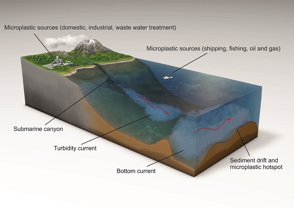
The team collected sediment samples from the seafloor of the Tyrrhenian Sea (part of the Mediterranean Sea) and combined these with calibrated models of deep ocean currents and detailed mapping of the seafloor. In the laboratory, the microplastics were separated from sediment, counted under the microscope, and further analysed using infra-red spectroscopy to determine the plastic types. Using this information the team were able to show how ocean currents controlled the distribution of microplastics on the seafloor.
Dr Mike Clare of the National Oceanography Centre, who was a co-lead on the research, stated: "Our study has shown how detailed studies of seafloor currents can help us to connect microplastic transport pathways in the deep-sea and find the 'missing' microplastics. The results highlight the need for policy interventions to limit the future flow of plastics into natural environments and minimise impacts on ocean ecosystems."
Dr Florian Pohl, Department of Earth Sciences, Durham University, said: "It's unfortunate, but plastic has become a new type of sediment particle, which is distributed across the seafloor together with sand, mud and nutrients. Thus, sediment-transport processes such as seafloor currents will concentrate plastic particles in certain locations on the seafloor, as demonstrated by our research."
Ian A. Kane, Michael A. Clare, Elda Miramontes, Roy Wogelius, James J. Rothwell, Pierre Garreau, Florian Pohl. Seafloor Microplastic Hotspots Controlled by Deep-Sea Circulation. Science, 2020 DOI: 10.1126/science.aba5899
Birding At Home In Pittwater
Thank you to everyone for staying at home as much as possible to stop the spread of the virus and save lives. We know self-isolation can be challenging and stressful at times so what we need right now is nature.
We can be so grateful that no matter where you live, you can still see birds and take comfort from them.
Please visit their new Birding at Home page to find out how you and your household can continue to enjoy the beauty of our feathered friends.
You'll find activities to occupy kids while our movements are restricted, links to our Autumn Birds in Backyards survey and Bird Finder, and information on how you can act to protect birds forever.
To help everyone who is now Birding at Home, they are also kicking off a regular live series on Facebook where our bird experts will be taking questions and talking about what we love best - birds.
Even if you are an expert birder, we encourage you to join in for a chat – and please spread the word to all the bird and nature lovers in your life.
P.S. They'll be having new bird experts every week to talk about a new topic, including Amanda Lilleyman in the NT on shorebirds and Holly Parsons to talk about bird friendly gardens. Make sure you have liked them on Facebook to get notifications and join in the talks.
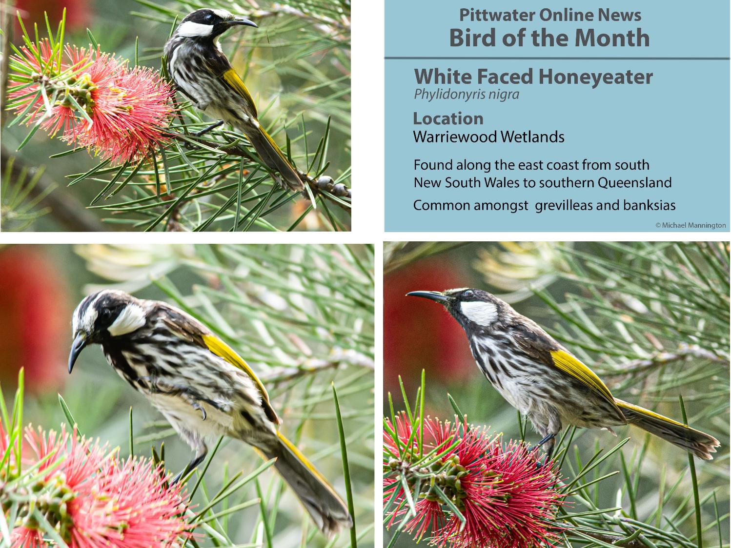
YM Efficiency Cleanup Completed

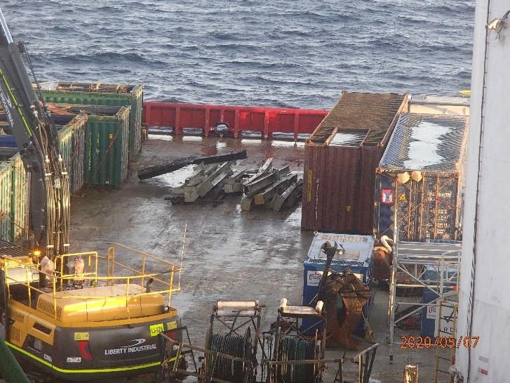
Fox At Bilgola Taking Chickens


National Seniors Says Self-Funded Retirees ‘Dumped’ During COVID-19
More Berries, Apples And Tea May Have Protective Benefits Against Alzheimer's
- Low intake of flavonols (apples, pears and tea) was associated with twice the risk of developing ADRD.
- Low intake of anthocyanins (blueberries, strawberries, and red wine) was associated with a four-fold risk of developing ADRD.
- Low intake of flavonoid polymers (apples, pears, and tea) was associated with twice the risk of developing ADRD.
The Commission’s Regulatory Actions In Response To Newmarch House Outbreak
UQ Purple Provides Wild Yeast For A True Queensland Brew
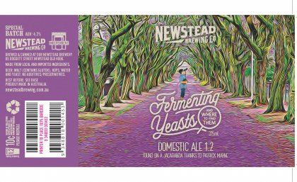 Researchers are raising a glass to a Queensland first: beer brewed using wild fermented yeast, hand-picked from a jacaranda tree at The University of Queensland.
World-Class Western Sydney Hospital Building Finished Early

- two new emergency departments — one for adults and one for children
- digital operating theatres
- expanded imaging, pharmacy and logistics
- more than 300 patient rooms (a high proportion of single rooms with dedicated carer zones)
- more spaces with natural light
- landscaped entry plaza and forecourt
- education, training and research facilities on every floor
- 1.5 floors for the University of Sydney to enable greater integration of education, research and health services delivery.
COVID-19: Potentially Lifesaving Immunoglobulin Treatment For Seriously Ill Australians
New Medicine Listings On The PBS For Cardiovascular Disease, Rheumatoid Arthritis And Asthma
- Patients with non-familial hypercholesterolemia (abnormally high cholesterol) who have atherosclerotic cardiovascular disease and meet certain conditions will now have access to Repatha.
- The listing of Repatha will also be extended to include more patients with familial hypercholesterolaemia (genetic high cholesterol).
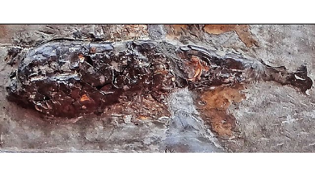
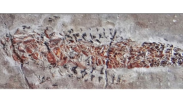
Fossil Reveals Evidence Of 200-Million-Year-Old 'Squid' Attack
Curious Kids: Why Is The Earth Round?
Why is the Earth round? – Zoe, age 3, Sydney.



Curious Kids: Why is our dog so cute?

Why is our dog Martha so cute? – Sam, aged nine, UK
Dogs are one of the most popular pets in the world – and many owners regard them as an important member of the family unit. Just looking at our dogs can put a smile on our faces. But why is this?
Well, in a nutshell, dogs look cute. With their large, round heads, big eyes that face forwards, soft fur and floppy ears, dogs simply look very appealing to us. They also behave in an endearing manner, with their clumsy movements, nuzzling noses and wagging tails.

In many respects, a lot of these characteristics (with the exception of the wagging tails) are very similar to those of a baby – something else that triggers us to feel a bit mushy inside. In fact, some research has even shown that if we look at a picture of a baby and a picture of a puppy, our brains respond in the same way, flooding our body with feelgood chemicals.
Happy Chemicals
These chemicals, in turn, help to put us into a good mood and make us feel protective, loving and – importantly – happy. This could explain why so many people search for dog images on social media – it gives them their daily dose of cuteness therapy.
Not only is it normal to find our “fur babies” engaging, it’s also very important that we perceive them that way. If we find something cute, we are much more likely to look after it. Cute things are usually regarded as vulnerable and needy – again, just like babies.
This is important from a survival perspective. And it seems that the younger a dog is, the more likely it is that we will find it attractive.

Curious Kids is a series by The Conversation that gives children the chance to have their questions about the world answered by experts. If you have a question you’d like an expert to answer, send it to curiouskids@theconversation.com. We won’t be able to answer every question, but we’ll do our very best.
One particularly neat study demonstrated this by showing a group of people pictures of dogs at different ages and asking them how cute they considered them. Interestingly, the puppies were found to be at their most appealing between eight and ten weeks of age – just when their mums would typically be weaning them and encouraging greater independence. This finding hints at puppies being at their cutest when they are at their most vulnerable.
Our Own Dogs Are The Cutest
While dogs in general are considered to be cute, it seems that we are pre-programmed to find our own dogs especially appealing because, very quickly, they become an important part of the family. We give them names, celebrate their birthdays and share their photos like proud parents.

The strong bond of attachment that develops between owners and their dogs is not surprising when you consider what goes on chemically when you interact with your pet pooch. A number of studies have shown that looking at, and in particular stroking, our dogs, triggers our brain to release something called oxytocin (sometimes known as the “love” hormone) into the bloodstream.
This so-called “cuddle chemical” helps us feel calmer and allows us to develop a strong bond of affection with our pet. This explains why we find our own dogs so much cuter than those that don’t belong to us.
Although dogs have looked cute for a very long time, they are deliberately being bred by humans to look more and more enchanting. Today’s popular breeds, such as the cockapoo, cavachon and Pomeranian, with their teddy bear appearance, are a far cry from their ancestor, the wolf.
It’s hard to say just how dogs will look in the future, but one thing is for sure: they will all have the cute factor.
When sending in questions to Curious Kids, make sure you include the asker’s first name, age and town or city. You can:![]()
- email curiouskids@theconversation.com
- tweet us @ConversationUK with #curiouskids
- DM us on Instagram @theconversationdotcom
Deborah Wells, Reader, School of Psychology, Queen's University Belfast
This article is republished from The Conversation under a Creative Commons license. Read the original article.
NSW WWII Veterans Share Memories Of VE Day
May 8, 2020
Incredible firsthand video accounts from veterans who served in the Second World War have recalled the moment victory in Europe was declared 75 years ago.
Acting Minister for Veterans Geoff Lee said the remarkable stories take us back in time to commemorate VE Day, an important event in Australia’s war time history.
“We are privileged to have these recordings of our veterans’ eyewitness accounts of VE Day so their stories can be told again and again to future generations,” said Mr Lee.
“Our soldiers escaped dangerous situations, risking their lives to support the Allied Forces’ fight against German occupation in Europe.”
95 year old Max Barry was a Royal Australian Air Force rear gunner and tells his story of great escapes and survival, after parachuting from a Lancaster bomber in 1944.
“We caught on fire and one engine after another packed up. The pilot said we had to bail out… so we did,” said Mr Barry.
Mr Barry spent 11 months as a prisoner of war before VE Day led to his freedom but he always had a deep sense he would make it back home.
“I was always confident I was going to survive. I’m still doing it!”
100 year old Bill Geoghegan who served with the Royal Australian Air Force and Bomber Command said he is lucky to have survived.
“One night there were two crews and they tossed up to see who would go on the operation. The other crew went and they never came back. It wasn’t my time,” said Mr Geoghegan.
Mr Lee encourages everyone to read the veterans’ incredible accounts on the new NSW Stories section of the War Memorial Register website, which has been launched especially for the 75th anniversary of VE Day.
Nearly one million Australians served in the Second World War with 39,000 Australians losing their lives and another 30,000 taken prisoner.
For more information, and to read transcripts, visit: www.warmemorialsregister.nsw.gov.au/nsw-stories - you can also watch the interviews in the video below.
Young Writers' Competition 2020
Splash through puddles, hear a suspicious splash or have your face splashed across the news... How will you make a splash?
The Northern Beaches Young Writers' Competition 2020 is now open!
Write an original story using this year's theme word 'splash' for a chance to be published as an author in a library eBook.
The competition is open to students up to and including year 12 who live or go to school on the Northern Beaches and are members of the Northern Beaches library service.
How to enter:
Complete the online entry form and attach your story as a Word document. If your story is hand-written, then a clear, readable photo or scanned PDF can be submitted. All entries must be submitted by 8pm, Wednesday 10 June.
Not a member of the library? Don't worry, we will use this form to create a membership for you. Just mark 'no' under the library member field in the online form. If you are a member and unsure of your library card number, just mark 'yes' in the library member field in the online form and we will find your library membership number.
About the competition:
Entries will be judged according to characterisation, originality, plot and use of language and will be arranged into six different age group categories.
Winners from each category will have their stories published in an eBook that will be added to our collection.
For more information, please email our Library Programs team or call 9976 1739.
Want some inspiration? Check out the 2019 Young Writers' Competition winning entries in the eBook Wild.
.JPG.opt958x751o0,0s958x751.jpg?timestamp=1588283649436)
Going Fishing This Weekend?
Capture Of A Large Sunfish.

Sounds Of Silent Space Come To Life In New Soundtrack
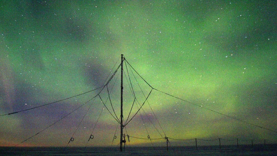
X-Ray Analysis Sheds Light On Construction And Conservation Of Artefacts From Henry VIII's Warship


Curious Kids: why do we have a QWERTY keyboard instead of putting the letters in alphabetical order?

Curious Kids is a series for children. If you have a question you’d like an expert to answer, send it to curiouskids@theconversation.edu.au You might also like the podcast Imagine This, a co-production between ABC KIDS listen and The Conversation, based on Curious Kids.
Why are the letters on the keyboard not in alphabetical order?? – Baker, age 9, Arrowtown, New Zealand.
Great question! That question really puzzled me when I was a kid. And so as a grown-up, I decided to research it and write a paper about it.
Let’s turn the clock back. About 150 years ago, all letters and business papers were written by hand. Most likely they were written using a pen that had to be dipped in ink every word or two. Writing was slow and messy.
Then some clever inventors built a machine for typing. The first typewriters were big heavy metal machines that worked a bit like a piano.
Have you ever seen the inside of a real piano? You press a key and some clever levers make a felt hammer hit just the right piano string to make a note.
Read more: Curious Kids: How long would garden snails live if they were not eaten by another animal?
Early typewriters were similar. They had all these levers with a metal alphabet letter at the end of it. You had to press a letter key quite hard to make the metal lever fly across and hit the paper. Hit the A key and the A lever would hit the paper and type A. The paper then shifted a bit to the left, so the next key would hit in just the right place next to the A. Press more keys and you could type a word, or even a whole book.
The first machine had the letter keys in alphabetical order. The trouble was that if you hit two keys quickly the levers would jam. Jams were most likely when the two keys were close together on the keyboard. Rearranging the letters could reduce jams.
Christopher Sholes was an American inventor who was most successful in reducing jams. He tried various arrangements, always trying to reduce the need to type two keys that were close together. The best arrangement he could find was similar to the QWERTY keyboard we all use today. (Look at the top row of a keyboard to see why it’s called QWERTY.)
He sold his invention to the Remington Company in the United States. In the 1870s, that company built and sold the first commercially successful typewriters. They used the QWERTY keyboard.
For 100 years or so after the Remington typewriter arrived, vast numbers of people all over the world trained to become touch typists (meaning they could type even without looking much at the keyboard). They were employed to type letters and all other kinds of things for business and government. Because so many people became so skilled at using QWERTY, it became very difficult to get everyone to change to any other key arrangement.
Many other key arrangements have been tried. Some are claimed to be easier to learn or faster to use than QWERTY. But none has proved good enough to beat QWERTY. It seems that we are stuck with this layout, even if jams are no longer a problem.
QWERTY was developed for the English language. Some other languages use variations. For example, AZERTY is commonly used for French, QWERTZ for German, and QZERTY for Italian. Perhaps you can find someone from India, Thailand, Japan, Korea, or China. Ask them to show you the keyboard they use in their language.

You’ll Never Regret Being Able To Touch Type
Now, on any keyboard, feel the F and J keys carefully and find some tiny bumps. Place your first fingers on those keys, and your other fingers along the same row. Your left fingers should be on ASDF and your right on JKL;. These are called the “home keys”.
Keep your fingers resting lightly on the home keys. Type other letters by moving just one finger up or down and perhaps a little sideways. Learn how to do that quickly, without watching your fingers, and you can touch type!
When I was a teenager, I owned a typewriter. I made a cardboard shield to stop me seeing my fingers as I typed. I used clothes pegs to fix it to the typewriter. Then I found a touch-typing book and started to practise, making sure that I kept my fingers on the home keys and always used the correct finger to type each letter. After lots of practice, I could touch type. I love being able to touch type. It has helped me all my life, first as a student, then in everything I have done since.
Now with computers it’s easier than ever to learn to touch type, even if QWERTY at first seems strange. There’s lots of good software to help (your school may have some), some of it feeling like a game.
Find software that you like, and put in some practice. It may seem hard at first, but persist and you will soon get good at it. Find a friend or two and do it together. Perhaps make it a competition. You’ll never regret being able to touch type.
Read more: Curious Kids: why do eggs have a yolk?
Hello, curious kids! Have you got a question you’d like an expert to answer? Ask an adult to send your question to curiouskids@theconversation.edu.au

Please tell us your name, age and which city you live in. We won’t be able to answer every question but we will do our best.![]()
Geoff Cumming, Emeritus Professor, La Trobe University
This article is republished from The Conversation under a Creative Commons license. Read the original article.
Botany and the colonisation of Australia in 1770
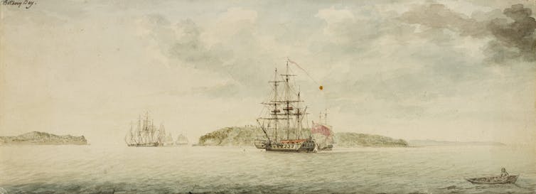
Captain James Cook arrived in the Pacific 250 years ago, triggering British colonisation of the region. We’re asking researchers to reflect on what happened and how it shapes us today. You can see other stories in the series here and an interactive here.
James Cook and his companions aboard the Endeavour landed at a harbour on Australia’s southeast coast in April of 1770. Cook named the place Botany Bay for “the great quantity of plants Mr. Banks and Dr. Solander found in this place”.
Joseph Banks and Daniel Solander were aboard the Endeavour as gentleman botanists, collecting specimens and applying names in Latin to plants Europeans had not previously seen. The place name hints at the importance of plants to Britain’s Empire, and to botany’s pivotal place in Europe’s Enlightenment and Australia’s early colonisation.
‘Nothing Like People’

Cook has always loomed large in Australia’s colonial history. White Australians have long commemorated and celebrated him as the symbolic link to the “civilisation” of Enlightenment and Empire. The two botanists have been less well remembered, yet Banks in particular was an influential figure in Australia’s early colonisation.
When Banks and his friend Solander went ashore on April 29, 1770 to collect plants for naming and classification, the Englishman recollected they saw “nothing like people”. Banks knew that the land on which he and Solander sought plants was inhabited (and in fact, as we now know, had been so for at least 65,000 years). Yet the two botanists were engaged in an activity that implied the land was blank and unknown.
They were both botanical adventurers. Solander was among the first and most favoured of the students of Carl Linnaeus, the Swedish botanist and colonial traveller who devised the method still used today for naming species. Both Solander and Banks were advocates for the Linnaean method of taxonomy: a systematic classification of newly named plants and animals.
When they stepped ashore at “Botany Bay” in 1770, the pair saw themselves as pioneers in a double sense: as Linnaean botanists in a new land, its places and plants unnamed by any other; as if they were in a veritable terra nullius.

Botany In ‘Nobody’s Land’
Terra nullius, meaning “nobody’s land”, refers to a legal doctrine derived from European traditions stretching back to the ancient Romans. The idea was that land could be declared “empty” and “unowned” if there were no signs of occupation such as cultivation of the soil, towns, cities, or sacred temples.
As a legal doctrine it was not applied in Australia until the late 1880s, and there is dispute about its effects in law until its final elimination by the High Court in Mabo v Queensland (No. II) in 1992.
Read more: Terra nullius interruptus: Captain James Cook and absent presence in First Nations art
Cook never used this formulation, nor did Banks or Solander. Yet each in their way acted as if it were true. That the land, its plants, and animals, and even its peoples, were theirs to name and classify according to their own standards of “scientific” knowledge.
In the late eighteenth century, no form of scientific knowledge was more useful to empire than botany. It was the science par excellence of colonisation and empire. Botany promised a way to transform the “waste” of nature into economic productivity on a global scale.
Plant Power
Wealth and power in Britain’s eighteenth century empire came from harnessing economically useful crops: tobacco, sugar, tea, coffee, rice, potatoes, flax. Hence Banks and Solander’s avid botanical activity was not merely a manifestation of Enlightenment “science”. It was an integral feature of Britain’s colonial and imperial ambitions.

Throughout the Endeavour’s voyage, Banks, Solander, and their assistants collected more than 30,000 plant specimens, naming more than 1,400 species.
By doing so, they were claiming new ground for European knowledge, just as Cook meticulously charted the coastlines of territories he claimed for His Majesty, King George III. Together they extended a new dispensation, inscribed in new names for places and for plants written over the ones that were already there.
Long after the Endeavour returned to Britain, Banks testified before two House of Commons committees in 1779 and 1785 that “Botany Bay” would be an “advantageous” site for a new penal colony. Among his reasons for this conclusion were not only its botanical qualities – fertile soils, abundant trees and grasses – but its virtual emptiness.
Turning Emptiness To Empire
When Banks described in his own Endeavour journal the land Cook had named “New South Wales”, he recalled: “This immense tract of Land … is thinly inhabited even to admiration …”. It was the science of botany that connected emptiness and empire to the Enlightened pursuit of knowledge.
One of Banks’s correspondents was the Scottish botanist and professor of natural history, John Walker. Botany, Walker wrote, was one of the “few Sciences” that “can promise any discovery or improvement”. Botany was the scientific means to master the global emporium of commodities on which empire grew.
Botany was also the reason why it had not been necessary for Banks or Solander to affirm the land on which they trod was empty. For in a very real sense, their science presupposed it. The land, its plants and its people were theirs to name and thereby claim by “discovery”.
When Walker reflected on his own botanical expeditions in the Scottish Highlands, he described them as akin to voyages of discovery to lands as “inanimate & unfrequented as any in the Terra australis”.
As we reflect on the 250-year commemoration of Cook’s landing in Australia, we ought also to consider his companions Banks and Solander, and their science of turning supposed emptiness to empire.![]()
Bruce Buchan, Associate Professor, Griffith University
This article is republished from The Conversation under a Creative Commons license. Read the original article.
Armchair Antarctica 2: Journey To Law Dome
Published by the Australian Antarctic division May 6, 2020
At the coldest time of year in 2019, expeditioners travel to one of the snowiest places in Antarctica to defrost a remote weather station.
Tales Of The City – Starring Buff-Banded Rails
May 5, 2020: By BIBY TV
These Buff-banded Rails (Gallirallus philippenis) are also found in Pittwater, with a pair and baby seen in Careel Creek in 2012 and another pair and baby seen towards the Careel Bay end of Careel Creek in late 2019. They can be very shy and as they are a low to the ground creek and shorebird, they need to be steered clear of so they don't become stressed.
These (in this video) were filmed on numerous occasions between mid January and mid March 2020 at Tumbalong Park in the Darling Harbour precinct of Sydney’s CBD. Tumbalong Park is a five hectare site largely designed to provide both green space and recreation opportunities (e.g. children’s play areas). Much of the landscaping consists of Australian native plants, but we have noted some exotics in the mix (e.g. philodendrons), especially where the rails appear to be living and thriving. (Photo 2 shows the exact location in the foreground.) BIBY TV strongly promotes the use of native plants, but this video shows how some exotics can contribute to habitat. Hence, we all should observe how animals use our gardens before making changes and ensure replacement plants have similar benefits. Buff-banded Rails undoubtedly appreciate this dense tussocky vegetation as their typical behaviour is to skulk about and forage under cover near water.
Buff-banded Rails are not uncommon birds, but their behaviour can make them elusive. Unlike some members of the Rallidae family, such as communal Eurasian Coots and raucous Australasian Swamphens, this rather quiet and often solitary species can easily slip under the radar even in the most likely habitats. For instance, just the odd individual is usually noted (on ebird.org) over a couple of months in bigger, more clearly suitable parklands within Sydney (e.g. Centennial Park, Sydney Olympic Park, Royal Botanic Gardens and Eastlakes Golf Course). So you can imagine how thrilled we were when the city worker in the BIBY TV team saw Buff-banded Rails for the first time at Tumbalong Park during a lunch break in early January. Until then, he was simply grateful for the “usual suspects”, that is birds who are generally comfortable in urban areas (e.g. Silver Gull, Australian White Ibis, Noisy Miner, Welcome Swallow, Australian Raven, Australian Magpie, Rainbow Lorikeet and the feral Rock Dove). Inspired by the rails’ beauty and endearing ways, he decided to film them with an iPhone 7 as the usual camera gear and tripod would be awkward in that situation. The only new equipment bought for this adventure was a selfie stick. A much better use for it surely....
The footage across two months isn’t presented in a linear fashion. Instead, you will meet the main star of this video in the opening scenes, which were captured in early March. This adorable bird was affectionately called Limpy after he/she (sexes alike) appeared with a newly injured leg in late January. Before then, this individual was seen (in juvenile plumage) darting about with a likely sibling and two adults (presumably parents). Of course, we were concerned about this injury and perplexed about how it happened. But we have seen several birds with unworkable or missing legs or feet who get about quite well on the good leg and possibly survive for many years. And with each passing day we saw Limpy manage the disability with greater ease while developing the stunning adult plumage. (There are various glimpses of the younger rails in January and their later appearance, as well as adult birds. One example of the duller juvenile form in mid January can be seen around 6.03 on the video.)
Not only did our resilient rail and its family appear to relish the vegetation and shallow water (with little floating platforms), they took advantage of human activity. Although no one was seen directly feeding them, the rails and other birds would feast on dropped scraps (e.g. bread). Obviously this is not ideal for any of the bird species, but thankfully the rails also had a more natural diet of invertebrates and plant matter (e.g. fallen figs). Juveniles can fend for themselves, but sometimes the female parent brings them food. (An example of this can be found at 5.09, with fed youngster out of sight.) Keen birders might notice some intriguing bird calls that you wouldn’t expect in this urban setting (e.g. Fan-tailed Cuckoo). This bird soundscape (see 3.46 for one of the speakers in situ) was actually created by the artist Janet Laurence and represents indigenous birds of the area pre-development (https://www.iccsydney.com.au/Visit-IC...). Note that we have presented Buff-banded Rail calls from this filmed family during the introductory photos. And yes, that gorgeous rail in photo 1 is Limpy (in mid March)! Wings are opened for sunbathing.
New Shorebird Identification Booklet
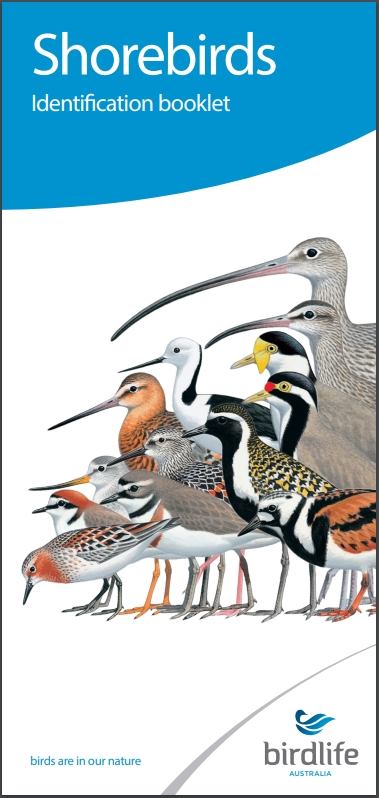 The Migratory Shorebird Program has just released the third edition of its hugely popular Shorebird Identification Booklet. The team has thoroughly revised and updated this pocket-sized companion for all shorebird counters and interested birders, with lots of useful information on our most common shorebirds, key identification features, sighting distribution maps and short articles on some of BirdLife’s shorebird activities.
The booklet can be downloaded here in PDF file format: http://www.birdlife.org.au/documents/Shorebird_ID_Booklet_V3.pdf
Paper copies can be ordered as well, see http://www.birdlife.org.au/projects/shorebirds-2020/counter-resources for details.
Download BirdLife Australia's children’s education kit to help them learn more about our wading birdlife
Shorebirds are a group of wading birds that can be found feeding on swamps, tidal mudflats, estuaries, beaches and open country. For many people, shorebirds are just those brown birds feeding a long way out on the mud but they are actually a remarkably diverse collection of birds including stilts, sandpipers, snipe, curlews, godwits, plovers and oystercatchers. Each species is superbly adapted to suit its preferred habitat. The Red-necked Stint is as small as a sparrow, with relatively short legs and bill that it pecks food from the surface of the mud with, whereas the Eastern Curlew is over two feet long with a exceptionally long legs and a massively curved beak that it thrusts deep down into the mud to pull out crabs, worms and other creatures hidden below the surface.
Some shorebirds are fairly drab in plumage, especially when they are visiting Australia in their non-breeding season, but when they migrate to their Arctic nesting grounds, they develop a vibrant flush of bright colours to attract a mate. We have 37 types of shorebirds that annually migrate to Australia on some of the most lengthy and arduous journeys in the animal kingdom, but there are also 18 shorebirds that call Australia home all year round.
What all our shorebirds have in common—be they large or small, seasoned traveller or homebody, brightly coloured or in muted tones—is that each species needs adequate safe areas where they can successfully feed and breed.
The National Shorebird Monitoring Program is managed and supported by BirdLife Australia.
This project is supported by Glenelg Hopkins Catchment Management Authority and Hunter Local Land Services through funding from the Australian Government’s National Landcare Program. Funding from Helen Macpherson Smith Trust and Port Phillip Bay Fund is acknowledged.
The National Shorebird Monitoring Program is made possible with the help of over 1,600 volunteers working in coastal and inland habitats all over Australia.
The National Shorebird Monitoring program (started as the Shorebirds 2020 project initiated to re-invigorate monitoring around Australia) is raising awareness of how incredible shorebirds are, and actively engaging the community to participate in gathering information needed to conserve shorebirds.
In the short term, the destruction of tidal ecosystems will need to be stopped, and our program is designed to strengthen the case for protecting these important habitats.
In the long term, there will be a need to mitigate against the likely effects of climate change on a species that travels across the entire range of latitudes where impacts are likely.
The identification and protection of critical areas for shorebirds will need to continue in order to guard against the potential threats associated with habitats in close proximity to nearly half the human population.
Here in Australia, the place where these birds grow up and spend most of their lives, continued monitoring is necessary to inform the best management practice to maintain shorebird populations.
BirdLife Australia believe that we can help secure a brighter future for these remarkable birds by educating stakeholders, gathering information on how and why shorebird populations are changing, and working to grow the community of people who care about shorebirds.
To find out more visit: http://www.birdlife.org.au/projects/shorebirds-2020/shorebirds-2020-program
Behind The Scenes At The Kirby Institute's COVID-19 Lab


Lifesaving Ventilators To Be Made Locally

Electrical Activity In Living Organisms Mirrors Electrical Fields In Atmosphere
Disclaimer: These articles are not intended to provide medical advice, diagnosis or treatment. Views expressed here do not necessarily reflect those of Pittwater Online News or its staff.
