Inbox and Environment News: Issue 467
September 20 - 26, 2020: Issue 467
Time of Ngoonungi
The Time of Ngoonungi - Murrai'yunggory — cool, getting warmer (September-October) in the D'harawal calendar of Indigenous Weather Knowledge begins this week. This is the time of the gathering of the flying foxes. A magical time of the year when the flying foxes gather in the darkening skies over D'harawal Lands. They come in from the north-east, the north, the north-west and the west, and swirl over the Sydney area in a wonderful, sky-dancing display just after sunset, before setting off for the night-time feeding grounds to the south.
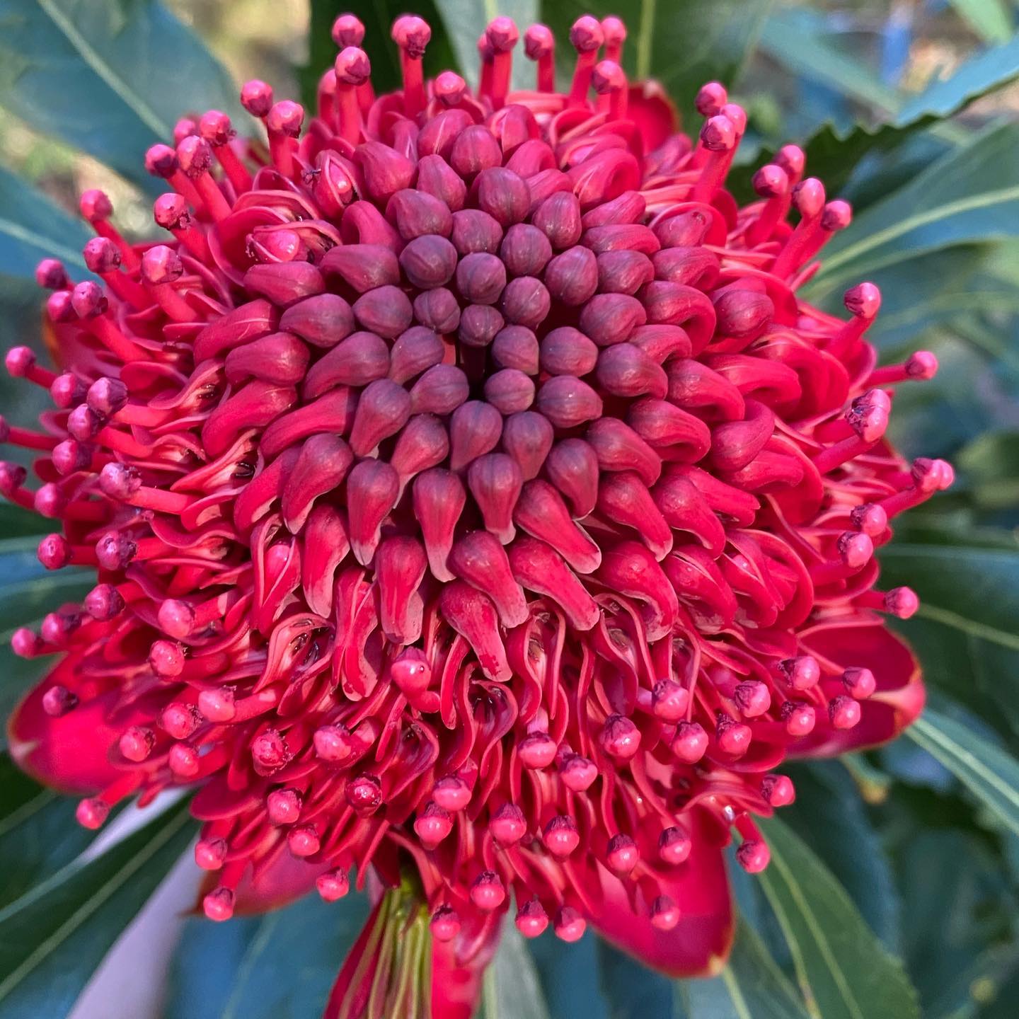
It is also a very important ceremonial time for the D'harawals, which begins with the appearance of the splashes of the bright red Miwa Gawaian (Telopea speciosissima - waratah) in the bushland.
Waratah (Telopea speciosissima) photo by Selena Griffith - Residents do not state where they have seen these glorious flowers as there are people who come to pick them and steal them for profit. Native plants are protected in New South Wales by the Biodiversity Conservation Act 2016 (BC Act). Under the BC Act it is an offence to pick, possess, buy or sell native plants listed in the Act for commercial purposes without a licence.
Visit: A Bunch Of Wildflowers: Historical Spring September Songs
The D'harawal Country and language area extends from the southern shores of Port Jackson (Sydney Harbour) to the northern shores of the Shoalhaven River, and from the eastern shores of the Wollondilly River system to the eastern seaboard.
Nocturnal Pittwater - The 4am-Ers
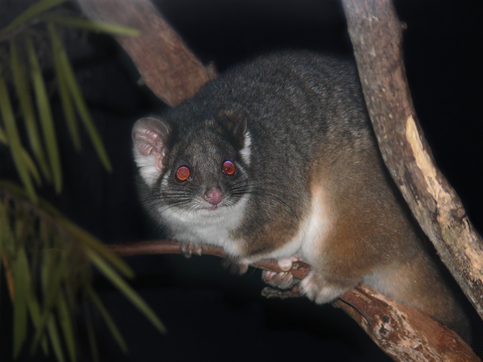
Two ringtails just scampered along the fence between the spotted gums, one after the other, a pair
The calls of frogs from up the hill and in the front yard
A boobok owl in the ecualypt beside the house - one answering from across the valley
The call of a Bush Stone-curlew from the bay
Bandicoots playing on the front lawn, their squeaky chirrups to each other
Alive.
Awake while you sleep.
.jpg?timestamp=1600453767563)
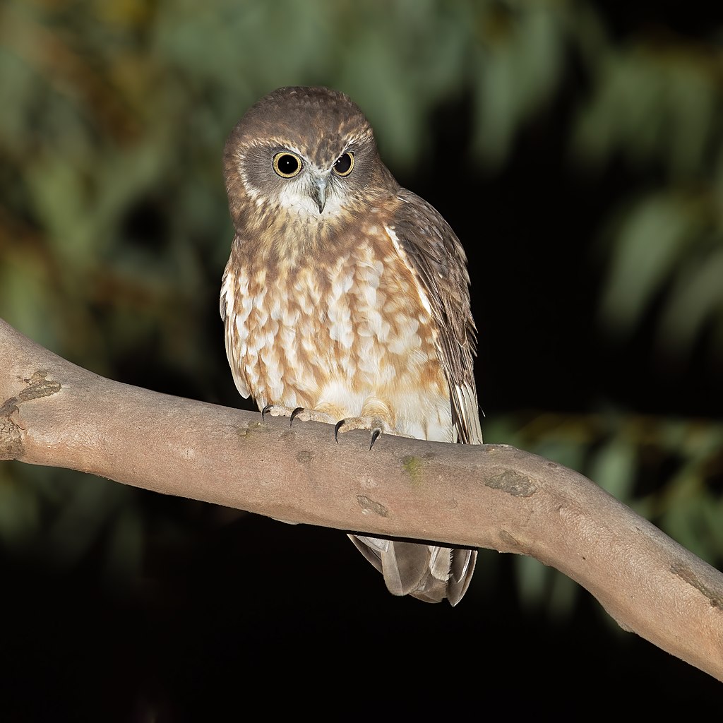
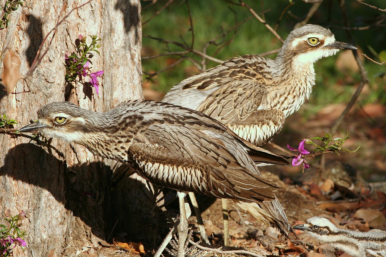
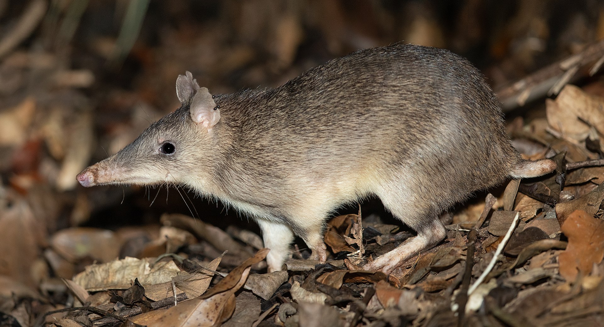
Image credits: Ring tailed possum by Benjamin 444, Perons Tree Frog by A J Guesdon, Boobook by JJ Harrison, Bush Stone-curlew pair by Andrew Fergus, Long-nosed Bandicoot (Perameles nasuta) by JJ Harrison
Pittwater Natural Heritage Association (PNHA) Chiltern Track In Spring
This is a guided wildflowers and bird walk on Sunday September 27th 2020.
This wide track allows social distancing. Interested children very welcome with carers.
PNHA says;
''We'll watch out for a nesting Spotted Pardalote family (example in photo by Rod Warnock) we saw last month. Scarlet Honeyeaters possible (photo Rod Warnock) and Eastern Spinebill (photo Neil Fifer). Bring binoculars.
Some different flowers will be out. ''
Numbers are limited so please book early via email: pnhainfo@gmail.com.
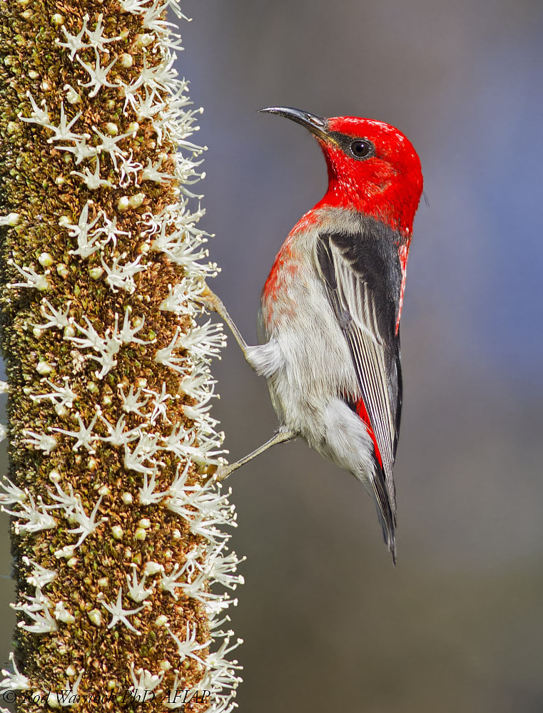
Flowering Grass Trees attract birds and insects to the thousands of tiny flowers on each spike. Male Scarlet Honeyeater here, the female is brown with little colour.
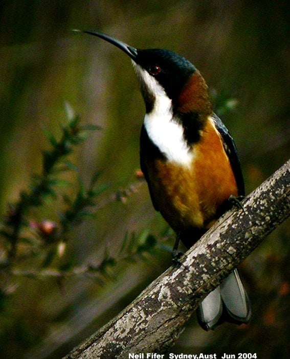
Eastern Spinebill male and female are similar. They feed on nectar and insects.
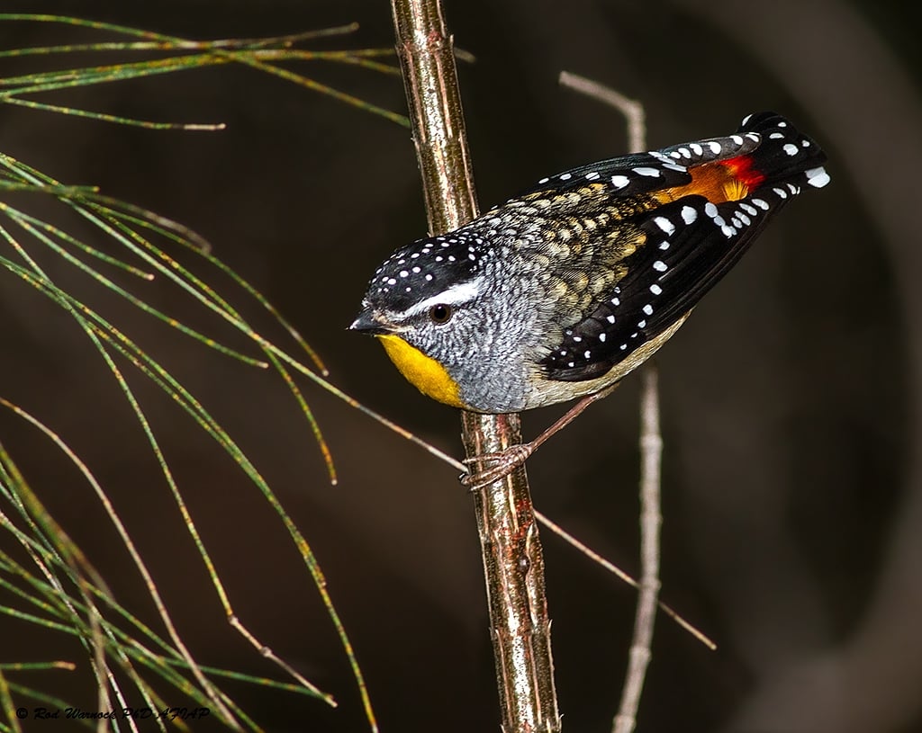
The Spotted Pardalote male (here) is more colourful that the female but she is a beauty too. To breed, they dig tunnels in earth banks, even hanging baskets, and construct a nest at the far end. Otherwise they are birds of the tree tops, feeding on tiny insects on eucalypt foliage, keeping the trees from being overwhelmed by these insects. Vulnerable to cats.
Watch Out On The Pittwater Estuary Water Zones & Beaches: Seals Are About
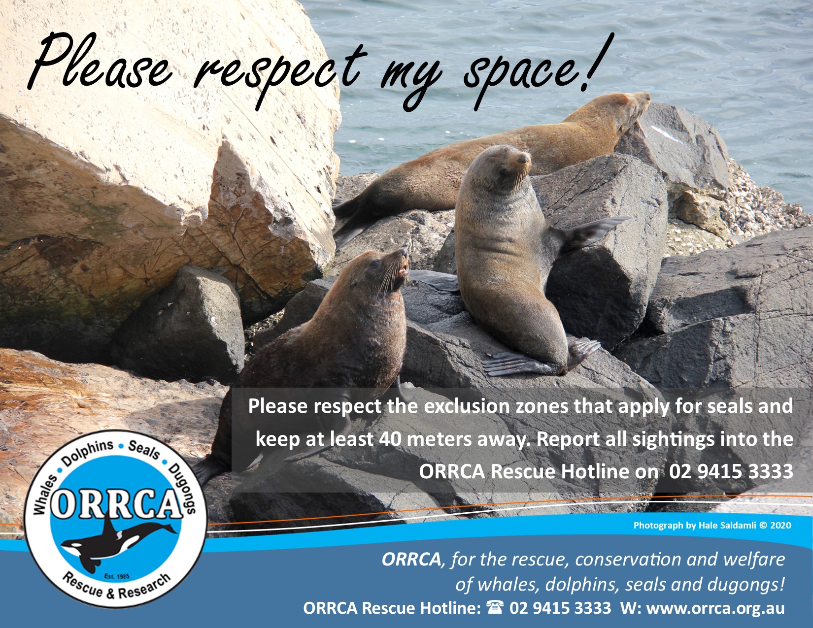
Residents have filmed and photographed the seals living at Barrenjoey as far south as Rowland Reserve and over at Clareville beach in recent days and ask that people keep an eye out for them and ensure they are kept safe from boat strikes and dogs are kept off the beaches they're not supposed to be on.
ORRCA Spring Migration Survey
With a successful northern migration complete, the whales are now slowing heading south from the warm tropical waters on their southern migration.
The ORRCA Research Team are super excited to start a new citizen science program in October with the aim of recording the Humpback mums with new calves as they make their way down our coastline on their journey back to Antarctica.
If you would like to join one of our research teams, simply become an ORRCA member via our website and email the team at orrcacensusday@gmail.com for more information.
No experience is necessary. Just a passion and some patience!
We would also open to additional locations if we have the volunteers to support it!
Council's Crown Reserve Land Categorisation: Seeking Your Input
Submissions Close Sunday October 4th, 2020
Council are proposing land categories for 35 Crown reserves as part of an obligation under the Crown Land Management (CLM) Act 2016. The CLM Act legislates that we are required to manage Crown land in the same manner as Community land, in accordance with the Local Government Act 1993.
This is an initial land categorisation process and only relates to current/existing use. It does not propose any change of use for the subject Crown reserves or indicate desired future use.
How to have your say
Council would like your thoughts on their proposed categorisation of these reserves.
To make commenting easier, they've presented the Proposed Crown Reserve Land Categories here in an interactive PDF document. You can also download the whole document here.
If you prefer, you can share your feedback in the submission form or via email council@northernbeaches.nsw.gov.au.
Feedback is also accepted in writing marked 'Crown reserve land categorisation' PO Box 82, Manly NSW 1655.
A few tips to get you started:
- Do you know of other factors impacting on the categorisation of a particular reserve?
- If you think another category would be more suitable, please let us know why.
- Any proposed variation to land categories must be justified in line with the category objectives.
Following this process, Council can then prepare new or updated Plans of Management (PoM) for the affected reserves. The relevant community engagement requirements and process will be followed at that time.
Background
In NSW, Crown land is administered by the Department of Planning, Industry and Environment in accordance with the Crown Land Management (CLM) Act 2016, which came into effect on 1 July 2018. Following an extensive review of how Crown land is managed, the CLM Act was passed in order to create a more simplified management structure.
The CLM Act requires Crown reserves managed by Council to be managed in line with the Local Government Act (LG) Act 1993 in the same manner as Council Community land. The transition requires the affected Crown reserves to be managed via a plan of management (PoM). The first step is to assign the appropriate land categories.
The transition to managing Crown reserves in accordance with the LG Act is to occur by June 30th 2021.
On June 23rd 2020 Council resolved to undertake community consultation on the proposed land categories. Comments will be reported back to Council with a recommendation, along with a summary of community feedback. The Minister will be notified of Council’s preferred categories and, following confirmation from the Minister, PoMs can be prepared.
Katandra Season 2020
Katandra Bushland Sanctuary on Lane Cove Rd Ingleside is now open every Sunday until October 25, 10am-4pm. Visitors to this lovely bushland have recently seen Powerful and Boobook Owls, Swamp Wallabies and Lyrebirds. Visitors, please make a small donation towards management of this Crown Land reserve. More details: http://www.katandra.org/home.htm
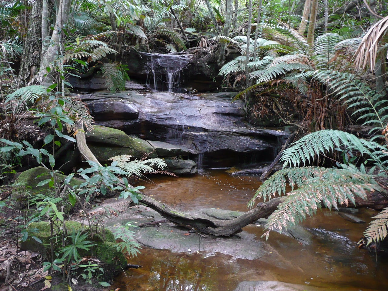
Several creeks flow down the escarpment - photo by Marita Macrae
The Global Biodiversity Outlook 5 (GBO-5)
September 15, 2020
 The Global Biodiversity Outlook 5 (GBO-5), published by the UN Convention on Biological Diversity (CBD), offers an authoritative overview of the state of nature. It is a final report card on progress against the 20 global biodiversity targets agreed in 2010 with a 2020 deadline, and offers lessons learned and best practices for getting on track.
The report calls for a shift away from “business as usual” across a range of human activities. It outlines eight transitions that recognize the value of biodiversity, the need to restore the ecosystems on which all human activity de-pends, and the urgency of reducing the negative impacts of such activity.
It also shows that governments will need to scale up national ambitions in support of the new Global Biodiversity Framework and ensure that all necessary resources are mobilized and the enabling environment strengthened. It emphasizes that countries need to bring biodiversity into the mainstream of decision making and factored into policies across all economic sectors. Download Full Report
Humanity at a crossroads
Global Biodiversity Outlook (GBO) is the flagship publication of the Convention on Biological Diversity (CBD). It is a periodic report that summarizes the latest data on the status and trends of biodiversity and draws conclusions relevant to the further implementation of the Convention.
GBO-5 provides global summary of progress towards the Aichi Biodiversity Targets and is based on a range of indicators, research studies and assessments (in particular the IPBES Global Assessment on Biodiversity and Ecosystem Services), as well as the national reports provided by countries on their implementation of the CBD. The national reports provide rich information about the steps taken in countries worldwide in support of biodiversity conservation, sustainable use, and the fair and equitable sharing of benefits. This body of Information provides a wealth of information on the successes and challenges in implementing the Strategic Plan for Biodiversity 2011-2020 and in reaching the Aichi Biodiversity Targets.
This Outlook draws on the lessons learned during the first two decades of this century to clarify the transitions needed if we are to realize the vision agreed by world governments for 2050, ‘Living in Harmony with Nature’.
Key transitions to sustainable pathways
Each of the conditions necessary to achieve the 2050 Vision for Biodiversity requires a significant shift away from ‘business as usual’ across a broad range of human activities. The shape and nature of such transformative change can already be identified through a series of transitions under way to a limited extent in key areas. This Outlook examines the promise, progress and prospects for interdependent transitions on the following issues, that collectively can move our societies into a more sustainable co-existence with nature:
- Land and Forests
- Freshwater
- Fisheries and Oceans
- Sustainable Agriculture
- Food Systems
- Cities and Infrastructure
- Climate Action
- One Health
– Despite encouraging progress in several areas, the natural world is suffering badly and getting worse. Eight transformative changes are, therefore, urgently needed to ensure human wellbeing and save the planet, the UN warns in a major report.
The report comes as the COVID-19 pandemic challenges people to rethink their relationship with nature, and to consider the profound consequences to their own wellbeing and survival that can result from continued biodiversity loss and the degradation of ecosystems.
The Global Biodiversity Outlook 5 (GBO-5), published by the UN Convention on Biological Diversity (CBD), offers an authoritative overview of the state of nature. It is a final report card on progress against the 20 global biodiversity targets agreed in 2010 with a 2020 deadline, and offers lessons learned and best practices for getting on track.
“This flagship report underlines that ‘humanity stands at a crossroads with regard to the legacy we wish to leave to future generations,’” said CBD Executive Secretary, Elizabeth Maruma Mrema.
“Many good things are happening around the world and these should be celebrated and encouraged. Nevertheless, the rate of biodiversity loss is unprecedented in human history and pressures are intensifying. Earth’s living systems as a whole are being compromised. And the more humanity exploits nature in unsustainable ways and undermines its contributions to people, the more we undermine our own wellbeing, security and prosperity.”
“As nature degrades,” Ms. Mrema continued, “new opportunities emerge for the spread to humans and animals of devastating diseases like this year’s coronavirus. The window of time available is short, but the pandemic has also demonstrated that transformative changes are possible when they must be made.”
“The decisions and level of action we take now will have profound consequences -- for good or ill -- for all species, including ours.”
With respect to the Aichi Biodiversity Targets, set in 2010, the analysis based on the 6th set of national reports to the CBD and the latest scientific findings shows that seven of 60 “elements” — success criteria — within the 20 targets have been achieved and 38 show progress. In the case of 13 elements, no progress was made, or a move away from the target was indicated, and for two elements the level of progress is unknown.
The report calls for a shift away from “business as usual” across a range of human activities. It outlines eight transitions that recognize the value of biodiversity, the need to restore the ecosystems on which all human activity depends, and the urgency of reducing the negative impacts of such activity:
- The land and forests transition: conserving intact ecosystems, restoring ecosystems, combatting and reversing degradation, and employing landscape level spatial planning to avoid, reduce and mitigate land-use change.
- The sustainable agriculture transition: redesigning agricultural systems through agroecological and other innovative approaches to enhance productivity while minimizing negative impacts on biodiversity.
- The sustainable food systems transition: enabling sustainable and healthy diets with a greater emphasis on a diversity of foods, mostly plant-based, and more moderate consumption of meat and fish, as well as dramatic cuts in the waste involved in food supply and consumption.
- The sustainable fisheries and oceans transition: protecting and restoring marine and coastal ecosystems, rebuilding fisheries and managing aquaculture and other uses of the oceans to ensure sustainability, and to enhance food security and livelihoods.
- The cities and infrastructure transition: deploying “green infrastructure” and making space for nature within built landscapes to improve the health and quality of life for citizens and to reduce the environmental footprint of cities and infrastructure.
- The sustainable freshwater transition: an integrated approach guaranteeing the water flows required by nature and people, improving water quality, protecting critical habitats, controlling invasive species and safeguarding connectivity to allow the recovery of freshwater systems from mountains to coasts.
- The sustainable climate action transition: employing nature-based solutions, alongside a rapid phase-out of fossil fuel use, to reduce the scale and impacts of climate change, while providing positive benefits for biodiversity and other sustainable development goals.
- The biodiversity-inclusive One Health transition: managing ecosystems, including agricultural and urban ecosystems, as well as the use of wildlife, through an integrated approach, to promote healthy ecosystems and healthy people.
GBO-5 underlines the urgent need to act to slow and end further loss, and highlights examples of proven measures available to help achieve the world’s agreed vision: “Living in harmony with nature” by 2050.
WWF's Living Planet Report, released on September 10th (See PBP's this Issue; ''Curbing land clearing for food production is vital to reverse biodiversity declines'' - CSIRO), documenting the precipitous fall in monitored populations of mammals, birds, amphibians, reptiles and fish between 1970 and 2016, further underlines the urgency to act.
GBO-5 reports financing for biodiversity (public, private, domestic and international), was up in some countries, roughly constant in others for the past decade, and resources available for biodiversity through international flows and official development assistance roughly doubled. In all, an estimated annual $78-91 billion is available, but “estimates of biodiversity finance needs are conservatively estimated in the hundreds of billions of dollars.”
“Moreover, these resources are swamped by support for activities harmful to biodiversity,” the report says. “These include $500 billion in fossil fuel and other subsidies that potentially cause environmental harm, $100 billion of which relate to agriculture.”
GBO-5 highlights that action on biodiversity is essential to address climate change, long- term food security and health. The time for action on all these issues is now - the global community must seize the opportunity to build back better from the COVID-19 pandemic in order to reduce the risk of future pandemics.
GBO-5 also underlines the importance of biodiversity for achieving the high-level, agreed Sustainable Development Goals established in 2015, and the 2016 Paris Agreement and, at the UN’s Nature Summit on 30 September, GBO-5’s findings will be taken up by heads of State and Government.
GBO-5 will also have an important impact on CBD’s ongoing process to create a set of new global biodiversity targets for 2021-2030, as part of a post-2020 framework for the Convention.
That framework, now under negotiation, will be considered at CBD’s 15th meeting of the Conference of Parties (COP-15), Kunming, China - postponed as a result of the coronavirus pandemic from October 2020 to 2021.
WWF's Living Planet Report - Key Findings From 2020 Include:
- Global wildlife populations fell by 68%, on average, between 1970 and 2016, while some Australian populations plummeted by up to 97%.
- Causes of biodiversity loss – deforestation, unsustainable agriculture, and the illegal wildlife trade – are also contributing to the emergence of zoonotic diseases such as COVID-19.
- Humanity’s influence on the decline of nature is so great that scientists believe we are entering a new geological epoch, the Anthropocene.
- Australia’s Bramble Cay melomys features as the first known mammal extinction to be linked directly to climate change.
- The report outlines how, with the right conservation effort, commitment, investment and expertise, species can be brought back from the brink. An example outlined in the report explains how following the creation of a marine protected area, the relative abundance of the grey reef shark increased by more than 360% between 2004 and 2016 on Ashmore Reef in Western Australia.
- The report includes the latest findings measured by the Living Planet Index tracking 21,000 populations of mammals, birds, amphibians, reptiles and fish since 1970. This includes more than 1100 populations in Australia, with almost all showing continual declines.
Download WWF's Living Planet Report 2020
Environment Minister Sussan Ley faces a critical test: will she let a mine destroy koala breeding grounds?
Lachlan G. Howell, University of Newcastle and Ryan R. Witt, University of NewcastleIn the next few weeks, federal Environment Minister Sussan Ley will decide whether to approve a New South Wales quarry expansion that will destroy critical koala breeding grounds.
The case, involving the Brandy Hill Quarry at Port Stephens, is emblematic of how NSW environment laws are failing wildlife — particularly koalas. Efforts to erode koala protections hit the headlines last week when NSW Nationals leader John Barilaro threatened to detonate the Coalition over the issue.
Read more: The NSW koala wars showed one thing: the Nationals appear ill-equipped to help rural Australia
Koala populations are already under huge pressure. A NSW parliamentary inquiry in June warned the koala faces extinction in the state by 2050 if the government doesn’t better control land clearing and habitat loss.
Ley could either continue these alarming trends, or set a welcome precedent for koala protection. Her decision is also the first big test of federal environment laws since an interim review found they were failing wildlife. So let’s take a closer look at what’s at stake in this latest controversy.
The Brandy Hill Quarry Expansion
The NSW government gave approval to Hanson Construction Materials, a subsidiary of Heidelberg Cement, to expand the existing Brandy Hill Quarry in Seaham in Port Stephens.
The project would provide concrete to meet Sydney’s growing construction demands, as the state fast-tracks infrastructure projects to help the economy recover from COVID-19.
The approval came despite the known presence of koalas in the area. A koala survey report, completed on behalf of the developer in 2019, determined the project would “result in a significant impact to the koala”.
The report recommended the quarry expansion be referred to the federal Environment Minister under the Environment Protection and Biodiversity Conservation (EPBC) Act 1999, for its potential impacts on “Matters of National Environmental Significance”.
Read more: View from The Hill: Barilaro keeps Nationals in the tent; koalas stay in limbo
The expansion site intersects habitat with preferred high quality koala feed and shelter trees. This habitat is established forest containing various key mature Eucalyptus trees, including the forest red gum and swamp mahogany.
The survey report didn’t propose any mitigation strategies to sustain the habitat. Instead, it suggested minimisation measures, such as ecologists to be present during habitat clearing, low speed limits for vehicles on site, and education on koalas for workers.
A Disaster For Koalas
In support of a community grassroots campaign (Save Port Stephens Koalas), we produced an report on the effect of the quarry expansion on koalas. The report now sits with Ley ahead of her decision, which is due by October 13.
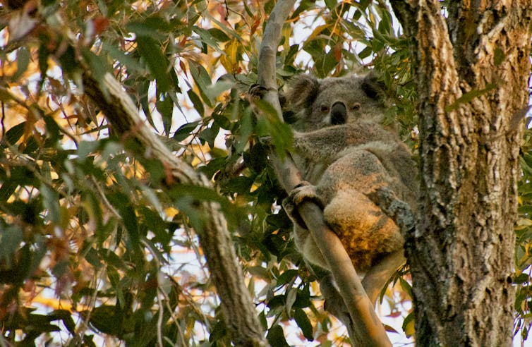
The expansion will clear more than 50 hectares of koala habitat. We found koalas breeding within 1 kilometre of the current quarry boundary, which indicates the expansion site is likely to destroy critical koala breeding habitat.
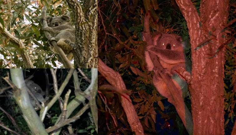
During the breeding season, male koalas bellow to attract females. Within 1km of the boundary we observed a female koala and a bellowing male koala 96m apart. A second male was reported bellowing 227m from the quarry boundary.
What’s more, the site expansion occurs within a NSW government listed Area of Regional Koala Significance. The expansion site actually has higher average koala habitat suitability than all remaining habitat on the quarry property.
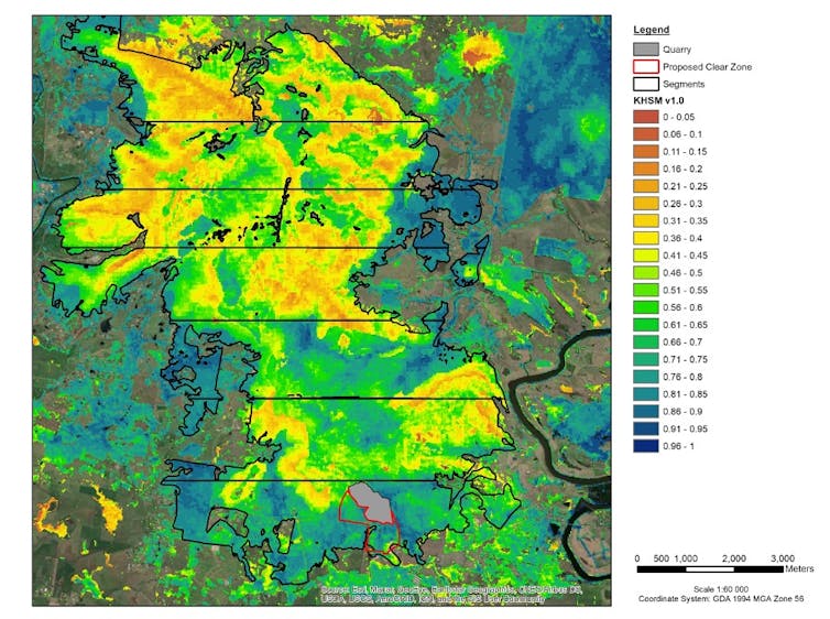
CSIRO research from 2016 suggests koalas in Port Stephens can move hundreds of metres in a day and up to 5km in one month. Movement is highest during the breeding season. This potential for koalas to move away was a key reason the NSW government approved the expansion.
Koalas can move in to the remaining property to breed, or they can move away from it. But habitat outside the expansion site is, on average, lesser quality, and this is where the expansion would force the koalas to move to.
Read more: Stopping koala extinction is agonisingly simple. But here's why I'm not optimistic
This habitat fragmentation would not only result in lost access to potential breeding grounds, but also further restrict movement and expose koalas to threats such as predation or road traffic.
Lastly, the expansion would sever a crucial East–West corridor koalas likely use to move across the landscape and breed.
Approved Under The State’s Weak Environmental Protections
It may seem surprising this destructive project was approved by the NSW government. But it’s a common story under the state’s protections.
Alarm over the weaknesses of NSW environmental protections has been raised by NSW government agencies including the Natural Resources Commission and NSW Audit Office.
The expansion approval is an example of how the NSW government relaxed the regulatory requirements for land clearing between 2016 and 2017. This led to a 13-fold increase in land clearing approvals, and tipped the balance away from sustainable development.
The expansion shines another spotlight on NSW’s poor biodiversity offset laws.
Biodiversity offsets involve compensating for environmental damage in one location by improving the environment elsewhere. Under the expansions approval, the developer was required to protect an estimated 450 hectares of habitat as offset.
But the recent parliamentary inquiry into NSW koalas recommended offsetting of prime koala habitat — such as that involved in the quarry expansion — be prohibited, which would mean not destroying the habitat in the first place.
The NSW decision also does not account for the Black Summer Bushfires which claimed 5,000 koalas and burned millions of hectares of koala habitat. The Port Stephens population was unburned but more than 75% of its habitat has been lost since colonial occupation. Securing this population is important for the overall security of koalas in the state.
The Koalas Are In Sussan Ley’s Hands
Sussan Ley will now assess the expansion under the EPBC Act. A recent interim report into the laws said they’d allowed an “unsustainable state of decline” of Australia’s environment.
Rejections under these laws are rare; just 22 of 6,500 projects referred for approval under the act have been refused. However, it’s not impossible.
Earlier this year Ley rejected a wind-farm in Queensland which threatened unburned koala habitat. If Ley gives full consideration to the evidence in our report, she should make the same decision.
Read more: Be worried when fossil fuel lobbyists support current environmental laws ![]()
Lachlan G. Howell, PhD Candidate | School of Environmental and Life Sciences, University of Newcastle and Ryan R. Witt, Conjoint Lecturer | School of Environmental and Life Sciences, University of Newcastle
This article is republished from The Conversation under a Creative Commons license. Read the original article.
No, Prime Minister, gas doesn't 'work for all Australians' and your scare tactics ignore modern energy problems
Samantha Hepburn, Deakin UniversityThe federal government today announced it will build a new gas power plant in the Hunter Valley, NSW, if electricity generators don’t fill the energy gap left by the Liddell coal-fired station when it retires in 2023.
The government says it’s concerned that when the coal plant closes, there’ll be insufficient dispatchable power (that can be used on demand) because the energy sector is focused on accelerating renewable energy at the expense of reliability. So electricity generators are required to come up with a plan to inject 1,000 megawatts of new dispatchable energy into the national grid.
This is tantamount to an ultimatum: if we must have renewables, then prove they generate the same amount of electricity as fossil fuel or we will go back to fossil fuel.
The government’s joint media release has this to say:
This is about making Australia’s gas work for all Australians. Gas is a critical enabler of Australia’s economy.
But under a rapidly changing climate, the issue is not just about keeping the lights on. We not only want energy, we also want to breathe clean air, have enough food, have clean and available water supplies, preserve our habitat and live in a sustainable community. So no, gas doesn’t “work for all Australians”.
Adapting to a new energy future is a complex process our national government must not only support, but progress. It should not be hijacked by fossil fuel politics.
Scare-Tactics Won’t Resolve The Climate Emergency
The government’s scare tactic completely ignores the two fundamental imperatives of modern energy.
Read more: 4 reasons why a gas-led economic recovery is a terrible, naïve idea
The first is the critical importance of decarbonisation. Energy production from fossil fuels is the most carbon intensive activity on the planet. If we are to reach net zero emissions by 2050 and stay within 2℃ of global warming, we cannot burn fossil fuels to produce energy.
The government shouldn’t revert to outdated fossil fuel rhetoric about “reliable, dispatchable power” during an accelerating climate emergency.
The second is it’s in the public interest to support and invest in energy that’s not only environmentally sustainable for the future, but also economically sustainable. Demand for fossil fuels is in terminal decline across the world and investing in new fossil fuel infrastructure may lead to stranded assets.
We Need To Address The ‘Energy Trilemma’
The question the government should instead focus on is this: how can the government continue to supply its citizens with affordable, reliable electricity but also maintain a reduction in greenhouse gas emissions and high air quality standards?
Answering this question involves addressing a three-part set of tensions, known as the “energy trilemma”:
- sustainable generation that is not emission intensive
- infrastructure reliability and
- affordability.
The energy trilemma is a well-known tool in the sector that powerfully communicates the relative positioning of each tension. No single axis is necessarily more important than the other two. The aim is to try to balance all three.
Constructing a new gas plant seeks to address the second pillar at the expense of the first. This isn’t good enough in the face of the climate emergency.
Gas fired electricity can emit methane. Over a 20-year period, methane is 84 times more effective than carbon dioxide in trapping heat, and 28 times more effective over 100 years.
Read more: Australia has plenty of gas, but our bills are ridiculous. The market is broken
The affordability pillar is also important. Morrison says constructing the plant will prevent energy price spikes. But research clearly confirms renewable energy generation is cheapest.
What Is It With The Federal Government And Gas?
After first informing us gas will help bolster the economy after the COVID-19 pandemic, this new announcement makes it clear the federal government is firmly wedded to gas.
This may be because the federal government regards adherence to gas as a compromise between the renewable sector and the demands of the fossil fuel industry.
In any case, we cannot and must not revert to fossil fuel energy generation. We must abandon past behaviours if we’re to adapt to a changing climate, which is set to hit the economy much harder than this pandemic.
Most Australians have derived their assumptions about energy security from fossil fuel dependency, because this is what they have known. The good news is this is changing.
Increasingly, the global community understands it’s not sustainable to burn coal or gas to generate energy just because we want to be “sure” we can turn the lights on. Consumer preference is shifting.
Read more: Why it doesn't make economic sense to ignore climate change in our recovery from the pandemic
This is something BP recognises in its 2020 Energy Outlook report, which outlines three scenarios for the global energy system in next 30 years.
Each scenario shows a shift in social preferences and a decline in the share of hydrocarbons (coal, oil and natural gas) in the global energy system. This decline is matched by an increase in the role of renewable energy.
I’ll Say It Again: Renewable Energy Is The Future
The technology underpinning renewable energy production from clean, low-cost generation such as wind, solar, hydro-electricity, hydrogen and bio-mass is advancing.
Renewable energy generation is sustainable, better for the environment, low in emissions, and affordable. Reliability is improving at a rapid rate. A recent report indicates electricity generated by solar photovoltaic (PV) and onshore wind farms from 2026 will overtake the combined power production from coal and gas.
The combined solar and wind capacity will grow to an estimated 41.4 gigawatts in 2023 from 26.4 gigawatts this year. By contrast, coal and gas capacity will shrink to 35.3 gigawatts in 2023 from 39.1 gigawatts this year.
The report is based on the Australian Energy Market Operator (AEMO) Step Change Scenario, which models a shift to renewables. It includes rapid adjustments in technology costs and a “well below 2℃” scenario as part of its 20-year planning blueprint.
Read more: Here's what the coronavirus pandemic can teach us about tackling climate change
Yes, there are challenges in shifting from a centralised grid and developing new transmission capacity.
But these are the challenges we need to be investing in. Not a new gas plant that’s likely to be a stranded asset in the not-too-distant future.![]()
Samantha Hepburn, Director of the Centre for Energy and Natural Resources Law, Deakin Law School, Deakin University
This article is republished from The Conversation under a Creative Commons license. Read the original article.
Ancient Volcanoes Once Boosted Ocean Carbon But Humans Are Now Far Outpacing Them
September 14, 2020
A new study of an ancient period that is considered the closest natural analogue to the era of modern human carbon emissions has found that massive volcanism sent great waves of carbon into the oceans over thousands of years -- but that nature did not come close to matching what humans are doing today. The study estimates that humans are now introducing the element three to eight times faster, or possibly even more. The consequences for life both in the water and on land are potentially catastrophic. The findings appear this week in the journal Proceedings of the National Academy of Sciences.
Researchers at Columbia University's Lamont-Doherty Earth Observatory examined ocean conditions 55.6 million years ago, a time known as the Paleocene-Eocene Thermal Maximum (PETM). Before this, the planet was already considerably warmer than it is today, and the soaring CO2 levels of the PETM drove temperatures up another 5 to 8 degrees C (9 to 14 degrees F). The oceans absorbed large amounts of carbon, spurring chemical reactions that caused waters to become highly acidic, and killing or impairing many marine species.
Scientists have known about the PETM carbon surge for years, but until now, have been shaky on what caused it. Aside from volcanism, hypotheses have included the sudden dissolution of frozen methane (which contains carbon) from ocean-floor muds, or even a collision with a comet. Researchers have also been uncertain about how much carbon dioxide was present in the air, and thus how much the oceans took in. The new study solidifies both the volcano theory, and the amount of carbon that was released into the air.
The research is directly relevant to today, said lead author Laura Haynes, who did the research as a graduate student at Lamont-Doherty. "We want to understand how the earth system is going to respond to rapid CO2 emissions now," she said. "The PETM is not the perfect analog, but it's the closest thing we have. Today, things are moving much faster." Haynes is now an assistant professor at Vassar College.
Up to now, marine studies of the PETM have relied on scant chemical data from the oceans, and assumptions based on a certain degree of guesswork that researchers fed into computer models.
The authors of the new study got at the questions more directly. They did this by culturing tiny shelled marine organisms called foraminifera in seawater that they formulated to resemble the highly acidic conditions of the PETM. They recorded how the organisms took up the element boron into their shells during growth. They then compared these data with analyses of boron from fossilized foraminifera in Pacific and Atlantic ocean-floor cores that span the PETM. This allowed them to identify carbon-isotope signatures associated with specific carbon sources. This indicated that volcanoes were the main source -- probably from massive eruptions cantered around what is now Iceland, as the North Atlantic ocean opened up, and northern North America and Greenland separated from northern Europe.
The researchers say the carbon pulses, which others estimate lasted for at least 4,000 to 5,000 years, added as much as 14.9 quadrillion metric tons of carbon to the oceans -- a two-thirds increase over their previous content. The carbon would have come from CO2 emitted directly by the eruptions, the combustion of surrounding sedimentary rocks, and some methane welling up from the depths. As the oceans absorbed carbon from the air, waters became highly acidic, and remained that way for tens of thousands of years. There is evidence that this killed off much deep-sea life, and probably other marine creatures as well.
Today, human emissions are causing carbon dioxide in the atmosphere to skyrocket, and the oceans are again absorbing much of it. The difference is that we are introducing it much faster than the volcanoes did -- within decades instead of millennia. Atmospheric levels have shot up from about 280 parts per million in the 1700s to about 415 today, and they are on a path to keep rising rapidly. Atmospheric levels would already be much higher if the oceans were not absorbing so much. As they do, rapid acidification is starting to stress marine life.
"If you add carbon slowly, living things can adapt. If you do it very fast, that's a really big problem," said the study's co-author Bärbel Hönisch, a geochemist at Lamont-Doherty. She pointed out that even at the much slower pace of the PETM, marine life saw major die-offs. "The past saw some really dire consequences, and that does not bode well for the future," she said. "We're outpacing the past, and the consequences are probably going to be very serious."
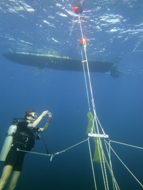
Study co-author Bärbel Hönisch captures foraminifera eight miles off Puerto Rico, near the ocean surface. Specimens were brought back to the lab to be incubated in controlled conditions. Photo: Laura Haynes.
Laura L. Haynes, Bärbel Hönisch. The seawater carbon inventory at the Paleocene–Eocene Thermal Maximum. Proceedings of the National Academy of Sciences, 2020; 202003197 DOI: 10.1073/pnas.2003197117
Climate Change Threatens Komodo Dragons
September 17, 2020
The world's largest lizard, the Komodo dragon, could be driven to extinction by climate change unless significant measures to intervene are taken soon. A new international study, led by the University of Adelaide and Deakin University, has found that the impact of both global warming and sea-level rise threatens the extinction of Komodo dragons, which already have restricted habitats, and this must be better incorporated into conservation strategies.
"Climate change is likely to cause a sharp decline in the availability of habitat for Komodo dragons, severely reducing their abundance in a matter of decades," says lead author Dr Alice Jones from the University of Adelaide's School of Biological Sciences. "Our models predict local extinction on three of the five island habitats where Komodo dragons are found today."
The Komodo dragon, Varanus komodoensis, is the world's most iconic lizard species which has existed on Earth for more than a million years, but only an estimated 4000 individuals survive in the wild. They are endemic to five islands in southeast Indonesia: Komodo, Rinca, Nusa Kode and Gili Motang which are part of Komodo National Park, and Flores, the fifth and largest island which has three nature reserves.
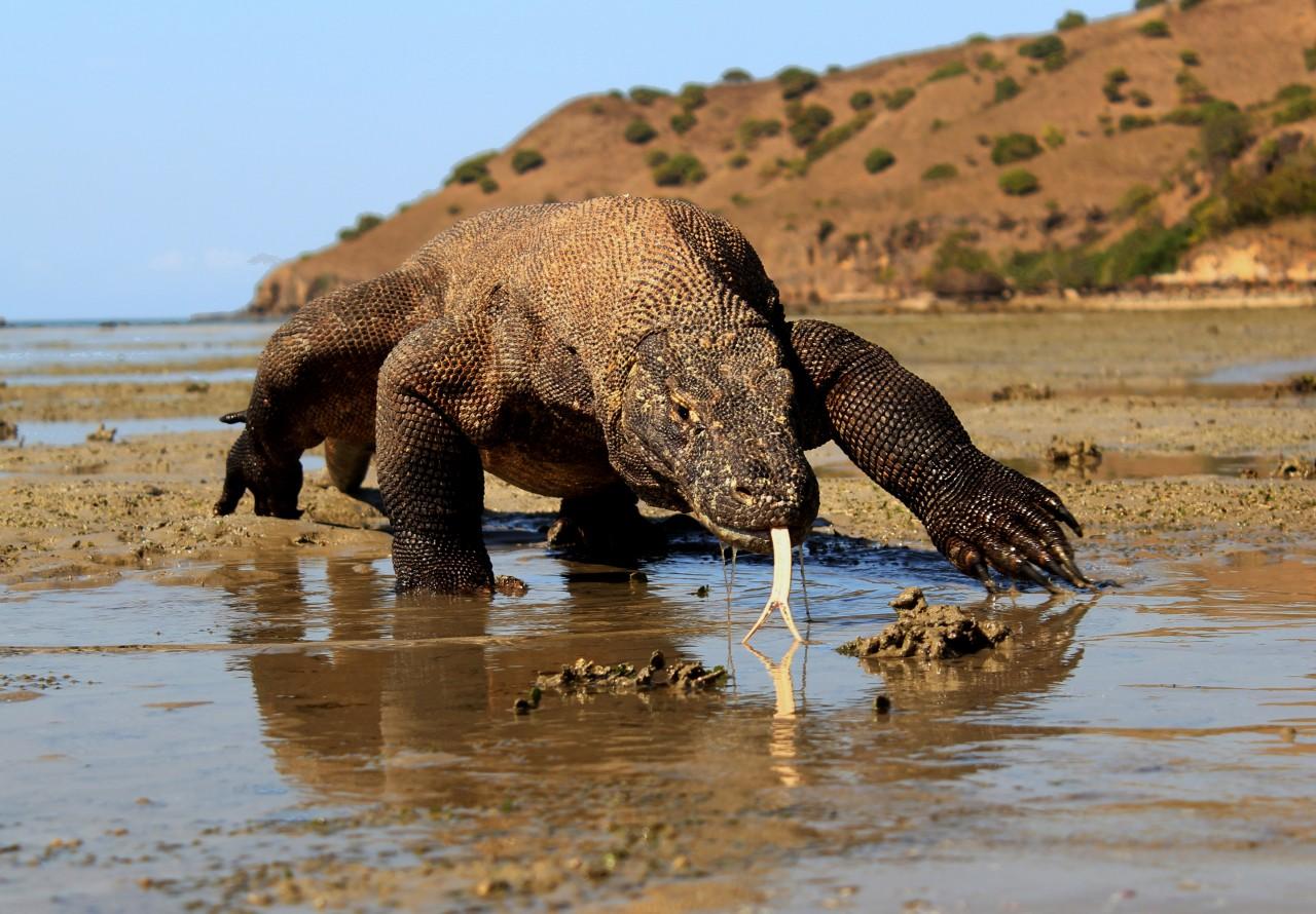
Komodo dragon. Photo: Achmad Ariefiandy, Komodo Survival Program.
"Current-day conservation strategies are not enough to avoid species decline in the face of climate change. This is because climate change will compound the negative effects of already small, isolated populations," says Dr Jones.
"Interventions such as establishing new reserves in areas that are predicted to sustain high-quality habitats in the future, despite global warming, could work to lessen the effects of climate change on Komodo dragons.
This study, which is published in the journal Ecology and Evolution, is the result of many years of fieldwork on the ecology and conservation status of Komodo dragons.
"Using this data and knowledge in conservation models has provided a rare opportunity to understand climate change impacts on Indonesia's exceptional but highly vulnerable biodiversity," says co-author Dr Tim Jessop, School of Life and Environmental Sciences, Deakin University.
Importantly, the research project involved close collaboration with the Komodo National Park and the Eastern Lesser Sunda Central Bureau for Conservation of Natural Resources.
"The severity and extent of human actions impacting Komodo dragon populations, especially on Flores Island, are only just being realised," says co-author Deni Purwandana, Coordinator of the Komodo Survival Program.
"Having an insight into future impacts of climate change provides new possibilities to work with conservation agencies and local communities to find on-ground solutions that will limit climate and other threats to Komodo dragons and their habitats."
The researchers say climate-change-informed decisions should be a common part of conservation practice.
"Our conservation models show that Komodo dragons on two protected large islands are less vulnerable to climate change. However, even these island habitats might not provide an adequate insurance policy for the survival of the species," says Associate Professor Damien Fordham from the University of Adelaide's Environment Institute.
"Conservation managers in coming decades may need to consider translocating animals to sites where Komodo dragons have not been found for many decades. This scenario can be tested easily using our approach.
"Our research shows that without taking immediate action to mitigate climatic change, we risk committing many range restricted species like Komodo dragons to extinction."
Alice R. Jones, Tim S. Jessop, Achmad Ariefiandy, Barry W. Brook, Stuart C. Brown, Claudio Ciofi, Yunias Jackson Benu, Deni Purwandana, Tamen Sitorus, Tom M. L. Wigley, Damien A. Fordham. Identifying island safe havens to prevent the extinction of the World’s largest lizard from global warming. Ecology and Evolution, 2020 DOI: 10.1002/ece3.6705
The 2020 Atlantic hurricane season is so intense, it just ran out of storm names
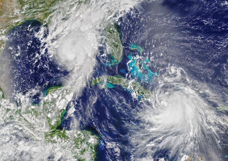
Here’s how active this year’s Atlantic hurricane season has been: When Tropical Storm Wilfred formed on Sept. 18, the National Hurricane Center ran out of names for only the second time since naming began in 1950.
Even more surprising is that we reached the 21st tropical storm of the year more than two weeks earlier than the only other time this happened, in 2005.
The 2020 Atlantic hurricane season is far from over. When the next tropical storm forms, forecasters will shift from the alphabetical list of people’s names to letters of the Greek alphabet – Alpha, Beta and so on. The 2005 season had six Greek-letter storms, ending with Zeta.
So, why is the Atlantic so active this year? Meteorologists like myself have been following a few important differences, including many tropical storms forming closer to the U.S. coast.
What’s Causing So Many Tropical Cyclones?
When a disturbance – a large blob of convective clouds, or thunderstorms – exists over the Atlantic Ocean, certain atmospheric conditions will help it grow into a tropical cyclone.
Warm water and lots of moisture help disturbances gain strength. Low vertical wind shear, meaning the wind speeds and directions don’t change much as you get higher in the atmosphere, is important since this shear can prevent convection from growing. And instability enables parcels of air to rise upward and keep going to build thunderstorms.
This year, sea surface temperatures have been above average across much of the Atlantic Ocean and wind shear has been below average. That means it’s been more conducive than usual to the formation of tropical cyclones.
La Niña probably also has something to do with it. La Niña is El Niño’s opposite – it happens when sea surface temperatures in the eastern and central Pacific are below average. That cooling affects weather patterns across the U.S. and elsewhere, including weakening wind shear in the Atlantic basin. NOAA determined in early September that we had entered a La Niña climate pattern. That pattern has been building up for weeks, so these trending conditions could have contributed to how favorable the Atlantic has been to tropical cyclones this year.
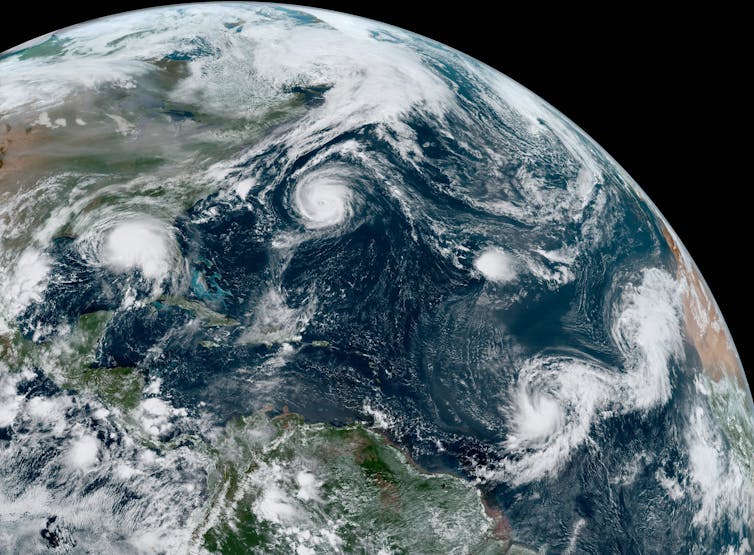
An Unusual Twist Off The US Coast
Four hurricanes have hit the U.S. coast this year – Hanna, Isaias, Laura and Sally, which is more than usual by this point in the hurricane season. But we also have observed many short-lived tropical storms that had less impact.
When a tropical cyclone develops from a disturbance that forms over Africa, it has a lot of ocean ahead of it to get organized and gain strength.
But this year, many storms have formed farther north, closer to the U.S. coast.
Most came from disturbances that didn’t look too promising – until they moved over the Gulf Stream. The Gulf Stream is a large ocean current that carries warm water from the Gulf of Mexico, up the East Coast and into the North Atlantic. Tropical cyclones typically need sea surface temperatures over 80 degrees Fahrenheit to form, and the warm water along the Gulf Stream can help disturbances spin up into tropical cyclones.
Because these tropical storms were already fairly far north, however, they didn’t have much time to gain strength. Meteorologists haven’t yet studied why so many storms formed this way this season, but it’s possible that it’s due to both warmer-than-normal Atlantic Ocean waters and the position of the Gulf Stream.
Lots Of Firsts As The Season Breaks Records
One of the biggest surprises this year has been how consistently we have been breaking records for earliest “Nth” named storms. For example, Edouard became the earliest fifth named storm, beating 2005’s Emily by a week. Fay was the earliest sixth named storm, showing up almost two weeks earlier than Franklin did in 2005.
Wilfred was the earliest to run out the list of designated storm names. In 2005, Hurricane Wilma formed on Oct. 17, but it ended up being the year’s 22nd named storm chronologically, not the 21st like Wilfred, because an unnamed subtropical storm formed on Oct. 4. The National Hurricane Center discovered this unnamed storm during a post-season analysis.
In all, the 2005 season had 28 tropical storms. The World Meteorological Organization’s Atlantic tropical cyclone name list skips letters where easy-to-distinguish names are harder to find, like Q and Z, then moves to the Greek alphabet. The Atlantic hurricane season runs through Nov. 30. Could we run out of Greek letters? I don’t think anyone’s ready to consider that.
[Get our best science, health and technology stories. Sign up for The Conversation’s science newsletter.]![]()
Kimberly Wood, Assistant Professor of Meteorology, Mississippi State University
This article is republished from The Conversation under a Creative Commons license. Read the original article.
Bushcare In Pittwater
Where we work Which day What time
Avalon
Angophora Reserve 3rd Sunday 8:30 - 11:30am
Avalon Dunes 1st Sunday 8:30 - 11:30am
Avalon Golf Course 2nd Wednesday 3 - 5:30pm
Careel Creek 4th Saturday 8:30 - 11:30am
Toongari Reserve 3rd Saturday 9 - 12noon (8 - 11am in summer)
Bangalley Headland 2nd Sunday 9 to 12noon
Bayview
Winnererremy Bay 4th Sunday 9 to 12noon
Bilgola
North Bilgola Beach 3rd Monday 9 - 12noon
Algona Reserve 1st Saturday 9 - 12noon
Plateau Park 1st Friday 8:30 - 11:30am
Church Point
Browns Bay Reserve 1st Tuesday 9 - 12noon
McCarrs Creek Reserve Contact Bushcare Officer To be confirmed
Clareville
Old Wharf Reserve 3rd Saturday 8 - 11am
Elanora
Kundibah Reserve 4th Sunday 8:30 - 11:30am
 Mona Vale
 Mona Vale Beach Basin 1st Saturday 8 - 11am
Mona Vale Dunes 2nd Saturday +3rd Thursday 8:30 - 11:30am
Newport
Bungan Beach 4th Sunday 9 - 12noon
Crescent Reserve 3rd Sunday 9 - 12noon
North Newport Beach 4th Saturday 8:30 - 11:30am
Porter Reserve 2nd Saturday 8 - 11am
North Narrabeen
Irrawong Reserve 2nd Saturday 2 - 5pm
Palm Beach
North Palm Beach Dunes 3rd Saturday 9 - 12noon
Scotland Island
Catherine Park 2nd Sunday 10 - 12:30pm
Elizabeth Park 1st Saturday 9 - 12noon
Pathilda Reserve 3rd Saturday 9 - 12noon
Warriewood
Warriewood Wetlands 1st Sunday 8:30 - 11:30am
Whale Beach
Norma Park 1st Friday 9 - 12noon
Western Foreshores
Coopers Point, Elvina Bay 2nd Sunday 10 - 1pm
Rocky Point, Elvina Bay 1st Monday 9 - 12noon
Gardens And Environment Groups And Organisations In Pittwater
Tick Population Booming In Our Area
Residents from Terrey Hills and Belrose to Narrabeen and Palm Beach report a high number of ticks are still present in the landscape. Local Veterinarians are stating there has not been the usual break from ticks so far and each day they’re still getting cases, especially in treating family dogs.
To help protect yourself and your family, you should:
- Use a chemical repellent with DEET, permethrin or picaridin.
- Wear light-colored protective clothing.
- Tuck pant legs into socks.
- Avoid tick-infested areas.
- Check yourself, your children, and your pets daily for ticks and carefully remove any ticks using a freezing agent.
- If you have a reaction, contact your GP for advice.
Nominations Open For Australian Biosecurity Awards
The search is on for the next round of biosecurity champions, with nominations now open for round two of the 2020 Australian Biosecurity Awards (ABAs).
Head of biosecurity, Andrew Tongue, said round two included new categories that demonstrate the diversity of biosecurity and the different roles we can all play.
“Australia has faced some tough challenges this year, but maintaining the nation’s biosecurity system has remained a priority,” Mr Tongue said.
“Our biosecurity system strengthens our country’s long-term resilience by safeguarding our economy, food sources, unique environment and way of life.
“It is important to recognise individuals and groups who support our biosecurity and are committed to safeguarding Australia from pests and diseases.
“It is a shared responsibility and we all have a role to play.
“We will be presenting four new award categories for round two—Environmental Biosecurity, Community, Education and the Dr Kim Ritman Award for Science and Innovation.
“The Dr Kim Ritman Award for Science and Innovation was created in honour of Dr Kim Ritman’s contributions as Australia’s Chief Plant Protection Officer.
“The new categories recognise a wider range of stakeholders and the diverse parts of our biosecurity system, as well as emphasise the importance of biosecurity education.
“If you know a group, individual or organisation that deserves to be recognised for their biosecurity work, nominate them today.”
The first round of 2020 ABAs were presented in March, with a range of winners from industry and government.
Round two of the ABAs will be presented at the National Biosecurity Forum in November.
Nominations close on Friday, October 2nd, 2020.
For more information and to put in a nomination, visit agriculture.gov.au/aba.
$10 Million In Grants For Smart Recycling Solutions
August 20, 2020
The Federal Government is further investing in research that will transform Australia’s waste recycling industry to improve the environment, grow the economy and create new jobs.
$10 million will be made available in the latest round of the Cooperative Research Centres Projects (CRC-P) grants program for projects that provide innovative solutions for the recycling and reuse of plastics, paper, glass and tyres.
Launching Round 10 today, Minister for Industry, Science and Technology Karen Andrews said this funding builds on the $20 million the Government invested in Round 8 to find smart solutions to managing Australia’s waste crisis.
“Recycling our waste is more than an environmental imperative, it presents an opportunity for us to grow the economy and create new jobs,” Minister Andrews said.
“This funding will help advance – and more importantly commercialise – new waste processing technologies.
“By bringing industry together with researchers we can develop solutions to environmental problems while creating products and processes that can be used here at home and potentially be exported to the world.”
Minister for the Environment Sussan Ley said the research grants would play a key role in a $1 billion transformation of the waste industry, one that will contribute to a cleaner environment and thousands of new jobs.
“We are driving unprecedented investments in recycling infrastructure,” Minister Ley said.
“Ideas that open up new processes and new markets for recycled products are going to be critical as we change the way we recycle materials for infrastructure, packaging and consumer products.
“Whether it is waste glass replacing virgin sand in concrete sound walls or waste plastic replacing virgin polymers in asphalt we are already seeing new technologies emerge and with support such as this Australia can play a lead role in reducing the pressure on the earth’s resources.”
The funding is part of the Australian Government’s commitment to establish a timetable with the states and territories to ban the export of plastics, paper, glass and tyres. The ban will be phased in, starting with glass on 1 January 2021.
Projects that involve other problem materials, such as building waste, will also be eligible for funding in Round 10.
CRC-Ps can run for up to three years, with grants capped at $3 million. They must have at least two Australian industry partners, including one small or medium sized business.
Close date: October 1, 2020 05:00 PM AEST.
Further information on the CRC-Ps is available at http://www.business.gov.au/crc-p
Reef 2050 Long-Term Sustainability Plan Review
 The Australian and Queensland governments are reviewing the Reef 2050 Long-Term Sustainability Plan, also known as the Reef 2050 Plan. This plan is Australia’s long-term strategy to protect and manage the Great Barrier Reef.
The plan sets clear actions, management goals, objectives and outcomes. These drive and guide the short, medium and long-term management of the reef.
The review and drafting of the updated Plan is being conducted by:
- Australian Government Department of Agriculture, Water and the Environment
- Great Barrier Reef Marine Park Authority
- Queensland Government Office of the Great Barrier Reef.
Scope of the review
The 2020 Review is the plan’s first 5-yearly review. The Federal Government would like to hear your thoughts on the:
- outcomes, objectives and management goals of the plan
- priority work areas
- strategic actions that deliver outcomes for the Reef.
The Government are seeking your views on the updated Reef 2050 Plan to ensure it contains the right priorities and actions to support the health and resilience of the Great Barrier Reef.
Share your feedback
You can now provide feedback. Your input will help us update the plan.
To have your say:
- read the Reef 2050 Long-Term Sustainability Plan Public Consultation Draft
- read the Reef 2050 Objectives and Management Goals
- read the fact sheet
- take the survey now
Submit your feedback by 11.59pm AEST Wednesday 30 September 2020.
Doodle Comer Swamp Nature Reserve Draft Plan Of Management: Public Consultation
The Doodle Comer Swamp Nature Reserve Draft Plan of Management is available for review and comment.
Public exhibition of the draft plan provides an important opportunity for members of the community to have a say in the future management of Doodle Comer Swamp Nature Reserve. Comments close 28 September 2020.
This plan has been prepared using a new format and presented as 2 separate documents:
- The plan of management which is the 'legal' document that will be provided to the Minister for formal adoption. This is the document we are seeking your feedback on.
- The planning considerations document supports the plan of management. It includes detailed information on park values (e.g. threatened species and cultural heritage) and threats to these values. A summary of this information is in the plan of management.
Doodle Comer Swamp Nature Reserve encompasses about half of the Doodle Comer Swamp, an ephemeral wetland listed in the National Directory of Important Wetlands and the largest wetland of its type in southern NSW. The catchment for Doodle Comer Swamp is unregulated and the wetland has an unaltered water flow regime, now uncommon in New South Wales inland wetlands and of high conservation value.
When inundated, Doodle Comer Swamp attracts large numbers of waterbirds that use the swamp for breeding and foraging. When dry, the wetland provides habitat for the threatened bush stone-curlew, listed as endangered in New South Wales. Other threatened animals found include brolga and superb parrot. The reserve contains several threatened ecological communities such as Inland Grey Box Woodland and Sandhill Pine Woodland.
Doodle Comer Swamp is part of the Country of the Wiradjuri speaking nation and is part of a larger network of swamps and lagoons across the Riverina that formed a significant part of the cultural landscape, sustaining the Wiradjuri with an extensive range of resources for thousands of years. A diverse range of Aboriginal sites exist in the reserve and surrounding area and in 2016 Doodle Comer was declared an Aboriginal place recognising these values and the wetland's special significance to Aboriginal culture.
What is a plan of management?
Parks and reserves established under the National Parks and Wildlife Act 1974 need to have a plan of management. The plan includes information on important park values and provides directions for future management. The plan of management is a legal document, and after the plan is adopted all operations and activities in the park must be in line with the plan. From time to time plans of management are amended to support changes to park management. Visit: Doodle Comer Swamp Nature Reserve Draft Plan of Management - PDF, 2.3MB
The National Parks and Wildlife Act sets out the matters that need to be considered when preparing a plan of management. These matters are addressed in the supporting Doodle Comer Swamp Nature Reserve Draft Plan of Management: Planning considerations document.
Why is a plan being prepared now?
Since the park`s reservation in 2011, it has been managed according to a statement of management intent. After a park's reservation and before the release of its plan of management, a statement of management intent is prepared outlining the management principles and priorities for the park's management. This statement documents the key values, threats and management directions for the park. It is not a statutory document and a plan of management will still need to be prepared according to the National Parks and Wildlife Act 1974.
Publication of a draft or final plan will replace the statement of management intent for the relevant parks covered.
What opportunities will the community have to comment?
The draft plan of management is on public exhibition until 28 September 2020 and anyone can review the plan of management and provide comments.
When will the plan of management be finalised?
At the end of the public exhibition period in September 2020 we will review all submissions, prepare a submissions report and make any necessary changes to the draft plan of management. The Far West Regional Advisory Committee and the National Parks and Wildlife Advisory Council will then review the plan along with the submissions and report, as required by the National Parks and Wildlife Act.
Once their input has been considered and any further changes made to the plan of management, we provide the plan to the Minister for Energy and Environment. The plan of management is finalised when the Minister formally adopts the plan under the National Parks and Wildlife Act. Once a plan is adopted it is published on the Department website and a public notice is advertised in the NSW Government Gazette.
How can I get more information about the draft plan?
For further information on the plan of management please contact the Park Management Planning Team at npws.parkplanning@environment.nsw.gov.au.
How can I comment on the draft plan?
Public exhibition for the plan of management is from 26 June 2020 until 28 September 2020. You are invited to comment on the draft plan by sending a written submission during this time.
Have your say
Public exhibition is from 26 June 2020 to 28 September 2020.
You can provide your written submission in any of the following ways:
Post your written submission to:
Manager Planning Evaluation and Assessment
Locked Bag 5022
Parramatta NSW 2124
Email your submission to: npws.parkplanning@environment.nsw.gov.au
Make a submission online by using the online form here
Tollingo Nature Reserve And Woggoon Nature Reserve Draft Plan Of Management: Public Consultation
The Tollingo Nature Reserve and Woggoon Nature Reserve Draft Plan of Management is available for review and comment.
Public exhibition of the draft plan provides an important opportunity for members of the community to have a say in the future management of Tollingo Nature Reserve and Woggoon Nature Reserve. Comments close 28 September 2020.
This plan has been prepared using a new format which is presented as two separate documents:
- The plan of management which is the legal document that will be provided to the Minister for formal adoption. This is the document we are seeking your feedback on.
- The planning considerations document supports the plan of management. It includes detailed information on park values (e.g. threatened species and cultural heritage) and threats to these values. A summary of this information is provided in the plan of management.
Tollingo Nature Reserve and Woggoon Nature Reserve are significant as two of the largest remaining mallee remnants in New South Wales. The largely intact old-age mallee vegetation is rare in the Central West, which is mostly used for agriculture. The reserves provide habitat for the endangered malleefowl and other native animals.
Tollingo Nature Reserve is shared Country for the Ngiyampaa and Wiradjuri people, while Woggoon Nature Reserve is within Wiradjuri traditional Country.
What is a plan of management?
Parks and reserves established under the National Parks and Wildlife Act 1974 need to have a plan of management. The plan includes information on important park values and provides directions for future management. The plan of management is a legal document, and after the plan is adopted all operations and activities in the park must be in line with the plan. From time to time plans of management are amended to support changes to park management.
The National Parks and Wildlife Act sets out the matters that need to be considered when preparing a plan of management. These matters are addressed in the supporting Tollingo Nature Reserve and Woggoon Nature Reserve Draft Planning Considerations document. This document may be updated from time to time, for example, to include new information on the values of the park (e.g. new threatened species), new management approaches (e.g. a new pest management technique) or new park programs. Visit Tollingo Nature Reserve and Woggoon Nature Reserve Draft Plan of Management - PDF 2.3MB
Why is a plan being prepared now?
This plan of management will replace the statement of management intent which was approved in 2014. Statements of management intent are non-statutory documents which summarise the key values and management directions for a park.
Since reservation in 1988 and 1974 respectively, Tollingo and Woggoon nature reserves have been managed according to a statement of management intent. After a park's reservation and before the release of its plan of management, a statement of management intent is prepared outlining the management principles and priorities for the park's management. This statement documents the key values, threats and management directions for the park. It is not a statutory document and a plan of management will still need to be prepared according to the National Parks and Wildlife Act 1974. Publication of a draft or final plan will replace the statements of management intent for the relevant parks covered.
What opportunities will the community have to comment?
The draft plan of management and planning considerations are on public exhibition until 28 September 2020 and anyone can provide comments.
When will the plan of management be finalised?
At the end of the public exhibition period in September 2020, National Parks and Wildlife Service (NPWS) will review all submissions, prepare a submissions report and make any necessary changes to the draft plan of management. The West Regional Advisory Committee and the National Parks and Wildlife Advisory Council will then review the plan along with the submissions and report, as required by the National Parks and Wildlife Act.
Once their input has been considered and any further changes made to the plan of management, we provide the plan to the Minister for Energy and Environment. The plan of management is finalised when the Minister adopts the plan under the National Parks and Wildlife Act. Once a plan is adopted it is published on the Department's website.
How can I get more information about the draft plan?
For further information on the plan of management please contact the NPWS Park Management Planning Team at npws.parkplanning@environment.nsw.gov.au
Where can I see a printed copy of the draft plan?
Hard copies are available for viewing at the following locations:
- National Parks and Wildlife Service (NPWS) office, Camp Street, Forbes
- Condobolin Library, 130 Bathurst Street, Condobolin
How can I comment on the draft plan?
Public exhibition for the plan of management is from 26 June until 28 September 2020. You are invited to comment on the draft plan by sending a written submission during this time.
Your privacy
Your submission will be provided to a number of statutory advisory bodies (including the relevant regional advisory committee and the National Parks and Wildlife Advisory Council). Your comments on the draft plan may include 'personal information'. the Department complies with the NSW Privacy and Personal Information Protection Act 1998 which regulates the collection, storage, access, amendment, use and disclosure of personal information. See our privacy webpage for details. Information that in some way identifies you may be gathered when you use our website or send us correspondence.
If an application to access information under the Government Information (Public Access) Act 2009 requests access to your submission, your views about release will be sought if you have indicated that you object to your submission being made public.
While all submissions count, they are most effective when we understand your ideas and the outcomes you want for park management. Some suggestions to help you write your submission are:
- Write clearly and be specific about the issues that are of concern to you.
- Note which part or section of the plan your comments relate to.
- Give reasoning in support of your points – this makes it easier for us to consider your ideas and will help avoid misinterpretation.
- Tell us specifically what you agree/disagree with and why you agree/disagree.
- Suggest solutions or alternatives to managing the issue if you can.
Have your say
Public exhibition is from 26 June 2020 to 28 September 2020.
You can provide your written submission in any of the following ways:
Post your written submission to:
Manager Planning Evaluation and Assessment
Locked Bag 5022
Parramatta NSW 2124
Email your submission to: npws.parkplanning@environment.nsw.gov.au
Make a submission online by using the online form here
Limeburners Creek National Park, Goolawah National Park And Goolawah Regional Park: Public Consultation
Planning for the future –NSW National Parks and Wildlife Service is preparing a new plan of management for Limeburners Creek National Park, Goolawah National Park and Goolawah Regional Park.
These parks are in the traditional Country of the Dunghutti and Birpai Aboriginal Peoples. The parks play a fundamental role in the lives of local Aboriginal people, helping to maintain a tangible link to the past and enabling continued connections to Country.
The existing plan of management for Limeburners Creek National Park was written in 1998. The areas that are now Goolawah National Park and Goolawah Regional Park were formerly Goolawah State Park and Crown land. Initial community consultation about the Goolawah parks was undertaken in 2012, soon after they were transferred to National Parks and Wildlife Service.
Since this time large new areas have been added to the parks, including the intertidal zone on some of the beaches. There has also been a steady increase in visitors, and new recreational uses have become popular. Information about the values of the park has improved and new approaches to managing fire, pests and weeds have been developed.
Accommodating all of these visitors, maintaining the unique visitor experience and protecting the environment is challenging. Good planning is essential to manage increasing demand and provide sustainable visitor facilities and opportunities while minimising impacts and retaining the natural and low key nature of this beautiful stretch of coast. The development of a new combined plan of management will help to protect the parks' unique values and improve the effectiveness of how we manage the parks.
What opportunities will the community have to contribute to the development of a new plan of management?
Previous consultation, including a community forum, identified a range of issues important to the local community which will be considered in the new plan. It is now time to reach out and reconnect with our neighbours, stakeholders and local communities, as well as extending the invitation to the wider community of park users.
There are now 2 opportunities to be involved in the development of the plan of management for Goolawah Regional Park and Goolawah and Limeburners Creek national parks:
- During the development of the draft plan - register your interest below to receive updates and be notified of further consultation dates. Complete the form to provide your ideas on what you believe are the most important values of the parks and how they should be managed in the future. Your input will be used to draft a plan that reflects community values and aspirations.
- During public exhibition of the draft plan - there will be another opportunity to have your say when the draft plan of management is completed and put on public exhibition for 90 days. Anyone can submit comments on the draft plan during this time.
Register your interest
Complete the online form here to register your interest, provide initial input and be notified of further consultation dates. Tell us what is important to you about the parks and what you would like to see in the future. Comments close 30 October 2020.
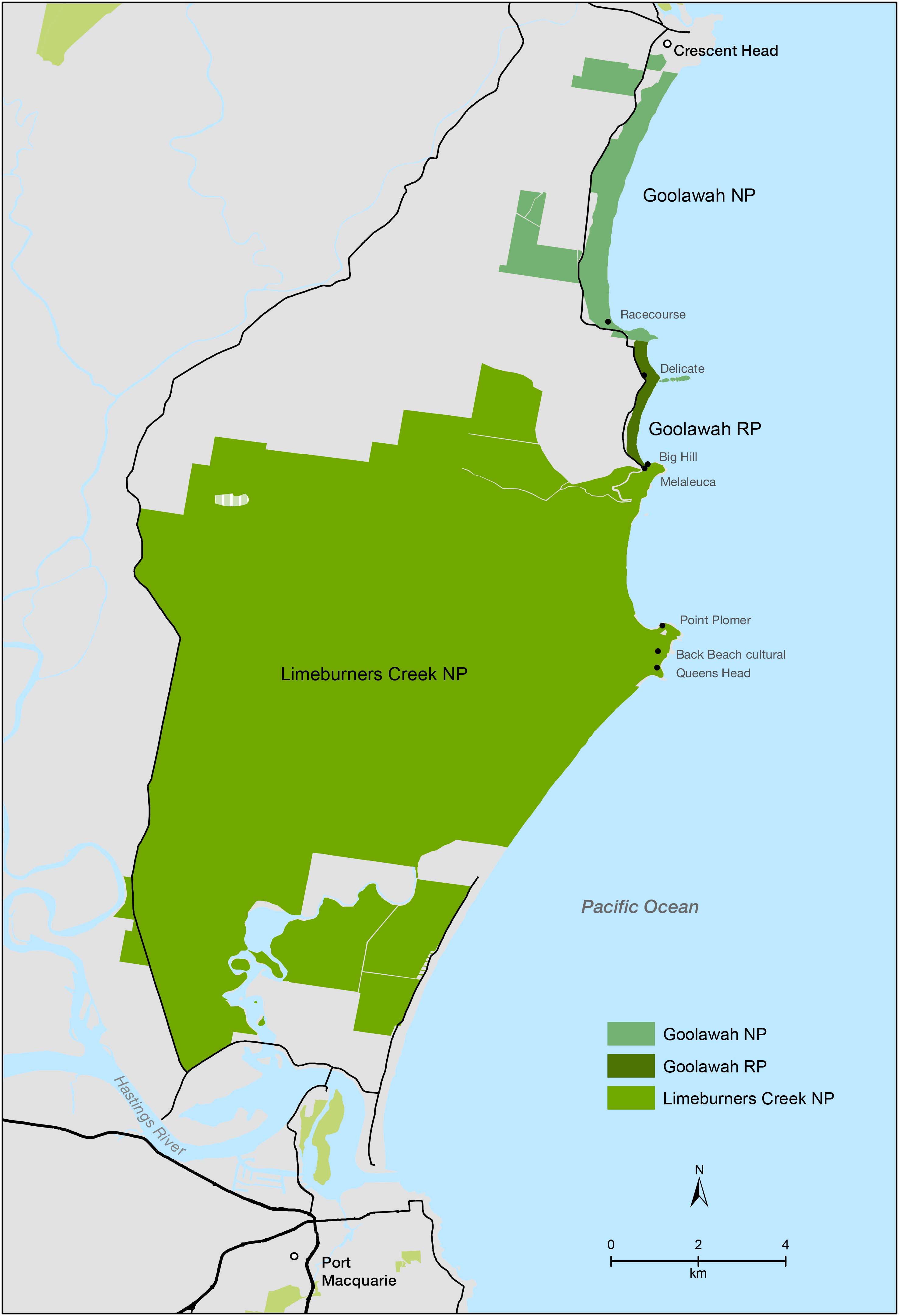
Limeburners Creek National Park, Goolawah National Park and Goolawah Regional Park engagement map Photo: DPIE
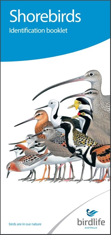 New Shorebird Identification Booklet
The Migratory Shorebird Program has just released the third edition of its hugely popular Shorebird Identification Booklet. The team has thoroughly revised and updated this pocket-sized companion for all shorebird counters and interested birders, with lots of useful information on our most common shorebirds, key identification features, sighting distribution maps and short articles on some of BirdLife’s shorebird activities.
The booklet can be downloaded here in PDF file format: http://www.birdlife.org.au/documents/Shorebird_ID_Booklet_V3.pdf
Paper copies can be ordered as well, see http://www.birdlife.org.au/projects/shorebirds-2020/counter-resources for details.
Download BirdLife Australia's children’s education kit to help them learn more about our wading birdlife
Shorebirds are a group of wading birds that can be found feeding on swamps, tidal mudflats, estuaries, beaches and open country. For many people, shorebirds are just those brown birds feeding a long way out on the mud but they are actually a remarkably diverse collection of birds including stilts, sandpipers, snipe, curlews, godwits, plovers and oystercatchers. Each species is superbly adapted to suit its preferred habitat. The Red-necked Stint is as small as a sparrow, with relatively short legs and bill that it pecks food from the surface of the mud with, whereas the Eastern Curlew is over two feet long with a exceptionally long legs and a massively curved beak that it thrusts deep down into the mud to pull out crabs, worms and other creatures hidden below the surface.
Some shorebirds are fairly drab in plumage, especially when they are visiting Australia in their non-breeding season, but when they migrate to their Arctic nesting grounds, they develop a vibrant flush of bright colours to attract a mate. We have 37 types of shorebirds that annually migrate to Australia on some of the most lengthy and arduous journeys in the animal kingdom, but there are also 18 shorebirds that call Australia home all year round.
What all our shorebirds have in common—be they large or small, seasoned traveller or homebody, brightly coloured or in muted tones—is that each species needs adequate safe areas where they can successfully feed and breed.
The National Shorebird Monitoring Program is managed and supported by BirdLife Australia.
This project is supported by Glenelg Hopkins Catchment Management Authority and Hunter Local Land Services through funding from the Australian Government’s National Landcare Program. Funding from Helen Macpherson Smith Trust and Port Phillip Bay Fund is acknowledged.
The National Shorebird Monitoring Program is made possible with the help of over 1,600 volunteers working in coastal and inland habitats all over Australia.
The National Shorebird Monitoring program (started as the Shorebirds 2020 project initiated to re-invigorate monitoring around Australia) is raising awareness of how incredible shorebirds are, and actively engaging the community to participate in gathering information needed to conserve shorebirds.
In the short term, the destruction of tidal ecosystems will need to be stopped, and our program is designed to strengthen the case for protecting these important habitats.
In the long term, there will be a need to mitigate against the likely effects of climate change on a species that travels across the entire range of latitudes where impacts are likely.
The identification and protection of critical areas for shorebirds will need to continue in order to guard against the potential threats associated with habitats in close proximity to nearly half the human population.
Here in Australia, the place where these birds grow up and spend most of their lives, continued monitoring is necessary to inform the best management practice to maintain shorebird populations.
BirdLife Australia believe that we can help secure a brighter future for these remarkable birds by educating stakeholders, gathering information on how and why shorebird populations are changing, and working to grow the community of people who care about shorebirds.
To find out more visit: http://www.birdlife.org.au/projects/shorebirds-2020/shorebirds-2020-program
Pittwater Reserves
Aussie Bread Tags Collection Points

A Message To The Class Of 2020 From The Premier

Diving With Dolphins - Joy
Published by BBC Earth, September 2020
Take a deep dive with dolphins for 3 minutes of pure bliss, with this extract from Mindful Escapes.
Subscribe: http://bit.ly/BBCEarthSub
How Was It Made? Danny MacAskill's Wee Day Out

The rise of ultra-processed foods and why they're really bad for our health

Humans (and our ancestors) have been processing food for at least 1.8 million years. Roasting, drying, grinding and other techniques made food more nutritious, durable and tasty. This helped our ancestors to colonise diverse habitats, and then develop settlements and civilisations.
Many traditional foods used in cooking today are processed in some way, such as grains, cheeses, dried fish and fermented vegetables. Processing itself is not the problem.
Only much more recently has a different type of food processing emerged: one that is more extensive, and uses new chemical and physical techniques. This is called ultra-processing, and the resulting products ultra-processed foods.
To make these foods, cheap ingredients such as starches, vegetable oils and sugars, are combined with cosmetic additives like colours, flavours and emulsifiers. Think sugary drinks, confectionery, mass-produced breads, snack foods, sweetened dairy products and frozen desserts.
Unfortunately, these foods are terrible for our health. And we’re eating more of them than ever before, partially because of aggressive marketing and lobbying by “Big Food”.
Ultra-Processed Foods Are Harming Our Health
So concludes our recent literature review. We found that more ultra-processed foods in the diet associates with higher risks of obesity, heart disease and stroke, type-2 diabetes, cancer, frailty, depression and death.
These harms can be caused by the foods’ poor nutritional profile, as many are high in added sugars, salt and trans-fats. Also, if you tend to eat more ultra-processed foods, it means you probably eat fewer fresh and less-processed foods.
Industrial processing itself can also be harmful. For example, certain food additives can disrupt our gut bacteria and trigger inflammation, while plasticisers in packaging can interfere with our hormonal system.
Certain features of ultra-processed foods also promote over-consumption. Product flavours, aromas and mouthfeel are designed to make these foods ultra-tasty, and perhaps even addictive.
Ultra-processed foods also harm the environment. For example, food packaging generates much of the plastic waste that enters marine ecosystems.
And Yet, We’re Eating More And More Of Them
In our latest study, published in August, we found ultra-processed food sales are booming nearly everywhere in the world.
Sales are highest in rich countries like Australia, the United States and Canada. They are rising rapidly in middle-income countries like China, South Africa and Brazil, which are highly populated. The scale of dietary change and harms to health are therefore likely immense.
‘Big Food’ Is Driving Consumption
We also asked: what explains the global rise in ultra-processed food sales? Growing incomes, more people living in cities, and working families seeking convenience are a few factors that contribute.
However, it’s also clear “Big Food” corporations are driving ultra-processed food consumption globally — think Coca-Cola, Nestlé and McDonald’s. Sales growth is lower in countries where such corporations have a limited presence.

Globalisation has allowed these corporations to make huge investments in their overseas operations. The Coca-Cola System, for example, now includes 900 bottling plants worldwide, distributing 2 billion servings every day.
As Big Food globalises, their advertising and promotion becomes widespread. New digital technologies, such as gaming, are used to target children. By collecting large amounts of personal data online, companies can even target their advertising at us as individuals.
Supermarkets are now spreading throughout the developing world, provisioning ultra-processed foods at scale, and at low prices. Where supermarkets don’t exist, other distribution strategies are used. For example, Nestlé uses its “door-to-door” salesforce to reach thousands of poor households in Brazil’s urban slums.
Rising consumption also reflects Big Food’s political power to undermine public health policies. This includes lobbying policymakers, making political donations, funding favourable research, and partnerships with community organisations.
Read more: Sweet power: the politics of sugar, sugary drinks and poor nutrition in Australia
Here’s How Things Can Change
The evidence that ultra-processed foods are harming our health and the planet is clear. We must now consider using a variety of strategies to decrease consumption. This includes adopting new laws and regulations, for example by using taxation, marketing restrictions and removing these products from schools.
We cannot rely on industry-preferred responses such as product reformulation alone. After all, reformulated ultra-processed foods are usually still ultra-processed.
Further, simply telling individuals to “be more responsible” is unlikely to work, when Big Food spends billions every year marketing unhealthy products to undermine that responsibility.
Should dietary guidelines now strongly advise people to avoid ultra-processed foods? Brazil and other Latin American countries are already doing this.
And for us as individuals the advice is simple — avoid ultra-processed foods altogether.![]()
Phillip Baker, Research Fellow, Institute for Physical Activity and Nutrition, Deakin University, Deakin University; Mark Lawrence, Professor of Public Health Nutrition, Institute for Physical Activity and Nutrition, Deakin University, and Priscila Machado, Research Fellow, School of Exercise & Nutrition Science, Faculty of Health, Deakin University
This article is republished from The Conversation under a Creative Commons license. Read the original article.
Behind the new Samsung Fold: how the quest to maximise screen size is driving major innovation

To enlarge a phone, or not to enlarge a phone? That is the question. In the world of flagship smartphones, there seems to be one clear trend: bigger is better.
Manufacturers are trying to strip away anything that might stand in the way of the largest possible slab of screen. There is also growing demand for thinner phones with diminishing bezels (the area surrounding a screen).
This trend has now culminated in the latest innovation in smartphone design, the foldable screen phone. These devices sport thin OLED self illuminating screens that can be folded in half.
The newest release is the Samsung Galaxy Z fold 2 – a device that is almost three-quarters screen and has extravagant overtones rivalled only by a hefty A$2,999 price tag.
But to prevent the phones themselves from growing to unwieldy size, manufacturers are having to find ways to balance size with usability and durability. This presents some interesting engineering challenges, as well as some innovative solutions.

Internal Design Complexities Of Folding Phones
Modern phones still typically use a thin LCD or plastic OLED display covered by an outer glass panel.
Folding displays are a new category that exploit the flexibility of OLED display panels. Instead of simply fixing these panels to a rigid glass panel, they carefully engineer the panel so that it bends – but never quite tightly enough to snap or crack.
Internal structural support is needed to make sure the panel doesn’t crease, or isn’t stressed to the point of creating damage, discolouration or visible surface ripples.
Since this is a mechanical, moving system, reliability issues need to be considered. For instance, how long will the hinge last? How many times can it be folded and unfolded before it malfunctions? Will dirt or dust make its way into the assembly during daily use and affect the screen?
Such devices need an added layer of reliability over traditional slab-like phones, which have no moving parts.
Read more: The new iPhone SE is the cheapest yet: smart move, or a premium tech brand losing its way?
Large Screen, Thin Phone: A Recipe For Disaster?
Each generation of smartphones becomes thinner and with smaller bezels, which improves the viewing experience but can make the phone harder to handle.
In such designs, the area of the device you can grip without touching the display screen is small. This leads to a higher chance of dropping the device – a blunder even the best of us have made.
There’s an ongoing tussle between consumers and manufacturers. Consumers want a large, viewable surface as well as an easily portable and rugged device. But from an engineering point of view, these are usually competing requirements.
You’ll often see people in smartphone ads holding the device with two hands. In real life, however, most people use their phone with one hand.
Thus, the shift towards larger, thinner phones has also given rise to a boom in demand for assistive tools attached to the back, such as pop-out grips and phone rings.
In trying to maximise screen size, smartphone developers also have to account for interruptions in the display, such as the placement of cameras, laser scanners (for face or object identification), proximity sensors and speakers. All are placed to minimise visual intrusion.
Now You See It, Now You Don’t
In the engineering world, to measure the physical world you need either cameras or sensors, such as in a fingerprint scanner.
With the race to increase the real estate space on screens, typically these cameras and scanners are placed somewhere around the screen. But they take up valuable space.
This is why we’ve recently seen tricks to carve out more space for them, such as pop up cameras and punch-hole cameras, in which the camera sits in a cutout hole allowing the display to extend to the corners.

But another fantastic place for sensors is right in front of us: the screen. Or more specifically, under the screen.
Samsung is one company that has suggested placing selfie-cameras and fingerprint readers behind the screen. But how do you capture a photo or a face image through a layer of screen?
Up until recently, this has been put in the “too hard basket”. But that is changing: Xiaomi, Huawei and Samsung all have patents for under-display cameras.
There are a range of ways to do this, from allowing a camera to see through the screen, to using microlenses and camera pixels distributed throughout the display itself – similar to an insect’s compound eye.
In either case, the general engineering challenge is to implement the feature in a way that doesn’t impact screen image quality, nor majorly affect camera resolution or colour accuracy.
Laptops In Our Pockets
With up to 3.8 billion smartphone users expected by 2021, mobile computing is a primary consumer technology area seeing significant growth and investment.
One driver for this is the professional market, where larger mobile devices allow more efficient on-the-go business transactions. The second market is individuals who who only have a mobile device and no laptop or desktop computer.
It’s all about choice, but also functionality. Whatever you choose has to get the job done, support a positive user experience, but also survive the rigours of the real world.
Read more: Apple's iPhone 11 Pro wants to take your laptop's job (and price tag) ![]()
Andrew Maxwell, Senior Lecturer, University of Southern Queensland
This article is republished from The Conversation under a Creative Commons license. Read the original article.
New coins celebrate Indigenous astronomy, the stars, and the dark spaces between them

Two new coins have been released by the Royal Australian Mint to celebrate the astronomical knowledge and traditions of Aboriginal and Torres Strait Islander people. They feature artworks from Wiradjuri (NSW) and Yamaji (WA) artists that represent two of the most famous features in Aboriginal astronomy: the great Emu in the Sky and the Seven Sisters.
Both celestial features are found in the astronomical traditions of many Aboriginal cultures across Australia. They are seen in similar ways and have similar meanings between cultures on opposite sides of the continent and are observed to note the changing seasons and the behaviours of plants and animals and inform Law.
The project has been three years in the making, with the third and final coin in the series to be released in mid-2021.
Read more: Kindred skies: ancient Greeks and Aboriginal Australians saw constellations in common
Gugurmin – The Emu In The Sky
The Wiradjuri of central New South Wales are the largest Aboriginal language group in the state and one of the largest in the country. Wiradjuri astronomical knowledge is rich and complex, linking the land and people to the cosmos (Wantanggangura). Traditional star knowledge features bright constellations of stars, as well as constellations comprising the spaces between the stars.
One of the many “dark constellations” is that of the celestial emu, called Gugurmin. The emu is a silhouette of the dark spaces stretching from the Southern Cross to Sagittarius in the backdrop of the Milky Way. The galaxy itself is a river called Gular (or Gilaa), which is also the Wiradjuri name of the Lachlan River.

Read more: Stories from the sky: astronomy in Indigenous knowledge
Wiradjuri watch when Gugurmin rises in the sky after sunset as a signal marking the emu’s behaviour patterns and changing seasons. When it rises at dusk in April and May, it signals the start of the emu breeding season, when the birds begin mating and nesting. By June and July, the male emus are sitting in the nest, incubating the eggs. In August and September, the chicks begin hatching.
The Emu in the Sky coin features the work of Wiradjuri artist Scott “Sauce” Towney from Peak Hill, NSW. Sauce specialises in drawing and pyrography (wood burning) and was a finalist in the NSW Premier’s Indigenous Art Awards. The edge of the coin shows a male emu sitting on the eggs during the months of June and July when his celestial counterpart is stretched across the sky. It also shows men dancing in a ceremony, which takes place in August and September.
Gugurmin was one of the artworks Sauce created for a project entitled Wiradjuri Murriyang (“Wiradjuri Sky World”). This featured 13 traditional constellations for use in local school education programs, as well as public outreach. His art was incorporated into the Stellarium planetarium software, enabling users around the world to see the movements of the stars from a Wiradjuri perspective.
Sauce’s work was incorporated into the Australian National Curriculum for the Year 7/8 module on digital technology and managing Indigenous astronomical knowledge.
Read more: The stories behind Aboriginal star names now recognised by the world's astronomical body
Nyarluwarri – The Seven Sisters
The artwork featured on the Seven Sisters coin is from Wajarri-Noongar artist Christine “Jugarnu” Collard of Yamaji Art. Christine was born and raised in Mullewa, Western Australia and paints under the name Jugarnu meaning “old woman” in the Wajarri language. The name was given to Christine by her now deceased Grandfather.
The Yamaji people of the Murchison region in Western Australia refer to the Pleiades star cluster as Nyarluwarri in the Wajarri language, representing seven sisters. When Nyarluwarri sits low on the horizon at sunset in April, the people know that emu eggs are ready for harvesting.

The story of the Seven Sisters tells of them fleeing to the sky to escape the advances of a man who wants to take one of the sisters as his wife. The man chases the sisters as they move from east to west each night, which appear to the northeast at dusk in November and set by April.
At the same time Nyarluwarri sets after the Sun in the west, the celestial emu (which is also featured in Yamaji traditions) rises in the southeast. Both serve as important seasonal markers.
The Seven Sisters and the Emu in the Sky were major themes in the Ilgarijiri – Things Belonging to the Sky art exhibition. This project saw radio astronomers and Yamaji artists come together to share knowledge under the stars at the site of the new Square Kilometre Array (SKA) telescope.
Read more: Indigenous culture and astrophysics: a path to reconciliation ![]()
Duane W. Hamacher, Associate Professor, University of Melbourne
This article is republished from The Conversation under a Creative Commons license. Read the original article.
RPAYC Youth Out There Program

Over 50 Artists Join Great Southern Nights Music Event
- Blue Mountains
- Central Coast
- Country NSW
- Hunter
- North Coast
- Outback NSW
- South Coast
- Sydney.


“Great White Sighting In Pittwater”: Art By Sea
(about: Art by Sea celebrates our natural environment with sustainable art by locals). Take a stroll along the pathway from Bayview to Church Point and cast your gaze further afield.
Visit: https://www.instagram.com/artbyseaau - more soon!
Students To Help Shape Future Of Education

Opportunity: Students Encouraged To Apply For Award In Fisheries Conservation Research
Construction Begins On World's Longest Wild Dog Fence: NSW
Commissioner Welcomes Latest Victim Of Crime Report
- Motor vehicle theft – down 68% (or 26,422 victims) in NSW compared to a 48% decrease nationally.
- Break and enter – down 69% (or 75,881 victims) in NSW compared to a 55% decrease nationally.
Reviewing The Quantum Material 'Engine Room'
A New Discovery In Regenerative Medicine
Greater Sydney Animal Lovers Called On To Join Campaign

Disclaimer: These articles are not intended to provide medical advice, diagnosis or treatment. Views expressed here do not necessarily reflect those of Pittwater Online News or its staff.