March 10-16, 2024: Issue 617
The Old Road To Narrabeen - The Unspoilt Days Of 100 Years Ago When You Could Still See The Sea

In fact, once you cross the Narrabeen bridge, it's hard to see any ocean unless you are glancing quickly down the streets that lead to the beach. If you do, there is a flash of blue and great open sky before the moment has passed and is blocked by multi-storey townhouses all the way south to each horizon until you get to Long Reef.
Photographer Tim Hixson delved into this years ago for his 'Head East' project, explaining then:
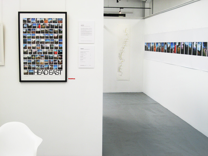
A project I did a little while ago, ‘Head East’ that was the idea behind that, to go back and see if my memories of a place were like I remembered and how my camera saw those scenes. I did the 91 roads that end up at the beach between Palm Beach and Manly. Certain things hadn’t changed, they were very similar to what they were when I was a kid. That was great – I hate this idea that a Town Planner comes along and says ‘I want to make all the beaches look the same’ – my idea was to say that all these beaches are unique and every one of them has their own different character and different people see some quality there growing up in this. So I did this idea of a shared history that was my interpretation of this through these roads that all ended at the beach.
So I was trying to rely on, not necessarily reason, or relevance, but what I remembered from when I was younger and in the process, discovered things I didn’t know existed, such as there’s a little cave down at Bilgola or one road that has no name, it’s just there and has these houses and no sign and this brings in that it’s just local knowledge that would help you find or see these places, these roads that all end at the beach.
Head East; It’s like being a passenger in a car and you’re looking out the window – once you become a photographer you’re looking for something – somehow something happens where you’re not just looking and saying ‘isn’t that pretty’ or ‘isn’t that amazing’ – you’re actually looking for something, there’s a language going on which is a visual language that you can see when you’re driving along – references that you’ve seen before in other people’s work, or ideas that you wanted to execute, but now I’m a driver all the time I have sort of lost that.
Head East shows this principle though – this turning left and seeing these glimpses of these shorter roads that all end at the beach – it took three years to shoot and the final print is 22 metres long – and that’s just one single print.
Fantastic!
Well, I don’t know; it’s just a project I wanted to do. This is the poster I made out of that for the Exhibition. So this is the shared history idea; that’s the lighthouse at Palm Beach and the last one, all through Narrabeen, Collaroy etc, is you end up at North Head looking across the Sydney Heads to Vaucluse and the Macquarie Lighthouse.
Now my great grandfather built those two lighthouses.
So this idea of how photography happens is, when you’re driving from here, from North Narrabeen all the way to Long Reef are about 25 roads, little roads that have been cut off by Pittwater Road, so when driving along you are eyes front and turning your head to see what the surf is doing – everyone does it – and it occurred to me that that movement is like taking a picture – and later on this made more sense and this was like taking a mental picture and you make up the difference in your head; what the wind is doing, what the swell is doing.
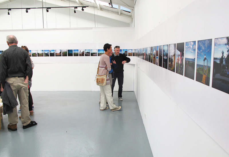
Head East
The difference between the wellbeing that comes from living in an environment open to the sky, where there is somewhere green to run to when you need to exhale, was clearer still in the recent council review of environment zones where initial analysis showed only one house in Warringah may be impacted by the proposed changes. Now dumped, those changes would have meant thousands in Pittwater would have been subject to the cumulative loss of trees, loss of pristine environment and subsequent loss of what millions of others come to Pittwater for annually - a green open place enfolding a blue estuary, lagoon and wetlands with green topped hills and base lands threaded with creeks, still.
In areas that do not have that recourse to the shady tree and chirruping creek or views over bush and water, the living indoors, and turning ever inwards, has been worked on in everything from playgrounds for children to providing 'something for people to do, somewhere for them to go' since this city began to be developed. Bayview's Maybanke Selfe-Wolstenholme-Anderson was a champion of the Kindergarten Union way back in 1890's Sydney. Better health and clearer thinking for youngsters was the result.
Around here we call it 'running into the arms of God', or Mother Nature, whichever name you choose - for what is experienced during that embrace.
As soon as many people cross the Narrabeen bridge into Pittwater they begin to relax, they feel as though they are 'home'. The same occurs on the long slide down the hill from Ingleside and Tumbledown; as soon as that first glimpse of ocean and salt air drifts in through the car window, a sense of coming home and relaxation begins - it's a natural response to something that was missed for the day or longer.
The perils of NOT sticking up for the places you live in, whether that's joining your local residents group, helping out for a few hours once a month with your bushcare group, or keeping across changes proposed at local, state or federal government level are obvious - you can see them from here.
Although the PON History pages for 2024 will share some of these changes through a focus on local creeks and beach reserves, having commenced with an overview of Mona Vale's Black Swamp, the first Pittwater camping reserve set aside for all for all time, and the Avalon Beach Reserve, the first Pittwater beach reserve set aside for all people for all time, it's worth looking into other causes of these changes that saw green landscapes threaded with sparkling creeks built upon to the point where the shape of the hills disappears and those creeks entombed in concrete pipes, channels and stormwater drains.
The rapid changes were lamented by those who were here before us, most especially by our First Nations people who felt the breaking of songlines with every carving into and cutting up of each place.
A few photos from past photographers, and words from the pens of those who could see what was coming, reveal those who witnessed the shift from this area being a place of farms and weekenders to the 1920's rush to build roads to access everywhere for development as the horse was overtaken by the motor vehicle, the movement to beaches and tents during the 1930's as at least there you could fix canvas over their heads when it rained and draw fish from the sea for their bellies, and then again in the post World War Two need for suburban plots for new families, called for better planning then, as people do today.
To whet your appetite for what will come, in between other history subjects, a few glimpses into a Run to Narrabeen:
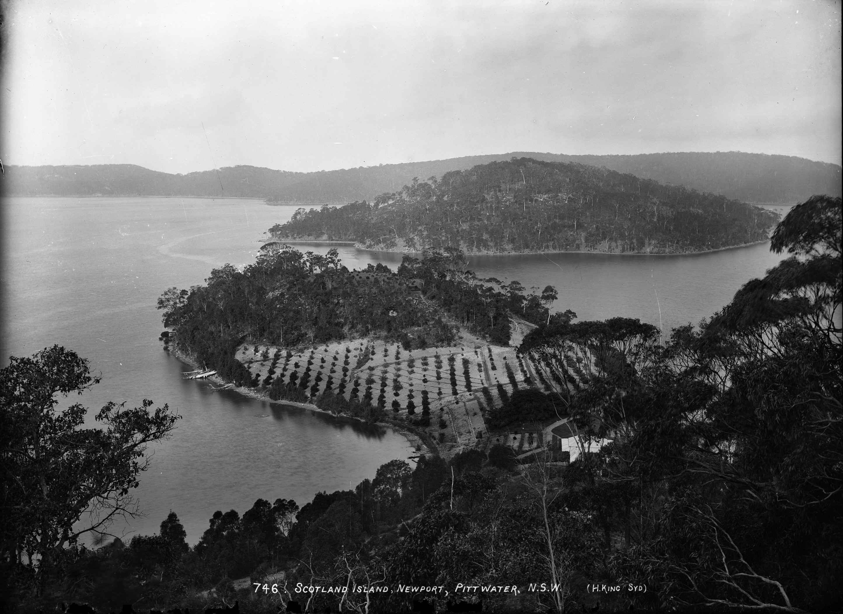
'Scotland Island, Newport, Pittwater, N.S.W.', photo by Henry King, Sydney, Australia, c. 1880-1886. From Tyrell Collection, courtesy Powerhouse Museum
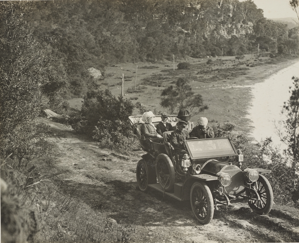
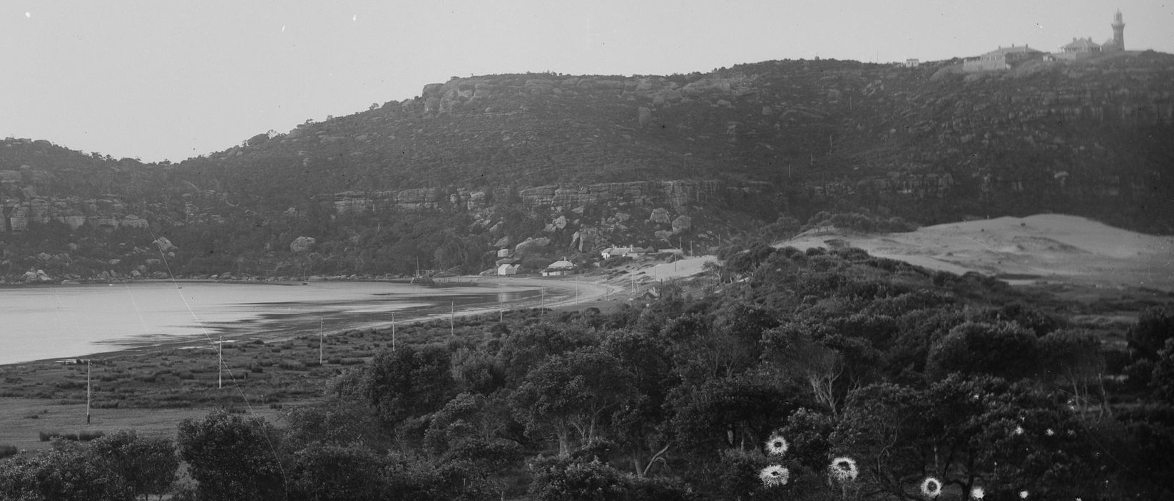
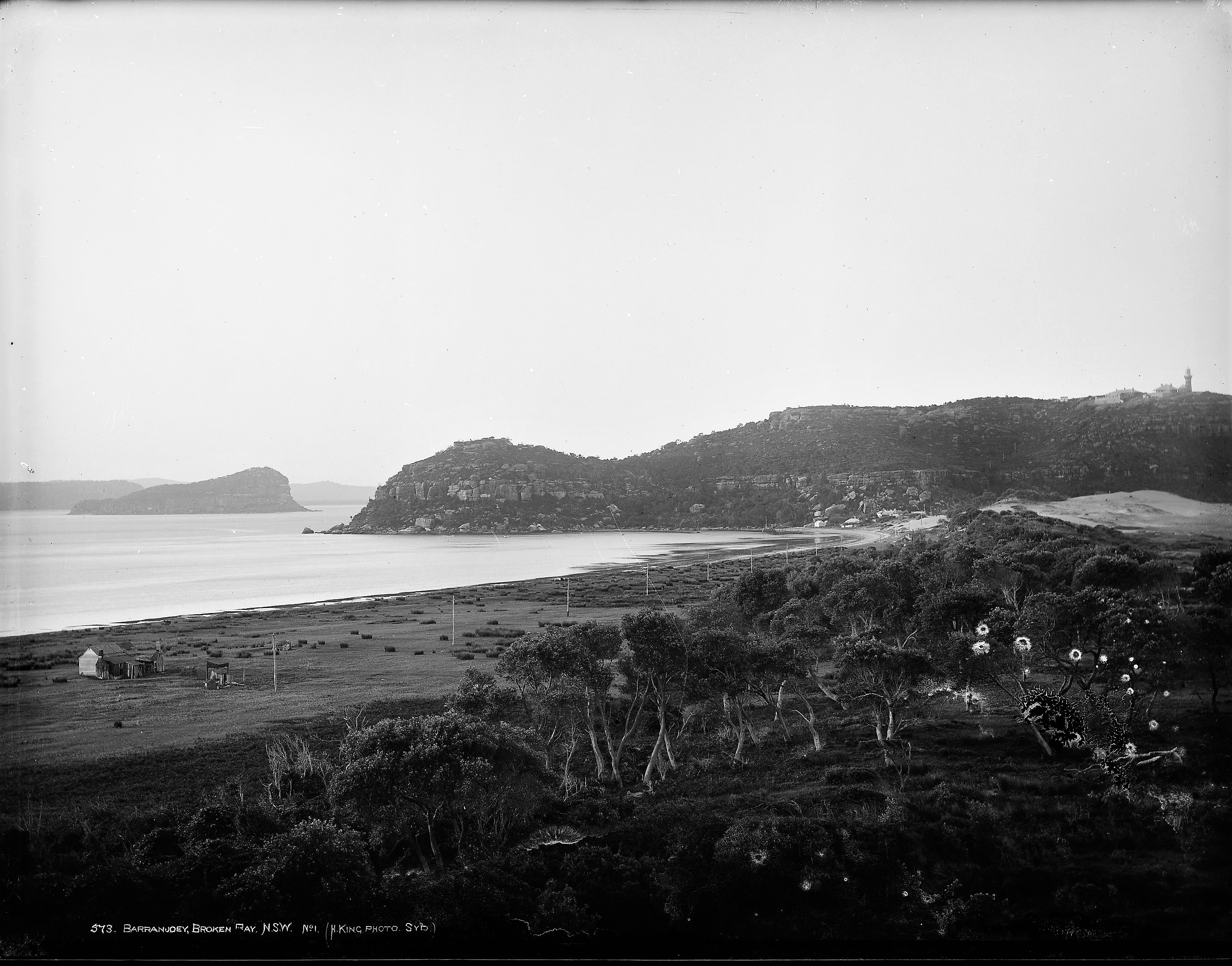 'Barranjoey' by Henry King, circa 1880, courtesy Tyrell Collection, Powerhouse Museum - and section from:
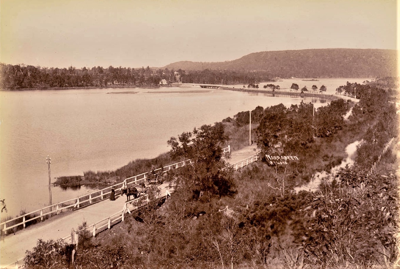
Narrabeen, Star photo, circa 1900. Item a116483h courtesy State Library of NSW
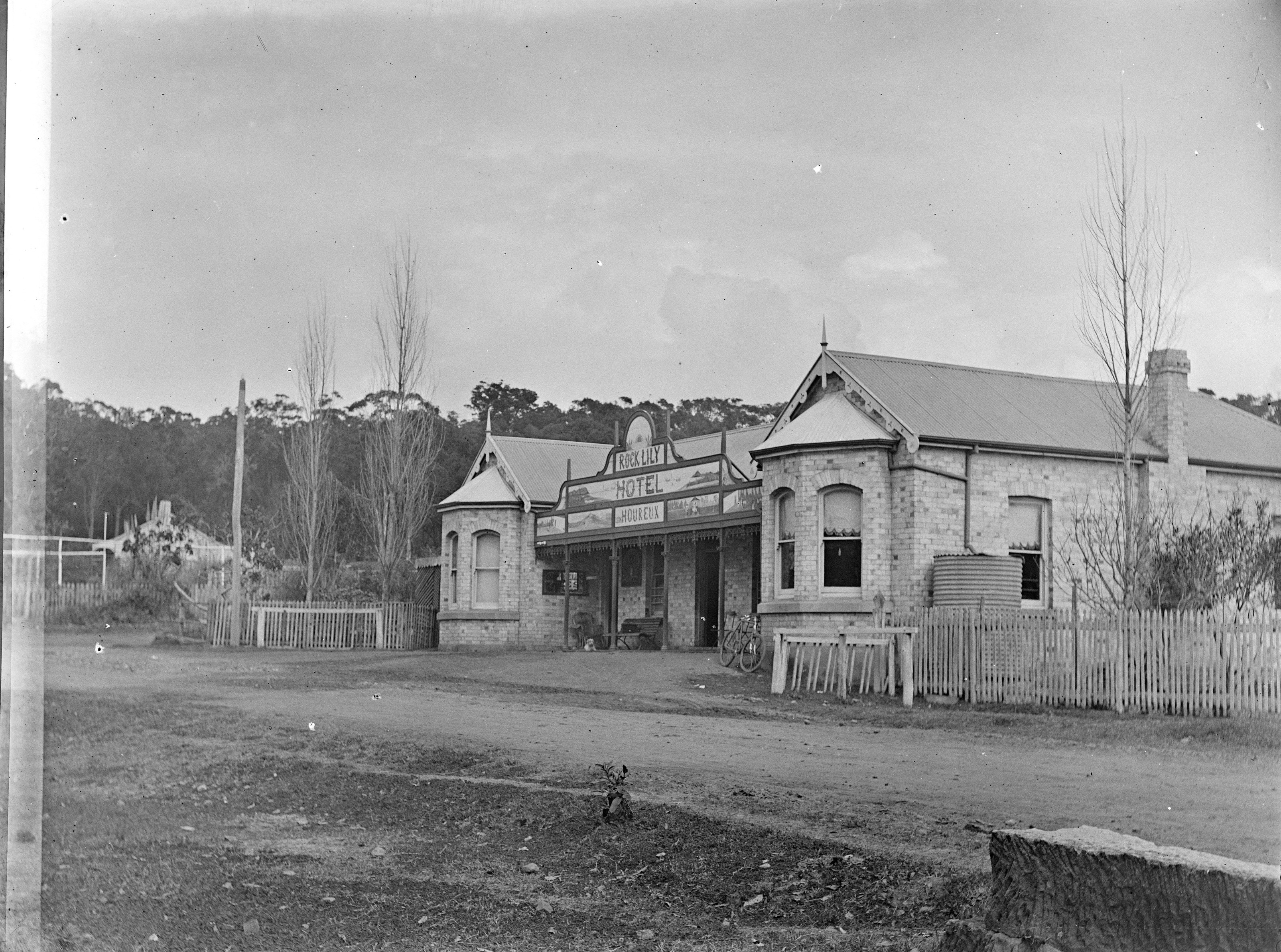
Rock Lily Hotel, Rock Lily (old name for Mona Vale section here) circa 1900-1907, Item: c16401_0050_c, courtesy State Library of NSW
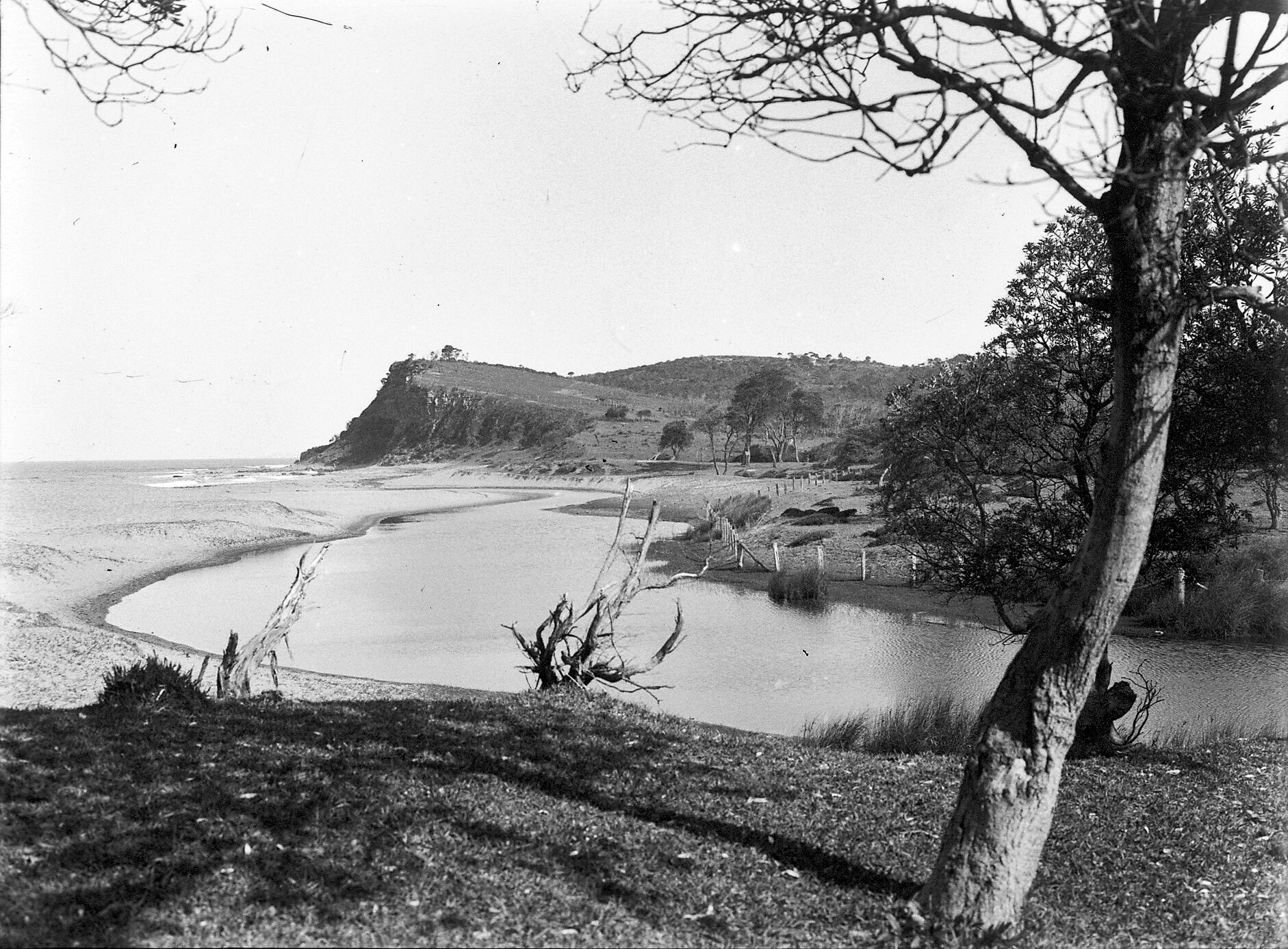
'Farrells Beach' Newport, 1912 showing lagoon outlet onto southern end of the beach. Item: FL2703235, courtesy NSW State Records and Archives
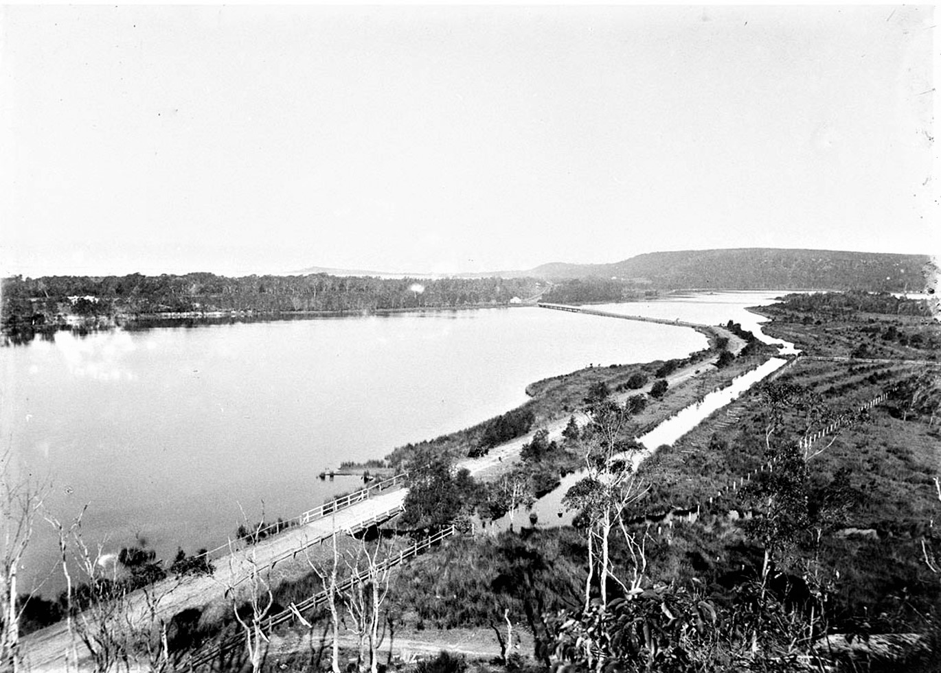
Narrabeen lagoon, circa 1915, Item hall_34703h, courtesy State Library of NSW
By Sydney's Shallow Waters - Flood And Field. Meccas Of The Sydney Motorist.
Cazneaux — Photos.
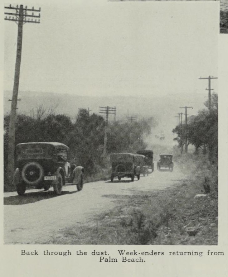
Back through the dust. Week-enders returning from Palm Beach.
.jpg?timestamp=1709955024328)
A Dodge car on the road beside the lakes at Narrabeen.
%20-%20Copy.jpg?timestamp=1709955066414)
A popular afternoon run beside the Narrabeen Lakes.
.jpg?timestamp=1709955103877)
Camping-grounds for cars at Narrabeen Beach.
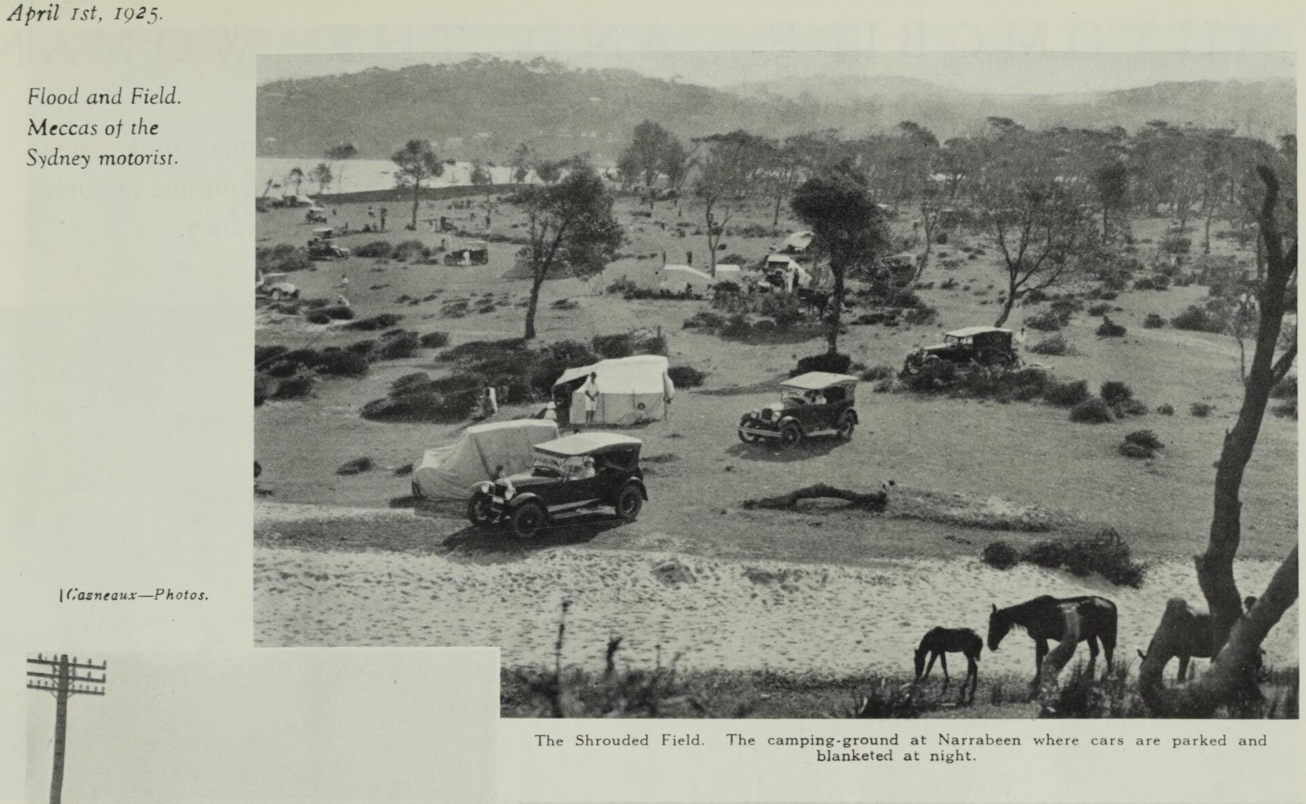
The Shrouded Field. The camping-ground at Narrabeen where cars are parked and blanketed at night.
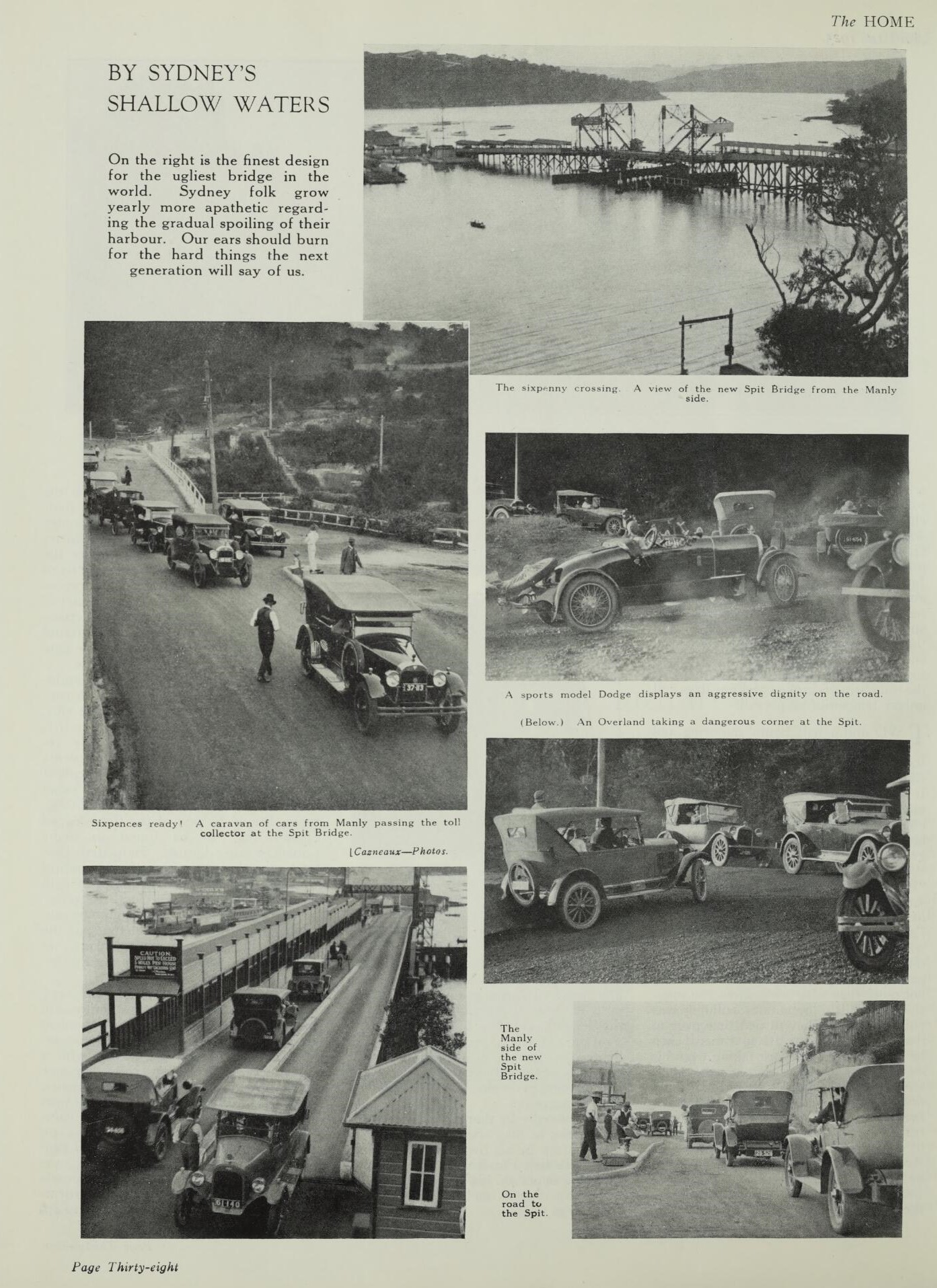
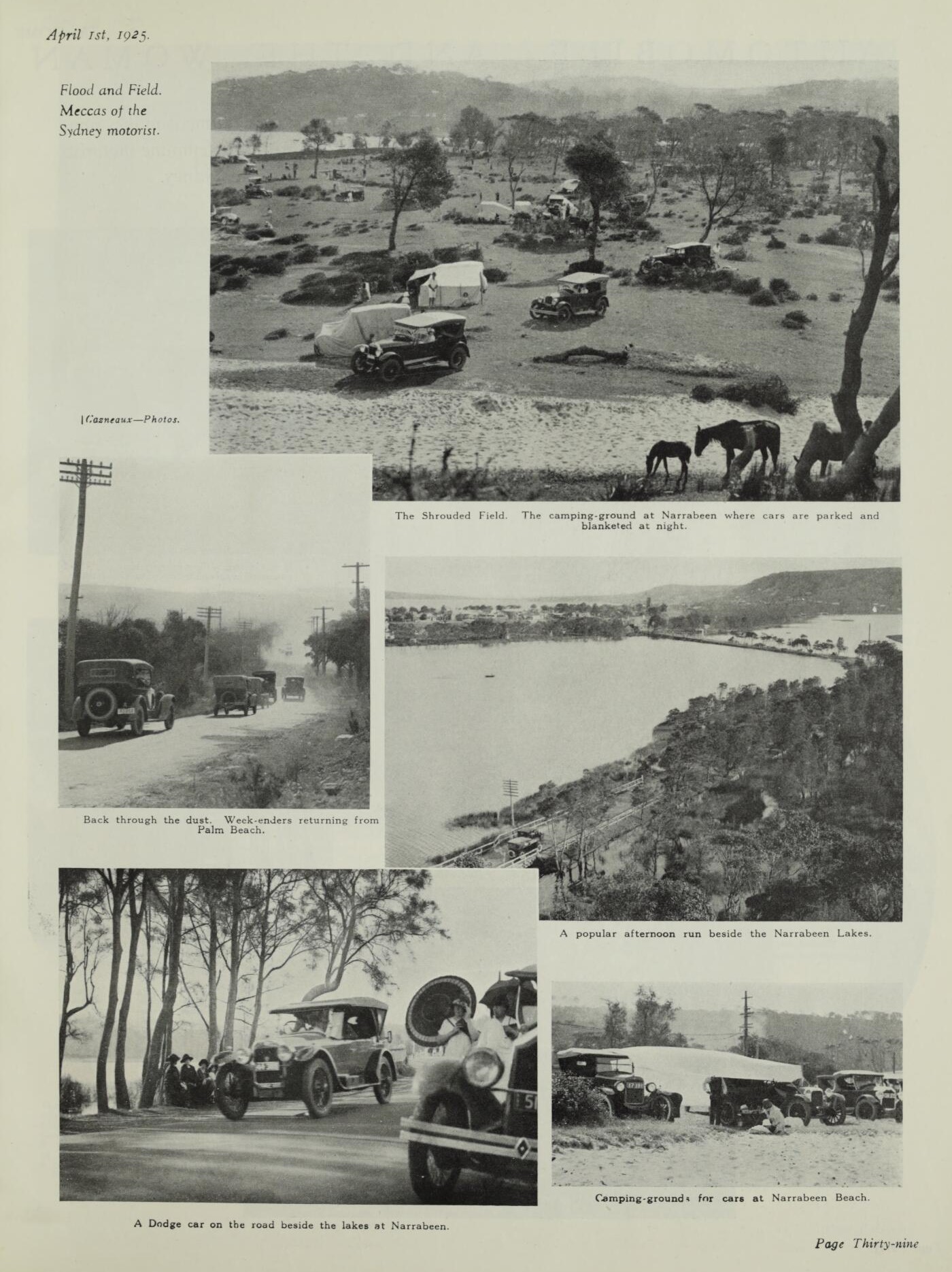
(1920 founded – April 1 1925 edition). BY SYDNEY’S SHALLOW WATERS, The Home : an Australian quarterly Retrieved from http://nla.gov.au/nla.obj-383961452
It wasn't just the access to motor vehicles that brought people here - thousands would attend surf life saving carnivals and would be charged a few pence or up to a shilling to meet the costs of surf life saving equipment, training and clubhouses - this one at Manly Beach for instance:
THE SHORES SET FREE
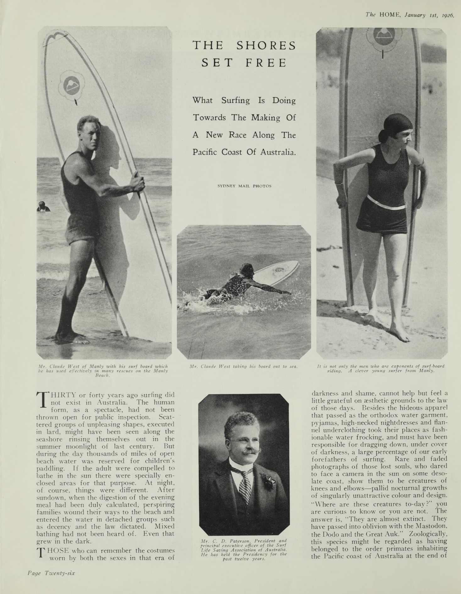

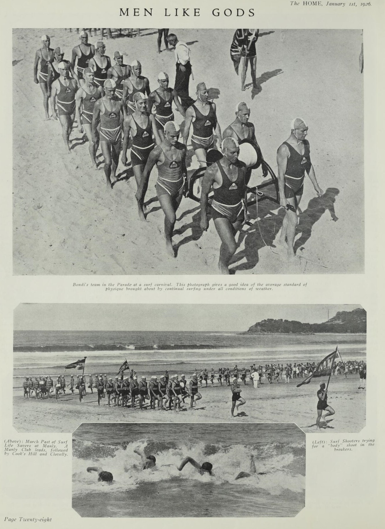
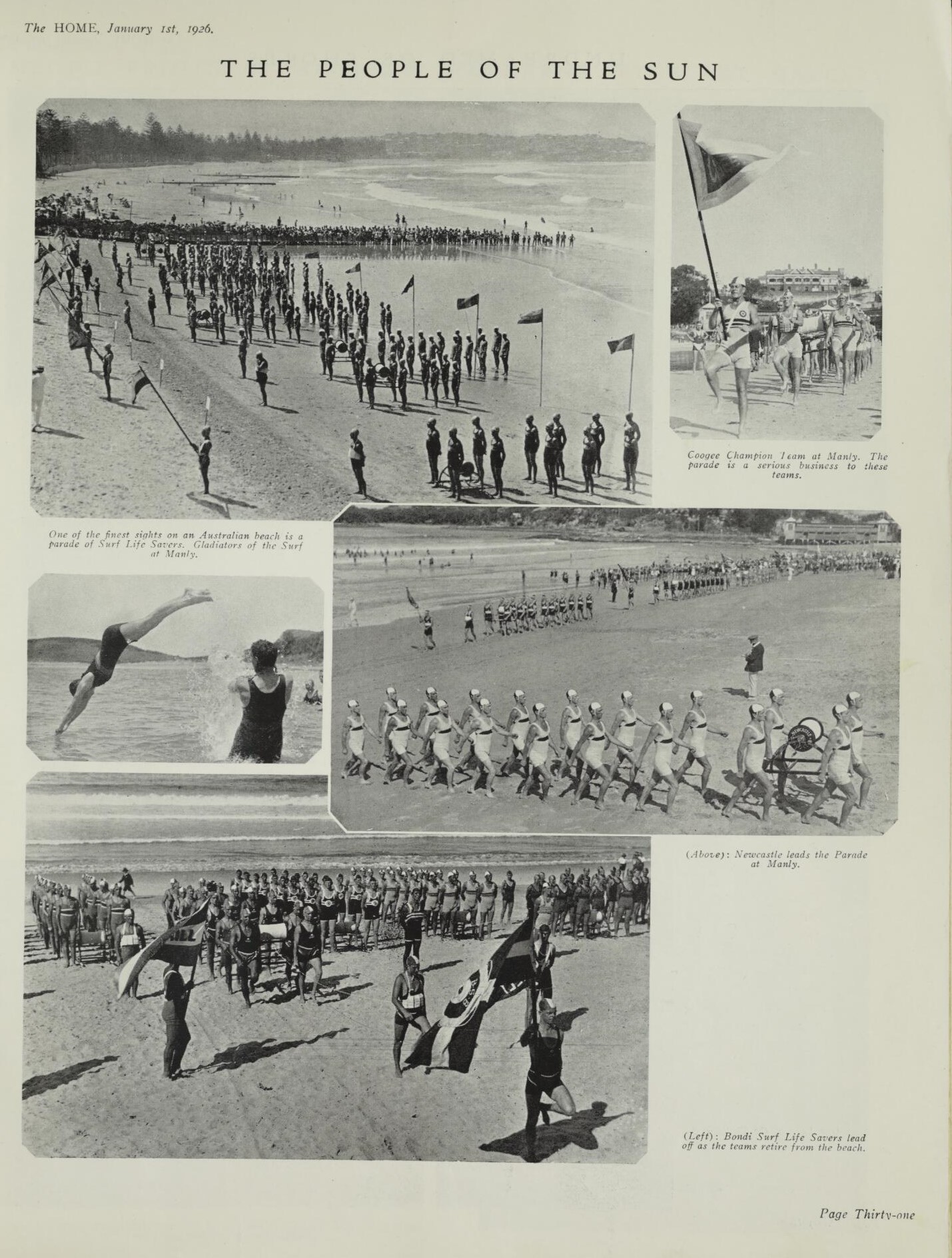
THE SHORES SET FREE, The Home : an Australian quarterly. Vol. 7 No. 1 (1 January 1926) Retrieved from http://nla.gov.au/nla.obj-384017699
In the same Issue of The Home : an Australian quarterly:
UNDREAMED OF SHORES
[PHOTO BY CAZNEAUX
Beaches during the week-end show humanity without its collar and tie and its self consciousness.
Our Lady of the Shallows.
The younger Naiades. These are immortal and preside over the sea-weed and the wet sand.
( Below ). When surf shooters go by the board.
A ridge of sand at Narrabeen where city-dwellers bring their families and hand them over to the sun for Summer suits of brown. page 32
.jpg?timestamp=1709965520593)
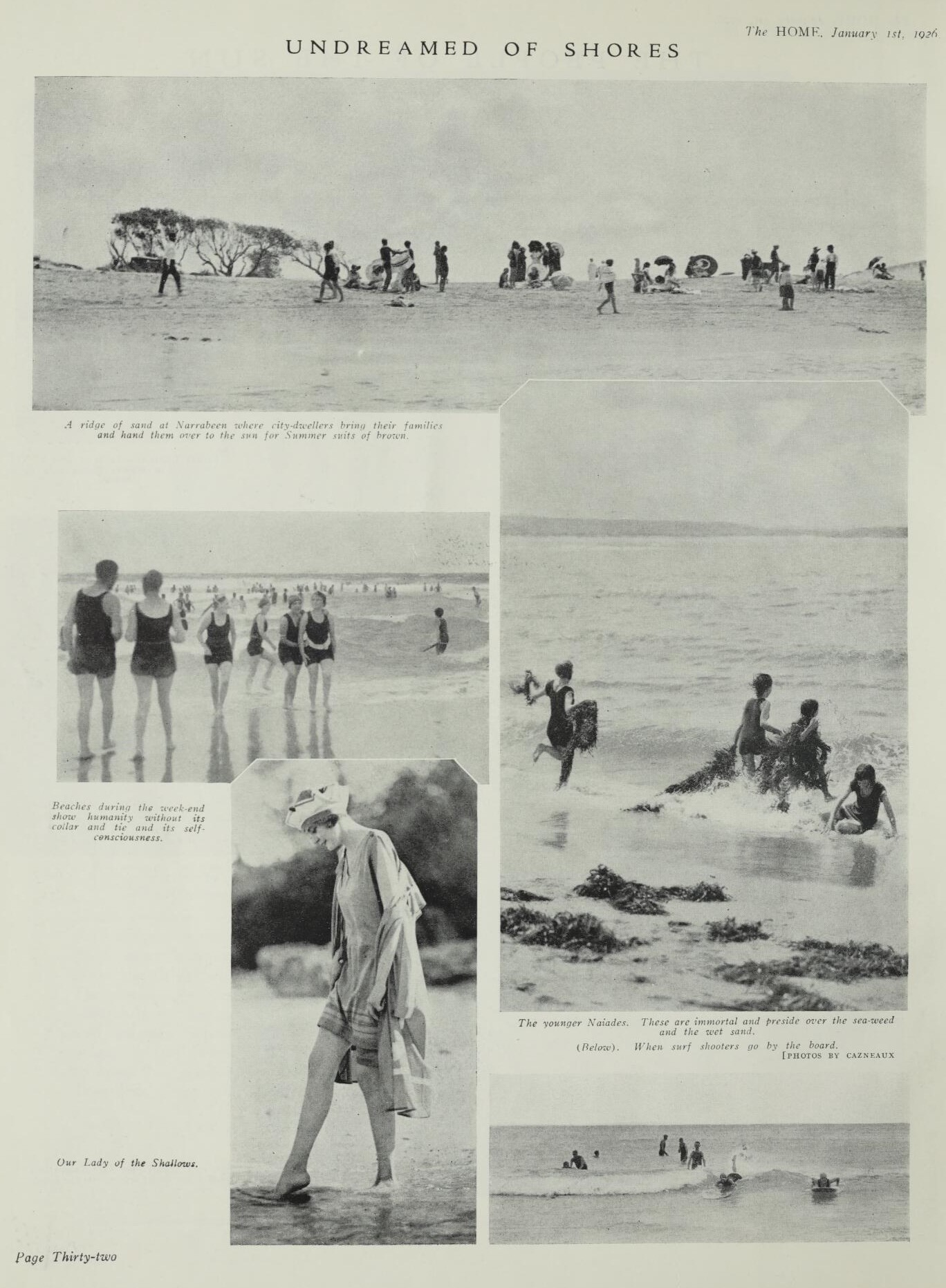
The HOME, January 1st. 1926 (1920). UNDREAMED OF SHORES, The Home : an Australian quarterly Retrieved from http://nla.gov.au/nla.obj-384017855
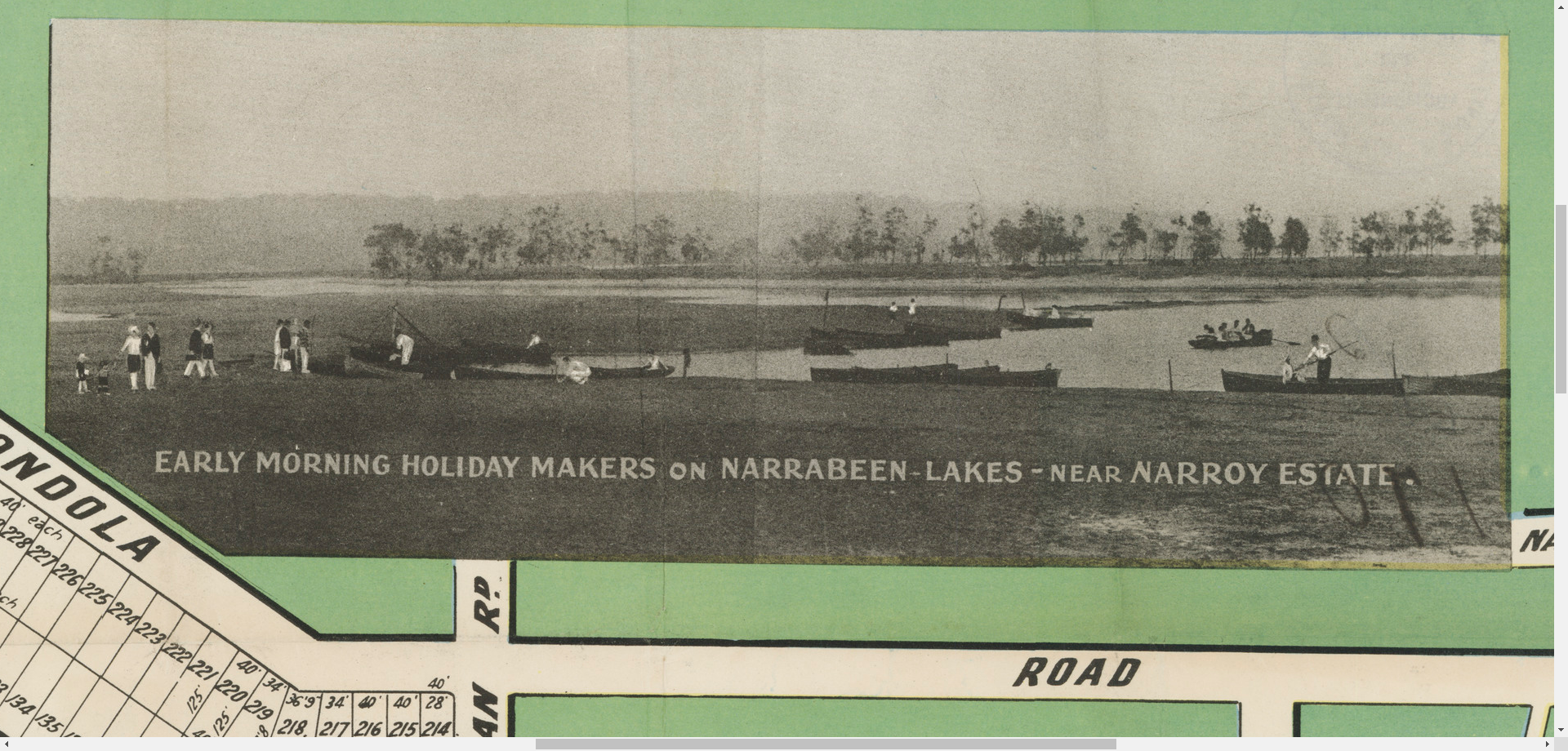
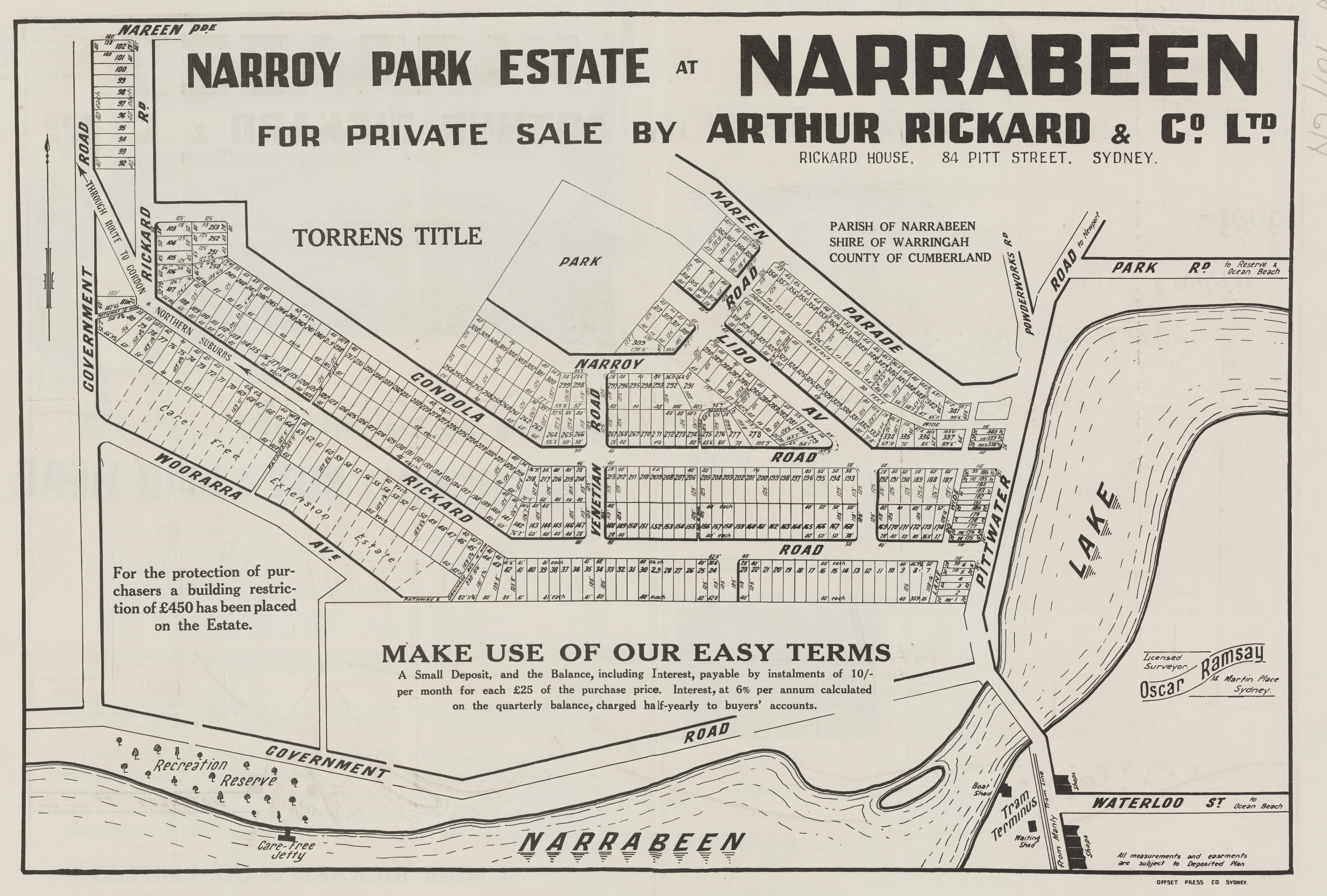
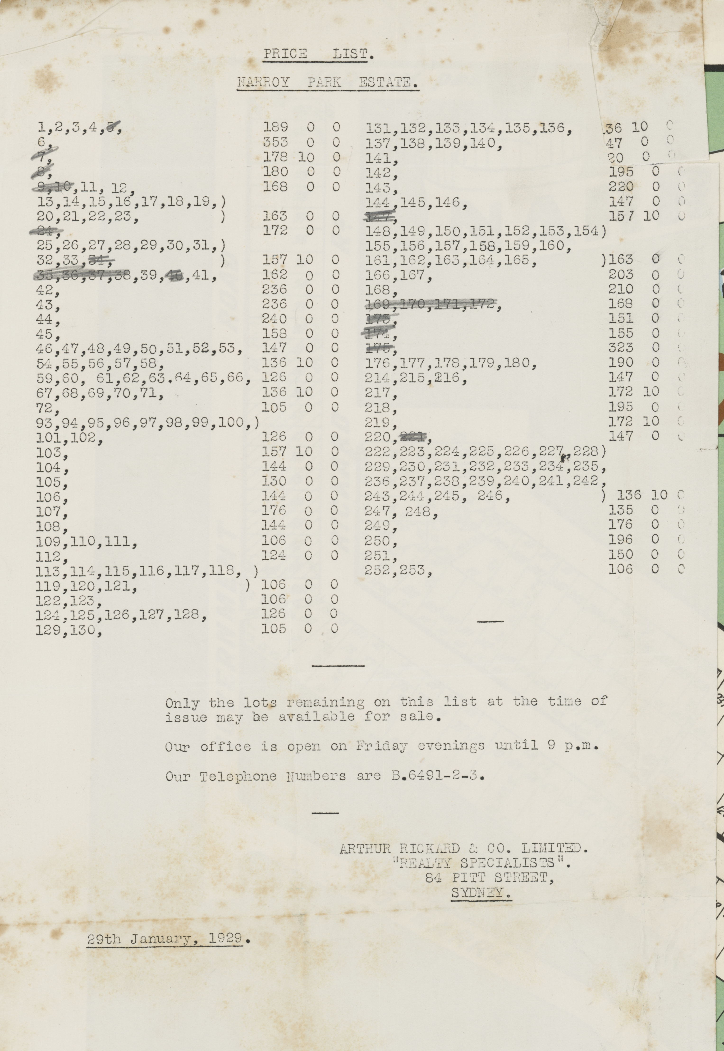
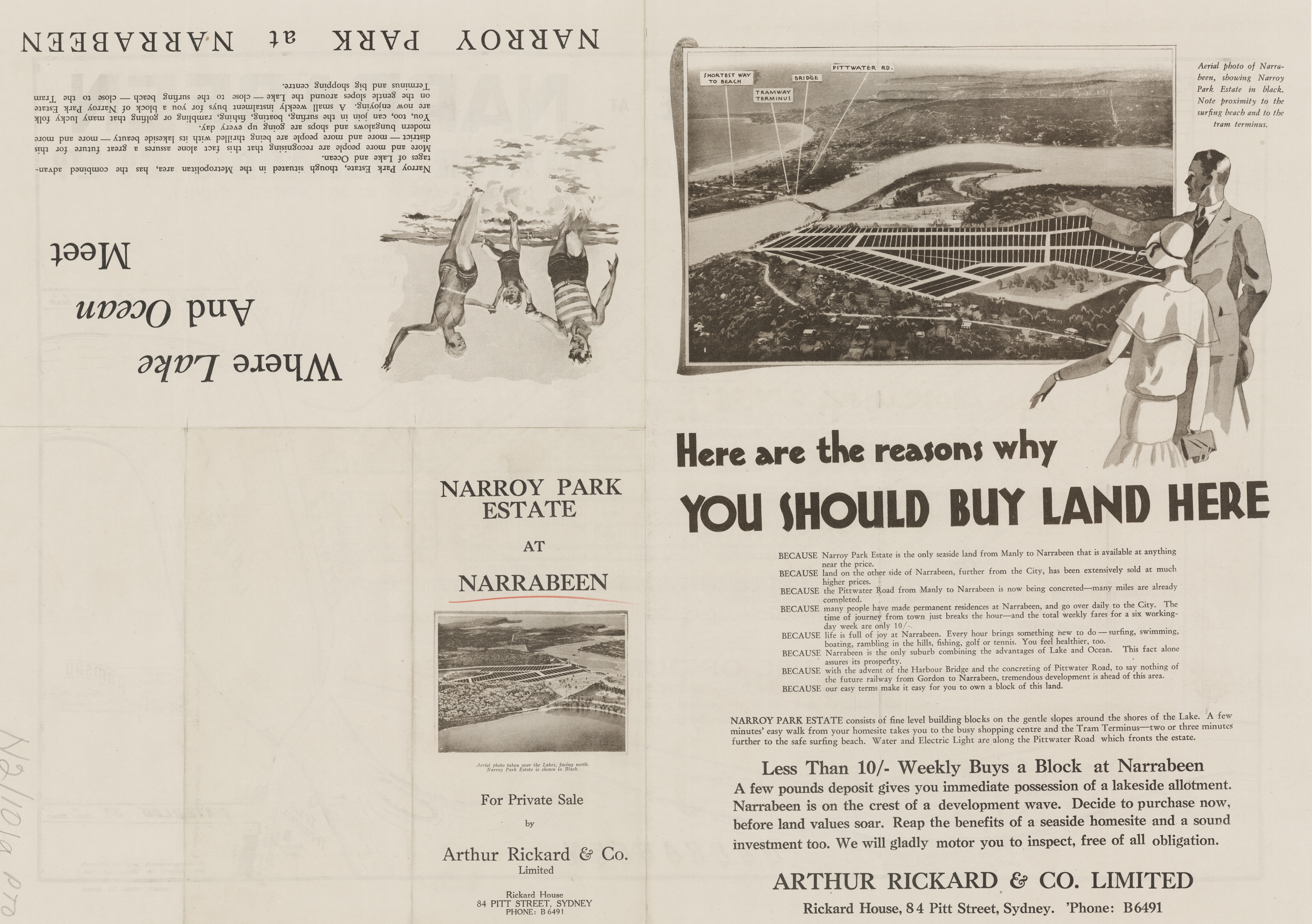
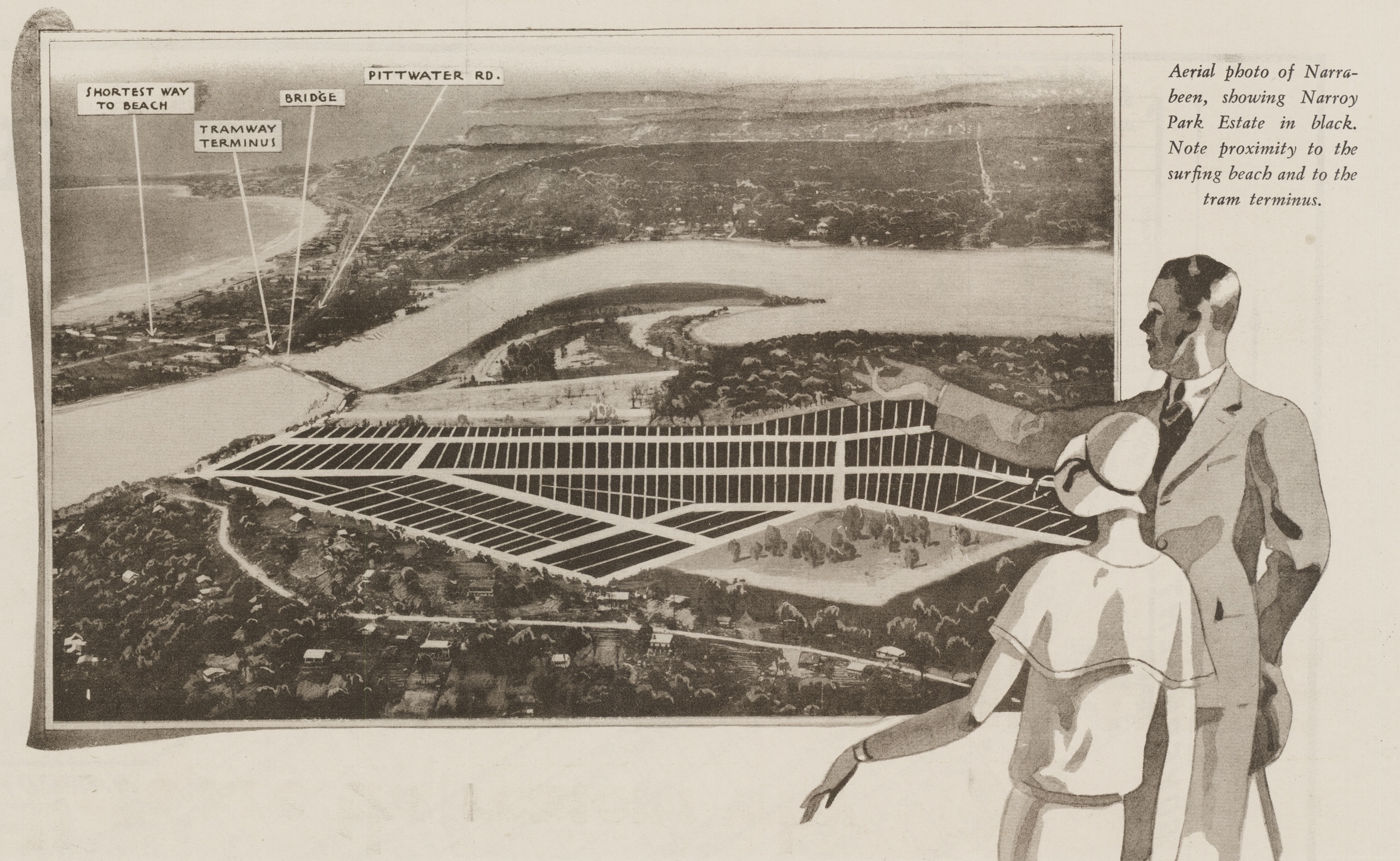
A few years later Rickard's gained permission to 'reclaim' parts of Narrabeen Lagoon on the Macpherson Lands - Warringah Shire Council minutes of meetings record:
17. Arthur Rickard R_Ia, 23.4.1926. submitting Plan of proposed subdivision of Pors. 4 and 52, North of Narrabeen Lake, with proposals for reclaiming the land, dedication of Public Recreation Grounds', and c. and c.
Jim Boots, who moved to Narrabeen in 1925, explained in his 2000 interview by Historian Roslyn Burge:
Father worked – near north Narrabeen bridge near the surf and went right through Narrabeen to Deep Creek. Father moved sand by horse and dray and steel skiff. Had a man helping him
The whole of Narrabeen Wimbledon Avenue right through to North Narrabeen was nearly all swamp and reeds. Built whole of Wimbledon Avenue, did this for Mr Rickard – Rickard’s Estate. Up Rickards Road to North Narrabeen where the football field is and the camping area where the high school is – all that area was swamp and reeds – 3 foot in height.
Jim and his siblings played in the reeds on the way home from school. Contractors did the dredging – did it about 1927/8 – did the work for about 2 years.
The Lake was so deep and so lovely and clear and clean water – full of fish and miles of prawns and buckets of prawns - 16 foot sailing boats used to sail up to Deep Creek. Olympic Rowers were training.
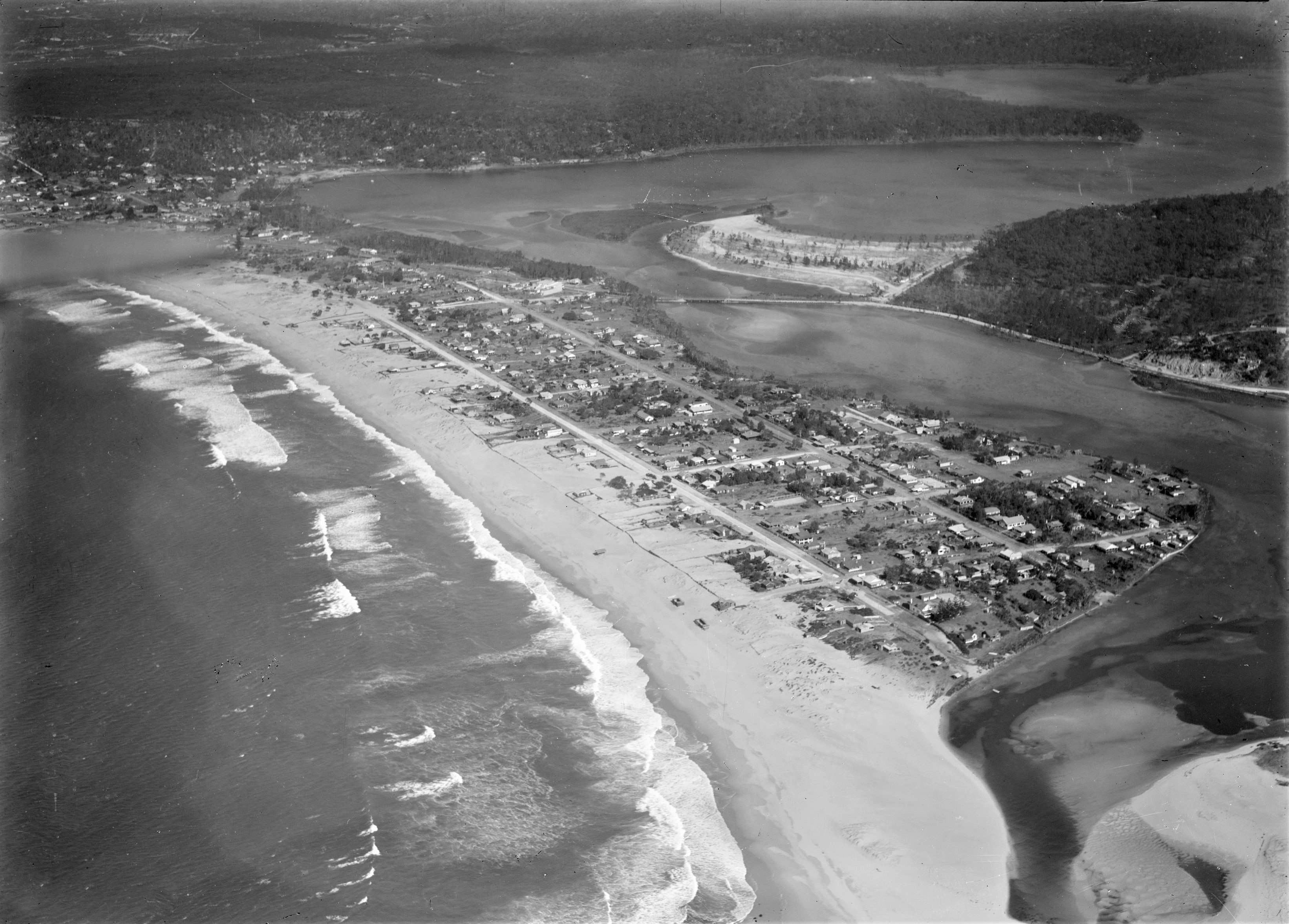
Narrabeen Lagoon aerial, from album Milton Kent aerial views of Bondi, Cronulla, Granville, Haberfield, Middle Harbour, Narrabeen in 1928, Mascot, Sydney, Sydney Harbour, Tempe, between 1926-1938, Item: c111660015, courtesy Mitchell Library, State Library of New South Wales - and sections from to show details; NB - no Bridge from Ocean street across Lagoon present, and old Nth. NSLSC still on beach - so pre-1927 and showing the larger section now reclaimed where Wimbledon Avenue will be formed:
.jpg?timestamp=1593071813851)
Striking Aerial Views : Newcastle and Narrabeen
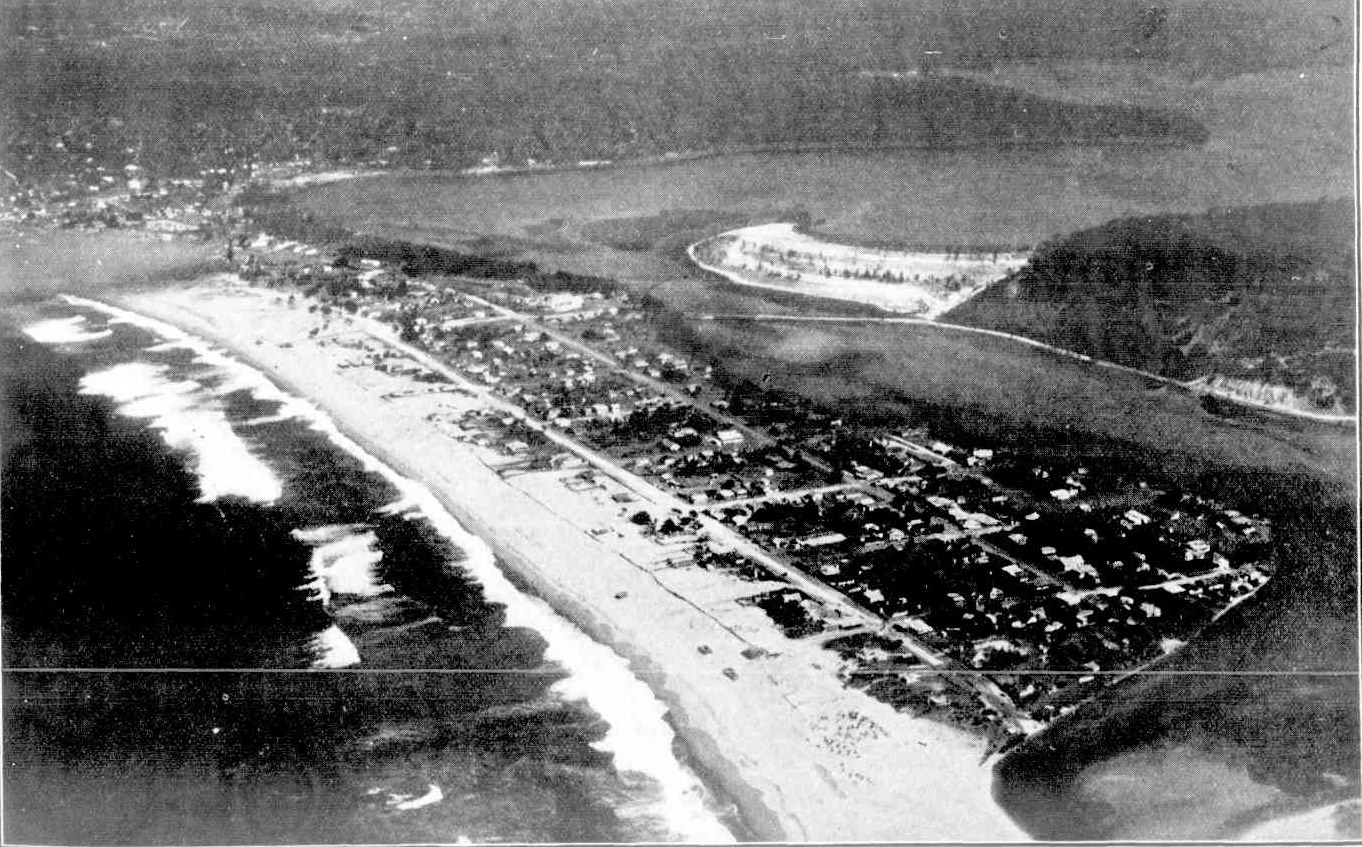
NARRABEEN, BETWEEN OCEAN AND LAKE. This fine strip of ocean beach runs from North Narrabeen through South Narrabeen to Collaroy (on the left). Narrabeen proper is situated on the peninsula in the centre of the picture. The main road from Manly to Newport, Avalon, and Palm Beach runs through the upper portion of Narrabeen, crossing the lake by the bridge, beyond which is seen a portion of low -lying land now being reclaimed. Striking Aerial Views : Newcastle and Narrabeen (1928, August 22). Sydney Mail (NSW : 1912 - 1938), p. 17. Retrieved from http://nla.gov.au/nla.news-article158401835
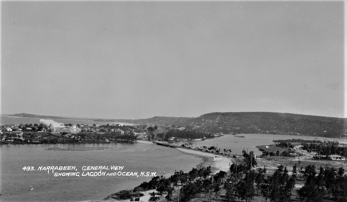
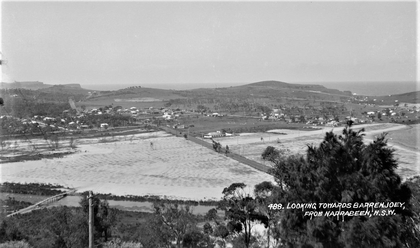
Narrabeen Lagoon, General View showing Lagoon and Ocean and Looking Towards Barrenjoey, From Narrabeen circa 1927/28, from Album 'Samuel Wood - postcard photonegatives of Narrabeen,' - Items a1470096h, a1470091h, courtesy State Library of NSW
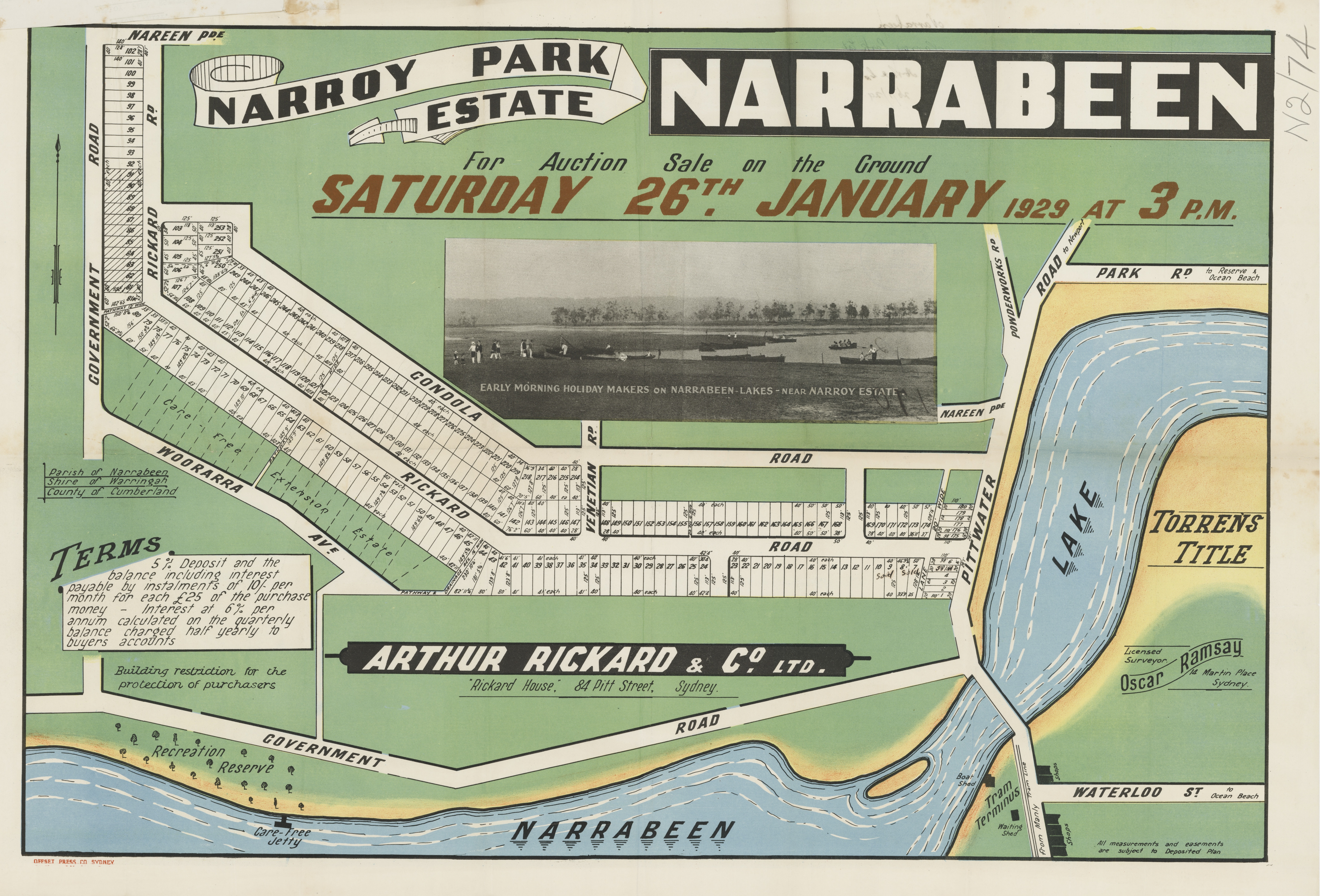
More in: Pictures From The Past: Views Of Early Narrabeen Bridges - 1860 To 1966 and Pittwater Roads II: Where The Streets Have Your Name - Narrabeen
THE OLD ROAD
Narrabeen's Unspoilt Days
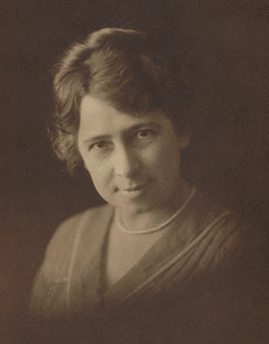 Once, long ago, the drive along this road was a feast of beauty, when one bowled along between sea and bush, with wide-spreading views on either side. We used to leave Circular Quay by the 8 o'clock boat to Manly, where at the wharf was waiting the old coach with its four horses. With luck-one seemed to be always lucky in those far-away days we got box seats and set out on our journey with gay spirits in the morning sunshine.
Down the Corso we rattled, and along the Steyne, with the pine trees making a delicate screen between us and the blue ocean. Leaving the Steyne, we crossed the bridge over the lagoon, not yet drained and ordered, into a golf course and suburban lots, but stretching lazily over the lowlands, where a vegetable gardener or two grew produce for "The Village."
Then on past swamps, where red callistemon flowered in thousands, on round the foot of the hills, where a million flowers bloomed amongst the grey rocks and birds sang gaily and darted to and fro before us.
Here and there, at long intervals was a dwelling-some hermit in search of solitude, or an intrepid pioneer sensing the future value of the land. But so few they were that they scarcely made an impression on the landscape, and the drive seemed to be all bush. All bush and sea, for ever and again as the road leaned seawards we had the uninterrupted view of golden sand and blue ocean. Deewhy Lagoon, with its background of sand- hills and bushy cliffs, was a-swarm with black swans.
Narrabeen stretched In a long, unbroken vista from Long Reef to the Lakes.
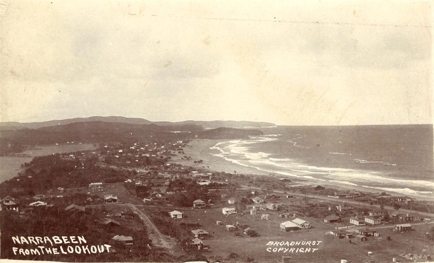
Narrabeen from the Lookout. circa 1900-1910 Image No.: a106055h, from Scenes of Narrabeen Album, Courtesy The Mitchell Library, State Library of Australia
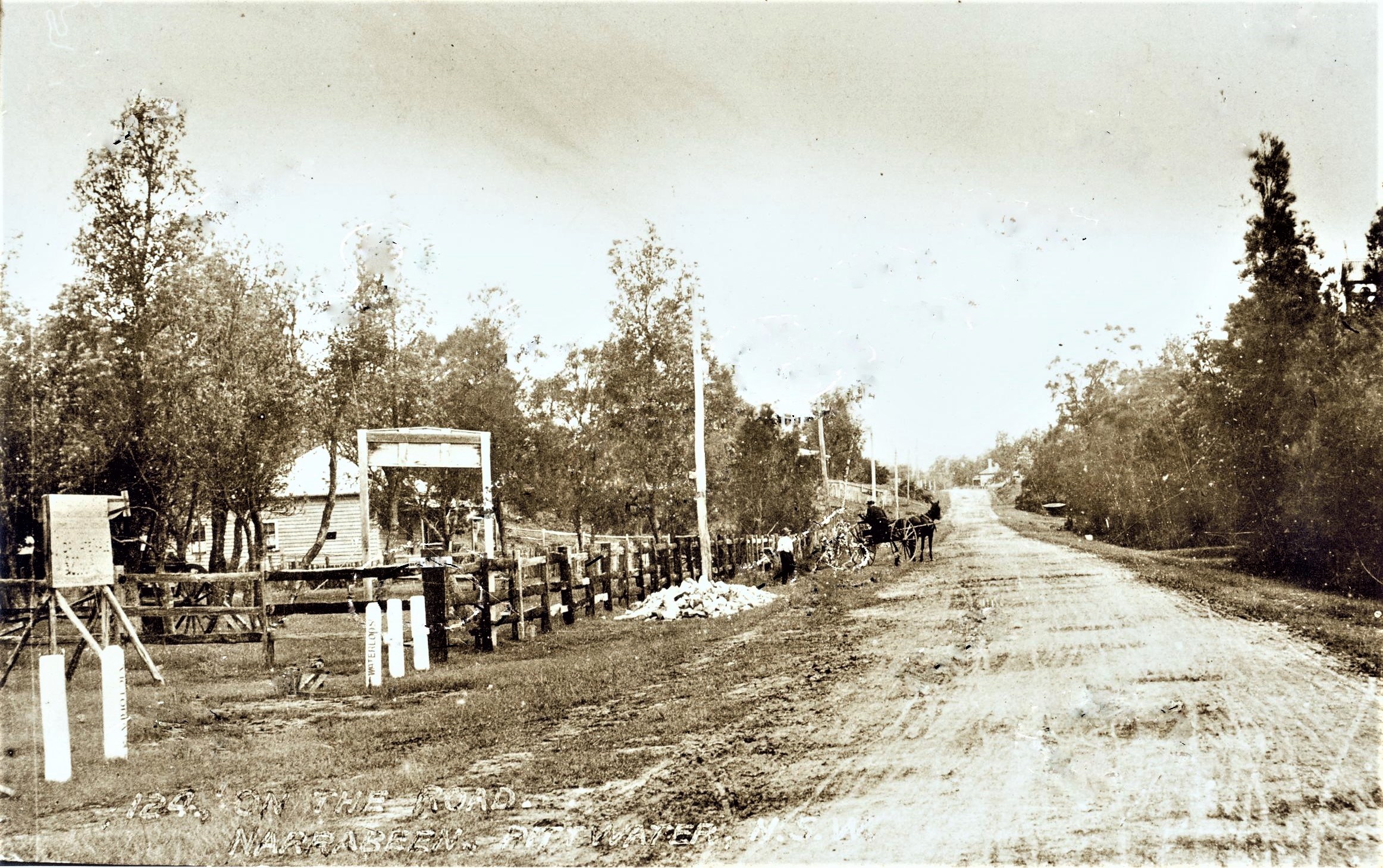
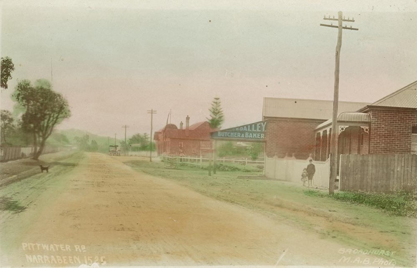
Waterloo street and Pittwater (Ocean) road looking south - Broadhurst Postcard, circa 1900, courtesy State Library of NSW
What houses there were were mostly on the land side of the road, and a few on the shore were so scattered that they did not interrupt the view. (Our young architect used to plan an ideal Narrabeen, with all the dwellings on the hillside and the whole sea front a reserve.) And so all the way to Church Point. At Rock Lily and Bayview, where painters and professors had holiday homes, the houses were built on the higher side of the road, above the encroachment of the tide and the mosquito-laden swamps, and the view was free for all travellers to enjoy.
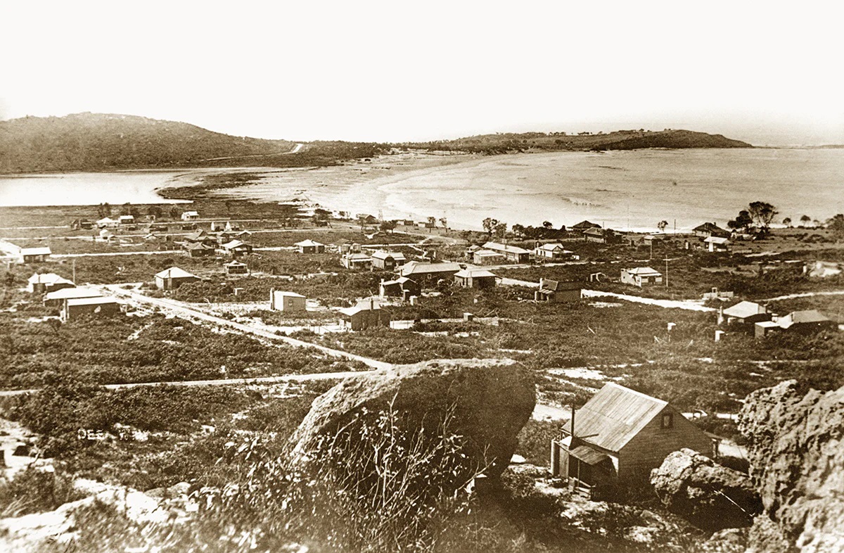
Dee Why looking north to Long Reef, circa 1919
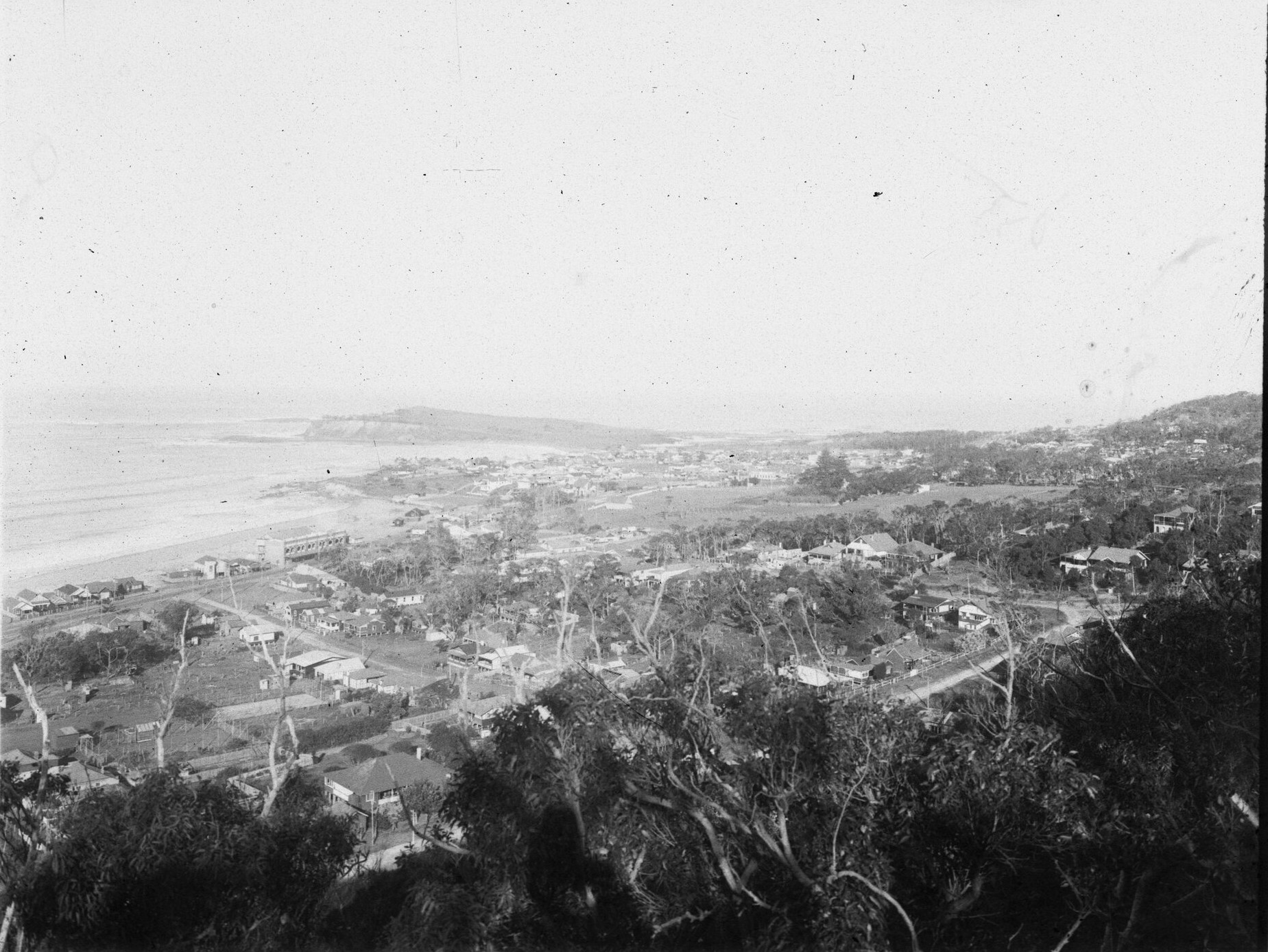
Collaroy Views: Collaroy and Long Reef from Narrabeen Heights, 1925. Item: FL4900093, Government Printing Office 1 - 15672, courtesy NSW Records and Archives.
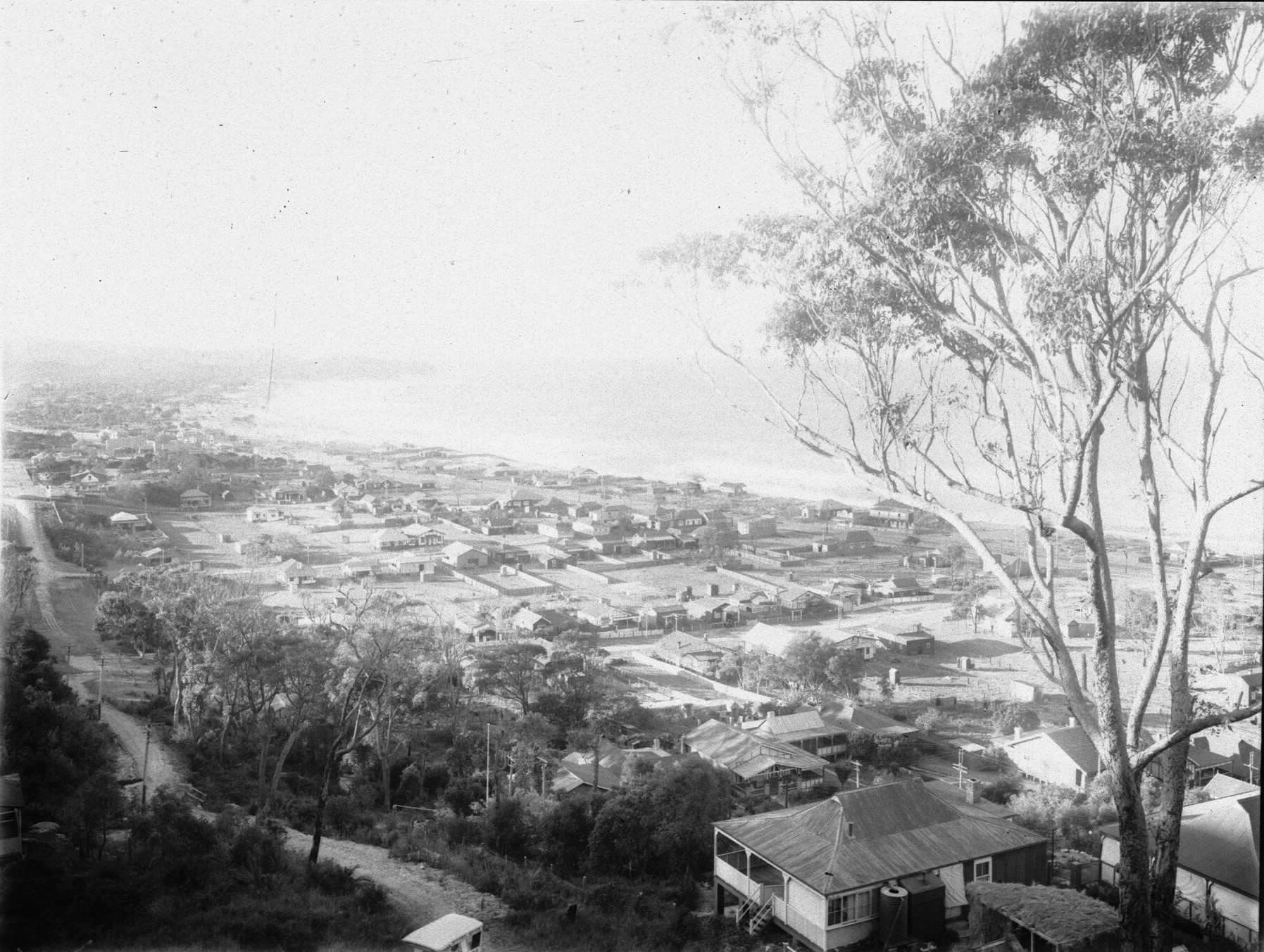
Village of Narrabeen, 1925. Item: FL3838572 - [From NSW Government Printer series: Narrabeen views]Government Printing Office 1 - 15971, courtesy NSW Records and Archives.
JOLTS AND JERKS.
Perhaps time has shed a glamour on that drive. Certainly the road surface was not what it is to-day, and the old coach rolled and rattled at times, but what are jolts and jerks to sixteen on a fresh spring morning, with sea and sky and bush alive with beauty?
Of the road which branched off to Newport and beyond we knew less, but we used to hear of the many charms along its length from two young men who every winter Sunday morning set out with a packet of sandwiches to walk to Barrenjoey. (They didn't "hike" in those days; they simply walked.) Later we came to know that road well, too. The green slopes and beach of Mona Vale, where a man ahead of his generation had built a mansion, almost at the end of the world it seemed then, the spreading sandhills of Newport, and the little beach beyond, with its rich palm grove-we knew them in their unspoiled days.
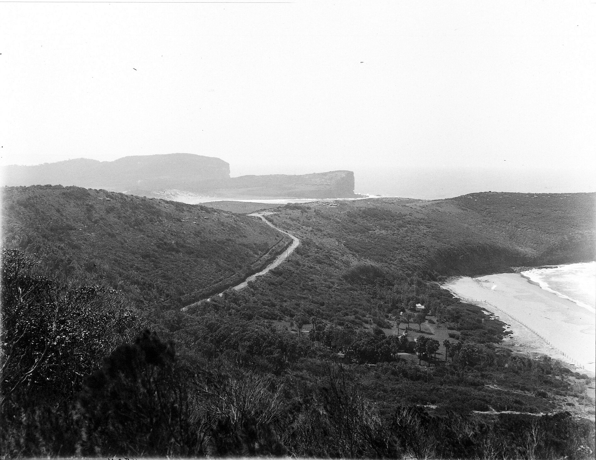
Bilgola 1912, Item: FL2703195, Courtesy NSW State Records and Archives
Leaving the sea, the road climbed across to the inland harbour and ran along the water's edge, with nothing but the tall gumtrees to break our view of the blue bay; past Careel Bay, with its mangrove swamp; past the green flats, with their narrow border of pearly sand, to Palm Beach itself, where the gaunt grotesque tea-trees and banksias grew to the edge of the rosy sands.
But year by year the road grew, and In Its growing lost much of its charm. Tramlines stretched out mile upon mile; houses sprang up in long rows; the swamps were drained; the wild flowers disappeared. At Deewhy the black swans still floated on the lagoon, but in lessening numbers; Narrabeen Beach-now Collaroy-was hidden by a continuous line of cottages, and the sea was glimpsed only at the end of side streets; our young architect's dream of an ideal Narrabeen was gone for ever. The pleasant green sward which flanked Broken Bay at Palm Beach was covered with dwellings, and the white beach which encircled it "like a lovely woman's arm." as a poet said, was barely visible from the road. On the ocean front most of the tea-trees and banksias had gone to make way for neat lawns stretching to within a few yards of the water. Everywhere beauty had been driven out by profit, and the road which might have been one of the loveliest of seaside drives had been reduced to an almost suburban dullness.
THE NEW ROAD THREATENED.
With a luck which comes but seldom to those who have wasted their opportunities, this coastal strip has been given another chance. A new road has been built along the top of the cliffs, with wide views over hills and ocean. It is a road along which we always take our visitors, and we are never disappointed at their exclamations of surprise and delight.
One world traveler said: "I have never seen a more beautiful seascape. It alone is worth the long journey to Australia!"
But alas! this new road is threatened with the fate of the old one. Already here and there a building stands between the road and the ocean. At present they are too few to spoil the landscape, but unless some action is taken in a few years, the whole of the view will be blocked out by rows of houses, and our last chance of a magnificent scenic drive will be gone. THE OLD ROAD. (1933, May 6). The Sydney Morning Herald (NSW : 1842 - 1954), p. 9. Retrieved from http://nla.gov.au/nla.news-article16965117 - Above: Photo of Amy Eleanor Mack, by May Moore, National Library of Australia, nla.pic-an3084668
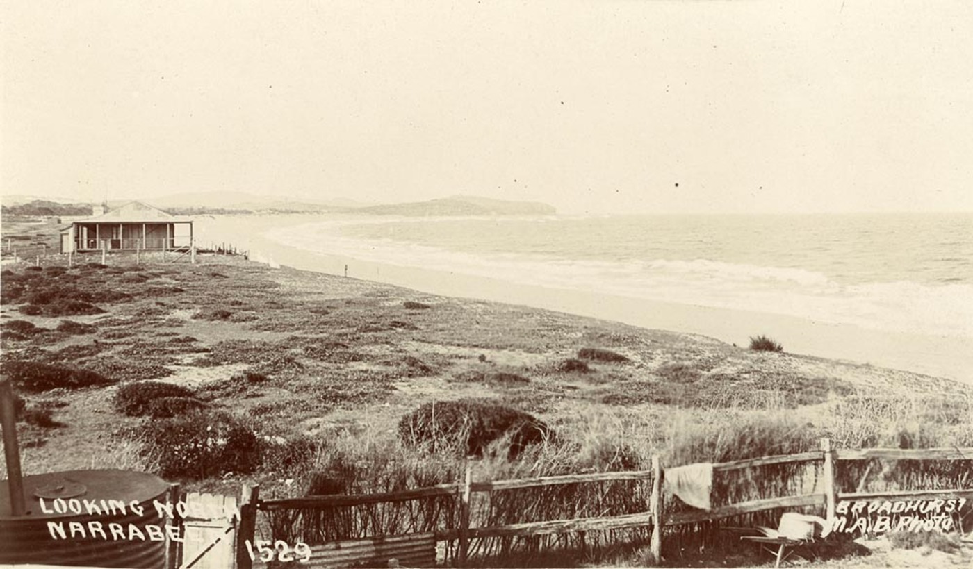
Looking north to Narrabeen, From Scenes of Narrabeen album, circa. 1900-1927 Sydney & Ashfield : Broadhurst Post Card, Images No.: a106058h and below; a105160h courtesy The Mitchell Library, State Library of NSW
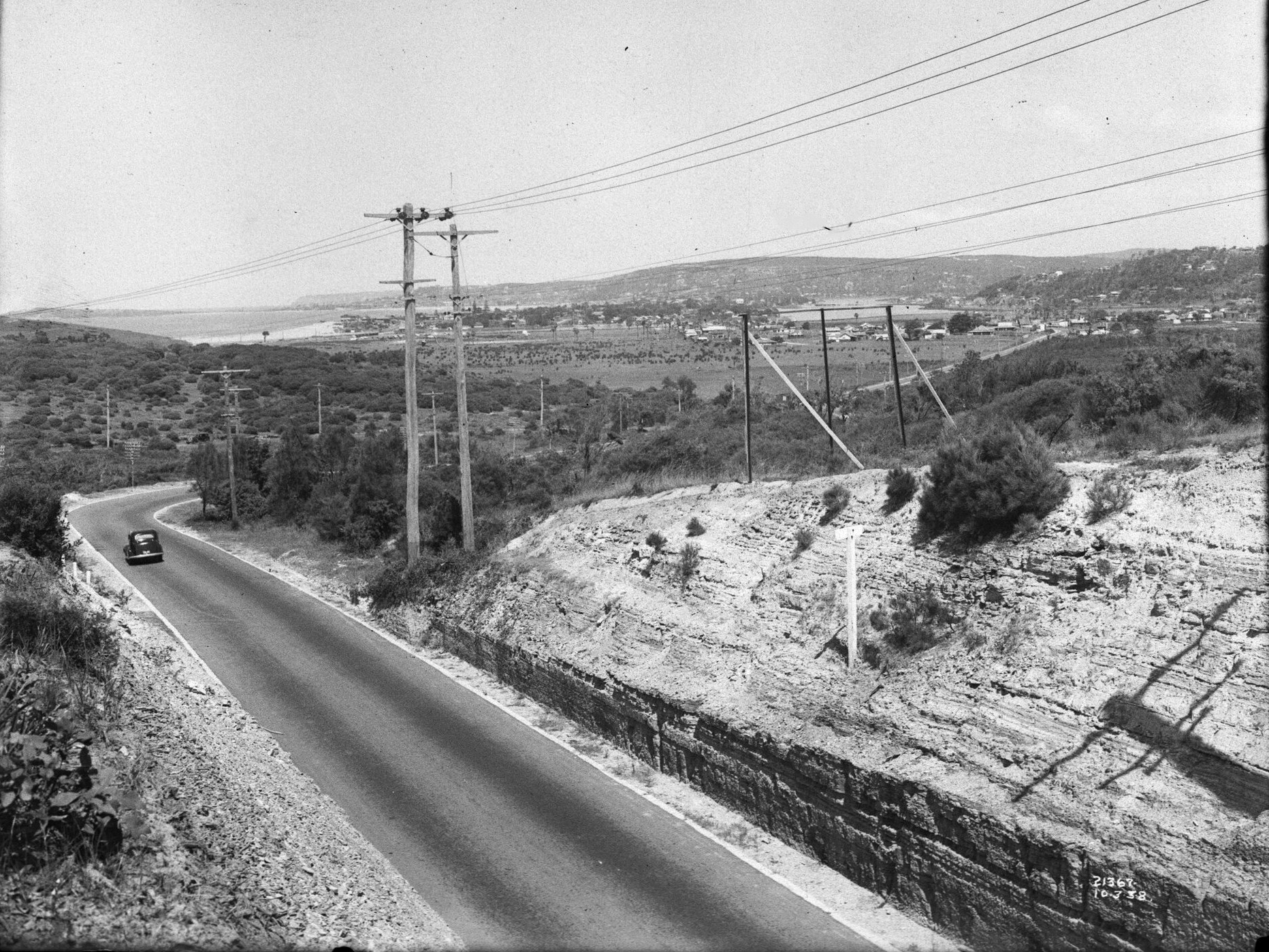
Pittwater Road, Main Road 164, on top of Sheep Station Hill looking south from Warriewood to Narrabeen, March 3, 1938. Item: FL3611325 courtesy NSW State Records and Archives

