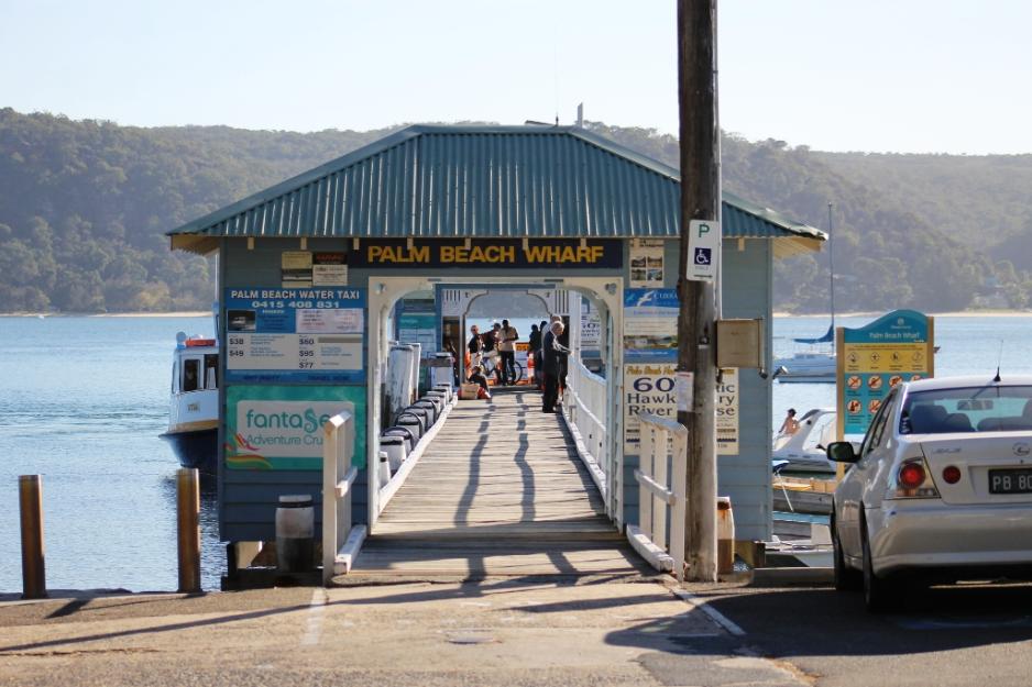
Clear Breach Of Height Limit in DA Recommended For Approval on Old Palm Beach Fish & Chip Site + rezoning of pittwater plans ignite renewed calls for a return of pittwater council

The continuing response to DA plans for the old fish and chip site at Palm Beach, modified but essentially unchanged through 4 iterations so far, records that the vast nucleus of Pittwater residents are still refusing to go silently into the long dark night imposed on them when their council was obliterated and subsumed into the large council it now has, a council which advocates for the overdevelopment of sites and approves or recommends approval of structures that ignore the Pittwater DCP and LEP.
Coupled with the council's rezoning plans, which will affect thousands of properties in Pittwater and just 1 in the former Warringah and 54 in the former Manly council area, the perceived targeted 'trashing of Pittwater', as Pittwater could have its own zoning, have reignited calls for a return of Pittwater Council and that council's focus on looking after the community and the environment that community lives in.
Cheek by jowl townhouses 'for the aging' are appearing in back streets that not only fill the block and tower over the privacy of near neighbours, but are being approved in known flood zones and will load more traffic into the streets or parking on the same. Roosting and Habitat Trees and all low to the ground vegetation are being cleared from blocks with little regard for wildlife or creating heat pockets, and then those same blocks are allowed to fill that whole space with concrete monstrosities. It's beginning to look like the other side of the Narrabeen bridge and every section of land heading south to Dee Why.
Which all works for the financial benefit of the developer at the expense of the community as a whole and neighbours as individuals.
In recent months Pittwater Online News has received several emails regarding DA's that do not comply with the conditions for their zones being approved by the Council. Over the height limit breaches, approving buildings that fill the whole block in zones where there is a 50-50 to 50-60 requirement for vegetation to be retained, incremental excising or whole taking of public land and planting this out to prevent the public using it for a footpath, building structures into and on public reserves are the subjects in each.
Palm Beach Fish and chip site proposals all over height and not meeting zone requirements
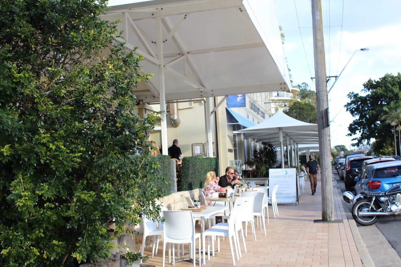
The development application and proposal details for the old Palm Beach fish and chip site has had ongoing attention as it has been drawn as three storeys in a two storey zone and again seeks to not only breach the height limit by metres but also tower over the heritage listed Barrenjoey House and its neighbours. Feedback from residents points out the third storey is all about profit and disrespects not only the community but the beauty of the place it is proposed for.
The Panel’s preliminary view is that proposed development is generally acceptable however the Panel is concerned that the proposed roof form creates a top heavy building form due to the expanse of roof and that this could be overcome by a redesign of the proposed mansard roof form.
Additionally the proposed roof form is unnecessarily high to screen the roof plant and adds to the unacceptable bulk of the proposal. The Panel also considered that the vertical columns overly dominated the street appearance and a more acceptable appearance could be achieved through a finer and light detailing outcome.
"The proposed development is adjacent to a heritage item, Barrenjoey House, and the design of the development must respect that heritage item. Instead it does not give that heritage item respect ‐ it does not give it space to be appreciated (insufficient separation) and in bulk and scale it overwhelms Barrenjoey House."
(a) to ensure that any building, by virtue of its height and scale, is consistent with the desired character of the locality,(b) to ensure that buildings are compatible with the height and scale of surrounding and nearby development,(c) to minimise any overshadowing of neighbouring properties,(d) to allow for the reasonable sharing of views,(e) to encourage buildings that are designed to respond sensitively to the natural topography,(f) to minimise the adverse visual impact of development on the natural environment, heritage conservation areas and heritage items.
Despite subclause (2), development on an area of land shown in Column 1 of the table to this subclause and identified as such on the Height of Buildings Map, may exceed the maximum building height shown on the Height of Buildings Map for that land, if the height of the development is not greater than the height shown opposite that area in Column 2.Column 1 Column 2Area Maximum height above the flood planning levelArea 1 11.5 metresArea 2 8.5 metres on the street frontage and 10.5 metres at the rearArea 3 8.5 metresArea 4 7.0 metres
(a) the consent authority is satisfied that the portion of the building above the maximum height shown for that land on the Height of Buildings Map is minor, and(b) the objectives of this clause are achieved, and(c) the building footprint is situated on a slope that is in excess of 16.7 degrees (that is, 30%), and(d) the buildings are sited and designed to take into account the slope of the land to minimise the need for cut and fill by designs that allow the building to step down the slope.
- To provide a range of small-scale retail, business and community uses that serve the needs of people who live or work in the surrounding neighbourhood.
- To provide healthy, attractive, vibrant and safe neighbourhood centres.
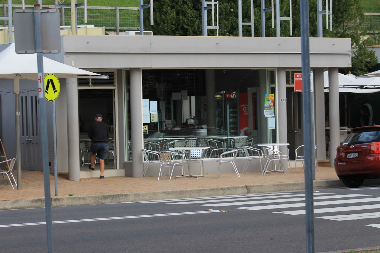
Aren’t LEP requirements such as a height limit for a building in place for a reason? By exceeding the height limit by 35% or 3 metres effectively allows the Developer a third floor which makes a mockery of the LEP and the surrounding streetscape.
If this precedent is set the “Fantasea Site” (vacant shops North of Barrenjoey House) will no doubt have an equally large three story structure with tiny Barrenjoey House wedged in between.
Looks like a giant monster, not in keeping with the area. As an aside, will there be any onsite parking? We don’t want more parking congestion.
There goes the neighbourhood! This is why Pittwater Council was established in the first place!It’s so disappointing.These new developments will be with us for decades if not longer. There’s no going back.
And looks bloody awful !!!Context of a beautiful beach area, a historic building adjacent to the site, the hill rising steeply behind and the Australian bush- and this is what style they come up !? with. Looks like an American mid western shopping mall.
So sad. My grandparents bought the block of land directly behind the fish shop on the hill in 1926. It will be a shame if this goes ahead. Will change the landscape of a beautiful area. Feel for Barrenjoey House.
Developers know how to work the system. They have resubmitted plans 3 times, with virtually no changes to the non compliant aspects, knowing that eventually they will be approved.Why would NBC recommend a grossly non compliant DA for approval?What use is our LEP and DCP?
Complete disregard for the rules. Its a smack in the face for all law abiding citizens. Another example of how insidiously the government agenda of development at all costs is destroying notions of community and heritage in pursuit of money. Please folks vote for the independent this time round if you value Pittwater. We need to press the Liberal party to do better for this special place.
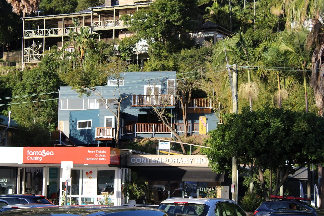
''Amended plans were submitted by the developer as requested by the NBLPP. The Panel held a closed meeting on 8 March 2023 to consider the requested design changes. The minutes of the non-public meeting of NBLPP are on the website but further confuse the procedure. It would appear that amended plans showing a flat roof design were submitted to the Panel showing some (but not all) of the amendments requested by the Panel at its 15 February meeting and were found to be unsatisfactory although on what grounds is unclear.What is clear is that some of Council’s senior planning team were present including Louise Kerr and Peter Robinson plus Rod Simpson from DSAP and Robert Moore Council's Heritage Officer and they were able to advocate reverting to the “original” plans contrary to the Panel's decision of 15th February.What is genuinely disturbing is that Council’s planning staff were able to advocate, in the absence of the public, for plans against which over 150 objections had been lodged by the public - plans which furthermore show a number of serious breaches of planning controls.Turning to the planning controls, the Pittwater LEP imposes a height control for this site of 8.5 meters. We understand that the proposed development, even in amended form, still exceeds this by approximately 2.5 meters (refer to survey plan ground levels). This still breaches the control by 30%. The fact that recommended ceiling heights for shop developments and the first floor of shop-top housing has been increased by the Australian Design rules is irrelevant – those rules do not operate to allow the developer to breach the height controls of the LEP.''
81.2 Heritage Conservation- Development in the vicinity of heritage items -Developments in the vicinity of a heritage item are to be designed to respect and complement the heritage significance in terms of the building envelope, proportions, materials, colours and finishes, and building alignment.
Why is this submission period during the Easter holidays and the closing date on Monday April 10th? A public holiday. It does appear to be a deliberate ploy by all to once again bamboozle residents so that this monster get’s through. This development is next to Barrenjoey House our iconic historic heritage building. It is the gateway into Pittwater.Why do residents have to police over and over this same DA? Why do we pay such high wages to council management if they can’t make good decisions for the area? You are supposed to be protecting us.The first time we were asked to comment on this DA no-one knew anything about it and when I complained to council one councillor said letters had gone to all residents in the area - which of course was not the case - the car parking spaces opposite Barrenjoey House was included in ’the residents notified’.If every single person in Pittwater knew about this development there would be an uproar - if only they could find it on the web.A reminder to the planning panel :NBC Heritage Item No. 2270076.B1.2 Heritage Conservation - Development in the vicinity of heritage items - Developments in the vicinity of a heritage item are to be designed to respect and complement the heritage significance in terms of the building envelope, proportions, materials, colours and finishes, and building alignment.The current proposal has a roof ridge height 1.5 metres above the existing ronon compliance with of ridge at Barrenjoey House. To achieve the desired future character of the neigbhourhood, the DCP requires -D12.1 – Pittwater DCPTo ensure new development responds to, reinforces and sensitively relates to the spatial characteristics of the existing built and natural environment.To enhance the existing streetscapes and promote a scale and density that is in scale with the height of the natural environment.Buildings do not dominate the streetscape and are at 'human scale'. Within residential areas, buildings give the appearance of being two-storey maximum.To have a development dominating and towering over such an iconic building as Barrenjoey House is in strong contrast to the future character of the locality and can ruin the visual care others have made in the vicinity.Additionally, the front section of the Second floor is not compliant with the Local Environment Plan Building Height Control of 8.5 metres.As the total building height of the proposed development currently dominates the building height of Barrenjoey House – the proposed development presents two areas of non-compliance· Non compliance with LEP Building Height control· Dominance in building bulk to an adjacent Heritage itemThis Development Application should be assessed requiring full compliance with both the Pittwater DCP and LEP controls as a minimum standard with the heritage importance component.With -4.6 loop hole not allowed‘on merit ’not allowed.''
- Rezone properties 159-167 Darley Street West, Mona Vale from R2 Low Density Residential to R3 Medium Density Residential to facilitate the redevelopment of these sites for medium density residential housing, and
- Amend clause 4.5A of the PLEP 2014 to remove its applicability to the subject site to provide a diversity and mix of housing.
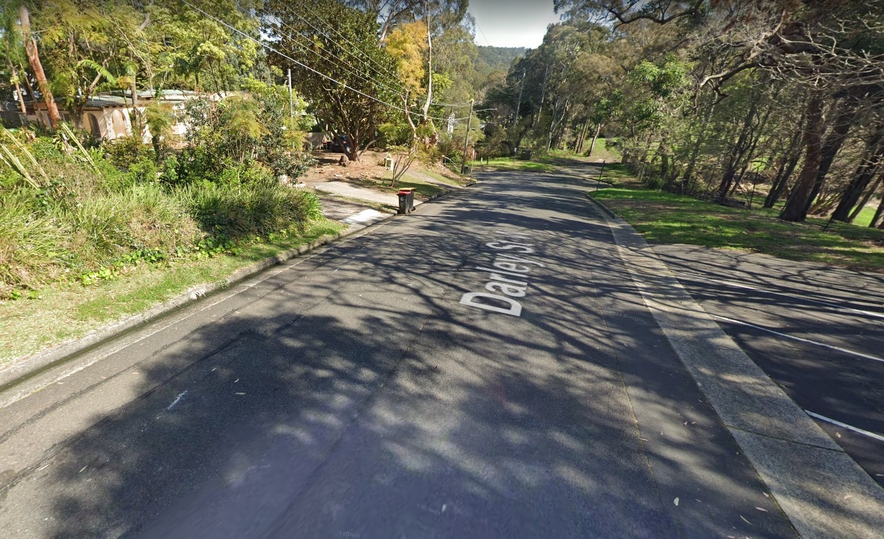
- Rezone properties 159-167 Darley Street West, Mona Vale from R2 Low Density Residential under Pittwater Local Environmental Plan (PLEP) 2014 to R3 Medium Density Residential.
- Amend Clause 4.5A(3) of PLEP 2014 to include reference to 159-167 Darley Street West, Mona Vale (thereby confirming that clause 4.5A does not apply and so removing the maximum density requirements for the site which restrict density to 1 dwelling per 200 square metres of site area).
Council's Housing webpage on this provides further insight:
The objective of draft Affordable Housing Tenancy Guidelines is to outline the requirements for the allocation and management of tenancies for properties within the Northern Beaches Council Affordable Housing Portfolio.
It also sets out criteria for eligibility, rent, management of waiting lists and asset management.
It is intended the full cost of the program, including day-to-day property and cyclical maintenance, tenancy management, administration fees and major upgrading works is fully covered by rent revenue collected by the Housing Manager (Council or its nominated agent)
Affordable Housing on any Council-owned Land
Any proposals for the redevelopment of Council-owned property will be assessed and considered against the directions in the LHS in the same way as proposals for private land.
Once Council has obtained affordable housing stock it will tender for a Community Housing Provider to manage and deliver affordable rental housing.
It includes as an 'Action' the completion and implementation of Place Plans for Avalon, Mona Vale and Manly within the next 1-2 years as well.
The Mona Vale Place Plan timeline, via council's webpage, was scheduled for a public exhibition of the draft place plan in early to mid 2023, to review feedback, revise draft place plan in mid to late 2023 and report to Council to endorse place plan by the end of this year.
Mona Vale was identified as a Centre for Investigation in Council’s Local Housing Strategy, in line with the Greater Sydney Commission’s North District Plan identifying the same from its outset as a potential 'hub'.
The Council's MVPP webpage states that; 'The current building height controls allow for up to four (4) storeys in the Mona Vale town centre. We are not planning to increase these existing building height controls as part of the place planning process.'
A newly advertised 4-storey development with two levels of basement parking, 'Maya, Mona Vale' for the corner of Bungan and Waratah streets, of shop-top housing with 33 apartments, costing an estimated $14,636,716.00 to build, and a height of over 15 metres, is another example of what is being approved in Mona Vale.
This DA started back in 2019 with the plans showing a height of 15.87 metres. The Pittwater LEP has a cap at 13 metres or 8.5 metres in this location. The proposal was presented to the Northern Beaches Local Planning Panel (LPP) on Wednesday 18 December 2019 with a recommendation for approval by the Northern Beaches Council, again.
The application was modified since being granted approval. This reduced the density of the development from 36 apartments to 33 and the number of car parking spaces from 112 to 103 spaces. Most of the flats will be 3 or 2 bedrooms.
The approved development still had a maximum height of 15.0m, which is a 4.0m non-compliance with the permitted 13.0m height limit. The modified development involved a slight reduction in the maximum height of the approved development of 400mm. The bulk of the areas that breach the height limit are situated in different areas of the roof of the building.
The application for modifications was exhibited in accordance with Council's Community Participation Plan (CPP), on its website, the only place DA's are now 'advertised', and no submissions were received.
Submissions had been received from neighbours and on behalf of the Body Corporate living in the adjacent building, pointing out the height breach, loss of privacy and sunlight, and the blocking of their view, in the first instance of the DA process. Their concerns did not stop the development being approved as is. However, here again the stated objectives of clause 4.3 of the still in place Pittwater Council LEP 2014 apply.
Under clause 4.3 (2C):
Despite subclause (2), development on an area of land shown in Column 1 of the table to this subclause and identified as such on the Height of Buildings Map, may exceed the maximum building height shown on the Height of Buildings Map for that land, if the height of the development is not greater than the height shown opposite that area in Column 2.
Column 1 Column 2
Area Maximum height above the flood planning level
Area 1 11.5 metres
Area 2 8.5 metres on the street frontage and 10.5 metres at the rear
Area 3 8.5 metres
Area 4 7.0 metres
(2D) Despite subclause (2), development on land that has a maximum building height of 8.5 metres shown for that land on the Height of Buildings Map may exceed a height of 8.5 metres, but not be more than 10.0 metres if—
(a) the consent authority is satisfied that the portion of the building above the maximum height shown for that land on the Height of Buildings Map is minor, and
(b) the objectives of this clause are achieved, and
(c) the building footprint is situated on a slope that is in excess of 16.7 degrees (that is, 30%), and
(d) the buildings are sited and designed to take into account the slope of the land to minimise the need for cut and fill by designs that allow the building to step down the slope.
(2E) Despite subclause (2), development for the purposes of shop top housing on land identified as “Area 5” on the Height of Buildings Map may have a height of up to 10 metres if the top floor of the building is setback a minimum of 6 metres from the boundary to the primary street frontage.
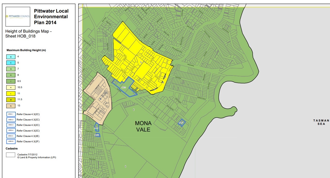
The Pittwater LEP to April 2018 HOB map for Mona Vale shows:
The 'Maya' site at present, 2023
Traffic along Bungan-Waratah street of a weekday has increased
The blocking of views, breach of privacy and the bulk and scale of the development increase the likelihood of similar developments being approved in areas adjacent to this, and, as with Darley Street West, being spread into streets adjacent.
The working group for the Mona Vale Place Plan, version II, has reiterated the community's aim/aspiration of ''retaining the village feel of Mona Vale''.
Mona Vale is just one of the local suburbs identified by the Northern Beaches Council as places to become 'hubs' or to 'activate' for more housing - Newport and Avalon are also named.
"The continuation of the merger process needs to be accompanied by a fast track approach to large housing projects during the transition process. The Minister for Housing, Anthony Roberts, should establish an action team under a Commissioner for Housing Supply for a two year period to lift housing approvals."
'Outdated provisions in the EP&A Regulation required planning authorities to notify the public of various planning matters through local newspapers. There is a broader industry trend away from hardcopy to digital media. Local newspapers have been transitioning to online-only delivery, often with a paywall, or suspending publication entirely.Planning authorities such as councils can therefore no longer effectively or efficiently comply with this regulatory requirement. The changes therefore replace the requirement to publish planning notices in a local newspaper with online publication. Online publication will be on the NSW Planning Portal or the relevant council’s website.The changes better align the EP&A Regulation with the digital government agenda and support the department’s established ePlanning program, which is increasing the use of technology in planning. It ensures development assessment and strategic planning processes make use of advances in technology and the changing communication preferences of consumers.The amendments allow online access to information, while reducing costs and administrative burden for planning authorities such as councils. The changes modernise the EP&A Regulation by responding to the short-term COVID-19 effects and longer-term structural changes to the news media industry.'
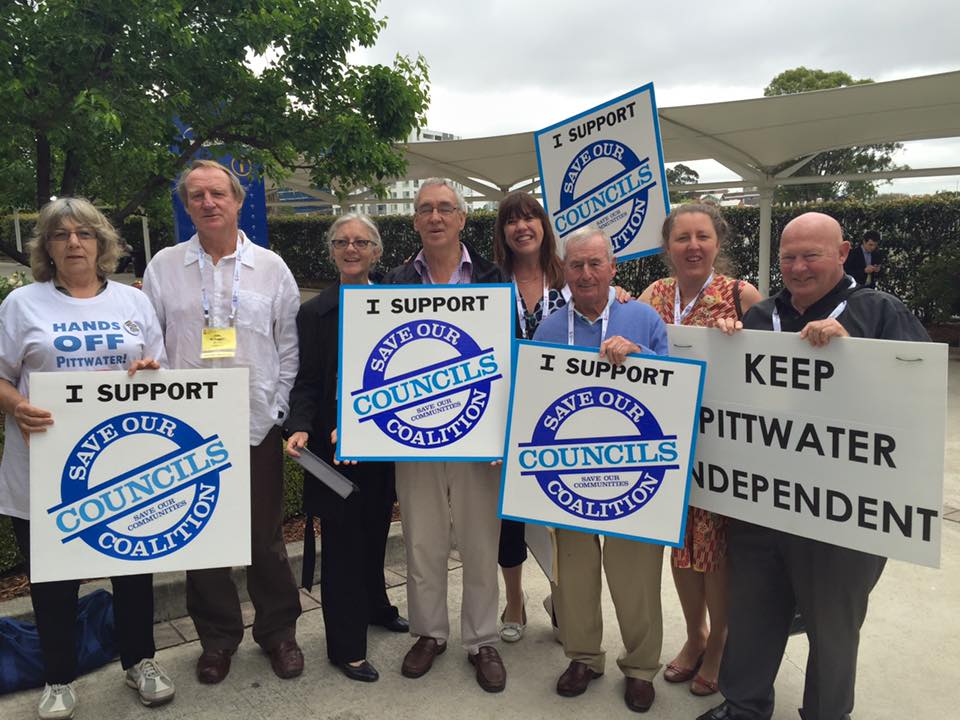
Six Pittwater Council Councillors and supporters at the NSW Local Government Conference on Tuesday October 13, 2015 at Rosehill - image courtesy Mona Vale Residents Association
We know that the only group to benefit from huge mega councils will be developers who have quite openly called for a reduction in the numbers of councils.
''a NSW Labor Government will not support the forced merger of local councils, nor will it support any forced demerger. Rather, this must be done voluntarily with the clear support of local residents as confirmed through a local plebiscite.To this effect, a NSW Labor Government will legislate to put into place independent mechanisms to enable this to occur.''
The Office of Local Government wrote to the group saying that:
“… the proposal … does not meet the legal requirement of being certain, nor is it supported by an appropriate minimum number of electors as required by the Act”.
“Given that our proposal was composed with the help of two barristers, Protect Pittwater will now take advice to consider our next course of action,” the group said in a statement.
However, Chapter 9 How are councils established? of the Local Government Act states:
Part 1 Areas
Division 2 What must be done before areas can be constituted?
215 Who may initiate a proposal?
(1) A proposal may be made by the Minister or it may be made to the Minister by a council affected by the proposal or by an appropriate minimum number of electors.
(2) An appropriate minimum number of electors is—
(a) if a proposal applies to the whole of an area or the proposal is that part of an area be constituted as a new area—250 of the enrolled electors for the existing area or 10 per cent of them, whichever is the greater, or
(b) if a proposal applies only to part of an area—250 of the enrolled electors for that part or 10 per cent of them, whichever is the lesser.
Nearly 3,500 signatures had been collected - 10% of the proposal applying to 'only part of an area' electors, and certainly not 'whichever is the lesser' but a demonstration of much more considering the short amount of time the group and its volunteers took to gather these.
On May 13th, 2021 the NSW government wrote a new opportunity for fully funded council demergers, updating local government laws to allow for council-initiated proposals within a fixed time frame.
Save Our Councils Coalition vice president Sue Young said then that under changes passed by both Houses of the NSW Parliament in the Local Government Amendment Bill 2021, councils amalgamated in 2016 would be able to launch demerger bids within 10 years of their establishment.
However this is applying a 'across the whole LGA' mark once again. Considering the former Warringah Council had advocated and campaigned for the amalgamation, and with a larger population, this too would be a fruitless exercise of ever shifting goal posts and ever changing applying of some sections of the Act while ignoring applicable sections.
The cost of any de-amalgamation of the new area resulting from a business case submitted under the new provision would be fully funded by the state government, Ms Young said, while also questioning the usefulness of the amendment unless a majority of councillors supported a demerger.
“The amendment may not be a viable pathway for Pittwater residents wanting to de-amalgamate from the Northern Beaches Council,” Ms Young said. “I consider the benefit for Pittwater is that the community proposal should be treated in the same manner as a proposal from an amalgamated council and fully funded by the government, with limits on response and processing times.”
This week's renewed calls by residents for a return of Pittwater Council back state the government's policies, modified Acts and requirements have disenfranchised residents participation in shaping their community, or ignore their 'feedback' as it does not fit in with what is planned. Approved developments that raze once green areas, fill the whole block with bulky buildings that breach height restrictions are cited as 'a deliberate destruction or 'uglification' of Pittwater'.
At the December 2022 Council Meeting a Mayoral Minute was submitted shortly before the meeting to: “Congratulate and thank our Development Assessment Team and senior staff on their continued efforts to ensure we have a robust, transparent and efficient development assessment system.”
This was in reference to the NSW Auditor-General December 12th 2022 released Report 'Development applications: assessment and determination stages'.
Pittwater Councillor Miranda Korzy stated in her January 2023 'From the Chamber' update for residents that:
''...as was pointed out to me by residents later - because the Mayoral Minute was submitted so close to the meeting that councillors had little time to read it - the report notes that the audit required interviews with a long list of council and government staff - but not with residents. Those on the list included council planning and compliance staff, NSW Planning and Environment department, ICAC, NSW Ombudsman, and the Planning Institute of Australia (NSW).
Secondly, the audit required detailed examination of only 25 of the 4,475 DAs the report said were determined by NBC between July 1, 2019 and June 30, 2021. The total estimated construction costs for all 4,000 plus developments was $1.8 billion.
NBC was one of three councils audited, and findings, reported on December 12, included that:
“Northern Beaches Council has established processes to support compliant and effective assessment and determination of development applications …
The Council has a clear governance and risk management framework for development assessment that sets out roles, responsibilities and delegations…
Northern Beaches Council's approach to managing conflicts of interest promotes transparency ...
Northern Beaches Council has established processes to deliver consistent, quality assessment of development applications …
Northern Beaches Council has established processes to effectively support the Northern Beaches Local Planning Panel.”
Without having had an opportunity to read the full report, I could not support this motion given the experience of Pittwater residents. I told the meeting that I recognise the technical skill and professional expertise of planning staff.
However, I noted that many Pittwater residents are extremely angry about DAs approved in recent years that permit cutting down of large numbers of mature canopy trees, with massive excavations changing the contours of the land and creek lines along with destroying wildlife habitat. These developments appear to many of us to be contrary to the intent of the Pittwater LEP and DCP as well as the community’s intense desire to protect Pittwater’s environment. ''
On April 5th 2022 newly reinstated Planning Minister Anthony Roberts stated at an event run by developer group Urban Taskforce he would be scrapping Design and Place State Environmental Planning Policy (SEPP).
The Design and Place State Environmental Planning Policy set a path for net zero, more tree canopy and green spaces, better ventilation of apartments, and resilience to heat, flood and fire threats, and requirements to assess where dwellings would be built, in particular whether they are in a flood zone or in a bushfire risk area registered by the NSW RFS. The proposed comprehensive Place and Design SEPP, which included updates to the Apartment Design Guide, The Building Sustainability Index (BASIX), a new Urban Development Guide and Design Review Manual included sustainability measures.
The study found that Western Sydney may have lost as much as 60% of its agricultural land over the past ten years.
Further:
The Department of Planning and Environment’s latest housing supply forecast predicts the region will supply roughly 60% of Greater Sydney’s new dwellings in the period 2021-2025.
Attempts have been made to concentrate new development in two designated growth areas – the North-West and South-West – from 2006 onwards. These locations used to contain swathes of undeveloped greenfield land. But local council policies to retain productive farmland have been put aside to accommodate state government growth plans.
In December 2022 the incumbent State Government announced it would rezone areas to deliver 70,000 homes by June 30, 2024 and it would be in charge of assessing these. The bulk of these sites are in Western Sydney at present, on or adjacent to Sydney's last koala population and its habitat. Under the Rezoning Pathways Program, developers can nominate rezoning proposals for more than 1,000 dwellings on sites in metropolitan NSW and at least 300 dwellings in regional NSW. These proposals would bypass councils and instead be assessed by the state’s planning department.
Despite the major implications of the scheme, the NSW Government failed to detail how local provisions will be considered when these residential developments are assessed and what community consultation, if any, will occur. LGNSW President Darriea Turley AM said the new program was the latest example of the NSW Government cosying up to property developers at the expense of councils and the communities they represent.
“The changes that are being proposed here would affect every council area in the state. It also brings into question what, if any, consideration will be given to existing local plans and policies when major housing developments are being assessed," Cr Turley said.
“By removing council input and community consultation on these major developments, the government is essentially removing the safeguards that protect communities from inappropriate and ad hoc development.”
Cr Turley questioned whether the NSW Government was being genuine when it badged the new program as a way of unlocking new homes faster.
“This government is quick to blame delays on councils. Yet it is well established that the overwhelming cause of delays stem from infrastructure delivery issues and other hold ups from a multitude of government agencies,” Cr Turley said.
“A few years ago, the NSW Government took development application powers off Sydney councils and introduced mandatory local planning panels. The argument was that councillors should focus on strategic planning rather than on individual development applications.
“Now with this latest announcement, the government is coming after the strategic planning as well.
LGNSW stated Property developers had been gifted an early Christmas present after the NSW Government announced it would sideline councils and communities from assessing new major housing developments.
The following week the State Government announced Michael Cassel has been appointed as the acting CEO of the NSW Reconstruction Authority, which has been formally established as part of the NSW Government’s response to the Flood Inquiry.
The NSW Reconstruction Authority is a statutory corporation reporting to the Minister for Planning, and the Minister for Emergency Services and Resilience and Minister for Flood Recovery.
Under section 12 of the NSW Reconstruction Authority Act 2022, the ‘’Authority may carry out development on certain land in particular circumstances’’. The Authority may carry out development on land (specified land) if the Authority is satisfied the specified land is in a part of the State that has been, or is likely to be, directly or indirectly affected by a disaster, and the development is necessary to give effect to the primary object of the Act.
Section 12 further states that ''given the nature of the disaster or likely disaster, and its direct or indirect effect on the specified land, carrying out the development immediately is appropriate in the circumstances, and the development will not involve clearing native vegetation or will involve clearing native vegetation only to the minimum extent necessary, or the Authority is satisfied the specified land is not in a part of the State that has been, or is likely to be, directly affected by a disaster but the development is a direct response to the disaster or likely disaster, and cites as an example— 'development for the purposes of residential accommodation to house residents who have been displaced by a disaster'.
This will include developing land within national parks, protected marine areas or land subject to native title claims, so long as the development is ''necessary and appropriate''. This will also include the habitat of threatened or critically endangered species, alike what the then state government is pushing through in western Sydney koala habitat lands along with developing what is left of Cumberland wood plain lands.
The authority will be able to do anything that is "supplementary, incidental or consequential" to these functions and the CEO will be able to take whatever steps they deem "necessary or desirable".
All a long way from adding an extra storey to a development at Palm Beach to maximise profit, helped by a recommendation for approval from a Council, despite an in place LEP and DCP - but applicable here, should a developer want to rezone land for another 1000 dwellings at Ingleside, the back of Bayview or Belrose.
''The Mona Vale Road isn't being upgraded into a dual lane both ways Mona Vale Highway just to funnel people to Mona Vale beach....'' one resident commented recently, '' ... it's pretty obvious by now what's coming down that road....''
As the council keeps approving thousands of developments across the area compliance with those approvals and 'boots on the ground' has been lacking according to residents reporting runoff from sites into the estuary and adjacent areas. Residents have been left to 'police' these themselves, alike that response to the Palm Beach fish and chip site, as with all these approvals the amount of staff needed to ensure compliance through site visits is not occurring.
At the March 2023 council meeting Curl Curl Councillor Greens Councillor Kristyn Glanville raised a motion at council last week addressing one of the greatest sources of complaints to councillors: compliance failures.
Pittwater Councillor Miranda Korzy reported in her 'From the Chamber' March update:
'A planning and environment lawyer, Ms Glanville called for a report from staff identifying issues with the private certification scheme and recommendations for improving state legislation concerning it.
Her motion also proposed a workshop for councillors to raise ideas for improving community compliance with building and development regulations.
Examples of these measures could include: random inspections of building sites; joint blitzes with the NSW Environment Protection Authority; new technology to identify illegal development, such as tree clearing; and education campaigns to encourage a culture of compliance.
Ms Glanville said that in talking to council staff, the community, and from her professional background, she believed there were two features of the system that needed to be dealt with.
Firstly, council must provide enough resources to deal with compliance issues properly; and secondly, apply pressure on the NSW government to fix problems with private certification - given that problems with privately certified development are a significant driver of complaints to council.
Complaints we receive include problems with certifiers, illegal clearing of trees or vegetation, illegal building works completed without permission, and inappropriately certified works by private certifiers.'
Although the motion passed unanimously, it is a too little too late for residents of Pittwater.
The targeted rezoning of Pittwater to facilitate environmental destruction and overdevelopment, buildings, such as the DA for the old Palm Beach site that breach the height limit for their zones by metres being recommended for approval, the rapid ruination of the villages of Mona Vale and Newport - are the reasons so many are celebrating a Labor government being installed by the NSW populace as that will bring the chance to restore Pittwater Council and in doing so also restore the environmental, heritage and community aspects of Pittwater that were thrown out with the forced amalgamation and caused the formation of groups such as Protect Pittwater and the Pittwater Environmental Heritage Group - both of which are already gathering signatures on a petition to commence that process, again - a movement that began when Pittwater Council was sacked by the previous Coalition government in May 2016.
''It's a pity that it required a change of government for us to finally achieve that opportunity.'' one Letter to the Editor remarked as this Issue goes to press.
Related:
- Sediment Running Off Into Creeks and Beaches From Work Sites - Public Parks Not Maintained – Bilgola Plateau Park Still Not Fixed: Residents NOT Happy - February 2023
- Who Wants To Keep All Pittwater's Conservation Zones? - Cr. Korzy Motion for February 2023 Council Meeting
- Saving Pittwater From The Chainsaws: Community Forum At Warriewood
- Pittwater Vulnerable To Develop-Driven NSW Planning Regime - Pittwater can have its own LEP by Law
- Conservation Zones Review Has Potential To Facilitate Medium Density In Previously 'Environmental Living' Zones - October 2022
- Conservation Zones Review Residents Forum: Resolutions Call For Shift In Criteria Applied, For Keeping Pittwater's Green-Blue Wings Intact, For State Election Candidates To Declare Their Position On Pittwater Community's Stated Expectations - October 2022
- From The Council Chamber March 28, 2023 - By Pittwater Councillor Miranda Korzy
- Pittwater Community Forum: A Discussion On How To Save Our Area - July 2022
- Profiteers Seek To Destroy Palm Beach With Yet Another Over The Top Development Proposal - June 2022
“Pittwater is a Series of Villages Connected by Bush, Beach and Water.”
Since the early 1990s, Pittwater’s Local Environment Plan (LEP) and its zonings have reflected residents’ desire to:
- protect and enhance Pittwater’s natural environment and recreation areas
- conserve Pittwater’s European and Aboriginal heritage
- minimise risks to the community in areas subject to environmental hazards including climate change and
- protect and promote the health and well-being of current and future residents of Pittwater.
In the same vein, the Pittwater Development Control plan recognises that:
“Any future growth of Pittwater must conserve, protect and enhance the natural environment and beauty of the area. Development will need to be ecologically sustainable and considerate of the natural hazards of the area that have helped to shape the region, which will ensure a safe and good quality of life for the community and future generations.
Pittwater’s zonings have been critical to protecting this spectacular and precious area. Large swathes of our suburbs were classified as Environmental Zones - later redefined by the NSW government as Conservation zones. Much of Pittwater’s residential areas are currently zoned C4 (Environmental Living).
Conservation zones, such as C4, are applied to properties with significant environmental values - which may be ecological, scientific or aesthetic - and to those potentially exposed to significant hazards such as bushfires, flooding and landslides. The zones help determine what owners are allowed to do on their land.
C3 zones, which are typically for Environmental Management, and what you can do in these zones is more restrictive.
Northern Beaches Council conducting a Conservation Zones Review, as part of its preparation for a harmonised or 'one' LEP across the Northern Beaches. The review was on public exhibition until December 2 2022, and comprises a complex set of documents and maps. It proposed rezoning 3,613 properties within the former Pittwater Local Government Area from C4 to residential zones, and 1,328 from an Residential zone to a Conservation zone. By comparison, 54 properties in the former Manly LGA will lose C zonings, and in the former Warringah Council area, one.
One of the main causes of the changes in Pittwater’s zones is that land with native vegetation in core habitat areas, and Threatened Ecological Communities, is defined as having “High Environmental Values” - and only one of these criteria is required for a C4 or C3 zone. However, similarly significant wildlife corridors and tree canopy are defined as only “Medium Environmental values” - and two of these are required for a C4 zone.
Protect Pittwater Update
