References and Extras
Definitive Resource is:
Tuckfields Birds and other cards: types, variants, chronology, exchange tokens, albums, and miscellany by Mark Calabretta and Cheryl Ridge Edition: 3.0, 2013/01/13 (111 pages - PDF)
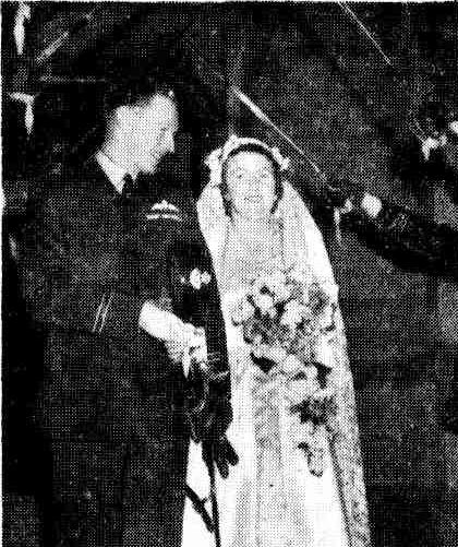 Married on Saturday -
 R.A.A.F. Guard of Honor
A guard of honor was formed by R.A.A.F. officers at the Presbyterian church, Toorak, after the marriage of Miss Margot Elizabeth (Jill) Tuckfield and Flight-' Lieutenant Ian Russell Olorenshaw (R.A.A.F.), at which Rev. Alan Watson officiated.
The bride, who is the elder daughter of Mr. and Mrs. F. S. Tuckfield, Caulfield, wore an heirloom veil of Brussels lace, lent by Mrs. M. Rossell, of Renmark, South Australia, over her classical gown of ivory, satin, which was fashioned with a train. She carried a small trail bouquet- of almond blossom and gardenias, and small sprays of almond blossom were fastened at each side, of her head. Her only sister, Miss Jennifer Tuckfield, attended the bride. She wore a white figured organdie frock, and, on her head, a circlet of azaleas and daphne matching her small bouquet. The bridegroom, who is the second son of Mr., and Mrs. F. J. Olorenshaw, of Renmark, South Australia, had Squadron Leader Robin Gray (R.AA.F.) as best man: Following the ceremony a small reception was held: at the home of the bride's parents.
Flight-Lieut. Olorenshaw, of South Australia, and his bride, formerly Miss Jill Tuckfield, leave the Presbyterian church, Toorak, beneath an archway of sxoords held by the bridegroom's brother officers, after their marriage on Saturday. Married on Saturday (1949, July 11). The Age (Melbourne, Vic. : 1854 - 1954), p. 5. Retrieved fromhttp://nla.gov.au/nla.news-article189466036
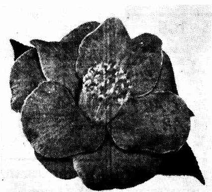
BEST BLOOM in the Royal Horticultural Society's camellia show was this fine specimen of The Czar, staged by Mr. F. S. Tuckfield, of Caulfield.
With its large crimson blooms — in which the golden stamens are a prominent , feature — this variety has become a universal favorite. No title (
1952, August 22).
The Age(Melbourne, Vic. : 1854 - 1954), p. 7. Retrieved from
http://nla.gov.au/nla.news-article206222316
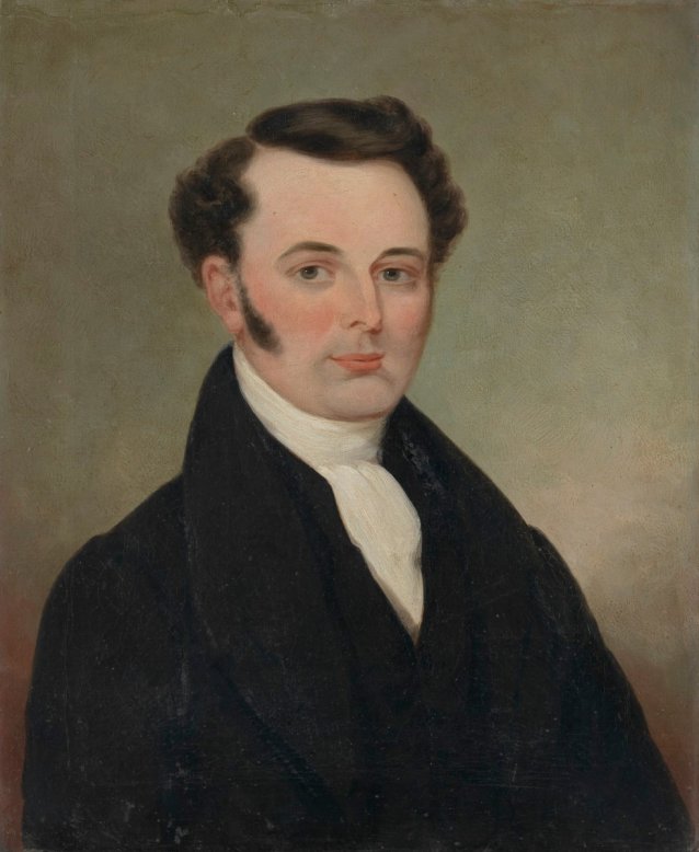
By the National Portrait Gallery - Canberra:
Francis Tuckfield (1808–1865), missionary, worked as a miner and a fisherman before deciding to become a preacher. Selected by the Wesleyan Mission of London as a missionary to the Aboriginal people of the Port Phillip district, he arrived in Australia in March 1838 with his wife, Sarah (née Gilbart c. 1808–1854), staying briefly in Hobart before proceeding to Melbourne.
He undertook a number of journeys around the Geelong and Colac districts – some with the ‘wild white man’ William Buckley as his interpreter – to find a place for the establishment of a mission, ultimately settling on a site on the Barwon River near Birregurra where he established the Buntingdale Mission in 1839.
Tuckfield declared his aim ‘to induce the natives to abandon their erratic habits … in order that we may teach them the arts of civilised life.’ Sarah supported Francis through her work as the mission’s nurse and teacher, while also raising the six children she bore between 1838 and 1846.
Despite Tuckfield’s zeal, the mission struggled to either convert the local Aboriginal people or convince them to stay at the station. His efforts at ‘civilising’ large numbers were also hampered by the worsening impact of tribal strife and of European settlement and disease on the Aboriginal population. The station closed in 1848. Sarah had two more children while they lived in Geelong between 1848 and 1850.
For the next three years they were in Sydney, where Francis ministered at the York Street Chapel. In the early days of the next phase of her husband’s career, in Maitland, Sarah died. Her death notice referred to a protracted and painful affliction, which she bore with exemplary patience.
From 1856 to 1860, Tuckfield worked in West Hobart and New Norfolk, married again and fathered a further four children with his second wife, Mary Stevens. Following a substantial leave of absence due to ill health, in 1864 he was appointed minister of the Methodist church in Portland, Victoria. He died there in October 1865, having contracted pneumonia while officiating at a funeral.
Family tradition holds that these portraits were painted in England prior to the couple’s departure for Australia in 1837. However, a stamp on the reverse of both works shows that the canvases were supplied by a firm operating between 1851 and 1854, suggesting that these portraits are later, local copies of the original 1837 paintings, possibly made around the time of Sarah Tuckfield’s death.
Gift of the Freer Tuckfield family 2010
Donated through the Australian Government's Cultural Gifts Program
Francis Tuckfield (age 46 in 1854) - Professions Accession number: 2010.138 courtesy and © National Portrait Gallery 2016
Currently on display in Gallery Four (Liangis Gallery).
THE LATE REV. FRANCIS TUCKFIELD.
At the close of his sermon to a crowded audience, in the Wesleyan Chapel last night, 29th Oct., the Rev. Mr. Blamires, Hamilton, read the following biographical sketch of the deceased minister: The Rev. Francis Tuckfield was born in Germoe, Cornwall, on May 10, 1808, and in the year 1825, was impressed with the importance of personal religion, and earnestly sought the salvation of God. After three months penitential distress and supplication, it pleased God to bless him with the enjoyment of his pardoning love. This event was as distinct and clear, as it was delightful. The whole scene and circumstances were carefully treasured in his memory. It was when he had retired for prayer to a pit, a forsaken Cornish mine, that his soul was set at liberty.
When he was 20 years of age he began to preach, and after laboring as a local preacher for 6 years, he was received into the Wesleyan Ministry. He was placed for two years at the Theological Institution, Heaton, under the care of the Rev Dr. Hannah, for whom Mr. Tuckfield cherished a profound affection.
With three other missionaries and their wives, Mr. and Mrs. Tuckfield at length set sail for Port Phillip, where they arrived in 1838. For ten years Mr. Tuckfield labored with unflinching missionary zeal midst danger, toil, and privations, to christianize and civilize the aborigines of this colony. Although the success of the enterprise was considerable, yet owing to the migratory nature of the aborigines and their many intertribal dissensions, but chiefly because of the rapid decrease of those tribes whose language he had learned, and because of the spiritual necessities of a larger influx of Europeans, the mission was abandoned. During Mr. Tuckfield's residence at the mission station, he had paid frequent visits to Melbourne, then a part of the Geelong Circuit. In 1841 he had the honor of commencing the first Wesleyan Church in Geelong, and of forming the first class, and of opening the new Wesleyan Church in Melbourne. In 1848 he was removed to the Geelong Circuit, and for two years labored with great success among a most affectionate and devoted people.
In 1850 he was stationed at Sydney, and in 1853 took charge of the Maitland Circuit. This Circuit then comprised the greater part of what is now the Maitland district, containing five Circuits and six ministers. The prodigious labor involved in the care of such a Circuit, together with the trying nature of the climate, soon impaired his health, and he was constrained to remove to Tasmania, where he spent four busy and useful years.
Under a failure of health he repaired to Geelong, where also for four years he rendered important service, although classed as a supernumerary. His health being restored, and longing to live and die in the full work of the Ministry, he offered himself again to the Conference, and rejoiced to find himself once more to Circuit work at Portland. Of his manner of life and labor in this Circuit, it is needless to speak to those who have witnessed for themselves his going in and out among them. It is believed that his loving and unselfish disposition, his willing and unsparing labors, and especially his deep solicitude for the welfare of God's cause, and his many touching and faithful appeals from, the pulpit, will bring forth blessed fruit ; and it is hoped that Mr. Tuckfield's most precious reward and enduring memorial will be found in the consistent Christian conduct of those amongst whom he laboured and in their renewed anal increased consecration to the great work in which he lived and died. May those who followed him, with their tears to the grave, follow him with their footsteps to heaven.
With reference to his last illness.- He had from the first a premonition that it was to be unto death. A voice unheard by others seemed to have reached his listening ear: "Set thine house in order for thou shalt die and not live." The God to whom he had submitted himself while he was yet young, and to whose glory his life's energies had been consecrated forsook him not in the greatest time of need, and when he was passing through the valley of the shadow of death, kept him in perfect peace. He said "I cannot doubt my precious Saviour;" "He will never leave nor forsake me;" "My trust is without a doubt, without a fear, for he that believeth on him shall be saved;" 'The blood of Jesus Christ, His Son, cleanseth us from all sin;" "'The precious blood of Jesus." At another time he rapturously exclaimed "O Death ! where is thy sting?" "The sting of death is sin;" " But thanks be to God which giveth us the victory ;" "This is the victory which overcometh the world, even our faith ;" "My God, My God, My Father God ;" "Not all the harmony of heaven Could so delight my ear," "How shall I praise my precious Saviour." He discussed the question with much interest how far that assumed promise might be pleaded, namely-"The prayer of faith shall save the sick ;" and thought that we must not presume on the mercy of God. God does not pledge himself absolutely, but in his dealings regards our spiritual and eternal, as well as temporal good. We should pray as did the Saviour, "If it be possible, let this cup pass from me; nevertheless not my will, but thine be done."
To some present he addressed words of touchinly earnest entreaty and loving counsel, recommending the service of God, and instant decision. As the final hour drew on, the struggle between life and death became extremely painful. He cried to God to release him: and let the Spirit free, and touchingly entreated his family to cease their efforts and let him die. Upon one saying "This is the last foe, you will soon have the victory and be where there is no pain nor sorrow. He repeated the last foe, the last foe. As the powers of nature failed he cried to those around, "Where are you all?" and upon their answering he seemed content, and gradually breathed his life away. His last word was "rest." He calmly and sweetly fell asleep at 23 minutes to 12 o'clock, Saturday night, October 21st, 1865. Thus lived and thus died a good man, a most affectionate husband and parent, and a faithful Christian minister. Personally and as a Church and community, we mourn his departure, but we at the same time rejoice in his final triumph and entrance through Christ into eternal rest. And we pray that that same Saviour may sanctify this solemn event to the turning of many to God, to the quickening of the religious life of believers, and to the attainment by us all of that life and walk of faith and holiness which alone can prepare us to join him above. THE LATE REV. FRANCIS TUCKFIELD. (
1865, October 30).
Portland Guardian and Normanby General Advertiser (Vic. : 1842 - 1876), , p. 2 (EVENING). Retrieved from
http://nla.gov.au/nla.news-article64635146
TUCKFIELD MEMORIAL TABLET.
THE UNVEILING CEREMONY.
A unique ceremony, unfolding some of the most interesting pages of Geelong's early history, took place at the Yarra-street Methodist Church yesterday afternoon, when a memorial tablet erected by the Larpeut survivors to the memory of the late Rev. Francis Tuckfield, was unveiled. There was a fair gathering of descendants of the Larpent survivors and their friends, and the Rev. W. Williams presided. On the platform were also the Revs. J. W. and John Tuckfield (sons of the late rev. gentleman), Mr. Jas Oddie and Mr. G. M. Hitchcock. The tablet, which is erected on the southern wall of the building, is worked in Mount Summers white freestone, and is of Gothic design. It consists of a moulded sill, supported on three ornamental corbels, relieved with carving. Richly moulded columns and ornamental jambs support the arch, which is relieved with tracery and decorated with neatly carved bosses and enrichments, the whole being surmounted by a decorated lintal. The inscription tablet is of Carrara marble, and the inscription is engraved in church text and old English. lettering, which blends harmoniously with the surroundings. The design and workmanship have been prepared and carried out by Mr. Joseph Smith, of Ryrie-street, and he has succeeded in adding a decided ornament to the .interior of the sacred edifice. The inscription reads as follows:—"On the 28th June, 1819, the good ship Larpent arrived in Corio Bay from London, having fever on board. The late Rev. Francis Tuckfield, then pastor of this church, visited the ship and saw the state of the passengers. As good Samaritans, he and his noble wife generously received a number of the sick into their home.-end in divine ways strewed on their path garlands of faith, hope and charity. At the 56th anniversary of their landing, the surviving passengers advised the erection of this tablet to record the Christly act.—James Oddie,. Benjamin Bonney, passengers; William Williams, Pastor. 1906."
The Centenary Celebrations at Geelong.
('Geelong Times.')
Mr. Tuckfield was sent to Victoria by the Missionary Society to take charge of the aboriginal station at Birregurra. The Government had set aside 2,000 acres for the aboriginal station, and placed it under the care of the Wesleyan Mission. The Revs. Tuckfield and Hurst laboured indefatigably to Christianise the natives, but their migratory habits made the effort almost hopeless, and the land eventually reverted to the Government.
Mr. Tuckfield had a bright and, cheery way with him, and years after his death natives in different parts of Victoria spoke of him with great affection. He tried hard to induce the adults to settle down to agriculture. He went with the natives in wanderings, and sat with, them at their camp fires; no self-sacrifice was too great for this devoted man of God. He went from camp to camp from Otway to the Murray-
Governor La Trobe was thoroughly acquainted with the working of the Mission and said: 'No man can make it a success if you do not.' It is greatly to be regretted that he did not publish an account of his 10 years' labour. Mr. Dredge was employed as a hired local preacher in Geelong for two years, and the ministers came occasionally from Melbourne by steamer, the fare being £2 cabin, 25 s. steerage. The Rev. B. Hurst, purchased a two-storey weatherboard store, which was removed to land in Yarra-street, and opened for public worship on February 20'th, 1842. It stood among the trees of the forest in a highly romantic spot; a tribe of natives, numbering 170 pitched their camp close to the chapel.
The land on which the property now stands was obtained in 1843. The foundation-stone of the first church was laid by Dr. Thompson, first Mayor of Geelong, in 1846. It was opened for public worship by the Revs. W. A. Lowe, Tuckfield and Sweetman. The Rev. W. A. Lowe was the first minister stationed in Geelong- Geelong was made, a separate circuit detached from Melbourne in 1848, when the Rev. F. Tuckfield took charge of the circuit. The parsonage was then erected, and continued to be the residence of the minister till 1891, when the present building, was completed. ...The Centenary Celebrations at Geelong. (
1915, August 20).
Spectator and Methodist Chronicle (Melbourne, Vic. : 1914 - 1918), p. 1198. Retrieved from
http://nla.gov.au/nla.news-article154175043
This only mentions the Rev. Tuckfield and where he was. We include it as he was surrounded by hopefuls leasing thousands of acres to run livestock, in 1849 - :
Superintendent's Office,
Melbourne, January, 1849. CLAIMS TO LEASES OF CROWN
LANDS, beyond the settled districts.
PORTLAND BAY DISTRICT.
HIS Excellency the Governor directs it to be notified, for the information of all persons interested, that in pursuance of Her Majesty's Order in Council, 9th March, 1847, the undermentioned persons have demanded Leases of the several runs of Crown Land particularised in connection with their respective names.
Persons who object to any of these claims, either wholly or in part, should lodge Caveats at this office within two months from the present date, specifying the Lands to which their objections extend, and the grounds on which their objections are based.
It is to be distinctly understood, that the Government does not pledge itself to the issue of a lease in any case until due enquiry has been made into the validity of the claim, and whether or not it may be necessary to reserve any portion of the land claimed for any of the public purposes contemplated in the Order in Council.
In the case of the Portland Bay District, it is possible that certain of these applications for lease may be found to have reference to lands really situated within the Settled District, and therefore only subject to occupation under the regulations of March 29th, 1848.
By His Excellency's Command,
C. J. LA TROBE.
No. 1. William W. Allen
Name of run—Colantet
Estimated area—8,675 acres
Estimated grazing capability — 5,500 sheep
Commencing at o point 1½miles west, by hut upon home station, running then 162 chains north-east by E half E 15 chains east, by north 17 chains, south-east 66 chains E half S 20 chains S half E along the great barrier, and 92 chains south-east in continuation along the barrier, being boundary line with J. and F. Manifold ; then 140 chains S to a marked tree, being boundary with Mr. Roadnight, thence on to another tree 72 chains south ; and from thence to another marked tree in the forest 165 chains south-west by south, being boundary with Mr. Henry Millers station ; and from thence following the course of the forest 204 chains NNW, and 140 chains, west by north to the bottom of a gully ; and from thence by a line running 175 chains north, being boundary with Messrs. M'Kinnon and Murchie where the points meet.
No. 2. James Austin
Name of run—Yoe
Estimated area—11,000 acres
Estimated grazing capability—500 head of cattle '
Bounded on the north by the station called Pollard's Old Station, being a line of general bearing east 3 miles, on the east by the Mission Station, being a line of general bearing ESE 6 miles, on the south by Mr. Roadnight, being a line of general bearing west 3 miles, and on the west by Mr. Murray, being a line of general bearing NNW 6½ miles.
No. 3. James Austin
Name of run—Pollards Old Station Estimated area—3,553 acres
Estimated grazing capability—300 head of cattle
Bounded on the north by the road from Colac to Geelong and the station of Messrs. Calvert and Bell, being a line of general bearing ENE 3 miles 35 chains, on the east by Messrs. Dennis, being a line bearing nearly south 2 miles 28 chains ; on the south by the station called Yoe, being a line bearing nearly west 2 miles 5 chains ; and on the west by the station of Mr Hugh Murray being a line of general bearing north-west 1 mile 69 chains.
No. 4. James Austin
Name of run—Long Water Hole Estimated area—52,200 acres
Estimated grazing capability— 16,000 sheep
Bounded on the north by the station of Messrs Thomson, being a line of general bearing ENE 10¼ miles ; on the east by the stations of G D Mercer and Harding, a line having a general bearing south-west 8 miles ; on the south by the stations of Mr Harding and F. Duvernay a line having a general bearing WSW 10¾ miles ; and on the west by the stations of Messrs Acheson and Compton Ferrars, being a line of general bearing north-east 8 miles.
No. 5.
George and David Aitcheson
Name of run—Kuruck Kuruck Estimated area—34,140 acres
Estimated grazing capability — 5,000 head of cattle or 15,000 sheep
Commencing at a point on the river Wardy Yallock 1 mile 72 chains north from crossing place over said river at the Frenchman's Inn ; and bounded on the south by a line bearing 285 ° 10 chains 90 links ; thence by a line bearing 273 ° 40 chains, thence by a line bearing 279 ° 2 miles 2 chains ; these last three lines dividing said run from that occupied by Messrs Williamson and Blow ; thence on the west by a line bearing 347 ° 52 chains dividing said run from that occupied by Messrs Williamson and Blow, thence by a line bearing 43 ° 1 mile 66 chains to the Wardy Yallock river, thence by a back water of the said river 21 chains 50 links, thence by a line bearing 47 ° 2 miles 51 chains, thence by a line bearing 1° 1 mile 36 chains ; these last three lines and back-water dividing said run from that of Glenfine occupied by Thos. Downie ; thence by a line bearing 96 ° 1 mile 47 chains to Kuruck Kuruck creek, thence by the said creek bearing from point to point 24 ° 30' 3 miles to the confluence of the Corindap Creek, thence by the said Corindap Creek, bearing 354 ° 4 miles 13 chains 50 links, the said Corindap Creek and Kuruck Kuruck Creek and last line dividing said run from that of Commeralghip occupied by Messrs M'Millan and Wilson ; thence on the north by a line bearing 91 ° 1 mile 60 chains to the White Hill gully, dividing said run from that of Dereel occupied by Messrs M'Millan and Wilson ; thence on the west by the said White Hill gully, bearing 135 ° 30' 34 chains 50 links, thence by a gully bearing 227 ° 29 chains, thence by a line bearing 200 ° 70 chains, thence by a line bearing 132 ° 1 mile 39 chains to White Hill gully, thence by a line bearing 155 ° 30' 1 mile 1 chain to Kuruck Kuruck Creek, thence by a continuation of the same line 45 chains to the point of the stony rises, thence by a line bearing 195 ° 5 miles 19 chains, thence by a line bearing 145 ° 57 chains; these last six lines and gully dividing said run from that occupied by Compton Ferrars, thence by a continuation of the last line 39 chains, thence by a line bearing 236 ° 1 mile 60 chains, thence by a line bearing 216 ° 2 miles 60 chains ; these last three lines dividing said run from that occupied by Mr. James Austin, and thence on the south by a line bearing 282 ° 2 miles 42 chains, and thence by the river Wardy Yallock, bearing 282 ° 16 chains to the commencing point.
No. 6.
William Adenly
Name of Run—Chocolyn
Estimated area-—5948½ acres
Estimated grazing capability—7000 sheep.
Bounded on the north by J. G. Ware's run, on the north-east and east and south by J. and P. Manifold's run. On the southwest by Sherrin's run and Medjinook Creek ; and on the west and north-west by Lake Golongoluck. Boundaries —N & NE & E, from north-east point of Lake Golongoluck on J. Ware's boun-dary 140 chains bearing west 54 °30 S, thence 90 chains bearing south-east to Lake Bromfield, thence across part of said lake, about 23 chains to the extre-mity of east boundary on bank of the lake, east from last-named point, 73 chains, bearing south-west 7° south to a mark in ground, thence 149 chains 70 links, bearing south 25.30 west, over stony banks of Weritgill Hill, south from last named point across Weritgill Marsh, 129 chains, 30 links, bearing west 13°30 north thence 121 chains 94 links, bearing west 5° north to the Medjinook creek at the site of Gibb's old hut, thence 40 chains bearing north 10° west from this point following east shore of Lake Go-longoluck to the point first mentioned on J. G. Ware's boundary distant about 300 chains north 27° east direct.
No. 7. S. and J. Austin
Name of run—Waterloo Plains Estimated area—17,000 acres
Estimated grazing capability — 8,000 sheep.
Bounded on the north by J. Highett, Esq., by a ploughed line bearing ENE 2½ miles on the east by the river Barwon, on the south by Henry Hopkins, Esq., being a line bearing WNW, about three miles, from thence by a line bearing NNW 2½ miles, and on the west by J. Highett, Esq., being a line bearing north six miles, by ploughed furrow to commencing point.
No. 8. John Austin
Name of run—Green Hills
Estimated area, 10,000 acres
Estimated grazing capability—800 head of cattle—4000 sheep
This station is bounded on the north by a line running north-east 3½ miles from a marked tree along the station of Dawson and Mitchell, to the junction of a road from Port Fairy, leading to Mount Rouse, from thence by a line running south-east 1 mile along the station of George Youl, on the east by a line running SSE 6 miles along the station of George Youl, on the south by a line running west 4 miles along a scrubby creek, dividing this station from the station of R. D. Chamberlain, on the west by a line running north four miles along the station of Henry Lemann, to the point of commencement.
No. 9. Robert Anderson
Name of run—Bolac Plains
Estimated Area—14,080 acres
Estimated grazing capability—30 head of cattle—6000 sheep
Situated upon the Salt Creek near Lake Bolac ; bounded on the north by the lands held by Henry Gibb ; on the west by Messrs. J. and A. Dennistoun, and on the south by Messrs. J. and A Dennistoun, and on the east by L. M'Kinnon.
No. 10.
Alexander Anderson, jun. Name of run—Bangal
Estimated area—13,866 acres
Estimated grazing capability—50 head of cattle—6,000 sheep.
Commencing at a point on the Mount Emu Creek, Mount Emu, bearing 31° distant 9 miles 20 chains, and bounded on the north by a line bearing 298° 4 miles 30 chains, thence by a line bearing 322°30, 86 chains, these two lines di-viding said run of Bangal from that of Bamganie, occupied by Messrs Wright and Montgomerie, thence by a line bearing 150° 2 miles, 58[?] chains, 50 links, dividing said run of Bangal from that of St. Enoch's occupied by Mr Phillip Black, on the west by a line bearing 180° 2 miles, 45 chains, 25 links, thence by a line bearing 143° 1 mile 78 chains to the Broken Creek, thence by a line bearing 124° 64 chains, these last three lines dividing said run of Bangal from that of Caranbalac, occupied by Messrs John-stone and Campbell, on the south, by a line bearing 76 ° 62 chains 50 links, thence by a line bearing 54° 3 miles, 11 chains, 50 links, thence by a line bearing 118 ° 1 mile 68 chains to the Mount Emu creek, these last three lines dividing said run of Bangal from that of Boryyallock occupied by Mr Henry Anderson and on the east by the Mount Emu creek, bearing from point to point 86° 33 chains dividing said run of Bangal from that of Boryyallock, occupied by Mr Henry Anderson, thence by the Mount Ernu creek, bearing from point to point 4°30, 87 chains to the commencing corner, and dividing said run of Bangal from that of Bamganie, occu-pied by Messrs Wright and Montgomerie.
No. 11. George Armytage
Name of run—Ingleby
Esitmated area—26,840 acres
Estimated Grazing capability—100 head of cattle—10,000 sheep
Bounded on the SW by Wesleyan Mission station and Airy's plough furrow to the main road, thence along said road about 2 miles to a plough furrow, thence along said furrow about 2 miles at right angles from the road, thence north easterly about 3 miles to another furrow, thence about 1½ miles by said furrow to main road and Stephens boundary, thence by Stephen's boundary 2½ miles to the river, thence ESE on south side of river about 7 miles (great portion marked with a plough furrow) turning SSW about 8 miles, thence N W about 3 miles to boun-dary creek, and by said creek 3¼ miles to Mr Vicary's furrow, and again along Mr Vicary's furrow to the Mission station about 4 miles.
No. 12. Francis Atkinson
Name of run—Beremboke
Estimated area—16000 acres
Estimated grazing capability — 6,000 sheep
Bounded on the north by Mr Labilliere, on the east by Messrs Moor and Griffiths, on the south by Mr Staunton on the south west by Mr Steiglitz, on the west by Mr Wallace, on the north west by Messrs Cowie and Stead.
No. 13.
Charles Ayrey
Name of run—Mount Gelibrand Estimated area—21,717 acres
Estimated grazing capability—40 head of cattle, 9,000 sheep
Bounded by Harding on the north, by Highett and Armytage on the east, by Dennis Brothers, and the Rev Mr Tuckfield on the south, by Calvert and Bell on the west
No. 14. William Adam
Name of run—Hopkins, Mount Shadwell
Estimated area—35,300 acres
Estimated grazing capability—17,000 sheep
The boundary line commences at the junction of Muston's creek with the river Hopkins, bounded on the south by Mus-ton's creek, bearing easterly from point to point 1 mile a little more or less to a bend in the creek 6 chains west from the crossing of a road, thence by a line north 28 ° west 2 miles and 78 chains to a swamp, by the swamp north westerly to a gully, and by the gully to a plough line which line bears north 70 ° west 48 chains, thence by a line north 51 ° east 60 chains to another plough line leading to the river Hopkins in a general bearing of north 72° east 3 miles and 65 chains, continuing in the same direction to a second bed of the river Hopkins 10 chains, thence by another plough line to the Salt Creek, meeting at a point bearing south 50 ° west from the flat topped hill, following the said creek south westerly to the Portland road, by the road south easterly 3 miles and 57 chains, south 3 miles and 38 chains, east 4 miles and 65 chains to a plough line, by the said plough line south 32 ° west 2 miles and 60 chains, north 75 ° west 2 miles and 60 chains to a creek, by the said creek westerly 1 mile and 60 chains, a little more or less, north 1 mile and 45 chains, north 45 ° west 5 miles and 50 chains to the Salt creek, by the Salt creek to its junction to the Hopkins, and by the Hopkins to the commencing point.
No. 15.
Addison and Murray
Name of run—Dunrobin
Estimated area—153,600 acres
Estimated grazing capability—37 head of cattle, 14,000 sheep
On the west side of the river Glenelg, commencing 55 chains north of the junction of the rivers Wannon and Glenelg, and bounded on the south by a perpendicular line of 11 miles due west along land occupied by John Macpherson, on the west by a perpendicular line of 24 miles due north, partly along land occupied by John' M'Lellan and unoccupied land, on the north by a perpendicular line of 9 miles due east, thence by a road to Mr Pearson's crossing place on the Glenelg river aforesaid & about 60 chains north of his home station, on the east by the Glenelg river to the point of commencement, distant 24 miles in a straight line with the exception of the border of the river much of the above run consists of extensive heaths and sandy stringy bark forests.
No. 16. Robert Adams
Name of run—Greenvale
Estimated area—56,880 acres
Estimated grazing capability— 18,000 sheep
Situated on the Hopkins river, boundaries, the starting point the plough furrow on the Hopkins river adjoining Mr J Ross, thence a line NW 52° 191 chains bounded by Mr J Ross, thence a line SW 24½° 565 chains, bounded by Messrs Chirnside and Ross, thence a line SW 68 ° 122 chains, thence a line SW 56 ° 355 chains, the last 2 lines are bounded by Messrs Chirnside, thence a line SE 12° 167 chains, thence a line NE 61 ° 44 chains, the last 2 lines are bounded by Mr T K Hardie, thence a line SE 80 ° 81 chains, thence a line SE 53½ ° 104 chains, the last two lines are bounded by Messrs Hutchison and Kidd, thence a line NE 70° 193 chains, thence a line SE 75 ° 159 chains, thence a line east 310 chains, the last 3 lines are bounded by Mr J D Wyselaskie, thence a line NE 45 ° 58 chains, thence a line NE 19° 248 chains, the last 2 lines are bounded by Mr Robert Patter-son, thence a line NE 10 ° 334 chains, bounded by Mr Fitzgerald, thence a line NW 48° 86 chains, thence a line NW 52 ° 262 chains, the last 2 lines are bounded by Mr J Ross.
No. 17.
Henry Anderson
Name of run—Borri-Yallock
Estimated area—50,570 acres
Estimated grazing capability—200 head of cattle—18,000 sheep
Commencing at a point on the Mount Emu Creek, Mount Emu bearing 29 ° 30' distant 10 miles 38 chains, and bounded on the north by a line bearing 298 ° 1 mile 68 chains ; thence by a line bearing 234 ° 3 miles 11 chains 50 links, thence by a line bearing 256 ° 62 chains 50 links, these last 3 lines dividing said run of Borri-Yallock from that of Ban-gal, occupied by Mr Alexander Anderson, junior ; on the west by a line bearing 159° 1 mile 76 chains to the Mount Emu creek, thence by the Mount Emu creek bearing from point to point 220 ° 29 chains 20 links, thence by a line bearing 160 ° 34' 46 chains, thence by a line bearing 195° 40' 3 miles 6 chains 50 links, thence by a line bearing 184 ° 30' 48 chains, these last five lines dividing said run of Borri-Yallock from that of Caranbalac, occupied by Messrs Johnstone and Campbell ; on the south by a line bearing 128 ° 40 chains, thence by a line bearing 109° 1 mile 21 chains 50 links, thence by a line bearing 128 ° 40 chains, thence by a line bearing 159 ° 2 2 miles 63 chains, these last four lines dividing said run of Borri-Yallock from that of Caranbalack occupied by Messrs Johnstone and Campbell, thence by a line bearing 63 ° 2 miles 14 chains, thence by a line bearing 67 ° 2 miles 6 chains, these last two lines dividing said run of Borri-Yallock from that of Mount Elephant occupied by Messrs John and Thomas Brown ; on the east by a line bearing 351° 74 chains dividing said run of Borri-Yallock from that of Mount Elephant occupied by Messrs John and Thomas Brown, thence by a line bearing 351° 1 mile 60 chains, thence by a line bearing °5 ° 1 mile 8 chains, thence by a line bearing 74 ° 4 miles 4 chains, these last three lines dividing said run of Borri-Yallock from that of Gnarkeet, occupied by Messrs Robert Tennent and Charles H. Lyon, thence by a line bearing 360° 71 chains, thence by a line bearing 319° 4 miles 26 chains and 50 links, these last two lines dividing said run of Borri-Yallock from that of Mount Bute, occupied by Mr Duncan Hoyle, and on the north by a line bearing 234 ° 76 chains 45 links, thence by a line bearing 298 ° 2 mi!es 42 chains, these last two lines dividing said run of Borri-Yallock from that of Bamganie occupied by Messrs Wright and Montgomierie, thence by the Mount Emu Creek bearing from point to point 266 ° 33 chains to the commencing comer dividing said run of Borri-Yallock from that of Bangal occupied by Mr Alexander Anderson, jun.
No. 18.
C. and D. Aplin
Name of run—St. Kitts
Estimated area—20,000 acres
Estimated grazing capability—1,300 head of cattle
The station is situated on the Shaw River about 6 miles from the mouth, and 12 miles north-west from Port Fairy; bounded on the south from the Shaw River a line of trees running east 5 ° , north 4½ miles, being a determined line with Mr. Ritchie ; on the east a line of marked trees running north adjoins Mr. Chamberlain 5½ miles ; on the north a line of trees running west 5.° , north 8¼ miles, crossing the River. Shaw ¼ mile below the crossing place of the Mount Napier road, being a determined line ; on the west a line running south ½ mile ad-joins Mr. Brown ; on the south-west by a line running with Messrs Campbell, M'Knight, and Irvine, south-east by east 5½ miles to the Shaw River, adjoins Mr. Baxter ; on the east the Shaw River ½ mile, also adjoins Mr. Baxter.
No. 19. George Armytage
Name of run—Fulham
Estimated area—65,500 acres
Estimated grazing capability —30 head of cattle—20,000 sheep
Boundaries—Commencing at a marked tree and plough furrow on Melbourne road about 2½ miles from Fulham head station, thence 7¼ miles north-easterly to a marked tree on river Glenelg, thence 8 SE ½ mile to mark on north-east side of river, thence north-east by north about 5 miles, thence westerly 5 miles, thence north-west about 7¾ miles to a marked tree again 4¼ miles WSW ½ W to another marked tree in gully known as Boundary Gully, and by the said gully to river 2¾ miles, then east ¾ mile to a marked tree on south side of river, from thence southby marked trees 7¾ miles.
No. 20.
Edward Robe Bostock Name of run—Jellalbad
Estimated area—16,000 acres
Estimated grazing capability—4,000 sheep
Commencing at a point on the River Clyde, Mount Elephant bearing 74 ° 45' distant 7 miles 52 chains and bounded on the north by a line bearing 97 ° 3 miles, 37 chains, 50 links dividing said run of Jellalabad from that of Terinallum, occupied by the Clyde Company, thence by a line bearing about 135 ° 35 chains to the centre of a swamp dividing Jellalabad from Gala occupied by J. & T. Brown ; on the south by that swamp and the dry bed of a creek to its junction with the River Clyde dividing Jellalabad from Western Cloven Hill occupied by Nicholas Cole by the River Clyde to the Elephant Bridge ; thence by a road leading to Mount Shad-well, about 5 miles dividing Jellalabad from Stony Points occupied by Matthew Hall, and Wooriorite occupied by J. G. Ware, on the west by a line bearing about north-west about 2 miles dividing Jellalabad from an out station occupied by Matthew Hall ; thence by a line bearing about north by east 2 miles 40 chains, and another line bearing about ENE about 2 miles 40 chains to the north side of a salt lagoon named Barribolook dividing Jellalabad from Mount Fyans occupied by Lachlan M'Kinnon, on the north from a point at the south end of Berribolook by a line bearing 97° 2 miles and 40 chains to the River Clyde, also an out station on the Salt Creek Plain, bounded on the north by Bolac Plains, occupied by R. Anderson, on the east by Mount Fyans occupied by Lachlan M'Kinnon, on the south by Mount Shadwell, occupied by James Webster on the west by Hopkins Hill occupied by Messrs. Dennistoun.
No. 21.
Henry and Frederick Burchett
Name of run—The Gums Estimated area—16,000 acres
Estimated grazing capability—1400 head of cattle
Bounding on the north with Messrs. Richie and Mr., Sceales by plough line boundaries, on the east with Mr. Palmer by a plough line boundary, on the south with Mr. M'Arthur, on the east side of Muston's creek and with Mr. Bell, on the west side by a road running between Mr. Palmer's station and Mount Rouse, as far westward from the point where the boundary with Mr. Palmer strikes the said road, as a point known as the Cross Roads, where a road from the Gums to Mr. M'Arthur's station crosses the Mount Rouse road, and thence westerly to a hut upon Muston's creek, formerly belonging to Mr. Clark, and known as Gibb's hut, thence following the creek northerly to a point halfway between Gibb's hut and the crossing place, on the creek of the Mount Rouse road, and thence westward to the boundary of the Mount Rouse protectorate reserve, on the west by the boundary of the Mount Rouse protectorate reserve. Superintendent's Office, Melbourne, January, 1849. CLAIMS TO LEASES OF CROWN LANDS, BEYOND THE SETTLED DISTRICTS. PORTLAND BAY DISTRICT. (
1849, January 19).
The Argus (Melbourne, Vic. : 1848 - 1957), , p. 1. Retrieved from
http://nla.gov.au/nla.news-article4765937 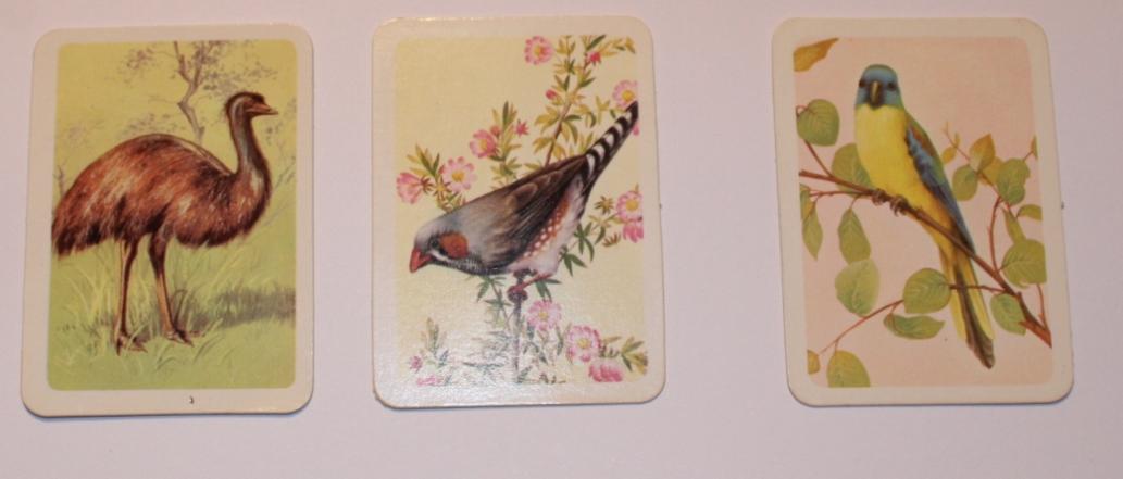
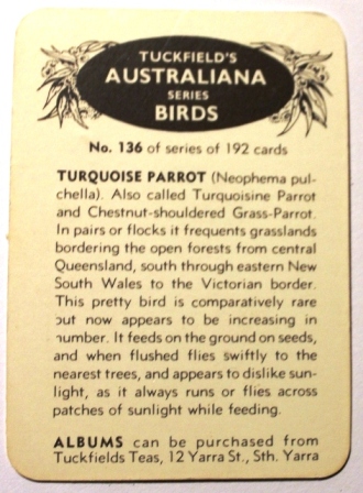 Investor Place lists the most expensive baseball cards as Eddie Plank, 1909 — $188,000, Shoeless Joe Jackson, 1910 — $199,750, Ty Cobb, 1911 — $273,000, Mickey Mantle, 1952 — $282,000 and Honus Wagner, 1909 — $2.8 million. So those who invested $50.00 in 1933 have seen a good return.
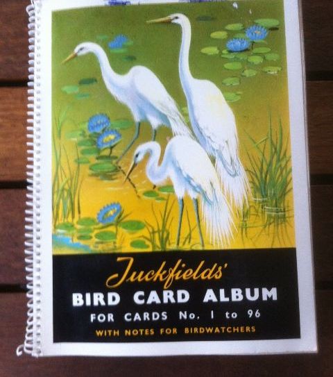
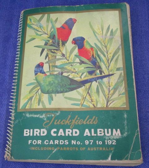
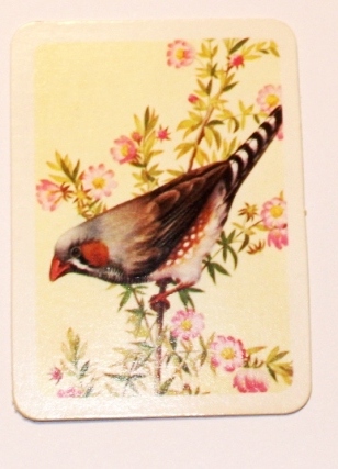 Waste not want not
 Married on Saturday -
 By the National Portrait Gallery - Canberra: